


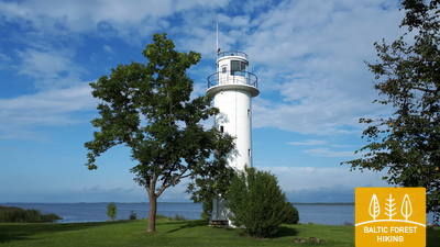
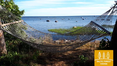
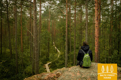
Baltic Forest Hiking - Cycling


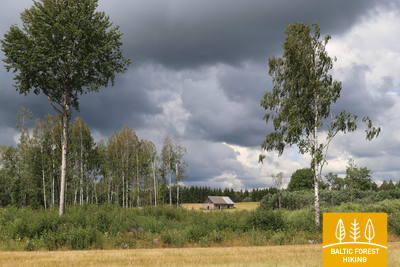
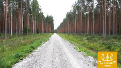
 Section 1. Old Riga - Baltezers.
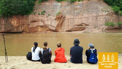
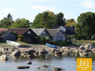
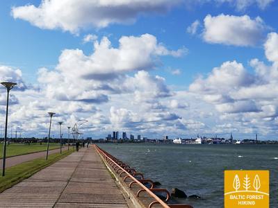
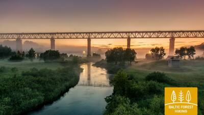
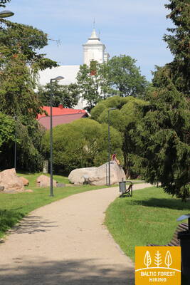
Through Riga – UNESCO World Heritage Site
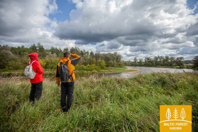
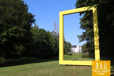
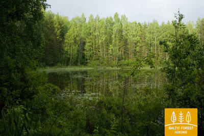
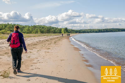
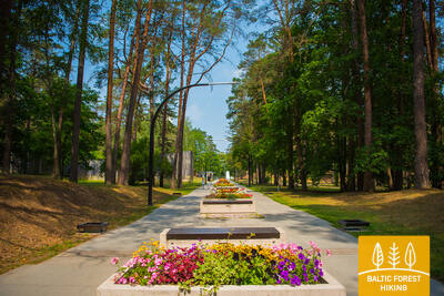
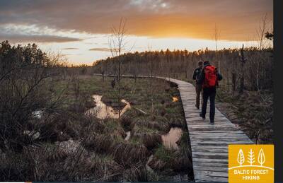
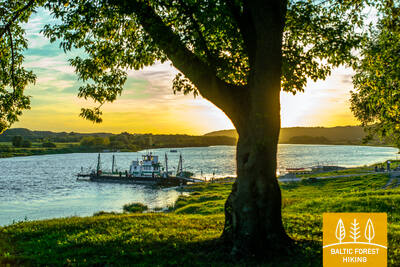
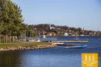
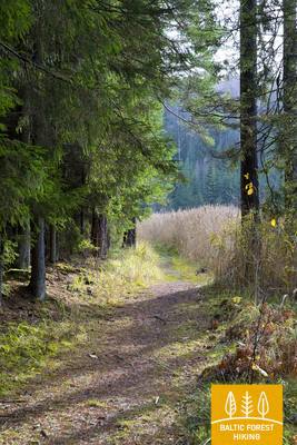
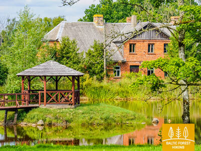
The starting point of Forest Trail in Latvia is located in the heart of Old Riga, the Town Hall Square. The route leads along Kaļķu Street, passes the Monument of Freedom, through Vērmane Garden and along the historic Tērbatas street. Then it arches over the Zemitāni railway station pedestrian bridge and treads into Biķernieki and Šmerlis forests. The Forest Trail winds through Jugla, passes the Latvian Ethnographic Open-Air Museum and goes on along the pedestrian-bicycle path until Baltezers.
You can travel from the center of Riga to Jugla and further to Baltezers along the bike paths.
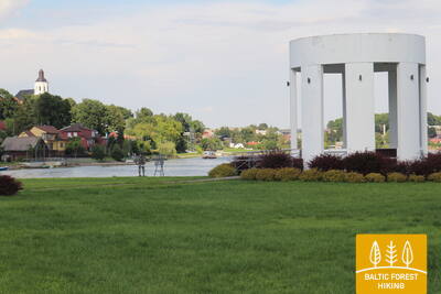
Section 2. Baltezers - Vangaži.
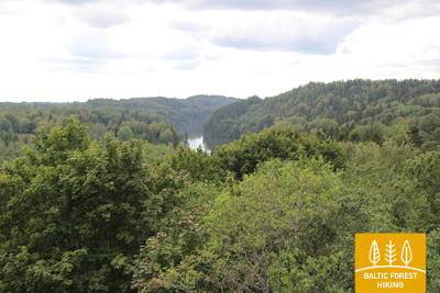
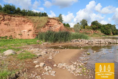
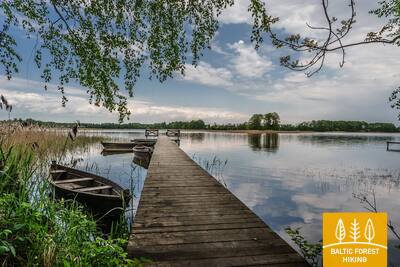
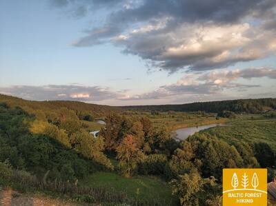
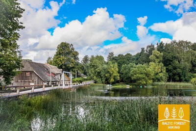
The historic Tērbata road along the banks of Gauja River and lakes
The Forest Trail crosses the VIA Baltica motorway via a tunnel and goes on through a private housing along the Lake Mazais Baltezers. Then it turns east, following the Gauja-Baltezers Canal. In the Garkalne–Āņi section, beautiful meadows stretch on both sides of the Forest Trail, drowning in heaps of blossoming red catchflies, white daisies and yellow buttercups during the summer. Since days of old, medieval roads have ran along the banks of Gauja River, and travellers used the ferry crossing at Iļķene to get across. Beyond Āņi, the Forest Trail passes through forested areas and a populated country area, and finally reaches Vangaži via Gaujas street.
Bikeable throughout its entire length.
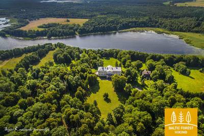
Section 3. Vangaži - Rāmkalni.
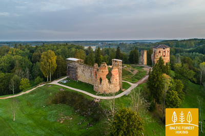
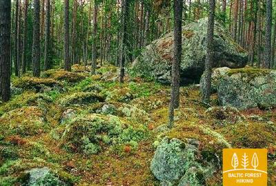
Along Inčukalns hunting palace towards Gauja National Park
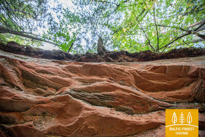
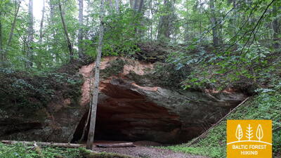
After leaving Vangaži, the Forest Trail leads through smaller paths, reaching Vangaži Lutheran Church and the Werewolf Pine. On its way to the Hunting Palace, it goes along the so-called Katrīna Road, disappears into the forest for a while and after the Hunting Castle continues along the Hunting trail. The first side ravines with pronounced relief of the ancient Gauja valley can be seen here. One of them is located by Inčukalns Velnala (Devil’s) Cave, surrounded by small river channels of old Gauja. From there, the Forest Trail continues through meadows and crosses the Murjāņi–Valmiera motorway, where the recreation park “Rāmkalni” is located.
The section is bikeable, except for a small trail and incline area near Kārļzemnieki - Inčukalns Devil's Cave, where you need to ride along the Kārļzemnieki - Sēnītes (V94) road.
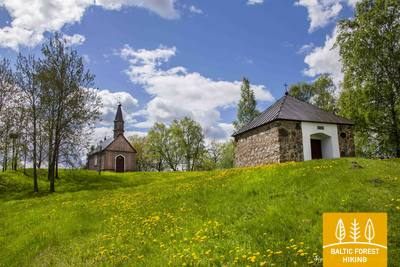
 Section 4. Rāmkalni - Sigulda.
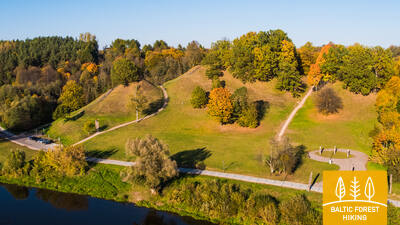
Stunning scenery of the ancient valley of Gauja River near Sigulda
Past “Rāmkalni”, the Forest Trail wanders up the steep banks of Gauja valley, passes through Gauja village and comes back down. Then it crosses river Lorupe and continues along the bends of river Gauja, passing one of the most spectacular outcrops of the river, the Velnala Cliffs, goes up to Ķeizarskats observation spot and circles down to Ķeizarkrēsls, adventure park “Mežakaķis” at Kaķīškalns and the Sigulda Bobsleigh and Luge Track.

Not recommended for cycling (trails, steep slopes, long stairs, etc.)
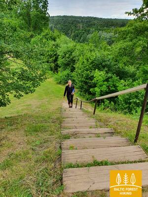
Section 5. Sigulda - Līgatne.
In the heart of Gauja National Park
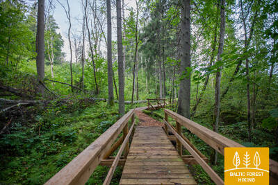
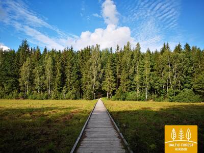
After passing through Sigulda, the Forest Trail follows the River Vējupīte to Mound Paradīzes, where a steep staircase leads down into the ancient valley of Gauja River and the ravine of River Vējupīte. It continues to wind down smaller paths through meadows, crossing small rivers whose banks reveal sandstone outcrops. The last six kilometres of this section follow a smaller path down Līgatne Nature Trails. As it draws closer to Līgatne, the Forest Trail moves up the hills of Gauja valley, before descending back down into the deep ravine of Līgatne River, where the village of the former Līgatne Paper Mill is located.
Not recommended for cycling—long stairs, steep or slippery slopes, narrow trails with steep edges, etc.
 Section 6. Līgatne - Cēsis.
Along the old Cēsis road through the valley of Amata River
One of the most scenic parts of the Forest Trail stretches along the historic village of the Līgatne Paper Mill, passes Spriņģi Rock, curves along Skaļupe Trails and the Mythological Trail, stops at one of the most secret sites on this side of the Iron Curtain, the Soviet Bunker, then continues along Roči Nature Reserve, crosses Amata (the most beautiful and rockiest part of the river) and finally comes to Zvārtes Rock. Next, the Forest Trail runs along the high banks of Amata valley and follows the historic Cēsis–Riga “highway” (now a small rural/forest road with old mileposts) to Rakši, then ascends up the Vāļukalni hills and Ozolkalns, following along the River Gauja until it meets Cīrulīši Nature Trails. It comes to a stop at Gaujas street, but travellers may continue down the path for a further 2.8 km to Cēsis, spend the night there, and continue walking on the following day.
The section is bikeable, except for the Amata Nature Trail from the Veclauči Bridge over the Amata River to Zvārtes Cliff. In this section, you should use the parallel road (Līgatne - Kārļi).
Section 7. Cēsis - Caunītes.
Impressive sandstone outcrops on the banks of River Gauja
The Forest Trail follows small roads and trails through the woods up until the water tourist camp “Lenči”, winds through the ever-changing terrain past Ērģeļu Cliffs and enters the ancient valley of Gauja River. Having passed Ērģeļu Cliffs, the trail turns back towards Cēsis, but then veers off towards Rāmnieki in Pieškalns, crossing the river. After the water tourist camp “Jāņarāmis” the Forest Trail enters a beautiful, bright pine forest, proceeding through the woods until it reaches “Caunītes”, which is one of the most beautiful places on the banks of the Gauja River.
The section is bikeable throughout, as it coincides with the cycling route 'Cēsis - Valmiera.'
Section 8. Caunītes - Valmiera.
On the road to Valmiera – the “Green City”
From Caunītes, the Forest Trail leads through mesmerising pine forests and wetlands, across and around hills and slopes. One of the most beautiful views of the River Gauja opens from Sietiņiezis, and it might be worth devoting some extra time to visit the Sietiņiezis Nature Trail. The further road stretches along farmsteads and through forests, until reaching Valmiera. After Valmiera bypass, the Forest Trail leads down urban sidewalks, while the last stretch of road – from the so-called “Dzelzītis” (a narrow-gauge railway bridge) to Cēsu street – follows a wooded path along the Gauja River.
The section is bikeable throughout, as it coincides with the cycling route 'Cēsis - Valmiera.'
Section 9. Valmiera - Strenči.
Along Abuls to Strenči, the capital of rafters
The trail passes through the historical centre of Valmiera and the Atpūtas Park, which is a popular place among hikers and Nordic walkers, then crosses the suspension bridge, passes Pauku priedes pine forest and Baiļu kalns. From there it follows the Abuls Trail, curving along the banks of the river until reaching the Brenguļi Brewery, and further down, beyond Pūpoli, enters vast, unpopulated forest areas. The first part of this section passes by numerous small summer cottage villages with names such as Enerģētiķis, Saulītes, Sprīdītis, Gaujmaļi, Pūpoli and Gaujaslāči, which were initially established during the Soviet period as summer cottage neighbourhoods of the people of Valmiera and the surrounding territories. Near Ūdriņas, the Forest Trail leads through a labyrinth of the riverbeds and turns north, crossing the Gauja Bridge, where a resting and boating stop is located. The centre of Strenči is located at a 1.5 km distance. Part of the section passes through the Northern Gauja protected landscape area.
The section between Valmiera and Brenguļi (part of which coincides with the Abula Nature Trail, which is not bikeable) should be bypassed via the Valmiera - Brenguļi (V196) road.
Section 10. Strenči - Spicu Bridge.
Through the beautiful forests of Vidzeme
The beginning of the Forest Trail at this section coincides with the Gauja Nature Trail, which runs along the very bank of the river. The Forest Trail crosses the A3 in two places (before the turn to Seda and before Kauči) (be careful!) and continues along small forest roads, a sand-gravel quarry, then continues down a gravel road at the turn to Oliņas. After 3.5 km, turn right again and follow the route to Spicu Bridge via small and remote forest roads where some of the most beautiful sights of the Northern Gauja (“Ziemeļgauja”) protected landscape area can be seen by the so called Zemā sala (Low Isle). A picnic area and a camp are located at the end of this section, where the P24 crosses the Spicu Bridge.
You can bike, except for the initial section near Strenči, from the bridge over the Gauja River to the Sedas turn, where the Mežtaka follows small trails unsuitable for cycling.
Section 11. Spicu Bridge - Zaķi.
Through the magnificent Cirgaļi dunes
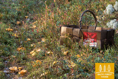
The Forest Trail crosses Spicu Bridge and leads to the four Kokši lakes (about 4 km), which are interconnected by a small stream. Here you will find a picnic area, tent spots and a nature trail for travellers. The surrounding nature is beautiful, and the forests are rich in edible mushrooms. After passing the last of the Kokši lakes, Lake Dibena, in an hour or two you will reach the Cirgaļi dune massif, which you will cross towards north-south. The further section of the Forest Trail crosses a large forested area, and a lone homestead or a smaller lake can be seen here and there. The section ends in a small village named Zaķi. The village provides no services, so be sure to consider the necessary arrangements and accommodation options as you plan your hike. The section is located in the Northern Gauja (“Ziemeļgauja”) protected landscape area.
Bikeable throughout its entire length.
Section 12. Zaķi - Gaujiena.
Along Zvārtava Castle to Gaujiena
1.5 km after Zaķi the Forest Trail turns off the Sēļi–Vireši road (P23) and continues on a small rural road all the way to Zvārtava, where Zvārtava Castle awaits at the end of a long alley. Having passed through Zvārtava, the Forest Trail returns to P23 and after a 2 km walk goes up a steep hill, reaching the centre of Gaujiena. A part of the section is located in the Northern Gauja (“Ziemeļgauja”) protected landscape area.
Bikeable throughout its entire length.
Section 13. Gaujiena - Trapene.
Along Latvia’s longest larch alley to Trapene
The stretch of road between Gaujiena and Līzespasts leads through remote forests, surrounded by large swamps. Mežciems is the only settlement here, and there are no solitary homesteads. Further along, the 5 km walk from Līzespasts to Trapene features open agricultural landscapes with lush meadows and landscapes typical of western Alūksne hillocks. About half of these 5 km lead through the breath-taking Trapene larch alley.
Bikeable throughout its entire length.
Section 14. Trapene - Ape.
Towards Ape, where witches used to reside on the banks of Vaidava River
The first 6 kilometres of the Forest Trail lead along P44 until it turns North on the Ādams–Ape road. 4 km before the Riga–Pskov motorway (A2), the Forest Trail passes through a magnificent, dense forest, which is a popular spot for foraging berries and mushrooms in Autumn. After the Riga–Pskov highway, the Forest Trail runs through agricultural lands until it reaches the centre of Ape, one of the smallest towns in Latvia, after crossing the former Ape–Valka narrow-gauge railway line.
Bikeable throughout its entire length.
Section 15. Ape – Paganamaa – Korneti – Latvian/Estonian border.
Through the Korneti-Peļļi Furrow and the Paganamaa or Devil's Land
After leaving Ape, the Forest Trail winds through a hilly farmland landscape, then enters a dark forest massive, occasionally interrupted by the blue surfaces of lakes. After Peļļi, the Forest Trail moves down the same path as Peļļi trail, crosses the Latvian/Estonian border and winds along the shores of Lakes Smilšājs, Sūneklis and Ilgājs for 2 km on the Estonian side, known as Paganamaa (translation: Devil's Land). There it descends and enters the Korneti-Peļļi subglacial depression, one of the most impressive ravines in Latvia. The Forest Trail returns to Latvia at Ilgājs and, after a steep climb, takes you through a hilly area to the Drusku castle mound. The Forest Trail descends in Korneti. It is less than 3 km from the centre of Korneti to the Latvian/Estonian border. Features beautiful landscapes on the banks of Lake Lielais Baltiņš and Lake Mazais Baltiņš along the route. The section is located in the protected landscape area “Veclaicene”.
The section is bikeable, except for the Peļļu and Paganamā Nature Trails (where you should go straight along the Palpiera Lake) and the Drusku Hillfort Nature Trail (with long, steep stairs and narrow, steep trails), which can be bypassed via the road connecting Druski with Korneti.
Section 16. Loogamäe‒Haanja (Suur Munamägi).
On the way to the highest point in the Baltic States – Suur Munamägi Hill
Having crossed the border of Latvia and Estonia via a small local road, the Forest Trail follows a country road, passes solitary farmsteads and villages, then drifts upward the west slope of Haanja Upland until reaching Suur Munamägi (‘Great Egg Hill’ in Estonian). This is the highest peak on the entire route from Riga to Tallinn. Feel free to linger here for a while to enjoy the Haanja scenery and the local cuisine.
Bikeable throughout its entire length.
Section 17. Haanja (Suur Munamägi)‒Tsiistre.
On the winding roads of Haanja Upland
The Forest Trail leads down from the highest point of the Haanja Upland, circles around the southern part of Lake Vaskna, and continues down small country roads surrounded by solitary homesteads and small clusters of farms. The hills along the route are covered in trees, but areas on the gentler slopes have been cultivated. As the village of Tsiistre draws closer, the landscape shows the presence of agricultural land, which turn into fields of gold by the end of the summer.
Bikeable throughout its entire length.
Section 18. Tsiistre‒Vana-Vastseliina.
Along the ancient pilgrim paths to Vana-Vastseliina
During this section, the Forest Trail passes through the northern part of the Haanja Upland and descends to Vana-Vastseliina, an ancient pilgrimage destination in the Piusa River valley. On its high bank the ruins of the bishop’s castle are quite a sight
Bikeable throughout its entire length.
Section 19. Vana-Vastseliina‒Kolodavitsa.
Along the banks of Piusa, the fastest river in Estonia
The first part of this section of the Forest Trail winds along the magnificent Piusa River valley, then, at Härmä village, it turns towards Obinitsa, an important cultural centre of Setomaa, the Land of Setos. Here you can discover the traditions of the local Seto people. After Obinitsa, the Forest Trail leads through beautiful pine forests rich in heather, descends back into the depths of the Piusa River valley and turns east at Piusa caves. From there it follows the left slope of Piusa valley until it reaches the motorway and railway line by Koidula railway station.
The banks of the Piusa Valley have narrow and steep trails that are not suitable for cycling. From Vana-Vastseliina to Obinitsa, an alternative route (a dense network of small country roads) must be chosen to reach Obinitsa and further on to Piusa.
Section 20. Kolodavitsa‒Värska.
Historical heritage and living traditions in Setomaa, the land of Seto people
The Forest Trail leads through the vast forests of Setomaa, along mires and moors, which are painted a fabulous shade of purple in September. This is a sparsely populated region, and hikers have the chance to really connect to the nature. At Lake Õrsava, the Forest Trail crosses several pedestrian bridges, circles around the lake and leads to the centre of Värska borough. Take your time to discover local Seto traditions and cuisine.
You can cycle this section, except at the very beginning where the Forest Trail crosses a tunnel under the railway (the bike must be walked). Certain sections of the road may be sandy or muddy depending on the season.
Section 21. Värska‒Ristipalo.
Värska – historical resort
After leaving Värska, the Forest Trail turns northwest towards Värska Gulf of Lake Pskov. Having circled around in the forest, the trail leads to Laossina village, where the visitors have the opportunity to learn more about the religious traditions of the Seto people. This section of the Forest Trail passes through the Lake Peipus lowlands, so the terrain is flat. The land is mainly used for agriculture. After crossing the Võhandu River near Võõpsu village, the Forest Trail turns towards Räpina.
Bikeable throughout its entire length.
Section 22. Ristipalo‒Mehikoorma.
Through the polder meadows of Lake Peipus
Nearly half of this section runs on straight polder roads of the Lake Peipus lowlands. The polders are designed to protect the surrounding land from flooding in spring. The flat polder meadows are used for agriculture and grazing livestock. The section from Naha to Mehikoorma leads along the Räpina‒Mehikoorma roadway. A beautiful view of Lake Lämmijärv opens from the Mehikoorma Lighthouse. This lake is a narrowing between Lake Pskov and Lake Peipus. Russia lies on the other side of Lake Lämmijärv (1.7 km).
The section is fully rideable by bicycle. In some areas, the roads may be muddy or overgrown with grass.
Section 23. Mehikoorma‒Lääniste.
Around the Emajõe-Suursoo wetland
The stage fully justifies the name of the Forest Trail, as the next three days lead through one of Estonia's largest wetlands, the Emajõe-Suursoo wetland, which is surrounded by extensive forest areas. The only settlement area between Jõepera and Ahja River is Järvselja, enclosed by forests. The terrain is flat, since the Forest Trail still runs through the Lake Peipus lowlands. The destination is located by the Ahja River, which is known for its scenic Devonian sandstone outcrops and a popular boat route.
Bikeable throughout its entire length.
Section 24. Lääniste‒Kavastu.
Crossing the Emajõgi River by the only cable ferry in Estonia
Most of this section of the Forest Trail passes through an uninhabited forest area to the west of the Emajõe-Suursoo wetland, which is protected by the Peipsiveere nature reserve. At the village of Kastre, the Forest Trail returns to civilisation, and hikers have to cross the Emajõgi River by the local cable ferry to get to the Kavastu village. The Peipsiveere visitor centre and nature trails are located at a 3.5 km distance from Kavastu.
Bikeable throughout its entire length.
Section 25. Kavastu‒Varnja.
Towards the Varnja old believers’ village
The Forest Trail has been circling around the Emajõe-Suursoo (a part of the Peipsiveere nature reserve) wetland for three days now. The most interesting part of the walk is the section between Vanaussaia and Varnja, where the Forest Trail runs along small rural roads. Before Varnja it reaches the shore of Lake Peipus (Peipsi), and here you can really feel the true size of the lake. The following distance from Varnja to Remniku along the shores of Lake Peipus and the surrounding territory will take about one week. Over this week, the hikers will learn more about the traditional culture of Eastern Estonia, such as onion cultivation, fishing, culinary heritage, crafts and the culture of the Old Believers.
Bikeable throughout its entire length.
Section 26. Varnja‒Alatskivi.
Visiting the onion farmers of Lake Peipus
A scenic and tradition-rich stretch of the Forest Trail symbolised by the onion. Onions were brought to the region by Old Believers in the 17th century. Ladies and gentlemen selling home-made onion strings on the roadside have become somewhat of a business card of the villages. The villages on the twenty-four kilometre stretch of road between Varnja and Kallaste are connected by the tourist route called Onion Road. The landscape is decorated by colourful wooden houses, small fish shops and a restaurant where you can enjoy tea made in the samovar, true to the traditions of Old Believers. The fish vendace (rääbis) from Lake Peipus is served throughout the year.
Bikeable throughout its entire length.
Section 27. Alatskivi‒Rannamõisa.
Smoked fish and onion pie – the culinary heritage of Lake Peipus
Alatskivi is a great place to try the traditional dishes of Lake Peipus, including the famous onion pie. After Alatskivi, the Forest Trail ascends to a higher ground, which offers beautiful views of Lake Peipus, and then descends to meet the shore of the lake again at Kallaste. In Kallaste, look out for the local fish restaurant and shop, and try smoked vendace (rääbis) as well as zander from Lake Peipus. The last part of this section leads along a road overlooking the lake.
Bikeable throughout its entire length.
Section 28. Rannamõisa‒Mustvee.
Through the vibrant villages on the shores of Lake Peipus to Mustvee
Onions, fish, villages that stretch out for several kilometres where the buildings are lined along the main street, ornate Old Believers' churches, small harbours with fishing boats and wooden houses, each painted in a different colour! Cafés, shops and a view of Lake Peipus, which looks more like a sea rather than a lake. That is how you could describe this section of the Forest Trail. For eight kilometres from Kasepää to Mustvee, the Forest Trail passes through small coastal villages, offering a pleasant change for those who have walked for a longer period of time.
Bikeable throughout its entire length.
Section 29. Mustvee‒Avinurme.
Down the old Sonda‒Mustvee narrow-gauge railroad track
After leaving the Mustvee promenade and beach, the Forest Trail curves through the city and continues along the former Sonda‒Mustvee narrow-gauge railroad track for the next 16 km. The railway tracks have been replaced by a gravel road on a straight line that connects Mustvee and Avinurme. Information stands placed along the railway designate former settlements that have been overtaken by the forest or turned into clearings to be reforested soon.
Bikeable throughout its entire length.
Section 30. Avinurme‒Lohusuu.
A visit to the craftsmen of Avinurme
Before going further down the Forest Trail, it is worth visiting the Avinurme wooden handicrafts centre, which has the richest selection of wickerwork in Estonia and offers various workshops such as basket weaving, felting, baking bread, candle making among many others. Up to the village of Separa, the Forest Trail passes through a large forest rich in bilberries, blueberries and mushrooms during late summer.
Bikeable throughout its entire length. In places where the Forest Trail winds along the beach, a parallel road along the shore of Lake Peipus can be used by bicycle.
Section 31. Lohusuu‒Kuru.
Through the mushroom and berry forests on the northern shore of Lake Peipus
The first half of this section leads through magnificent coniferous forests, especially in the Järvevälja landscape reserve, where the trail is surrounded by beautiful dunes in the north and a raised bog in the south. It is well worth visiting the kiosk at Rannapungerja to buy smoked fished – the Lake Peipus vendace (rääbis) and some local farm produce. The Forest Trail crosses the Rannapungerja River via the motorway bridge and comes to the shores of Lake Peipus at Kauksi. There is a picnic area to cosy up and eat the fish you’ve brought along. Here, the shores of Lake Peipus resemble a magnificent beach surrounded by beautiful pine-covered dunes.
As the Forest Trail leads along the sandy shore of Lake Peipus, the parallel road along the coast can be used for cycling.
Section 32. Kuru‒Remniku.
The beautiful dunes and beaches of Lake Peipus
Apart from the Alajõe village, the Forest Trail winds along the coast of the beautiful Lake Peipus. During the summer, when the water level in the lake is lower, beautiful, sandy beaches with wide shallows appear. Past Alajõe, the highest dunes of Lake Peipus (up to 20 m) rise on the landscape, providing a distant view of Lake Peipus, one of the largest lakes in Europe.
As the Forest Trail runs along the sandy shore of Lake Peipus, the parallel road along the coast is suitable for cycling.
Section 33. Remniku‒Kuremäe.
Through Alutaguse – Estonia's newest national park
From here on, the Forest Trail passes through the newest member of Estonian national park family, the Alutaguse national park (several parts of the park in a wider area, to be exact), which was founded in 2018. The main objective of the park is the protection of Estonia’s largest coniferous forests and swamp areas. This is also one of the most sparsely populated areas of North-eastern Estonia.
Bikeable throughout its entire length.
Section 34. Kuremäe‒Vasavere.
Through the Kurtna Protected Landscape Area
Having left the Kuremäe Convent hill, the Forest Trail continues along the picturesque Kurtna landscape reserve (part of Alutaguse national park), ornamented by the mirror surfaces of its many lakes (42 lakes in total, the highest density in Estonia) among beautiful, bright coniferous forests. Wooden footbridges pass through the wetter areas, while bridges are built over ditches and small rivers. A network of hiking and Nordic walking trails has been established in the vicinity of the Alutaguse recreation and sports centre.
This section is more suitable for walking. Cyclists can choose slightly larger roads (there is a high density of small roads) to get from the start to the finish point of the section.
Section 35. Vasavere‒Toila.
Towards the rocky coast of Northern Estonia near Toila
Behind Vasavere, the Forest Trail continues through the Kurtna landscape reserve, encircles over a peat bog, crosses the town of Oru, passes through the Voka River valley and arrives at the Baltic Sea, where it turns west. Here, on the coast of the Gulf of Finland, rises the North-Estonian Klint – a steep, rocky and forest-covered cliff that stretches non-continuously to Tallinn and further to the islands of West-Estonia. The Forest Trail runs on top of the cliff and occasionally descends into valleys. It crosses the deep and vast Pühajõgi valley in the Toila-Oru park and comes to Toila, a popular coastal resort.
The section is rideable by bicycle, but some parts of the route may be more difficult to traverse depending on the weather and season. Near Voka Gorge, the bicycle will need to be pushed by hand.
Section 36. Toila‒Saka.
The scenic North-Estonian Klint between Toila and Saka
One of the most unusual sections of the Forest Trail in Northern Estonia, which leads along the foot of the impressive North- Estonian Klint in good weather, then climbs to the top of the klint in the villages of Valaste and Saka, revealing breath-taking views of the Gulf of Finland from the so-called Viru Rise. In the Saka‒Ontika‒Toila section (about 23 km), the maximum height of the North-Estonian Klint reaches 55 m. If the weather is clear, you can see the isles named Great and Small Tütarsaar, which belong to Russia, at a 50 km distance.
You cannot cycle along the seashore. You can use the roads that run along the top of the North Estonian Klint.
Section 37. Saka‒Aseri.
Millions of years old fossils on the seashore
At Saka manor, the Forest Trail ventures down a steep staircase to the seashore, where it continues along the beach for less than 6 km. At the villages of Moldova and Jabara, the Forest Trail moves back up the North-Estonian Klint (great scenery from the Viru Rise), passes through the village of Purtse, circles around the Purtse River and moves further down the narrow seacoast to Aseri. Shortly before arriving at the town, it climbs the slope of the klint again. Animal fossils can be observed by the seashore below the North-Estonian Klint, some of them hundreds of millions of years old.
It is not possible to cycle along the seashore, so from Saka to Purtses and further to Aseri, you need to choose small roads that run close to the sea.
Section 38. Aseri‒Mahu.
Towards Aseri, the capital of Estonia’s brick production
Before you continue the hike, consider visiting the seaside to take a look at the giant quarries. These quarries have produced clay for brick production for a very long time and are still used today. Behind Aseri, the Forest Trail passes through a former Soviet military territory, moves along the top of the North-Estonian Klint for about a kilometre, offering beautiful views of the Gulf of Finland, passes the Kalvi manor and continues further along the road towards Mahu. It crosses a beautiful forested area behind the Pada River (nature reserve), then comes to the seashore and continues through coastal forests until Mahu.
It is possible to cycle the entire route, but a specific section near the North Estonian Klint may be difficult to traverse in different seasons and conditions.
Section 39. Mahu‒Kunda.
Experiencing the Kunda industrial heritage
From Mahu to Letipea village, the Forest Trail runs along small coastal roads close to the sea and along the coastline for a stretch of road. It may be worth taking a 2 km detour (there and back) to the Ehalkivi Boulder. For the next three kilometres from Simunamäe, the Forest Trail leads along the foot of the North-Estonian Klint, which is covered by a primary forest. The coastline is about a kilometre away from here. Information boards about the history of Kunda have been placed in the territory surrounding the Lontova manor. You can also visit the many objects located in the city and along the river that are related to the historical development of the city cement plant.
The entire section can be cycled using the roads.
Section 40. Kunda‒Eisma.
Coastal fishing traditions and art in Karepa
After leaving Kunda, the Forest Trail comes out by the North-Estonian Klint and follows along its surface for the next two kilometres. From there on the trail often goes by the paved road with traffic. Be aware of cars! In the village of Toolse, it is worth taking a two-kilometre detour to visit the romantic Toolse castle ruins. Lamprey catching traps, which is a rare type of fishing in Estonia, are sometimes placed near the bridge over the Selja River. They are owned by the museum, located in a beautiful farmhouse on the right bank of the river, which can be seen from the Selja bridge. From Toolse to Eisma, the Forest Trail runs along the road, making a brief detour on a beautiful, rock-covered beach before Eisma.
The section, except for the beach, is rideable by bicycle.
Section 41. Eisma‒Oandu.
Along the trails of Lahemaa National Park
Behind the village of Vainupea, the Forest Trail enters the first Estonian national park ‒ Lahemaa, which means “the land of bays” in Estonian. For the next five and a half days, the Forest Trail will continue along the bays and peninsulas of Lahemaa national park, introducing the hikers to its most significant natural and cultural heritage. Special attention must be paid to the rules of the park. On this day, the Forest Trail passes through beautiful and quiet coastal forests, where mushrooms grow abundantly in autumn. It passes through the scenic Altja fishing village. The section comes to an end at Oandu in the visitor centre of the Estonian State Forest Management (RMK), where hikers can learn more about forest habitat types and forest management traditions.
The section is rideable by bicycle, but it may be necessary to push the bicycle by hand for a short distance in some areas.
Section 42. Oandu‒Käsmu.
Käsmu captains' village and ship building site
The next 9 kilometres of the Forest Trail between Oandu and Võsu coincide with the RMK trail, so be aware of the change of the signs. The trail goes through a beautiful, wooded inland dune area, where hikers can see cuts on pine trees, used to extract resin from the trees. Resin was obtained in the Baltic States using this method up to the 1960s-1970s. Trees are richly covered in lichen, indicating that the air is clean. In autumn, mushrooms and blueberries adorn the edges of the trail. After passing through Võsu village (a popular resort), the Forest Trail continues along a beautiful coastal forest promenade to Käsmu village. It is worth walking an additional extra kilometre to the Vana-Jüri rocks and the historical sites of Käsmu at the tip of the peninsula.
Between Oandu and Võsu, the Forest Trail follows small forest paths and dune slopes, so it is recommended to cycle this section via the main road that connects Oandu with Koljaku and continues to Võsu.
Section 43. Käsmu‒Viinistu.
In the kingdom of the giant rocks of the Käsmu Peninsula
The first part of this section passes through the fairytale-like Käsmu Peninsula with its wooded dunes and moss-covered rock fields. From Eru it continues along the Võsu‒Kotka road for 2 km, passes through Vihasoo village and further along the road, from where you can see Eru Bay and the Käsmu Peninsula. The section features some of the most impressive boulders in Lahemaa national park, the Tammispea and Jaani-Tooma boulders, which resemble huge monoliths. From Viinistu, you can spot the Mohni Island and its lighthouse in the distance.
The section can be cycled in its entirety. However, in some places (depending on weather conditions), you may need to push the bicycle by hand for a short distance.
Section 44. Viinistu‒Loksa.
Purekkari ‒ the northernmost point of the Estonian mainland
The forest trail continues around the Pärispea Peninsula, which is part of Lahemaa national park, until it reaches Purekkari Cape. In windless weather, you can take a walk along the kilometre-long pebble-covered cape and visit the impressive Purekkari stone. From there, the Forest Trail follows down the winding coast of Hara Bay through former Soviet military bases and then passes through Loksa, where a brick factory used to operate (historical buildings). It curves through the centre of the town until it reaches the finish point, half a kilometre away from a fantastic beach.
Bikeable throughout its entire length.
Section 45. Loksa‒Tsitre.
Through the forests and swamps of the Juminda Peninsula
On this day, the Forest Trail crosses the Juminda Peninsula. After leaving Loksa, in 7 km it passes by a Soviet-era military object, the Hara Submarine Port. To visit it, you have to take a two-kilometre detour and buy a ticket. The Forest Trail goes through an area of beautiful forests and marshes, with high, dense forested sand dunes at the western end of the territory. It continues down the road from Pedaspea to Tsitre and passes a small section of the North-Estonian Klint just before Tsitre, where the Muuksi stronghold hill is located. The Tsitre picnic area is located 0.2 km from the sea.
The section can be cycled, except for the educational trail. You can use the 6 km long parallel road located to the east of the trail.
Section 46. Tsitre‒ Kaberneeme.
Sandy beaches and isles in Kolga Bay
A harbour was established at the Tsitre village as early as the Viking times. The first 4 km of the Forest Trail in this section pass through the territory of the Lahemaa national park. Between the villages of Muuksi and Soorinna, the road crosses an oval plateau, the klint elevation of northern Estonia, covered with scenic juniper fields. At the village of Põhja, the trail passes by the coastal wetland, and comes out by the sea behind the Salmistu harbour. From here, look out for the 1.3 km distant Pedassaar isle to the northeast, and the Umblu and Rohusi isles to the northwest. On Valkla beach, a nice beach restaurant awaits hikers. In Haapse the beach you can swim, sea gets quickly deep.
You can cycle, except for the beach sections, where you should use the parallel roads along the coast.
Section 47. Kaberneeme ‒ Jõelähtme.
Along the banks of the Jägala River
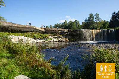
From Kaberneeme the route runs through a forest where you can see piles of stones carried here during the last ice-age. Soon the trail climbs about 20 m up to the hiking trail which runs on the old shore line of Lake Ancylus. Trail crosses the Kaberla-Kaberneeme road and follows over a small sandy canyon of the Kaberla stream, before arriving at the Kalevi-Liiva memorial of holocaust. The trail continues to the Linnamäe HES and a suspension bridge. Follow the trail over the ancient fortress hill of Linnamäe and continue on the right bank of the Jägala river, until reaching the Jägala waterfall. The Suka bridge is about 500 meters up from the waterfall. After crossing the river, the trail strolls through the Jägala waterfall park. Finally, the trail runs through the village of Koogi and arrives at Jõelähtme.
Bikeable throughout its entire length.
Section 48. Jõelähtme - Muuga.
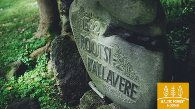
Through Maardu, the phosphorite mining area
The Forest Trail passes the village of Jõelähtme, then turns northwest 1 km before the sea and follows the North-Estonian Klint for the next 3 kilometres. Behind Ülgase, the Forest Trail passes through Kallavere, Maardu and Muuga, the suburb of Tallinn. It takes a few hours to get from Muuga to Old Tallinn, but the Forest Trail takes a two-day detour through the Viimsi Peninsula before arriving at the capital of Estonia.
Bikeable throughout its entire length.
Section 49. Muuga‒Püünsi.
Through the magnificent Viimsi Peninsula
The Forest Trail passes through the most densely forested area of the Viimsi Peninsula, where several nature protection areas have been established. It crosses the former Soviet-era military territory in Rohuneeme. On this day, the Forest Trail follows along pedestrian sidewalks and the many roads running through the peninsula. It turns south at Püünsi village, where towers, skyscrapers and the Port of Tallinn with ferries can be seen in the distance across the Gulf.
Bikeable throughout its entire length (a large proportion of cycle paths).
Section 50. Püünsi‒Tallinn.
Most beautiful sights of Old Tallinn
The Forest Trail passes by the Gulf of Tallinn, and beautiful views of the towers, harbour and skyscrapers of the city can be seen as early as in Püünsi. The Forest Trail turns into a beautiful pine forest before Pirita, then follows along a sandy beach for 2 km. Behind Pirita all the way to the Port of Tallinn, the Forest Trail takes you along the beautiful city waterfront promenade, which overlooks the city’s most important cultural and historical sites, and offers beautiful views of the sea and the port. The final destination of the Forest Trail is located in the Port of Tallinn, next to the Old Town. You can spend another day or two visiting various tourist locations of Tallinn.
Bikeable throughout its entire length (a large proportion of cycle paths).
Section 51. Lazdijai – Veisiejai.
Along the hills of the Sūduva Upland
A little further than 1 km from the Lazdijai Tourism Information Center, the Forest Trail leads along the Lazdijai–Augustow road (No. 135), then turns onto a small country-forest road, which used to serve as a border guard road during the “Iron Curtain”. Walking along it, the landscapes of the Sūduva Upland offer beautiful landscapes. After crossing a more open place opposite Kučiūnai village, the Forest Trail slips into a wooded area again. After about 5.5 km, it turns east, further winds through a maze of forests and lakes, crosses the Zapsė river and meets the Lazdijai–Kučiūnai–Veisiejai road (No. 2510). After less than 6 km, the Forest Trail turns right to Dainaviškiai village. Then it turns around the bays of Veisiejai lake and, through Veisiejai Manor Park, takes you to the centre of the town. The section before the town of Veisiejai is part of the Veisiejai Regional Park.
Bikeable throughout its entire length.
Section 52. Veisiejai – Trikojis.
Through the Veisiejai Regional Park
After leaving the centre of Veisiejai town, the Forest Trail crosses the channel of Veisiejai lake, then, along Vytauto, Turgaus and Leipalingio streets (road No. 134), it takes you to the shore of Snaigynas lake, where there is an observation tower and recreation places. After crossing a small forest massif near Veisiejai, the Forest Trail leads for about 1.4 km on the Veisiejai – Barčiai (No. 2529) road, then turns right. It continues through a beautiful pine forest along Ančia lake, which is rich in berries and mushrooms. Turning to the east, the Forest Trail approaches Barčiai village from the south, and further to Trikojis lake leads through cereal fields. At the bay of Trikojis lake, the Forest Trail crosses wooded areas and goes to road No. 2517. This section of the Forest Trail is part of the Veisiejai Regional Park.
Bikeable throughout its entire length.
Section 53. Trikojis – Didžiasalis.
Forests rich in forest goods – mushrooms and berries
From Trikojis lake and Bertašiūnai village, the Forest Trail goes south along the road No. 2517, crosses the Leipalingis–Kapčiamiestis road (No. 2505) and Viktarinas village. Further on, the trail turns around Stirtos lake and winds its way through wide forest massifs, where in some places you can see fields and small villages. In summer, the forest is rich in blueberries and mushrooms. Then, the Forest Trail crosses the canal connecting the Baltajis Bilsas and Juodajis Bilsas lakes, rises on the steep shore of the lake and turns south. From here you can see Didžiasalis village. The section from Trikojis lake to Viktarinas village belongs to the Veisiejai Regional Park.
Bikeable throughout its entire length.
Section 54. Didžiasalis – Druskininkai – Žiogeliai.
Druskininkai – the most popular resort in Southern Lithuania
Between Didžiasalis village and the resort town of Druskininkai, the Forest Trail leads through a coniferous forest with abundant berry and mushroom spots. Before Druskininkai, the Forest Trail merges with the Nemunas road, turns around the Druskininkai Snow Arena and continues along the pedestrian and bicycle path to the Park Bridge across the Nemunas river. After crossing the bridge, the Forest Trail continues on Maironio street. and continues along the small streets of the historic Druskininkai resort and the park roads, crossing the Ratnyčia river and the forest park on the right bank of the Nemunas. The route behind Veisiejai street goes along the sidewalk of Neravų street and after about 1 km turns left into Sodžiaus street, which at the end of Neravai village becomes a beautiful forest road. This is where Dzūkija National Park begins. The Forest Trail turns around Viečiūnai village, opening a beautiful landscape to the Liškiava monastery on the opposite bank of the Nemunas. The Forest Trail then leads to Žiogeliai village along a beautiful secluded forest road.
Bikeable throughout its entire length. There is a network of bike paths in the Druskininkai area.
Section 55. Žiogeliai – Merkinė.
Through the Dzūkija National Park
Up to the Merkys estuary to the Nemunas, the Forest Trail leads along the banks of the Nemunas valley, where it is surrounded by large and beautiful forests of Dzūkija in the vicinity of the Dainava Lowland (Dainavos lyguma). In some places in the forest massif there are open places where small villages are scattered. Nearby Česukai village, the Forest Trail forms a large circle around the Merkys estuary to the Nemunas, because the nearest bridge is on the A4 road. Here you can see picturesque landscapes over the wide and deep Merkys valley. After crossing Merkys, the Forest Trail stretches along a narrow country road on the left bank of the river and leads to the Merkinė mound, from which one of the most beautiful landscapes of Southern Lithuania opens up. Along the small and winding streets of Merkinė (Piliakalnio, V. Sladkevičiaus, S. Dariaus and S. Girėno) the Forest Trail reaches the town centre. This section of the Forest Trail is a part of Dzūkija National Park.
Bikeable throughout its entire length.
Section 56. Merkinė – Nemunaitis.
Along the Nemunas valley
In Merkinė small town, the Forest Trail goes along Seinų street in the direction of the Nemunas, turns right and comes to the observation tower. It offers an excellent landscape over the wide river valley and the island in the Nemunas river, which is grazed by livestock. For more than 3 km, the Forest Trail moves to the steep slopes of the Nemunas valley, then sharply turns to the north and further goes along small forest roads to the villages of Netiesos and Druskininkai. After Druskininkai village, it crosses the largest open area of this section with beautiful views. Then the Forest Trail runs along the Nemunas valley, but the river itself is not visible from the trail. In some places along the way there are hills with steep slopes. At Vangelonys village, the Forest Trail comes out again in an open place, crosses a small forest massif and reaches the main street of Nemunaitis village along Vangelonių and Saulėtekio streets. Part of this section from Merkinė to Druskininkai village is located in Dzūkija National Park.
Bikeable throughout its entire length.
Section 57. Nemunaitis – Alytus.
Across the highest pedestrian bridge to Alytus
From Nemunaitis along Vytauto street and the Kaniūkai–Einorai–Nemunaitis road (no. 1102), the Forest Trail goes 1.5 km in northeast direction, then turns left to the north and after 3 km reaches Gečialaukis village. Then the Forest Trail turns right to the east and after 3.3 km meets the road No. 1102 again. After another 3.3 km, the Forest Trail reaches road No.128 and descends along the sidewalk in the Nemunas valley. From here, a beautiful trail in the Nemunas valley with a length of more than 3 km leads through the forest to a pedestrian bridge across the river. After a long ascent to the highest pedestrian bridge in Lithuania, there opens a view of the endless and mighty landscape of the Nemunas. After the bridge, the Forest Trail passes along the former railway dam, meanders along the streets of the Alytus resort park, and in the centre of the town, along S. Dariaus and S. Girėno street goes to the Old Town Square. The Alytus Tourism Information Center is located on its southern side.
Bikeable throughout its entire length.
Section 58. Alytus – Panemunis.
Along the hills of the Dzūkija Upland
From Alytus, the Forest Trail takes you along Vilniaus street, crosses the Nemunas through the A. Juozapavičiaus Bridge, then turns left to the north along Jiezno street and further crosses the Normandy–Nemunas road along Miškininkų street (No. 1334). Having passed almost 2 km through the forest, the Forest Trail comes out on a small country road and goes another 8 km in a northern direction. There are vast and open landscapes of the Dzūkija Upland in this area. After Staniava village the Forest Trail leads down a beautiful forest road to the Nemunas and then up a steep slope to the Punia castle mound, which overlooks the river. Along the Punia church along Kauno, Šilo and Birštono streets, after less than 4 km, the Forest Trail reaches a larger forest massif. Crossing it, after 5 km the Forest Trail comes out to Nemajūnai village. 3.5 km away is the destination of this section.
Bikeable throughout its entire length, except for the stairs and the steep slopes of the hillfort.
Section 59. Panemunis – Birštonas.
Nemunas loops and ethnographic farmsteads
Repeating the loops of the Nemunas, the Forest Trail throws more than 20 km long bends in Nemunas Loops Regional Park, winding through open landscapes and small villages with typical wooden buildings painted in different shades. A larger forest massif there is only between Siponiai and Puzoniai villages, through which the route leads along small forest roads. Crossing the Vilnius–Marijampolė road (A16), the Forest Trail descends to the next circle of the Nemunas, where the popular Birštonas resort is located. Along the sidewalk of B. Sruogos street, the Forest Trail reaches the Birštonas Tourism Information Center.
Bikeable throughout its entire length.
Section 60. Birštonas – Alksniakiemis.
Through the Birštonas resort
After the Birštonas Tourist Information Centre, the Forest Trail leads for more than 1 km along the Nemunas bank promenade, then turns onto Algirdo street, crosses Vytautas Jurgis Meška Park, returns to the promenade and after 0.6 km turns onto the pedestrian and bicycle path. The path crosses the Žvėrinčiaus forest for about 5 km, and then the leads through the Paprienė recreation area, reaching the Greimų bridge over the Nemunas river. Behind the bridge the Forest Trail moves along the Vytauto, Nemuno, J. Zdebskio, Kęstučio, J. Basanavičiaus streets and along Kęstučio street (No. 3306) exits from the central part of Prienai. Along Paupio street, it forms a loop around the Nemunas and about 7 km from the centre of Prienai turns left to northeast towards Alksniakiemis. Part of this section is located in Nemunas Loops Regional Park.
Bikeable throughout its entire length.
Section 61. Alksniakiemis – Pakuonis.
Along the banks of the Nemunas through the Kalviai forest
From Alksniakiemis, the Forest Trail winds along a small country road on the left bank of the Nemunas and forms a more than 7 km long loop of forest roads and trails through the Kalviai Forest Massif (Kalvių Miškas). From Vangai village to Pašventupys, about 3 km, the Forest Trail winds along the banks of the Nemunas, from which picturesque panoramas open. Hikers will be delighted by the ever-changing landscape: small villages with gardens and fields sinking in the flowers in spring and summer, as well as fishing boats or other little boats on the flat river bank. From Pašventupys village the Forest Trail by road No. 3313 after about 3 km reaches the centre of Pakuonis town.
Bikeable throughout its entire length.
Section 62. Pakuonis – Vaišvydava.
Through the Kaunas Lagoon Regional Park
From Pakuonis town the Forest Trail continues along Kauno street (No. 1901) in the northwest and northern direction and after 7 km reaches Piliuona town. After Piliuona, it runs along Nemuno street and after about 1.6 km turns left in the direction of Dubravai. After crossing the forest massif, after about 2.4 km the Forest Trail leads to Dubravai village, winds along its main street and after 3 km (Klonio street, No. 1937) reaches Vaišvydava village, where the visitor centre of Kaunas Lagoon Regional Park is located.
Bikeable throughout its entire length.
Section 63. Vaišvydava – Kaunas.
Through Kaunas parks
From the Kaunas Lagoon Regional Park Visitor Centre, the Forest Trail leads through the Rokų forest and along the Miškininkų, Kelmyno, Muraškinės, Žarstos, Garšvės and Rokelių streets, circles the Kaunas suburbs, crosses the Marijampolė road (No. 139) and continues in the direction of Balčkalnio street to Panemunė district. At the stadium of Kaunas University of Technology Engineering Lyceum, it descends to Vaidoto street, then continues along the sidewalk to Baterijos highway, where it turns left. About a third of Kaunas city area is occupied by parks and other nature territories. The Forest Trail crosses the city through its greenest parts. About 2.5 km long the Forest Trail passes through the Panemunė pinewood, which has a dense network of trails, recreation areas and a beach. The Forest Trail crosses the Nemunas along the Three Virgin Bridge, leads through Gričiupis district, runs along Kaunas Zoo, crosses the vast Oak-Wood Park (Ąžuolynas) and leads through Vytauto Park behind the Lithuanian Sports University. Down the park stairs, the path descends to the beginning of the Avenue of Freedom (Laisvės Alėja) and continues to the destination of the section in Kaunas center.
IMPORTANT. There are no markings where itineraries are crossing the territory of Kaunas city.
It is possible to ride a bicycle along the entire length, using the city's bike paths, but where they are not available - pedestrian sidewalks.
Section 64. Kaunas – Lampėdžiai.
Through the historical centre of Kaunas
Kaunas is the second largest city in Lithuania. The 1621 m long Avenue of Freedom (Laisvės Alėja) stands out for its unique modernist architecture – its 1914–1940 buildings has received the European Heritage Label. Vilniaus street is the “gateway” to the medieval city of Kaunas, run by Hanseatic merchants. The Forest Trail runs along Avenue of Freedom (Laisvės Alėja), crosses the Old Town of Kaunas with churches, the Town Hall Square and historical buildings, and throws a circle along Confluence Park (Santakos parkas), where Lithuania's largest rivers, the Nemunas and the Neris, meet. After crossing the Neris river, the Forest Trail continues along the footpaths and bicycle paths to the 4 km distant former Lampėdis gravel quarry, which is flooded and now is a popular place for recreation and swimming.
IMPORTANT. There are no markings where itineraries are crossing the territory of Kaunas city.
It is possible to ride a bicycle along the entire length, using the city's bike paths, but where they are not available - pedestrian sidewalks.
Section 65. Lampėdžiai – Kulautuva.
Along the bank of the Nemunas
The first 2 km the Forest Trail winds along the northern shore of the Lampėdis quarry and leads to the highway in front of the cemetery. Continuing its journey along the sidewalk in the direction of Raudondvaris, the Forest Trail crosses the Nevėžis river. After 0.6 km, the Forest Trail turns left onto Pakalnės street and, in front of the confluence of the Nevėžis and Nemunas, continues along small paths on the right bank of the Nemunas. Old mounds can be seen on the banks of the Nemunas valley. Beyond Šilelis village, the Forest Trail continues along a pedestrian / bicycle path to the small-town of Kulautuva, in front of which it throws a circle along a small forest path. Then the trail moves along Pušyno and V. Augustausko street until it reaches the destination of this section.
IMPORTANT. There are no markings where itineraries are crossing the territory of Kaunas city.
It is possible to ride a bicycle along the entire length, using the city/suburban bike paths.
Section 66. Kulautuva – Vilkija.
Along the meadows of the floodplains of Nemuna
Throughout this section, the Forest Trail leads along paths and small country gravel roads on the right bank of the Nemunas. Beautiful landscapes with views of the river, riverside meadows and small villages. The destination of the section – the Vilkija ferry can be seen from afar on the banks of the Nemunas. Opposite the ferry there is a centre of the small-town with a church. In the second half of the summer, the Nemunas meadows bloom in yellow and blue flowers. It is worth trying a round-trip ferry, because such a vehicle is preserved in only a few places in the Baltic States.
Bikeable throughout its entire length.
Section 67. Vilkija – Padubysys.
Between the valleys of two rivers – the Nemunas and the Dubysa
The first kilometre the Forest Trail leads along the very bank of the Nemunas, then turns off the Kaunas–Jurbarkas road (No. 141) and continues on a pedestrian / bicycle path to Ringovė mound. Turning to the right to the north, the Forest Trail crosses a small forest massif (entomological nature reserve for insect protection) and further follows the road No. 1929. After 2 km, the Forest Trail turns left and travels through agricultural lands. Before Lazduoniai village, it crosses the deep valley of the Lazduona river, follows the road No. 1917 for 0.2 km and then turns right to the northwest until it reaches the deep and wide Dubysa river valley. In the next 2 km, the Forest Trail winds along a country road on the left bank of the Dubysa, where you can see rare farmsteads. The river water is clear in summer, the flow is calm and it is interrupted only by the remnants of the former mill dam. Finally, the Forest Trail winds up on the steep bank of the Dubysa river valley and reaches the destination of this section.
Bikeable throughout its entire length.
Section 68. Padubysys – Ariogala – Kirkšnovė.
On the way to one of the oldest settlements in Lithuania – Ariogala
Winding on the steep bank of the Dubysa valley, the Forest Trail crosses a small forest for 2.5 km and further 4 km up to Čekiškė through an area where large corn fields bloom in summer. A similar landscape can be seen for the next 9 km, until the Forest Trail crosses the Kaunas–Klaipėda highway (A1) along the bridge. About 1.5 km further, before Gėluva village, the Forest Trail descends into the deep Dubysa valley and winds along small paths and quiet country roads along the bends of the river, revealing wide views of the town of Ariogala at the top of the valley. Along Dubysos and Gedimino streets, it winds up to the town's central street, Vytauto street. Further along Plento street, the Forest Trail 5 km from the centre reaches the point where you have to turn to the end of the section – Krikšnovė pond (another 0.2 km).
Bikeable throughout its entire length.
Section 69. Kirkšnovė – Kaulakiai.
Through Dubysa Regional Park
About 0.5 km after Kirkšnovė the Forest Trail turns left from the Ariogala–Betygala road (No. 3504) and then up to the destination at the Raseiniai–Baisogala road (No. 225) winds along the bends of the Dubysa river, where floodplain meadows alternate with small forest massifs and little villages. In some places there are vast views of the high banks of the Dubysa valley and the castle mounds. There is a pronounced land relief in this section – the Forest Trail winds up and down the steep slopes of the shores, ensuring a memorable hiking experience. This is a section for hikers – “gourmets”!
It is possible to ride a bicycle along almost the entire length. Depending on the weather conditions, season, and the rider's preparation and equipment, in certain small sections of the river valley slopes, the bicycle may need to be pushed by hand.
Section 70. Kaulakiai – Šiluva.
Dubysa valley and the highest railway bridge in Lithuania
Moving along the Raseiniai–Baisogala road (No. 225) and along its pedestrian sidewalk, the Forest Trail crosses the deep Dubysa valley and turns right at the village of Ginčaičiai. After throwing a wide circle through the surrounding countryside, after 6 km it leads to the Raseiniai–Šiluva road (No. 148) and after about 3 km, crossing the Dubysa valley again, it reaches the Kušeliškė village. For the next 5.5 km, the Forest Trail runs along the Kušeliškė–Lyduvėnai (No. 3516) road, where the famous and scenic Lyduvėnai railway bridge can be seen in the distance. On the bend of the road before the Dubysa motorway bridge, the Forest Trail turns right to the northeast and along the road No. 3544 after 9 km reaches Šiluva, but after another 0.8 km – the centre of the town. At this section, the terrain of the neighbourhood is gradually becoming more pronounced, as it leads to the area where the Dubysa valley alternates with the southern part of the East Žemaitija Upland. The section of the route to Lyduvėnai leads along or nearby the Dubysa Regional Park, but Šiluva is part of the next section – Tytuvėnai Regional Park.
Bikeable throughout its entire length.
Section 71. Šiluva – Tytuvėnai – Aukštiškiai.
Through the Tytuvėnai Regional Park
From Šiluva to Tytuvėnai, a 7 km long paved pedestrian / bicycle lane leads along the road. The Forest Trail crosses the centre of Tytuvėnai along Šiluvos and Maironio streets, turns to Miško street and continues as a scenic trail along the western shore of Gilius lake. In the northern part of the lake, it turns east along the old railway dam, after about 1.4 km reaches Kuršių street (No. 148) and, following its pedestrian sidewalk, after 0.6 km opposite Budraičiai village turns left to the west. Another 4 km trail leads along a gravel country road until it reaches the final destination of this section – Aukštiškiai.
Bikeable throughout its entire length.
Section 72. Aukštiškiai – Dengtiltis.
Through the picturesque Šimša Forest
The section of the route leads to the East Žemaitija Upland (also known as East Samogitian Upland). The Forest Trail bends through for 5 km between cultivated fields, crosses the Šiauliai – Tauragė railway line and reaches Kiaunoriai village through small forest roads in Šimša Forest in Tytuvėnai Regional Park. It leads through the village along the main street – Draugystės street, and after 0.5 km turns left to the northwest (road No. 2122); after 4 km it reaches Pašiaušė village. After another 4 km, the Forest Trail descends into the Dubysa valley and turns left, where it meanders along the right bank of the river. After 0.5 km, the route reaches the final destination of the section. Dengtiltis and the next section of the Forest Trail are located in Kurtuvėnai Regional Park.
Bikeable throughout its entire length.
Section 73. Dengtiltis – Kurtuvėnai.
Through Kurtuvėnai Regional Park
Kurtuvėnai Regional Park is one of the most forested areas in Central Lithuania with very pronounced glacier-shaped terrain forms spread in the Eastern Žemaitija Upland, between the rivers Venta and Dubysa. From Dengtiltis, along small forest roads, the Forest Trail leads to Kelmė road (No. 2106), for a short time moves along to a northeast and after 0.4 km turns left. The trail further winds along forest paths in the direction of Pageluvis and Geluva lakes. After turning a loop around Geluvos, Barsukyno and Dubuko lakes, the Forest Trail continues in a westerly and north-westerly direction, crosses the A12 highway through a tunnel and further, along more open places, where small villages are located, makes another loop around Dambos pond. Kurtuvėnai village is located on the western side of the pond. Along the P. Višinskio street – main street of the village, the Forest Trail reaches the destination of this section.
The section can be ridden by bicycle, but it is more suitable for walking. It is possible that in some places (slope, footbridges, etc.) the bicycle will need to be pushed by hand.
Section 74. Kurtuvėnai – Šaukėnai.
Natural wonders in Kurtuvėnai Regional Park
Along forest paths and small roads, the Forest Trail leads through Kurtuvėnai Regional Park. It is equipped with nature trails. From Kurtuvėnai, the Forest Trail leads along a beautiful tree alley and further along a small country trail winds between fish ponds, small hills overgrown with meadows, until it reaches the forest again. The trail turns around Vainagiai village, leads along a wooden footbridge through the wetland and reaches the castle mound on the shore of Vainagiai lake. For the next 8 km to Šaukėnai, it continues as a small forest road and, before entering the Šaukėnai small town, surrounds the northwestern shore of Juodlė lake. In Šaukėnai small town, the Forest Trail continues along Juodlės street.
The section can be ridden by bicycle, but it is more suitable for walking. It is possible that in some places (slope, footbridges, etc.) the bicycle will need to be pushed by hand.
Section 75. Šaukėnai – Gaulėnai.
In the heart of the Žemaitija Upland
From the centre of Šaukėnai small town along Laisvės street, the Forest Trail reaches Kelmė Road (No. 2103), turns right to the north, and after 2.2 km on Road No. 215 turns left and continue on the Ramučiai–Užvenčio road (No. 159). After 3.5 km, the Forest Trail turns right to Beržėnai village, where it continues along Liepų and Degsnės streets. Behind Beržėnai, it winds for more than 14 km through the surrounding fields and forests until it reaches the Ramučiai-Luokė road (No. 2111). Walking quietly, there is a great opportunity to see wildlife at this section. After 3.6 km, the Forest Trail reaches the end of the section.
Bikeable throughout its entire length.
Section 76. Gaulėnai – Pavandenė.
To the place where the Žemaitijos witches gathered
In this section of the Forest Trail, there is one of the highest regions of the Žemaitija Upland and one of the highest hills – Šatrija Hill, which offers an excellent landscape. The Žemaitija Upland are crossed by small, winding roads, which from time to time rise up to a high hill and soon descend again sharply. The first 2.4 km of the Forest Trail meanders along the Ramučiai–Luokė road (No. 2111), then it turns left to the south, settling a wide circle around Šatrija Hill. Approximately 2 km from Šatrija Hill, the Forest Trail reaches the Užmiestis, where it turns left again to the south and continues for about 10 km on the Luokė – Užventis road (No. 2114). Then it goes right to the southwest and after almost 7 km reaches the centre of Pavandenė. Throughout the route, open spaces alternate with wooded areas, creating a nice mosaic landscape.
The section can be ridden by bicycle along its entire length, except for Šatrija Hill, where stairs lead up the slope.
Section 77. Pavandenė – Biržuvėnai.
Through Varniai Regional Park
From Pavandenė village, the Forest Trail continues in a north-western direction along the road no. 4609 and after 7.5 km turns right and then makes about 4 km long circle around a small wooded area, in which there hides Baltežeris lake. Near Kuršiai, it crosses the Luokė–Janapolės road (No. 4611), descends in the valley of the Virvytė river, passes through the Baltininkai village and crosses once more the Virvytė river, which is popular with water tourists. After about 5 km, winding along the right bank of the Virvytė river, the Forest Trail reaches Biržuvėnai village on the shore of the mill lake. While traveling this section of the Forest Trail, you can admire the hilly landscape of Varniai Regional Park.
Bikeable throughout its entire length.
Section 78. Biržuvėnai – Telšiai.
On the way to the capital of Žemaitija – Telšiai
After Biržuvėnai, for the next 3 km the Forest Trail goes through Biržuvėnai forest. 1 km to the village of Rudupiai, it follows the Luokė–Viešvėnai road (No. 4605) until it turns right to the north-northwest. For the next 11 km, it travels through the agricultural area until it leaves the village of Rainiai. From Rainiai, the Forest Trail continues initially as a lane separated from the road and then as a pedestrian / bicycle path for about 3 km continues to Telšiai, where it turns into Kauno street and then reaches the shore of Mastis lake. Further, it winds through the park, revealing beautiful views of Mastis lake panorama from Zaksas hill. Then the Forest Trail bends around a small bay of Mastis lake and then reaches the destination of this section.
Bikeable throughout its entire length.
Section 79. Telšiai – Buožėnai.
Through the Germantas Landscape Reserve
The Forest Trail along the pedestrian promenade throws a circle along the northern shore of Mastis lake and further along Ežero, L. Giros and Plungės streets (sidewalks, pedestrian / bicycle paths) heads west. Approximately 2.5 km from Mastis lake, it turns left to the south-west and follows road No. 4656 in the direction of Lieplaukė. After 2.1 km near the Užgiriai village, the Forest Trail turns right to the north to cross the Germantas landscape reserve along small forest paths and wooden footbridges. After Germantas lake it continues along J. Perkovskio street, turns to Plungė street, crosses the railway, at the roundabout goes to the right (Margiukų street), then to the left (Šilelio street), crosses the A11 highway and along a small country road after 5 km reaches the Buožėnai village.
The section can be ridden by bicycle along its entire length, but it is possible that in some places the bicycle will need to be pushed by hand.
Section 80. Buožėnai – Plinkšės.
Through the Plinkšiai Forest Biosphere Reserve
From Buožėnai the Forest Trail throws a zigzag circle, after 5 km crosses the Seda–Gaudikaičiai road (No. 161) and after 2 km enters Pamarkija forest. It then moves north and after 2.5 km reaches a larger forest massif. The 7 km route travels through the territory of the Plinkšiai Forest Biosphere Reserve and turns into Plinkšės village, and after 2 km reaches the final destination of the section. At the beginning of the section there can be seen open landscapes of the northern part of Žemaitija Upland, but on the other part the route mostly leads through the woods.
Bikeable throughout its entire length.
Section 81. Plinkšės – Žemaičių Kalvarija.
To the destination of pilgrims
From Plinkšiai the Forest Trail leads to the west, crosses the wooded area and reaches the Seda–Gaudikaičiai road (No. 161) 2 km away. After 1.8 km, the Forest Trail turns left to the south. For the next 7.4 km, it crosses agricultural land and a larger forest area until it turns right, heading west into Bertuliai village. After another 3.8 km, the Forest Trail crosses the Seda–Plungė (No. 164) road, where the towers of the pilgrimage destination, Žemaičių Kalvarija, can be seen from the surrounding hills. Shortly before the village, the Forest Trail crosses the border of the Žemaitija National Park.
Bikeable throughout its entire length.
Section 82. Žemaičių Kalvarija – Paplatelė.
Along the beautiful hills of the Žemaitija Upland
The Forest Trail exits Žemaičių Kalvarija village along Pagardinio, Alsėdžių and Platelių streets. About 6.5 km from the village centre the Forest Trail, along a scenic road surrounded by hills (No. 3210), enters the parking lot. At the parking lot, it turns left to the south, enters the forest and crosses the Gegrėnai archaeological complex. Leaving the forest, the Forest Trail continues along Ežero street, after a short time crosses Dvaro street, turns to Paežerės street and after 5 km reaches Žemaičių Kalvarijos road (No. 2302). Here the Forest Trail turns left again and follows the pedestrian / bicycle paths. After 1.7 km, it reaches the junction with Plokštinės street and turns right to the south. After 1.8 km the Forest Trail reaches the village of Paplatelė. This section is located in the Žemaitija National Park and introduces the landscapes and natural diversity of the northwestern part of the Žemaitija Upland.
The section can be ridden by bicycle along its entire length, except for the Gegrēni archaeological area, where the bicycle needs to be pushed by hand and carried up long stairs.
Section 83. Paplatelė – Plateliai.
Around the largest lakes in the Žemaitija National Park
For the first 3.5 km, the Forest Trail leads through beautiful coniferous forests that cover the slopes of the Žemaitija Upland. Up to the Cold War exposition, it coincides with the Plokštinė cognitive trail. From the museum, the Forest Trail for 5 km follows the Plokštinė road, where a pedestrian / bicycle path has been created and, approaching Plateliai lake, descends into the lowland of the lake. At the road No. 3202 (Malūno street) , the Forest Trail turns left to the south-east and after 0.3 km turns right to right to the south-southwest. After about 0.5 km it reaches Ilgio Ežero street. For the next 5.5 km, the Forest Trail forms a wide circle around Ilgis and Beržoras lakes, reaching the Beržoras village. After the village, after 2 km along Plungės street, the Forest Trail reaches the centre of Plateliai and throws another circle along Ežero street to the beach and Šeirė educational trail. Then along Ežero, Naujoji and Žemaičių Kalvarijos streets, the Forest Trail returns to the centre of the town.
The section can be ridden by bicycle along its entire length. It is possible that in some places, due to the steepness of the slope, the bicycle will need to be pushed by hand.
Section 84. Plateliai – Salantai.
Towards the Pajūris Lowland
The Forest Trail for 6 km runs along the edge of the Plateliai–Salantai (No.2302) road. At this section, there opens up the view of the landscapes of the western part of the Žemaitija Upland over the Pajūris Lowland. In the centre of Gintališkė village, the Forest Trail turns left to the southwest, coming to road No. 3216. After 2.4 km, it turns right to the west, where it crosses the largest forest massif in this section. During the Soviet era, there was a missile base here, as evidenced by the road paved with concrete slabs. Then the Forest Trail briefly follows the Plungė–Salantai road (No. 169) and after 1.4 km turns left. Up to Salantai, it wanders through a small country road, and the small-town centre is reached through Žemaitės and M. Valančiaus streets. The beginning of this section is in Žemaitija National Park, but the last part is in Salantai Regional Park.
Bikeable throughout its entire length.
Section 85. Salantai – Mosėdis.
Through the Salantai Regional Park
From the small-town of Salantai, the Forest Trail goes along M. Valančiaus, Padvaralio and Ilgoji streets. 100 m before road No. 169 the Forest Trail turns left on a country road, after 3.5 km reaches Erlos street and turns left to the west. After 0.4 km it turns right to the north and reaches Šatraminiai village. There, it turns right to the southwest, after 2.9 km crosses the Salantai–Skuodas road (No. 169) and in Šaukliai village turns left to the north, after 3.8 km reaching Mosėdis, the destination of the section. Most of the section, except for the Šatraminiai area, runs through the territory of Salantai Regional Park.
Bikeable throughout its entire length.
Section 86. Mosėdis – Skuodas.
To Skuodas in the Lithuanian/Latvian border area
From small-town of Mosėdis, along the Salantų and Skuodo streets, the Forest Trail winds towards Skuodas and after less than 8 km reaches the Salantai–Skuodas road (No. 169). The route goes through agricultural lands. The landscape changes when it enters the valley of the Bartuva river. The Forest Trail goes 0.5 km along the Salantai–Skuodas road, then turns left and winds 6.7 km on small country roads until it reaches the town of Skuodas. It continues along Kretingos, Laisvės and Krantinės streets, crosses Skuodas Park and via Gedimino, Vytauto and J. Basanavičiaus streets (road No. 169) until it reaches the state border.
Bikeable throughout its entire length.
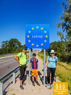
Section 87. Lithuanian– Latvian border – Gramzda.
Along the Vārtāja undulating plain
The Lithuanian – Latvian border in nature is marked by the Apše river, which the Forest Trail crosses, entering Latvia via the Skuodas – Priekule road bridge (P114). The Forest Trail initially winds along the side of the road, but after 1.7 km turns onto a gravel road in the direction of Kalēti. Starting from the surroundings of Ozolu village, the view opens up to the beautiful and wide landscapes of the Vārtāja undulating plain of the Rietumkursa Upland. In Ozoli, the Forest Trail for 0.5 km follows the road V1217, then turns right and after 2 km reaches the Bārta–Kalēti–Gramzda road (V1218), that leads to Gramzda.
Bikeable throughout its entire length.
Section 88. Gramzda – Priekule.
To Priekule, rich in stories
After Gramzda the Forest Trail as a small path swirls along sand and gravel quarries and along a straight path through the agricultural landscape moves northeast. At the Lejasbunči house, it turns to Mazgramzda. Before Mazgramzda, the Forest Trail crosses the deep and shady Ruņupe valley. After Mazgramzda, it runs along the Gramzda–Priekule road (P 114), from which there open up beautiful landscapes of the Vārtāja undulating plain of the Rietumkursa Upland. After crossing this road, it runs along the former airfield, crosses the Priekule–Purmsāti–Kalēti road (V 1211) and throws a circle through a small wooded area. Along the banks of the winding Virga river, the Forest Trail leads through the forest park “Priekules Priediens”, from which there is visible the destination of this section.
Bikeable throughout its entire length.
Section 89. Priekule – Kalvene.
Along the historical road through Embūte and Bandava hills
The Forest Trail along Ķieģeļu, Galvenā and Parka streets bends through Priekule, throws circles along small park paths near Dobeļupe and continues to Audari, where it crosses the Grobiņa–Embūte road (P106). After 4 km, it turns right and in the next section, up to the Rīga–Liepāja highway, leads along a sparsely populated area, where agricultural land alternates with forest clusters and small wetlands. The area between Sepene lake and Kalvene is distinctly hilly – here the Embūte hills alternate with the Bandava hills. The highest point reached by the Forest Trail is 115 m above sea level. Crossing the Rīga–Liepāja highway (A9), after 1 km the Forest Trail reaches the destination of this section.
Bikeable throughout its entire length.
Section 90. Kalvene – Aizpute.
To Aizpute – one of the oldest cities in Latvia
The Forest Trail winds along the small streets of Kalvene to the Aizpute–Kalvene road (P115), for 1.4 km leads along its side and then turns right. Then the Forest Trail crosses the Jelgava– Liepāja railway and winds along a small country road all the way to Bojas village. There are many former fish ponds in the area. The open landscape is occasionally enlivened by a farmstead, where you can sometimes buy locally grown and prepared food. After the Kazdanga–Mazbojas road (V1299), the Forest Trail crosses the Grantnieki quarry. In the section from Kalvene to Bojas, the Forest Trail leads through the Bandava hills of the Rietumkursa Upland, where the highest relief points slightly exceed 100 m above sea level. After Bojas, the Forest Trail crosses the Laža river and at the Tebra river comes out again on the Aizpute–Kalvene road, along which it leads to Aizpute. Along Kalvenes and Atmodas streets, the Forest Trail reaches the centre of the town.
Bikeable throughout. You need to cross railway tracks without a crossing, so it is advisable not to turn towards the Jasmīnu houses, but rather continue on the P115 route. After crossing the tracks, turn right, where you will soon connect to the marked Mežtaka route at a curve.
Section 91. Aizpute – Snēpele.
In the footsteps of baron von Manteuffel
The Forest Trail along Atmodas and Jelgavas streets winds through Aizpute, after the Laža water reservoir turns right, and approaches the Kazdanga manor park with a large circle from the south. As a small path, it leads along Dzirnavu lake through the manor park, around the manor and Zēnu pond, for 0.7 km continues along the Kazdanga–Cildi road (V1200) and then turns right onto the Snēpele–Kazdanga road (V1296). Up to the country house “Zemturi”, the Forest Trail gradually rises in the Bandava hills of the Rietumkursa Upland, revealing beautiful views in both directions. The height of the relief here reaches a maximum of about 81 m above sea level. From “Zemturi”, for about 12 km , the Forest Trail leads through a sparsely populated forest massif and only in the last 3 km comes out again in an open area with agricultural lands and farmsteads, reaching Snēpele.
Bikeable throughout its entire length.
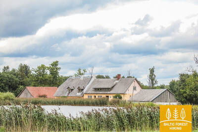
Section 92. Snēpele – Kuldīga.
Venta valley and Riežupe Nature Park
Along the main street of Snēpele, the Forest Trail takes the road V1294 and after 0.3 km opposite Ķepšu lake turns right onto a small country road. Along this road, the Forest Trail bends to Slipiņciems, before crossing Sprincupe along the dam, where a pond has been created. Then the Forest Trail goes in the direction of Pelči. Nearby Pelči, the trail bends along Pelču Dambu ponds, leads to the Kuldīga–Pelču road (V1293) and further stretches through the Kuldīga garden areas – “Kurzemīte” and “Rumba”, until it reaches the Venta bank and the Kuldīga bypass. From there to the Old Brick Bridge, the Forest Trail for 2.4 km leads along a beautiful Venta coastal path, where there are wooden bridges and footbridges in wetter places and across streams town of Kurzeme.
Bikeable throughout. Upon entering Kuldīga, the route includes a meadow where the bike must be pushed. Therefore, it is advisable for cyclists to continue along Pelču Street, which leads to Ganību Street (a real bypass), and then proceed to the New Bridge. Before reaching the bridge, turn left to reconnect with the original Mežtaka route.
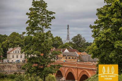
Section 93. Kuldīga – Renda.
Venta valley and Riežupe Nature Park
After the Old Brick Bridge across the Venta river, the Forest Trail continues for a short time on the right bank of the Venta, notched by ravines, then, along Krasta street and Vetklīnika–Paleja road, it crosses Kalnmuiža forest and Riežupe and further up to Mazrenda continues along the roads of the vast Renda forest massif. The terrain is flat here, because this section is part of the Pieventa plain of the Kursa Lowland. In Mazrenda, the Forest Trail crosses a sand-gravel quarry and takes you to the centre of Renda along Kuldīgas street. The section belongs to the territory of the nature reserve “Ventas ieleja” and the nature park “Riežupe”.
Bikeable throughout. At the start of the route, after crossing the old bridge, you should not go down the stairs but instead turn slightly further onto Krasta Street, where you will soon join the Mežtaka route.
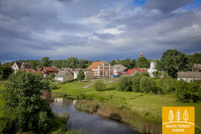
Section 94. Renda – Sabile.
To the town of wine and cider – Sabile
The Forest Trail in Renda for a short distance circles along the rocky banks of the Īvande river and then leads to Kroju Road. At first you can see open landscapes, but later the trail continues through the forest. In some places there are views of the Abava valley. The natural landscapes are gradually changing, as the Forest Trail leaves the Pieventa plain of the Kursa Lowland and slowly rises to the Vāne descent of the Austrumkursa Upland, reaching 50–60 m above sea level. Before Valgale village, it turns around the deep ravine of the Valgale river and goes to Sabile along the upper bank of the Abava valley, and only nearby Sabile descends to Abava bridge (Lāčplēša, Kuldīgas street). In the vicinity of Sabile, the natural areas are changing again and the landscapes of the Saldus hills of the Austrumkursa Upland can be seen here. The depth of the Abava valley between Rumbciems and Sabile reaches about 40 m. The Forest Trail today and the next day crosses the nature park “Abavas senleja” (“Abava valley”).
Bikeable throughout, except for the Īvande Waterfall and a short section of the river valley, which should be bypassed.
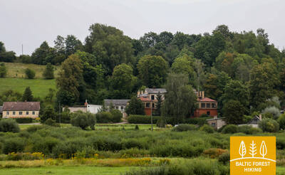
Section 95. Sabile – Kandava.
One of the most beautiful nature parks in Kurzeme
The Forest Trail continues along the left bank of the Abava, along Kr. Barona street. Further, as a small path, it crosses the meadows and forest clusters of the Abava valley until it reaches a hill called the Swedish hat (Zviedru cepure). After Zviedru cepure, the Forest Trail goes along a small country road to the Plosti – Pūces road (V1471), crosses Amula and at Kalnmuiža winds up in the Abava valley, along which the next 6 km leads to Aizdzire Manor park. Another 1 km to the north the Forest Trail crosses the Abava valley in its full width, revealing some of the most beautiful views of the valley. The depth of the Abava valley in this place is about 40 m. After the Fisherman's Bridge (Zvejnieku tilts), the Forest Trail rises on the northern slope of a valley where vineyards are planted. Winding through the forest, it crosses the Kandava–Renda road (P130) and further along Sabiles street reaches Kandava. Along the Lauku, Ozola, Zīļu, Sabiles and Pils streets of this picturesque small-town the Forest Trail reaches the Knights' Castle Mound. Throughout the section, the Forest Trail winds through the nature park “Abavas senleja” (“Abava valley”).
The section is bikeable, except near Zviedru Cepure (from Sabile, take Brīvības Street (V1402) and then turn left onto Zviedru Cepure)
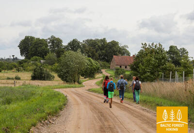
Section 96. Kandava – Jaunmokas.
Pūre – a place where chocolate is made
Along Jelgavas street, crossing the old boulder bridge over Abava, the Forest Trail along Daigones street and further along a gravel road leads to the 5 km distant Daigone village, after which it descends along the Dziļkalns–Pūre road (V1464) in the Abava valley. After the bridge over Abava, the Forest Trail turns right and along a small path reaches Pūre. Circling around the Pūre Manor, it stretches for the next 5 km to Galciems along Zemeņu street and Pūre–Jaunsāti (C004) road. Sand and gravel are mined here in the quarries of the region. In Galciems, the Forest Trail turns left onto a small gravel road (C003), which after 3.5 km connects with Jaunmoku–Jaunsāti road (V1444). After another 3 km, the Forest Trail crosses the Rīga–Ventspils highway and reaches Jaunmoku palace along small paths surrounded by tree alleys. Approaching the palace from Jaunsāti, you can see the beautiful wide landscapes around the Forest Trail, where Spārnene, the wavy plain of Austrumkursa, alternates with Vanema hills.
Bikeable throughout its entire length.
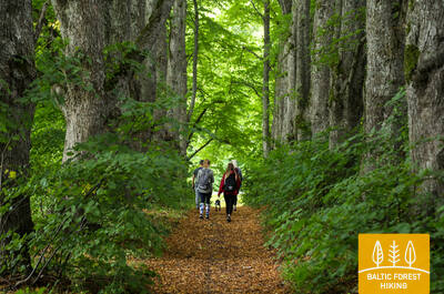
Section 97. Jaunmokas – Tukums.
To Tukums for the beauty!
In the vicinity of Jaunmoku palace, spectators are delighted by the beautiful landscapes of the Vanema hills of Austrumkursa Upland. The Forest Trail slopes down to the Bēru watermill and then, further up to Vecmokas, in a length of three kilometres rises by about 50 m, revealing beautiful landscapes to the wide Slocene valley in the south. After the alley of Vecmoku Manor, the Forest Trail crosses the Tukums–Lazdas road (V1442), turns around a cluster of farmsteads and then along straight forest path goes southeast along Sekļa lake. The lake can be accessed via small paths. In the vicinity of Recreation complex “Sveikuli”, the route continues along beautiful forest paths and joins the Tukums–Kesterciems–Kolka road (P131) near the Ozoliņi cemetery, where the town of Tukums begins. Along Raudas, Kurzeme Forest and Melnezera streets, the Forest Trail reaches the Sun hill (Saules kalns).
The section is bikeable, except for the area between Sekļu Lake and Ozoliņu Cemetery at the beginning of Tukums, where there are small trails unsuitable for cycling and muddy spots. Before reaching Sekļu Lake, it is better to continue on the same Vecmoku Road and then Purva Road, which will lead you to the Tukums - Engure road. Continuing the route towards Tukums, after joining the bike path, it will connect with the Mežtaka route.
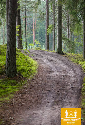
Section 98. Tukums – Jāņukrogs.
Through the best mushroom forests in the area
Along Melnezera street, the Forest Trail leaves Tukums. Up to Milzkalne, it winds through beautiful forests, except for a short section along Jaunūdru road. Then the trail throws bows up and down along the backs of the steep hills of the Raudas massif. One of the highest points is Milzkalns, 113 m above sea level. Crossing the Tukums–Milzkalne–Smārde road (V1446), the Forest Trail leads through the Šlokenbeka Manor, crosses the Slocene river, turns around Bērzāji and further along the left bank of the Slocene curves through the beautiful forests to the Kārniņi cemetery on the Tukums–Milzkalne–Smārde road. From here, Valguma lake, with accommodations nearby, is about 2.5 km away. Ķemeri National Park starts behind Bērzāji.
In the section between Tukums and Milzkalns, the Mežtaka follows small forest trails that are not suitable for cycling. Here, you should choose the Tukums - Milzkalns road. From Milzkalns to the end point of the section, follow the Ķemeri National Park cycling route 'Šlokenbekas Loop.'
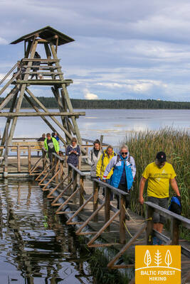
Section 99. Jāņukrogs – Bigauņciems.
Through Ķemeri National Park
After crossing the area with some homesteads, the Forest trail winds through beautiful coniferous forests and further 6.5 km along Čaukciems until the turn to the Green Dune leads along the side of the Antiņciems–Smārde road The neighbourhood is flat, as the section is part of the Engure plain of the Piejūras Lowland. The Green Dune (Zaļā kāpa) offers wide views of the Green Bog (Zaļais purvs) and the Witches' Bog (Raganu purvs). A small forest road bends along the lower part of the dune and in two places crosses the bog along wooden footbridges. In Ķemeri, the Forest Trail moves along Partizāna, Robeža, A. Upīša, Katedrāles and E. Dārziņa streets, along the Forest House and Vēršupīte, into which the waters of sulphur springs flow. Crossing Tūristu street, it continues along the Dūņu road to the Sloka lake. Further the trail crosses the Vēršupīte swamp forest, which is one of the most outstanding wet forest habitats in the whole part of the trail in Kurzeme. At Melnezers it turns onto the Old Ķemeri road and after 2 km it reaches Bigauņciems. Behind the Talsi highway, the Forest Trail reaches the shore of the Gulf of Riga and connects with the Coastal Hiking Trail. The Forest Trail runs through the Ķemeri National Park along the entire section.
The section is bikeable, except for the Sloka Lake Nature Trail, where the bike must be walked (cycling on nature and interpretive trails in Ķemeri National Park is prohibited). In this section, the Mežtaka overlaps with two Ķemeri National Park cycling routes—'Meža Aplis' and 'Zaļā Kāpa.'
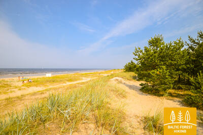
Section 100. Bigauņciems – Dubulti.
The historic resort of Jūrmala
In Bigauņciema village, you can clearly see the whole length of the Jūrmala coast. The first third of this day’s itinerary is part of the Ķemeri National Park where you can get to know historic fishing villages, the Ragaciems village fishing area with net huts and a fish market, dune habitats, as well as watch birds in the estuary of the Starpiņupe River. Starting from Jaunķemeri to Dubulti, the walk takes you across the widest sandy beach of the Gulf of Riga through the historic resort in Jūrmala and the longest city in Latvia. Keep in mind that on warm and sunny summer days there will be a lot of beachgoers.
The section runs along the seaside beach. By bike, you can use the city bike paths, which connect Jūrmala with Riga along the entire length.

Section 101. Dubulti - Lielupe - Bulduri.
The Most Popular Beaches in Latvia
The widest sandy beach of the Gulf of Riga stretches from Dubulti to the Lielupe River. It is the main asset of the Jūrmala resort offering many beach cafés and different recreational possibilities. The coastal dune forests are permeated with a dense web of trails suitable for walking and stick-walking. The part of the Baltic Coastal Hiking Route located between the beach of the Lielupe River and Jūrmala beach is part of the Ragakāpa Nature Park. From here, you can easily get back to Bulduri by taking Bulduri prospekts and the 5th line.
The section runs along the seaside beach. By bike, you can use the city bike paths that connect Jūrmala with Riga along the entire route.
Section 102. Bulduri - Riga City Center.
Through the Forests To Riga
The itinerary is an alternative way to get from Jūrmala to Riga by going through the forest. After passing the bridge across the Lielupe River, the Baltic Coastal Hiking Route snakes through Priedaine with its wooden buildings, goes along the right bank of the Lielupe River, then turns towards the Southern part of Bolderāja Dune and crosses Kleisti forest past Lāčupe Cemetery. Next, it goes along the historic roads of Pārdaugava on the West bank of the Daugava River, namely, Buļļu and Daugavgrīvas iela, through Dzegužkalns Hill, passing the Zunda Canal and Āgenskalns bay until reaching the Daugava River, which the route crosses via the Stone bridge and then stops at Town Hall Square.
The section between Bulduri, Priedaine, and Riga is most conveniently covered via the Riga - Jūrmala bike path, which connects the centers of both cities.