


Section 83. Paplatelė – Plateliai. Žemaitija ethnographic region.
Section 83. Paplatelė – Plateliai.
Paplatelė – Plateliai Around the largest lakes in the Žemaitija National Park
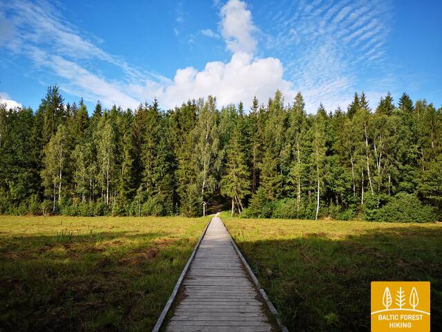
For the first 3.5 km, the Forest Trail leads through beautiful coniferous forests that cover the slopes of the Žemaitija Upland. Up to the Cold War exposition, it coincides with the Plokštinė cognitive trail. From the museum, the Forest Trail for 5 km follows the Plokštinė road, where a pedestrian / bicycle path has been created and, approaching Plateliai lake, descends into the lowland of the lake. At the road No. 3202 (Malūno street) , the Forest Trail turns left to the south-east and after 0.3 km turns right to right to the south-southwest. After about 0.5 km it reaches Ilgio Ežero street. For the next 5.5 km, the Forest Trail forms a wide circle around Ilgis and Beržoras lakes, reaching the Beržoras village. After the village, after 2 km along Plungės street, the Forest Trail reaches the centre of Plateliai and throws another circle along Ežero street to the beach and Šeirė educational trail. Then along Ežero, Naujoji and Žemaičių Kalvarijos streets, the Forest Trail returns to the centre of the town.


