


Forest route - hiking sites and applications
Travel to Baltic Forest Hiking Trail using one of the local or foreign hiking sites and mobile apps. Choose the most suitable and convenient for you. These apps will help you to keep track of your route, find nearby attractions and services, and more options.
Accessible Hiking Guidelines for using Online Tools
The Accessible Hiking Trails initiative aims to enhance hiking safety and accessibility by using online tools and digital solutions. Digital platforms provide real-time information, improve route planning, and ensure safe navigation in diverse terrains and weather conditions.
These guidelines help hikers, tourism organizers, and outdoor groups integrate digital resources into their hiking experience, covering:
- Weather forecasts and emergency alerts.
- GPS tracking and navigation apps.
- Digital trail databases and community platforms.
- Real-time information from webcams and local reports.
- Online tools for group coordination and communication.
By using these solutions, hikers can avoid risks, improve preparation, and enjoy safer, more inclusive hikes.

Geocaching at the Baltic Forest Hiking Trail
The Estonian part of the Forest Hiking trail has some geocaching treasures hidden on all of the day routes. You can hike the trail on both directions and choose your own pace. The geocaches show the hikers some interesting places of cultural history and nature, or give you food for thought during the long journey. This game can be played by those who have no previous experience in geocaching. Geocache coordinates help to discover beautiful places and spend some time with family or friends outdoors, even if you do not have the opportunity to make the entire hiking trail.
What is geocaching?
Geocaching is a treasure hunt game played in the open air, which takes you to unprecedented locations, beautiful places, offers puzzles to solve and as well as physical challenges. Geocaching makes you see things you have never seen before or were unaware of.
Game rules:
- Make a user account at www.geocaching.com (it's free)
- Follow the instructions to find the treasure
- Write a message about your visit in the logbook inside the box: names of finders, date found. If possible, log also on the website or in the Geocaching app.
- Close the treasure box so that all things remain there and put it back in the same place where you found it. If you wish, you can exchange the items in the geocache for equivalent ones.
More information about the rules of geocaching can be found here.
List of geocaches at the Forest Hiking Trail can be found here (in Estonia) and here (in Latvia).

NaviCup mobile application
"NaviCup" offers thematic tourist maps and hiking trails with points of interest, audio and online guided tours, outdoor event area maps and other tools to help you plan your itineraries and events. Here you will also find the Forest Trail.
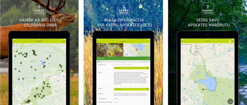
The Latvian Nature Conservation Agency application "Nature Tourism"
The mobile application "Nature Tourism" provides an opportunity to plan a day for a beautiful walk or trip in nature in a short time. The app helps to find answers to questions - where to go today or what to do - it has more than 400 different nature tourism destinations - nature trails and sights, towers, throughout the territory of Latvia, including the Baltic Forest Hiking route!
To find the Baltic Forest Hiking route in the territory of Latvia, use the search engine of the application and enter the keywords "Forest trail". Therefore, select the appropriate route section, starting from the Riga Old Town and ending with the Korneti, the Latvian-Estonian border. The mobile app can be downloaded here.

"Jāņa Sēta" mobile application "Baltic Maps"
The popular long-distance hiking route "Forest trail" for the pleasure of hiking enthusiasts can now also be found in the mobile app BalticMaps (Android version). The mobile app can be downloaded here.
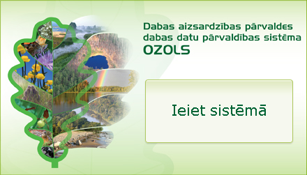
Nature data management system Ozols
Nature data management system "Ozols" is a place where information about specially protected nature territories, micro-reserves, specially protected species and habitats, management measures, tourism infrastructure in specially protected nature territories and other data relevant to nature protection is stored.
The northern part of the Forest Trail route in Latvia is also integrated into this system. It can be viewed here (highlighted in red).
Mobile application "LVM GEO"
"LVM GEO" is a mobile application that allows you to navigate in nature, using a wide range of maps and data. The application is based on pre-made cartographic material that can be used both online and downloaded for offline use. The application is developed to support the employees, service providers and customers of JSC "Latvijas valsts meži", but it is also freely available to anyone who wants to go outdoors. The app can be downloaded here and the Forest Trail can also be found there.
The route can also be found on the LVM map online.
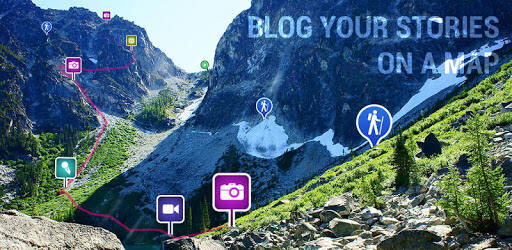
Mobile application Ramblr
Ramblr is a service to record and share your outdoor activities such as hiking, biking, skiing, kayaking, road trip, travel, or any type of trip. Now the Forest trail is also a part of this service.
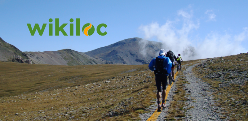
Mobile application Wikiloc
Wikiloc is a place to discover and share the best outdoor trails for hiking, cycling and many other activities. There you can also find information about the Forest trail.

Mobile application Komoot
Komoot will inspire your next ride, hike, or run by shared community knowledge and recommendations of routes. Here you can also find the Forest trail. The Forest Trail is a part of the European long-distance hiking route E11. The Forest trail passes through the Baltics (Estonia, Latvia, and Lithuania). Along the route, you will see more than 400 natural, historical, and cultural objects and monuments.

Mobile application Outdooractive
The Outdooractive App is a companion on your next hiking, cycling, mountaineering, and other outdoor activities where you can find plan routes from around the world. There you can also find the Forest trail.
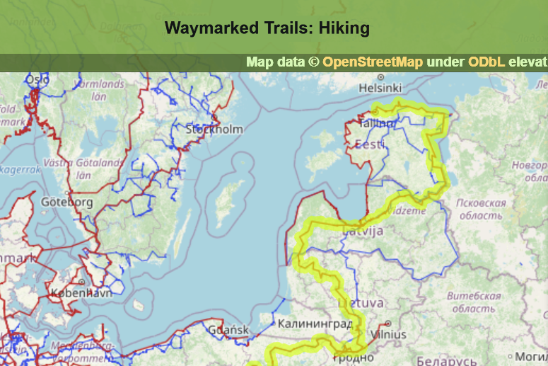
Mobile application Waymarked Trails
Mobile app "Waymarked Trails" shows hiking routes from the local to international level, with maps and information from Open Street Map. Here you can find also the Forest trail.

Traildino hiking portal
Traildino is one of the largest hiking route databases in the world. There you can also find the Forest trail.

European Ramblers Association
The European Ramblers Association (ERA) is a network organisation working for promotion of walking, hiking, creating trails, exchange of the know-how over the borders and secure the rights of free access to nature for the walkers. Information about the Forest trail as as part of E11 European long distance path can be found on the ERA website.

Wikipedia
Wikipedia is a free online encyclopedia, created and edited by volunteers around the world. It contains information also about the Forest trail which is a part of European long distance path E11.
Open Street Map
Open Street Map (OSM) is an initiative to create and provide free geographic data, such as street maps, to anyone. Here you can find also the Forest trail.
- Forest trail in Lithuania
- Forest trail in Latvia
- Forest trail in Estonia

Regio
Regio is the oldest and biggest Estonian map publisher. Regio added the Baltic Forest Trail route to their maps/hiking brochure, information was given by ERTO (Estonian Rural tourism Association). Example of the brochure you can find here: https://issuu.com/regio_as/docs/matkame_eestis
Biliki is a global marketplace of self-guided tours. It connects travellers with sustainable and responsible tourism experiences, local guides and small businesses. It enables travellers to easily discover and access unique and culturally immersive experiences while empowering local providers to reach a global audience of responsible travellers. Biliki allows users to create, share, and sell their self-guided tours. Offline interactive maps increase the safety and convenience of the journey. Local SMEs can publish their businesses on the platform's map, attracting a relevant audience of responsible travellers. Biliki cultivates a vibrant ecosystem that supports sustainable tourism growth and unlocks new revenue opportunities for content creators and small businesses.