


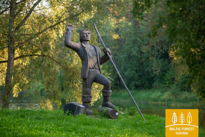
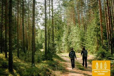
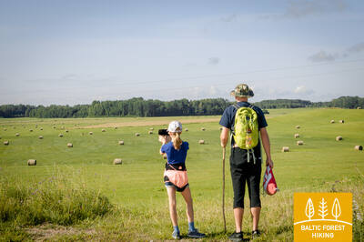
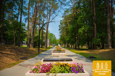
Baltic Forest Hiking - Canoeing


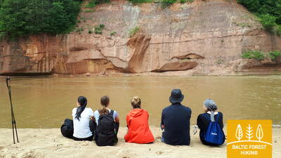
 1-й этап. Старая Рига – Балтэзерс.
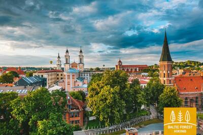
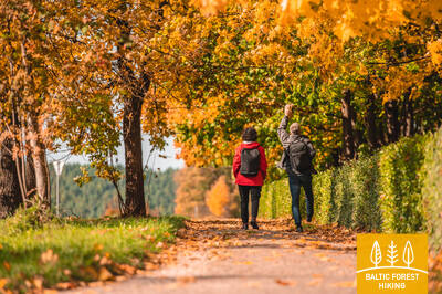
Сквозь Ригу – объект Всемирного наследия ЮНЕСКО
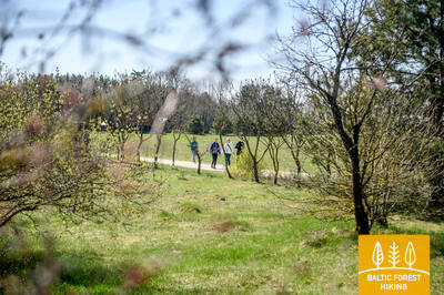
В Латвии Лесная тропа начинается в самом сердце Старой Риги – на Ратушной площади. Тропа идет по улице Калькю, мимо Памятника Свободы, через Верманский парк и по исторической улице Тербатас. Далее она устремляется к пешеходному мосту, пересекает железнодорожную станцию «Земитану» и продолжается в Бикерниекском лесу и лесном массиве Шмерлис. Лесная тропа проходит через Юглу, мимо Латвийского этнографического музея под открытым небом и по пешеходно-велосипедным дорожкам приводит в Балтэзерс.

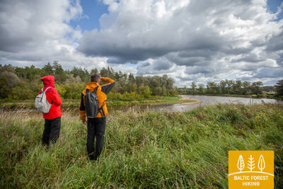
Рижский канал и река Даугава — популярные места для катания на байдарках и каноэ.
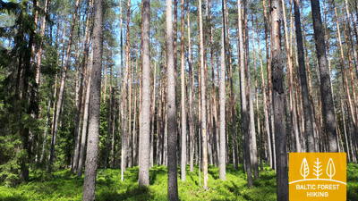
2-й этап. Балтэзерс – Вангажи.
По исторической дороге Тербатас вдоль озер и реки Гауи
По туннелю Лесная тропа пересекает автодорогу VIA Baltica и, оставляя за собой тихие коттеджные районы, устремляется к берегам озера Малый Балтэзерс. Там тропа поворачивает на восток и следует вдоль канала Гауя – Балтэзерс. По обеим сторонам Лесной тропы на отрезке пути Гаркалне – Ани простираются живописные луга, утопающие в цветах красной смолки, белой ромашки и желтых лютиков. В средние века пути пролегали вдоль Гауи с паромной переправой в Илькене. Миновав Ани, Лесная тропа проходит как по лесным участкам, так и по сельским населенным пунктам, и по улице Гауяс приводит в Вангажи.
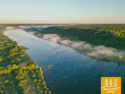
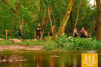
От Гауйены до Гаркалне тропа Межтака проходит близко к реке, а в некоторых местах и вдоль ее (древней долины) берегов. Этот участок можно использовать для гребли на каноэ или байдарках (примерно недельная поездка). Самый популярный участок для водного туризма на Гауе находится в Национальном парке Гауя, между Валмиерой и Сигулдой или Рамкални (поездка длится 3-5 дней). Более подробную информацию см. на сайте https://riverways.eu/en/
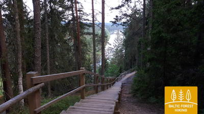
3-й этап. Вангажи – Рамкални.
Мимо Охотничьего замка в Инчукалнсе к национальному парку "Гауя"
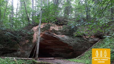
Миновав Вангажи, Лесная тропа разветвляется на маленькие тропинки и приводит к Вангажской лютеранской церкви и сосне Вилкачу. Направляясь к Охотничьему замку по так называемой Екатерининской дороге, тропа ненадолго исчезает в лесу. Путь от Охотничьего замка проходит по Могучей охотничьей тропе. Этот участок имеет очень выразительный рельеф: здесь впервые можно увидеть овраги, образовавшиеся на склонах древней долины Гауи. В одном из них, окруженная древними руслами Гауи, находится Инчукалнская пещера Велнала. Миновав пещеру, Лесная тропа ныряет в прибрежные луга Гауи, а затем пересекает автодорогу Мурьяни – Валмиера, на краю которой стоит парк отдыха «Рамкални».
От Гауйены до Гаркалне тропа Межтака проходит близко к реке, а в некоторых местах и вдоль ее (древней долины) берегов. Этот участок можно использовать для гребли на каноэ или байдарках (примерно недельная поездка). Самый популярный участок водного туризма Гауи находится в Национальном парке Гауя, между Валмиерой и Сигулдой или Рамкални (3-5-дневная поездка). Более подробную информацию см. на сайте https://riverways.eu/en/
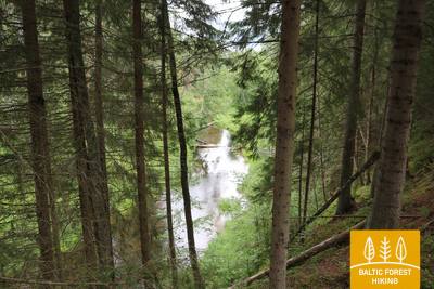
 4-й этап. Рамкални – Сигулда.
Красивейшие виды древнего русла Гауи возле Сигулды
Покинув парк Рамкални, Лесная тропа поднимается на высокий, крутой склон древней долины Гауи, проходит через поселок Гауя и устремляется вниз. Далее тропа пересекает речку Лорупе, проходит по изгибам Гауи и приводит к одному из самых впечатляющих береговых обнажений на Гауе – утесу Чертовой пещеры. Затем тропа ведет к таким достопримечательностям как Кейзарскатс, делает круг до Кейзаркреслса, Межакакиса на горе Какишкалнс, Сигулдской санно-бобслейной трассы и достигает центра Сигулды.
От Гауйены до Гаркалне тропа Межтака проходит близко к реке или, в некоторых местах, вдоль ее (древней долины) берегов. Этот участок можно использовать для гребли на каноэ или байдарках (примерно недельная поездка). Самый популярный участок водного туризма Гауи находится в Национальном парке Гауя, между Валмиерой и Сигулдой или Рамкални (3-5-дневная поездка). Более подробную информацию см. на сайте https://riverways.eu/en/
5-й этап. Сигулда – Лигатне.
В самом сердце Национального парка Гауя
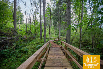
Сделав круг через Сигулду, Лесная тропа по верхней части склона оврага Вейупите приводит путников к горе Парадизес, затем спускается по крутой лестнице к древней долине Гауи и оврагу Вейупите. Основную часть дальнейшего этапа составляют небольшие одинокие тропинки, ведущие через лес и луга (на которых в июне цветет смолка). Далее Лесная тропа пересекает ущелья многих небольших рек, на склонах которых виднеются обнажения песчаника. Последние шесть километров этапа – природные тропы Лигатне. На подступах к городу Лигатне Лесная тропа поднимается по склону древней долины Гауи, а в Лигатне спускается в глубокий овраг реки Лигатне, на склонах которого находится поселок бывшей бумажной фабрики.
От Гауйены до Гаркалне тропа Межтака проходит близко к реке, а в некоторых местах и вдоль ее (древней долины) берегов. Этот участок можно использовать для гребли на каноэ или байдарках (примерно недельная поездка). Самый популярный участок водного туризма на Гауе находится в Национальном парке Гауя, между Валмиерой и Сигулдой или Рамкални (3-5-дневная поездка). Более подробную информацию см. на сайте https://riverways.eu/en/
 6-й этап. Лигатне – Цесис.
По старой цесисской дороге через долину реки Амата
Один из самых живописных участков Лесной тропы проходит через исторический поселок бумажной фабрики Лигатне, мимо геологического обнажения Сприньгю, по извилистым тропинкам Скальупе и Мифологической тропе. Заглянув в Советский бункер (один из секретных объектов периода Железного занавеса), Лесная тропа доходит до заповедника Рочу, пересекает реку Амата, по геологической тропе (самый красивый и скалистый участок у берегов Аматы) приводит к геологическому образованию Звартес. Далее Лесная тропа устремляется на высокий склон долины Аматы и по исторической дороге (ранее столбовая дорога Цесис – Рига, ныне небольшая проселочная и лесная дорога со старыми дорожными столбами) приводит в Ракши. Далее Тропа поднимается на холм Валюкалнс и из Озолкалнса идет по извилистым природным тропам Цирулиши, вдоль берегов Гауи, где находится множество родников и отложений песчаника. Этап завершается на улице Гауяс, по которой путешественники, преодолев 2,8 км, могут дойти до Старого города, провести день в Цесисе и продолжить путь.
Участок от Гауйены до Гаркалне на тропе Межтака проходит близко к реке или вдоль ее (долины) берегов в некоторых местах. Этот участок можно использовать для гребли на каноэ или байдарках (примерно недельная поездка). Самый популярный туристический маршрут по реке Гауя проходит в пределах Национального парка Гауя, между Валмиерой и Сигулдой или Рамкални (3-5-дневная поездка). Более подробную информацию см. на сайте https://riverways.eu/en/
7-й этап. Цесис – Цаунитес.
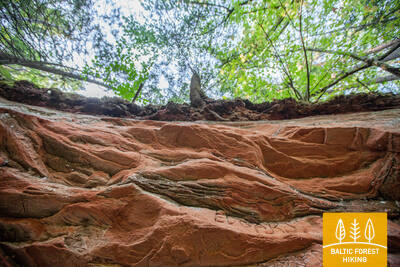
Впечатляющие обнажения песчаника на берегах Гауи
К базе водного туризма Ленчи Лесная тропа проходит по небольшим дорогам и тропам, пролегающим в лесу, вдоль излучины Гауи и древних речных долин. Не доходя до скал Эргелю, Лесная тропа сливается с выразительным рельефом местности, поднимается и спускается по склонам древней долины Гауи, изборожденной небольшими ручьями. Миновав скалы Эргелю, Лесная тропа слегка отклоняется в сторону Цесиса, в Пиешкални делает поворот в направлении Рамниеки, где пересекает мост через Гаую. Оставив позади базу водного туризма Яньрамис, Лесная тропа, будто стремясь оправдать свое название, устремляется в светлохвойный лес. Затем тропа приводит путников в Цаунитес, где находится одно из красивейших мест отдыха на берегах Гауи.
От Гауйены до Гаркалне тропа Межтака проходит близко к реке, а в некоторых местах и вдоль ее (долины) берега. Этот участок можно использовать для гребли на каноэ или байдарках (примерно недельная поездка). Самый популярный участок водного туризма Гауи находится в национальном парке Гауя, между Валмиерой и Сигулдой или Рамкални (3-5-дневная поездка). Более подробную информацию см. на сайте https://riverways.eu/en/
8-й этап. Цаунитес – Валмиера.
По дороге в «Зеленый город» – Валмиеру
Покинув Цаунитес, Лесная тропа уводит в сосновые боры, смешанные леса, богатые мхом и травянистыми растениями, поднимается на склоны и холмы или огибает их. С утеса Сиетиньиезис открывается один из самых красивых видов на Гаую. Здесь же находится природная тропа Сиетиньиезис, которая заслуживает того, чтобы прогуляться по ней. Дальнейший путь, вплоть до границы Валмиеры, ведет через леса и мимо небольших хуторов. Миновав Валмиерскую окружную дорогу, Лесная тропа ведет по городским тротуарам Валмиеры. На завершающем участке, от «Железки» (бывший узкоколейный железнодорожный мост) до улицы Цесу, Лесная тропа ведет по небольшим тропам и обочинам, окруженным деревьями.
От Гауйены до Гаркалне тропа Межтака проходит близко к реке, а в некоторых местах и вдоль ее (древней долины) берега. Этот участок можно использовать для гребли на каноэ или байдарках (примерно недельная поездка). Самый популярный маршрут водного туризма по Гауе проходит в национальном парке Гауя, между Валмиерой и Сигулдой или Рамкални (3-5-дневная поездка). Более подробную информацию см. на сайте https://riverways.eu/en/
9-й этап. Валмиера – Стренчи.
Вдоль берегов реки Абула – в Стренчи, город плотогонов
Заглянув в исторический центр Валмиеры и Парк отдыха, где созданы трассы для пеших прогулок и скандинавской ходьбы, Лесная тропа пересекает Вантовый мост и уводит к соснам Пауку и горе Байлю. По тропе Абула, пролегающей вдоль крутых первозданных речных берегов, Лесная тропа ведет к пивоварне Бренгелю, и далее, миновав Пуполи, – к малонаселенным местам и обширным лесным массивам. Первая половина этапа представлена небольшими дачными поселками Энергетик, Саулитис, Спридитис, Гауймали, Пуполи и Гауяслачи, созданными в советское время для работников промышленных предприятий Валмиеры и ее окрестностей. В районе Удрини Лесная тропа проходит через лабиринты старых речных долин, поворачивает на север, пересекает мост через Гаую, возле которого находится база отдыха и лодочного спорта. Расстояние отсюда до центра Стренчи составляет около 1,5 км. Часть пути находится в заповедной зоне Северной Гауи.
Лесная пешеходная тропа от Гауйены до Гаркалне проходит близко к реке или, в некоторых местах, вдоль ее (древней долины) берега. Этот участок можно использовать для гребли на каноэ или байдарках (примерно недельная поездка). Самый популярный маршрут водного туризма по Гауе проходит в национальном парке Гауя, между Валмиерой и Сигулдой или Рамкални (3-5-дневная поездка). Более подробную информацию см. на сайте https://riverways.eu/en/
10-й этап. Стренчи – мост Спицу.
Через прекрасные грибные и ягодные леса Видземе
Начальный участок этого этапа проходит по природной тропе Гауя, ведущей вдоль берега реки. Лесная тропа в двух местах (перед поворотами на Седу и на Каучи) пересекает автодорогу А3 (будьте осторожны!), затем проходит по лесным дорожкам, вдоль песчано-гравийного карьера, а возле поворота к поселку Олиняс выходит на гравийную дорогу. Через 3,5 км тропа снова поворачивает направо и следующую часть пути (до моста Спицу) ведет по небольшим и отдаленным лесным дорогам. В этом месте, за островом Зема, находится одно из самых красивых мест охраняемой природной территории "Ziemeļgauja". На завершающем участке этапа, там, где дорога P24 проходит по мосту Спицу, находится база отдыха и водного туризма.
Тропа Межтака от Гауйены до Гаркалне проходит близко к реке или, в некоторых местах, вдоль ее (древней долины) берега. Этот участок можно использовать для гребли на каноэ или байдарках (примерно недельная поездка). Самый популярный маршрут водного туризма по Гауе проходит в национальном парке Гауя, между Валмиерой и Сигулдой или Рамкални (3-5-дневная поездка). Более подробную информацию см. на сайте https://riverways.eu/en/
11-й этап. Мост Спицу – Заки.
По живописным дюнным окрестностям Циргали
Лесная тропа пересекает мост Спицу и приводит к четырем озерам Кокшу (протяженность – около 4 км), которые связаны небольшим ручьем. В их окрестностях находятся база отдыха, кемпинг и природная тропа. Местность славится прекрасными пейзажами и богатыми грибными лесами. Миновав озеро Дибена (последнее из озер Кокшу) и совершив 1,5-2-часовой переход, путники попадают в дюнный массив Циргалю. Далее путь ведет в направлении север-юг. Лесная тропа пересекает большой лесной участок, проходит мимо хутора или маленького озера. Этап завершается в небольшом поселке Заки, где нет туристических услуг. Поэтому перед походом следует продумать этап и возможности ночлега. Этап находится в охраняемой ландшафтной зоне "Ziemeļgauja".
Тропа Межтака от Гауйены до Гаркалне проходит близко к реке, а в некоторых местах и вдоль ее (древней долины) берега. Этот участок можно использовать для гребли на каноэ или байдарках (примерно недельная поездка). Самый популярный маршрут водного туризма по Гауе проходит в национальном парке Гауя, между Валмиерой и Сигулдой или Рамкални (3-5-дневная поездка). Более подробную информацию см. на сайте https://riverways.eu/en/
12-й этап. Заки – Гауйиена.
Вдоль Звартавского замка – в Гауйиену
Покинув Заки и преодолев 1,5 км, Лесная тропа сворачивает с дороги (P 23) Сели – Виреши и далее направляется по небольшой извилистой проселочной дороге до Звартавы, где в конце длинной аллеи виднеется Звартавский замок. Миновав Звартаву, Лесная тропа возвращается на дорогу P 23 и через 2 км поднимается на крутой склон долины Гауи, где находится центр Гауйиены. Часть этапа проходит по охраняемой ландшафтной зоне Северная Гауя.
Тропа Межтака от Гауйены до Гаркалне проходит близко к реке, а в некоторых местах и вдоль ее (древней долины) берега. Этот участок можно использовать для гребли на каноэ или байдарках (примерно недельная поездка). Самый популярный маршрут водного туризма по Гауе проходит в национальном парке Гауя, между Валмиерой и Сигулдой или Рамкални (3-5-дневная поездка). Более подробную информацию см. на сайте https://riverways.eu/en/
54-й этап. Didžiasalis – Druskininkai – Žiogeliai.
Друскининкай – самый популярный курорт в Восточной Литве
Между деревней Диджясалис и курортом Друскининкай Лесная тропа петляет по хвойным лесам, отличающимся обилием ягод и грибов. Возле Друскининкай Лесная тропа совпадает с маршрутом вдоль реки Неман, огибает комплекс зимних развлечений Сноу Арена в Друскининкай, а затем по пешеходным и велосипедным дорожкам выходит к Парковому мосту через реку Неман. Миновав мост, Лесная тропа пролегает по улице Майронё и далее по небольшим улочкам и парковым аллеям исторического курорта Друскининкай, пересекает небольшую реку Ратнича и лесопарк на правом берегу Немана. За улицей Вейсею маршрут проходит по тротуару улицы Нераву и через приблизительно 1 км поворачивает налево на улицу Соджяус, которая на окраине деревни Неравай превращается в живописную лесную дорожку. Это граница Дзукийского национального парка. Лесная тропа огибает деревню Вечюнай, где перед пешими туристами открывается красивейшая панорама Лишкявского монастыря на противоположном берегу реки Неман. Далее до деревни Жиогяляй Лесная тропа пролегает по красивой и спокойной лесной дорожке.
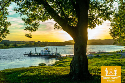
От Друскининкай до Каунаса (Друскининкай - Меркине - Алитус - Бирштонас - Пакуонис - Пилюона - Каунас) и за Каунасским водохранилищем Лесная тропа примерно следует по долине Нямунаса. Участок Нямунаса от Друскининкай до Пилюоны доступен для плавания на каноэ или каяке (Друскининкай – Пилюона по реке Нямунас – около 200 км, 7 – 10 дней сплава).
55-й этап. Žiogeliai – Merkinė.
Дзукийский национальный парк
До самого устья реки Мяркис, места её слияния с рекой Неман, Лесная тропа пролегает по берегам долины Немана, где в окрестностях Дайнавской равнины её окружают огромные и прекрасные Дзукийские леса. Местами в лесных массивах встречаются открытые участки, на которых разбросаны небольшие деревни. Возле деревни Чесукай Лесная тропа по большой дуге огибает место впадения реки Мяркис в реку Неман, так как ближайший мост расположен на шоссе А4. Здесь открываются впечатляющие виды на широкое и глубокое устье реки Мяркис. После пересечения реки Мяркис, Лесная тропа проходит по узкой сельской дорожке по левому берегу реки и выводит к Мяркинскому городищу, с которого открывается панорама одного из красивейших ландшафтов Восточной Литвы. По узким и извилистым улочкам Мяркине (Пилякалнё, В. Сладкявичяус, С. Даряус и С. Гирено) Лесная тропа приводит в центр городка. Данный этап маршрута проходит по территории Дзукийского национального парка.
От Друскининкай до Каунаса (Друскининкай - Меркине - Алитус - Бирштонас - Пакуонис - Пилюона - Каунас) и за Каунасским водохранилищем Лесная тропа более или менее следует по долине Нямунаса. Участок Нямунаса от Друскининкай до Пилюоны доступен для плавания на каноэ или каяке (Друскининкай – Пилюона по реке Нямунас – около 200 км, 7 – 10 дней сплава).
56-й этап. Merkinė – Nemunaitis.
По долине реки Неман
В Мяркине Лесная тропа по улице Сейню пролегает в направлении реки Неман, сворачивает вправо и останавливается у обзорной башни, с которой открывается изумительный вид на широкую речную долину и остров Нямунас, служащий пастбищем для домашних животных. Далее на протяжении более 3 км Лесная тропа петляет вдоль крутых берегов реки Неман, затем резко поворачивает на север и по небольшим лесным дорожкам в западном направлении выводит к деревне Нятесос и курорту Друскининкай. За Друскининкай тропа пересекает крупнейшую на данном этапе открытую местность, которая подарит вам прекрасные виды. Далее Лесная тропа пролегает по долине Немана, однако сама река на данном участке пока не просматривается. Местами на пути встречаются холмы с крутыми склонами. У деревни Вангелонис Лесная тропа выходит на более открытое пространство, пересекает небольшой лесной массив и по улицам Вангелоню и Саулетякё приводит на главную улицу деревни Нямунайтис. Часть данного этапа от Мяркине до Друскининкай находится на территории Дзукийского национального парка.
От Друскининкай до Каунаса (Друскининкай - Меркине - Алитус - Бирштонас - Пакуонис - Пилюона - Каунас) и за Каунасским водохранилищем тропа Межтака более или менее следует по долине Нямунаса. Участок Нямунаса от Друскининкай до Пилюоны доступен для плавания на каноэ или каяке (Друскининкай – Пилюона по реке Нямунас – около 200 км, 7 – 10 дней сплава).
57-й этап. Nemunaitis – Alytus.
В Алитус по самому высокому пешеходному мосту
Из Нямунайтисa по улице Витауто и шоссе Канюкай–Эйнорай–Нямунайтис (№ 1102) Лесная тропа на протяжении около 1,5 км пролегает в северо-восточном направлении, затем сворачивает влево на север и ещё через 3 км приводит в деревню Гечялаукис. Далее Лесная тропа поворачивает направо в восточном направлении и через 3,3 км снова выходит на шоссе № 1102. Через 3,3 км Лесная тропа достигает шоссе № 128 и по пешеходному тротуару спускается в долину реки Неман. Отсюда, миновав через чуть более 3 км, красивейшая тропа, протянувшаяся в долине Немана, через лес выводит к пешеходному мосту через реку. После значительного подъёма на самый высокий в Литве пешеходный мост, перед глазами открывается широкая и ошеломляющая панорама реки Неман. Миновав мост, Лесная тропа петляет по насыпи бывшей железной дороги, по небольшим дорожкам Курортного парка Алитуса, и в центре города, по улице С. Даряус и С. Гирено, приводит в скверу Старого города, в южной части которого находится туристический информационный центр Алитуса.
От Друскининкай до Каунаса (Друскининкай - Меркине - Алитус - Бирштонас - Пакуонис - Пилюона - Каунас) и за Каунасским водохранилищем тропа Межтака более или менее следует по долине Нямунаса. Участок Нямунаса от Друскининкай до Пилюоны доступен для плавания на каноэ или каяке (Друскининкай – Пилюона по реке Нямунас – около 200 км, 7 – 10 дней сплава).
58-й этап. Alytus – Panemunis.
По холмам Дзукийской возвышенности
Лесная тропа покидает Алитус по улице Вильняус, пересекая реку Неман по мосту Антанаса Юозапавичюса. Затем по улице Йезно поворачивает влево на север и по улице Мишкининку пересекает шоссе Нормандия–Неман (№ 1134), которое пролегает через лес на протяжении почти 2 км. Далее Лесная тропа сворачивает на небольшую сельскую дорожку и по ней на протяжении 8 км ведёт в северном направлении. Здесь можно полюбоваться открывающимися вокруг видами на Дзукийскую возвышенность. За деревней Станява Лесная тропа по красивейшей лесной дороге спускается вниз к реке Неман, а затем по крутому склону поднимается к городищу Пуня, с которого открывается вид на реку. Достигнув костёла в местечке Пуня, Лесная тропа по улицам Кауно, Шило и Бирштоно менее чем через 4 км выводит к лесному массиву, из которого через 5 км выныривает у деревни Нямунайтис. Ещё через 3,5 км находится конечная точка данного этапа.
От Друскининкай до Каунаса (Друскининкай - Меркине - Алитус - Бирштонас - Пакуонис - Пилюона - Каунас) и за Каунасским водохранилищем Лесная тропа примерно следует по долине Нямунаса. Участок Нямунаса от Друскининкай до Пилюоны доступен для плавания на каноэ или каяке (Друскининкай – Пилюона по реке Нямунас – около 200 км, 7 – 10 дней сплава).
59-й этап. Panemunis – Birštonas.
Вдоль излучин реки Неман через этнографические хутора
Повторяя излучины реки Неман, Лесная тропа на территории Регионального парка излучин Немана образует изгиб длиной более 20 км, петляя по красивейшим природным уголкам и небольшим деревням с характерными для данной местности деревянными постройками, выкрашенными в разные цвета. Единственный на данном этапе крупный лесной массив, в котором маршрут пролегает по небольшим лесным дорожкам, расположен между деревнями Сипонис и Пузонис. После пересечения шоссе Вильнюс–Мариямполе (A16), Лесная тропа выходит к следующей излучине реки Неман, где располагается бальнеологический курорт Бирштонас. По улице Б. Сруогос тропа приводит к туристическому информационному центру Бирштонаса.
От Друскининкай до Каунаса (Друскининкай - Меркине - Алитус - Бирштонас - Пакуонис - Пилюона - Каунас) и за Каунасским водохранилищем - до Середжиуса Лесная тропа более или менее следует по долине Нямунаса. Участок Нямунаса от Друскининкай до Пилюоны доступен для плавания на каноэ или каяке (Друскининкай – Пилюона по реке Нямунас – около 200 км, 7 – 10-дневное плавание).
60-й этап. Birštonas – Alksniakiemis.
По курорту Бирштонас и городу Пренай
Миновав туристический информационный центр Бирштонаса, Лесная тропа на протяжении более 1 км пролегает по променаду набережной реки Неман, затем сворачивает на улицу Альгирдо, пересекает парк имени Витаутаса Юргиса Мяшки, снова возвращается на набережную и через 0,6 км сворачивает на пешеходную и велосипедную дорожку, на протяжении около 5 км петляющую по лесу Жверинчюса. Вынырнув из леса, маршрут выходит к городу Пренай и к обустроенной рядом с рекой Неман рекреационной зоне. После перехода на другой берег реки Неман по ближайшему мосту, Лесная тропа продолжает петлять по улицам Витауто, Нямуно, Й. Здебскё, Кястучё, Й. Басанавичяус и Кястучё (№ 3306), покидая центральную часть Пренай. По улице Паупё Лесная тропа повторяет излучину реки Неман и через 7 км от центра Пренай сворачивает влево в восточном направлении, на Алкснякемис. Практически весь данный этап проходит по территории Регионального парка дельты Немана.
От Друскининкай до Каунаса (Друскининкай - Меркине - Алитус - Бирштонас - Пакуонис - Пилюона - Каунас) и далее за Каунасским водохранилищем - до Середжюса Лесная тропа более или менее следует по долине Нямунаса. Участок Нямунаса от Друскининкай до Пилюоны доступен для плавания на каноэ или каяке (Друскининкай – Пилюона по реке Нямунас – около 200 км, 7 – 10 дней сплава).
61-й этап. Alksniakiemis – Pakuonis.
По берегам реки Неман через лес Кальвяй
Из Алкснякемиса Лесная тропа по небольшой лесной дорожке петляет по левому берегу реки Неман, формируя дугу длиной более 7 км, затем по лесным дорожкам и тропинкам ведёт через лесной массив Кальвяй. От деревни Вангай до деревни Пашвянтуписа на протяжении около 3 км Лесная тропа петляет по берегам реки Неман, откуда открываются живописные панорамы. Пеших туристов порадует постоянная смена пейзажа: небольшие деревни с садами и полями, утопающими в цветах весной и летом, покачивающиеся на реке рыбацкие лодки и проплывающие мимо небольшие пароходики. Миновав деревню Пашвянтупис, Лесная тропа по шоссе № 3313 приблизительно через 3 км достигает центра городка Пакуонис.
От Друскининкай до Каунаса (Друскининкай - Меркине - Алитус - Бирштонас - Пакуонис - Пилюона - Каунас) и далее за Каунасским водохранилищем - до Середжюса Лесная тропа более или менее следует по долине Нямунаса. Участок Нямунаса от Друскининкай до Пилюоны доступен для плавания на каноэ или каяке (Друскининкай – Пилюона по реке Нямунас – около 200 км, 7 – 10 дней сплава).
63-й этап. Vaišvydava – Kaunas.
По паркам Каунаса
От Центра обслуживания посетителей дирекции Регионального парка Каунасского моря Лесная тропа ведёт в направлении Рокайского леса и по улицам Мишкининку, Келмино, Мурашкинес, Жарстос, Гаршвес и Рокялю делает немалый круг, огибая пригороды юго-восточной части Каунаса, затем приводит в город Каунас, пересекает Мариямпольское шоссе (№ 139) и по улице Балчкальнё в северном направлении спускается в микрорайон Панямуне. У стадиона Инженерного лицея Каунасского технологического университета Лесная тропа спускается до улицы Вайдото, далее по тротуару ведёт на шоссе Батериёс, где поворачивает налево в направлении Панямунского соснового бора. Около трети площади Каунаса занимают парки и другие природные территории. Лесная тропа пролегает по городу через его самые зелёные участки. Около 2,5 км тропа петляет по Панямунскому сосновому бору, в котором оборудовано немало площадок для отдыха, а также пляж. Затем через Мост трёх девушек Лесная тропа пересекает реку Неман, проходит через район Гречюпис, ведёт вдоль Каунасского зоопарка, через парк Ажуолинас и за Литовским спортивным университетом выводит к парку Витаутаса, где по лестнице спускается к началу аллеи Лайсвес и ведёт до площади Независимости, в центре которой располагается впечатляющий Собор Святого Михаила Архангела, а вокруг – небольшие уютные кафе.
ВАЖНЫЙ. На участках, пересекающих город Каунас, разметки нет.
От леса Панемунес до центра Каунаса и далее до Кулаутувы, Вилькии и Середжюса (место слияния Дубисы) можно совершить походы на каноэ различной протяженности по реке Нямунас.
64-й этап. Kaunas – Lampėdžiai.
По историческим улицам города Каунаса
Каунас – второй по величине город Литвы, временная столица государства в 1919–1940 гг., культурная столица Европы 2022 г. Лесная тропа пролегает по самой известной улице города, предназначенной только для пешеходов и велосипедистов – обсаженной липами аллее Лайсвес. Аллея протяжённостью более 1,5 м и окрестные улицы отличаются уникальной архитектурой в стиле модернизма. Зданиям, возведённым в 1914–1940 гг., присвоен Знак европейского культурного наследия. Затем маршрут приводит на улицу Вильняус – главную улицу средневекового Каунаса, на которой некогда хозяйничали ганзейские купцы. В старой части города Лесная тропа проходит через Ратушную площадь, мимо различных исторических зданий и костёлов, а затем выводит на побережье Немана в месте слияния крупнейших литовских рек Немана и Нярис, в расположенный здесь парк. Миновав Каунасский замок и перейдя на другой берег реки Нярис, Лесная тропа ещё на протяжении 4 км пролегает по пешеходным и велосипедным дорожкам до бывшего щебневого карьера Лампеджяй. Сейчас карьер заполнен водой, рядом оборудованы пляж и кемпинг, так что в тёплое время года он становится любимым местом отдыха жителей и гостей Каунаса.
ВАЖНЫЙ. На участках, пересекающих город Каунас, разметки нет.
От леса Панемунес до центра Каунаса и далее до Кулаутувы, Вилькии и Середжюса (место слияния Дубисы) можно совершить походы на байдарках различной протяженности по реке Неман. От леса Панемунес до Середжюса по реке около 50 км (двухдневный поход на байдарках).
65-й этап. Lampėdžiai – Kulautuva.
По берегам реки Неман
Первые 2 км Лесная тропа петляет по полевой дорожке по северному берегу карьера Лампеджяй и напротив кладбища выходит на автомобильное шоссе. Продолжая свой путь в направлении Раудондвариса по тротуару, Лесная тропа через 1,7 км пересекает реку Невежис по мосту им. Казиса Веверскиса. Ещё через 0,6 км маршрут сворачивает влево на улицу Пакальнес и напротив места слияния рек Невежис и Неман по небольшим тропинкам продолжает петлять по правому берегу Немана. На берегах долины реки Неман виднеются места древних городищ. За деревней Шилялис Лесная тропа ведёт по пешеходным и велосипедным дорожкам к курортному городку Кулаутава, перед которым образует дугу по небольшой лесной дорожке, а затем по улицам Пушино и В. Аугустауско достигает конечной точки данного отрезка.
ВАЖНЫЙ. На участках, пересекающих город Каунас, разметки нет.
От леса Панемунес до центра Каунаса и далее до Кулаутувы, Вилькии и Середжюса (место слияния Дубисы) можно совершить походы на байдарках различной протяженности по реке Неман. От леса Панемунес до Середжюса по реке около 50 км (двухдневный поход на байдарках).
66-й этап. Kulautuva – Vilkija.
По заливным лугам у реки Неман
На протяжении всего данного этапa Лесная тропа пролегает по тропам и небольшим сельским грунтовым дорогам на правом берегу реки Неман. Маршрут проходит по красивому ландшафту, через прибрежные луга и уютные населённые пункты, из которых открывается панорама реки. Конечная точка данного этап Лесной тропы – переправа в городке Вилькия уже издалека виднеется на излучине реки Неман. Напротив переправы находится центр Вилькии. Вилькия – самобытный городок в гористой местности, памятник урбанистики, уникальная форма и развитие которого обусловлено влиянием географического положения и природных условий, в особенности реки Неман. Во второй половине лета луга у реки Неман сплошь покрыты жёлтыми и синими цветами. Используйте уникальный шанс переправиться на другой берег Немана и обратно на моторном речном пароме «Vilkynė», так как транспортные средства такого вида в странах Балтии сохранились всего в нескольких местах.
От леса Панемунес до центра Каунаса и далее до Кулаутувы, Вилькии и Середжюса (место слияния Дубисы) можно совершить походы на байдарках различной протяженности по реке Неман. От леса Панемунес до Середжюса по реке около 50 км (двухдневный поход на байдарках).
67-й этап. Vilkija – Padubysys.
По долинам рек Неман и Дубиса
На протяжении первого километра этапа Лесная тропа проходит по берегу Немана, затем поворачивает на шоссе Каунас–Юрбаркас (№ 141) и по пешеходным и велосипедным дорожкам ведёт к городищу Рингове. Свернув вправо на север, маршрут пересекает небольшой лесной массив (энтомологический природный заповедник для защиты насекомых) и далее пролегает по шоссе № 1929. Ещё через 2 км Лесная тропа поворачивает налево и далее петляет по обрабатываемым полям. У деревни Лаздуоняй маршрут пересекает глубокую долину реки Лаздуона, на протяжении 0,2 км пролегает по шоссе № 1917. Затем сворачивает направо в северо-западном направлении и приводит к глубокой и широкой Дубисской долине. Далее ещё 2 км Лесная тропа петляет по сельской дорожке по левому берегу реки Дубиса, с раскиданными на нём отдельными усадьбами. Летом вода в реке Дубиса прозрачная, а течение – спокойное, его нарушают только развалины запруды бывшей мельницы. Затем Лесная тропа поднимается по крутому берегу Дубисы и приводит в конечную точку данного этапа.
От Лидувенай до реки Неман по Дубисе можно пройти на байдарках. На берегах реки есть несколько предприятий, которые сдают лодки в аренду и предоставляют логистические услуги. Для водных туристов обустроены места отдыха.
68-й этап. Padubysys – Ariogala – Kirkšnovė.
Путь в один из старейших населённых пунктов Литвы – Ариогалу
Поднявшись на крутой берег Дубисской долины, Лесная тропа на протяжении 2,5 км петляет по небольшому лесному массиву, а затем ещё 4 км до самого Чекишке ведёт по окрестностям с зеленеющими летом бескрайними полями. Похожие виды открываются и на протяжении следующих 9 км, до пересечения по мосту Лесной тропой автомагистрали Каунас–Клайпеда (А1). Приблизительно за 1,5 км до деревни Гелува Лесная тропа спускается в глубокую Дубисскую долину, где по узким тропинкам и тихим сельским дорожкам петляет вдоль изгибов реки, открывая широкие виды на городок Ариогала. По улицам Дубисос и Гедимино маршрут ведёт вверх на улицу Витауто – центральную улицу Ариогалы. Затем Лесная тропа по улице Плянто через 5 км от центра приводит к повороту к конечной точке этапа – водоёму Киркшнове (0,2 км до конечной точки).
От Лидувенай до реки Неман по Дубисе можно пройти на байдарках. На берегах реки есть несколько предприятий, которые сдают лодки в аренду и предоставляют логистические услуги. Для водных туристов обустроены места отдыха.
69-й этап. Kirkšnovė – Kaulakiai.
По Дубисскому региональному парку
Приблизительно через 0,5 км от Киркшнове Лесная тропа сворачивает налево от шоссе Ариогала–Бетигала (№ 3504) и далее до конечной точки маршрута у шоссе Расейняй–Байсогала (№ 225) повторяет изгибы реки Дубиса, где заливные луга сменяют небольшие лесные массивы и маленькие деревеньки. Местами открываются впечатляющие виды на высокие берега и городища Дубисской долины. На данном этапе особенно чёткий рельеф – Лесная тропа петляет вверх и вниз по береговым откосам, обеспечивая пешим туристам незабываемые впечатления. Это этап для путешественников-гурманов!
От Лидувенай до реки Неман по Дубисе можно пройти на байдарках. На берегах реки есть несколько предприятий, которые сдают лодки в аренду и предоставляют логистические услуги. Для водных туристов обустроены места отдыха.
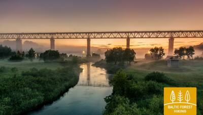
70-й этап. Kaulakiai – Šiluva.
Дубисская долина и самый высокий в Литве железнодорожный мост
Петля по шоссе Расейняй–Байсогала (№ 225) и по пролегающей рядом с ним пешеходной дорожке, маршрут пересекает глубокую Дубисскую долину и у деревни Гинчяйчяй поворачивает направо. Обогнув по большой дуге окрестные поля, Лесная тропа через 6 км сливается с шоссе Расейняй–Шилува и приблизительно ещё через 3 км, после повторного пересечения Дубисской долины, выводит к деревне Кушелишке. Затем на протяжении 5,5 км Лесная тропа петляет рядом с шоссе Кушелишке–Лидувенай (№ 3516), откуда издали уже можно разглядеть Лидувенский железнодорожный мост. На повороте шоссе напротив автомобильного моста через Дубису Лесная тропа сворачивает вправо в северном направлении и по шоссе № 3544 через 9 км выходит к Шилуве, а ещё через 0,8 км достигает центра городка. На данном этапе рельеф постепенно становится всё более выразительным, так как маршрут пролегает по местности, где Дубисская долина переходит в южную часть востока Жемайтийской возвышенности. Этап маршрута до Лидувенай проходит через или рядом с Дубисским региональным парком, а городок Шилува относится уже к Титувенайскому региональному парку.
Дубиса судоходна на байдарках. На берегах реки есть несколько предприятий, сдающих лодки в аренду и предоставляющих логистические услуги. Для туристов-водников обустроены места отдыха.
72-й этап. Aukštiškiai – Dengtiltis.
По живописному лесу Шимшу
Данный этап маршрута пролегает по восточной части Жемайтской возвышенности. Лесная тропа на протяжении 5 км петляет между обрабатываемыми полями, пересекает железнодорожную линию Шяуляй–Таураге и через лес Шимшу на территории Титувенайского регионального парка по небольшим лесным дорожкам выходит к деревне Кяуноряй. Далее тропа пролегает по улице Драугистес, через 0,5 км поворачивает налево в северо-восточном направлении (шоссе № 2122), где через 4 км достигает деревни Пашяуше. Ещё через 4 км Лесная тропа спускается в Дубисскую долину и сворачивает влево, продолжая петлять по правому берегу реки. Ещё через 0,5 км маршрут достигает конечной точки этапа. Денгтилтис и следующий этап Лесной тропы находятся на территории Куртувенайского регионального парка.
От Денгтилтиса до Лидувенай и далее до реки Неман по Дубисе можно плавать на байдарках. На берегах реки есть несколько предприятий, которые сдают лодки в аренду и оказывают логистические услуги. Для водных туристов обустроены места отдыха.
94-й этап. Renda – Sabile.
В Сабиле – город вина и сидра
Маршрут лесной тропы в Ренде петляет по скалистым берегам речушки Иванде и ведет к Кройской дороге через луга, а затем идёт лесом. Местами открывается вид на старое русло реки Абавы. Пейзаж постепенно меняется по мере того, как Лесная тропа покидает Пиевентскую равнину Куршской низменности и медленно поднимается по склону Восточно-Куршской возвышенности на высоте 50–60 м над уровнем моря.
Напротив деревни Валгале маршрут делает зигзаг через глубокое русло речушки Валгале и до Сабиле идёт по вершине склона старого русла Абавы, только в Сабиле спускается к Абавскому мосту (Лачплеша, ул. Кулдигас). В окрестностях Сабиле пейзаж снова меняется, и вы можете увидеть виды Салдуского холмогорья Восточно-Куршской возвышенности. Глубина старого русла между Румбциему и Сабиле достигает 40 метров. Сегодня и на следующий день Лесная тропа проходит через природный парк старого русла Абавы «Abavas senleja» («Древняя долина Абавы»).
Участок реки Абава от Кандавы до Ренды популярен для гребли на каноэ, каякинга и других видов лодочного спорта. Для получения дополнительной информации см. https://riverways.eu/en/
95-й этап. Sabile – Kandava.
По одному из самых красивых природных парков Курземе
Лесная тропа проходит по левому берегу Абавы – по ул. Кр.Барона. Далее, переходя в небольшую тропку, она петляет через луга и леса долины старого русла Абавы, пока не достигает холма, называемого Шведской шапкой. За ним небольшая тропа ведёт к дороге Плости - Пуцес (V1471), пересекает Амулу и у Калнмуйжа поднимается на вершину старого русла Абавы, где продолжается 6 км до парка поместья Айздзире. В северном направлении маршрут протяженностью 1 км петляет по долине старого русла Абавы, откуда открываются одни из самых красивых видов на эту долину. Старое русло Абавы в этом месте достигает 40 метровой глубины. За Звейниекским мостом маршрут поднимается по северному берегу старого русла, где растут виноградники. Далее за лесом пересекает дорогу Кандава – Ренда (Р130) и по ул. Сабиле доходит до Кандавы. Улицы этого живописного городка - Лауку, Озола, Зилу, Сабилес и Пилс ведут к Рыцарскому городищу. Маршрут всё время петляет по старому руслу реки Абава.
Участок реки Абава от Кандавы до Ренды популярен для гребли на каноэ, каякинга и других видов лодочного спорта. Для получения дополнительной информации см. https://riverways.eu/en/