


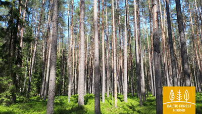
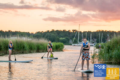
Baltic Forest Hiking - Wheelchair accesible


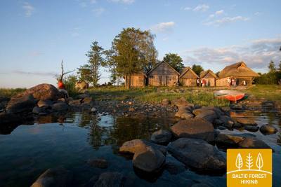
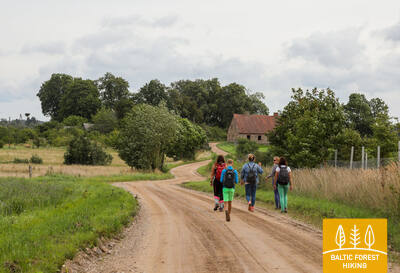
 Section 1. Old Riga - Baltezers.
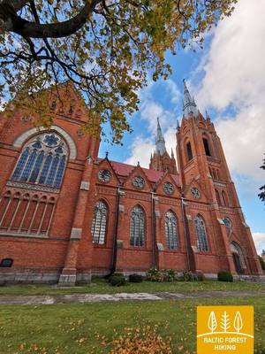
Through Riga – UNESCO World Heritage Site
The starting point of Forest Trail in Latvia is located in the heart of Old Riga, the Town Hall Square. The route leads along Kaļķu Street, passes the Monument of Freedom, through Vērmane Garden and along the historic Tērbatas street. Then it arches over the Zemitāni railway station pedestrian bridge and treads into Biķernieki and Šmerlis forests. The Forest Trail winds through Jugla, passes the Latvian Ethnographic Open-Air Museum and goes on along the pedestrian-bicycle path until Baltezers.
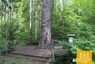
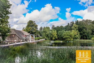
The "Feel Jugla" Walking Trail
In the northeastern part of Lake Jugla in Jugla, a 250-meter wooden boardwalk (one way) has been created with a viewing platform overlooking Lake Jugla, a bench, 20 tactile spatial reliefs depicting characteristic animal species of the lake and its surroundings, and information in Braille. It is accessible to people in wheelchairs. The site is located 0.5 kilometers from the Mežtaka trail.


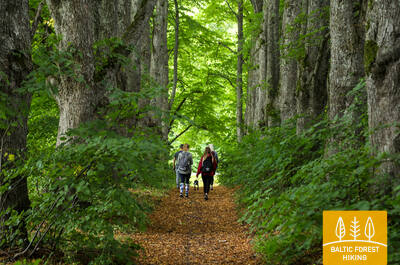
 Section 4. Rāmkalni - Sigulda.
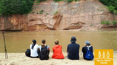
Stunning scenery of the ancient valley of Gauja River near Sigulda
Past “Rāmkalni”, the Forest Trail wanders up the steep banks of Gauja valley, passes through Gauja village and comes back down. Then it crosses river Lorupe and continues along the bends of river Gauja, passing one of the most spectacular outcrops of the river, the Velnala Cliffs, goes up to Ķeizarskats observation spot and circles down to Ķeizarkrēsls, adventure park “Mežakaķis” at Kaķīškalns and the Sigulda Bobsleigh and Luge Track.
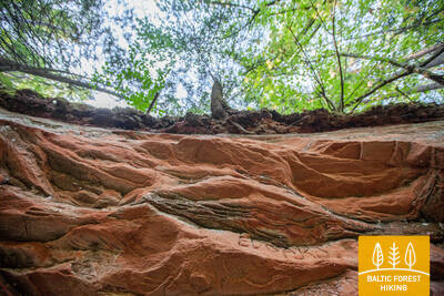
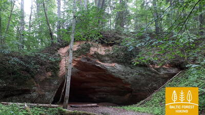
Trail to Gutman's cave
From the Gūtmaņala Visitor Center parking lot (GPS: 57.176245, 24.846747), the trail leads to one of the most popular attractions in Gauja National Park—Gūtmaņala. The trail surface includes gravel, asphalt 1.15 to 2 meters wide. The trail is 0.5 kilometers long (round trip) and is accessible to people in wheelchairs with a companion. The elevator in the tunnel does not work! It is necessary to cross the street, where there is a small curb! An adapted restroom is available. The trail is located 2.7 kilometers from the Mežtaka trail.


Section 5. Sigulda - Līgatne.
In the heart of Gauja National Park
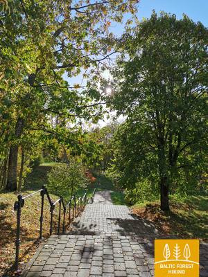
After passing through Sigulda, the Forest Trail follows the River Vējupīte to Mound Paradīzes, where a steep staircase leads down into the ancient valley of Gauja River and the ravine of River Vējupīte. It continues to wind down smaller paths through meadows, crossing small rivers whose banks reveal sandstone outcrops. The last six kilometres of this section follow a smaller path down Līgatne Nature Trails. As it draws closer to Līgatne, the Forest Trail moves up the hills of Gauja valley, before descending back down into the deep ravine of Līgatne River, where the village of the former Līgatne Paper Mill is located.
Trail to Paradise Hill
From the Miera Street parking lot (GPS: 57.170624, 24.862061), you can explore Gleznotājkalns via a circular route approximately 2 kilometers long. The trail is accessible to people in wheelchairs and parents with strollers. The surface includes asphalt, gravel, and boardwalks (bridges). The trail is unmarked, but there are signs at intersections. The section from the parking lot to Gleznotājkalns coincides with the Mežtaka trail.
Līgatne Nature Trails
Līgatne Nature Trails is one of the most popular attractions in Gauja National Park, where animals typical of Latvian forests live in conditions close to their natural habitat. Two sections of the trails from the "Pauguri" Visitor Center are accessible to people in wheelchairs: one leads to the bear enclosure (300 meters one way) and the other to the fox enclosure (600 meters one way). The Visitor Center has adapted restrooms and a designated parking lot (GPS: 57.248149, 25.014735). It is located next to the Mežtaka trail.


 Section 6. Līgatne - Cēsis.
Along the old Cēsis road through the valley of Amata River
One of the most scenic parts of the Forest Trail stretches along the historic village of the Līgatne Paper Mill, passes Spriņģi Rock, curves along Skaļupe Trails and the Mythological Trail, stops at one of the most secret sites on this side of the Iron Curtain, the Soviet Bunker, then continues along Roči Nature Reserve, crosses Amata (the most beautiful and rockiest part of the river) and finally comes to Zvārtes Rock. Next, the Forest Trail runs along the high banks of Amata valley and follows the historic Cēsis–Riga “highway” (now a small rural/forest road with old mileposts) to Rakši, then ascends up the Vāļukalni hills and Ozolkalns, following along the River Gauja until it meets Cīrulīši Nature Trails. It comes to a stop at Gaujas street, but travellers may continue down the path for a further 2.8 km to Cēsis, spend the night there, and continue walking on the following day.
The trail to Zvanu Cliff
The 900-meter-long trail leads to the slope of the Gauja Valley's main bank, where the Zvanu Cliffs rise, and a viewing platform is located. The trail is 1.5 meters wide with a wooden boardwalk surface. The trail is accessible for people in wheelchairs with the assistance of a companion, as a curb must be overcome to access the trail, and the slope is too steep in some places. There is no parking or restroom available. On the side of the road next to it there is a sandy "pocket" where you can leave the car. The trail is located next to the Forest Trail.


Section 7. Cēsis - Caunītes.
Impressive sandstone outcrops on the banks of River Gauja
The Forest Trail follows small roads and trails through the woods up until the water tourist camp “Lenči”, winds through the ever-changing terrain past Ērģeļu Cliffs and enters the ancient valley of Gauja River. Having passed Ērģeļu Cliffs, the trail turns back towards Cēsis, but then veers off towards Rāmnieki in Pieškalns, crossing the river. After the water tourist camp “Jāņarāmis” the Forest Trail enters a beautiful, bright pine forest, proceeding through the woods until it reaches “Caunītes”, which is one of the most beautiful places on the banks of the Gauja River.
Ērgļu (Ērģeļu) Cliffs Nature Trail
The trail introduces visitors to one of the most impressive sandstone outcrops in Latvia. It connects the cliffs with the parking lot (GPS: 57.357495, 25.262360). The 460-meter-long trail (one way) follows a forest path and is suitable for people in wheelchairs with assistance. The trail is very steep! An adapted restroom is available. The trail coincides with the Mežtaka trail.


Section 9. Valmiera - Strenči.
Along Abuls to Strenči, the capital of rafters
The trail passes through the historical centre of Valmiera and the Atpūtas Park, which is a popular place among hikers and Nordic walkers, then crosses the suspension bridge, passes Pauku priedes pine forest and Baiļu kalns. From there it follows the Abuls Trail, curving along the banks of the river until reaching the Brenguļi Brewery, and further down, beyond Pūpoli, enters vast, unpopulated forest areas. The first part of this section passes by numerous small summer cottage villages with names such as Enerģētiķis, Saulītes, Sprīdītis, Gaujmaļi, Pūpoli and Gaujaslāči, which were initially established during the Soviet period as summer cottage neighbourhoods of the people of Valmiera and the surrounding territories. Near Ūdriņas, the Forest Trail leads through a labyrinth of the riverbeds and turns north, crossing the Gauja Bridge, where a resting and boating stop is located. The centre of Strenči is located at a 1.5 km distance. Part of the section passes through the Northern Gauja protected landscape area.
Strenči Nature Trail and Wooden Sculpture Park
The trail's theme is the Gauja raftsmen, featuring around 30 sculptures. The trail can be started from the Ozolu Street parking lot (GPS: 57.623436, 25.690133). It has two loops, 5 and 7 kilometers long, but the section suitable for people in wheelchairs with assistance is relatively short. It is located 0.7 km from the Forest Trail.


Section 10. Strenči - Spicu Bridge.
Through the beautiful forests of Vidzeme
The beginning of the Forest Trail at this section coincides with the Gauja Nature Trail, which runs along the very bank of the river. The Forest Trail crosses the A3 in two places (before the turn to Seda and before Kauči) (be careful!) and continues along small forest roads, a sand-gravel quarry, then continues down a gravel road at the turn to Oliņas. After 3.5 km, turn right again and follow the route to Spicu Bridge via small and remote forest roads where some of the most beautiful sights of the Northern Gauja (“Ziemeļgauja”) protected landscape area can be seen by the so called Zemā sala (Low Isle). A picnic area and a camp are located at the end of this section, where the P24 crosses the Spicu Bridge.
The rest area by Spicu Bridge
The rest area located by the Forest Trail is accessible for people in wheelchairs. Special tables have been installed, and the restroom is adapted.


Section 11. Spicu Bridge - Zaķi.
Through the magnificent Cirgaļi dunes
The Forest Trail crosses Spicu Bridge and leads to the four Kokši lakes (about 4 km), which are interconnected by a small stream. Here you will find a picnic area, tent spots and a nature trail for travellers. The surrounding nature is beautiful, and the forests are rich in edible mushrooms. After passing the last of the Kokši lakes, Lake Dibena, in an hour or two you will reach the Cirgaļi dune massif, which you will cross towards north-south. The further section of the Forest Trail crosses a large forested area, and a lone homestead or a smaller lake can be seen here and there. The section ends in a small village named Zaķi. The village provides no services, so be sure to consider the necessary arrangements and accommodation options as you plan your hike. The section is located in the Northern Gauja (“Ziemeļgauja”) protected landscape area.
The rest area by Spicu Bridge
The rest area located by the Forest Trail is accessible for people in wheelchairs. Special tables have been installed, and the restroom is adapted.
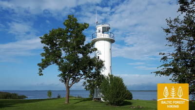
Section 22. Ristipalo‒Mehikoorma.
Through the polder meadows of Lake Peipus
Nearly half of this section runs on straight polder roads of the Lake Peipus lowlands. The polders are designed to protect the surrounding land from flooding in spring. The flat polder meadows are used for agriculture and grazing livestock. The section from Naha to Mehikoorma leads along the Räpina‒Mehikoorma roadway. A beautiful view of Lake Lämmijärv opens from the Mehikoorma Lighthouse. This lake is a narrowing between Lake Pskov and Lake Peipus. Russia lies on the other side of Lake Lämmijärv (1.7 km).
Mehikorma Harbor Shore Promenade
A nature trail and promenade have been created between Mehikorma Harbor and the lighthouse, introducing the Peipus Lake shoreline over a distance of 1.3 km. Part of it, including the promenade and the boardwalk route, is accessible for people in wheelchairs with the assistance of a companion. It is located next to the Forest Trail.
Section 23. Mehikoorma‒Lääniste.
Around the Emajõe-Suursoo wetland
The stage fully justifies the name of the Forest Trail, as the next three days lead through one of Estonia's largest wetlands, the Emajõe-Suursoo wetland, which is surrounded by extensive forest areas. The only settlement area between Jõepera and Ahja River is Järvselja, enclosed by forests. The terrain is flat, since the Forest Trail still runs through the Lake Peipus lowlands. The destination is located by the Ahja River, which is known for its scenic Devonian sandstone outcrops and a popular boat route.
Mehikorma Harbor Shore Promenade
A nature trail and promenade have been created between Mehikorma Harbor and the lighthouse, introducing the Peipus Lake shoreline over a distance of 1.3 km. Part of it, including the promenade and the boardwalk route, is accessible for people in wheelchairs with the assistance of a companion. It is located next to the Forest Trail.
Section 25. Kavastu‒Varnja.
Towards the Varnja old believers’ village
The Forest Trail has been circling around the Emajõe-Suursoo (a part of the Peipsiveere nature reserve) wetland for three days now. The most interesting part of the walk is the section between Vanaussaia and Varnja, where the Forest Trail runs along small rural roads. Before Varnja it reaches the shore of Lake Peipus (Peipsi), and here you can really feel the true size of the lake. The following distance from Varnja to Remniku along the shores of Lake Peipus and the surrounding territory will take about one week. Over this week, the hikers will learn more about the traditional culture of Eastern Estonia, such as onion cultivation, fishing, culinary heritage, crafts and the culture of the Old Believers.
Emajõe-Suursoo trail
At the Emajegi-Suursoo Center, a 3 km long trail begins, leading through forested terrain and wetlands along the Emajegi Riverbank. The wooden boardwalk section of the trail, from the start to the second campfire site, is 700 meters long and accessible for people in wheelchairs. The width of the trail in this section is 1.2 meters. The parking lot is located here: GPS: 58.382315, 27.105629. It is approximately 2.6 km away from the Forest Trail.


Section 35. Vasavere‒Toila.
Towards the rocky coast of Northern Estonia near Toila
Behind Vasavere, the Forest Trail continues through the Kurtna landscape reserve, encircles over a peat bog, crosses the town of Oru, passes through the Voka River valley and arrives at the Baltic Sea, where it turns west. Here, on the coast of the Gulf of Finland, rises the North-Estonian Klint – a steep, rocky and forest-covered cliff that stretches non-continuously to Tallinn and further to the islands of West-Estonia. The Forest Trail runs on top of the cliff and occasionally descends into valleys. It crosses the deep and vast Pühajõgi valley in the Toila-Oru park and comes to Toila, a popular coastal resort.
Toila - Oru Park
The park can be partially explored with a wheelchair from the Karu Gate parking lot along the linden avenue. The park features a network of primarily gravel paths. Due to the local terrain, an assistant is needed. There is no wheelchair access to the pond and the Hebeallika (Hõbeallika) spring cave. The Forest Trail crosses the Toila - Oru Park. The parking lot is located at GPS: 59.418662, 27.531208.


Section 36. Toila‒Saka.
The scenic North-Estonian Klint between Toila and Saka
One of the most unusual sections of the Forest Trail in Northern Estonia, which leads along the foot of the impressive North- Estonian Klint in good weather, then climbs to the top of the klint in the villages of Valaste and Saka, revealing breath-taking views of the Gulf of Finland from the so-called Viru Rise. In the Saka‒Ontika‒Toila section (about 23 km), the maximum height of the North-Estonian Klint reaches 55 m. If the weather is clear, you can see the isles named Great and Small Tütarsaar, which belong to Russia, at a 50 km distance.
Toila - Oru Park
The park can be partially explored with a wheelchair from the Karu Gate parking lot along the linden avenue. The park features a network of primarily gravel paths. Due to the local terrain, an assistant is needed. There is no wheelchair access to the pond and the Hebeallika (Hõbeallika) spring cave. The Forest Trail crosses the Toila - Oru Park. The parking lot is located at GPS: 59.418662, 27.531208.
Section 41. Eisma‒Oandu.
Along the trails of Lahemaa National Park
Behind the village of Vainupea, the Forest Trail enters the first Estonian national park ‒ Lahemaa, which means “the land of bays” in Estonian. For the next five and a half days, the Forest Trail will continue along the bays and peninsulas of Lahemaa national park, introducing the hikers to its most significant natural and cultural heritage. Special attention must be paid to the rules of the park. On this day, the Forest Trail passes through beautiful and quiet coastal forests, where mushrooms grow abundantly in autumn. It passes through the scenic Altja fishing village. The section comes to an end at Oandu in the visitor centre of the Estonian State Forest Management (RMK), where hikers can learn more about forest habitat types and forest management traditions.
Sagadi - Oandu Forest Fairy Tale Trail
The 5.6 km trail connects the Oandu Visitor Center with Sagadi Manor in Lahemaa National Park. The first 3 km of the trail are accessible for people in wheelchairs. The trail begins at the Oandu Visitor Center, where there is a parking lot (GPS: 59.565440, 26.099671) and an adapted restroom. It is located near the Forest Trail.


Section 42. Oandu‒Käsmu.
Käsmu captains' village and ship building site
The next 9 kilometres of the Forest Trail between Oandu and Võsu coincide with the RMK trail, so be aware of the change of the signs. The trail goes through a beautiful, wooded inland dune area, where hikers can see cuts on pine trees, used to extract resin from the trees. Resin was obtained in the Baltic States using this method up to the 1960s-1970s. Trees are richly covered in lichen, indicating that the air is clean. In autumn, mushrooms and blueberries adorn the edges of the trail. After passing through Võsu village (a popular resort), the Forest Trail continues along a beautiful coastal forest promenade to Käsmu village. It is worth walking an additional extra kilometre to the Vana-Jüri rocks and the historical sites of Käsmu at the tip of the peninsula.
Sagadi - Oandu Forest Fairy Tale Trail
The 5.6 km trail connects the Oandu Visitor Center with Sagadi Manor in Lahemaa National Park. The first 3 km of the trail are accessible for people in wheelchairs. The trail begins at the Oandu Visitor Center, where there is a parking lot (GPS: 59.565440, 26.099671) and an adapted restroom. It is located near the Forest Trail.
Section 45. Loksa‒Tsitre.
Through the forests and swamps of the Juminda Peninsula
On this day, the Forest Trail crosses the Juminda Peninsula. After leaving Loksa, in 7 km it passes by a Soviet-era military object, the Hara Submarine Port. To visit it, you have to take a two-kilometre detour and buy a ticket. The Forest Trail goes through an area of beautiful forests and marshes, with high, dense forested sand dunes at the western end of the territory. It continues down the road from Pedaspea to Tsitre and passes a small section of the North-Estonian Klint just before Tsitre, where the Muuksi stronghold hill is located. The Tsitre picnic area is located 0.2 km from the sea.
Viru Bog Nature Trail
The 3.5 km trail explores the raised bog and its characteristic landscape and biodiversity. The section up to the tower, 1.3 km long, is accessible for people in wheelchairs with assistance. The first platform of the observation tower and the dry toilet are also accessible. It is located approximately 10 km from the Forest Trail.


Tsitre Tree Trail
The 1 km trail introduces visitors to the history and biodiversity of Tsitre Summer Manor Park and its surroundings. It is equipped with 29 information points. Approximately 150 meters of the trail consists of boardwalks up to 1 meter wide, which are accessible for people in wheelchairs. There is an adapted restroom. The trail starts at the parking lot (GPS: 59.518268, 25.510726). It is located near the Forest Trail.


Section 46. Tsitre‒ Kaberneeme.
Sandy beaches and isles in Kolga Bay
A harbour was established at the Tsitre village as early as the Viking times. The first 4 km of the Forest Trail in this section pass through the territory of the Lahemaa national park. Between the villages of Muuksi and Soorinna, the road crosses an oval plateau, the klint elevation of northern Estonia, covered with scenic juniper fields. At the village of Põhja, the trail passes by the coastal wetland, and comes out by the sea behind the Salmistu harbour. From here, look out for the 1.3 km distant Pedassaar isle to the northeast, and the Umblu and Rohusi isles to the northwest. On Valkla beach, a nice beach restaurant awaits hikers. In Haapse the beach you can swim, sea gets quickly deep.
Tsitre Tree Trail
The 1 km trail introduces visitors to the history and biodiversity of Tsitre Summer Manor Park and its surroundings. It is equipped with 29 information points. Approximately 150 meters of the trail consists of boardwalks up to 1 meter wide, which are accessible for people in wheelchairs. There is an adapted restroom. The trail starts at the parking lot (GPS: 59.518268, 25.510726). It is located near the Forest Trail.
Section 49. Muuga‒Püünsi.
Through the magnificent Viimsi Peninsula
The Forest Trail passes through the most densely forested area of the Viimsi Peninsula, where several nature protection areas have been established. It crosses the former Soviet-era military territory in Rohuneeme. On this day, the Forest Trail follows along pedestrian sidewalks and the many roads running through the peninsula. It turns south at Püünsi village, where towers, skyscrapers and the Port of Tallinn with ferries can be seen in the distance across the Gulf.
Tedu (Tädu) Nature Trail.
The 3.1 km trail introduces visitors to forestry traditions. The entire trail surface is gravel and accessible for people in wheelchairs. There is a parking lot (GPS: 59.520475, 24.895883). It is located near the Forest Trail.


Section 50. Püünsi‒Tallinn.
Most beautiful sights of Old Tallinn
The Forest Trail passes by the Gulf of Tallinn, and beautiful views of the towers, harbour and skyscrapers of the city can be seen as early as in Püünsi. The Forest Trail turns into a beautiful pine forest before Pirita, then follows along a sandy beach for 2 km. Behind Pirita all the way to the Port of Tallinn, the Forest Trail takes you along the beautiful city waterfront promenade, which overlooks the city’s most important cultural and historical sites, and offers beautiful views of the sea and the port. The final destination of the Forest Trail is located in the Port of Tallinn, next to the Old Town. You can spend another day or two visiting various tourist locations of Tallinn.
Pirita Promenade
The approximately 3 km long, well-maintained promenade connects the Tallinn harbor area with Pirita, running along the sea coast. It features a surface suitable for cyclists and active leisure enthusiasts and is accessible for people in wheelchairs throughout its length. At Pirita Beach, there are swimming aids, changing facilities, and a wooden ramp providing access to the water. Services must be reserved in advance: +372 5425 0424. The Pirita Promenade coincides with the Forest Trail.


Section 59. Panemunis – Birštonas.
Nemunas loops and ethnographic farmsteads
Repeating the loops of the Nemunas, the Forest Trail throws more than 20 km long bends in Nemunas Loops Regional Park, winding through open landscapes and small villages with typical wooden buildings painted in different shades. A larger forest massif there is only between Siponiai and Puzoniai villages, through which the route leads along small forest roads. Crossing the Vilnius–Marijampolė road (A16), the Forest Trail descends to the next circle of the Nemunas, where the popular Birštonas resort is located. Along the sidewalk of B. Sruogos street, the Forest Trail reaches the Birštonas Tourism Information Center.
Birštonas Nemunas krasta promenāde un gājēju celiņš
Behind the Birštonas Tourist Information Center, the Mežtaka trail runs for more than 1 kilometer along the Nemunas River promenade. Then, it turns onto Algirdo Street, crosses the Vytautas Jurgis Meška Park, returns to the promenade, and after 0.6 kilometers, it turns onto a pedestrian and bicycle path. The path, approximately 5 kilometers long, crosses the Žvėrinčius Forest, then the pedestrian trail passes through the Paprienė recreational area, reaching the Greimų Bridge over the Nemunas River. The promenade and pedestrian path are accessible almost along their entire length for people in wheelchairs. The surface is mostly asphalt, and in Prienai, it is gravel. The trail coincides with the Mežtaka route.
Section 83. Paplatelė – Plateliai.
Around the largest lakes in the Žemaitija National Park
For the first 3.5 km, the Forest Trail leads through beautiful coniferous forests that cover the slopes of the Žemaitija Upland. Up to the Cold War exposition, it coincides with the Plokštinė cognitive trail. From the museum, the Forest Trail for 5 km follows the Plokštinė road, where a pedestrian / bicycle path has been created and, approaching Plateliai lake, descends into the lowland of the lake. At the road No. 3202 (Malūno street) , the Forest Trail turns left to the south-east and after 0.3 km turns right to right to the south-southwest. After about 0.5 km it reaches Ilgio Ežero street. For the next 5.5 km, the Forest Trail forms a wide circle around Ilgis and Beržoras lakes, reaching the Beržoras village. After the village, after 2 km along Plungės street, the Forest Trail reaches the centre of Plateliai and throws another circle along Ežero street to the beach and Šeirė educational trail. Then along Ežero, Naujoji and Žemaičių Kalvarijos streets, the Forest Trail returns to the centre of the town.
Šeire's Educational Trail
The trail is approximately 7 kilometers long, but there is a viewing platform accessible to people in wheelchairs that offers a view of Lake Plateliai and its islands. Plateliai is located in the Žemaitija National Park. The information board features a tactile map of the lake with its islands, allowing people with visual impairments to explore it. The parking lot is located here: GPS 56.048355, 21.826901. It is situated next to the Mežtaka trail.


Section 84. Plateliai – Salantai.
Towards the Pajūris Lowland
The Forest Trail for 6 km runs along the edge of the Plateliai–Salantai (No.2302) road. At this section, there opens up the view of the landscapes of the western part of the Žemaitija Upland over the Pajūris Lowland. In the centre of Gintališkė village, the Forest Trail turns left to the southwest, coming to road No. 3216. After 2.4 km, it turns right to the west, where it crosses the largest forest massif in this section. During the Soviet era, there was a missile base here, as evidenced by the road paved with concrete slabs. Then the Forest Trail briefly follows the Plungė–Salantai road (No. 169) and after 1.4 km turns left. Up to Salantai, it wanders through a small country road, and the small-town centre is reached through Žemaitės and M. Valančiaus streets. The beginning of this section is in Žemaitija National Park, but the last part is in Salantai Regional Park.
Šeire's Educational Trail
The trail is approximately 7 kilometers long, but there is a viewing platform accessible to people in wheelchairs that offers a view of Lake Plateliai and its islands. Plateliai is located in the Žemaitija National Park. The information board features a tactile map of the lake with its islands, allowing people with visual impairments to explore it. The parking lot is located here: GPS 56.048355, 21.826901. It is situated next to the Mežtaka trail.
Section 85. Salantai – Mosėdis.
Through the Salantai Regional Park
From the small-town of Salantai, the Forest Trail goes along M. Valančiaus, Padvaralio and Ilgoji streets. 100 m before road No. 169 the Forest Trail turns left on a country road, after 3.5 km reaches Erlos street and turns left to the west. After 0.4 km it turns right to the north and reaches Šatraminiai village. There, it turns right to the southwest, after 2.9 km crosses the Salantai–Skuodas road (No. 169) and in Šaukliai village turns left to the north, after 3.8 km reaching Mosėdis, the destination of the section. Most of the section, except for the Šatraminiai area, runs through the territory of Salantai Regional Park.
The Šauklių Nature Trail
The 2.7-kilometer-long trail introduces the landscape of Salantai Regional Park, which is covered with boulders and junipers, showcasing its biodiversity. The trail surface consists of a well-trodden path and boardwalks. Part of the boardwalk is accessible to people in wheelchairs. Visitors need to inform the park management in advance so that the gate can be opened. The parking lot is located here: GPS 56.125202, 21.592115, and is 1.2 kilometers from the Mežtaka trail.

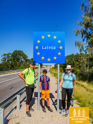
Section 87. Lithuanian– Latvian border – Gramzda.
Along the Vārtāja undulating plain
The Lithuanian – Latvian border in nature is marked by the Apše river, which the Forest Trail crosses, entering Latvia via the Skuodas – Priekule road bridge (P114). The Forest Trail initially winds along the side of the road, but after 1.7 km turns onto a gravel road in the direction of Kalēti. Starting from the surroundings of Ozolu village, the view opens up to the beautiful and wide landscapes of the Vārtāja undulating plain of the Rietumkursa Upland. In Ozoli, the Forest Trail for 0.5 km follows the road V1217, then turns right and after 2 km reaches the Bārta–Kalēti–Gramzda road (V1218), that leads to Gramzda.
Gramzdas mežaparka taka
A trail approximately 2 kilometers long has been created in Gramzda Forest Park. It is not marked, and the surface consists of gravel, asphalt, and simple well-trodden paths. The trail is partially accessible to people in wheelchairs and parents with strollers. A suitable starting point is the parking lot near the "Aibe" store (GPS: 56.369134, 21.604151). The Gramzda Parish administration building has an adapted restroom. The Mežtaka trail passes through Gramzda Forest Park.


Section 88. Gramzda – Priekule.
To Priekule, rich in stories
After Gramzda the Forest Trail as a small path swirls along sand and gravel quarries and along a straight path through the agricultural landscape moves northeast. At the Lejasbunči house, it turns to Mazgramzda. Before Mazgramzda, the Forest Trail crosses the deep and shady Ruņupe valley. After Mazgramzda, it runs along the Gramzda–Priekule road (P 114), from which there open up beautiful landscapes of the Vārtāja undulating plain of the Rietumkursa Upland. After crossing this road, it runs along the former airfield, crosses the Priekule–Purmsāti–Kalēti road (V 1211) and throws a circle through a small wooded area. Along the banks of the winding Virga river, the Forest Trail leads through the forest park “Priekules Priediens”, from which there is visible the destination of this section.
Gramzdas mežaparka taka
A trail approximately 2 kilometers long has been created in Gramzda Forest Park. It is not marked, and the surface consists of gravel, asphalt, and simple well-trodden paths. The trail is partially accessible to people in wheelchairs and parents with strollers. A suitable starting point is the parking lot near the "Aibe" store (GPS: 56.369134, 21.604151). The Gramzda Parish administration building has an adapted restroom. The Mežtaka trail passes through Gramzda Forest Park.
Section 91. Aizpute – Snēpele.
In the footsteps of baron von Manteuffel
The Forest Trail along Atmodas and Jelgavas streets winds through Aizpute, after the Laža water reservoir turns right, and approaches the Kazdanga manor park with a large circle from the south. As a small path, it leads along Dzirnavu lake through the manor park, around the manor and Zēnu pond, for 0.7 km continues along the Kazdanga–Cildi road (V1200) and then turns right onto the Snēpele–Kazdanga road (V1296). Up to the country house “Zemturi”, the Forest Trail gradually rises in the Bandava hills of the Rietumkursa Upland, revealing beautiful views in both directions. The height of the relief here reaches a maximum of about 81 m above sea level. From “Zemturi”, for about 12 km , the Forest Trail leads through a sparsely populated forest massif and only in the last 3 km comes out again in an open area with agricultural lands and farmsteads, reaching Snēpele.
Kazdangas parka dabas takas
Kazdanga Park is one of the richest Latvian manor parks in terms of dendrological diversity. The park features a dense network of trails, extending up to 9 kilometers. The trail surfaces include gravel, well-trodden paths, and wooden boardwalks. Signposts direct visitors to various points of interest. A parking lot has been established as a starting point for exploring the park (GPS: 56.732242, 21.733626). The park's trails are accessible to people in wheelchairs with the assistance of a helper and are also convenient for parents with strollers. An adapted restroom is available. The Mežtaka trail passes through Kazdanga Park.


Section 92. Snēpele – Kuldīga.
Venta valley and Riežupe Nature Park
Along the main street of Snēpele, the Forest Trail takes the road V1294 and after 0.3 km opposite Ķepšu lake turns right onto a small country road. Along this road, the Forest Trail bends to Slipiņciems, before crossing Sprincupe along the dam, where a pond has been created. Then the Forest Trail goes in the direction of Pelči. Nearby Pelči, the trail bends along Pelču Dambu ponds, leads to the Kuldīga–Pelču road (V1293) and further stretches through the Kuldīga garden areas – “Kurzemīte” and “Rumba”, until it reaches the Venta bank and the Kuldīga bypass. From there to the Old Brick Bridge, the Forest Trail for 2.4 km leads along a beautiful Venta coastal path, where there are wooden bridges and footbridges in wetter places and across streams town of Kurzeme.
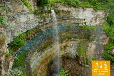
The walking trail along the Venta River in Kuldīga
The trail stretches along the left bank of the Venta River from Kuldīga City Garden to the new Kuldīga bridge, covering 2.4 kilometers. Rest areas and information boards are placed along the trail. It is accessible to people in wheelchairs due to its smooth surface, which consists of fine, hard gravel, though some sections may require assistance due to inclines. The trail is wide, and where it crosses small stream ravines, wooden boardwalks and bridges have been constructed. This section of the Mežtaka trail runs along the Kuldīga promenade trail. Adapted restrooms are available. A parking lot has been established at GPS: 56.973354, 21.977798.


The Mārtiņsala Nature Trail
The approximately 1-kilometer-long trail is located on Mārtiņsala and introduces visitors to the Ventas Rumba waterfall. The surface consists of gravel (1.60 meters wide) or a boardwalk (95 cm wide) without passing areas. Some sections are accessible to people in wheelchairs. Adapted restrooms are available. The parking lot is at GPS: 56.970622, 21.980747. The Mārtiņsala Nature Trail is situated next to the Mežtaka trail.


Section 93. Kuldīga – Renda.
Venta valley and Riežupe Nature Park
After the Old Brick Bridge across the Venta river, the Forest Trail continues for a short time on the right bank of the Venta, notched by ravines, then, along Krasta street and Vetklīnika–Paleja road, it crosses Kalnmuiža forest and Riežupe and further up to Mazrenda continues along the roads of the vast Renda forest massif. The terrain is flat here, because this section is part of the Pieventa plain of the Kursa Lowland. In Mazrenda, the Forest Trail crosses a sand-gravel quarry and takes you to the centre of Renda along Kuldīgas street. The section belongs to the territory of the nature reserve “Ventas ieleja” and the nature park “Riežupe”.
The Mārtiņsala Nature Trail
The approximately 1-kilometer-long trail is located on Mārtiņsala and introduces visitors to the Ventas Rumba waterfall. The surface consists of gravel (1.60 meters wide) or a boardwalk (95 cm wide) without passing areas. Some sections are accessible to people in wheelchairs. Adapted restrooms are available. The parking lot is at GPS: 56.970622, 21.980747. The Mārtiņsala Nature Trail is situated next to the Mežtaka trail.
Section 95. Sabile – Kandava.
One of the most beautiful nature parks in Kurzeme
The Forest Trail continues along the left bank of the Abava, along Kr. Barona street. Further, as a small path, it crosses the meadows and forest clusters of the Abava valley until it reaches a hill called the Swedish hat (Zviedru cepure). After Zviedru cepure, the Forest Trail goes along a small country road to the Plosti – Pūces road (V1471), crosses Amula and at Kalnmuiža winds up in the Abava valley, along which the next 6 km leads to Aizdzire Manor park. Another 1 km to the north the Forest Trail crosses the Abava valley in its full width, revealing some of the most beautiful views of the valley. The depth of the Abava valley in this place is about 40 m. After the Fisherman's Bridge (Zvejnieku tilts), the Forest Trail rises on the northern slope of a valley where vineyards are planted. Winding through the forest, it crosses the Kandava–Renda road (P130) and further along Sabiles street reaches Kandava. Along the Lauku, Ozola, Zīļu, Sabiles and Pils streets of this picturesque small-town the Forest Trail reaches the Knights' Castle Mound. Throughout the section, the Forest Trail winds through the nature park “Abavas senleja” (“Abava valley”).
The "Fairy Tale Forest" play trail
Near the café "Plostkrogs" (GPS: 57.020908, 22.645401), the "Fairy Tale Forest" play trail has been created, featuring various forest animal figures, wooden houses, and other games for children. The trail is 1.6 km long. There are some obstacles, such as tree roots and an entrance through a wooden house, but with an assistant, people in wheelchairs can explore the "Fairy Tale Forest." It is located 1.2 km from the Mežtaka Trail.
Section 96. Kandava – Jaunmokas.
Pūre – a place where chocolate is made
Along Jelgavas street, crossing the old boulder bridge over Abava, the Forest Trail along Daigones street and further along a gravel road leads to the 5 km distant Daigone village, after which it descends along the Dziļkalns–Pūre road (V1464) in the Abava valley. After the bridge over Abava, the Forest Trail turns right and along a small path reaches Pūre. Circling around the Pūre Manor, it stretches for the next 5 km to Galciems along Zemeņu street and Pūre–Jaunsāti (C004) road. Sand and gravel are mined here in the quarries of the region. In Galciems, the Forest Trail turns left onto a small gravel road (C003), which after 3.5 km connects with Jaunmoku–Jaunsāti road (V1444). After another 3 km, the Forest Trail crosses the Rīga–Ventspils highway and reaches Jaunmoku palace along small paths surrounded by tree alleys. Approaching the palace from Jaunsāti, you can see the beautiful wide landscapes around the Forest Trail, where Spārnene, the wavy plain of Austrumkursa, alternates with Vanema hills.
Čužu Marsh Nature Trail
The circular trail in Čužu Marsh introduces visitors to the unique wild occurrence of the bush cranberry, a calcareous swamp, and a former mineral water resort. A wooden boardwalk section, approximately 1 kilometer long with edging, is adapted for people in wheelchairs. The boardwalk connects to a 0.5-kilometer gravel path with a specially designed parking lot (GPS: 57.026431, 22.785473) and adapted restrooms. Due to the slope in some areas, assistance may be needed. The trail is located about 0.8 kilometers from the Mežtaka trail.


Jaunmoku Castle Trail
The trail introduces visitors to the manor complex and park, approximately 1.5 kilometers long. It is accessible to people in wheelchairs. The trail surface includes asphalt, paving, and gravel. The parking lot is at GPS: 56.982423, 23.053098. Using a call button, visitors can summon staff to assist with entering the building and viewing it from the inside. The trail is located next to the Mežtaka trail. Adapted restrooms are available.


Section 97. Jaunmokas – Tukums.
To Tukums for the beauty!
In the vicinity of Jaunmoku palace, spectators are delighted by the beautiful landscapes of the Vanema hills of Austrumkursa Upland. The Forest Trail slopes down to the Bēru watermill and then, further up to Vecmokas, in a length of three kilometres rises by about 50 m, revealing beautiful landscapes to the wide Slocene valley in the south. After the alley of Vecmoku Manor, the Forest Trail crosses the Tukums–Lazdas road (V1442), turns around a cluster of farmsteads and then along straight forest path goes southeast along Sekļa lake. The lake can be accessed via small paths. In the vicinity of Recreation complex “Sveikuli”, the route continues along beautiful forest paths and joins the Tukums–Kesterciems–Kolka road (P131) near the Ozoliņi cemetery, where the town of Tukums begins. Along Raudas, Kurzeme Forest and Melnezera streets, the Forest Trail reaches the Sun hill (Saules kalns).
Jaunmoku Castle Trail
The trail introduces visitors to the manor complex and park, approximately 1.5 kilometers long. It is accessible to people in wheelchairs. The trail surface includes asphalt, paving, and gravel. The parking lot is at GPS: 56.982423, 23.053098. Using a call button, visitors can summon staff to assist with entering the building and viewing it from the inside. The trail is located next to the Mežtaka trail. Adapted restrooms are available.
Section 99. Jāņukrogs – Bigauņciems.
Through Ķemeri National Park
After crossing the area with some homesteads, the Forest trail winds through beautiful coniferous forests and further 6.5 km along Čaukciems until the turn to the Green Dune leads along the side of the Antiņciems–Smārde road The neighbourhood is flat, as the section is part of the Engure plain of the Piejūras Lowland. The Green Dune (Zaļā kāpa) offers wide views of the Green Bog (Zaļais purvs) and the Witches' Bog (Raganu purvs). A small forest road bends along the lower part of the dune and in two places crosses the bog along wooden footbridges. In Ķemeri, the Forest Trail moves along Partizāna, Robeža, A. Upīša, Katedrāles and E. Dārziņa streets, along the Forest House and Vēršupīte, into which the waters of sulphur springs flow. Crossing Tūristu street, it continues along the Dūņu road to the Sloka lake. Further the trail crosses the Vēršupīte swamp forest, which is one of the most outstanding wet forest habitats in the whole part of the trail in Kurzeme. At Melnezers it turns onto the Old Ķemeri road and after 2 km it reaches Bigauņciems. Behind the Talsi highway, the Forest Trail reaches the shore of the Gulf of Riga and connects with the Coastal Hiking Trail. The Forest Trail runs through the Ķemeri National Park along the entire section.
The Melnalkšņu Swamp Boardwalk
Located near the Ķemeru National Park Visitor Center, the trail introduces visitors to one of the park's characteristic habitats: the wet forests. The 0.6-kilometer boardwalk trail is elevated on wooden piles and crosses a swamp that floods in the spring. The boardwalk is 1.2 meters wide without passing areas, so it's important to follow the designated direction of travel. It is accessible to people in wheelchairs with assistance. At the beginning and end of the trail, the surface is gravel and asphalt. An adapted restroom is available, and the parking lot is at GPS: 56.951980, 23.512914. The trail is located near the Mežtaka trail and is being restored following the summer 2024 storm.


Section 100. Bigauņciems – Dubulti.
The historic resort of Jūrmala
In Bigauņciema village, you can clearly see the whole length of the Jūrmala coast. The first third of this day’s itinerary is part of the Ķemeri National Park where you can get to know historic fishing villages, the Ragaciems village fishing area with net huts and a fish market, dune habitats, as well as watch birds in the estuary of the Starpiņupe River. Starting from Jaunķemeri to Dubulti, the walk takes you across the widest sandy beach of the Gulf of Riga through the historic resort in Jūrmala and the longest city in Latvia. Keep in mind that on warm and sunny summer days there will be a lot of beachgoers.
Kupskalni Nature Trail
The trail extends for half a kilometer along the right bank of the Siliņupe River and leads from the Sloka-Talsi road to the sea. It is partially accessible to people in wheelchairs with assistance, as tree roots at the beginning of the trail may be an obstacle. The further section of the trail (wide boardwalks with passing areas) is accessible. Partial restroom accessibility is available. The walk can be started from a nearby gas station (GPS: 56.992203, 23.522736).


Jūrmalas pilsētas pludmales
Jūrmala's city beaches are accessible to people with functional impairments, including those in wheelchairs and seniors. In Jūrmala, there are 14 adapted access points to the sea for wheelchairs: 36. līnija, Vienības prospekts (2 access points), Turaidas iela (2 access points), Pilsoņu iela, Baznīcas iela, Kļavu iela, Līgatnes iela, Dzimtenes iela, Vēju iela, Atbalss iela, Kapteiņa Zolta iela, and Jaunķemeru ceļš. These access points are designed to be suitable for both people with functional impairments and those with strollers, considering the surface and terrain. Additionally, there are four locations—Vaivari, Kaugguri, Jaunķemeri, and Jaundubulti—where expanded and more comfortable changing cabins are available.

Section 101. Dubulti - Lielupe - Bulduri.
The Most Popular Beaches in Latvia
The widest sandy beach of the Gulf of Riga stretches from Dubulti to the Lielupe River. It is the main asset of the Jūrmala resort offering many beach cafés and different recreational possibilities. The coastal dune forests are permeated with a dense web of trails suitable for walking and stick-walking. The part of the Baltic Coastal Hiking Route located between the beach of the Lielupe River and Jūrmala beach is part of the Ragakāpa Nature Park. From here, you can easily get back to Bulduri by taking Bulduri prospekts and the 5th line.
Jūrmalas pilsētas pludmales
Jūrmala's city beaches are accessible to people with functional impairments, including those in wheelchairs and seniors. In Jūrmala, there are 14 adapted access points to the sea for wheelchairs: 36. līnija, Vienības prospekts (2 access points), Turaidas iela (2 access points), Pilsoņu iela, Baznīcas iela, Kļavu iela, Līgatnes iela, Dzimtenes iela, Vēju iela, Atbalss iela, Kapteiņa Zolta iela, and Jaunķemeru ceļš. These access points are designed to be suitable for both people with functional impairments and those with strollers, considering the surface and terrain. Additionally, there are four locations—Vaivari, Kaugguri, Jaunķemeri, and Jaundubulti—where expanded and more comfortable changing cabins are available.
Section 102. Bulduri - Riga City Center.
Through the Forests To Riga
The itinerary is an alternative way to get from Jūrmala to Riga by going through the forest. After passing the bridge across the Lielupe River, the Baltic Coastal Hiking Route snakes through Priedaine with its wooden buildings, goes along the right bank of the Lielupe River, then turns towards the Southern part of Bolderāja Dune and crosses Kleisti forest past Lāčupe Cemetery. Next, it goes along the historic roads of Pārdaugava on the West bank of the Daugava River, namely, Buļļu and Daugavgrīvas iela, through Dzegužkalns Hill, passing the Zunda Canal and Āgenskalns bay until reaching the Daugava River, which the route crosses via the Stone bridge and then stops at Town Hall Square.
Babīte Rhododendron Nursery
A 1.9-kilometer-long trail has been established, accessible to people in wheelchairs and parents with strollers. The trail surface is asphalt. There is a designated parking lot (GPS: 56.962330, 23.952280) and an adapted restroom available. The trail is located approximately 2.7 kilometers from the Jūrtaka trail.
Daugavgrīva Nature Trail
The trail starts at the parking lot (GPS: 57.036769, 24.018166), near Valentīna Pikuļa Street, and leads across the Daugavgrīva Marsh to the dunes and the sea. The trail surface near the sea is paved, and the paved section is accessible to people in wheelchairs. A birdwatching tower has been built along the trail, with the first floor accessible to people in wheelchairs. The trail is approximately 12.5 kilometers from the Jūrtaka trail, located at the sea coast in Daugavgrīva.

Jūrmalas pilsētas pludmales
Jūrmala's city beaches are accessible to people with functional impairments, including those in wheelchairs and seniors. In Jūrmala, there are 14 adapted access points to the sea for wheelchairs: 36. līnija, Vienības prospekts (2 access points), Turaidas iela (2 access points), Pilsoņu iela, Baznīcas iela, Kļavu iela, Līgatnes iela, Dzimtenes iela, Vēju iela, Atbalss iela, Kapteiņa Zolta iela, and Jaunķemeru ceļš. These access points are designed to be suitable for both people with functional impairments and those with strollers, considering the surface and terrain. Additionally, there are four locations—Vaivari, Kaugguri, Jaunķemeri, and Jaundubulti—where expanded and more comfortable changing cabins are available.