


Baltic Forest Hiking - Žemaitija

Žemaitija ethnographic region
Through Žemaitija Upland
Dengtiltis – Kurtuvėnai – Šaukėnai – Gaulėnai – Pavandenė – Biržuvėnai – Telšiai – Buožėnai – Plinkšės – Žemaičių Kalvarija – Paplatelė – Plateliai – Salantai – Mosėdis – Skuodas – Lithuanian/Latvian border: 276 km, 14 days.
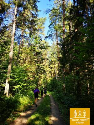
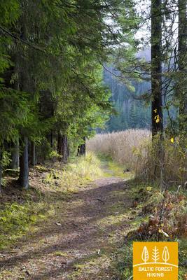
The Forest Trail passes through Kurtuvėnai, Varniai and Salantai Regional Parks and Žemaitija National Park, presenting the natural and cultural heritage of Žemaitija ethnographic region. The Forest Trail opens a view on a hilly and wooded landscape, dotted with lakes, rivers, streams, swamps and springs. More than a half of the Žemaitija National Park area is covered in forest, mainly thick and dark fir forests and natural, old coniferous and mixed forests, while the open areas feature meadows. Forests and hills conceal what once was human settlements and castle-mounds. The forest trail passes through the unique villages and towns of Žemaitija where people have preserved their dialect, customs and traditional holidays (Shrove Tuesday, Midsummer Night).
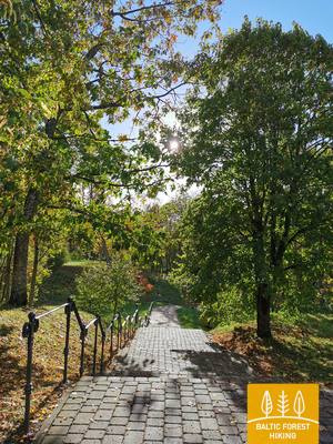
 Section 73. Dengtiltis – Kurtuvėnai.
Through Kurtuvėnai Regional Park
Kurtuvėnai Regional Park is one of the most forested areas in Central Lithuania with very pronounced glacier-shaped terrain forms spread in the Eastern Žemaitija Upland, between the rivers Venta and Dubysa. From Dengtiltis, along small forest roads, the Forest Trail leads to Kelmė road (No. 2106), for a short time moves along to a northeast and after 0.4 km turns left. The trail further winds along forest paths in the direction of Pageluvis and Geluva lakes. After turning a loop around Geluvos, Barsukyno and Dubuko lakes, the Forest Trail continues in a westerly and north-westerly direction, crosses the A12 highway through a tunnel and further, along more open places, where small villages are located, makes another loop around Dambos pond. Kurtuvėnai village is located on the western side of the pond. Along the P. Višinskio street – main street of the village, the Forest Trail reaches the destination of this section.
Section 74. Kurtuvėnai – Šaukėnai.
Natural wonders in Kurtuvėnai Regional Park
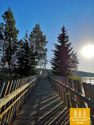
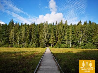
Along forest paths and small roads, the Forest Trail leads through Kurtuvėnai Regional Park. It is equipped with nature trails. From Kurtuvėnai, the Forest Trail leads along a beautiful tree alley and further along a small country trail winds between fish ponds, small hills overgrown with meadows, until it reaches the forest again. The trail turns around Vainagiai village, leads along a wooden footbridge through the wetland and reaches the castle mound on the shore of Vainagiai lake. For the next 8 km to Šaukėnai, it continues as a small forest road and, before entering the Šaukėnai small town, surrounds the northwestern shore of Juodlė lake. In Šaukėnai small town, the Forest Trail continues along Juodlės street.
 Section 75. Šaukėnai – Gaulėnai.
In the heart of the Žemaitija Upland
From the centre of Šaukėnai small town along Laisvės street, the Forest Trail reaches Kelmė Road (No. 2103), turns right to the north, and after 2.2 km on Road No. 215 turns left and continue on the Ramučiai–Užvenčio road (No. 159). After 3.5 km, the Forest Trail turns right to Beržėnai village, where it continues along Liepų and Degsnės streets. Behind Beržėnai, it winds for more than 14 km through the surrounding fields and forests until it reaches the Ramučiai-Luokė road (No. 2111). Walking quietly, there is a great opportunity to see wildlife at this section. After 3.6 km, the Forest Trail reaches the end of the section.
Section 76. Gaulėnai – Pavandenė.
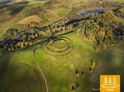
To the place where the Žemaitijos witches gathered
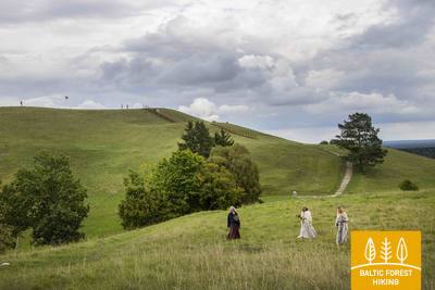
In this section of the Forest Trail, there is one of the highest regions of the Žemaitija Upland and one of the highest hills – Šatrija Hill, which offers an excellent landscape. The Žemaitija Upland are crossed by small, winding roads, which from time to time rise up to a high hill and soon descend again sharply. The first 2.4 km of the Forest Trail meanders along the Ramučiai–Luokė road (No. 2111), then it turns left to the south, settling a wide circle around Šatrija Hill. Approximately 2 km from Šatrija Hill, the Forest Trail reaches the Užmiestis, where it turns left again to the south and continues for about 10 km on the Luokė – Užventis road (No. 2114). Then it goes right to the southwest and after almost 7 km reaches the centre of Pavandenė. Throughout the route, open spaces alternate with wooded areas, creating a nice mosaic landscape.
Section 77. Pavandenė – Biržuvėnai.
Through Varniai Regional Park
From Pavandenė village, the Forest Trail continues in a north-western direction along the road no. 4609 and after 7.5 km turns right and then makes about 4 km long circle around a small wooded area, in which there hides Baltežeris lake. Near Kuršiai, it crosses the Luokė–Janapolės road (No. 4611), descends in the valley of the Virvytė river, passes through the Baltininkai village and crosses once more the Virvytė river, which is popular with water tourists. After about 5 km, winding along the right bank of the Virvytė river, the Forest Trail reaches Biržuvėnai village on the shore of the mill lake. While traveling this section of the Forest Trail, you can admire the hilly landscape of Varniai Regional Park.
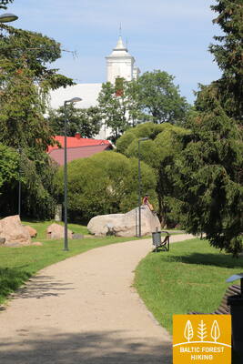
Section 78. Biržuvėnai – Telšiai.
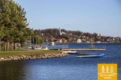
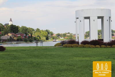
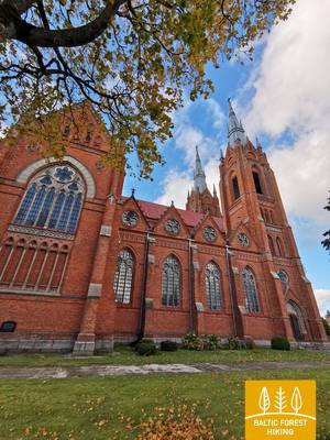
On the way to the capital of Žemaitija – Telšiai
After Biržuvėnai, for the next 3 km the Forest Trail goes through Biržuvėnai forest. 1 km to the village of Rudupiai, it follows the Luokė–Viešvėnai road (No. 4605) until it turns right to the north-northwest. For the next 11 km, it travels through the agricultural area until it leaves the village of Rainiai. From Rainiai, the Forest Trail continues initially as a lane separated from the road and then as a pedestrian / bicycle path for about 3 km continues to Telšiai, where it turns into Kauno street and then reaches the shore of Mastis lake. Further, it winds through the park, revealing beautiful views of Mastis lake panorama from Zaksas hill. Then the Forest Trail bends around a small bay of Mastis lake and then reaches the destination of this section.
Section 79. Telšiai – Buožėnai.
Through the Germantas Landscape Reserve
The Forest Trail along the pedestrian promenade throws a circle along the northern shore of Mastis lake and further along Ežero, L. Giros and Plungės streets (sidewalks, pedestrian / bicycle paths) heads west. Approximately 2.5 km from Mastis lake, it turns left to the south-west and follows road No. 4656 in the direction of Lieplaukė. After 2.1 km near the Užgiriai village, the Forest Trail turns right to the north to cross the Germantas landscape reserve along small forest paths and wooden footbridges. After Germantas lake it continues along J. Perkovskio street, turns to Plungė street, crosses the railway, at the roundabout goes to the right (Margiukų street), then to the left (Šilelio street), crosses the A11 highway and along a small country road after 5 km reaches the Buožėnai village.
Section 80. Buožėnai – Plinkšės.
Through the Plinkšiai Forest Biosphere Reserve
From Buožėnai the Forest Trail throws a zigzag circle, after 5 km crosses the Seda–Gaudikaičiai road (No. 161) and after 2 km enters Pamarkija forest. It then moves north and after 2.5 km reaches a larger forest massif. The 7 km route travels through the territory of the Plinkšiai Forest Biosphere Reserve and turns into Plinkšės village, and after 2 km reaches the final destination of the section. At the beginning of the section there can be seen open landscapes of the northern part of Žemaitija Upland, but on the other part the route mostly leads through the woods.
Section 81. Plinkšės – Žemaičių Kalvarija.
To the destination of pilgrims
From Plinkšiai the Forest Trail leads to the west, crosses the wooded area and reaches the Seda–Gaudikaičiai road (No. 161) 2 km away. After 1.8 km, the Forest Trail turns left to the south. For the next 7.4 km, it crosses agricultural land and a larger forest area until it turns right, heading west into Bertuliai village. After another 3.8 km, the Forest Trail crosses the Seda–Plungė (No. 164) road, where the towers of the pilgrimage destination, Žemaičių Kalvarija, can be seen from the surrounding hills. Shortly before the village, the Forest Trail crosses the border of the Žemaitija National Park.
Section 82. Žemaičių Kalvarija – Paplatelė.
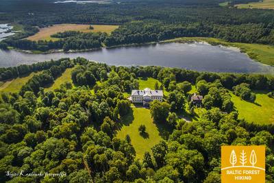
Along the beautiful hills of the Žemaitija Upland
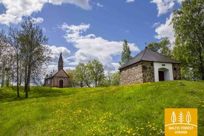
The Forest Trail exits Žemaičių Kalvarija village along Pagardinio, Alsėdžių and Platelių streets. About 6.5 km from the village centre the Forest Trail, along a scenic road surrounded by hills (No. 3210), enters the parking lot. At the parking lot, it turns left to the south, enters the forest and crosses the Gegrėnai archaeological complex. Leaving the forest, the Forest Trail continues along Ežero street, after a short time crosses Dvaro street, turns to Paežerės street and after 5 km reaches Žemaičių Kalvarijos road (No. 2302). Here the Forest Trail turns left again and follows the pedestrian / bicycle paths. After 1.7 km, it reaches the junction with Plokštinės street and turns right to the south. After 1.8 km the Forest Trail reaches the village of Paplatelė. This section is located in the Žemaitija National Park and introduces the landscapes and natural diversity of the northwestern part of the Žemaitija Upland.
Section 83. Paplatelė – Plateliai.
Around the largest lakes in the Žemaitija National Park
For the first 3.5 km, the Forest Trail leads through beautiful coniferous forests that cover the slopes of the Žemaitija Upland. Up to the Cold War exposition, it coincides with the Plokštinė cognitive trail. From the museum, the Forest Trail for 5 km follows the Plokštinė road, where a pedestrian / bicycle path has been created and, approaching Plateliai lake, descends into the lowland of the lake. At the road No. 3202 (Malūno street) , the Forest Trail turns left to the south-east and after 0.3 km turns right to right to the south-southwest. After about 0.5 km it reaches Ilgio Ežero street. For the next 5.5 km, the Forest Trail forms a wide circle around Ilgis and Beržoras lakes, reaching the Beržoras village. After the village, after 2 km along Plungės street, the Forest Trail reaches the centre of Plateliai and throws another circle along Ežero street to the beach and Šeirė educational trail. Then along Ežero, Naujoji and Žemaičių Kalvarijos streets, the Forest Trail returns to the centre of the town.
Section 84. Plateliai – Salantai.
Towards the Pajūris Lowland
The Forest Trail for 6 km runs along the edge of the Plateliai–Salantai (No.2302) road. At this section, there opens up the view of the landscapes of the western part of the Žemaitija Upland over the Pajūris Lowland. In the centre of Gintališkė village, the Forest Trail turns left to the southwest, coming to road No. 3216. After 2.4 km, it turns right to the west, where it crosses the largest forest massif in this section. During the Soviet era, there was a missile base here, as evidenced by the road paved with concrete slabs. Then the Forest Trail briefly follows the Plungė–Salantai road (No. 169) and after 1.4 km turns left. Up to Salantai, it wanders through a small country road, and the small-town centre is reached through Žemaitės and M. Valančiaus streets. The beginning of this section is in Žemaitija National Park, but the last part is in Salantai Regional Park.
Section 85. Salantai – Mosėdis.
Through the Salantai Regional Park
From the small-town of Salantai, the Forest Trail goes along M. Valančiaus, Padvaralio and Ilgoji streets. 100 m before road No. 169 the Forest Trail turns left on a country road, after 3.5 km reaches Erlos street and turns left to the west. After 0.4 km it turns right to the north and reaches Šatraminiai village. There, it turns right to the southwest, after 2.9 km crosses the Salantai–Skuodas road (No. 169) and in Šaukliai village turns left to the north, after 3.8 km reaching Mosėdis, the destination of the section. Most of the section, except for the Šatraminiai area, runs through the territory of Salantai Regional Park.
Section 86. Mosėdis – Skuodas.
To Skuodas in the Lithuanian/Latvian border area
From small-town of Mosėdis, along the Salantų and Skuodo streets, the Forest Trail winds towards Skuodas and after less than 8 km reaches the Salantai–Skuodas road (No. 169). The route goes through agricultural lands. The landscape changes when it enters the valley of the Bartuva river. The Forest Trail goes 0.5 km along the Salantai–Skuodas road, then turns left and winds 6.7 km on small country roads until it reaches the town of Skuodas. It continues along Kretingos, Laisvės and Krantinės streets, crosses Skuodas Park and via Gedimino, Vytauto and J. Basanavičiaus streets (road No. 169) until it reaches the state border.