


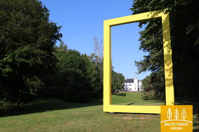
Baltic Forest Hiking - Peipsimaa region

Peipsimaa Region
FISHING VILLAGES AND ONION ROUTE
Ristipalo – Kuremäe: 255 km, Day 22 – 33
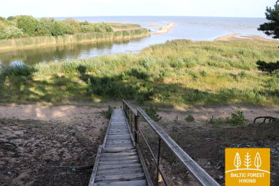
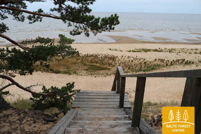
Lake Peipus is so large that it could be mistaken for sea. Forest trail leads along the shores of the lake, passing through villages that are linked together by long streets. The streets are packed with rows of colourful houses. An influence of Orthodox culture can be sensed in the way these villages are constructed. Since the time of the Russian Emperor Tsar Nicholas, a tradition of growing onions persists in this region, and often people sell strings of home-grown onions on street sides. Visitors can buy fresh fish from Lake Peipus in shops or enjoy delicious meals served in local restaurants. As Forest trail reaches the northern shore of Lake Peipus, the route stretches along a sandy beach for two days.
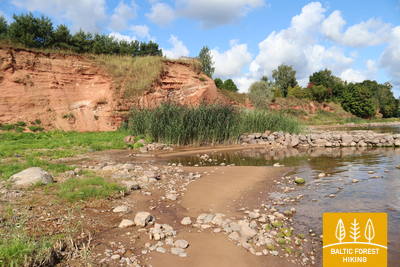
Highlights: Peipus – the fourth largest lake in Europe, Kavastu Ferry – the only manually powered ferry in the Baltic states, Emajõe wetland with a wooden footpath, Varnja, Kolkja, Kallaste, Mustvee – Old Believers’ villages, where onions are traditionally grown, Fishing traditions and fish restaurants in Lake Peipus area, Alatskivi castle, Kallaste sandstone cliffs, Lake Peipus lighthouses, Avinurme handicraft centre, Sandy beach on the northern shore of Lake Peipus, Alutaguse National Park is one of the most densely wooded and swampy areas in Estonia, Kuremäe Monastery – a popular pilgrimage place.
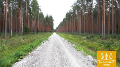
 Section 22. Ristipalo‒Mehikoorma.
Through the polder meadows of Lake Peipus
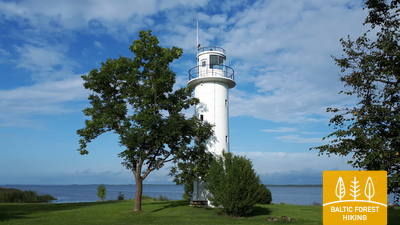
Nearly half of this section runs on straight polder roads of the Lake Peipus lowlands. The polders are designed to protect the surrounding land from flooding in spring. The flat polder meadows are used for agriculture and grazing livestock. The section from Naha to Mehikoorma leads along the Räpina‒Mehikoorma roadway. A beautiful view of Lake Lämmijärv opens from the Mehikoorma Lighthouse. This lake is a narrowing between Lake Pskov and Lake Peipus. Russia lies on the other side of Lake Lämmijärv (1.7 km).
 Section 23. Mehikoorma‒Lääniste.
Around the Emajõe-Suursoo wetland
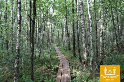
The stage fully justifies the name of the Forest Trail, as the next three days lead through one of Estonia's largest wetlands, the Emajõe-Suursoo wetland, which is surrounded by extensive forest areas. The only settlement area between Jõepera and Ahja River is Järvselja, enclosed by forests. The terrain is flat, since the Forest Trail still runs through the Lake Peipus lowlands. The destination is located by the Ahja River, which is known for its scenic Devonian sandstone outcrops and a popular boat route.
Section 24. Lääniste‒Kavastu.
Crossing the Emajõgi River by the only cable ferry in Estonia
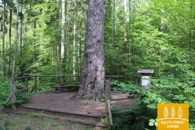
Most of this section of the Forest Trail passes through an uninhabited forest area to the west of the Emajõe-Suursoo wetland, which is protected by the Peipsiveere nature reserve. At the village of Kastre, the Forest Trail returns to civilisation, and hikers have to cross the Emajõgi River by the local cable ferry to get to the Kavastu village. The Peipsiveere visitor centre and nature trails are located at a 3.5 km distance from Kavastu.
 Section 25. Kavastu‒Varnja.
Towards the Varnja old believers’ village
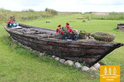
The Forest Trail has been circling around the Emajõe-Suursoo (a part of the Peipsiveere nature reserve) wetland for three days now. The most interesting part of the walk is the section between Vanaussaia and Varnja, where the Forest Trail runs along small rural roads. Before Varnja it reaches the shore of Lake Peipus (Peipsi), and here you can really feel the true size of the lake. The following distance from Varnja to Remniku along the shores of Lake Peipus and the surrounding territory will take about one week. Over this week, the hikers will learn more about the traditional culture of Eastern Estonia, such as onion cultivation, fishing, culinary heritage, crafts and the culture of the Old Believers.
Section 26. Varnja‒Alatskivi.
Visiting the onion farmers of Lake Peipus
A scenic and tradition-rich stretch of the Forest Trail symbolised by the onion. Onions were brought to the region by Old Believers in the 17th century. Ladies and gentlemen selling home-made onion strings on the roadside have become somewhat of a business card of the villages. The villages on the twenty-four kilometre stretch of road between Varnja and Kallaste are connected by the tourist route called Onion Road. The landscape is decorated by colourful wooden houses, small fish shops and a restaurant where you can enjoy tea made in the samovar, true to the traditions of Old Believers. The fish vendace (rääbis) from Lake Peipus is served throughout the year.
Section 27. Alatskivi‒Rannamõisa.
Smoked fish and onion pie – the culinary heritage of Lake Peipus
Alatskivi is a great place to try the traditional dishes of Lake Peipus, including the famous onion pie. After Alatskivi, the Forest Trail ascends to a higher ground, which offers beautiful views of Lake Peipus, and then descends to meet the shore of the lake again at Kallaste. In Kallaste, look out for the local fish restaurant and shop, and try smoked vendace (rääbis) as well as zander from Lake Peipus. The last part of this section leads along a road overlooking the lake.
Section 28. Rannamõisa‒Mustvee.
Through the vibrant villages on the shores of Lake Peipus to Mustvee
Onions, fish, villages that stretch out for several kilometres where the buildings are lined along the main street, ornate Old Believers' churches, small harbours with fishing boats and wooden houses, each painted in a different colour! Cafés, shops and a view of Lake Peipus, which looks more like a sea rather than a lake. That is how you could describe this section of the Forest Trail. For eight kilometres from Kasepää to Mustvee, the Forest Trail passes through small coastal villages, offering a pleasant change for those who have walked for a longer period of time.
Section 29. Mustvee‒Avinurme.
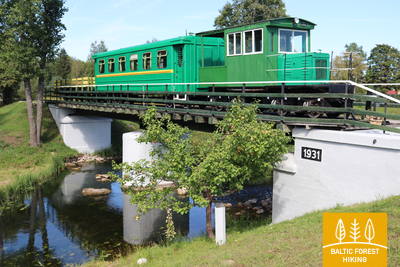
Down the old Sonda‒Mustvee narrow-gauge railroad track
After leaving the Mustvee promenade and beach, the Forest Trail curves through the city and continues along the former Sonda‒Mustvee narrow-gauge railroad track for the next 16 km. The railway tracks have been replaced by a gravel road on a straight line that connects Mustvee and Avinurme. Information stands placed along the railway designate former settlements that have been overtaken by the forest or turned into clearings to be reforested soon.
Section 30. Avinurme‒Lohusuu.
A visit to the craftsmen of Avinurme
Before going further down the Forest Trail, it is worth visiting the Avinurme wooden handicrafts centre, which has the richest selection of wickerwork in Estonia and offers various workshops such as basket weaving, felting, baking bread, candle making among many others. Up to the village of Separa, the Forest Trail passes through a large forest rich in bilberries, blueberries and mushrooms during late summer.
Section 31. Lohusuu‒Kuru.
Through the mushroom and berry forests on the northern shore of Lake Peipus
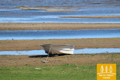
The first half of this section leads through magnificent coniferous forests, especially in the Järvevälja landscape reserve, where the trail is surrounded by beautiful dunes in the north and a raised bog in the south. It is well worth visiting the kiosk at Rannapungerja to buy smoked fished – the Lake Peipus vendace (rääbis) and some local farm produce. The Forest Trail crosses the Rannapungerja River via the motorway bridge and comes to the shores of Lake Peipus at Kauksi. There is a picnic area to cosy up and eat the fish you’ve brought along. Here, the shores of Lake Peipus resemble a magnificent beach surrounded by beautiful pine-covered dunes.
Section 32. Kuru‒Remniku.
The beautiful dunes and beaches of Lake Peipus
Apart from the Alajõe village, the Forest Trail winds along the coast of the beautiful Lake Peipus. During the summer, when the water level in the lake is lower, beautiful, sandy beaches with wide shallows appear. Past Alajõe, the highest dunes of Lake Peipus (up to 20 m) rise on the landscape, providing a distant view of Lake Peipus, one of the largest lakes in Europe.
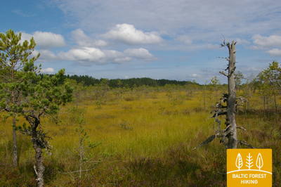
Section 33. Remniku‒Kuremäe.
Through Alutaguse – Estonia's newest national park
From here on, the Forest Trail passes through the newest member of Estonian national park family, the Alutaguse national park (several parts of the park in a wider area, to be exact), which was founded in 2018. The main objective of the park is the protection of Estonia’s largest coniferous forests and swamp areas. This is also one of the most sparsely populated areas of North-eastern Estonia.