


Baltic Forest Hiking - South Kurzeme

South Kurzeme
Along the hills and river valleys of Rietumkursa Upland
Lithuanian – Latvian border – Snēpele: 111 km, 6 days
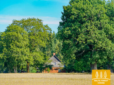
Southern Kurzeme is also referred to as Leišmale — the area next to the Lithuanian border. The landscape features no old homesteads or villages, as they were destroyed in World War II, and the area around the Forest Trail is dominated by agricultural landscapes sparingly interspersed with wooded areas. The Swedish Gate in Priekule, built in 1688, adorned with the ducal coats of arms of the von Korff and von Redern families, chiselled in sandstone from Gotland, as well as the 18–19th century historical buildings in Aizpute, are testimonies of by-gone times.
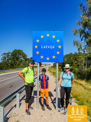
 Section 87. Lithuanian– Latvian border – Gramzda.
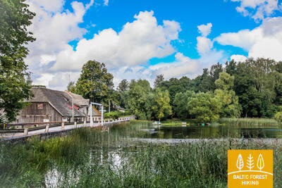
Along the Vārtāja undulating plain
The Lithuanian – Latvian border in nature is marked by the Apše river, which the Forest Trail crosses, entering Latvia via the Skuodas – Priekule road bridge (P114). The Forest Trail initially winds along the side of the road, but after 1.7 km turns onto a gravel road in the direction of Kalēti. Starting from the surroundings of Ozolu village, the view opens up to the beautiful and wide landscapes of the Vārtāja undulating plain of the Rietumkursa Upland. In Ozoli, the Forest Trail for 0.5 km follows the road V1217, then turns right and after 2 km reaches the Bārta–Kalēti–Gramzda road (V1218), that leads to Gramzda.
Section 88. Gramzda – Priekule.
To Priekule, rich in stories
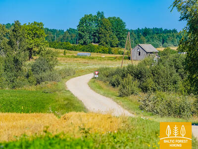
After Gramzda the Forest Trail as a small path swirls along sand and gravel quarries and along a straight path through the agricultural landscape moves northeast. At the Lejasbunči house, it turns to Mazgramzda. Before Mazgramzda, the Forest Trail crosses the deep and shady Ruņupe valley. After Mazgramzda, it runs along the Gramzda–Priekule road (P 114), from which there open up beautiful landscapes of the Vārtāja undulating plain of the Rietumkursa Upland. After crossing this road, it runs along the former airfield, crosses the Priekule–Purmsāti–Kalēti road (V 1211) and throws a circle through a small wooded area. Along the banks of the winding Virga river, the Forest Trail leads through the forest park “Priekules Priediens”, from which there is visible the destination of this section.
 Section 89. Priekule – Kalvene.
Along the historical road through Embūte and Bandava hills
The Forest Trail along Ķieģeļu, Galvenā and Parka streets bends through Priekule, throws circles along small park paths near Dobeļupe and continues to Audari, where it crosses the Grobiņa–Embūte road (P106). After 4 km, it turns right and in the next section, up to the Rīga–Liepāja highway, leads along a sparsely populated area, where agricultural land alternates with forest clusters and small wetlands. The area between Sepene lake and Kalvene is distinctly hilly – here the Embūte hills alternate with the Bandava hills. The highest point reached by the Forest Trail is 115 m above sea level. Crossing the Rīga–Liepāja highway (A9), after 1 km the Forest Trail reaches the destination of this section.
Section 90. Kalvene – Aizpute.
To Aizpute – one of the oldest cities in Latvia
The Forest Trail winds along the small streets of Kalvene to the Aizpute–Kalvene road (P115), for 1.4 km leads along its side and then turns right. Then the Forest Trail crosses the Jelgava– Liepāja railway and winds along a small country road all the way to Bojas village. There are many former fish ponds in the area. The open landscape is occasionally enlivened by a farmstead, where you can sometimes buy locally grown and prepared food. After the Kazdanga–Mazbojas road (V1299), the Forest Trail crosses the Grantnieki quarry. In the section from Kalvene to Bojas, the Forest Trail leads through the Bandava hills of the Rietumkursa Upland, where the highest relief points slightly exceed 100 m above sea level. After Bojas, the Forest Trail crosses the Laža river and at the Tebra river comes out again on the Aizpute–Kalvene road, along which it leads to Aizpute. Along Kalvenes and Atmodas streets, the Forest Trail reaches the centre of the town.
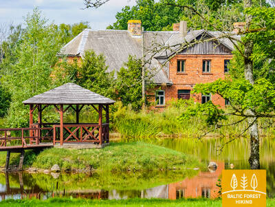
Section 91. Aizpute – Snēpele.
In the footsteps of baron von Manteuffel
The Forest Trail along Atmodas and Jelgavas streets winds through Aizpute, after the Laža water reservoir turns right, and approaches the Kazdanga manor park with a large circle from the south. As a small path, it leads along Dzirnavu lake through the manor park, around the manor and Zēnu pond, for 0.7 km continues along the Kazdanga–Cildi road (V1200) and then turns right onto the Snēpele–Kazdanga road (V1296). Up to the country house “Zemturi”, the Forest Trail gradually rises in the Bandava hills of the Rietumkursa Upland, revealing beautiful views in both directions. The height of the relief here reaches a maximum of about 81 m above sea level. From “Zemturi”, for about 12 km , the Forest Trail leads through a sparsely populated forest massif and only in the last 3 km comes out again in an open area with agricultural lands and farmsteads, reaching Snēpele.