


Baltic Forest Hiking - Cultural experience


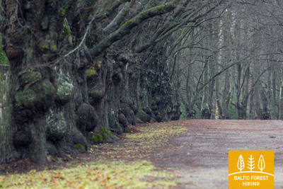
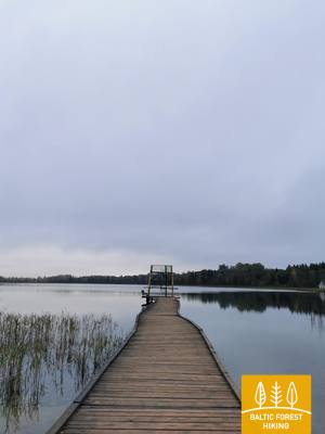
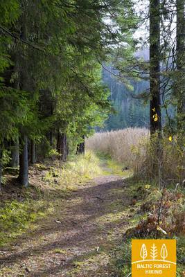
 Section 1. Old Riga - Baltezers.
Through Riga – UNESCO World Heritage Site
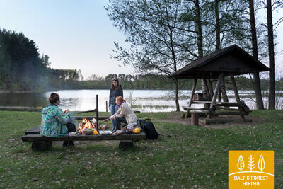
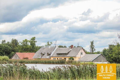
The starting point of Forest Trail in Latvia is located in the heart of Old Riga, the Town Hall Square. The route leads along Kaļķu Street, passes the Monument of Freedom, through Vērmane Garden and along the historic Tērbatas street. Then it arches over the Zemitāni railway station pedestrian bridge and treads into Biķernieki and Šmerlis forests. The Forest Trail winds through Jugla, passes the Latvian Ethnographic Open-Air Museum and goes on along the pedestrian-bicycle path until Baltezers.
The historic center of Riga is a UNESCO World Heritage site with a rich array of cultural monuments. Riga hosts the largest number of museums, exhibitions, and various annual events. The city offers a wide range of dining establishments and restaurants, including those serving traditional Latvian cuisine, as well as souvenirs and events related to national and other traditions.
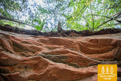
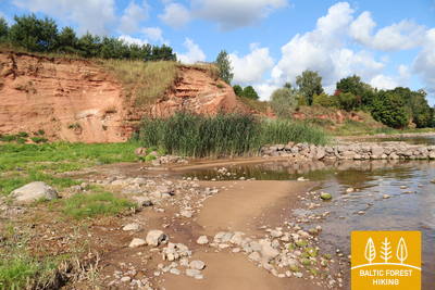
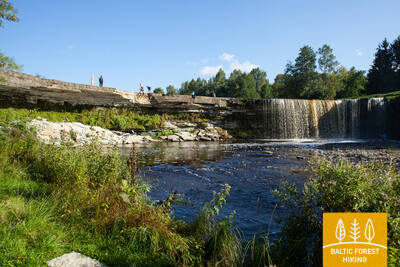
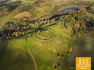
 Section 4. Rāmkalni - Sigulda.
Stunning scenery of the ancient valley of Gauja River near Sigulda
Past “Rāmkalni”, the Forest Trail wanders up the steep banks of Gauja valley, passes through Gauja village and comes back down. Then it crosses river Lorupe and continues along the bends of river Gauja, passing one of the most spectacular outcrops of the river, the Velnala Cliffs, goes up to Ķeizarskats observation spot and circles down to Ķeizarkrēsls, adventure park “Mežakaķis” at Kaķīškalns and the Sigulda Bobsleigh and Luge Track.
Sigulda is one of the most popular tourist destinations in Latvia. It is notable for its three medieval castle ruins, manors, Gutman’s Cave, the Turaida Museum Reserve, and annual cultural events, including the Sigulda Opera Music Festival and other events and attractions.
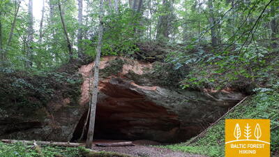
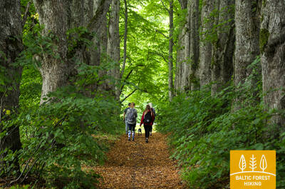
Section 5. Sigulda - Līgatne.
In the heart of Gauja National Park
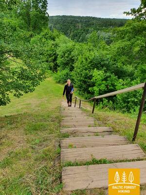
After passing through Sigulda, the Forest Trail follows the River Vējupīte to Mound Paradīzes, where a steep staircase leads down into the ancient valley of Gauja River and the ravine of River Vējupīte. It continues to wind down smaller paths through meadows, crossing small rivers whose banks reveal sandstone outcrops. The last six kilometres of this section follow a smaller path down Līgatne Nature Trails. As it draws closer to Līgatne, the Forest Trail moves up the hills of Gauja valley, before descending back down into the deep ravine of Līgatne River, where the village of the former Līgatne Paper Mill is located.
Līgatne offers a wide range of dining options featuring local products, Latvian cuisine, and beverages produced in Līgatne. The restaurant "Pavāru māja" has been awarded the Michelin Green Star. Local souvenirs are available at souvenir shops. The Līgatne Paper Factory Village is an industrial heritage site with former production and warehouse buildings, residential barracks, cellars used for storing vegetables, and the Līgatne ferry. Nearby is the secret Līgatne bunker.
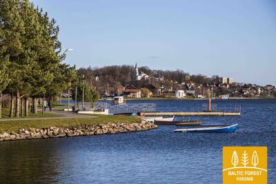
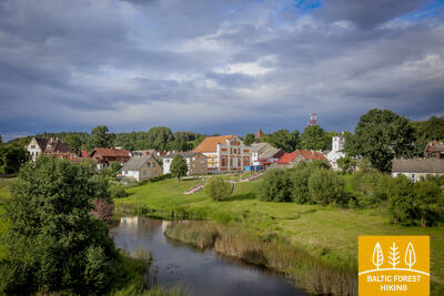
 Section 9. Valmiera - Strenči.
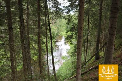
Along Abuls to Strenči, the capital of rafters
The trail passes through the historical centre of Valmiera and the Atpūtas Park, which is a popular place among hikers and Nordic walkers, then crosses the suspension bridge, passes Pauku priedes pine forest and Baiļu kalns. From there it follows the Abuls Trail, curving along the banks of the river until reaching the Brenguļi Brewery, and further down, beyond Pūpoli, enters vast, unpopulated forest areas. The first part of this section passes by numerous small summer cottage villages with names such as Enerģētiķis, Saulītes, Sprīdītis, Gaujmaļi, Pūpoli and Gaujaslāči, which were initially established during the Soviet period as summer cottage neighbourhoods of the people of Valmiera and the surrounding territories. Near Ūdriņas, the Forest Trail leads through a labyrinth of the riverbeds and turns north, crossing the Gauja Bridge, where a resting and boating stop is located. The centre of Strenči is located at a 1.5 km distance. Part of the section passes through the Northern Gauja protected landscape area.
Valmiera’s historic center features the ruins of the Livonian Order Castle, St. Simon's Church, fragments of city walls, and other cultural monuments. At Valmiermuiža Brewery and its restaurants, you can enjoy gourmet tours and visit the production facility. In Brenguļi, you can taste the products of the Brenguļi Brewery. Strenči is the capital of Latvian log rafting, where the traditions of log rafting are still preserved today.
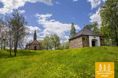
Section 19. Vana-Vastseliina‒Kolodavitsa.
Along the banks of Piusa, the fastest river in Estonia
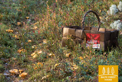
The first part of this section of the Forest Trail winds along the magnificent Piusa River valley, then, at Härmä village, it turns towards Obinitsa, an important cultural centre of Setomaa, the Land of Setos. Here you can discover the traditions of the local Seto people. After Obinitsa, the Forest Trail leads through beautiful pine forests rich in heather, descends back into the depths of the Piusa River valley and turns east at Piusa caves. From there it follows the left slope of Piusa valley until it reaches the motorway and railway line by Koidula railway station.
A section of the Forest Trail that represents the Seto cultural space with objects of tangible and intangible heritage - museums, sacred buildings, and the opportunity to enjoy traditional Seto foods, listen to songs, watch dances, and more. At the beginning of the section are the ruins of the Bishop's Castle of Vana-Vastseliina with a museum, from which half of the route leads through the Piusa Valley.
Section 20. Kolodavitsa‒Värska.
Historical heritage and living traditions in Setomaa, the land of Seto people
The Forest Trail leads through the vast forests of Setomaa, along mires and moors, which are painted a fabulous shade of purple in September. This is a sparsely populated region, and hikers have the chance to really connect to the nature. At Lake Õrsava, the Forest Trail crosses several pedestrian bridges, circles around the lake and leads to the centre of Värska borough. Take your time to discover local Seto traditions and cuisine.
In Värska, one can enjoy Seto land traditions - culinary and intangible heritage, as well as learn about the history of the mineral water resort. In Värska, the so-called North Camp is a unique military heritage site in Estonia, preserved in a form not found anywhere else. Guides are available to take visitors around these sites.
Section 21. Värska‒Ristipalo.
Värska – historical resort
After leaving Värska, the Forest Trail turns northwest towards Värska Gulf of Lake Pskov. Having circled around in the forest, the trail leads to Laossina village, where the visitors have the opportunity to learn more about the religious traditions of the Seto people. This section of the Forest Trail passes through the Lake Peipus lowlands, so the terrain is flat. The land is mainly used for agriculture. After crossing the Võhandu River near Võõpsu village, the Forest Trail turns towards Räpina.
Värska is a popular resort in Southeastern Estonia, so it is worth staying here for at least one additional day to explore the area's historical monuments, starting with the North Camp, Räägi House, and Värska Seto House, and continuing with the Värska Sanatorium, surrounding forests, educational trails, and chapels along the Forest Trail.
Section 25. Kavastu‒Varnja.
Towards the Varnja old believers’ village
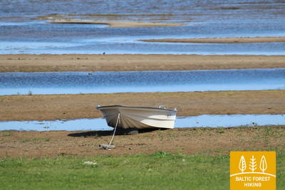
The Forest Trail has been circling around the Emajõe-Suursoo (a part of the Peipsiveere nature reserve) wetland for three days now. The most interesting part of the walk is the section between Vanaussaia and Varnja, where the Forest Trail runs along small rural roads. Before Varnja it reaches the shore of Lake Peipus (Peipsi), and here you can really feel the true size of the lake. The following distance from Varnja to Remniku along the shores of Lake Peipus and the surrounding territory will take about one week. Over this week, the hikers will learn more about the traditional culture of Eastern Estonia, such as onion cultivation, fishing, culinary heritage, crafts and the culture of the Old Believers.
One of the rare places in Europe where the riverbanks are connected by a hand-operated ferry.
Section 26. Varnja‒Alatskivi.
Visiting the onion farmers of Lake Peipus
A scenic and tradition-rich stretch of the Forest Trail symbolised by the onion. Onions were brought to the region by Old Believers in the 17th century. Ladies and gentlemen selling home-made onion strings on the roadside have become somewhat of a business card of the villages. The villages on the twenty-four kilometre stretch of road between Varnja and Kallaste are connected by the tourist route called Onion Road. The landscape is decorated by colourful wooden houses, small fish shops and a restaurant where you can enjoy tea made in the samovar, true to the traditions of Old Believers. The fish vendace (rääbis) from Lake Peipus is served throughout the year.
An interesting section of the Forest Trail along the shores of Lake Peipus, which becomes particularly visually appealing in autumn when local residents sell onion garlands and other home-grown produce along the streets of the Old Believers' villages. It is possible to visit a farm where onions are grown, enjoy tea from a samovar, and visit museums and exhibitions that showcase local traditions. At the end of the section is Alatskivi Castle, a venue for various cultural events.
Section 27. Alatskivi‒Rannamõisa.
Smoked fish and onion pie – the culinary heritage of Lake Peipus
Alatskivi is a great place to try the traditional dishes of Lake Peipus, including the famous onion pie. After Alatskivi, the Forest Trail ascends to a higher ground, which offers beautiful views of Lake Peipus, and then descends to meet the shore of the lake again at Kallaste. In Kallaste, look out for the local fish restaurant and shop, and try smoked vendace (rääbis) as well as zander from Lake Peipus. The last part of this section leads along a road overlooking the lake.
It is worth walking through the streets of Kallaste and along the shore of Lake Peipus opposite Kallaste, sitting in one of the coastal cafes, and enjoying Peipus whitefish or other smoked or otherwise prepared fish. In autumn, as in other Peipus villages, you can buy onion garlands and other home-grown produce from local residents. It is a suitable place for photography and filming, especially near the Kallaste sandstone outcrops. Alatskivi Castle with its park is a popular destination.
Section 28. Rannamõisa‒Mustvee.
Through the vibrant villages on the shores of Lake Peipus to Mustvee
Onions, fish, villages that stretch out for several kilometres where the buildings are lined along the main street, ornate Old Believers' churches, small harbours with fishing boats and wooden houses, each painted in a different colour! Cafés, shops and a view of Lake Peipus, which looks more like a sea rather than a lake. That is how you could describe this section of the Forest Trail. For eight kilometres from Kasepää to Mustvee, the Forest Trail passes through small coastal villages, offering a pleasant change for those who have walked for a longer period of time.
In terms of urban environment, an interesting section of the Forest trail leads through the small coastal villages of Lake Peipus with their unique low-rise architecture and many sacred buildings. The traditions and history of this area can be explored in museums and exhibitions.
Section 29. Mustvee‒Avinurme.
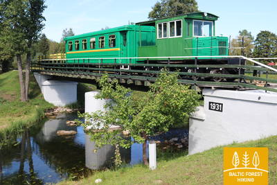
Down the old Sonda‒Mustvee narrow-gauge railroad track
After leaving the Mustvee promenade and beach, the Forest Trail curves through the city and continues along the former Sonda‒Mustvee narrow-gauge railroad track for the next 16 km. The railway tracks have been replaced by a gravel road on a straight line that connects Mustvee and Avinurme. Information stands placed along the railway designate former settlements that have been overtaken by the forest or turned into clearings to be reforested soon.
The only place on the Forest Trail (E11) where such a long section (16 km) of the route follows a former narrow-gauge railway line. In Avinurme, you can also see the reconstructed train. It is worth visiting the Avinurme Lifestyle Center, where you can participate in workshops and buy souvenirs from local craftsmen, as well as enjoy delicious coffee with local cakes."
Section 33. Remniku‒Kuremäe.
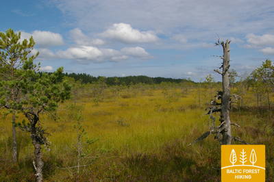
Through Alutaguse – Estonia's newest national park
From here on, the Forest Trail passes through the newest member of Estonian national park family, the Alutaguse national park (several parts of the park in a wider area, to be exact), which was founded in 2018. The main objective of the park is the protection of Estonia’s largest coniferous forests and swamp areas. This is also one of the most sparsely populated areas of North-eastern Estonia.
Kuremäe is an important destination for religious tourism and pilgrimages.
Section 35. Vasavere‒Toila.
Towards the rocky coast of Northern Estonia near Toila
Behind Vasavere, the Forest Trail continues through the Kurtna landscape reserve, encircles over a peat bog, crosses the town of Oru, passes through the Voka River valley and arrives at the Baltic Sea, where it turns west. Here, on the coast of the Gulf of Finland, rises the North-Estonian Klint – a steep, rocky and forest-covered cliff that stretches non-continuously to Tallinn and further to the islands of West-Estonia. The Forest Trail runs on top of the cliff and occasionally descends into valleys. It crosses the deep and vast Pühajõgi valley in the Toila-Oru park and comes to Toila, a popular coastal resort.
Oru Park is significant to North Estonian history with its once-impressive manor, gardens, terraces, and views of the Pehahegi River and the Gulf of Finland. The castle was destroyed during World War II, but the park and gardens are maintained today.
Section 37. Saka‒Aseri.
Millions of years old fossils on the seashore
At Saka manor, the Forest Trail ventures down a steep staircase to the seashore, where it continues along the beach for less than 6 km. At the villages of Moldova and Jabara, the Forest Trail moves back up the North-Estonian Klint (great scenery from the Viru Rise), passes through the village of Purtse, circles around the Purtse River and moves further down the narrow seacoast to Aseri. Shortly before arriving at the town, it climbs the slope of the klint again. Animal fossils can be observed by the seashore below the North-Estonian Klint, some of them hundreds of millions of years old.
The section of the Forest Trail features a wealth of evidence from various types and historical periods, ranging from Iron Age burial sites and sacred places to medieval fortresses, clay extraction quarries, and a tourism center for spirits smuggling.
Section 39. Mahu‒Kunda.
Experiencing the Kunda industrial heritage
From Mahu to Letipea village, the Forest Trail runs along small coastal roads close to the sea and along the coastline for a stretch of road. It may be worth taking a 2 km detour (there and back) to the Ehalkivi Boulder. For the next three kilometres from Simunamäe, the Forest Trail leads along the foot of the North-Estonian Klint, which is covered by a primary forest. The coastline is about a kilometre away from here. Information boards about the history of Kunda have been placed in the territory surrounding the Lontova manor. You can also visit the many objects located in the city and along the river that are related to the historical development of the city cement plant.
At the end of this section of the Forest Trail is Kunda—a town with a long industrial history, associated with cement production and the first hydroelectric power station in the Baltic States.
Section 46. Tsitre‒ Kaberneeme.
Sandy beaches and isles in Kolga Bay
A harbour was established at the Tsitre village as early as the Viking times. The first 4 km of the Forest Trail in this section pass through the territory of the Lahemaa national park. Between the villages of Muuksi and Soorinna, the road crosses an oval plateau, the klint elevation of northern Estonia, covered with scenic juniper fields. At the village of Põhja, the trail passes by the coastal wetland, and comes out by the sea behind the Salmistu harbour. From here, look out for the 1.3 km distant Pedassaar isle to the northeast, and the Umblu and Rohusi isles to the northwest. On Valkla beach, a nice beach restaurant awaits hikers. In Haapse the beach you can swim, sea gets quickly deep.
The section of the Mežtaka trail where you can get to know local traditions, participate in creative workshops, etc.: Lahemaa Heritage House, blacksmith workshop, Tomani farmstead - museum, as well as a rich range of historical objects - ancient burial sites, sacred oak, and military heritage.
Section 47. Kaberneeme ‒ Jõelähtme.
Along the banks of the Jägala River
From Kaberneeme the route runs through a forest where you can see piles of stones carried here during the last ice-age. Soon the trail climbs about 20 m up to the hiking trail which runs on the old shore line of Lake Ancylus. Trail crosses the Kaberla-Kaberneeme road and follows over a small sandy canyon of the Kaberla stream, before arriving at the Kalevi-Liiva memorial of holocaust. The trail continues to the Linnamäe HES and a suspension bridge. Follow the trail over the ancient fortress hill of Linnamäe and continue on the right bank of the Jägala river, until reaching the Jägala waterfall. The Suka bridge is about 500 meters up from the waterfall. After crossing the river, the trail strolls through the Jägala waterfall park. Finally, the trail runs through the village of Koogi and arrives at Jõelähtme.
The Forest trail section with diverse cultural and industrial heritage: Estonia's most powerful hydroelectric power station, Rebala cultural and historical area with a visitor center and ancient burial sites, sacred buildings, and a monument dedicated to the Holocaust.
Section 50. Püünsi‒Tallinn.
Most beautiful sights of Old Tallinn
The Forest Trail passes by the Gulf of Tallinn, and beautiful views of the towers, harbour and skyscrapers of the city can be seen as early as in Püünsi. The Forest Trail turns into a beautiful pine forest before Pirita, then follows along a sandy beach for 2 km. Behind Pirita all the way to the Port of Tallinn, the Forest Trail takes you along the beautiful city waterfront promenade, which overlooks the city’s most important cultural and historical sites, and offers beautiful views of the sea and the port. The final destination of the Forest Trail is located in the Port of Tallinn, next to the Old Town. You can spend another day or two visiting various tourist locations of Tallinn.
A rich cultural heritage in the coastal villages, Pirita, and Tallinn - museums, sacred buildings, monuments, castles, and coastal parks. Tallinn's historic center is a UNESCO World Heritage site. Tallinn is the city richest in cultural events, where you can explore Estonia's culinary heritage, traditions, and more.
Section 54. Didžiasalis – Druskininkai – Žiogeliai.
Druskininkai – the most popular resort in Southern Lithuania
Between Didžiasalis village and the resort town of Druskininkai, the Forest Trail leads through a coniferous forest with abundant berry and mushroom spots. Before Druskininkai, the Forest Trail merges with the Nemunas road, turns around the Druskininkai Snow Arena and continues along the pedestrian and bicycle path to the Park Bridge across the Nemunas river. After crossing the bridge, the Forest Trail continues on Maironio street. and continues along the small streets of the historic Druskininkai resort and the park roads, crossing the Ratnyčia river and the forest park on the right bank of the Nemunas. The route behind Veisiejai street goes along the sidewalk of Neravų street and after about 1 km turns left into Sodžiaus street, which at the end of Neravai village becomes a beautiful forest road. This is where Dzūkija National Park begins. The Forest Trail turns around Viečiūnai village, opening a beautiful landscape to the Liškiava monastery on the opposite bank of the Nemunas. The Forest Trail then leads to Žiogeliai village along a beautiful secluded forest road.
The section crosses Druskininkai - the most popular resort town in Southern Lithuania with ancient resort traditions and many cultural monuments - sanatoriums, parks, springs, museums, etc. Druskininkai is the venue for various annual cultural events. In the second part of the section near the Nemunas River, there is a beautiful view of the Liškiava Monastery.
Section 57. Nemunaitis – Alytus.
Across the highest pedestrian bridge to Alytus
From Nemunaitis along Vytauto street and the Kaniūkai–Einorai–Nemunaitis road (no. 1102), the Forest Trail goes 1.5 km in northeast direction, then turns left to the north and after 3 km reaches Gečialaukis village. Then the Forest Trail turns right to the east and after 3.3 km meets the road No. 1102 again. After another 3.3 km, the Forest Trail reaches road No.128 and descends along the sidewalk in the Nemunas valley. From here, a beautiful trail in the Nemunas valley with a length of more than 3 km leads through the forest to a pedestrian bridge across the river. After a long ascent to the highest pedestrian bridge in Lithuania, there opens a view of the endless and mighty landscape of the Nemunas. After the bridge, the Forest Trail passes along the former railway dam, meanders along the streets of the Alytus resort park, and in the centre of the town, along S. Dariaus and S. Girėno street goes to the Old Town Square. The Alytus Tourism Information Center is located on its southern side.
At the end of the section is Alytus - a popular resort in Southern Lithuania with landmarks - interesting sights that tell the history of the resort's development - parks, squares, gardens, sculptures, a museum, the old railway site, and the highest pedestrian-bicycle bridge in Lithuania. Alytus is a popular venue for various annual cultural events.
Section 58. Alytus – Panemunis.
Along the hills of the Dzūkija Upland
From Alytus, the Forest Trail takes you along Vilniaus street, crosses the Nemunas through the A. Juozapavičiaus Bridge, then turns left to the north along Jiezno street and further crosses the Normandy–Nemunas road along Miškininkų street (No. 1334). Having passed almost 2 km through the forest, the Forest Trail comes out on a small country road and goes another 8 km in a northern direction. There are vast and open landscapes of the Dzūkija Upland in this area. After Staniava village the Forest Trail leads down a beautiful forest road to the Nemunas and then up a steep slope to the Punia castle mound, which overlooks the river. Along the Punia church along Kauno, Šilo and Birštono streets, after less than 4 km, the Forest Trail reaches a larger forest massif. Crossing it, after 5 km the Forest Trail comes out to Nemajūnai village. 3.5 km away is the destination of this section.
The section features many cultural and historical monuments - sacred buildings, a hillfort with a wide view of the Nemunas valley, a spring, etc. The second part of the route is within the Nemunas Loops Regional Park.
Section 59. Panemunis – Birštonas.
Nemunas loops and ethnographic farmsteads
Repeating the loops of the Nemunas, the Forest Trail throws more than 20 km long bends in Nemunas Loops Regional Park, winding through open landscapes and small villages with typical wooden buildings painted in different shades. A larger forest massif there is only between Siponiai and Puzoniai villages, through which the route leads along small forest roads. Crossing the Vilnius–Marijampolė road (A16), the Forest Trail descends to the next circle of the Nemunas, where the popular Birštonas resort is located. Along the sidewalk of B. Sruogos street, the Forest Trail reaches the Birštonas Tourism Information Center.
The Forest Trail section leads through the arcs of the Nemunas, where small, ethnographic-looking villages with interesting wooden architecture are located on the riverbanks. At the end of the route is Birštonas, one of the most popular resorts in Southern Lithuania, with many cultural and historical landmarks: parks, squares, gardens, spring water collection points - pavilions, medical institutions, promenades. For the purpose of viewing the resort and the bends of the Nemunas, the highest observation tower in Lithuania has been built.
Section 64. Kaunas – Lampėdžiai.
Through the historical centre of Kaunas
Kaunas is the second largest city in Lithuania. The 1621 m long Avenue of Freedom (Laisvės Alėja) stands out for its unique modernist architecture – its 1914–1940 buildings has received the European Heritage Label. Vilniaus street is the “gateway” to the medieval city of Kaunas, run by Hanseatic merchants. The Forest Trail runs along Avenue of Freedom (Laisvės Alėja), crosses the Old Town of Kaunas with churches, the Town Hall Square and historical buildings, and throws a circle along Confluence Park (Santakos parkas), where Lithuania's largest rivers, the Nemunas and the Neris, meet. After crossing the Neris river, the Forest Trail continues along the footpaths and bicycle paths to the 4 km distant former Lampėdis gravel quarry, which is flooded and now is a popular place for recreation and swimming.
IMPORTANT. There are no markings where itineraries are crossing the territory of Kaunas city.
Kaunas is one of the former capitals of Lithuania, and its historical center is a UNESCO World Heritage site with numerous cultural monuments, parks, sculptures, sacred buildings, museums, squares, and plazas, cultural institutions, Laisvės Avenue (pedestrian street), bridges, riverfront promenades, and other attractions. There are extensive opportunities to learn about traditions and participate in various annual cultural events.
Section 66. Kulautuva – Vilkija.
Along the meadows of the floodplains of Nemuna
Throughout this section, the Forest Trail leads along paths and small country gravel roads on the right bank of the Nemunas. Beautiful landscapes with views of the river, riverside meadows and small villages. The destination of the section – the Vilkija ferry can be seen from afar on the banks of the Nemunas. Opposite the ferry there is a centre of the small-town with a church. In the second half of the summer, the Nemunas meadows bloom in yellow and blue flowers. It is worth trying a round-trip ferry, because such a vehicle is preserved in only a few places in the Baltic States.
A picturesque section of the Nemunas Valley with many cultural monuments - the Kulautuva resort with its mineral water facility, park and trails, sculptures, sacred buildings, the town of Vilkija (fantastic view of the Nemunas), a hillfort, and a ferry across the Nemunas, which is still operational today.

Section 70. Kaulakiai – Šiluva.
Dubysa valley and the highest railway bridge in Lithuania
Moving along the Raseiniai–Baisogala road (No. 225) and along its pedestrian sidewalk, the Forest Trail crosses the deep Dubysa valley and turns right at the village of Ginčaičiai. After throwing a wide circle through the surrounding countryside, after 6 km it leads to the Raseiniai–Šiluva road (No. 148) and after about 3 km, crossing the Dubysa valley again, it reaches the Kušeliškė village. For the next 5.5 km, the Forest Trail runs along the Kušeliškė–Lyduvėnai (No. 3516) road, where the famous and scenic Lyduvėnai railway bridge can be seen in the distance. On the bend of the road before the Dubysa motorway bridge, the Forest Trail turns right to the northeast and along the road No. 3544 after 9 km reaches Šiluva, but after another 0.8 km – the centre of the town. At this section, the terrain of the neighbourhood is gradually becoming more pronounced, as it leads to the area where the Dubysa valley alternates with the southern part of the East Žemaitija Upland. The section of the route to Lyduvėnai leads along or nearby the Dubysa Regional Park, but Šiluva is part of the next section – Tytuvėnai Regional Park.
In the middle of the section is the highest railway bridge in the Baltic States (an industrial heritage site), and at the end - Šiluva with many sacred buildings and religious traditions - an annual tradition event location.
Section 71. Šiluva – Tytuvėnai – Aukštiškiai.
Through the Tytuvėnai Regional Park
From Šiluva to Tytuvėnai, a 7 km long paved pedestrian / bicycle lane leads along the road. The Forest Trail crosses the centre of Tytuvėnai along Šiluvos and Maironio streets, turns to Miško street and continues as a scenic trail along the western shore of Gilius lake. In the northern part of the lake, it turns east along the old railway dam, after about 1.4 km reaches Kuršių street (No. 148) and, following its pedestrian sidewalk, after 0.6 km opposite Budraičiai village turns left to the west. Another 4 km trail leads along a gravel country road until it reaches the final destination of this section – Aukštiškiai.
In Tytuvėnai, nature and cultural heritage intertwine. The town of Tytuvėnai is known for its sacred traditions, monastery, and annual cultural events. The area is located in the Tytuvėnai Regional Park (in Tytuvėnai - a visitor center). The surroundings offer extensive recreational opportunities - lakes, swimming areas, parks, trails, an educational trail, and more.
Section 77. Pavandenė – Biržuvėnai.
Through Varniai Regional Park
From Pavandenė village, the Forest Trail continues in a north-western direction along the road no. 4609 and after 7.5 km turns right and then makes about 4 km long circle around a small wooded area, in which there hides Baltežeris lake. Near Kuršiai, it crosses the Luokė–Janapolės road (No. 4611), descends in the valley of the Virvytė river, passes through the Baltininkai village and crosses once more the Virvytė river, which is popular with water tourists. After about 5 km, winding along the right bank of the Virvytė river, the Forest Trail reaches Biržuvėnai village on the shore of the mill lake. While traveling this section of the Forest Trail, you can admire the hilly landscape of Varniai Regional Park.
A section of the Forest Trail rich in hillforts.
Section 78. Biržuvėnai – Telšiai.
On the way to the capital of Žemaitija – Telšiai
After Biržuvėnai, for the next 3 km the Forest Trail goes through Biržuvėnai forest. 1 km to the village of Rudupiai, it follows the Luokė–Viešvėnai road (No. 4605) until it turns right to the north-northwest. For the next 11 km, it travels through the agricultural area until it leaves the village of Rainiai. From Rainiai, the Forest Trail continues initially as a lane separated from the road and then as a pedestrian / bicycle path for about 3 km continues to Telšiai, where it turns into Kauno street and then reaches the shore of Mastis lake. Further, it winds through the park, revealing beautiful views of Mastis lake panorama from Zaksas hill. Then the Forest Trail bends around a small bay of Mastis lake and then reaches the destination of this section.
In the city of Telsiai, there are many interesting historical and contemporary historical monuments.
Section 81. Plinkšės – Žemaičių Kalvarija.
To the destination of pilgrims
From Plinkšiai the Forest Trail leads to the west, crosses the wooded area and reaches the Seda–Gaudikaičiai road (No. 161) 2 km away. After 1.8 km, the Forest Trail turns left to the south. For the next 7.4 km, it crosses agricultural land and a larger forest area until it turns right, heading west into Bertuliai village. After another 3.8 km, the Forest Trail crosses the Seda–Plungė (No. 164) road, where the towers of the pilgrimage destination, Žemaičių Kalvarija, can be seen from the surrounding hills. Shortly before the village, the Forest Trail crosses the border of the Žemaitija National Park.
Žemaičių Kalvarija is one of the most notable pilgrimage centers in Lithuania with sacred buildings and annual traditions.
Section 82. Žemaičių Kalvarija – Paplatelė.
Along the beautiful hills of the Žemaitija Upland
The Forest Trail exits Žemaičių Kalvarija village along Pagardinio, Alsėdžių and Platelių streets. About 6.5 km from the village centre the Forest Trail, along a scenic road surrounded by hills (No. 3210), enters the parking lot. At the parking lot, it turns left to the south, enters the forest and crosses the Gegrėnai archaeological complex. Leaving the forest, the Forest Trail continues along Ežero street, after a short time crosses Dvaro street, turns to Paežerės street and after 5 km reaches Žemaičių Kalvarijos road (No. 2302). Here the Forest Trail turns left again and follows the pedestrian / bicycle paths. After 1.7 km, it reaches the junction with Plokštinės street and turns right to the south. After 1.8 km the Forest Trail reaches the village of Paplatelė. This section is located in the Žemaitija National Park and introduces the landscapes and natural diversity of the northwestern part of the Žemaitija Upland.
In terms of cultural monuments and landscape, it's a rich section. At the beginning, there's Žemaičių Kalvarija with its sacred traditions, in the middle, the Gegrėnai archaeological complex with hillforts, and at the end (within the territory of Žemaitija National Park), the recreational area of Lake Plateliai.
Section 85. Salantai – Mosėdis.
Through the Salantai Regional Park
From the small-town of Salantai, the Forest Trail goes along M. Valančiaus, Padvaralio and Ilgoji streets. 100 m before road No. 169 the Forest Trail turns left on a country road, after 3.5 km reaches Erlos street and turns left to the west. After 0.4 km it turns right to the north and reaches Šatraminiai village. There, it turns right to the southwest, after 2.9 km crosses the Salantai–Skuodas road (No. 169) and in Šaukliai village turns left to the north, after 3.8 km reaching Mosėdis, the destination of the section. Most of the section, except for the Šatraminiai area, runs through the territory of Salantai Regional Park.
The Forest Trail section connects two inhabited places - Salantai and Mosėdis. In Salantai, you can visit the Orvidas homestead - a museum, and in Mosėdis, the "Stone Capital" created by Vaclovas Intas and the Stone Museum, thus making both small towns a kind of man-made "monuments."
Section 86. Mosėdis – Skuodas.
To Skuodas in the Lithuanian/Latvian border area
From small-town of Mosėdis, along the Salantų and Skuodo streets, the Forest Trail winds towards Skuodas and after less than 8 km reaches the Salantai–Skuodas road (No. 169). The route goes through agricultural lands. The landscape changes when it enters the valley of the Bartuva river. The Forest Trail goes 0.5 km along the Salantai–Skuodas road, then turns left and winds 6.7 km on small country roads until it reaches the town of Skuodas. It continues along Kretingos, Laisvės and Krantinės streets, crosses Skuodas Park and via Gedimino, Vytauto and J. Basanavičiaus streets (road No. 169) until it reaches the state border.
In Mosėdis, the "Stone Capital" created by Vaclovas Intas and the Stone Museum, thus making both small towns a kind of man-made "monuments."
Section 90. Kalvene – Aizpute.
To Aizpute – one of the oldest cities in Latvia
The Forest Trail winds along the small streets of Kalvene to the Aizpute–Kalvene road (P115), for 1.4 km leads along its side and then turns right. Then the Forest Trail crosses the Jelgava– Liepāja railway and winds along a small country road all the way to Bojas village. There are many former fish ponds in the area. The open landscape is occasionally enlivened by a farmstead, where you can sometimes buy locally grown and prepared food. After the Kazdanga–Mazbojas road (V1299), the Forest Trail crosses the Grantnieki quarry. In the section from Kalvene to Bojas, the Forest Trail leads through the Bandava hills of the Rietumkursa Upland, where the highest relief points slightly exceed 100 m above sea level. After Bojas, the Forest Trail crosses the Laža river and at the Tebra river comes out again on the Aizpute–Kalvene road, along which it leads to Aizpute. Along Kalvenes and Atmodas streets, the Forest Trail reaches the centre of the town.
Aizpute is one of the oldest towns in Latvia. The town's historic center is interesting with its 19th-century wooden architecture, Aizpute manor, hillfort, church, bridge, and restored water tower.
Section 92. Snēpele – Kuldīga.
Venta valley and Riežupe Nature Park
Along the main street of Snēpele, the Forest Trail takes the road V1294 and after 0.3 km opposite Ķepšu lake turns right onto a small country road. Along this road, the Forest Trail bends to Slipiņciems, before crossing Sprincupe along the dam, where a pond has been created. Then the Forest Trail goes in the direction of Pelči. Nearby Pelči, the trail bends along Pelču Dambu ponds, leads to the Kuldīga–Pelču road (V1293) and further stretches through the Kuldīga garden areas – “Kurzemīte” and “Rumba”, until it reaches the Venta bank and the Kuldīga bypass. From there to the Old Brick Bridge, the Forest Trail for 2.4 km leads along a beautiful Venta coastal path, where there are wooden bridges and footbridges in wetter places and across streams town of Kurzeme.
The old town of Kuldīga gained UNESCO World Heritage status in 2023. The historic center with the Alekšupīte River is one of the most interesting cultural monuments in Latvia. The Venta Rapid with the ancient brick bridge over the Venta River is one of the scenic symbols of Kurzeme. You can also visit the Snēpele and Pelči manors with their parks.
Section 94. Renda – Sabile.
To the town of wine and cider – Sabile
The Forest Trail in Renda for a short distance circles along the rocky banks of the Īvande river and then leads to Kroju Road. At first you can see open landscapes, but later the trail continues through the forest. In some places there are views of the Abava valley. The natural landscapes are gradually changing, as the Forest Trail leaves the Pieventa plain of the Kursa Lowland and slowly rises to the Vāne descent of the Austrumkursa Upland, reaching 50–60 m above sea level. Before Valgale village, it turns around the deep ravine of the Valgale river and goes to Sabile along the upper bank of the Abava valley, and only nearby Sabile descends to Abava bridge (Lāčplēša, Kuldīgas street). In the vicinity of Sabile, the natural areas are changing again and the landscapes of the Saldus hills of the Austrumkursa Upland can be seen here. The depth of the Abava valley between Rumbciems and Sabile reaches about 40 m. The Forest Trail today and the next day crosses the nature park “Abavas senleja” (“Abava valley”).
Since the time of the Duchy of Courland and Duke Jacob, Sabile has been known for its wine-making traditions. For a long time, Sabile was home to the northernmost vineyard in Europe. Today, the wine-making traditions of Sabile continue. There is also a cider house in Sabile, where you can taste their products. In Sabile, you can enjoy meals made from local products, including traditional Latvian and contemporary dishes.
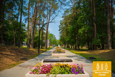
Section 97. Jaunmokas – Tukums.
To Tukums for the beauty!
In the vicinity of Jaunmoku palace, spectators are delighted by the beautiful landscapes of the Vanema hills of Austrumkursa Upland. The Forest Trail slopes down to the Bēru watermill and then, further up to Vecmokas, in a length of three kilometres rises by about 50 m, revealing beautiful landscapes to the wide Slocene valley in the south. After the alley of Vecmoku Manor, the Forest Trail crosses the Tukums–Lazdas road (V1442), turns around a cluster of farmsteads and then along straight forest path goes southeast along Sekļa lake. The lake can be accessed via small paths. In the vicinity of Recreation complex “Sveikuli”, the route continues along beautiful forest paths and joins the Tukums–Kesterciems–Kolka road (P131) near the Ozoliņi cemetery, where the town of Tukums begins. Along Raudas, Kurzeme Forest and Melnezera streets, the Forest Trail reaches the Sun hill (Saules kalns).
It is worth exploring Tukums' historic center, the Rose Route, visiting the Tukums Museum of Art, the History Museum, the "Durvis" art gallery, the Tukums market, and Durbe Palace - one of the most interesting neoclassical palaces in Kurzeme.

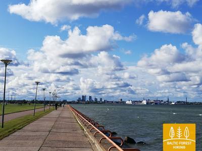
Section 101. Dubulti - Lielupe - Bulduri.
The Most Popular Beaches in Latvia
The widest sandy beach of the Gulf of Riga stretches from Dubulti to the Lielupe River. It is the main asset of the Jūrmala resort offering many beach cafés and different recreational possibilities. The coastal dune forests are permeated with a dense web of trails suitable for walking and stick-walking. The part of the Baltic Coastal Hiking Route located between the beach of the Lielupe River and Jūrmala beach is part of the Ragakāpa Nature Park. From here, you can easily get back to Bulduri by taking Bulduri prospekts and the 5th line.
The resort town of Jūrmala has long-standing spa traditions.The city's historic wooden architecture and its details are particularly interesting. You can explore many historical and contemporary landmarks, such as museums, memorial sites, Jomas Street, and the historic districts of Jūrmala. The Dzintari Concert Hall is a popular venue for various events.