Baltic Coastal Hiking trail - Wheelchair accesible
 Section 2. Pape - Bernāti.
The Westernmost point in Latvia
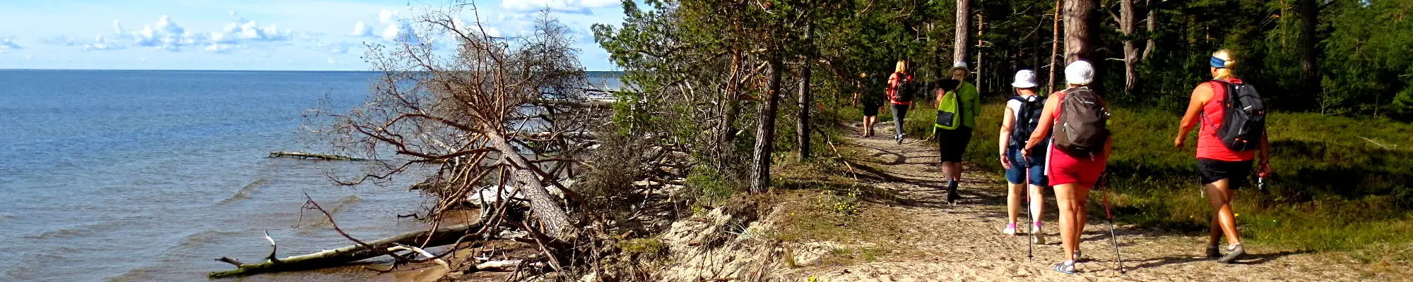
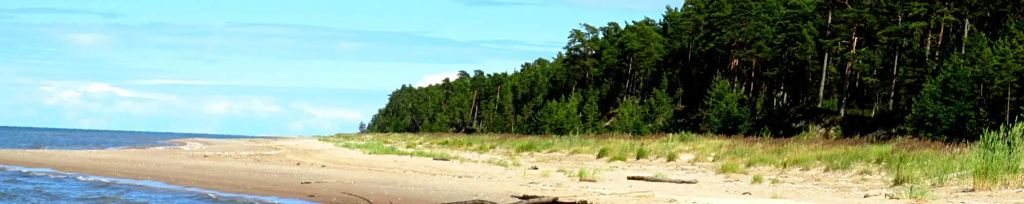
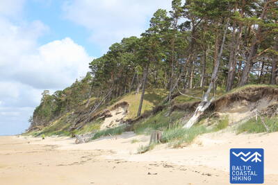
Throughout this section, the Baltic Coastal Hiking Route stretches alongside a beach. In the surroundings of Pape, the coastal side of the beach is surrounded by beautiful foredunes, while further away from the village it transforms into a washed away shore of nearly 10 km with broken pine trees lying across it. Gently sloping dunes reappear near Jūrmalciems. After passing Jūrmalciems, the wide silted beaches continue, but when coming closer to Cape Bernāti, an astounding bluff rises before your eyes which is overgrown with a pine forest and occasionally washed away.
Bernāti Beach Boardwalk
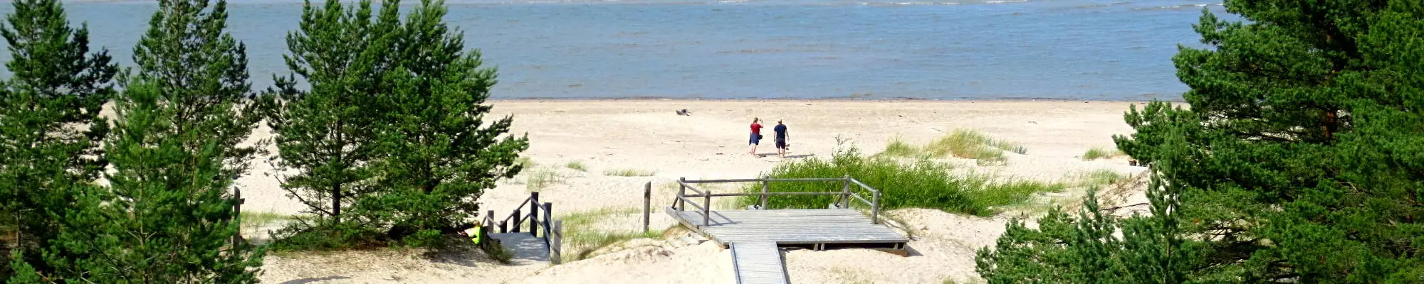
The boardwalk at Bernāti Beach is approximately 400 meters long in one direction, with a width of 1.2 to 1.6 meters. It is partially accessible for people in wheelchairs and recommended with assistance due to slopes reaching up to 12 percent. It is also usable for parents with strollers. At the end of the boardwalk, there is a viewing platform and a lounge area. During the season, the boardwalk is extended to allow wheelchair users to reach the shoreline. There is a parking lot near the boardwalk (GPS: 56.366156, 20.976715) and a dry toilet (not adapted).


Section 2. Pape - Bernāti.
The Westernmost point in Latvia
Throughout this section, the Baltic Coastal Hiking Route stretches alongside a beach. In the surroundings of Pape, the coastal side of the beach is surrounded by beautiful foredunes, while further away from the village it transforms into a washed away shore of nearly 10 km with broken pine trees lying across it. Gently sloping dunes reappear near Jūrmalciems. After passing Jūrmalciems, the wide silted beaches continue, but when coming closer to Cape Bernāti, an astounding bluff rises before your eyes which is overgrown with a pine forest and occasionally washed away.
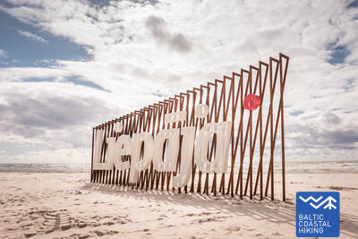
Section 3. Bernāti - Liepāja - Karosta (The War Port).
The City Where The Wind Is Born
From Bernāti to Liepāja, the Baltic Coastal Hiking Route leads through a wide beach where initially the coast is formed by washed away shores, but as you approach Liepāja high foredunes covered in sand ryegrass and marram grass appear in sight. Later the trail winds through the old town of Liepāja and “New Liepāja”, crossing the Naval Port Canal to reach the Naval Port: a complex of military and fortification buildings the visitation of which is likely to take a half day. You should certainly try the special dish of Liepāja called Liepājas menciņi made of smoked cod according to an ancient recipe from Southern Kurzeme.
The hiking route "Hear, Smell, Touch Liepāja."
Created for blind and visually impaired individuals, the route is guided by a trained blind guide. It includes visits to significant cultural and historical sites in Liepāja. The length of the route depends on the group's needs. It is located near the Coastal Trail. Several tactile maps have been developed in Liepāja to help people with visual impairments navigate more easily.
Liepāja Beach near the Central Rescue Station
At Liepāja Beach near the Central Rescue Station (GPS: 56.504199, 20.991922), a facility for people with disabilities has been set up. It includes showers, changing rooms, and wooden boardwalks that extend to the sea, allowing wheelchair users to reach the shoreline. Special wheelchairs suitable for swimming in the sea are available. For blind and visually impaired individuals, audio buoys are placed in the sea to provide information via signals on how far one can swim.


Liepāja Seaside Park.
The park features a network of trails approximately 3 km long, suitable for people in wheelchairs. The trail surfaces vary, including gravel, paving, boardwalks, and asphalt. There are rest areas, places to have a meal, parking lots, and restrooms available. The park can be accessed from the intersection of Liepu and Peldu Streets (GPS: 56.506365, 20.997112). It is located near the Coastal Trail.


Liepāja Lake Boardwalk
The Liepāja Lake Boardwalk is accessible for people in wheelchairs and parents with strollers. It is wide and equipped with edges, extending approximately 400 meters in one direction. The tower is not accessible for wheelchair users. It is located about 2 km from the Coastal Trail, GPS: 56.494511, 21.024515.


Liepāja Lake Horse Island Trail
The Liepāja Lake Horse Island Trail is approximately 2 km long in one direction. At the start of the trail, there is a parking lot (GPS: 56.516585, 21.032329) and the Dabasmāja - Science and Education Innovation Center (equipped with ramps). The trail surface consists of boardwalks at the beginning, followed by a gravel path. It is accessible for people in wheelchairs, although the gravel section is recommended with assistance. It is located 1.3 km from the Coastal Trail.


Section 3. Bernāti - Liepāja - Karosta (The War Port).
The City Where The Wind Is Born
From Bernāti to Liepāja, the Baltic Coastal Hiking Route leads through a wide beach where initially the coast is formed by washed away shores, but as you approach Liepāja high foredunes covered in sand ryegrass and marram grass appear in sight. Later the trail winds through the old town of Liepāja and “New Liepāja”, crossing the Naval Port Canal to reach the Naval Port: a complex of military and fortification buildings the visitation of which is likely to take a half day. You should certainly try the special dish of Liepāja called Liepājas menciņi made of smoked cod according to an ancient recipe from Southern Kurzeme.
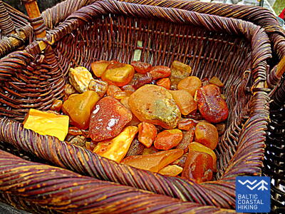
 Section 5. Ziemupe - Pāvilosta.
The Singing Sand and Amber
This beach is rarely visited by people and you can gather pieces of amber and little stones with fossils and hear the singing sand beneath your feet. Near Ziemupe, beautiful bluffs appear, but further on near Akmensrags and Pāvilosta there are beautiful, occasionally washed off foredunes overgrown with sand ryegrass and marram grass. In some places, you can see grey dunes. The Akmeņrags Lighthouse will serve as a good place to rest. Pāvilosta, with its provincial charm and the scent of the harbor and smoked fish will bring you back from wilderness to civilization.
Pāvilosta Pier Promenade
A section of the Pāvilosta Mole Promenade, around 200 meters long, is accessible to people in wheelchairs, but the mole itself is not. A suitable starting point is the Pāvilosta Local History Museum (GPS: 56.889365, 21.172837). It is located next to the Coastal Trail.


Pāvilosta Beach Boardwalk
The Pāvilosta Beach Boardwalk introduces visitors to the Grey Dune and coastal dune habitats. It is a 1.2-meter-wide wooden boardwalk, half a kilometer long (round trip). The trail begins with a gravel surface. There is a parking lot available (GPS: 56.892935, 21.185369). The trail is accessible to people in wheelchairs with assistance, as there are some inclines and declines. Access to the shoreline is not possible.


Section 5. Ziemupe - Pāvilosta.
The Singing Sand and Amber
This beach is rarely visited by people and you can gather pieces of amber and little stones with fossils and hear the singing sand beneath your feet. Near Ziemupe, beautiful bluffs appear, but further on near Akmensrags and Pāvilosta there are beautiful, occasionally washed off foredunes overgrown with sand ryegrass and marram grass. In some places, you can see grey dunes. The Akmeņrags Lighthouse will serve as a good place to rest. Pāvilosta, with its provincial charm and the scent of the harbor and smoked fish will bring you back from wilderness to civilization.
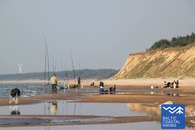
 Section 6. Pāvilosta - Jūrkalne.
The Most Outstanding Bluffs Around The Baltic Sea
To the northeast of Pāvilosta, there are excellent views of the grey dunes, while only a couple of kilometers further you can see the beginning of one of the most beautiful sections the Baltic Coastal Hiking Route with outstanding bluffs continuing for more than 20 km. The most interesting bluff scenery is located near Strante and Ulmale villages and the estuary of the Rīva River. In many places, orchids bloom on the lower part of coastal landslides in summer. In Jūrkalne and in its surroundings, you can see “two sunsets”: the first one from the beach and the second one from the top of the bluff a couple of moments later.
Pāvilosta Beach Boardwalk
The Pāvilosta Beach Boardwalk introduces visitors to the Grey Dune and coastal dune habitats. It is a 1.2-meter-wide wooden boardwalk, half a kilometer long (round trip). The trail begins with a gravel surface. There is a parking lot available (GPS: 56.892935, 21.185369). The trail is accessible to people in wheelchairs with assistance, as there are some inclines and declines. Access to the shoreline is not possible.
Pāvilosta Pier Promenade
A section of the Pāvilosta Mole Promenade, around 200 meters long, is accessible to people in wheelchairs, but the mole itself is not. A suitable starting point is the Pāvilosta Local History Museum (GPS: 56.889365, 21.172837). It is located next to the Coastal Trail.
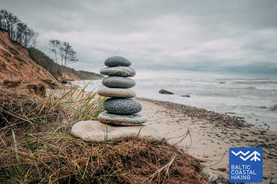
Section 8. Sārnate - Užava.
The Most Beautiful Scenery Of The Latvian Seacoast
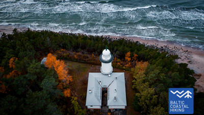
Near Sārnate, you can still see the bluffs of the Baltic Sea, which slowly become lower towards the North and is replaced by a washed away dam of foredunes. Between Vendzavas village and the Užava Lighthouse, you can see coastal sceneries that are quite unusual for Latvia and that remind one of sandy and rocky deserts with sparse vegetation: it used to be a firing ground for the Soviet army. In this place and in the territories of former firing grounds located beyond the Užava Lighthouse, there are now grey foredunes. Getting closer to the estuary of the Užava River, the beach becomes wider and the dunes – lower. The most beautiful scenery of the Baltic Coastal Hiking Route can be seen from the top of the romantic Užava Lighthouse.
Užava Creek beach boardwalk
The boardwalk near the Užava River mouth by the sea is a 0.5 km round trip wooden path, designed for wheelchair users. The boardwalk is 1.2 meters wide, with passing areas along the way. A parking lot is available nearby (GPS: 57.247001, 21.414652). There is a rest area along the path, although it is not accessible by wheelchair, and access to the seashore is not available. The boardwalk is located adjacent to the Jūrtaka trail.


Section 9. Užava - Ventspils.
Gather Your Amber Collection!
In this section of the Baltic Coastal Hiking Route, the first 6 km are a lonely stretch of the coast with a wide beach and low foredunes, the tops of which are covered in silvery sand ryegrass and marram grass tillers. After passing the Medole brook, an impressive bluff (~ 19 m high) rises before your eyes with a narrow rocky beach beneath it. The bluff quickly shrinks and then rises again two kilometers further. Between the bluffs, there is a former firing ground for the Soviet army. The last five kilometers of the Baltic Coastal Hiking Route to the South Pier in Ventspils lead through a wide sandy beach, the coastal side of which is delimited by the biotopes of grey dunes.
Ventspils Seaside Park
The Ventspils Seaside Park features a network of trails around 3.5 km long, including the 730 m long Anchor Trail. The trails (except for the Jungle Trail) are accessible for people in wheelchairs and parents with strollers. The trail surface consists of gravel and asphalt (at the beginning). A convenient starting point for exploring the park is the intersection of Parka and Loču streets (GPS: 57.389279, 21.537021), where there is parking and a WC. The park is located next to the Jūrtaka Trail. For people in wheelchairs and parents with strollers, the most suitable beach access near the sea is Entrance 6, located within the park.
Section 9. Užava - Ventspils.
Gather Your Amber Collection!
In this section of the Baltic Coastal Hiking Route, the first 6 km are a lonely stretch of the coast with a wide beach and low foredunes, the tops of which are covered in silvery sand ryegrass and marram grass tillers. After passing the Medole brook, an impressive bluff (~ 19 m high) rises before your eyes with a narrow rocky beach beneath it. The bluff quickly shrinks and then rises again two kilometers further. Between the bluffs, there is a former firing ground for the Soviet army. The last five kilometers of the Baltic Coastal Hiking Route to the South Pier in Ventspils lead through a wide sandy beach, the coastal side of which is delimited by the biotopes of grey dunes.
Section 10. Ventspils - Staldzene.
Through Ventspils
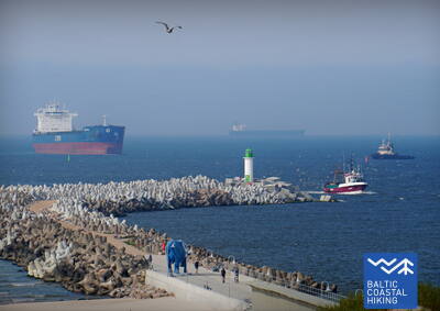
The itinerary goes through Ventspils and its surrounding forests. The Baltic Coastal Hiking Route winds from the South Pier through the historic Ostgals and the Old Town, crosses the Venta River and continues through the Pārventa District via a pedestrian and cyclist path in the direction of Staldzene where it circles the Ventspils Port and then returns to the seacoast. It is worth taking one “day off” and get to know the most interesting places in the city, as well as visit the Seaside Open-Air Museum.
Lake Būšnieki Nature Trail
The trail around Lake Būšnieki is a 9 km loop, accessible for wheelchair users and parents with strollers. It features an audio guide, tactile information, and a parking area for people with mobility impairments. A recommended starting point is the parking lot on the southeast side of the lake (GPS: 57.437632, 21.656062). The trail is located approximately 1 km from the Jūrtaka trail.


Section 15. Saunags village – Kolka.
The Heart Of Europe: Cape Kolka
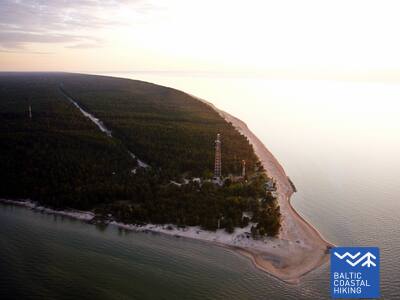
The Baltic Coastal Hiking Route winds through small country and forest roads from Saunags village to Vaide village where it returns to the seacoast again. Wide sandy beaches stretch up to Cape Kolka turning into low sparse foredunes; wooded seaside dunes continue behind them. For around 2 km, there are washed away dunes followed by the Dumbrkalni Hills. Cape Kolka, the point where the Great Sea meets the Little Sea, is one of the most popular bird-watching sites on the Baltic seacoast.
Kolka Pine Trail
The 1.8 km trail is designed for exploring coastal dune biodiversity. It features two observation platforms that are accessible to people in wheelchairs. The dry toilets are partially adapted for individuals with functional impairments. There is a parking lot available (GPS: 57.756668, 22.591180). The trail is located next to the Jūrtaka trail.


Section 16. Kolka - Ģipka.
Along The “Closed Coast”
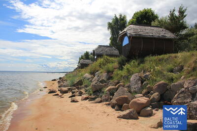
At Cape Kolka, when turning towards the Gulf, you can clearly see the difference between the “Great Sea” and the “Little Sea”. The first 10 km of the Baltic Coastal Hiking Route lead through the coastal area of the Slītere National Park: first, past pine trees that are washed into the sea, past the building of a former fishing kolkhoz, a ship berth and Ēvaži Bluff which is surrounded by an unusually narrow sandy beach with overhanging black alders. The next section of the trail leading to Ģipka also has a narrow sandy beach with pools created by the rich springfens and the mouths of small streams that are shallow in summer. During Soviet times, the seacoast of the Slītere National Park was a closed territory for two reasons: it was a frontier zone and a nature reserve.
Ēvažu Nature Trail
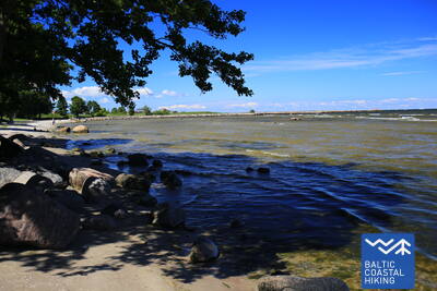
The trail is designed for viewing one of the rare steep coasts of the Gulf of Riga. Wheelchair users can access the observation platform, which offers views of the Gulf of Riga. The trail is 1.2 km round trip. The surface includes gravel at the start, followed by a worn path, and boardwalks with stairs near the steep coast. There is a parking lot on the opposite side of the Tukums - Kolka road (GPS: 57.677789, 22.567982). The trail is located adjacent to the Jūrtaka trail.


Section 17. Ģipka - Kaltene.
The Rocky Beach of Kurzeme
A sandy beach that is not too wide and has beautiful dunes and coastal pine forests stretches from Ģipka to Roja, but before reaching Roja it is overgrown with reeds. Conversely, the section between Roja and the Kaltene Church is one of the most extraordinary parts of the seashore of Latvia, where the coast is notched by small capes and coves with a very narrow beach. All over the coast, there are piles of boulders of different sizes with the green foliage of black alders hanging over them. In some places, the large gnarled root systems of the trees washed ashore rise before your eyes. In some places, an unpaved road goes right along the coast and a lot of former fishermen homesteads are aligned next to it.
Walking Path at Roja Beach
The wooden boardwalks are designed for wheelchair users and parents with strollers. There is an information stand in Braille and a tactile beach map. Facilities include an adapted WC and a parking lot (GPS: 57.510088, 22.799207). The boardwalk is 0.5 km long in one direction. While wheelchair users can use the boardwalks, they cannot reach the sea due to the lack of a ramp. The boardwalks are wide, with guardrails on the sides and passing areas.


Section 17. Ģipka - Kaltene.
The Rocky Beach of Kurzeme
A sandy beach that is not too wide and has beautiful dunes and coastal pine forests stretches from Ģipka to Roja, but before reaching Roja it is overgrown with reeds. Conversely, the section between Roja and the Kaltene Church is one of the most extraordinary parts of the seashore of Latvia, where the coast is notched by small capes and coves with a very narrow beach. All over the coast, there are piles of boulders of different sizes with the green foliage of black alders hanging over them. In some places, the large gnarled root systems of the trees washed ashore rise before your eyes. In some places, an unpaved road goes right along the coast and a lot of former fishermen homesteads are aligned next to it.
Section 18. Kaltene - Mērsrags.
The Multifarious Coast
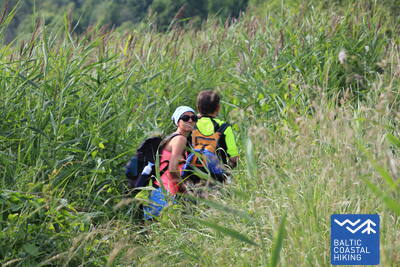
A truly multifaceted section of the Baltic Coastal Hiking Route in terms of nature, cultural history and scenery. Near Kaltene village, the seashore is speckled with small coves with rocky beaches followed by a thickly overgrown coast where a narrow trail winds its way through reeds and lush vegetation. Further on, the seacoast covered in stones is only a couple of meters wide, in some places it has layers of clay, fields of reeds, in other places, it is carpeted with the algae washed ashore. Sandy beaches with shoals in the sea reappear between Valgalciems village and Mērsrags village. After passing Mērsrags village, the itinerary continues on a road, but when you reach the Lutheran church it turns towards the sea and goes through the coastal meadows as far as the center of Mērsrags village.
Boardwalk in Upesgrīva
Located between Lūši Camping and the sea (GPS: 57.381441, 23.025370). The boardwalk lacks side rails and passing areas. It is accessible for wheelchair users with an assistant. Its length is approximately 90 meters in one direction. It does not provide access to the sea shore. It is situated close to the Coastal Trail (Jūrtaka).


Boardwalk near Mērsrags Lighthouse
Located at Bākas Street 60. The boardwalk allows wheelchair users to travel from the parking lot (GPS: 57.365315, 23.120436) to the dunes where the sea can be seen. The boardwalk has partial edge protection and lacks turn-around areas. Length is approximately 150 m (round trip). It is near the Coastal Trail.


Section 19. Mērsrags - Engure.
In the Engure Nature Park
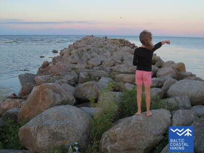
A forest trail surrounded by pine trees leads you from the center of the village to the beach. Next, the Baltic Coastal Hiking Route meanders between a rocky seacoast richly overgrown with reeds and other grasses on one side and wooded seaside dunes on the other side. In some places, the beach is paved with small round stones, in other places you can see grey dunes with a rich variety of plants. Near Bērzciems village, there are large coastal meadows with shoals appearing far away in the sea that are suited for birdwatching. Overgrown seacoast continues up to Abragciems village, while from Abragciems to Engure there is a beach.
Engure Nature Trail
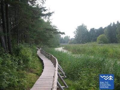
From the parking lot (GPS: 57.171428, 23.222504) on Slimnīcas Street, a wooden boardwalk extends across the dunes to the sea, and is designed to be accessible for wheelchair users. Due to the incline, assistance may be required. The trail is approximately 200 meters in one direction. It is located near the Coastal Trail (Jūrtaka).


Section 20. Engure - Ragaciems.
Fishing Villages And Smoked Fish
At first, the Baltic Coastal Hiking Route winds through Engure village, then leads through a comparatively narrow beach on one side and beautiful woody seaside dunes on the other side reaching Plieņciems Dune after which the sandy beach becomes increasingly wider and large shoals appear in the sea. On the coast, overgrown bluffs equipped with stairs and plank-ways rise before your eyes and stretch as far as the road connecting Kolka and Tukums. You have to take into consideration that on warm summer days a lot of holidaymakers come here. The last third of the itinerary is located in Ķemeri National Park.
Apšuciems
In Apšuciems, there are two floating beach wheelchairs available for people with mobility impairments. These can be obtained from the Apšuciems School by prior arrangement at +371 26132761. Users must provide their own assistant to help them get to and from the water, swim, and return. Life vests are also available. Plans are underway to build sea access in 2025, which will include wheelchair access, vests, changing cabins, and specialized sunbathing mats. With assistance, small trips along the hard sand portion of the coastline will be possible. This is located on the Baltic Sea Trail.

Plieņciems White Dunes Border Trail
The trail is located at the southern border of Plieņciems, going in the direction from Riga to Engure.
The name Plieņciems comes from the Baltic word "pliens" - limestone or mergelis. The village was first mentioned in documents as early as 1551, but it appears on maps as a populated place from 1702. In the middle of the 18th century, the parish register of Engure mentions that there were nine farms in Plieņciems, which had the right to fish in the sea and Lake Engure, as well as to collect sea grass.
The trail leads from the road to the sea, taking walkers across the dune rampart. The surface of the trail is designed in such a way that it is accessible for wheelchair users (preferably with a companion) and families with children in prams. The beach has a changing room and a small playground. There is no designated area on the trail for exchanging places with oncoming traffic.


Section 20. Engure - Ragaciems.
Fishing Villages And Smoked Fish
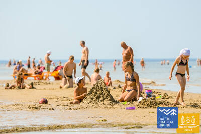
At first, the Baltic Coastal Hiking Route winds through Engure village, then leads through a comparatively narrow beach on one side and beautiful woody seaside dunes on the other side reaching Plieņciems Dune after which the sandy beach becomes increasingly wider and large shoals appear in the sea. On the coast, overgrown bluffs equipped with stairs and plank-ways rise before your eyes and stretch as far as the road connecting Kolka and Tukums. You have to take into consideration that on warm summer days a lot of holidaymakers come here. The last third of the itinerary is located in Ķemeri National Park.
Section 21. Ragaciems - Dubulti.
The Historic Resort of Jūrmala
In Ragaciems village, you can clearly see the whole length of the Jūrmala coast. The first third of this day's itinerary is part of the Ķemeri National Park where you can get to know historic fishing villages, the Ragaciems village fishing area with net huts and a fish market, dune habitats, as well as watch birds in the estuary of the Starpiņupe River. Starting from Jaunķemeri to Dubulti, the walk takes you across the widest sandy beach of the Gulf of Riga through the historic resort in Jūrmala and the longest city in Latvia. Keep in mind that on warm and sunny summer days there will be a lot of beachgoers.
Jūrmalas pilsētas pludmales
Jūrmala's city beaches are accessible to people with functional impairments, including those in wheelchairs and seniors. In Jūrmala, there are 14 adapted access points to the sea for wheelchairs: 36. līnija, Vienības prospekts (2 access points), Turaidas iela (2 access points), Pilsoņu iela, Baznīcas iela, Kļavu iela, Līgatnes iela, Dzimtenes iela, Vēju iela, Atbalss iela, Kapteiņa Zolta iela, and Jaunķemeru ceļš. These access points are designed to be suitable for both people with functional impairments and those with strollers, considering the surface and terrain. Additionally, there are four locations—Vaivari, Kaugguri, Jaunķemeri, and Jaundubulti—where expanded and more comfortable changing cabins are available.
Kupskalni Nature Trail
The trail extends for half a kilometer along the right bank of the Siliņupe River and leads from the Sloka-Talsi road to the sea. It is partially accessible to people in wheelchairs with assistance, as tree roots at the beginning of the trail may be an obstacle. The further section of the trail (wide boardwalks with passing areas) is accessible. Partial restroom accessibility is available. The walk can be started from a nearby gas station (GPS: 56.992203, 23.522736).


Section 22. Dubulti - Lielupe - Bulduri.
The Most Popular Beaches in Latvia
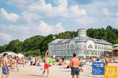
The widest sandy beach of the Gulf of Riga stretches from Dubulti to the Lielupe River. It is the main asset of the Jūrmala resort offering many beach cafés and different recreational possibilities. The coastal dune forests are permeated with a dense web of trails suitable for walking and stick-walking. The part of the Baltic Coastal Hiking Route located between the beach of the Lielupe River and Jūrmala beach is part of the Ragakāpa Nature Park. From here, you can easily get back to Bulduri by taking Bulduri prospekts and the 5th line.
Jūrmalas pilsētas pludmales
Jūrmala's city beaches are accessible to people with functional impairments, including those in wheelchairs and seniors. In Jūrmala, there are 14 adapted access points to the sea for wheelchairs: 36. līnija, Vienības prospekts (2 access points), Turaidas iela (2 access points), Pilsoņu iela, Baznīcas iela, Kļavu iela, Līgatnes iela, Dzimtenes iela, Vēju iela, Atbalss iela, Kapteiņa Zolta iela, and Jaunķemeru ceļš. These access points are designed to be suitable for both people with functional impairments and those with strollers, considering the surface and terrain. Additionally, there are four locations—Vaivari, Kaugguri, Jaunķemeri, and Jaundubulti—where expanded and more comfortable changing cabins are available.
Section 23. Bulduri - Riga City Center.
Through the Forests To Riga
The itinerary is an alternative way to get from Jūrmala to Riga by going through the forest. After passing the bridge across the Lielupe River, the Baltic Coastal Hiking Route snakes through Priedaine with its wooden buildings, goes along the right bank of the Lielupe River, then turns towards the Southern part of Bolderāja Dune and crosses Kleisti forest past Lāčupe Cemetery. Next, it goes along the historic roads of Pārdaugava on the West bank of the Daugava River, namely, Buļļu and Daugavgrīvas iela, through Dzegužkalns Hill, passing the Zunda Canal and Āgenskalns bay until reaching the Daugava River, which the route crosses via the Stone bridge and then stops at Town Hall Square.
Jūrmalas pilsētas pludmales
Jūrmala's city beaches are accessible to people with functional impairments, including those in wheelchairs and seniors. In Jūrmala, there are 14 adapted access points to the sea for wheelchairs: 36. līnija, Vienības prospekts (2 access points), Turaidas iela (2 access points), Pilsoņu iela, Baznīcas iela, Kļavu iela, Līgatnes iela, Dzimtenes iela, Vēju iela, Atbalss iela, Kapteiņa Zolta iela, and Jaunķemeru ceļš. These access points are designed to be suitable for both people with functional impairments and those with strollers, considering the surface and terrain. Additionally, there are four locations—Vaivari, Kaugguri, Jaunķemeri, and Jaundubulti—where expanded and more comfortable changing cabins are available.
Babīte Rhododendron Nursery
A 1.9-kilometer-long trail has been established, accessible to people in wheelchairs and parents with strollers. The trail surface is asphalt. There is a designated parking lot (GPS: 56.962330, 23.952280) and an adapted restroom available. The trail is located approximately 2.7 kilometers from the Jūrtaka trail.
Daugavgrīva Nature Trail
The trail starts at the parking lot (GPS: 57.036769, 24.018166), near Valentīna Pikuļa Street, and leads across the Daugavgrīva Marsh to the dunes and the sea. The trail surface near the sea is paved, and the paved section is accessible to people in wheelchairs. A birdwatching tower has been built along the trail, with the first floor accessible to people in wheelchairs. The trail is approximately 12.5 kilometers from the Jūrtaka trail, located at the sea coast in Daugavgrīva.

Section 24. Riga City Center - Vecāķi.
Riga Old Town – a UNESCO World Heritage site
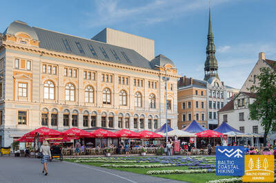
Initially, the itinerary takes you on a small stroll around Riga City Center, Riga Old Town, leads along the City Canal through Kronvalds Park, via Alberta iela (Art Nouveau buildings) and further on via Miera iela through the Lielie kapi Cemetery, via Kokneses and Ostas prospekts through Mežaparks and then it reaches Jaunmīlgrāvis and crosses Mīlgrāvis . Then it meanders along Vecāķu prospekts up to Ziemeļblāzma and the banks of the Old Daugava River (Vecdaugava) separated by only a couple of kilometers from Vecāķi. After a two-day hike through Riga, the Baltic Coastal Hiking Route leads you out to the beach again.
Mangaļsala walking paths
Two trails in Mangaļsala lead through dune areas and coastal forests to the sea. The first trail (GPS: 57.071642, 24.087599) is recommended for people in wheelchairs with an assistant, as it leads to the sea but doesn't provide direct access to the beach. The second trail (GPS: 57.062730, 24.055460) starts as a dirt road and later continues as a wide wooden boardwalk, allowing wheelchair users to reach the beach. The third trail (GPS: 57.061976, 24.041811) leads to the Eastern Pier. Although not specifically designed for wheelchair access, it can be navigated with assistance, including the pier itself, except during strong winds or storms. Both the first and second trails feature dedicated parking and WC facilities. The nearest trail is approximately 3.5 km from Jūrtaka.


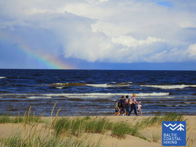
Section 25. Vecāķi - Carnikava.
Between The Estuaries Of Two Rivers: The Daugava River And The Gauja River
This sections of the Baltic Coastal Hiking Route is a comparatively short hike across a beautiful sandy beach, the coastal side of which is bounded by brightly colored pine forests with spectacular dunes and dams of dunes. To get from the beach to Carnikava, the Baltic Coastal Hiking Route will take you through a forest via a promenade. Then it takes a stroll around the Old Gauja River via a levee and reaches the pedestrian bridge over the Gauja River. Both as you start and end the hike, it is nice to sit in one of the pubs and summer cafés located on Vecāķi beach and in Carnikava.
Section 25. Vecāķi - Carnikava.
Between The Estuaries Of Two Rivers: The Daugava River And The Gauja River
This sections of the Baltic Coastal Hiking Route is a comparatively short hike across a beautiful sandy beach, the coastal side of which is bounded by brightly colored pine forests with spectacular dunes and dams of dunes. To get from the beach to Carnikava, the Baltic Coastal Hiking Route will take you through a forest via a promenade. Then it takes a stroll around the Old Gauja River via a levee and reaches the pedestrian bridge over the Gauja River. Both as you start and end the hike, it is nice to sit in one of the pubs and summer cafés located on Vecāķi beach and in Carnikava.
Garciems nature trail
The boardwalk leads to the mouth of the Eimuri Canal at the sea. The end of the boardwalk is close to the shore, and with the help of an assistant, it may be possible to reach the sea. It is suitable for people in wheelchairs and parents with strollers. A parking lot (GPS: 57.108161, 24.192324) and WC are available. The length in one direction is 0.7 km. It is located next to Jūrtaka.
Carnikava Promenade

Connects Carnikava with the sea coast. The path is paved, but in the sand dunes - with wooden footbridges. There are walkways and viewing platforms with deckchairs on the seashore. The length of the trail in one direction is 1.8 km. It is accessible to people in wheelchairs and parents with prams. A parking lot has been created (GPS: 57.133531, 24.265631) on Laivu street, adapted WC, information stands and rest areas. The sandy area of the seashore is not wheelchair accessible. The last section of the promenade has a 9.2% gradient. Jurtaka moves along Carnikava promenade. 2024/2025 g. at the Carnikava promenade, it is planned to create a special route for specialized off-road wheelchairs, which will be available to their users together with an assistant.


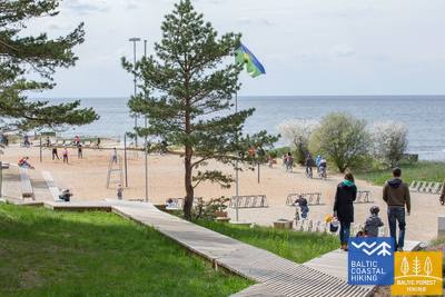
Section 26. Carnikava - Saulkrasti.
The Sunset Trail With Romantic Sunset Vistas
Initially, the itinerary leads you through the Gauja River levees in Gauja village reaching the estuary of the Gauja River, which is a good place for bird watching. The hike continues along a sandy beach up to the estuary of the Inčupe River, before which you have to turn inland to get to a bridge and to cover the next couple of kilometers across the wooded dune tops of the Sunset Trail with a view of the beach. After crossing the Pēterupe River (cable bridge), the Baltic Coastal Hiking Route continues along the beach and reaches the Sea Park in Saulkrasti.
Lilaste Beach
Takes to the sea. Its length in one direction is 130 m. It starts at the parking lot (GPS: 57.187403, 24.329523), from which a person in a wheelchair can get to the beach with the help of an assistant. It is located next to Jurtaka.

White Dune
One of the most scenic dunes of the Gulf of Riga. Accessible for people in wheelchairs with an assistant to the viewing platform from the parking lot (GPS: 57.233560, 24.393407). Baltas kapa is part of the Jūrtakas route.
Path and wooden boardwalk network in the coastal dunes of Saulkrasti
Located between Raiņa Street and Bīriņu Street (Sea Park, Saulkrasti Tourism Information Centre), the path is adapted for wheelchair users and parents with strollers. It runs parallel to the Jūrtaka trail. The easiest access to the path and boardwalk is from the parking lot (GPS: 57.267111, 24.413875).


Section 26. Carnikava - Saulkrasti.
The Sunset Trail With Romantic Sunset Vistas
Initially, the itinerary leads you through the Gauja River levees in Gauja village reaching the estuary of the Gauja River, which is a good place for bird watching. The hike continues along a sandy beach up to the estuary of the Inčupe River, before which you have to turn inland to get to a bridge and to cover the next couple of kilometers across the wooded dune tops of the Sunset Trail with a view of the beach. After crossing the Pēterupe River (cable bridge), the Baltic Coastal Hiking Route continues along the beach and reaches the Sea Park in Saulkrasti.
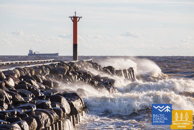
Section 27. Saulkrasti – Lauči.
The Gate To The Rocky Seashore Of Vidzeme
The first kilometers leading up to Zvejniekciems can be covered via the beach or via a trail meandering through the dune forest with old pines whose bark looks like crocodile skin. Here you can also see an old wooden hut with fishing nets and tools. Before reaching the port of Skulte, the first rocks appear on the beach of Zvejniekciems. After making a detour around the estuary of the Aģe River and the port, the Baltic Coastal Hiking Route returns to the beach where you can already see Cape Ārņi from afar, while beyond it the brown back of the Big Lauči Sea Boulder comes into view. Varied coastal landscapes.
Path and wooden boardwalk network in the coastal dunes of Saulkrasti
Located between Raiņa Street and Bīriņu Street (Sea Park, Saulkrasti Tourism Information Centre), the path is adapted for wheelchair users and parents with strollers. It runs parallel to the Jūrtaka trail. The easiest access to the path and boardwalk is from the parking lot (GPS: 57.267111, 24.413875).
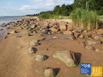
Section 28. Lauči - Tūja.
The Bygone Times Of Sailing Ships
This section of the seacoast of Vidzeme is of outstanding scenic beauty with a lot of rocky capes and boulders in the sea alternating with small, sandy coves where the small streams and rivulets, which dry out in summer, flow into. Occasionally, the beach is completely covered with the gray backs of stones. In some places, small patches of reeds appear, while near Tūja you will see the first sandstone outcrops.
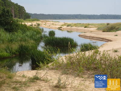
Munchausen’s Beer Mug Trail
The 1.3 km long trail (one way) is located at Dunte Manor and starts near the Minhauzens Museum. The trail surface consists of 1.5-meter-wide wooden boardwalks with several passing areas. It is convenient to begin exploring the trail from the parking lot (GPS: 57.405620, 24.424681). The trail is located 1.7 km from the Jūrtaka trail.
Section 29. Tūja - Svētciems.
The Rocky Beach of Vidzeme
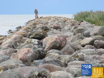
One of the most beautiful sections of the Baltic Coastal Hiking Route, which begins by crossing the Zaķupīte River. Up to the Ķurmrags Lighthouse, there are mostly sandy beaches with small sections of stones. Further on, the Rocky Seashore of Vidzeme starts: capes alternate with small coves, while 4 m high sandstone outcrops emerge on the coast. Sandy beaches continue to prevail after passing Cape Meleki, while before the mouth of the Svētupe River the beach is thickly overgrown and reedy, so it must be bypassed via a forest trail.
Rest area "Vasas"
A viewing platform and a parking lot (GPS: 57.520544, 24.379052) have been created, accessible to people in wheelchairs. It is located next to the Jūrtaka trail.
Veczemju Cliffs
Near the Veczemju Cliffs, there is a ramp for wheelchair users with the assistance. However, the beach sands are not suitable for wheelchair access. The ramp's base is often damaged by storms. It is located near the Baltic Coastal Hiking Trail (Jūrtaka).


Section 30. Svētciems - Ainaži.
The Lamprey Kingdom
The beach between Svētciems village and Salacgrīva is thickly overgrown, so the Baltic Coastal Hiking Route continues on a forest trail meandering among the dunes. To get from Salacgrīva to Kuiviži, you can take the sandy beach or forest trails. From Kuiviži to the Vēverupe River, you have to bypass the Randu Meadows via a forest road located on the east side of the A1 road. After passing the Vēverupe River, the Baltic Coastal Hiking Route returns to a thickly overgrown beach and then leaves it next to the estuary of the Blusupīte River to reach Ainaži Pier by going along Kāpu and Valdemāra iela. You have covered ~ 580 km in Latvia and reached the state border.
Salacgrīvas promenade
The approximately 260-meter-long, well-maintained promenade (including Slavas Alley) along the right bank of the Salaca River is accessible for wheelchair users with the assistance of a helper. You can start exploring from the parking lot (GPS: 57.756060, 24.358155). It is located near the Baltic Coastal Hiking Trail (Jūrtaka).


Monument "White Sun"
Located in Ainaži. A wooden walkway, approximately 150 meters long, has been created for the purpose of viewing it (starting GPS: 57.859628, 24.347306). It is accessible to wheelchair users with assistance and to parents with strollers. The distance from the parking lot to the walkway is about 250 meters. It is located near the Coastal Trail.


Krasta ielas promenāde Salacgrīvā
Around 0.8 km long, it is created along the left bank of Salaca from the bridge to Meža street, where the tennis courts are located. Accessible to people in wheelchairs. Places for rest and viewing have been created, at Meža Street - an adapted WC. Covering - modern pavement.


Laipas līdz Salacgrīvas pludmalei
Two wooden footbridges have been created from the Jūrmala Street parking lot (57.75083, 24.34911) to the beach. Accessible for people in wheelchairs with an assistant, as the place where the boardwalk crosses the dune may contain rotten sand. A toilet is available at the parking lot. Boardwalk covering - wood. Two wheelchairs cannot interchange on the boardwalk.


Section 30. Svētciems - Ainaži.
The Lamprey Kingdom
The beach between Svētciems village and Salacgrīva is thickly overgrown, so the Baltic Coastal Hiking Route continues on a forest trail meandering among the dunes. To get from Salacgrīva to Kuiviži, you can take the sandy beach or forest trails. From Kuiviži to the Vēverupe River, you have to bypass the Randu Meadows via a forest road located on the east side of the A1 road. After passing the Vēverupe River, the Baltic Coastal Hiking Route returns to a thickly overgrown beach and then leaves it next to the estuary of the Blusupīte River to reach Ainaži Pier by going along Kāpu and Valdemāra iela. You have covered ~ 580 km in Latvia and reached the state border.
Section 32. Kabli - Häädemeeste.
Birds, Dunes and Forests
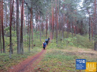
This itinerary is particularly recommended for birdwatchers. To cover the section of the Baltic Coastal Hiking Route connecting Kabli and the South of Häädemeeste, you will have to take the old Pärnu–Riga road because reedy meadows and lagoons stretch across the seashore. Before reaching Häädemeeste, the Baltic Coastal Hiking Route branches off from the road and meanders through Jaagupi Nature reserve (going around the east side of the village) running up the backs of high dunes and scooting down to the deep troughs between the dunes covered with a sparse pine forest. Here you will find good places for picking berries and mushrooms.
Kabli nature trail
The trail introduces visitors to the coastal dunes and their natural values. It starts at the parking lot (GPS: 58.019424, 24.450986), located near the Kabli Visitor Center. The trail is 1.8 km long. Trail surfaces include gravel, forest paths, and 1.5 m wide wooden boardwalks. The trail is accessible for wheelchair users, and there is an adapted WC available. Informational stands are located along the trail, which also features a viewing platform and two birdwatching towers (not wheelchair accessible). It is situated close to the Coastal Trail.


Section 34. Uulu - Pärnu.
Along the Wetlands to Pärnu
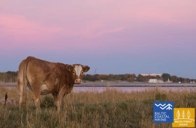
First, the Baltic Coastal Hiking Route takes the old coastal roads surrounded by pine forests, but after passing Lottemaa Park it turns towards the sea and comes out at Reiu beach. Next, the hike continues across an overgrown beach (wide shoals when the winds create an outflow of water) and after a little less than 4 km you have to turn inland, cross a golf course and turn in the direction of Pärnu. Near the Raeküla district, it snakes along a small trail forming the border between the large coastal wetland and the forest. Having looped around the wetland for ~ 6 km, the Baltic Coastal Hiking Route emerges at Pärnu beach. Further on, the road goes through the western part of Pärnu Old Town, crosses the Pärnu River and the Sauga River and ends in the Vana-Pärnu district.
Pärnu Coastal Meadow Hiking Trail
The trail explores the wet coastal meadows, lagoons, and the local bird and plant life. It is designed in an oval shape with a viewing platform (first floor accessible) and stretches 600 meters. The visit can be conveniently started from the nearby parking lot (GPS: 58.372397, 24.507902). The trail surface includes wooden boardwalks, with asphalt pathways near the parking lot. The trail is accessible for wheelchair users, though assistance is recommended as some sections have a slope exceeding 8%. It is located close to the Coastal Trail.


Pärnu Beach Promenade
The trail runs parallel to the Pärnu Bay beach for half a kilometer. The surface is mostly wooden boardwalk (2.3 to 3.1 meters wide), with some sections of paving, up to 4 meters wide. It is accessible for wheelchair users. The trail can be conveniently started from the nearby parking lot (GPS: 58.372397, 24.507902).
Access to the beach and rental of swimming aids
In 2024, at the Hedon SPA & Hotel, seasonal access will be provided to swimming aids and other equipment, and a special surface will be created to allow wheelchair users to reach the water.


Pärnu Beach Park
The park, established in 1882, is a popular recreational area for both city visitors and local residents. It features a network of approximately 1 km of trails (about 3 m wide) that are accessible to wheelchair users. The trail surfaces include gravel and asphalt. Paid parking is available around the park's perimeter. It is located near the Jūrtaka.


Pärnu Mole Boardwalk
The boardwalk starts across from Pärnu Pier (GPS: 58.381941, 24.483994). The boardwalk is 0.6 km long (one way) and accessible to wheelchair users. The surface is made of wood, and the width is 3 meters. There are path extensions and rest areas at various points. It offers a great opportunity to explore Pärnu Harbor. It is located approximately 350 meters from the Jūrtaka.


Section 35. Pärnu - Liu.
The Most Beautiful Views of Pärnu Bay and Smoked Fish
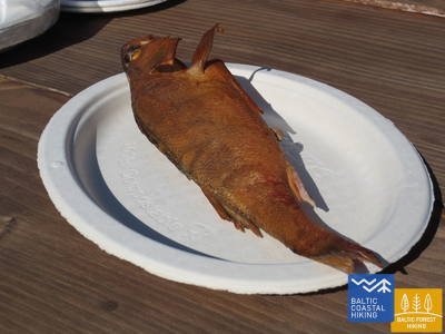
The Baltic Coastal Hiking Route meanders on the outskirts of the west of Pärnu, crosses the Audru River and turns towards Valgeranna, the southern side of which is surrounded by a thick forest and a white sandy beach, while to the north you will find a golf course. After passing Valgeranna, the Baltic Coastal Hiking Route advances between the polders across the northern part of Pärnu Bay. From the Audru polders you will see the most spectacular views of Pärnu Bay. After Audru reeds, the Baltic Coastal Hiking Route turns south and leads through coastal fishing villages with small ports and berths. Here you can see the daily life of fishermen and if you are lucky, then also taste smoked fish.
Valgeranna Beach Promenade
The trail connects the parking lot with the beach. The surface includes paving and wooden boardwalk, with a width ranging from 1.95 to 3 meters. It is accessible to wheelchair users. There is a dry toilet available. It is located next to the Jūrtaka.


Section 38. Tõstamaa - Matsi.
Pastoral Idyll of Estonia
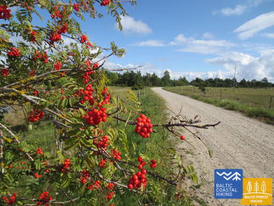
In this section of the Baltic Coastal Hiking Route, you will see a traditional rural landscape. The littoral is notched by shallow coves, peninsulas and capes surrounded by coastal meadows, reeds, shallow lagoons, marshes, as well as hard to access islands. When walking along the small country roads, overhung by red rowans in autumn, you can see ethnographic-like individual farmsteads and farms with cows and goats. The landscapes of farmsteads interchange with the remains of rock fences, farmland and juniper forests. Access to the sea and rest areas are located south of Ranniku and near Kastna village.
Matsi Port
The trail introduces visitors to the former Matsi fishing port. It is 500 meters long (round trip). The trail starts at the parking lot (GPS: 58.360251, 23.746683). The surface includes asphalt, concrete, and gravel. In windy conditions, the trail may be covered with sand, so wheelchair users might need assistance. The trail features tactile objects and information in Braille. An accessible WC is available. It is located next to the Jūrtaka.


Section 39. Matsi - Varbla.
Beaches and Forests
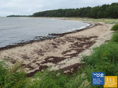
Matsi beach is one of the rare sandy beaches in the subsequent section of the trail leading to Haapsalu. The Baltic Coastal Hiking Route takes you on a small stroll through Kulli village and for the next 5 km leads you along small trails surrounded by wide forests and dunes. In autumn, their surroundings are rich in berries and mushrooms. After bypassing Uue-Varbla Manor, the trail reaches Varbla village.
Matsi Port
The trail introduces visitors to the former Matsi fishing port. It is 500 meters long (round trip). The trail starts at the parking lot (GPS: 58.360251, 23.746683). The surface includes asphalt, concrete, and gravel. In windy conditions, the trail may be covered with sand, so wheelchair users might need assistance. The trail features tactile objects and information in Braille. An accessible WC is available. It is located next to the Jūrtaka.
Section 45. Penijõe - Laiküla.
Around the Largest Wetland in Northern Europe
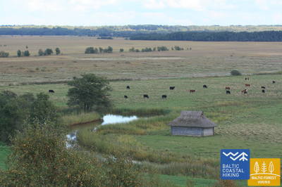
The Baltic Coastal Hiking Route takes you on a stroll around the Kasari River delta where it flows into Matsalu Bay and where one of the largest wetlands in Northern Europe has taken shape with large reedy fields, coastal meadows, oxbow lakes and water from the shallow bay, being a notable nesting and stopover site for migratory birds. The itinerary mainly leads through farmland landscapes and small villages. In the surroundings of Kirbla, you can see an elevation of the terrain, which is a former Baltic Ice Lake Island with its ancient coast in the north.
RMK Rannajõe Observation Platform
The trail introduces visitors to the floodplain meadows of Matsalu National Park, where large flocks of birds gather during migration. The platform is accessed via a 100-meter-long wooden boardwalk (up to 110 cm wide). Wheelchair users will need assistance as the ramp gradient reaches 32%. It is located at (GPS: 58.816865, 23.781363) next to the Jūrtaka.


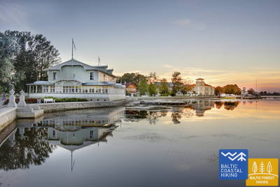
Section 48. Rohuküla - Haapsalu - Uuemõisa.
The Most Popular Resort in Estonia - Haapsalu
A multifarious section of the Baltic Coastal Hiking Route. The first three kilometres of the itinerary go along the former Haapsalu – Rohuküla broad-gauge railway line, takes you on a stroll along Haapsalu Bay through Pullapää cape, crosses coastal forests, which contain health trails, and continues via coastal promenades and small streets around Haapsalu Town. After crossing a small wetland beyond the town, this section of the trail ends in the beautiful Uuemõisa Park.
Paralepas dabas taka un pludmale
The nature trail begins at the parking lot (GPS: 58.940856, 23.515004) opposite Paralepa Beach. The trail runs parallel to the coastline, loops around a shallow bay, and crosses a small wetland, reaching the western part of the town of Haapsalu. The trail is 2 km long in one direction. Surface: asphalt and wooden boardwalk. The entire trail is accessible by wheelchair. There is an accessible WC. The nature trail coincides with the Jūrtaka.


Haapsalu Väike Viik
Mazais Vīks (Väike Viik) is a former bay that was separated from the sea in earlier times and is now popular with birds. It is located in the northern part of Haapsalu. A trail about 2 km long has been created around the small lake, which can be fully accessed by people in wheelchairs and parents with strollers. The surface consists of gravel and asphalt. The nearest accessible WC is located at the Haapsalu Tourist Information Centre. The trail partially overlaps with the Jūrtaka Trail.


Haapsalu Promenade and Africa Beach
One of the most beautiful seaside promenades in Estonia runs along the eastern coast of Haapsalu for 1.2 km. The surface is paved with cobblestones. The entire length of the promenade is suitable for people in wheelchairs and parents with strollers. Near Africa Beach, there is a children's playground and a bird-watching tower. In the farther section of the trail, there is a wheelchair skills training park, exercise equipment, and a playground adapted for children with functional disabilities. The trail partially overlaps with the Jūrtaka Trail.


Uuemõisa Manor Park
The park is crisscrossed by a network of trails that are accessible to people in wheelchairs. The total length of the trails is approximately 1.2 km. The path surface is gravel. The trails partially overlap with the Jūrtaka Trail.


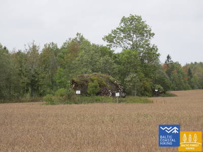
Section 49. Uuemõisa - Elbiku.
Around Haapsalu Bay
The Baltic Coastal Hiking Route mainly goes along the side of the road and it only winds through smaller country roads between Ingküla and Aulepa Villages, where you can enjoy rural landscapes with individual farmsteads, boulders and pastures.
Uuemõisa Manor Park
The park is crisscrossed by a network of trails that are accessible to people in wheelchairs. The total length of the trails is approximately 1.2 km. The path surface is gravel. The trails partially overlap with the Jūrtaka Trail.
Silma Workshop and Nature Reserve
Silma Workshop is a nature school located within the Silma Nature Reserve. It offers views of the overgrown waters of Haapsalu Bay and its branches, rich in birds and plants. The trail is 0.4 km long (round trip) with a surface of a worn path, gravel, and grass. The workshop is wheelchair accessible but requires assistance and prior registration, as there is a barrier along the path. It is located about 3.5 km from the Jūrtaka Trail.
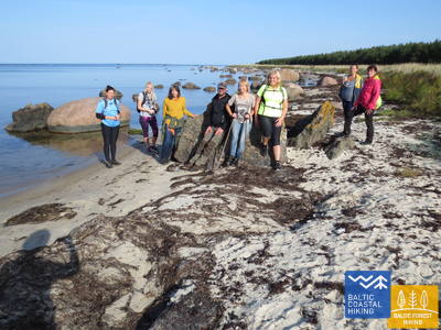
Section 51. Riguldi - Dirhami.
A Place Marked by Meteorites
With the exception of the first 3 km, the itinerary goes along the seashore. It is mainly a sandy beach with beautiful foredunes, grey dunes and sea boulders. The beach may be covered in algae that has been washed ashore and it is occasionally overgrown with dense vegetation. Opposite Rooslepa village and in other places in the sea and on the coast, there are badly weathered stones or the so-called breccias that have melted and weathered as a result of an ancient meteorite explosion. At the destination of the itinerary, you can spend some time in a pub and from its terrace you will have a beautiful view of the sea and the port.
Roosta Beach
From the Rosta Recreation Complex, boardwalks have been installed leading to the dunes, which are accessible for people in wheelchairs.


Dirhami Port
From the harbor parking lot (GPS: 59.209328, 23.497846), which is covered with gravel (assistance may be needed), you can proceed to the Dirhami fishing and trading port dock. For about 300 meters (paved), you can enjoy views of the Gulf of Finland coastline and the harbor. Nearby is the charming Dirhami restaurant, which is accessible via a special board ramp. It is located near the Jūrtaka Trail.


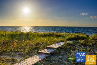
Section 52. Dirhami - Nõva.
The Harsh Northern Nature
An exceptionally multifaceted section of the Baltic Coastal Hiking Route in terms of landscapes, where you can already get an insight of the nature characteristic to the north coast of Estonia. The itinerary leads you along the seacoast for almost its entire length, where you will find beautiful sandy beaches near coves, beaches covered in boulders at capes, while dolomite layers uncover themselves in the northern part of Cape Põõsaspea (an excellent birdwatching site). The Baltic Coastal Hiking Route goes through Nõva Nature reserve where you will have exceptional views of the white and grey dunes. The beaches are popular for fishing and kite-boarding.
Dirhami Port
From the harbor parking lot (GPS: 59.209328, 23.497846), which is covered with gravel (assistance may be needed), you can proceed to the Dirhami fishing and trading port dock. For about 300 meters (paved), you can enjoy views of the Gulf of Finland coastline and the harbor. Nearby is the charming Dirhami restaurant, which is accessible via a special board ramp. It is located near the Jūrtaka Trail.
Peraküla beach and camping site
From the rest area and parking lot (GPS: 59.221567, 23.602891), you can reach a viewing platform via a wooden boardwalk (0.1 km), offering views of the Gulf of Finland coastline. Assistance may be needed, as the boardwalk can sometimes be covered with sand due to the wind. The WC is partially accessible. The location is near the Jūrtaka Trail.


Section 58. Laulasmaa - Vääna-Jõesuu.
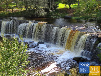
The Most Beautiful Waterfall in Estonia
A multifaceted section of the Baltic Coastal Hiking Route in terms of landscape that is suitable for hardy hikers. There are both rocky and sandy beaches and good swimming areas, fascinating coastal pine forests, the astounding Türisalu Cliff wall and giant sea boulders. By taking the trails of the vast Keila forest park, you can go to the Keila waterfall, near which some fragments of the popular Latvian feature film Vella kalpi (Devil’s servants) were shot, and you can also get to know the exhibition dedicated to the life of coastal fishermen in Lohusalu village.
RMK Keila-Joa Park nature trail
The 2.1 km long trail introduces visitors to the Keila-Joa Park, designed in the English style, and the popular Keila Waterfall. The first 250 meters, starting from the parking lot (GPS: 59.393587, 24.294767), are accessible for people in wheelchairs with an assistant. The surface consists of gravel, crushed stone, and a natural path. The trail is located near the Jūrtaka Trail.


Section 60. Tabasalu - Tallinna sadam.
Tallinn – A UNESCO World Heritage Site
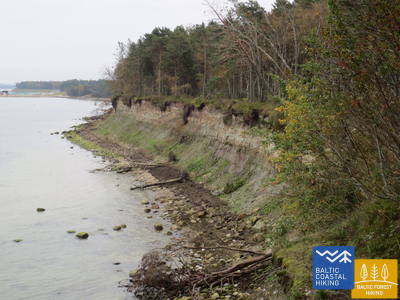
Near Tabasalu, the Baltic Coastal Hiking Route crosses the boundary of Tallinn and goes through the Tiskre and Vismeistri districts to reach Kakumäe beach, where it takes you on a stroll around the wooded upper part of the Kakumäe Peninsula surrounded by cliffs. Here, you will have a vista of the Port of Tallinn across Kopli Bay. Opposite the Õismäe district, an excellent promenade goes along the seashore. After bypassing the Estonian Open-Air Museum, the Baltic Coastal Hiking Route winds along the coastal promenade up to Stroomi beach and after passing the Pelguranna district it takes pedestrian sidewalks to the Estonian Maritime Museum, where it leads you, via the coastal promenade, to the Port of Tallinn, marking the end of the Baltic Coastal Hiking Route. You have covered ~ 620 km in Estonia.
Pēsakilas (Pääsküla) purva dabas taka
The 4 km long trail introduces visitors to various types of forests and a bog. Two kilometers of the trail are accessible for people in wheelchairs. It is located about 8.5 km from the Jūrtaka Trail.


Pikakari beach
Pikakari Beach offers swimming aids, changing rooms, and a wooden ramp for access to the water. The service needs to be booked in advance at +372 5666 2455. It is located 2.5 km from the Jūrtaka Trail.
Section 64. Nida – Pervalka.
Along the coast of the Curonian Lagoon
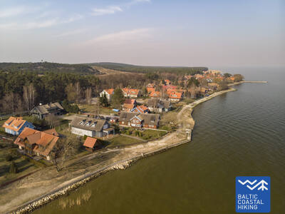
The Baltic Coastal Hiking Route starts in the center of Nida, by the port. In Nida, the trail winds along the Curonian Lagoon walkway which offers beautiful views of the expansive waters all the way to Rusnė Island on the east coast of the Curonian Lagoon. Nida features the typical architecture of the Curonian Spit region — one-storey wooden buildings with tile or reed roofs and window shutters painted blue and white. From Nida to Bulvikis Cape (shortly before the cape there is an abandoned runway), the Baltic Coastal Hiking Route winds through single-track forest trails up and down the pine-covered dunes, occasionally coming out onto beachside meadows with scarce vegetation. Rest spots and bird watching towers are available along the trail. The next section features unique open seaside meadows covered in lichens and vegetation characteristic to the Curonian Spit. The Baltic Coastal Hiking Route follows the coastal walkway in the village of Preila. It then winds through forest trails, briefly also following a pedestrian/cyclist lane and coastal paths, eventually reaching Pervalka. This section leads through the Curonian Spit National Park.
Nida Promenade
The Nida Promenade extends approximately 2 km from Nida Harbor along the Curonian Lagoon, designed for pedestrians and cyclists. It features well-equipped rest areas. The surface is modern paving and is accessible for people in wheelchairs. It coincides with the Coastal Trail.
Section 65. Pervalka – Juodkrantė.
Along the most majestic sand dunes in Northern Europe
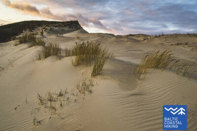
Having departed Pervalka, the Baltic Coastal Hiking Route follows a pedestrian path to cross the Curonian Spit in an east–western direction, arriving at the coast of the Baltic Sea. The next section of 13 km leads along a beautiful, sandy beach protected by high and steep sand dunes on the east. It is called the protective dune ridge and it has been man-made in order to protect the inland from the movement of sand. Entering Juodkrantė, the Baltic Coastal Hiking Route turns eastward and crosses the Curonian Spit once again over wooded and steep dunes, to reach the Curonian Lagoon coast. The Baltic Coastal Hiking Route briefly coincides with the Hill of Witches trail. It then follows the Juodkrantė beachside walkway to the port. This section leads through the Curonian Spit National Park.
Juodkrantė Promenade
The Juodkrantė Promenade extends approximately 1.4 km from Juodkrantė Harbor along the Curonian Lagoon, designed for pedestrians and cyclists. It features well-equipped rest areas and has a modern paving surface. It is accessible for people in wheelchairs and coincides with the Coastal Trail.
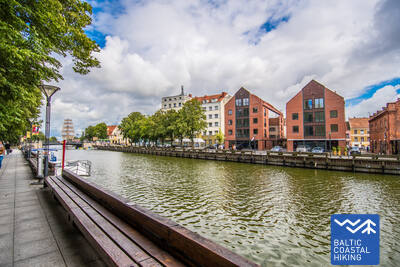
Section 66. Juodkrantė – Klaipėda.
Klaipėda — Lithuania’s gate to the sea
Having left the Juodkrantė beachside walkway, the Baltic Coastal Hiking Route crosses the Curonian Spit in a southeast–northwest direction leading along single-track forest trails that wind through the steep, pine-covered dunes until it eventually comes back out onto the coast of the Baltic Sea. For the next 9 km, the Baltic Coastal Hiking Route follows the coastline along sandy beaches. The steep foredune on the eastern side protects the inland from the moving sand. After Alksnynė village (not seen from the beach), the Baltic Coastal Hiking Route turns eastward, crossing a hillock covered in Pinus mugo pines and a World War II German army base, eventually approaching the coast of the Curonian Lagoon. Then the trail winds across the ridges of pine-covered dunes, providing regular views of Klaipėda Port. The route between the New and Old Ferry Port first follows a single-track path, and later a beachside walkway. Having crossed the Curonian Lagoon from the Old Ferry Port, the Baltic Coastal Hiking Route arrives in the center of Klaipėda where it follows Danės Street to the Birža Bridge. The section until Smiltynė leads through the Curonian Spit National Park.
Juodkrantė Promenade
The Juodkrantė Promenade extends approximately 1.4 km from Juodkrantė Harbor along the Curonian Lagoon, designed for pedestrians and cyclists. It features well-equipped rest areas and has a modern paving surface. It is accessible for people in wheelchairs and coincides with the Coastal Trail.
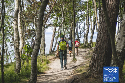
Section 67. Klaipėda – Palanga.
Through the Seaside Regional Park
Following H. Manto Street, the Baltic Coastal Hiking Route leads out of the center of Klaipėda, traverses the Klaipėda Recreation Park, crosses a railway line by bridge and comes out onto the coast of the Baltic Sea in the southern part of Melnragė. The trail then winds through the dunes, for the protection of which wooden walkways have been installed, and continues on along a beautiful path through the coastal forest, following at a distance of about 10–20 m the pedestrian/cyclist lane through Antroji Melnragė to Giruliai. At Giruliai, it briefly comes out onto the beach, but from Kukuliškiai to the southern part of Karklė Village, the Baltic Coastal Hiking Route first passes along the incredibly beautiful coastline of the former Littorina Sea covered in primeval forest, and later, along a scenic bluff, created by the washing of waves; there are several viewing points along the way (including the Dutchman's Cap). From the Village of Karklė for the next 11 km to the Palanga Botanical Park, the Baltic Coastal Hiking Route leads across sandy and pebbly, occasionally rocky beaches. Through the coastal pathways in the western part of the Palanga Botanical Park, the trail leads over to Meilės avenue and then to the Palanga pedestrian bridge. Most of this section of the trail leads through the Seaside Regional Park.
Palanga Sea Bridge
The only structure of its kind in the Baltic States. The surface consists of modern paving before the bridge and wood on the bridge itself. It is accessible for people in wheelchairs. The main pedestrian street of Palanga, J. Basanavičiaus Street, is also accessible. It is located near the Coastal Trail.

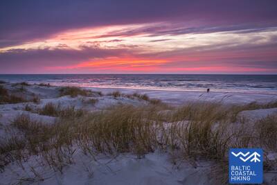
Section 68. Palanga – Latvia-Lithuania border (Šventoji).
Through the most popular seaside resorts of Lithuania
Having crossed the small Rąžė River, the Baltic Coastal Hiking Route follows the Labrytys pedestrian/runners’ lane and exits out onto the beach at Kontininkų Street. For the next 9 km to the old Šventoji Pier, the trail leads across the sandy, sea-washed beach. Then it loops around the mouth of the Šventoji River, leads through the resort town, and at the end of Kopų Street it crosses the Šventoji River over a hanging footbridge to come back out onto the beach. At the Žemaičių Alka parking lot, the Baltic Coastal Hiking Route makes another small loop “inland” and then follows the sandy beach to the Latvia-Lithuania border 3 km away.
Palanga Sea Bridge
The only structure of its kind in the Baltic States. The surface consists of modern paving before the bridge and wood on the bridge itself. It is accessible for people in wheelchairs. The main pedestrian street of Palanga, J. Basanavičiaus Street, is also accessible. It is located near the Coastal Trail.