


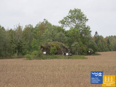
Jūrtaka - Pieejams ratiņkrēslā

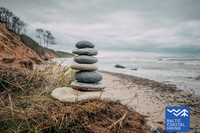
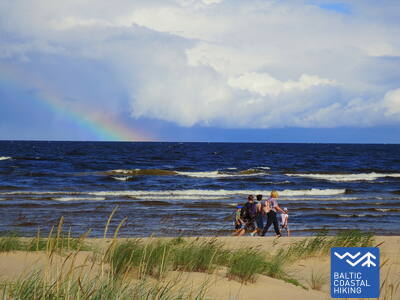
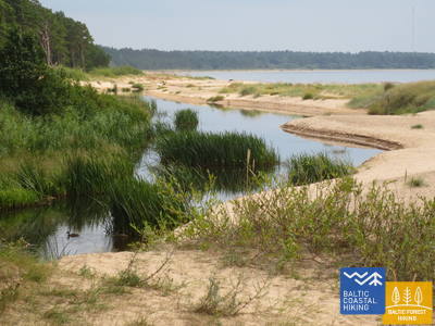
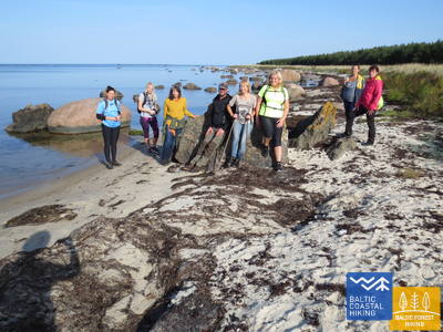
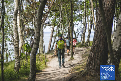
 2. posms. Pape - Bernāti.
Tālākais Latvijas rietumu punkts
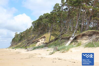
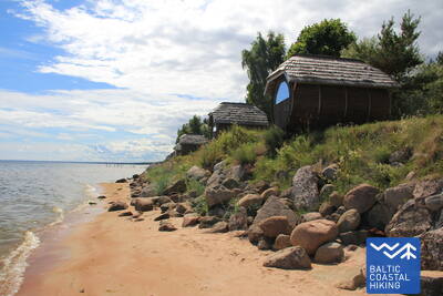
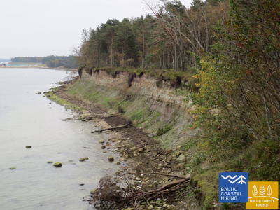
Visā posma garumā Jūrtaka stiepjas pa liedagu, kuru no sauszemes puses Papes apkaimē ieskauj skaistas priekškāpas, bet aiz ciema nomaina noskalots krasts turpat 10 km garumā, pār kuru sagāzušies priežu stumbri. Lēzenas kāpas atkal parādās Jūrmalciema apkaimē. Aiz Jūrmalciema turpinās plaši saskaloti liedagi, bet, tuvojoties Bernātu ragam, paceļas iespaidīgs, ar priežu mežu apaudzis un vietām noskalots stāvkrasts.
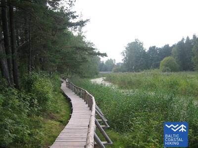
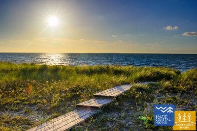
Bernātu pludmales laipa
Garums - ap 400 m vienā virzienā bez sezonālās laipas. Veidota no dēļiem 1,2 - 1,6 m platumā. Cilvēkiem ratiņkrēslos ir daļēji braucama un ieteicama ar asistentu, jo slīpums vietām sasniedz 12 procentus. Izmantojama vecākiem ar bērnu ratiņiem. Laipas galā ir izveidota skatu platforma un zvilnis. Sezonas laikā ir nodrošināts laipas pagarinājums, lai cilvēki ratiņkrēslos varētu nokļūt līdz pašam jūras krastam. Pie laipas ir izveidota autostāvvieta (GPS 56.366156, 20.976715). Ir sausā tualete (nav pielāgota).


2. posms. Pape - Bernāti.
Tālākais Latvijas rietumu punkts
Visā posma garumā Jūrtaka stiepjas pa liedagu, kuru no sauszemes puses Papes apkaimē ieskauj skaistas priekškāpas, bet aiz ciema nomaina noskalots krasts turpat 10 km garumā, pār kuru sagāzušies priežu stumbri. Lēzenas kāpas atkal parādās Jūrmalciema apkaimē. Aiz Jūrmalciema turpinās plaši saskaloti liedagi, bet, tuvojoties Bernātu ragam, paceļas iespaidīgs, ar priežu mežu apaudzis un vietām noskalots stāvkrasts.
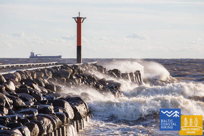
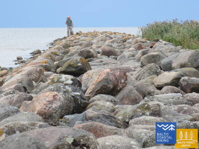
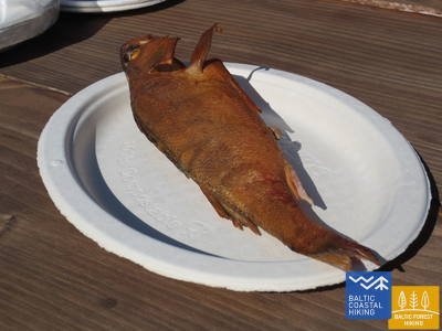
3. posms. Bernāti - Liepāja - Karosta.
Pilsēta, kurā piedzimst vējš
No Bernātiem līdz Liepājai Jūrtaka ved pa platu liedagu, kur sauszemes pusē sākotnēji ir vērojami noskaloti krasti, bet, tuvojoties Liepājai, augstas priekškāpas, apaugušas ar smiltāju kāpukviešiem un kāpuniedrēm. Tālāk tā izlīkumo cauri Liepājas vecpilsētai un Jaunliepājai un, šķērsojot Karostas kanālu, nonāk līdz Karostai - militāro un fortifikācijas būvju kompleksam, kuras apskatei ir vērts ieplānot vismaz pusi dienas. Noteikti jānogaršo Liepājas īpašais ēdiens – ”Liepājas menciņi”, kas gatavots no kūpinātas mencas pēc senas Dienvidkurzemes receptes.
Pārgājienu maršruts "Sadzirdi, sasmaržo, satausti Liepāju"
Radīts neredzīgajiem un vājredzīgajiem cilvēkiem. Maršrutu vada apmācīts neredzīgais gids. Maršruts ietver nozīmīgu Liepājas kultūrvēsturisko objektu apskati. Garums - atkarībā no grupas iespējām. Atrodas blakus Jūrtakai. Liepājā ir izveidotas vairākas taktīlās kartes, lai cilvēkiem ar redzes traucējumiem būtu vieglāk orientēties.
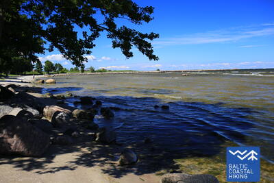
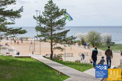
Liepājas pludmale pie Centrālās glābšanas stacijas
Liepājas pludmalē pie Centrālās glābšanas stacijas (GPS: 56.504199, 20.991922) ir izveidots komplekss cilvēkiem ar funkcionaļiem traucējumiem - ierīkotas dušas, pārģērbšanās telpas, koka laipas ved līdz pašai jūrai, tādēļ cilvēki ar ratiņkrēsliem var nokļūt līdz pašai jūrai. Ir pieejami īpaši ratiņkrēsli, kas piemēroti peldēm jūrā. Neredzīgiem un vājredzīgiem cilvēkiem jūrā ir izvietotas audiobojas, kas ar signāla palīdzību sniedz informāciju - cik tālu var peldēt.


Liepājas Jūrmalas parks
Parku caurauž taku tīkls apmēram 3 km garumā, kas piemērots cilvēkiem ar ratiņkrēslu. Taku segums ir dažāds - grants, bruģis, laipas, asfalts. Te pieejamas atpūtas vietas, var ieturēt maltīti, izveidotas autostāvvietas un tualetes. Parka iepazīšanu var sākt no Liepu un Peldu ielas krustojuma (GPS: 56.506365, 20.997112). Parks atrodas blakus Jūrtakai.


Liepājas ezera laipa
Liepājas ezera laipa ir pielāgota cilvēkiem ratiņkrēslos un vecākiem ar bērnu ratiņiem. Tā ir plata, ar aprīkota ar apmalēm. Garums vienā virzienā - ap 400 m. Tornis nav pieejams cilvēkiem ratiņkrēslā. Atrodas apmēram 2 km no Jūrtakas, GPS: 56.494511, 21.024515


Liepājas ezera Zirgu salas taka
Liepājas ezera Zirgu salas taka ir ap 2 km gara vienā virzienā. Tās sākumā ir stāvlaukums (GPS:56.516585, 21.032329), Dabasmāja - Zinātnes un izglītības inovāciju centrs (ierīkotas uzbrauktuves). Takas segums ir dēļu laipas (sākumā), pēc tam - grantēts ceļš. Pieejama cilvēkiem ratiņkrēslos, grantētā daļa - vēlama ar asistentu. Atrodas 1,3 km attālumā no Jūrtakas.


3. posms. Bernāti - Liepāja - Karosta.
Pilsēta, kurā piedzimst vējš
No Bernātiem līdz Liepājai Jūrtaka ved pa platu liedagu, kur sauszemes pusē sākotnēji ir vērojami noskaloti krasti, bet, tuvojoties Liepājai, augstas priekškāpas, apaugušas ar smiltāju kāpukviešiem un kāpuniedrēm. Tālāk tā izlīkumo cauri Liepājas vecpilsētai un Jaunliepājai un, šķērsojot Karostas kanālu, nonāk līdz Karostai - militāro un fortifikācijas būvju kompleksam, kuras apskatei ir vērts ieplānot vismaz pusi dienas. Noteikti jānogaršo Liepājas īpašais ēdiens – ”Liepājas menciņi”, kas gatavots no kūpinātas mencas pēc senas Dienvidkurzemes receptes.
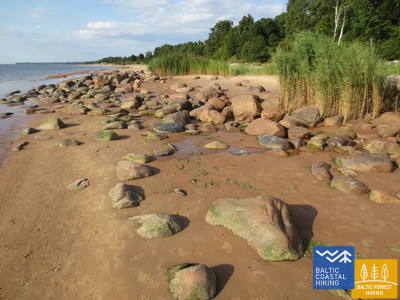
 5. posms. Ziemupe - Pāvilosta.
Dziedošās smiltis un dzintars
Cilvēku maz apmeklēta pludmale, kur var lasīt dzintarus un akmentiņus ar fosilijām, dzirdēt dziedošās smiltis zem kājām. Ziemupes apkaimē parādās jūras noskaloti stāvkrasti, bet tālāk līdz Akmensragam un Pāvilostai – skaistas, vietām noskalotas priekškāpas, kas noaugušas ar smiltāju kāpukviešiem un kāpuniedrēm. Vietām redzamas pelēkās kāpas. Akmeņraga bāka būs labs atpūtas punkts. Pāvilosta ar savu mazpilsētas šarmu, ostas un kūpinātu zivju smaržu liks atgriezties no neskartās dabas civilizācijā.
Pāvilostas mola promenāde
Cilvēkiem ratiņkrēslos ir pieejama tikai mola promenādes daļa ap 200 m garumā, bet ne pats mols. Piemērota vieta startam ir Pāvilostas Novadpētniecības muzejs (GPS: 56.889365, 21.172837). Atrodas blakus Jūrtakai.


Pāvilostas pludmales laipa
Pāvilostas pludmales laipa iepazīstina ar Pelēko kāpu un piekrastes kāpu biotopiem. Tā ir 1,2 m plata dēļu laipa puskilometra garumā (turp - atpakaļ). Sākumā ir grants segums. Ir izveidota autostāvvieta (GPS: 56.892935, 21.185369). Taka ir pieejama cilvēkiem ar ratiņkrēsliem asistenta pavadībā, jo atsevišķos posmos ir kāpumi un kritumi. Pie jūras krasta nav iespējams nokļūt.


5. posms. Ziemupe - Pāvilosta.
Dziedošās smiltis un dzintars
Cilvēku maz apmeklēta pludmale, kur var lasīt dzintarus un akmentiņus ar fosilijām, dzirdēt dziedošās smiltis zem kājām. Ziemupes apkaimē parādās jūras noskaloti stāvkrasti, bet tālāk līdz Akmensragam un Pāvilostai – skaistas, vietām noskalotas priekškāpas, kas noaugušas ar smiltāju kāpukviešiem un kāpuniedrēm. Vietām redzamas pelēkās kāpas. Akmeņraga bāka būs labs atpūtas punkts. Pāvilosta ar savu mazpilsētas šarmu, ostas un kūpinātu zivju smaržu liks atgriezties no neskartās dabas civilizācijā.
 6. posms. Pāvilosta - Jūrkalne.
Izcilākie Baltijas jūras stāvkrasti
Ziemeļaustrumos no Pāvilostas ir apskatāmas izcilas pelēko kāpu ainavas, bet jau dažus kilometrus tālāk sākas viens no skaistākajiem Jūrtakas posmiem ar izciliem stāvkrastiem vairāk nekā 20 km garumā. Interesantākās stāvkrastu ainavas ir redzamas pie Strantes, Ulmales un Rīvas ietekas. Daudzviet krasta nobrukumu lejasdaļā vasarā zied orhidejas. Jūrkalnē un tās apkaimē var vērot „divus saulrietus”, - pirmo no pludmales, bet otru – īsu mirkli vēlāk - no stāvkrasta augšas.
Pāvilostas pludmales laipa
Pāvilostas pludmales laipa iepazīstina ar Pelēko kāpu un piekrastes kāpu biotopiem. Tā ir 1,2 m plata dēļu laipa puskilometra garumā (turp - atpakaļ). Sākumā ir grants segums. Ir izveidota autostāvvieta (GPS: 56.892935, 21.185369). Taka ir pieejama cilvēkiem ar ratiņkrēsliem asistenta pavadībā, jo atsevišķos posmos ir kāpumi un kritumi. Pie jūras krasta nav iespējams nokļūt.
Pāvilostas mola promenāde
Cilvēkiem ratiņkrēslos ir pieejama tikai mola promenādes daļa ap 200 m garumā, bet ne pats mols. Piemērota vieta startam ir Pāvilostas Novadpētniecības muzejs (GPS: 56.889365, 21.172837). Atrodas blakus Jūrtakai.
8. posms. Sārnate - Užava.
Skaistākais Latvijas piekrastes skats
Sārnates apkaimē vēl ir redzams Baltijas jūras stāvkrasts, kas ziemeļu virzienā pamazām kļūst zemāks, un to nomaina noskalots priekškāpu valnis. Starp Vendzavām un Užavas bāku gar jūras krastu ir novērojami Latvijai neparasti skati, kas atgādina smilšaini – akmeņainus tuksnešus ar nabadzīgu veģetāciju – bijušās Padomju armijas poligons. Šeit un arī aiz Užavas bākas bijušo poligonu teritorijās mūsdienās ir redzamas pelēkās kāpas. Tuvojoties Užavas ietekai, liedags kļūst aizvien plašāks un kāpu vaļņi – zemāki. No romantiskās Užavas bākas paveras skaistākais Jūrtakas skats.
Užavas grīvas pludmales laipa
Atrodas pie Užavas ietekas jūrā. Blakus tai ir izveidots autosvāvlaukums (GPS: 57.247001, 21.414652). Cilvēki ratiņkrēslā var izbraukt koka laipu 0,5 km garumā (turp - atpakaļ). Tā veidota kā dēļu laipa 1,2 m platumā ar samainīšanās laukumiem. Izveidota atpūtas vieta (nav pieejama ratiņkrēslos tāpat ka pats jūras krasts). Atrodas blakus Jūrtakai.


9. posms. Užava - Ventspils.
Savāc savu dzintaru kolekciju!
Šajā posmā Jūrtakas pirmie 6 km ir vientuļš krasta posms ar plašu liedagu un zemām priekškāpām, kuru muguras sedz sudrabotie smiltāju kāpukviešu un kāpuniedru ceri. Aiz Medoles strauta ietekas paceļas iespaidīgs stāvkrasts (~ 19 m) ar šauru, akmeņainu liedagu. Stāvkrasts ātri sarūk un no jauna paceļas divus kilometrus tālāk. Starp stāvkrastiem atrodas bijušais padomju armijas poligons. Pēdējie pieci Jūrtakas kilometri līdz Dienvidu molam Ventspilī ved pa plašu smilšainu liedagu, ko no sauszemes puses norobežo pelēko kāpu biotopi.
Ventspils Jūrmalas parks
Ventspils Jūrmalas parku caurvij taku tīkls ap 3,5 km garumā, t.sk. 730 m garā Enkuru taka. Takas (izņemot Džungļu taku) ir pieejamas cilvēkiem ratiņkrēslos un vecākiem ar bērnu ratiņiem. Taku segums - grants šķembas un asfalts (sākumā). Ērta vieta uzsākt parka iepazīšanu ir Parka un Loču ielas krustojums (GPS: 57.389279, 21.537021), kur atrodas autostāvvieta un WC. Parks atrodas blakus Jūrtakai. Cilvēkiem ratiņkrēslā un vecākiem ar bērnu ratiņiem, lai nokļūtu pludmalē pie pašas jūras, vispiemērotākā būs 6. ieeja, kas atrodas parka teritorijā.
9. posms. Užava - Ventspils.
Savāc savu dzintaru kolekciju!
Šajā posmā Jūrtakas pirmie 6 km ir vientuļš krasta posms ar plašu liedagu un zemām priekškāpām, kuru muguras sedz sudrabotie smiltāju kāpukviešu un kāpuniedru ceri. Aiz Medoles strauta ietekas paceļas iespaidīgs stāvkrasts (~ 19 m) ar šauru, akmeņainu liedagu. Stāvkrasts ātri sarūk un no jauna paceļas divus kilometrus tālāk. Starp stāvkrastiem atrodas bijušais padomju armijas poligons. Pēdējie pieci Jūrtakas kilometri līdz Dienvidu molam Ventspilī ved pa plašu smilšainu liedagu, ko no sauszemes puses norobežo pelēko kāpu biotopi.
10. posms. Ventspils - Staldzene.
Cauri Ventspilij!
Maršruts ved cauri Ventspilij un tās apkārtnes mežiem. Jūrtaka no Dienvidu mola izlīkumo cauri vēsturiskajam Ostgalam un Vecpilsētai, šķērso Ventu un tālāk cauri Pārventai pa gājēju – veloceliņu turpinās Staldzenes virzienā, kur, apmetusi loku ap Ventspils ostu, atkal atgriežas jūras krastā. Ir vērts paņemt vienu "brīvdienu" un iepazīt pilsētas interesantākās vietas, kā arī apmeklēt Piejūras brīvdabas muzeju.
Būšnieku ezera dabas taka
Veidota apkārt Būšnieku ezeram 9 km garumā. Taka ir pielāgota cilvēkiem ar ratiņkrēsliem un vecākiem ar bērnu ratiem Ir izveidots audiogids, taktīlā informācija un autostāvvieta cilvēkiem ar kustību traucējumiem. Piemērota vieta uzsākšanai ir autostāvlaukums Būšnieku ezera DA pusē (GPS: 57.437632, 21.656062). Līdz Jūrtakai (tuvākā vieta) ir aptuveni 1 km.


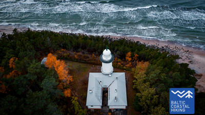
15. posms. Saunags - Kolka.
Eiropas sirds – Kolkasrags!
Jūrtakas posms, kas piemērots ikviena vecuma un sagatavotības gājējam. No Saunaga pa maziem lauku un meža ceļiem Jūrtaka izlokas līdz Vaidei, kur tā atkal atgriežas jūras krastā. Līdz Kolkasragam aizstiepjas plaši, smilšaini liedagi, kas pāriet zemās, skrajās priekškāpās, aiz kurām atkal seko mežainas jūrmalas kāpas, bet ~ 2 km garumā – noskalotas kāpas, aiz kurām paceļas Dumbrkalni. Ir veikti ~ 250 km un sasniegts Kolkasrags – robežšķirtne starp Dižjūru un Mazjūru – Rīgas jūras līci. Kolkasrags ir viena no Baltijas piekrastes populārākajām putnu vērošanas vietām.
Lībiešu valodā Saunags senais nosaukums Sǟnag, Vaide / Vaid un Kolka / Kūolka.
Kolkas priežu taka
1,8 km garā taka ir veidota piekrastes kāpu biodaudzveidības izziņai. Takā ir izveidotas divas skatu platformas, līdz kurām var tikt un uzbraukt cilvēki ratiņkrēslos. Sausās tualetes ir daļēji pielāgotas cilvēkiem ar funkcionāliem traucējumiem. Izveidots autostāvlaukums (GPS: 57.756668, 22.591180). Atrodas blakus Jūrtakai.


16. posms. Kolka - Ģipka.
Gar "slēgto krastu"
Pagriežoties no Kolkasraga uz līča pusi, manāma atšķirība starp Dižjūru un Mazjūru. Jūrtakas pirmie 10 km ved pa Slīteres nacionālā parka piekrasti: sākumā gar jūrā ieskalotajām priedēm, gar kādreizējām zvejas kolhoza ēkām, kuģu piestātni un Ēvažu stāvkrastu, kura apkaimē ir neparasti šaurs, smilšains liedags ar tam pāri līkstošiem melnalkšņiem. Arī tālākajā posmā līdz Ģipkai raksturīgs šaurs, smilšains liedags ar bagātīgo avoksnāju veidotām lāmām un nelielu, vasarā – seklu upīšu ietekām. Slīteres krasts kādreiz bija divkārt slēgta teritorija – te bija pierobežas režīma zona un dabas rezervāts.
Lībiešu valodā Kolka senais nosaukums Kūolka, Melnsils / Mustānum un Ģipka / Gipk.
Ēvažu dabas taka
Taka ir veidota viena no retajiem Rīgas jūras līča stāvkrastiem - apskatei. Cilvēki ratiņkrēslos var nokļūt līdz skatu platformai, no kuras ir redzama Rīgas jūras līča ainava. Garums (turp - atpakaļ) - 1,2 km. Segums: sākumā grants, tad iestaigāta taka, pie stāvkrasta - dēļu laipas un kāpnes. Tukuma - Kolkas ceļa otrā pusē ir izveidots autostāvlaukums (GPS: 57.677789, 22.567982). Atrodas blakus Jūrtakai.


17. posms. Ģipka - Kaltene.
Kurzemes akmeņainā jūrmala
No Ģipkas līdz Rojai stiepjas smilšaina, ne pārāk plata pludmale ar skaistām kāpām un piekrastes priežu mežiem, bet pirms Rojas – tā ir aizaugusi ar niedrēm. Savukārt, posms starp Roju un Kaltenes baznīcu ir savdabīgākais visā Latvijas piekrastē, kur jūras krasts ir izrobots ar maziem zemesragiem un līcīšiem ar ļoti šauru pludmali, kuru viscaur klāj dažādu izmēru laukakmeņu krāvumi, virs kuriem līkst melnalkšņu zaļā lapotne. Dažviet krastā slejas izskaloto koku plašās sakņu rozetes. Vietām gar pašu krastu iet zemes ceļš, gar kuru rindojas daudzas bijušās zvejnieku sētas. Maršruts piemērots aktīviem un izveicīgiem gājējiem!
Lībiešu valodā Ģipka senais nosaukums Gipk.
Laipas Rojas kāpās
Koka laipas ir pielāgotas cilvēkiem ratiņkrēslos un vecākiem ar bērniem. Ir izveidots informatīvais stends Braila rakstā un pludmales taktīlā karte, pielāgota WC un autostāvvieta (GPS: 57.510088, 22.799207). Laipu garums vienā virzienā - 0,5 km. Cilvēki ratiņkrēslos var izmantot laipas, bet līdz jūrai nevar tikt, jo nav nobrauktuves. Laipas ir platas, ar aizsargvalnīti malās un samainīšanās laukumiem.


17. posms. Ģipka - Kaltene.
Kurzemes akmeņainā jūrmala
No Ģipkas līdz Rojai stiepjas smilšaina, ne pārāk plata pludmale ar skaistām kāpām un piekrastes priežu mežiem, bet pirms Rojas – tā ir aizaugusi ar niedrēm. Savukārt, posms starp Roju un Kaltenes baznīcu ir savdabīgākais visā Latvijas piekrastē, kur jūras krasts ir izrobots ar maziem zemesragiem un līcīšiem ar ļoti šauru pludmali, kuru viscaur klāj dažādu izmēru laukakmeņu krāvumi, virs kuriem līkst melnalkšņu zaļā lapotne. Dažviet krastā slejas izskaloto koku plašās sakņu rozetes. Vietām gar pašu krastu iet zemes ceļš, gar kuru rindojas daudzas bijušās zvejnieku sētas. Maršruts piemērots aktīviem un izveicīgiem gājējiem!
Lībiešu valodā Ģipka senais nosaukums Gipk.
18. posms. Kaltene - Mērsrags.
Daudzveidīgais krasts
Maršruts piemērots aktīviem un izveicīgiem gājējiem! Dabas, kultūrvēstures pieminekļu un ainavu ziņā – ļoti daudzveidīgs Jūrtakas posms. Pie Kaltenes jūras krastu izraibina nelieli līcīši ar akmeņainām pludmalēm, bet tālāk seko ļoti aizaudzis jūras krasts, kur starp niedrēm un bagātīgi sazēlušo augāju iemīta šaura taciņa. Tālāk akmeņiem klātais jūras krasts ir tikai dažus metrus plats, vietām ar māla slāņiem, niedru laukiem, citviet ar izskalotajām aļģēm klāts. Posmā no Valgalciema līdz Mērsragam atkal parādās smilšaini liedagi ar sēkļiem jūrā. Aiz Mērsraga maršruts turpinās pa ceļu, bet pie luterāņu baznīcas – nogriežas uz jūras pusi un līdz pat Mērsraga centram iet gar Piejūras pļavu.
Laipa Upesgrīvā
Atrodas starp Lūšu kempingu un jūru (GPS: 57.381441, 23.025370). Laipai nav maliņu un apmainīšanās laukumu. Pieejama cilvēkiem ar ratiņkrēslu ar asistentu. Garums - ap 90 m vienā virzienā. Līdz pašam jūras krastam nevar nobraukt. Atrodas blakus Jūrtakai.


Laipa pie Mērsraga bākas
Atrodas Bākas ielā 60. Pa laipu cilvēki ratiņkrēslā var nokļūt no autostāvlaukuma (GPS: 57.365315, 23.120436) līdz kāpām, kur var redzēt jūru. Laipai daļēji ir maliņa, nav samainīšanās laukumu. Garums ap 150 m (turp - atpakaļ). Atrodas blakus Jūrtakai.


19. posms. Mērsrags - Engure.
Engures dabas parkā
Maršruts piemērots aktīviem gājējiem. No ciema centra līdz pludmalei aizved meža ceļs, ko ieskauj priežu mežs. Tālāk Jūrtaka ved pa takām, kas izlokas starp niedrēm un citiem zālaugiem bagātīgi apaugušo un akmeņaino jūras krastu vienā un mežainām jūrmalas kāpām – otrā pusē. Dažviet liedags ir nobruģēts ar maziem, apaļiem akmeņiem, citur redzamas pelēkās kāpas ar bagātīgu augu sugu klāstu. Bērzciema apkaimē plešas piejūras pļavas ar sēkļiem tālu jūrā, kas ir laba putnu vērošanas vieta. Līdz Abragciemam turpinās aizaugušais jūras krasts, bet no Abragciema līdz Engurei ir liedags.
Engures taka
No stāvlaukuma (GPS: 57.171428, 23.222504) Slimnīcas ielas malā līdz jūrai pāri kāpām ir izveidota dēļu laipa, kas piemērota cilvēkiem ratiņkrēslā. Slīpuma dēļ, iespējams, ir nepieciešama aistenta palīdzība. Takas garums ir ap 200 m vienā virzienā. Atrodas blakus Jūrtakai.


20. posms. Engure - Ragaciems.
Zvejniekciemi un kūpinātas zivis
Maršruts, kura pēdējā trešdaļa atrodas Ķemeru nacionālajā parkā, piemērots aktīviem gājējiem. Sākotnēji Jūrtaka izvijas cauri Engures ciemam, tad pa salīdzinoši šauru liedagu vienā pusē un skaistām mežainām jūrmalas kāpām otrā pusē aizved līdz Plieņciema kāpai, kur tālākajā posmā smilšainais liedags kļūst aizvien plašāks, bet jūrā parādās plaši sēkļi. Sauszemes virzienā šeit paceļas apauguši stāvkrasti ar kāpnēm un labiekārtotām laipām līdz Kolkas - Tukuma autoceļam. Jārēķinās, ka siltās vasaras dienās šeit ir daudz atpūtnieku.
Apšuciems
Apšuciemā ir pieejami divi peldošie pludmales ratiņkrēsli cilvēkiem ar kustību traucējumiem. Tos var saņemt Apšuciema skolā, iepriekš piesakoties pa tālruni: +371 26132761. Pakalpojuma izmantotājiem pašiem ir jānodrošina asistents, kas palīdzēs nokļūt līdz ūdenim, peldēties un atpakaļ. Ir pieejamas vestes. Ir plānots 2025. g. uzbūvēt piekļuvi jūrai, kad būs iespēja izmantot ratiņus, vestes, ģērbšanās kabīnes un speciālus sauļošanās klājus. Ar asistenta palīdzību vārēs veikt nelielus braucienus gar jūras krasta cieto smilšu daļu. Atrodas uz Jūrtakas.

Plieņciema Baltās kāpas Robežas taka
Taka atrodas pie Plieņciema Dienvidu robežas, braucot virzienā no Rīgas uz Enguri.
Plieņciema nosaukums cēlies no baltu cilmes vārda „pliens” - kaļķakmens jeb merģelis. Pirmoreiz ciema nosaukums dokumentos minēts jau 1551. gadā, bet kā apdzīvota vieta kartēs parādās no 1702. gada. Savukārt 18. gadsimta vidū Engures draudzes reģistrā minēts, ka Plieņciemā bijušas deviņas saimniecības, kam piederējušas tiesības zvejot jūrā un Engures ezerā, kā arī vākt jūras zāles.
Taka aizvedīs no ceļa līdz pat jūrai, vedot gājējus pāri kāpas valnim. Takas segums veidots tā, ka taka pieejama gan cilvēkiem ratiņkrēslos (vēlams ar pavadoni), gan ģimenēm ar bērniem ratiņos. Pludmalē ir gan ģērbtuve, gan neliels rotaļu laukums. Uz takas speciāli veidotas vietas, lai apmainītos vietām ar pretīmnākošajiem, nav.


20. posms. Engure - Ragaciems.
Zvejniekciemi un kūpinātas zivis
Maršruts, kura pēdējā trešdaļa atrodas Ķemeru nacionālajā parkā, piemērots aktīviem gājējiem. Sākotnēji Jūrtaka izvijas cauri Engures ciemam, tad pa salīdzinoši šauru liedagu vienā pusē un skaistām mežainām jūrmalas kāpām otrā pusē aizved līdz Plieņciema kāpai, kur tālākajā posmā smilšainais liedags kļūst aizvien plašāks, bet jūrā parādās plaši sēkļi. Sauszemes virzienā šeit paceļas apauguši stāvkrasti ar kāpnēm un labiekārtotām laipām līdz Kolkas - Tukuma autoceļam. Jārēķinās, ka siltās vasaras dienās šeit ir daudz atpūtnieku.
21. posms. Ragaciems - Dubulti.
Vēsturiskais Jūrmalas kūrorts
No Ragaciema labi redzams Jūrmalas krasts visā tā garumā. Šīs dienas posma pirmā trešdaļa ietilpst Ķemeru Nacionālajā parkā, kur var iepazīt vēsturiskos zvejniekciemus, Ragaciema sedumu un zivju tirdziņu, kāpu biotopus, kā arī vērot putnus Starpiņupītes grīvā. No Jaunķemeriem līdz pat Dubultiem gājiens norit pa Rīgas jūras līča platāko smilšu pludmali, cauri Jūrmalas vēsturiskajam kūrortam un Latvijas garākajai pilsētai. Skaistās un siltās vasaras dienās jārēķinās ar daudzajiem pludmales apmeklētājiem.
Jūrmalas pilsētas pludmales
Jūrmalas pilsētas pludmales ir pieejamas arī cilvēkiem ar funkcionāliem traucējumiem - ratiņkrēslos un senjoriem. Ratiņkrēsliem Jūrmalā ir pielāgotas 14 izejas uz jūru (36.līnijā, Vienības prospekts (2.izejas) , Turaidas ielā (2 izejas), Pilsoņu ielā, Baznīcas ielā, Kļavu ielā, Līgatnes ielā, Dzimtenes ielā, Vēju ielā, Atbalss ielā, Kapteiņa Zolta ielā, Jaunķemeru ceļš, kur noejas līdz pludmalei, ņemot vērā segumu un reljefu, ir piemērotas gan cilvēkiem ar funkcionāliem traucējumiem, gan cilvēkiem ar bērnu ratiņiem), bet četrās vietās - Vaivaros, Kauguros, Jaunķemeros un Jaundubultos ir pieejamas paplašinātas, ērtākas pārģērbšanās kabīnes.
Kupskalnu dabas taka
Puskilometra garumā virzās gar Siliņupes labo krastu un no Slokas - Talsu ceļa aizved līdz jūrai. Tā ir daļēji pieejama cilvēkiem ratiņkrēslos ar asistentu, jo takas sākumā var traucēt koku saknes. Tālākā takas daļa (platas laipas ar izmainīšanās laukumu) ir izbraucamas. Daļēji pieejama WC. Gājienu var sākt no netālu esošās DUS (GPS: 56.992203, 23.522736).


22. posms. Dubulti - Lielupe - Bulduri.
Populārākās Latvijas pludmales
Maršruts piemērots ikviena vecuma un fiziskās sagatavotības gājējam. Starp Dubultiem un Lielupi plešas Rīgas jūras līča platākais smilšu liedags – Jūrmalas kūrorta nozīmīgākā vērtība ar daudzām pludmales kafejnīcām, dažādām atpūtas iespējām. Piekrastes kāpu mežus caurvij blīvs taku tīkls, kas piemērots iešanai un nūjošanai. Jūrtakas daļa starp Lielupes pludmali un Jūrmalas brīvdabas muzeju ietilpst Ragakāpas dabas parkā. No šejienes atpakaļ uz Bulduriem var ērti nokļūt pa Bulduru prospektu un 5. līniju.
Jūrmalas pilsētas pludmales
Jūrmalas pilsētas pludmales ir pieejamas arī cilvēkiem ar funkcionāliem traucējumiem - ratiņkrēslos un senjoriem. Ratiņkrēsliem Jūrmalā ir pielāgotas 14 izejas uz jūru (36.līnijā, Vienības prospekts (2.izejas) , Turaidas ielā (2 izejas), Pilsoņu ielā, Baznīcas ielā, Kļavu ielā, Līgatnes ielā, Dzimtenes ielā, Vēju ielā, Atbalss ielā, Kapteiņa Zolta ielā, Jaunķemeru ceļš, kur noejas līdz pludmalei, ņemot vērā segumu un reljefu, ir piemērotas gan cilvēkiem ar funkcionāliem traucējumiem, gan cilvēkiem ar bērnu ratiņiem), bet četrās vietās - Vaivaros, Kauguros, Jaunķemeros un Jaundubultos ir pieejamas paplašinātas, ērtākas pārģērbšanās kabīnes.
23. posms. Bulduri - Rīgas centrs.
Cauri mežiem uz Rīgu!
Maršruts ir alternatīvs veids, kā no Jūrmalas nokļūt līdz Rīgai, ejot pa mežu. Aiz Lielupes tilta Jūrtaka izlīkumo cauri Priedainei ar skatiem uz tās koka apbūvi, iet līdztekus Lielupes labajam krastam, tad nogriežas gar Bolderājas kāpas dienviddaļu un šķērso Kleistu mežu, virzoties gar Lāčupes kapiem. Tālāk pa vēsturiskajiem Pārdaugavas ceļiem – Buļļu un Daugavgrīvas ielām cauri Dzegužkalnam, garām Zunda kanālam un Āgenskalna līcim nonāk līdz Daugavai, kur pa Akmens tiltu šķērso Daugavu un apstājas Rīgas Rātslaukumā.
Jūrmalas pilsētas pludmales
Jūrmalas pilsētas pludmales ir pieejamas arī cilvēkiem ar funkcionāliem traucējumiem - ratiņkrēslos un senjoriem. Ratiņkrēsliem Jūrmalā ir pielāgotas 14 izejas uz jūru (36.līnijā, Vienības prospekts (2.izejas) , Turaidas ielā (2 izejas), Pilsoņu ielā, Baznīcas ielā, Kļavu ielā, Līgatnes ielā, Dzimtenes ielā, Vēju ielā, Atbalss ielā, Kapteiņa Zolta ielā, Jaunķemeru ceļš, kur noejas līdz pludmalei, ņemot vērā segumu un reljefu, ir piemērotas gan cilvēkiem ar funkcionāliem traucējumiem, gan cilvēkiem ar bērnu ratiņiem), bet četrās vietās - Vaivaros, Kauguros, Jaunķemeros un Jaundubultos ir pieejamas paplašinātas, ērtākas pārģērbšanās kabīnes.
Babītes rododendru audzētava
Ir izveidota 1,9 km gara taka, kas ir pieejama cilvēkiem ratiņkrēslos un vecākiem ar bērnu ratiem. Takas segums - asfalts. Izveidota autostāvvieta (GPS: 56.962330, 23.952280), pielāgota WC. Atrodas ap 2,7 km no Jūrtakas.
Daugavgrīvas dabas taka
Taka sākās pie autostāvlaukuma (GPS: 57.036769, 24.018166), netālu no Valentīna Pikuļa ielas un aizved pāri Daugavgrīvas mitrājam līdz kāpām un jūrai. Līdz jūrai esošās takas klājums ir bruģis un bruģētā daļa ir pieejama cilvēkiem ar ratiņkrēsliem. Takas malā ir izveidots putnu vērošanas tornis, kura pirmais stāvs ir pieejams cilvēkiem ratiņkrēslos. Atrodas ap 12,5 km attālumā no Jūrtakas, bet jūras krastā - Daugavgrīvā.

24. posms. Rīgas centrs - Vecāķi.
Vecrīga – UNESCO pasaules mantojuma vieta
Maršruts piemērots aktīviem gājējiem, kas nebaidās Rīgu šķērsot ar kājām. Tas sākotnēji izmet nelielu loku pa Rīgas centru – Vecrīgu, ved gar Pilsētas kanālu, cauri Kronvalda parkam, pa Alberta ielu (Jūgendstila pērle) un tālāk pa Miera ielu cauri Lielajiem kapiem, Kokneses un Ostas prospektiem cauri Mežaparkam, sasniedzot Jaunmīlgrāvi un šķērso Mīlgrāvi. Tālāk pa Vecāķu prospektu tas aizlokas līdz Ziemeļblāzmai un Vecdaugavas krastiem, no kurienes dažu kilometru attālumā jau ir Vecāķi. Pēc divu dienu gājuma cauri Rīgai, Jūrtaka atkal izved pludmalē.
Mangaļsalas pastaigu takas
Divas Mangaļsalas takas ir veidotas cauri kāpu zonai un piekrastes mežiem līdz jūrai. Pirmā no tām (GPS: 57.071642, 24.087599) cilvēkiem ratiņkrēslā ir ieteicama ar asistentu, jo aizved līdz jūrai, bet pa to nevar tikt līdz pludmalei. Otrā (GPS: 57.062730, 24.055460) iesākas ar zemes ceļu, bet tālāk turpinās kā plata koka laipa, pa kuru var nokļūt līdz pludmalei. Trešā (GPS: 57.061976, 24.041811) aizved uz Austrumu molu. Tā nav veidota kā ratiņkrēslam pieejama, taču ar asistenta palīdzību ir izbraucama, molu ieskaitot, izņemot stipra vēja un vētras laikā. Pirmajā un otrajā takā ir speciāli izveidota autostāvvieta un WC. Tuvākā taka atrodas apm. 3,5 km attālumā no Jūrtakas.


25. posms. Vecāķi - Carnikava.
Starp divu upju – Daugavas un Gaujas grīvām
Maršruts piemērots ikvienam, kas vēlas doties salīdzinoši īsā pārgājienā pa skaistu smilšainu pludmali, ko no sauszemes puses norobežo gaiši piekrastes priežu meži ar iespaidīgām kāpām un kāpu vaļņiem. No pludmales līdz Carnikavai Jūrtaka ved pa promenādi, kas iet cauri mežam. Tālāk pa aizsargdambi tā apmet loku Vecgaujai – Gaujas vecupei un sasniedz kājnieku tiltu pār Gauju. Gan uzsākot, gan nobeidzot gājienu, ir vērts pasēdēt kādā no Vecāķu pludmales vai Carnikavas krodziņiem un vasaras kafejnīcām.
Garciema dabas taka
Koka laipu taka aizved līdz Eimuru kanāla ietekai jūrā. Laipas beigu posms atrodas tuvu krastam un ar asistenta palīdzību var būt iespēja tikt līdz jūrai. Piemērota cilvēkiem ratiņkrēslos un vecākiem ar bērnu ratiem. Izveidota autostāvvieta (GPS: 57.108161, 24.192324) un WC. Garums vienā virzienā - 0,7 km. Atrodas blakus Jūrtakai.
Carnikavas promenāde
Savieno Carnikavu ar jūras krastu. Taka ir klāta ar bruģi, bet smilšu kāpās - ar koka laipām. Jūras krastā ir noejas un skatu platformas ar zviļņiem. Takas garums vienā virzienā - 1,8 km. Tā ir pieejama cilvēkiem ratiņkrēslos un vecākiem ar bērnu ratiem. Izveidota autostāvlaukums (GPS: 57.133531, 24.265631) Laivu ielā, pielāgota WC, informācijas stendi un atpūtas vietas. Jūras krasta smilšu zona nav pieejama ar ratiņkrēslu. Promenādes pēdējā posmā ir 9,2 % slīpums. Jūrtaka virzās pa Carnikavas promenādi. 2024./2025. g. pie Carnikavas promenādes ir plānots izveidot īpašu maršrutu specializētiem of-road ratiņkrēsliem, kas būs pieejami to lietotājiem kopā ar asistentu.


26. posms. Carnikava - Saulkrasti.
Saulrieta taka ar romantiskākajiem saulrietu skatiem
Sākotnēji maršruts ved pa Gaujas aizsargdambjiem Gaujas ciemā, sasniedzot Gaujas grīvu, kas ir laba putnu vērošanas vieta. Tālākais gājiens norit pa smilšainu pludmali līdz Inčupes ietekai, pirms kuras jāpagriežas uz iekšzemi, lai nokļūtu līdz tiltam un turpmākos dažus kilometrus uz pludmali nolūkotos no Saulrieta takas mežaino kāpu virsotnēm. Pēc Pēterupes šķērsošanas (trošu tilts) pa pludmali Jūrtaka sasniedz Saulkrastu “Jūras parku”.
Lilastes pludmales laipa
Aizved līdz jūrai. Tās garums vienā virzienā ir 130 m. Tā sākas pie autostāvvietas (GPS: 57.187403, 24.329523), no kuras cilvēks ratiņkrēslā ar asistenta palīdzību var nokļūt līdz pludmalei. Atrodas blakus Jūrtakai.

Baltā kāpa
Viena no ainaviskākajām Rīgas jūras līča kāpām. Pieejama cilvēkiem ratiņkrēslā ar asistentu līdz skatu platformai no autostāvlaukuma (GPS: 57.233560, 24.393407). Baltā kāpa ietilpst Jūrtakas maršrutā.
Gājēju celiņš un koka laipu tīkls Saulkrastu piekrastes kāpās
Atrodas starp Raiņa ielu un Bīriņu ielu (Jūras parks, Saulkrastu tūrisma informācijas centrs) un ir pielāgots cilvēkiem ratiņkrēslā un vecākiem ar bērnu ratiem. Virzās paralēli Jūrtakai. Visērtāk takas un laipas ir sasniegt no autostāvvietas (GPS: 57.267111, 24.413875).


26. posms. Carnikava - Saulkrasti.
Saulrieta taka ar romantiskākajiem saulrietu skatiem
Sākotnēji maršruts ved pa Gaujas aizsargdambjiem Gaujas ciemā, sasniedzot Gaujas grīvu, kas ir laba putnu vērošanas vieta. Tālākais gājiens norit pa smilšainu pludmali līdz Inčupes ietekai, pirms kuras jāpagriežas uz iekšzemi, lai nokļūtu līdz tiltam un turpmākos dažus kilometrus uz pludmali nolūkotos no Saulrieta takas mežaino kāpu virsotnēm. Pēc Pēterupes šķērsošanas (trošu tilts) pa pludmali Jūrtaka sasniedz Saulkrastu “Jūras parku”.
27. posms. Saulkrasti - Lauči.
„Vārti” uz Vidzemes akmeņaino jūrmalu
Maršruts piemērots visdažādāko vecumu un sagatavotības gājējiem. Līdz Zvejniekciemam pirmos kilometrus var iet pa pludmali, vai arī pārmaiņas pēc – pa taku, kas izlokas cauri kāpu mežam ar vecām priedēm, kurām raksturīga „krokodilādas” miza. Te redzama arī kāda veca zvejnieku tīklu un piederumu koka būda. Pirms Skultes ostas, Zvejniekciema liedagā parādās pirmie akmeņi. Apmetot līkumu Aģes grīvai un ostai, Jūrtaka atgriežas pludmalē, kur jau iztālēm redzams Ārņu rags, bet aiz tā – Lielā Lauču akmens brūnā mugura. Piekrastes ainavu daudzveidība.
Gājēju celiņš un koka laipu tīkls Saulkrastu piekrastes kāpās
Atrodas starp Raiņa ielu un Bīriņu ielu (Jūras parks, Saulkrastu tūrisma informācijas centrs) un ir pielāgots cilvēkiem ratiņkrēslā un vecākiem ar bērnu ratiem. Virzās paralēli Jūrtakai. Visērtāk takas un laipas ir sasniegt no autostāvvietas (GPS: 57.267111, 24.413875).
28. posms. Lauči - Tūja.
Aizgājušais burinieku laikmets
Izcili ainavisks Vidzemes krasta posms ar daudziem akmeņainiem zemesragiem un akmeņu „amfiteātriem” jūrā, kas mijas ar maziem, smilšainiem līcīšiem, kuros ietek mazu upīšu un urgu vasarā izsīkstošās tērcītes. Piemērots aktīviem gājējiem ar piemērotiem apaviem, jo vietām liedagu pilnībā klāj tikai akmeņu pelēkās muguras. Dažviet parādās arī nelieli niedru pleķīši, bet pie Tūjas – pirmie smilšakmens atsegumi.
Minhauzena alus kausa taka
1,3 km garā taka (vienā virzienā) atrodas Duntes muižā un sākas pie Minhauzena muzeja. Takas segums ir dēļu laipas 1,5 m platumā ar vairākiem samainīšanās laukumiem. Takas iepazīšanu ir ērti sākt no autostāvvietas (GPS: 57.405620, 24.424681). Atrodas 1,7 km attālumā no Jūrtakas.
29. posms. Tūja - Svētciems.
Vidzemes akmeņainā jūrmala
Maršruts piemērots aktīviem un izturīgiem gājējiem! Viens no skaistākajiem Jūrtakas posmiem, kas sākas ar Zaķupītes šķērsošanu. Līdz Ķurmraga bākai pārsvarā ir smilšaini liedagi ar nelieliem akmeņainiem posmiem. Tālāk sākas Vidzemes akmeņainā jūrmala, kur zemesragi mijas ar nelieliem līcīšiem, bet krastā paceļas līdz 4 m augsti smilšakmens atsegumi. Aiz Meleku raga atkal seko galvenokārt smilšains liedags, bet pirms Svētupes ietekas – stipri aizaugusi pludmale un niedrājs, kas apejams pa meža ceļu.
Atpūtas vieta "Vasas"
Izveidota skatu platforma un autostāvvieta (GPS: 57.520544, 24.379052), kas ir pieejama cilvēkiem ar ratiņkrēsliem. Atrodas blakus Jūrtakai.
Veczemju klintis
Pie Veczemju klintīm ir izveidota nobrauktuve cilvēkiem ar ratiņkrēslu asistenta pavadībā. Liedaga smiltis gan nav piemērotas braukšanai ar ratiņkrēslu. Nobrauktuves pamatni samērā bieži noposta vētras. Atrodas blakus Jūrtakai.


30. posms. Svētciems - Ainaži.
Nēģu karaliste
Daudzveidīgs Jūrtakas posms, kas piemērots aktīviem un izturīgiem gājējiem un putnu vērotājiem. Pludmale starp Svētciemu un Salacgrīvu ir stipri aizaugusi, tādēļ Jūrtaka iet pa meža ceļu, kas izvijas starp kāpu vaļņiem. No Salacgrīvas līdz Kuivižiem var doties pa smilšaino pludmali, vai arī pa meža takām. Randu pļavas no Kuivižiem līdz Vēverupei ir jāapiet pa meža ceļu, kas iet līdztekus A1 autoceļa austrumu pusē. Aiz Vēverupes Jūrtaka atgriežas stipri aizaugušā pludmalē, ko atkal pamet pie Blusupītes ietekas, lai tālāk pa Kāpu un Valdemāra ielu sasniegtu Ainažu molu. Latvijā ir veikti ap 580 km un sasniegta valsts robeža.
Salacgrīvas promenāde
Ap 260 m garā, labiekārtotā promenāde (iekļaujot Slavas aleju), kas ved gar Salacas labo krastu, ir pieejama cilvēkiem ar ratiņkrēslu un asistentu. Iepazīšanu var sākt no autostāvlaukuma (GPS: 57.756060, 24.358155). Atrodas blakus Jūrtakai.


Piemineklis "Baltā saule"
Atrodas Ainažos. Tā apskates nolūkos ir izveidota ap 150 m gara koka laipa (sākums GPS: 57.859628, 24.347306), kas pieejama cilvēkiem ratiņkrēslos ar asistentu un vecākiem ar bērnu ratiem. No autostāvvietas līdz laipai ir ap 250 m. Atrodas blakus Jūrtakai.


Krasta ielas promenāde Salacgrīvā
Ap 0,8 km garumā izveidota gar Salacas kreiso krastu no tilta līdz Meža ielai, kur atrodas Tenisa korti. Pieejama cilvēkiem ratiņkrēslā. Izveidotas atpūtas un skatu vietas, pie Meža ielas - pielāgota WC. Segums - mūsdienu bruģis.


Laipas līdz Salacgrīvas pludmalei
No Jūrmalas ielas autostāvlaukuma (57.75083, 24.34911) līdz pludmalei izveidotas divas koka laipas. Pieejamas cilvēkiem ratiņkrēslā ar asistentu, jo vietā, kur laipa šķērso kāpu, var būt sapūstas smiltis. Pie autostāvlaukuma pieejama tualete. Laipas segums - koks. Uz laipas nevar apmainīties divi ratiņkrēsli.


30. posms. Svētciems - Ainaži.
Nēģu karaliste
Daudzveidīgs Jūrtakas posms, kas piemērots aktīviem un izturīgiem gājējiem un putnu vērotājiem. Pludmale starp Svētciemu un Salacgrīvu ir stipri aizaugusi, tādēļ Jūrtaka iet pa meža ceļu, kas izvijas starp kāpu vaļņiem. No Salacgrīvas līdz Kuivižiem var doties pa smilšaino pludmali, vai arī pa meža takām. Randu pļavas no Kuivižiem līdz Vēverupei ir jāapiet pa meža ceļu, kas iet līdztekus A1 autoceļa austrumu pusē. Aiz Vēverupes Jūrtaka atgriežas stipri aizaugušā pludmalē, ko atkal pamet pie Blusupītes ietekas, lai tālāk pa Kāpu un Valdemāra ielu sasniegtu Ainažu molu. Latvijā ir veikti ap 580 km un sasniegta valsts robeža.
32. posms. Kabli - Häädemeeste.
Putni, kāpas un meži!
Maršruts piemērots ikviena vecuma un sagatavotības gājējam, taču īpaši ieteicams putnu vērotājiem. Jūrtakas posmu no Kabli līdz Häädemeeste dienviddaļai ir jāturpina pa veco Rīgas ceļu, jo jūras krastā plešas pļavas ar niedrājiem un lagūnām. Pirms Häädemeeste Jūrtaka nogriežas no autoceļa un aizlīkumo pa Jaagupi dabas liegumu (apmet loku ciemam no austrumiem), uzskriedama augsto kāpu mugurās un mezdamās lejup dziļajās starpkāpu ieplakās, kuras klāj skrajš priežu mežs. Te ir labas ogošanas un sēņošanas vietas.
Kabli dabas taka
Taka iepazīstina ar piekrastes kāpām un dabas vērtībām tajās. Tā sākas pie autostāvlaukuma (GPS: 58.019424, 24.450986), kas atrodas pie Kabli apmeklētāju centra. Garums - 1,8 km. Takas segums: sākumā grants šķembas, meža ceļš, 1,5 m platas koka laipas. Taka pieejama cilvēkiem ratiņkrēslā. Ir pielāgota WC. Takas malās ir informācijas stendi, izveidota skatu platforma, divi putnu vērošanas torņi (nav pieejami ar ratiņkrēslu). Atrodas blakus Jūrtakai.


34. posms. Uulu - Pärnu.
Gar mitrājiem uz Pērnavu!
Jūrtakas posms piemērots aktīviem gājējiem un dabas vērotājiem. Sākotnēji Jūrtaka iet pa priežu mežu ieskautiem vecajiem piekrastes ceļiem, bet aiz Lottemaa parka pagriežas uz jūru un iznāk Reiu pludmalē. Tālāk seko gājiens pa aizaugošu liedagu (vējatplūdu laikā - plaši sēkļi), kur pēc nepilniem 4 km ir jānogriežas uz iekšzemi, jāšķērso golfa laukums un jāpagriežas Pērnavas virzienā. Pie Raeküla rajona tā līkumo pa mazu taciņu, kas ir plašo piejūras mitrāju un meža robeža. Apmetusi ~ 6 km garu loku apkārt mitrājiem, Jūrtaka iznāk Pērnavas pludmalē. Tālākais ceļš ved cauri Pērnavas vecpilsētas rietumdaļai, šķērso Pērnavas un Sauga upes un beidzas Vana - Pērnavas rajonā.
Pērnavas piekrastes pļavu dabas taka
Taka iepazīstina ar mitrajām piekrastes pļavām, lagūnām, putnu un augu valsti. Tā veidota ovāla formā ar skatu platformu (pieejams pirmais stāvs) 600 m garumā. Tās apmeklējumu ērti sākt no blakus esošā autostāvlaukuma (GPS: 58.372397, 24.507902). Takas segums - koka laipas, pie autostāvlaukuma - asfalta ietves. Taka pieejama cilvēkiem ratiņkrēslā. Ieteicama asistenta palīdzība, jo slīpums atseviškos posmos pārsniedz 8%. Atrodas blakus Jūrtakai.


Pērnavas pludmales promenāde
Stiepjas paralēli Pērnavas līča pludmalei puskilometra garumā. Segums pārsvarā ir koka laipa (2,3 - 3,1 m plata), daļēji - bruģis, līdz 4 m plats. Pieejama cilvēkiem ar ratiņkrēslu. Tās iepazīšanu ir ērti sākt no blakus esošā autostāvlaukuma (GPS: 58.372397, 24.507902)
Pieeja pie jūras, peldratu noma
2024. g. pie viesnīcas Hedon SPA&Hotel sezonas laikā ir pieejami peldrati u.c. inventārs, kā arī tiek izveidots speciāla virsma, lai cilvēki ratiņkrēslos varētu nokļūt līdz ūdenim.


Pērnavas pludmales parks
1882. g. izveidotais parks ir populāra pilsētas viesu un vietējo iedzīvotāju atpūtas zona. Parku caurauž ap vienu km garš taku (ap 3 m platas) tīkls, kuras pieejamas cilvēkam ar ratiņkrēslu. Segums: grants, asfalts. Autostāvlaukumi (maksas) ir pieejami parka perimetrā. Atrodas pie Jūrtakas.


Koka laipa uz Pērnavas molu
Laipas sākums atrodas iepretim Pērnavas molam (GPS: 58.381941, 24.483994). 0,6 km (vienā virzienā) laipas ir pieejamas cilvēkiem ratiņkrēslā. Laipas segums: koks, platums - 3 m. Vietām ir takas paplašinājumi, atpūtas vietas. Lieliska vieta Pērnavas ostas iepazīšanai. Atrodas ap 350 m no Jūrtakas


35. posms. Pärnu - Liu.
Skaistākie Pērnavas līča skati un kūpinātas zivis!
Jūrtaka izlīkumo pa Pērnavas rietumu pievārti, šķērso Audru upi un nogriežas Valgeranna virzienā, kur no dienvidiem to ieskauj biezs mežs un balta, smilšaina pludmale, bet no ziemeļiem – golfa laukums. Aiz Valgeranna Jūrtaka virzās pa Pērnavas līča ziemeļdaļu. No Audru polderiem paveras skaistākie skati uz Pērnavas līci. Aiz Audru niedrāja Jūrtaka pagriežas uz dienvidiem un izved cauri piekrastes zvejniekciemiem ar mazām ostiņām un laivu piestātnēm. Te redzama zvejnieku ikdiena, var nogaršot kūpinātas zivis. Maršruts piemērots izturīgiem gājējiem!
Valgreannas pludmales promenāde
Taka savieno autostāvlaukumu ar pludmali. Tās segums ir bruģis, koka laipa. Platums - 1,95 - 3 m. Pieejama cilvēkiem ratiņkrēslā. Sausā WC. Atrodas blakus Jūrtakai.


38. posms. Tõstamaa - Matsi.
Igaunijas lauku idille
Šajā Jūrtakas posmā redzama tradicionāla lauku ainava. Piekrasti izrobo daudzi sekli līči, pussalas, zemesragi, kurus ieskauj piejūras pļavas, niedrāji, seklas lagūnas, purvāji, kā arī grūti pieejamas salas. Ejot pa mazajiem lauku ceļiem, pār kuriem rudeņos nolīkuši sarkanie pīlādži, redzamas etnogrāfiska izskata viensētas, lauku saimniecības ar govīm un kazām. Lauku sētas ainavā mijas ar akmens žogu paliekām, lauksaimniecības zemēm un kadiķu audzēm. Pieeja jūrai un atpūtas vietas ir uz dienvidiem no Ranniku un pie Kastna ciema.
Matsi ostas taka
Taka iepazīstina ar kādreizējo Matsi zvejas ostu. Garums - puskilometrs (turp - atpakaļ). Tās sākums ir autostāvlaukums (GPS: 58.360251, 23.746683). Segums: asfalts, betons, grants šķembu segums. Vējainā laikā taka var būt appūsta ar smiltīm, tādēļ cilvēkam ar ratiņkrēslu var būt nepieciešama asistenta palīdzība. Takā ir izvietoti taktīlie objekti un informācija Braila rakstā. Ir pielāgota WC. Atrodas blakus Jūrtakai.


39. posms. Matsi - Varbla.
Pludmale un meži!
Matsi pludmale ir viena no retajām smilšainajām pludmalēm takas turpmākajā posmā līdz Hāpsalai. Jūrtaka izmet loku caur Kulli ciemu un turpmākos 5 km ved pa maziem, plašu mežu un kāpu ieskautiem ceļiem, kuru apkaime rudeņos ir bagāta ar ogām un sēnēm. Apmetusi loku apkārt Uue-Varbla muižai, taka sasniedz Varbla ciemu.
Matsi ostas taka
Taka iepazīstina ar kādreizējo Matsi zvejas ostu. Garums - puskilometrs (turp - atpakaļ). Tās sākums ir autostāvlaukums (GPS: 58.360251, 23.746683). Segums: asfalts, betons, grants šķembu segums. Vējainā laikā taka var būt appūsta ar smiltīm, tādēļ cilvēkam ar ratiņkrēslu var būt nepieciešama asistenta palīdzība. Takā ir izvietoti taktīlie objekti un informācija Braila rakstā. Ir pielāgota WC. Atrodas blakus Jūrtakai.
45. posms. Penijõe - Laiküla.
Apkārt Ziemeļeiropas lielākajam mitrājam
Jūrtaka apmet līkumu Kasari upes deltai – tās ietekai Matsalu līcī, kur izveidojies viens no Ziemeļeiropas lielākajiem mitrājiem ar plašiem niedru laukiem, piejūras pļavām, vecupēm un seklā līča ūdeņiem, kas ir nozīmīga putnu ligzdošanas un atpūtas vieta migrāciju laikā. Lielākā maršruta daļa ved pa lauksaimniecības zemju ainavām un maziem ciematiem. Kirblas apkaimē redzams reljefa paaugstinājums – kādreizējā Baltijas ledus ezera sala ar senkrastu tās ziemeļdaļā.
Rannajõe (Rannajē) skatu platforma
Iepazīstina ar Matsalu Nacionālā parka applūstošajām palieņu pļavām, kurās migrāciju laikā uzturas lieli putnu bari. Uz platformas uzved 100 m gara koka laipa (līdz 110 cm plata), kuras veikšanai cilvēkam ar ratiņkrēslu ir nepieciešams asistents, jo uzbraukuma stāvums sasniedz 32 %. Atrodas (GPS: 58.816865, 23.781363) blakus Jūrtakai.


48. posms. Rohuküla - Haapsalu - Uuemõisa.
Populārais Igaunijas kūrorts - Hāpsalu
Daudzveidīgs Jūrtakas posms, kas piemērots aktīviem gājējiem, kam interesē kūrorta vēsture un tradīcijas. Pirmie trīs maršruta kilometri iet pa bijušo Haapsalu – Rohuküla platsliežu dzelzceļu, izmet loku gar Haapsalu līci caur Pullapää neem, šķērso piekrastes mežus, kur izveidotas veselības takas un pa piekrastes promenādēm un mazajām ieliņām apmet loku apkārt Haapsalas pilsētai. Šķērsojot nelielu mitrāju aiz pilsētas, tā finišē skaistajā Uuemõisa parkā.
Paralepas dabas taka un pludmale
Dabas takas sākums atrodas pie autostāvlaukuma (GPS: 58.940856, 23.515004) iepretim Paralepas pludmalei. Taka virzās paralēli jūras krastam, apmet loku seklam līcim un šķērso nelielu mitrāju, līdz nonāk Hāpsalu pilsētas rietumdaļā. Tās garums vienā virzienā - 2 km. Segums: asfalts un koka laipa. Taka visā garumā izbraucama ar ratiņkrēslu. Ir pielāgota WC. Dabas taka sakrīt ar Jūrtaku.


Mazā Vīka taka
Mazais Vīks (Väike Viik) ir agrākos laikos no jūras atdalījies līcis, ko mūsdienās iecienījuši putni. Tas atrodas Hāpsalas ziemeļdaļā. Ezeriņam apkārt ir izveidota ap 2 km gara taka, ko visā garumā var veikt cilvēki ratiņkrēslā un vecāki ar bērnu ratiem. Segums: grants šķembas un asfalts. Tuvākā pielāgotā WC atrodas Hāpsalu tūrisma informācijas centrā. Daļēji sakrīt ar Jūrtaku.


Hāpsalas promenāde un Āfrikas pludmale
Viena no skaistākajām Igaunijas jūras krasta promenādēm ved gar Hāpsalas pilsētas austrumu krastu 1,2 km garumā. Tās segums ir bruģis. Tā visā garumā ir piemērota cilvēkiem ratiņkrēslā un vecākiem ar bērnu ratiem. Pie Āfrikas pludmales ir bērnu rotaļlaukums un putnu vērošanas tornis. Takas tālākajā daļā atrodas ratiņkrēsla prasmju apmācīšanas parks, trenažieri un spēļu laukums, kas pielāgots bērniem ar funkcionāliem traucējumiem. Daļēji sakrīt ar Jūrtaku.


Ūemeizas (Uuemõisa) muižas parks
Parku caurauž taku tīkls, kas ir pieejams cilvēkiem ar ratiņkrēslu. Taku garums - ap 1,2 km. Celiņu segums: grants. Daļēji sakrīt ar Jūrtaku.


49. posms. Uuemõisa - Elbiku.
Apkārt Hāpsalu līcim
Maršruts piemērots tikai sportiskiem gājējiem, kam vairāk svarīgs ir pats iešanas process. Jūrtaka galvenokārt virzās gar autoceļu malu un tikai starp Ingküla un Aulepa ciemiem izlokas pa mazākiem lauku ceļiem, kur baudāmas lauku ainavas ar viensētām, laukakmeņiem un ganībām.
Ūemeizas (Uuemõisa) muižas parks
Parku caurauž taku tīkls, kas ir pieejams cilvēkiem ar ratiņkrēslu. Taku garums - ap 1,2 km. Celiņu segums: grants. Daļēji sakrīt ar Jūrtaku.
Silma darbnīca
Silma darbnīca ir dabas skola, kas atrodas Silma dabas lieguma teritorijā. Te paveras skats uz aizaugošajiem, putniem un augiem bagātajiem Hāpsalu līča un tā atzaru ūdeņiem. Takas garums ir 0,4 km (abos virzienos), segums - iestaigāts ceļš, grants, zāle. Darbnīca ir pieejama ar ratiņkrēslu, bet asistenta pavadībā, iepriekš piesakoties, jo ceļam priekšā ir barjera. Atrodas ap 3,5 km attālumā no Jūrtakas.
51. posms. Riguldi - Dirhami.
Vieta ar meteorīta krišanas pēdām
Maršruts piemērots ikviena vecuma un sagatavotības gājējam. Izņemot pirmos 3 km, maršruts iet gar jūras krastu. Pārsvarā tas ir smilšains liedags ar skaistām priekškāpām, pelēkajām kāpām un laukakmeņiem jūrā. Liedagā var būt saskalotas aļģes, dažviet tas aizaudzis ar blīvu augāju. Iepretim Rooslepa ciemam un citviet jūrā un krastā redzami stipri sadēdējuši akmeņi – t.s. brekčijas, kas ir sena meteorīta sprādziena rezultātā sakusuši un sadēdējuši ieži. Maršruta galapunktā var pasēdēt krodziņā, no kura terases paveras skaists skats uz jūru un ostu.
Rostas (Roostas) pludmale
No Rostas aptūtas kompleksa līdz kāpām ierīkotas dēļu laipas, kas pieejamas ar ratiņkrēslu.


Dirhami osta
No ostas stāvlaukuma (GPS: 59.209328, 23.497846), kas ir klāts ar šķembām (iespējams, nepieciešama asistenta palīdzība) tālāk var doties uz Dirhami zvejas un tirdzniecības ostas piestātni un ap 300 m garumā (asfalts) izbaudīt Somu jūras līča piekrastes un ostas skatus. Blakus atrodas jaukais Dirhami restorāns, kurā var iekļūt pa speciālu dēļu rampu. Atrodas pie Jūrtakas.


52. posms. Dirhami - Nõva.
Skarbā ziemeļu daba
Maršruts piemērots ikviena vecuma un sagatavotības gājējam. Ainavu ziņā izcili daudzveidīgs Jūrtakas posms, kurā jau ir apjaušama Igaunijas ziemeļu piekrastei raksturīgā daba. Maršruts gandrīz visā garumā ved gar jūras krastu, kur līčos ir skaisti, smilšaini liedagi, zemesragos – laukakmeņiem klāti krasti, bet Põõsaspea neem raga (izcila putnu vērošanas vieta) ziemeļdaļā atsedzas dolomīta slāņi. Jūrtaka iet pa Nõva dabas liegumu, kur redzami izcili balto un pelēko kāpu skati. Pludmales ir populāra makšķerēšanas un kaitborda vieta.
Dirhami osta
No ostas stāvlaukuma (GPS: 59.209328, 23.497846), kas ir klāts ar šķembām (iespējams, nepieciešama asistenta palīdzība) tālāk var doties uz Dirhami zvejas un tirdzniecības ostas piestātni un ap 300 m garumā (asfalts) izbaudīt Somu jūras līča piekrastes un ostas skatus. Blakus atrodas jaukais Dirhami restorāns, kurā var iekļūt pa speciālu dēļu rampu. Atrodas pie Jūrtakas.
Perakilas (Peraküla) pludmale
No atpūtas vietas un autostāvlaukuma (GPS: 59.221567, 23.602891) pa koka laipu (0,1 km) var nokļūt līdz skatu platformai, no kuras var vērot Somu jūras līča piekrasti. Var būt nepieciešama asistenta palīdzība, jo laipu vējš mēdz ieputināt smiltīs. WC ir daļēji pieejama. Atrodas pie Jūrtakas.


58. posms. Laulasmaa - Vääna-Jõesuu.
Skaistākais Igaunijas ūdenskritums
Ainaviski daudzveidīgs Jūrtakas posms, kas piemērots izturīgiem gājējiem. Redzamas gan akmeņainas, gan smilšainas pludmales un labas peldvietas, skaisti piekrastes priežu meži, iespaidīgā Türisalu klints siena un dižakmeņi. Pa plašā Keilas Mežaparka takām var aiziet līdz Keilas ūdenskritumam, pie kura uzņemti fragmenti populārajai latviešu mākslas filmai „Vella kalpi”, kā arī iepazīt piekrastes zvejnieku dzīvei veltīto ekspozīciju Lohusalu ciemā.
Keilas parka taka
2,1 km garā taka iepazīstina ar angļu stilā veidoto Keila - Joa parku un populāro Keilas ūdenskritumu. Pirmie 250 m, ejot no autostāvlaukuma (GPS: 59.393587, 24.294767), ir pieejami cilvēkiem ar ratiņkrēslu un pavadoni. Segums ir grants, šķembas un dabiska taka. Atrodas pie Jūrtakas.


60. posms. Tabasalu - Tallinas osta.
Tallina – UNESCO pasaules mantojuma vieta
Pie Tabasalu Jūrtaka šķērso Tallinas robežu un cauri Tiskre un Vismeistri rajoniem iznāk Kakumäe pludmalē, kur apmet loku klinšu ieskautajai Kakumäe pussalai pa tās augšdaļu mežā. Te skats pāri Kopli līcim uz Tallinas ostu. Iepretim Õismäe rajonam gar jūras krastu ved lieliska promenāde. Apmetusi loku apkārt Igaunijas Brīvdabas muzejam, Jūrtaka pa krasta promenādi aizlokās līdz Stroomi pludmalei un tālāk aiz Pelguranna rajona pa gājēju ietvēm līdz Igaunijas Jūras muzejam, kur gar krasta promenādi sasniedz Tallinas ostu – Jūrtakas finišu. Cauri Igaunijai ir veikti ~ 620 km.
Pēsakilas (Pääsküla) purva dabas taka
4 km garā taka iepazīstina ar dažādiem mežu tipiem un purvu. Divi kilometri no tās ir pieejami cilvēkiem ar ratiņkrēslu. Atrodas ap 8,5 km attālumā no Jūrtakas.


Pikakari pludmale
Pikakari pludmalē ir pieejami peldrati, ģērbtuve un koka rampa, pa kuru var piekļūt līdz ūdenim. Pakalpojums jārezervē iepriekš: +372 5666 2455. Atrodas 2,5 km attālumā no Jūrtakas.
64. posms. Nida – Pervalka.
Gar Kuršu jomas krastu
Jūrtaka sākas Nidas centrā pie ostas. Nidā tā vijas pa Kuršu jomas jeb Kuršu līča promenādi, no kuras paveras skaists skats uz plašajiem ūdeņiem līdz pat Rusnes salai Kuršu jomas austrumu krastā. Nidā redzama Kuršu kāpām raksturīga apbūve – vienstāva koka ēkas ar dakstiņu vai niedru jumtiem, zilos un baltos toņos krāsotiem logu slēģiem. No Nidas līdz Bulvikio ragam (pirms raga – pamestās lidostas skrejceļš) Jūrtaka izlokās pa mazām meža taciņām, kas ved augšup un lejup pa priedēm apaugušām kāpām, vietām iznākot nabadzīga augāja klātās piekrastes pļavās. Takas malās atpūtas vietas un putnu vērošanas torņi. Tālākajā posmā redzamas ļoti savdabīgas, ķērpjiem un Kuršu kāpai raksturīgu sugu augiem klātas, klajas piekrastes pļavas. Preilas ciemā Jūrtaka virzās pa krasta promenādi. Līdz Pervalkas ciemam tā izlokās pa meža takām un īsā posmā arī pa gājēju/veloceliņu, līdz sasniedz Pervalkas centru. Posms ietilpst Kuršu kāpu Nacionālajā parkā.
Nidas promenāde
No Nidas ostas apmēram 2 km garumā gar Kuršu jomu virzās Nidas promenāde, kas ir izveidota gājējiem un velobraucējiem. Labiekārtotas atpūtas vietas. Segums: mūsdienu bruģis. Pieejama cilvēkiem ratiņkrēslā. Sakrīt ar Jūrtaku.
65. posms. Pervalka – Juodkrantė.
Gar Ziemeļeiropas iespaidīgākajām smilšu kāpām
Pametusi Pervalku, Jūrtaka pa gājēju celiņu šķērso Kuršu kāpu austrumu–rietumu virzienā, nonākot Baltijas jūras krastā. Tālākais posms ap 13 km garumā ved pa skaistu, smilšainu pludmali, kuru no austrumiem norobežo augsta un stāva kāpu grēda. Tā ir cilvēku izveidota, lai pasargātu iekšzemi no smilšu kustības. Iepretī Jodkrantei Jūrtaka pagriežas austrumu virzienā un pa mežainu un stāvu kāpu masīvu atkal šķērso Kuršu kāpu, nonākot Kuršu jomas (līča) pusē. Nelielā posmā Jūrtaka sakrīt ar Raganu kalna taku. Tālāk gar Jodkrantes krasta promenādi tā aizved līdz ostai. Posms ietilpst Kuršu kāpu Nacionālajā parkā.
Jodkrantes (Juodkrante) promenāde
No Jodkrantes ostas apmēram 1,4 km garumā gar Kuršu jomu virzās Jodkrantes promenāde, kas ir izveidota gājējiem un velobraucējiem. Labiekārtotas atpūtas vietas. Segums: mūsdienu bruģis. Pieejama cilvēkiem ratiņkrēslā. Sakrīt ar Jūrtaku.
66. posms. Juodkrantė – Klaipėda.
Klaipēda – Lietuvas jūras vārti
Atstājusi Jodkrantes krasta promenādi, Jūrtaka dienvidaustrumu-ziemeļrietumu virzienā šķērso Kuršu kāpu, virzoties pa mazām meža takām, kuras izvijās pa stāvo, priedēm apaugušo kāpu nogāzēm, līdz atkal iznāk Baltijas jūras krastā. Tālākos 9 km Jūrtaka ved gar krastu pa smilšainām pludmalēm. Austrumu pusē to ieskauj stāva kāpa, kas sargā iekšzemi no kustīgajām smiltīm. Aiz Alksnīnes ciema (no krasta nav redzams) Jūrtaka pagriežas uz austrumiem, šķērso kalnu priežu Pinus mugo audzi un Otrā pasaules kara laika vācu armijas militāro bāzi, līdz pietuvojas Kuršu jomas (līča) krastam. Tālāk Jūrtaka izlokās pa priedēm apaugušu kāpu mugurām, ik pa brīdim atklādama skatus uz Klaipēdas ostu. Maršruts starp Jauno un Veco pārceltuvi sākumā ved pa mazu taku, bet tālāk – pa krasta promenādi. No Vecās pārceltuves šķērsojot Kuršu jomu, Jūrtaka nonāk Klaipēdas centrā, kur gar Danės gatvi aizved līdz Biržas tiltam. Posms līdz Smiltīnei ietilpst Kuršu kāpu Nacionālajā parkā.
Jodkrantes (Juodkrante) promenāde
No Jodkrantes ostas apmēram 1,4 km garumā gar Kuršu jomu virzās Jodkrantes promenāde, kas ir izveidota gājējiem un velobraucējiem. Labiekārtotas atpūtas vietas. Segums: mūsdienu bruģis. Pieejama cilvēkiem ratiņkrēslā. Sakrīt ar Jūrtaku.
67. posms. Klaipėda – Palanga.
Cauri Piejūras reģionālajam parkam
Gar H. Manto ielu Jūrtaka izved no Klaipēdas centra, šķērso Klaipēdas atpūtas parku, pa tiltu šķērso dzelzceļa līniju un Melnrages ciema dienviddaļā iznāk Baltijas jūras krastā. Tālāk tā izvijas cauri kāpām, kuru saudzēšanas nolūkā ir izveidotas koka laipas, un turpinās pa jauku taku cauri piekrastes mežiem, ap 10–20 m attālumā no gājēju/velobraucēju celiņa cauri Antroji Melnragė līdz Giruliai ciemam. Pie Giruliai tā īsu brīdi iznāk pludmalē, bet no Kukuliškiai līdz Karkles ciema dienviddaļai Jūrtaka sākumā virzās gar ļoti skaistu bijušās Litorīnas jūras krastu, kas apaudzis ar pirmatnēju mežu, bet tālāk – gar ainavisku, viļņu noskalotu stāvkrastu ar vairākām skatu vietām (t.sk. – Olando kepurė). No Karkles ciema nākamos 11 km līdz Palangas Botānikas parkam Jūrtaka ved pa smilšaini oļainām pludmalēm, kuras vietumis klāj arī akmeņi. Pa piekrastes takām Palangas Botānikas parka rietumdaļā Jūrtaka aizvijas līdz Meilės alejai un tālāk – līdz Palangas gājēju tiltam. Posma lielākā daļa ietilpst Piejūras (Pajūrio regioninis parkas) reģionālajā parkā.
Palangas Jūras tilts
Vienīgais šāda veida objekts Baltijas valstīs. Segums: pirms tilta - mūsdienu bruģis, uz tilta - koks. Pieejama cilvēkiem ar ratiņkrēslu. Tāpat pieejama arī galvenā Palangas gājēju iela - J. Basanavičiaus gatve. Atrodas pie Jūrtakas.

68. posms. Palanga – Lietuvas-Latvijas robeža (Šventoji).
Gar Lietuvas populārākajiem piekrastes kūrortiem
Pa gājēju tiltiņu šķērsojusi Rąžė upīti, Jūrtaka aizlokās pa gājēju/skrējēju taku “Labrytys” un pie Kontininkų ielas iznāk jūras krastā. Nākamos 9 km līdz Sventājas vecajam molam Jūrtaka aizstiepjas pa smilšainu, jūras apskalotu liedagu. Tālāk tā apmet loku Sventājas upes grīvai, izved cauri kūrortpilsētiņai, Kopų ielas galā pa trosu gājēju tiltu šķērso Sventājas upi un atkal iznāk pludmalē. Pie Žemaišu upurkalna svētvietas Jūrtaka vēlreiz izmet nelielu loku “iekšzemē” un tālāk pa smilšainu pludmali aizved līdz 3 km attālajai Lietuvas-Latvijas robežai.
Palangas Jūras tilts
Vienīgais šāda veida objekts Baltijas valstīs. Segums: pirms tilta - mūsdienu bruģis, uz tilta - koks. Pieejama cilvēkiem ar ratiņkrēslu. Tāpat pieejama arī galvenā Palangas gājēju iela - J. Basanavičiaus gatve. Atrodas pie Jūrtakas.