


Jūrų takas - Wheelchair accesible


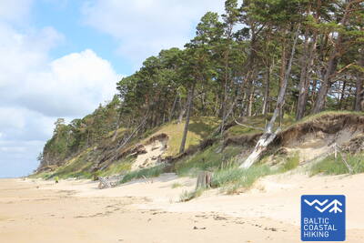
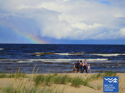
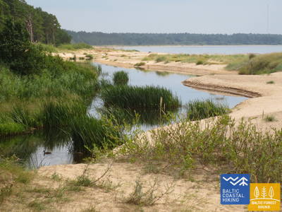
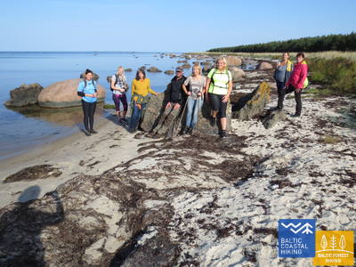
 Atkarpa 2. Pape - Bernāti.
Tolimiausias vakarų Latvijos taškas
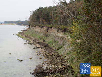
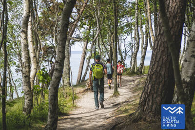
Visoje atkarpoje palei paplūdimį driekiasi Baltijos pajūrio žygių maršrutas. Papės apylinkėse paplūdimio pakrantę supa gražūs prieštakai, o toliau nuo kaimo virsta beveik 10 km nuplautu krantu, skersai tyvuliuojančių nulūžusių pušų. Prie Jūrmalciemo vėl atsiranda švelniai pasvirusios kopos. Pravažiavus Jūrmalciemą tęsiasi platūs uždumblėję paplūdimiai, tačiau priartėjus prie Bernati kyšulio prieš akis iškyla stulbinantis pušynu apaugęs ir retkarčiais nuplaunamas staigus.
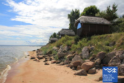
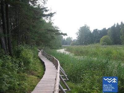
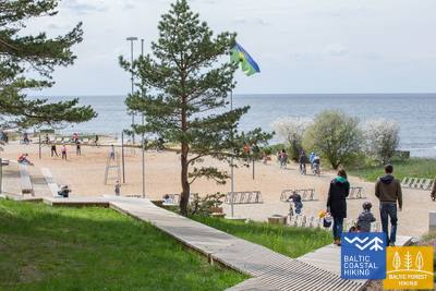
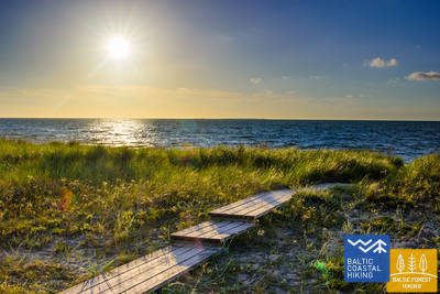
Bernāti Beach Boardwalk
Bernāti paplūdimio lentų takas yra maždaug 400 metrų ilgio viena kryptimi, o plotis nuo 1,2 iki 1,6 metro. Jis iš dalies pritaikytas žmonėms su vežimėliais ir rekomenduojamas su pagalba, nes nuolydžiai siekia iki 12 proc. Taip pat tinka tėvams su vežimėliais. Lentinio tako gale yra apžvalgos aikštelė ir poilsio zona. Sezono metu lentų takas yra pratęsiamas, kad neįgaliųjų vežimėliais galėtų pasiekti krantą. Prie lentinio tako yra automobilių stovėjimo aikštelė (GPS: 56.366156, 20.976715) ir sausas tualetas (nepritaikytas).


Atkarpa 2. Pape - Bernāti.
Tolimiausias vakarų Latvijos taškas
Visoje atkarpoje palei paplūdimį driekiasi Baltijos pajūrio žygių maršrutas. Papės apylinkėse paplūdimio pakrantę supa gražūs prieštakai, o toliau nuo kaimo virsta beveik 10 km nuplautu krantu, skersai tyvuliuojančių nulūžusių pušų. Prie Jūrmalciemo vėl atsiranda švelniai pasvirusios kopos. Pravažiavus Jūrmalciemą tęsiasi platūs uždumblėję paplūdimiai, tačiau priartėjus prie Bernati kyšulio prieš akis iškyla stulbinantis pušynu apaugęs ir retkarčiais nuplaunamas staigus.
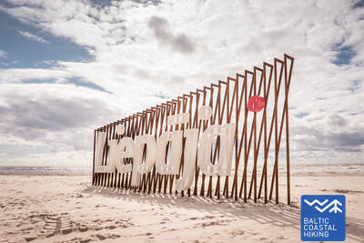
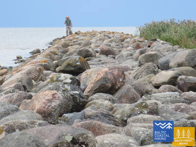
Atkarpa 3. Bernāti - Liepāja - Karosta (Karinis uostas).
Miestas, kuriame gimsta vėjas
Nuo Bernatų iki Liepojos Baltijos pajūrio pėsčiųjų maršrutas veda plačiu paplūdimiu, kur iš pradžių pakrantę formuoja išplautos krantai, tačiau artėjant prie Liepojos akyse iškyla aukšti priedangos, apaugusios smėlynėmis svidrėmis ir marražolėmis. Vėliau takas vingiuoja per Liepojos senamiestį ir „Naująją Liepoją“, kertant Karinio jūrų laivyno uosto kanalą ir pasiekti Karinių jūrų pajėgų uostą: karinių ir fortifikacinių pastatų kompleksą, kurio apžiūra, tikėtina, užtruks pusę dienos. Neabejotinai turėtumėte paragauti ypatingo Liepojos patiekalo, vadinamo Liepājas menciņi , pagamintą iš rūkytos menkės pagal senovinį Pietų Kuržemės receptą.
The hiking route "Hear, Smell, Touch Liepāja."
Sukurtas akliesiems ir silpnaregiams, maršrutą veda apmokytas aklas gidas. Tai apima apsilankymus svarbiose Liepojos kultūros ir istorijos vietose. Maršruto ilgis priklauso nuo grupės poreikių. Jis yra netoli Pajūrio tako. Liepojoje buvo sukurti keli lytėjimo žemėlapiai, padedantys žmonėms su regos negalia lengviau orientuotis.
Liepāja Beach near the Central Rescue Station
Liepojos paplūdimyje prie centrinės gelbėjimo stoties (GPS: 56.504199, 20.991922) įrengtas neįgaliesiems skirtas objektas. Jame yra dušai, persirengimo kambariai ir mediniai lentiniai takai, besitęsiantys iki jūros, leidžiantys neįgaliųjų vežimėliams pasiekti krantą. Galimi specialūs vežimėliai, tinkami maudytis jūroje. Akliesiems ir silpnaregiams jūroje įrengiami garso plūdurai, kurie signalais informuoja, kiek galima nuplaukti.


Liepāja Seaside Park.
Parke įrengtas maždaug 3 km ilgio takų tinklas, pritaikytas žmonėms su vežimėliais. Tako paviršiai skiriasi, įskaitant žvyrą, grindinį, lentų takus ir asfaltą. Yra poilsio zonos, vietos pavalgyti, automobilių stovėjimo aikštelės ir tualetai. Į parką galima patekti iš Liepų ir Peldu gatvių sankryžos (GPS: 56.506365, 20.997112). Jis yra netoli Pajūrio tako.


Liepāja Lake Boardwalk
Liepojos ežero lentų takas yra prieinamas žmonėms su vežimėliais ir tėvams su vežimėliais. Jis platus ir su briaunomis, besitęsiančiais į vieną pusę apie 400 metrų. Bokštas neprieinamas neįgaliųjų vežimėliams. Jis yra apie 2 km nuo Pajūrio tako, GPS: 56.494511, 21.024515.


Liepāja Lake Horse Island Trail
Liepojos ežero žirgų salos takas yra apie 2 km į vieną pusę. Tako pradžioje yra automobilių stovėjimo aikštelė (GPS: 56.516585, 21.032329) ir Dabasmāja – mokslo ir švietimo inovacijų centras (įrengtas rampas). Tako dangą pradžioje sudaro lentiniai takai, po kurių eina žvyruotas takas. Jį galima pasiekti žmonėms su vežimėliais, nors žvyro ruožas rekomenduojamas su pagalba. Jis yra už 1,3 km nuo Pajūrio tako.


Atkarpa 3. Bernāti - Liepāja - Karosta (Karinis uostas).
Miestas, kuriame gimsta vėjas
Nuo Bernatų iki Liepojos Baltijos pajūrio pėsčiųjų maršrutas veda plačiu paplūdimiu, kur iš pradžių pakrantę formuoja išplautos krantai, tačiau artėjant prie Liepojos akyse iškyla aukšti priedangos, apaugusios smėlynėmis svidrėmis ir marražolėmis. Vėliau takas vingiuoja per Liepojos senamiestį ir „Naująją Liepoją“, kertant Karinio jūrų laivyno uosto kanalą ir pasiekti Karinių jūrų pajėgų uostą: karinių ir fortifikacinių pastatų kompleksą, kurio apžiūra, tikėtina, užtruks pusę dienos. Neabejotinai turėtumėte paragauti ypatingo Liepojos patiekalo, vadinamo Liepājas menciņi , pagamintą iš rūkytos menkės pagal senovinį Pietų Kuržemės receptą.
 Atkarpa 5. Ziemupe - Pāvilosta.
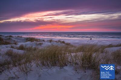
Dainuojantis smėlis ir gintaras
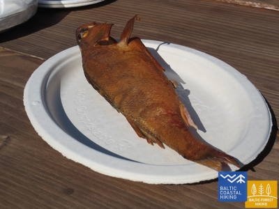
Šiame paplūdimyje retai lankosi žmonės, galima prisirinkti gintaro gabalėlių ir akmenukų su fosilijomis ir išgirsti po kojomis dainuojantį smėlį. Prie Žiemupės iškyla gražūs blefai, bet toliau prie Akmensrago ir Pavilostos yra gražių, retkarčiais nuplautų prietakų, apaugusių smėlinėmis svidrėmis ir marražolėmis. Vietomis matyti pilkos kopos. Akmenrago švyturys bus puiki vieta poilsiui. Pavilosta su savo provincijos žavesiu ir uosto kvapu bei rūkyta žuvimi sugrąžins Jus iš dykumos į civilizaciją.
Pāvilosta Pier Promenade
Maždaug 200 metrų ilgio Pavilostos kurmio promenados atkarpa yra prieinama žmonėms su vežimėliais, o pats kurmis – ne. Tinkamas atspirties taškas – Pavilostos kraštotyros muziejus (GPS: 56.889365, 21.172837). Jis yra šalia Pajūrio tako.


Pāvilosta Beach Boardwalk
Pavilostos paplūdimio lentinis takas lankytojus supažindina su Pilkosios kopos ir pakrantės kopų buveinėmis. Tai 1,2 metro pločio, pusės kilometro ilgio medinis lentų takas (atgal ir atgal). Takas prasideda nuo žvyro. Yra automobilių stovėjimo aikštelė (GPS: 56.892935, 21.185369). Takas yra prieinamas žmonėms su vežimėliais su pagalba, nes yra tam tikrų įkalnių ir nuokalnių. Prieiti prie kranto negalima.


Atkarpa 5. Ziemupe - Pāvilosta.
Dainuojantis smėlis ir gintaras
Šiame paplūdimyje retai lankosi žmonės, galima prisirinkti gintaro gabalėlių ir akmenukų su fosilijomis ir išgirsti po kojomis dainuojantį smėlį. Prie Žiemupės iškyla gražūs blefai, bet toliau prie Akmensrago ir Pavilostos yra gražių, retkarčiais nuplautų prietakų, apaugusių smėlinėmis svidrėmis ir marražolėmis. Vietomis matyti pilkos kopos. Akmenrago švyturys bus puiki vieta poilsiui. Pavilosta su savo provincijos žavesiu ir uosto kvapu bei rūkyta žuvimi sugrąžins Jus iš dykumos į civilizaciją.
 Atkarpa 6. Pāvilosta - Jūrkalne.
Įspūdingiausi Baltijos jūros šlaitai
Į šiaurės rytus nuo Pavilostos atsiveria puikūs vaizdai į pilkąsias kopas, o vos už poros kilometrų toliau matosi daugiau nei 20 km besitęsiančio vieno gražiausių Baltijos pajūrio pėsčiųjų maršruto atkarpų pradžia. Įdomiausias blefų peizažas yra netoli Strante ir Ulmale kaimų bei Ryvos upės žiočių. Daug kur vasarą pajūrio nuošliaužų apatinėje dalyje žydi orchidėjos. Jūrkalnėje ir jos apylinkėse matomi „du saulėlydžiai“: pirmasis iš paplūdimio ir antrasis po kelių akimirkų nuo blefo viršūnės.
Pāvilosta Beach Boardwalk
Pavilostos paplūdimio lentinis takas lankytojus supažindina su Pilkosios kopos ir pakrantės kopų buveinėmis. Tai 1,2 metro pločio, pusės kilometro ilgio medinis lentų takas (atgal ir atgal). Takas prasideda nuo žvyro. Yra automobilių stovėjimo aikštelė (GPS: 56.892935, 21.185369). Takas yra prieinamas žmonėms su vežimėliais su pagalba, nes yra tam tikrų įkalnių ir nuokalnių. Prieiti prie kranto negalima.
Pāvilosta Pier Promenade
Maždaug 200 metrų ilgio Pavilostos kurmio promenados atkarpa yra prieinama žmonėms su vežimėliais, o pats kurmis – ne. Tinkamas atspirties taškas – Pavilostos kraštotyros muziejus (GPS: 56.889365, 21.172837). Jis yra šalia Pajūrio tako.
Atkarpa 8. Sārnate - Užava.
Vaizdingiausias Latvijos pajūrio peizažas
Netoli Sarnatės vis dar matosi Baltijos jūros uolos, kurios šiaurės kryptimi pamažu nusileidžia ir pakeičiamos išplautos foredunių užtvanka. Tarp Vendzavo kaimo ir Užavos švyturio matosi gana neįprasti Latvijai pajūrio vaizdai, primenantys smėlėtas ir uolėtas dykumas su reta augmenija: čia buvo sovietų kariuomenės šaudymo aikštelė. Šioje vietoje ir už Užavos švyturio esančiose buvusių šaudyklų teritorijose dabar stūkso pilki priedangos. Artėjant prie Užavos upės žiočių paplūdimys tampa platesnis, o kopos – žemesnės. Nuo romantiško Užavos švyturio viršaus atsiveria gražiausi Baltijos pajūrio pėsčiųjų maršruto peizažai.
Užava Creek beach boardwalk
Lentų takas prie Užavos upės žiočių prie jūros – 0,5 km ilgio medinis takas, skirtas neįgaliųjų vežimėliams. Lentų takas yra 1,2 metro pločio, pakeliui yra pravažiavimų. Netoliese yra automobilių stovėjimo aikštelė (GPS: 57.247001, 21.414652). Palei taką įrengta poilsiavietė, nors neįgaliojo vežimėliu nepasiekiama, o prie jūros pakrantė negalima. Lentų takas yra greta Jūrtakos tako.


Atkarpa 9. Užava - Ventspils.
Surink savo gintaro kolekciją!
Šioje Baltijos pajūrio pėsčiųjų maršruto atkarpoje pirmieji 6 km – vienišas pajūrio ruožas su plačiu paplūdimiu ir žemomis prietakomis, kurių viršūnes dengia sidabrinio smėlio svidrės ir marraminės žolės kultivatoriai. Praplaukus Medolės upelį, prieš akis iškyla įspūdingas uolos (~ 19 m aukščio) su siauru uolėtu paplūdimiu po juo. Blefas greitai susitraukia ir vėl pakyla dviem kilometrais toliau. Tarp blefų yra buvusi sovietų kariuomenės šaudykla. Paskutiniai penki Baltijos pajūrio pėsčiųjų maršruto kilometrai iki Ventspilio pietinio molo veda plačiu smėlio paplūdimiu, kurio pakrantės pusę riboja pilkųjų kopų biotopai.
Ventspils Seaside Park
Ventspilio pajūrio parke yra apie 3,5 km ilgio takų tinklas, įskaitant 730 m ilgio Inkarų taką. Takai (išskyrus Džiunglių taką) prieinami žmonėms su vežimėliais ir tėvams su vežimėliais. Tako danga sudaryta iš žvyro ir asfalto (pradžioje). Patogus atspirties taškas tyrinėti parką yra Parka ir Loču gatvių sankryža (GPS: 57.389279, 21.537021), kur yra automobilių stovėjimo aikštelė ir WC. Parkas yra šalia Jūrtakos tako. Žmonėms su vežimėliais ir tėvams su vežimėliais tinkamiausia prieiga prie jūros yra parke esantis 6 įėjimas.
Atkarpa 9. Užava - Ventspils.
Surink savo gintaro kolekciją!
Šioje Baltijos pajūrio pėsčiųjų maršruto atkarpoje pirmieji 6 km – vienišas pajūrio ruožas su plačiu paplūdimiu ir žemomis prietakomis, kurių viršūnes dengia sidabrinio smėlio svidrės ir marraminės žolės kultivatoriai. Praplaukus Medolės upelį, prieš akis iškyla įspūdingas uolos (~ 19 m aukščio) su siauru uolėtu paplūdimiu po juo. Blefas greitai susitraukia ir vėl pakyla dviem kilometrais toliau. Tarp blefų yra buvusi sovietų kariuomenės šaudykla. Paskutiniai penki Baltijos pajūrio pėsčiųjų maršruto kilometrai iki Ventspilio pietinio molo veda plačiu smėlio paplūdimiu, kurio pakrantės pusę riboja pilkųjų kopų biotopai.
Atkarpa 10. Ventspils - Staldzene.
Ventspilio miestu
Maršrutas driekiasi per Ventspilį ir aplinkinius miškus. Baltijos pajūrio pėsčiųjų maršrutas vingiuoja nuo pietinio molo per istorinį Ostgalą ir senamiestį, kerta Ventos upę ir tęsiasi per Parventos rajoną pėsčiųjų ir dviratininkų taku Staldzenės kryptimi, kur apvažiuoja Ventspilio uostą ir grįžta į jūros pakrantė. Verta pasiimti vieną „laisvą dieną“ ir susipažinti su įdomiausiomis miesto vietomis, taip pat apsilankyti Pajūrio muziejuje po atviru dangumi.
Lake Būšnieki Nature Trail
Takas aplink Būšniekų ežerą yra 9 km ilgio kilpa, prieinama neįgaliųjų vežimėliams ir tėvams su vežimėliais. Jame yra garso vadovas, lytėjimo informacija ir automobilių stovėjimo aikštelė žmonėms su judėjimo negalia. Rekomenduojamas atspirties taškas yra automobilių stovėjimo aikštelė pietrytinėje ežero pusėje (GPS: 57.437632, 21.656062). Takas yra apie 1 km nuo Jūrtakos tako.


Atkarpa 15. Saunags kaimas – Kolka.
Europos širdis: Kolka iškyšulys
Baltijos pajūrio žygių maršrutas vingiuoja nedideliais kaimo ir miško keliukais nuo Saunago kaimo iki Vaidės kaimo, kur vėl grįžta į pajūrį. Platūs smėlio paplūdimiai driekiasi iki Kolkos kyšulio, virsdami žemais retais fortūnais; Už jų tęsiasi miškingos pajūrio kopos. Maždaug 2 km ilgio nuplautos kopos, o paskui – Dumbrkalnų kalvos. Kolkos kyšulys, Didžiosios jūros susiliejimo su Mažąja jūra vieta, yra viena populiariausių paukščių stebėjimo vietų Baltijos pajūryje.
Kolka Pine Trail
1,8 km ilgio takas skirtas pakrantės kopų biologinei įvairovei tyrinėti. Jame yra dvi stebėjimo platformos, kurios yra prieinamos žmonėms su vežimėliais. Sausieji tualetai iš dalies pritaikyti asmenims, turintiems funkcinių sutrikimų. Yra automobilių stovėjimo aikštelė (GPS: 57.756668, 22.591180). Takas yra šalia Jūrtakos tako.


Atkarpa 16. Kolka - Ģipka.
Palei "uždarą pakrantę"
Ties Kolkos kyšuliu, pasukus link įlankos, aiškiai matosi skirtumas tarp „Didžiosios jūros“ ir „Mažosios jūros“. Pirmieji 10 km Baltijos pakrantės pėsčiųjų maršruto veda per Šliterės nacionalinio parko pakrantės zoną: pirmiausia pro pušų, įplauktų į jūrą, pastatą, buvusį žvejų kolchozo pastatą, laivų krantinę ir Ēvaži Bluff. apsuptas neįprastai siauro smėlėto paplūdimio su pakibusiais juodalksniais. Kitoje tako atkarpoje, vedančioje į Ģipką, taip pat yra siauras smėlėtas paplūdimys su baseinais, kuriuos sukuria gausūs šaltiniai ir vasarą seklių upelių žiotys. Sovietmečiu Šliterės nacionalinio parko pajūris buvo uždara teritorija dėl dviejų priežasčių: pasienio zona ir gamtos rezervatas.
Ēvažu Nature Trail
Takas skirtas apžiūrėti vieną iš retų stačių Rygos įlankos pakrančių. Vežimėliai gali patekti į apžvalgos aikštelę, nuo kurios atsiveria vaizdas į Rygos įlanką. Takas yra 1,2 km į abi puses. Paviršiaus pradžioje yra žvyras, po kurio eina susidėvėjęs takas, o šalia stačios pakrantės – lentiniai takai su laiptais. Priešingoje kelio Tukums - Kolka pusėje yra automobilių stovėjimo aikštelė (GPS: 57.677789, 22.567982). Takas yra greta Jūrtakos tako.


Atkarpa 17. Ģipka - Kaltene.
Akmenuotas Kuržemės paplūdimys
Nuo Ģipkos iki Rojos driekiasi ne per platus smėlio paplūdimys su gražiomis kopomis ir pakrantės pušynais, tačiau dar nepasiekus Rojos apauga nendrėmis. Atvirkščiai, atkarpa tarp Rojos ir Kaltenės bažnyčios yra viena išskirtiniausių Latvijos pajūrio dalių, kur pakrantę raižo nedideli kyšuliai ir įlankelės su labai siauru paplūdimiu. Visoje pakrantėje – krūvos įvairaus dydžio riedulių, ant kurių kabo žalia juodalksnių lapija. Vietomis prieš akis iškyla į krantą išplautų medžių stambios gumbuotos šaknų sistemos. Vietomis palei pakrantę eina neasfaltuotas kelias, o šalia rikiuojasi daug buvusių žvejų sodybų.
Walking Path at Roja Beach
Mediniai lentų takai skirti neįgaliųjų vežimėliams ir tėvams su vežimėliais. Yra informacinis stendas Brailio raštu ir liečiamas paplūdimio žemėlapis. Priemonėse yra pritaikytas WC ir automobilių stovėjimo aikštelė (GPS: 57.510088, 22.799207). Lentinio tako ilgis į vieną pusę 0,5 km. Neįgaliųjų vežimėlių naudotojai gali važiuoti lentiniais takais, tačiau jie negali pasiekti jūros, nes nėra rampos. Lentiniai takai platūs, su apsauginiais turėklais šonuose ir pravažiavimo aikštelėse.


Atkarpa 17. Ģipka - Kaltene.
Akmenuotas Kuržemės paplūdimys
Nuo Ģipkos iki Rojos driekiasi ne per platus smėlio paplūdimys su gražiomis kopomis ir pakrantės pušynais, tačiau dar nepasiekus Rojos apauga nendrėmis. Atvirkščiai, atkarpa tarp Rojos ir Kaltenės bažnyčios yra viena išskirtiniausių Latvijos pajūrio dalių, kur pakrantę raižo nedideli kyšuliai ir įlankelės su labai siauru paplūdimiu. Visoje pakrantėje – krūvos įvairaus dydžio riedulių, ant kurių kabo žalia juodalksnių lapija. Vietomis prieš akis iškyla į krantą išplautų medžių stambios gumbuotos šaknų sistemos. Vietomis palei pakrantę eina neasfaltuotas kelias, o šalia rikiuojasi daug buvusių žvejų sodybų.
Atkarpa 18. Kaltene - Mērsrags.
Įvairialypis krantas
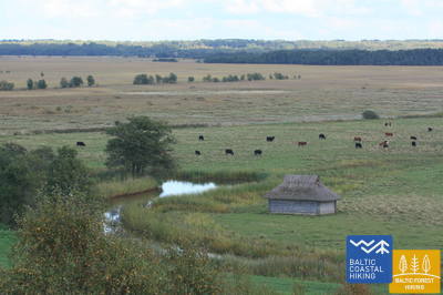
Išties įvairiapusė Baltijos pajūrio pėsčiųjų maršruto atkarpa gamtos, kultūros istorijos ir kraštovaizdžiu. Netoli Kaltenės kaimo pajūris išmargintas mažomis įlankelėmis su uolėtais paplūdimiais, po kurių eina tankiai apaugusi pakrantė, kur per nendres ir vešlią augmeniją vingiuoja siauras takelis. Toliau akmenimis apaugusi jūros pakrantė vos poros metrų pločio, vietomis molio sluoksnių, nendrių laukų, kitur išklota į krantą išplautų dumblių kilimu. Tarp Valgalciemo kaimo ir Mērsrago kaimo vėl atsiranda smėlio paplūdimiai su seklumomis jūroje. Pravažiavus Mērsrags kaimą, maršrutas tęsiasi keliu, bet pasiekus liuteronų bažnyčią pasuka į jūrą ir eina pamario pievomis iki pat Mērsrags kaimo centro.
Boardwalk in Upesgrīva
Įsikūręs tarp Lūši kempingo ir jūros (GPS: 57.381441, 23.025370). Lentų takui trūksta šoninių bėgių ir pravažiavimo zonų. Jį gali pasiekti neįgaliojo vežimėlio naudotojai su asistentu. Jo ilgis yra apie 90 metrų viena kryptimi. Jis nesuteikia prieigos prie jūros kranto. Jis yra netoli Pajūrio tako (Jūrtaka).


Boardwalk near Mērsrags Lighthouse
Įsikūręs Bākas g. 60. Lentiniu taku neįgaliojo vežimėliuose galima keliauti iš automobilių stovėjimo aikštelės (GPS: 57.365315, 23.120436) iki kopų, kur matosi jūra. Lentų takas turi dalinę krašto apsaugą ir jame nėra apsisukimo zonų. Ilgis apie 150 m (kelionė pirmyn ir atgal). Jis yra netoli Pakrantės tako.


Atkarpa 19. Mērsrags - Engure.
Engurės gamtos parke
Iš kaimo centro į paplūdimį veda pušų apsuptas miško takas. Toliau Baltijos pajūrio žygių maršrutas vingiuoja tarp uolėtos pajūrio, gausiai apaugusios nendrėmis ir kitomis žolėmis vienoje pusėje, o kitoje – miškingų pajūrio kopų. Vietomis paplūdimys grįstas smulkiais apvaliais akmenėliais, kitur matosi pilkos kopos su gausia augalų įvairove. Netoli Bėrzciemo kaimo yra didelės pakrantės pievos su toli jūroje iškylančiomis seklumomis, tinkamomis paukščių stebėjimui. Apaugusi jūros pakrantė tęsiasi iki Abragciemo kaimo, o nuo Abragciemo iki Engurės yra paplūdimys.
Engure Nature Trail
Nuo Slimnīcas gatvėje esančios automobilių stovėjimo aikštelės (GPS: 57.171428, 23.222504) medinis lentų takas driekiasi per kopas iki jūros, suprojektuotas taip, kad būtų pritaikytas neįgaliųjų vežimėliams. Dėl nuolydžio gali prireikti pagalbos. Takas yra apie 200 metrų į vieną pusę. Jis yra šalia Pajūrio tako (Jūrtaka).


Atkarpa 20. Engure - Ragaciems.
Žvejų kaimai ir rūkyta žuvis
Iš pradžių Baltijos pajūrio pėsčiųjų maršrutas vingiuoja per Engurės kaimą, tada iš vienos pusės veda per palyginti siaurą paplūdimį, o kitoje pusėje – gražias sumedėjusias pajūrio kopas ir pasiekia Plienciemo kopą, po kurios smėlėtas paplūdimys tampa vis platesnis ir jūroje atsiranda didelių seklumos. . Pakrantėje prieš akis iškyla apaugę slenksčiai su laiptais ir lentų takais, kurie driekiasi iki pat kelio, jungiančio Kolką ir Tukumą. Reikia atsižvelgti į tai, kad šiltomis vasaros dienomis čia užsuka daug poilsiautojų. Paskutinis maršruto trečdalis yra Ķemeri nacionaliniame parke.
Apšuciems
Apšucieme yra du plaukiojantys paplūdimio vežimėliai žmonėms su judėjimo negalia. Juos galima gauti Apšuciemo mokykloje iš anksto susitarus telefonu +371 26132761. Naudotojai turi pasirūpinti savo asistentu, kuris padėtų patekti į vandenį ir iš jo, plaukti ir grįžti. Galimos ir gelbėjimosi liemenės. 2025 m. planuojama įrengti prieigą prie jūros, kuri apims prieigą prie neįgaliųjų vežimėlių, liemenes, persirengimo kabinas ir specializuotus deginimosi kilimėlius. Su pagalba bus įmanomos nedidelės išvykos palei kieto smėlio pakrantės dalį. Tai yra Baltijos jūros taku.

Plieņciemo baltųjų kopų pasienio takas
Takas yra prie pietinės Plieņciemo ribos, einantis Rygos-Engurės kryptimi.
Plieņciemo pavadinimas kilęs iš baltiško žodžio „pliens“ - kalkakmenis arba mergelis. Pirmą kartą dokumentuose kaimas paminėtas dar 1551 m., tačiau žemėlapiuose kaip apgyvendinta vietovė jis atsiranda nuo 1702 m. XVIII a. viduryje Engure parapijos registre minima, kad Plieņcieme buvo devyni ūkiai, kurie turėjo teisę žvejoti jūroje ir Engure ežere, taip pat rinkti jūros žolę.
Nuo kelio į jūrą veda takas, vedantis pėsčiuosius per kopų pylimą. Tako danga suprojektuota taip, kad juo galėtų naudotis neįgaliojo vežimėliu judantys asmenys (pageidautina su palydovu) ir šeimos su vaikais vežimėliuose. Paplūdimyje yra persirengimo kabina ir nedidelė žaidimų aikštelė. Take nėra nustatytos vietos, kurioje būtų galima apsikeisti vietomis su priešpriešiais atvažiuojančiais automobiliais.


Atkarpa 20. Engure - Ragaciems.
Žvejų kaimai ir rūkyta žuvis
Iš pradžių Baltijos pajūrio pėsčiųjų maršrutas vingiuoja per Engurės kaimą, tada iš vienos pusės veda per palyginti siaurą paplūdimį, o kitoje pusėje – gražias sumedėjusias pajūrio kopas ir pasiekia Plienciemo kopą, po kurios smėlėtas paplūdimys tampa vis platesnis ir jūroje atsiranda didelių seklumos. . Pakrantėje prieš akis iškyla apaugę slenksčiai su laiptais ir lentų takais, kurie driekiasi iki pat kelio, jungiančio Kolką ir Tukumą. Reikia atsižvelgti į tai, kad šiltomis vasaros dienomis čia užsuka daug poilsiautojų. Paskutinis maršruto trečdalis yra Ķemeri nacionaliniame parke.
Atkarpa 21. Ragaciems - Dubulti.
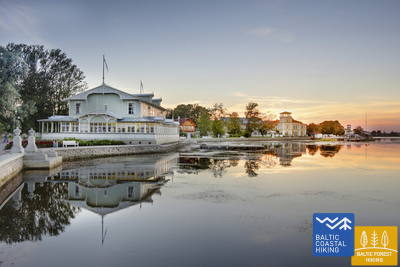
Istorinis Jūrmalos kurortas
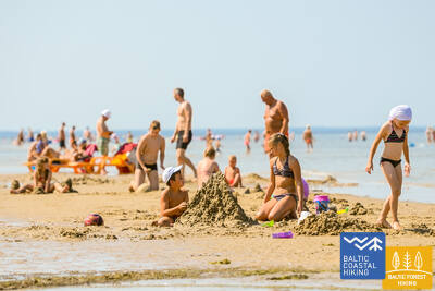
Ragaciemo kaime aiškiai matosi visa Jūrmalos pakrantė. Pirmasis šios dienos maršruto trečdalis – Ķemerių nacionalinio parko dalis, kur galima pažinti istorinius žvejų kaimelius, Ragaciemo kaimo žvejų zoną su tinkliniais nameliais ir žuvų turgumi, kopų buveines, taip pat stebėti paukščius žiotyse. Starpiņupės upė. Pradedant nuo Jaunķemeri iki Dubultų, pėsčiomis pasieksite plačiausią smėlėtą Rygos įlankos paplūdimį per istorinį Jūrmalos kurortą ir ilgiausią Latvijos miestą. Turėkite omenyje, kad šiltomis ir saulėtomis vasaros dienomis paplūdimyje bus daug lankytojų.
Jūrmalas pilsētas pludmales
Jūrmalos miesto paplūdimiai yra prieinami žmonėms, turintiems funkcinių sutrikimų, įskaitant neįgaliųjų vežimėlius ir senjorus. Jūrmaloje yra 14 neįgaliųjų vežimėliams pritaikytų prieigos prie jūros taškų: 36 linija, Vienības prospekts (2 prieigos taškai), Turaidas iela (2 prieigos taškai), Pilsonu iela, Baznīcas iela, Kļavu iela, Līgatnes iela, Dzimtenes iela, Vēju iela iela, Atbalss iela, Kapteiņa Zolta iela ir Jaunķemeri kelias. Šie prieigos taškai, atsižvelgiant į paviršių ir reljefą, sukurti taip, kad būtų tinkami tiek žmonėms, turintiems funkcinių sutrikimų, tiek su vežimėliais. Be to, yra keturios vietos – Vaivari, Kaugguri, Jaunķemeri ir Jaundubulti – kur yra išplėstos ir patogesnės persirengimo kabinos.
Kupskalni Nature Trail
Takas tęsiasi pusę kilometro dešiniuoju Siliņupės upės krantu ir veda nuo kelio Sloka-Talsi iki jūros. Jį iš dalies gali pasiekti žmonės vežimėliuose su pagalba, nes tako pradžioje gali trukdyti medžių šaknys. Tolimesnė tako atkarpa (platūs lentiniai takai su pravažiavimo vietomis) pasiekiama. Galimas dalinis tualeto prieinamumas. Pasivaikščiojimą galima pradėti iš netoliese esančios degalinės (GPS: 56.992203, 23.522736).


Atkarpa 22. Dubulti - Lielupe - Bulduri.
Populiariausi paplūdimiai Latvijoje
Plačiausias Rygos įlankos smėlio paplūdimys driekiasi nuo Dubultų iki Lielupės upės. Tai didžiausia Jūrmalos kurorto vertybė, siūlanti daugybę paplūdimio kavinių ir įvairių poilsio galimybių. Pakrantės kopų miškus juosia tankus takų tinklas, skirtas tiek pasivaikščiojimams, tiek šiaurietiškam ėjimui. Jūrų tako dalis nuo Lielupės paplūdimio iki Jūrmalos buities muziejaus priskiriama Ragakapos gamtos parkui. Iš čia atgal į Buldurus galima patogiai patekti einant Buldurų prospektu ir 5. līnija.
Jūrmalas pilsētas pludmales
Jūrmalos miesto paplūdimiai yra prieinami žmonėms, turintiems funkcinių sutrikimų, įskaitant neįgaliųjų vežimėlius ir senjorus. Jūrmaloje yra 14 neįgaliųjų vežimėliams pritaikytų prieigos prie jūros taškų: 36 linija, Vienības prospekts (2 prieigos taškai), Turaidas iela (2 prieigos taškai), Pilsonu iela, Baznīcas iela, Kļavu iela, Līgatnes iela, Dzimtenes iela, Vēju iela iela, Atbalss iela, Kapteiņa Zolta iela ir Jaunķemeri kelias. Šie prieigos taškai, atsižvelgiant į paviršių ir reljefą, sukurti taip, kad būtų tinkami tiek žmonėms, turintiems funkcinių sutrikimų, tiek su vežimėliais. Be to, yra keturios vietos – Vaivari, Kaugguri, Jaunķemeri ir Jaundubulti – kur yra išplėstos ir patogesnės persirengimo kabinos.
Atkarpa 23. Buldurai – Rygos centras.
Per miškus į Rygą
Maršrutas yra alternatyvus būdas, norint iš Jūrmalos patekti į Rygą, einant mišku. Už Lielupės tilto Jūrų takas vingiuoja per Priedainę, kurioje galima pasigėrėti mediniais pastatais. Toliau maršrutas eina lygiagrečiai dešiniajam Lielupės krantui, tada pasuka palei pietinę Bolderajas kopos dalį ir kerta Kleistų mišką, vingiuodamas palei Lačupės kapines. Istoriniais Pardaugavos keliais – Buļļu ir Daugavgrīvas gatvėmis per Dzegužkalną, palei Zunda kanalą ir Agenskalno įlanką veda iki Dauguvos, kur Akmens tiltu kerta Dauguvą ir sustoja Rygos Rotušės aikštėje.
Jūrmalas pilsētas pludmales
Jūrmalos miesto paplūdimiai yra prieinami žmonėms, turintiems funkcinių sutrikimų, įskaitant neįgaliųjų vežimėlius ir senjorus. Jūrmaloje yra 14 neįgaliųjų vežimėliams pritaikytų prieigos prie jūros taškų: 36 linija, Vienības prospekts (2 prieigos taškai), Turaidas iela (2 prieigos taškai), Pilsonu iela, Baznīcas iela, Kļavu iela, Līgatnes iela, Dzimtenes iela, Vēju iela iela, Atbalss iela, Kapteiņa Zolta iela ir Jaunķemeri kelias. Šie prieigos taškai, atsižvelgiant į paviršių ir reljefą, sukurti taip, kad būtų tinkami tiek žmonėms, turintiems funkcinių sutrikimų, tiek su vežimėliais. Be to, yra keturios vietos – Vaivari, Kaugguri, Jaunķemeri ir Jaundubulti – kur yra išplėstos ir patogesnės persirengimo kabinos.
Babīte Rhododendron Nursery
Įrengtas 1,9 kilometro ilgio takas, prieinamas žmonėms su vežimėliais ir tėvams su vežimėliais. Tako danga asfaltuota. Yra numatyta automobilių stovėjimo aikštelė (GPS: 56.962330, 23.952280) ir pritaikytas tualetas. Takas yra apie 2,7 kilometro nuo Jūrtakos tako.
Daugavgrīva Nature Trail
Takas prasideda automobilių stovėjimo aikštelėje (GPS: 57.036769, 24.018166), netoli Valentīna Pikuļa gatvės ir veda per Daugavgryvos pelkę iki kopų ir jūros. Tako danga prie jūros yra asfaltuota, o asfaltuota atkarpa yra prieinama žmonėms su vežimėliais. Palei taką pastatytas paukščių stebėjimo bokštas, kurio pirmas aukštas pritaikytas žmonėms su vežimėliais. Takas yra apie 12,5 kilometro nuo Jūrtakos tako, esančio Daugavgryvoje, jūros pakrantėje.

Atkarpa 24. Rygos centras - Vecāķi.
Rygos senamiestis - UNESCO pasaulio paveldo objektas
Iš pradžių kelionės programa nuves jus į nedidelį pasivaikščiojimą po Rygos centrą, Rygos senamiestį, veda palei miesto kanalą per Kronvalds parką, per Alberta gatvę (Art Nouveau pastatai) ir toliau per Miera gatvę per Lielie kapi kapines, per Kokneses ir Ostas prospektu per Mežaparką ir tada pasiekia Jaunmīlgrāvį ir kerta Mīlgravį . Toliau vingiuoja Vecāķu prospektu iki Ziemeļblāzmos ir Senosios Dauguvos (Vecdaugavos) krantų, kuriuos nuo Vecākių skiria vos pora kilometrų. Po dviejų dienų žygio per Rygą Baltijos pakrantės žygių maršrutas vėl nuves į paplūdimį.
Mangaļsala walking paths
Du Mangaļsalos takai veda per kopas ir pakrantės miškus iki jūros. Pirmasis takas (GPS: 57.071642, 24.087599) rekomenduojamas žmonėms su vežimėliais su asistentu, nes jis veda prie jūros, bet nesuteikia tiesioginio priėjimo prie paplūdimio. Antrasis takas (GPS: 57.062730, 24.055460) prasideda kaip purvo kelias, o vėliau tęsiasi kaip platus medinis lentų takas, leidžiantis neįgaliųjų vežimėliams pasiekti paplūdimį. Trečiasis takas (GPS: 57.061976, 24.041811) veda į Rytų molą. Nors jis nėra specialiai sukurtas neįgaliųjų vežimėliams, jį galima važiuoti su pagalba, įskaitant pačią prieplauką, išskyrus stiprų vėją ar audras. Tiek pirmame, tiek antrame take yra automobilių stovėjimo aikštelė ir tualetas. Artimiausias takas yra maždaug už 3,5 km nuo Jūrtakos.


Atkarpa 25. Vecāķi - Carnikava.
Tarp dviejų upių - Dauguvos ir Gaujos - žiočių
Šios Baltijos pajūrio žygių maršruto atkarpos – tai palyginti trumpas žygis nuostabiu smėlio paplūdimiu, kurio pakrantės pusę riboja ryškiaspalviai pušynai su įspūdingomis kopomis ir kopų užtvankomis. Norėdami patekti iš paplūdimio į Carnikavą, Baltijos pajūrio pėsčiųjų maršrutas nuves jus per mišką promenada. Tada per užtvanką pasivaikščiojama aplink Senąją Gaują ir pasiekiamas pėsčiųjų tiltas per Gaują. Pradedant ir baigiant žygį malonu prisėsti vienoje iš Vecāķi paplūdimyje ir Carnikavos mieste esančių užeigų ir vasaros kavinių.
Garciems nature trail
Lentų takas veda prie Eimurio kanalo žiočių prie jūros. Lentinio tako galas yra arti kranto, o su asistento pagalba galbūt pavyks pasiekti jūrą. Tinka žmonėms su vežimėliais ir tėvams su vežimėliais. Yra automobilių stovėjimo aikštelė (GPS: 57.108161, 24.192324) ir WC. Ilgis viena kryptimi 0,7 km. Jis yra šalia Jūrtakos.
Carnikava Promenade
Sujungia Carnikavą su jūros pakrante. Takas asfaltuotas, bet smėlynuose - mediniais liepteliais. Pajūryje įrengti takai ir apžvalgos aikštelės su gultais. Tako ilgis viena kryptimi – 1,8 km. Į jį gali patekti žmonės vežimėliuose ir tėvai su vežimėliais. Sukurta automobilių stovėjimo aikštelė (GPS: 57.133531, 24.265631) Laivų gatvėje, pritaikytas WC, informaciniai stendai ir poilsio aikštelės. Smėlėta pajūrio zona neprieinama neįgaliųjų vežimėliams. Paskutinė promenados atkarpa turi 9,2% nuolydį. Jurtaka juda Carnikavos promenada. 2024/2025 m g. Carnikavos promenadoje planuojama sukurti specialų maršrutą specializuotiems bekelės vežimėliams, kuriais galės naudotis jų naudotojai kartu su asistentu.


Atkarpa 26. Carnikava - Saulkrasti.
Saulėlydžio takas, užburiantis romantiškais vaizdais
Iš pradžių maršrutas veda per Gaujos upės užtvankas Gaujos kaime iki Gaujos upės žiočių, kuri yra gera vieta paukščių stebėjimui. Žygis tęsiasi smėlėtu paplūdimiu iki Inčupės upės žiočių, prieš kurią reikia pasukti į sausumą, kad patektumėte iki tilto ir įveiktumėte artimiausius porą kilometrų miškingomis Saulėlydžio tako kopų viršūnėmis su vaizdu į papludimys. Perplaukus Pēterupės upę (lynų tiltą), Baltijos pajūrio žygių maršrutas tęsiasi palei paplūdimį ir pasiekia Jūrų parką Saulkrastuose.
Lilaste Beach
Veža prie jūros. Jo ilgis viena kryptimi – 130 m. Prasideda prie automobilių stovėjimo aikštelės (GPS: 57.187403, 24.329523), iš kurios su asistento pagalba į paplūdimį gali patekti žmogus vežimėlyje. Jis yra šalia Jurtakos.

White Dune
Viena vaizdingiausių Rygos įlankos kopų. Prie apžvalgos platformos iš automobilių stovėjimo aikštelės gali patekti žmonės vežimėliuose su padėjėju (GPS: 57.233560, 24.393407). Balta kapa yra Jūrtakos maršruto dalis.
Path and wooden boardwalk network in the coastal dunes of Saulkrasti
Tarp Raiņa gatvės ir Bīriņu gatvių (Jūros parkas, Saulkrastų turizmo informacijos centras) esantis takas pritaikytas neįgaliųjų vežimėliams ir tėvams su vežimėliais. Jis eina lygiagrečiai su Jūrtakos taku. Lengviausias privažiavimas prie tako ir lentinio tako yra iš automobilių stovėjimo aikštelės (GPS: 57.267111, 24.413875).


Atkarpa 26. Carnikava - Saulkrasti.
Saulėlydžio takas, užburiantis romantiškais vaizdais
Iš pradžių maršrutas veda per Gaujos upės užtvankas Gaujos kaime iki Gaujos upės žiočių, kuri yra gera vieta paukščių stebėjimui. Žygis tęsiasi smėlėtu paplūdimiu iki Inčupės upės žiočių, prieš kurią reikia pasukti į sausumą, kad patektumėte iki tilto ir įveiktumėte artimiausius porą kilometrų miškingomis Saulėlydžio tako kopų viršūnėmis su vaizdu į papludimys. Perplaukus Pēterupės upę (lynų tiltą), Baltijos pajūrio žygių maršrutas tęsiasi palei paplūdimį ir pasiekia Jūrų parką Saulkrastuose.
Atkarpa 27. Saulkrasti – Lauči.
"Vartai" į uolėtą Vidžemės pakrantę
Pirmuosius kilometrus iki Žvejniekciemo galima įveikti paplūdimiu arba taku, vingiuojančiu per kopų mišką su senomis pušimis, kurių žievė atrodo kaip krokodilo oda. Čia taip pat galima pamatyti seną medinę trobelę su žvejybos tinklais ir įrankiais. Dar nepasiekus Skultės uosto, Žvejniekciemo paplūdimyje pasirodo pirmosios uolos. Apvažiavus Age upės žiotis ir uostą, Baltijos pakrantės pėsčiųjų maršrutas grįžta į paplūdimį, kur jau iš tolo matosi Arnių kyšulys, o už jo atsiveria rudas Didžiojo Lauči jūros riedulio nugara. Įvairūs pakrančių kraštovaizdžiai.
Path and wooden boardwalk network in the coastal dunes of Saulkrasti
Tarp Raiņa gatvės ir Bīriņu gatvių (Jūros parkas, Saulkrastų turizmo informacijos centras) esantis takas pritaikytas neįgaliųjų vežimėliams ir tėvams su vežimėliais. Jis eina lygiagrečiai su Jūrtakos taku. Lengviausias privažiavimas prie tako ir lentinio tako yra iš automobilių stovėjimo aikštelės (GPS: 57.267111, 24.413875).
Atkarpa 28. Lauči - Tūja.
Burlaivių laikus prisimenant...
Ši Vidžemės pajūrio atkarpa yra išskirtinio vaizdingo grožio, jūroje daug uolėtų kyšulių ir riedulių, besikeičiančių su mažomis smėlėtomis įlankomis, į kurias įteka vasarą išdžiūvantys upeliai ir upeliai. Retkarčiais paplūdimį visiškai dengia pilkos akmenų nugarėlės. Vietomis išryškėja nedideli nendrių lopinėliai, o prie Tūjos pamatysite pirmąsias smiltainio atodangas.
Munchausen’s Beer Mug Trail
1,3 km ilgio takas (į vieną pusę) yra Duntės dvare ir prasideda netoli Minhauzens muziejaus. Tako paviršių sudaro 1,5 metro pločio mediniai lentų takai su keliomis pravažiavimo zonomis. Pradėti tyrinėti taką patogu nuo automobilių stovėjimo aikštelės (GPS: 57.405620, 24.424681). Takas yra 1,7 km nuo Jūrtakos tako.
Atkarpa 29. Tūja - Svētciems.
Uolėtas Vidžemės paplūdimys
Viena gražiausių Baltijos pajūrio pėsčiųjų maršruto atkarpų, kuri prasideda kertant Zaķupytės upę. Iki Ķurmrags švyturio daugiausia yra smėlio paplūdimių su nedidelėmis akmenų dalimis. Toliau prasideda Vidžemės uolėtas pajūris: kyšuliai kaitaliojasi su nedidelėmis įlankomis, o pakrantėje išnyra 4 m aukščio smiltainio atodangos. Pravažiavus Meleki kyšulį ir toliau vyrauja smėlio paplūdimiai, o prieš Šventupės žiotis paplūdimys yra tankiai apaugęs ir nendrėtas, todėl jį reikia aplenkti miško taku.
Rest area "Vasas"
Sukurta apžvalgos aikštelė ir automobilių stovėjimo aikštelė (GPS: 57.520544, 24.379052), prieinama žmonėms su vežimėliais. Jis yra šalia Jūrtakos tako.
Veczemju Cliffs
Netoli Veczemju uolų yra rampa, skirta neįgaliųjų vežimėliams su pagalba. Tačiau paplūdimio smėlis nepritaikytas neįgaliųjų vežimėliams. Audros dažnai pažeidžia rampos pagrindą. Jis yra šalia Baltijos pajūrio pėsčiųjų tako (Jūrtaka).


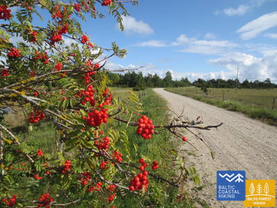
Atkarpa 30. Svētciems - Ainaži.
Nėgių karalystė
Paplūdimys tarp Svētciemo kaimo ir Salacgryvos yra tankiai apaugęs, todėl Baltijos pajūrio žygių maršrutas tęsiasi miško takeliu, vingiuojančiu tarp kopų. Iš Salacgrivos į Kuivižius galite nuvykti smėlio paplūdimiu arba miško takais. Nuo Kuivižių iki Vėverupės upės Randu pievas tenka aplenkti miško keliuku, esančiu rytinėje A1 kelio pusėje. Pravažiavus Vēverupės upę, Baltijos pakrantės žygių maršrutas grįžta į tankiai apaugusį paplūdimį ir iš jo išeina šalia Blusupites upės žiočių, kad pasiektų Ainaži prieplauką, eidami Kāpu ir Valdemāra gatve. Latvijoje įveikėte ~ 580 km ir pasiekėte valstybės sieną.
Salacgrīvas promenade
Maždaug 260 metrų ilgio sutvarkyta promenada (įskaitant Slavų alėją) palei dešinįjį Salacos upės krantą yra prieinama neįgaliųjų vežimėliams su pagalbininko pagalba. Pradėti tyrinėti galite nuo automobilių stovėjimo aikštelės (GPS: 57.756060, 24.358155). Jis yra šalia Baltijos pajūrio pėsčiųjų tako (Jūrtaka).


Monument "White Sun"
Įsikūręs Ainažuose. Jį apžiūrėti sukurtas maždaug 150 metrų ilgio medinis takas (pradedantis GPS: 57.859628, 24.347306). Jį gali pasiekti neįgaliojo vežimėlio naudotojai su pagalba ir tėvai su vežimėliais. Atstumas nuo automobilių stovėjimo aikštelės iki pėsčiųjų tako apie 250 metrų. Jis yra netoli Pajūrio tako.


Krasta ielas promenāde Salacgrīvā
Maždaug 0,8 km ilgio, suformuotas kairiajame Salacos krante nuo tilto iki Meža gatvės, kur yra teniso kortai. Prieinamos žmonėms su vežimėliais. Sukurtos vietos poilsiui ir apžiūrai, Meža gatvėje - pritaikytas WC. Danga – moderni danga.


Laipas līdz Salacgrīvas pludmalei
Nuo Jūrmalos gatvės automobilių stovėjimo aikštelės (57.75083, 24.34911) į paplūdimį sukurti du mediniai liepteliai. Prieinama neįgaliojo vežimėliams su asistentu, nes lentinio tako per kopą vietoje gali būti supuvusio smėlio. Automobilių stovėjimo aikštelėje yra tualetas. Lentinio tako danga - medinė. Dviejų neįgaliųjų vežimėlių ant lentinio tako sukeisti negalima.


Atkarpa 30. Svētciems - Ainaži.
Nėgių karalystė
Paplūdimys tarp Svētciemo kaimo ir Salacgryvos yra tankiai apaugęs, todėl Baltijos pajūrio žygių maršrutas tęsiasi miško takeliu, vingiuojančiu tarp kopų. Iš Salacgrivos į Kuivižius galite nuvykti smėlio paplūdimiu arba miško takais. Nuo Kuivižių iki Vėverupės upės Randu pievas tenka aplenkti miško keliuku, esančiu rytinėje A1 kelio pusėje. Pravažiavus Vēverupės upę, Baltijos pakrantės žygių maršrutas grįžta į tankiai apaugusį paplūdimį ir iš jo išeina šalia Blusupites upės žiočių, kad pasiektų Ainaži prieplauką, eidami Kāpu ir Valdemāra gatve. Latvijoje įveikėte ~ 580 km ir pasiekėte valstybės sieną.
Atkarpa 32. Kabli - Häädemeeste.
Paukščiai, kopos ir miškai
Šis maršrutas ypač rekomenduojamas paukščių stebėtojams. Norėdami įveikti Baltijos pakrantės pėsčiųjų maršruto atkarpą, jungiančią Kabli ir Hademeeste pietus, turėsite važiuoti senuoju Pernu–Rygos keliu, nes per pajūrį driekiasi nendrinės pievos ir lagūnos. Prieš pasiekiant Häädemeeste, Baltijos pakrantės pėsčiųjų maršrutas atsišakoja nuo kelio ir vingiuoja per Jaagupi gamtos rezervatą (aplink rytinę gyvenvietės pusę), eidamas aukštų kopų gale ir nusileisdamas žemyn iki gilių duburių tarp kopų, uždengtų retas pušynas. Čia rasite gerų vietų uogauti ir grybauti.
Kabli nature trail
Takas supažindina lankytojus su pajūrio kopomis ir jų gamtos vertybėmis. Jis prasideda automobilių stovėjimo aikštelėje (GPS: 58.019424, 24.450986), esančioje netoli Kablio lankytojų centro. Tako ilgis 1,8 km. Tako dangos – žvyro, miško takai, 1,5 m pločio mediniai lentų takai. Takas pritaikytas neįgaliųjų vežimėliams, yra pritaikytas tualetas. Informaciniai stendai yra įrengti palei taką, kuriame taip pat yra apžvalgos aikštelė ir du paukščių stebėjimo bokštai (negalima neįgaliojo vežimėliu). Jis yra netoli Pakrantės tako.


Atkarpa 34. Uulu - Pärnu.
Palei raistus į Pernu
Pirmiausia Baltijos pajūrio pėsčiųjų maršrutas eina senais pakrantės keliais, apsuptais pušynų, tačiau pravažiavus Lottemaa parką pasuka jūros link ir išeina į Reiu paplūdimį. Toliau žygis tęsiasi per apaugusį paplūdimį (plačios seklumos, kai vėjas sukuria vandens nutekėjimą) ir už kiek mažiau nei 4 km reikia sukti į vidų, kirsti golfo aikštyną ir sukti Pernu kryptimi. Netoli Raeküla rajono, jis gyvatės nedideliu takeliu, sudarantis ribą tarp didelės pakrantės pelkės ir miško. Apėjus šlapžemę ~ 6 km, Pernu paplūdimyje išnyra Baltijos pajūrio žygių maršrutas. Toliau kelias eina per vakarinę Pernu senamiesčio dalį, kerta Pernu ir Saugos upes ir baigiasi Vana-Pernu rajone.
Pärnu Coastal Meadow Hiking Trail
Taku tyrinėjamos drėgnos pakrantės pievos, lagūnos, vietinis paukščių ir augalų gyvenimas. Jis suprojektuotas ovalo formos su apžvalgos platforma (galima patekti į pirmąjį aukštą) ir tęsiasi 600 metrų. Apsilankymą patogiai galima pradėti iš šalia esančios automobilių stovėjimo aikštelės (GPS: 58.372397, 24.507902). Tako dangą sudaro mediniai lentų takai, šalia automobilių stovėjimo aikštelės yra asfaltuoti takai. Takas yra prieinamas neįgaliųjų vežimėliams, tačiau rekomenduojama padėti, nes kai kurių atkarpų nuolydis viršija 8%. Jis yra netoli Pakrantės tako.


Pärnu Beach Promenade
Takas pusę kilometro eina lygiagrečiai su Pernu įlankos paplūdimiu. Paviršius daugiausia medinis lentų takas (2,3–3,1 metro pločio), su kai kuriomis trinkelėmis, iki 4 metrų pločio. Jis prieinamas neįgaliųjų vežimėliams. Taką patogiai galima pradėti iš šalia esančios automobilių stovėjimo aikštelės (GPS: 58.372397, 24.507902).
Access to the beach and rental of swimming aids
2024 metais viešbutyje „Hedon SPA & Hotel“ bus suteikta sezoninė prieiga prie pagalbinių plaukimo priemonių ir kitos įrangos, taip pat bus sukurta speciali danga, kad neįgaliojo vežimėliuose būtų galima pasiekti vandenį.


Pärnu Beach Park
1882 m. įkurtas parkas yra populiari rekreacinė zona tiek miesto lankytojams, tiek vietos gyventojams. Jame yra apie 1 km ilgio (apie 3 m pločio) takų tinklas, pritaikytas neįgaliųjų vežimėliams. Tako paviršių sudaro žvyras ir asfaltas. Aplink parko perimetrą yra mokama automobilių stovėjimo aikštelė. Jis yra netoli Jūrtakos.


Pärnu Mole Boardwalk
Lentų takas prasideda priešais Pernu prieplauką (GPS: 58.381941, 24.483994). Lentų takas yra 0,6 km ilgio (į vieną pusę) ir yra prieinamas neįgaliųjų vežimėliams. Paviršius medinis, plotis 3 metrai. Įvairiose vietose yra takų pratęsimų ir poilsio zonų. Tai puiki galimybė apžiūrėti Pernu uostą. Jis yra apie 350 metrų nuo Jūrtakos.


Atkarpa 35. Pärnu - Liu.
Gražiausios Pernu įlankos vietos ir rūkyta žuvis
Baltijos pakrantės pėsčiųjų maršrutas vingiuoja Pernu vakarinėje dalyje, kerta Audru upę ir pasuka link Valgeranos, kurios pietinė pusė yra apsupta tankaus miško ir balto smėlio paplūdimio, o šiaurėje rasite golfo aikštyną. kursą. Pravažiavus Valgeraną, Baltijos pakrantės žygių maršrutas driekiasi tarp polderių per šiaurinę Pernu įlankos dalį. Iš Audru polderių atsiveria įspūdingiausi Pernu įlankos vaizdai. Už Audrų nendrynų Baltijos pajūrio žygių maršrutas pasuka į pietus ir veda per pakrančių žvejų kaimelius su nedideliais uosteliais ir krantinėmis. Čia galima pamatyti žvejų kasdienybę, o jei pasiseks, paragauti ir rūkytos žuvies.
Valgeranna Beach Promenade
Takas jungia automobilių stovėjimo aikštelę su paplūdimiu. Paviršių sudaro grindinys ir medinis lentų takas, kurio plotis svyruoja nuo 1,95 iki 3 metrų. Jis prieinamas neįgaliųjų vežimėliams. Yra sausas tualetas. Jis yra šalia Jūrtakos.


Atkarpa 38. Tõstamaa - Matsi.
Estijos kaimo idilė
Šioje Baltijos pajūrio pėsčiųjų maršruto atkarpoje pamatysite tradicinį kaimo kraštovaizdį. Pamario raištis – seklios įlankos, pusiasaliai ir kyšuliai, apsupti pajūrio pievų, nendrių, seklių lagūnų, pelkių, taip pat sunkiai prieinamų salų. Einant nedideliais kaimo keliukais, rudeniškai nusėtais raudonų šermukšnių, galima pamatyti etnografiškai primenančias individualias sodybas ir fermas su karvėmis ir ožkomis. Sodybų kraštovaizdžiai keičiasi su uolų tvorų liekanomis, dirbama žeme ir kadagių miškais. Prieiga prie jūros ir poilsio zonos yra į pietus nuo Ranniku ir netoli Kastnos kaimo.
Matsi Port
Takas supažindina lankytojus su buvusiu Matsi žvejybos uostu. Jis yra 500 metrų ilgio (atgal į abi puses). Takas prasideda automobilių stovėjimo aikštelėje (GPS: 58.360251, 23.746683). Paviršius sudarytas iš asfalto, betono ir žvyro. Vėjuotomis sąlygomis takas gali būti padengtas smėliu, todėl neįgaliojo vežimėliams gali prireikti pagalbos. Take yra lytėjimo objektai ir informacija Brailio raštu. Yra prieinamas tualetas. Jis yra šalia Jūrtakos.


Atkarpa 39. Matsi - Varbla.
Paplūdimiai ir miškai
Matsi paplūdimys yra vienas iš retų smėlio paplūdimių tolesnėje tako dalyje, vedančioje į Haapsalu. Baltijos pakrantės žygių maršrutas nuves jus į nedidelį pasivaikščiojimą per Kulli kaimą, o kitus 5 km veda nedideliais takais, apsuptais plačių miškų ir kopų. Rudenį jų apylinkėse gausu uogų ir grybų. Aplenkus Uue-Varbla dvarą, takas pasiekia Varblos kaimą.
Matsi Port
Takas supažindina lankytojus su buvusiu Matsi žvejybos uostu. Jis yra 500 metrų ilgio (atgal į abi puses). Takas prasideda automobilių stovėjimo aikštelėje (GPS: 58.360251, 23.746683). Paviršius sudarytas iš asfalto, betono ir žvyro. Vėjuotomis sąlygomis takas gali būti padengtas smėliu, todėl neįgaliojo vežimėliams gali prireikti pagalbos. Take yra lytėjimo objektai ir informacija Brailio raštu. Yra prieinamas tualetas. Jis yra šalia Jūrtakos.
Atkarpa 45. Penijõe - Laiküla.
Aplink didžiausią pelkę Šiaurės Europoje
Baltijos pakrantės žygių maršrutas leidžia pasivaikščioti po Kasario upės deltą, kur ji įteka į Matsalu įlanką ir kur susiformavo viena didžiausių šlapžemių Šiaurės Europoje su dideliais nendrių laukais, pakrantės pievomis, ežerais ir vandeniu iš seklios įlankos. , yra svarbi migruojančių paukščių lizdų ir sustojimo vieta. Maršrutas daugiausia veda per dirbamos žemės kraštovaizdžius ir mažus kaimelius. Kirblos apylinkėse galite pamatyti reljefo aukštį, kuris yra buvusi Baltijos ledo ežero sala su senovine pakrante šiaurėje.
RMK Rannajõe Observation Platform
Takas supažindina lankytojus su Matsalu nacionalinio parko salpų pievomis, kuriose migruojant susirenka dideli paukščių būriai. Į platformą patenkama 100 metrų ilgio mediniu lentiniu taku (iki 110 cm pločio). Neįgaliųjų vežimėlių naudotojams reikės pagalbos, nes rampos nuolydis siekia 32%. Jis yra adresu (GPS: 58.816865, 23.781363) šalia Jūrtakos.


Atkarpa 48. Rohuküla - Haapsalu - Uuemõisa.
Populiariausias Estijos kurortas - Hapsalu
Įvairi Baltijos pakrantės pėsčiųjų maršruto atkarpa. Pirmieji trys maršruto kilometrai eina palei buvusią Haapsalu – Rohuküla plačiojo geležinkelio liniją, pasivaikščioti Haapsalu įlanka per Pulapė ragą, kerta pakrantės miškus, kuriuose yra sveikatingumo takai, o toliau – pakrantės promenadomis ir nedidelėmis gatvelėmis aplinkui. Haapsalu miestas. Pervažiavus nedidelę pelkę už miestelio, ši tako atkarpa baigiasi nuostabiame Uuemõisa parke.
Paralepas dabas taka un pludmale
Pažintinis takas prasideda automobilių stovėjimo aikštelėje (GPS: 58.940856, 23.515004) priešais Paralepos paplūdimį. Takas eina lygiagrečiai pakrantei, vingiuoja aplink seklią įlanką ir kerta nedidelę pelkę, pasiekiančią vakarinę Haapsalu miesto dalį. Tako ilgis 2 km viena kryptimi. Paviršius: asfaltuotas ir medinis lentų takas. Visas takas pasiekiamas neįgaliojo vežimėliu. Yra prieinamas tualetas. Pažintinis takas sutampa su Jūrtaka.


Haapsalu Väike Viik
Mažasis Vīks (Väike Viik) – buvusi įlanka, kuri anksčiau buvo atskirta nuo jūros, o dabar pamėgta paukščių. Jis yra šiaurinėje Haapsalu dalyje. Aplink nedidelį ežerėlį sukurtas apie 2 km ilgio takas, į kurį pilnai galės patekti ir žmonės vežimėliuose, ir tėveliai su vežimėliais. Paviršius sudarytas iš žvyro ir asfalto. Artimiausias prieinamas tualetas yra Haapsalu turizmo informacijos centre. Takas iš dalies persidengia su Jūrtakos taku.


Haapsalu Promenade and Africa Beach
Viena gražiausių pajūrio promenadų Estijoje driekiasi rytine Haapsalu pakrante 1,2 km. Paviršius išklotas trinkelėmis. Promenada per visą ilgį pritaikyta žmonėms su vežimėliais ir tėvams su vežimėliais. Netoli Afrikos paplūdimio yra vaikų žaidimų aikštelė ir paukščių stebėjimo bokštas. Tolimesnėje tako atkarpoje įrengtas neįgaliųjų vežimėlių įgūdžių lavinimo parkas, treniruokliai, žaidimų aikštelė, pritaikyta vaikams su funkcine negalia. Takas iš dalies persidengia su Jūrtakos taku.


Uuemõisa Manor Park
Parką kerta takų tinklas, prieinamas žmonėms su vežimėliais. Bendras takų ilgis apie 1,2 km. Tako paviršius žvyras. Takai iš dalies persidengia su Jūrtakos taku.


Atkarpa 49. Uuemõisa - Elbiku.
Aplink Hapsalu įlanką
Baltijos pajūrio pėsčiųjų maršrutas daugiausia eina kelio pakraščiu ir vingiuoja tik mažesniais kaimo keliukais tarp Ingküla ir Aulepa kaimų, kur galėsite mėgautis kaimo kraštovaizdžiu su individualiomis sodybomis, rieduliais ir ganyklomis.
Uuemõisa Manor Park
Parką kerta takų tinklas, prieinamas žmonėms su vežimėliais. Bendras takų ilgis apie 1,2 km. Tako paviršius žvyras. Takai iš dalies persidengia su Jūrtakos taku.
Silma Workshop and Nature Reserve
Silmos dirbtuvės yra gamtos mokykla, įsikūrusi Silmos gamtos rezervate. Iš jo atsiveria vaizdas į apaugusį Haapsalu įlanką ir jos šakas, kuriose gausu paukščių ir augalų. Takas yra 0,4 km ilgio (atgal) su susidėvėjusio tako, žvyro ir žolės danga. Dirbtuvės yra pritaikytos neįgaliųjų vežimėliams, tačiau jai reikia pagalbos ir išankstinės registracijos, nes palei taką yra užtvara. Jis yra apie 3,5 km nuo Jūrtakos tako.
Atkarpa 51. Riguldi - Dirhami.
Vieta, paženklinta meteoritų
Išskyrus pirmus 3 km, maršrutas eina pajūriu. Tai daugiausia smėlėtas paplūdimys su gražiais priešakiais, pilkomis kopomis ir jūros rieduliais. Paplūdimys gali būti padengtas į krantą išplautos dumbliais ir retkarčiais apaugęs tankia augmenija. Priešais Rooslepos kaimą ir kitose vietose jūroje ir pajūryje stūkso prastai aptrupėję akmenys arba vadinamosios brekčios, kurios išsilydė ir aptrupėjo dėl senovinio meteorito sprogimo. Kelionės tikslo vietoje galite praleisti laiką užeigoje, o iš jos terasos atsiveria nuostabus vaizdas į jūrą ir uostą.
Roosta Beach
Nuo Rosta poilsio komplekso įrengti lentiniai takai, vedantys į kopas, į kuriuos gali patekti žmonės su vežimėliais.


Dirhami Port
Iš uosto automobilių stovėjimo aikštelės (GPS: 59.209328, 23.497846), kuri yra padengta žvyru (gali prireikti pagalbos), galite nuvykti į Dirhami žvejybos ir prekybos uosto doką. Už maždaug 300 metrų (asfaltuotas) galėsite mėgautis Suomijos įlankos pakrantės ir uosto vaizdais. Netoliese yra žavus Dirhami restoranas, į kurį galima patekti per specialią lentų rampą. Jis yra šalia Jūrtakos tako.


Atkarpa 52. Dirhami - Nõva.
Atšiauri Šiaurės gamta
Kraštovaizdžiu išskirtinai įvairialypė Baltijos pajūrio pėsčiųjų maršruto atkarpa, kurioje jau galima pažvelgti į šiaurinei Estijos pakrantei būdingą gamtą. Maršrutas veda palei jūros pakrantę beveik visą ilgį, kur rasite nuostabių smėlio paplūdimių prie įlankų, paplūdimių, padengtų rieduliais prie kyšulių, o dolomito sluoksniai atsiskleidžia šiaurinėje Põõsaspea kyšulio dalyje (puiki paukščių stebėjimo vieta). Baltijos pajūrio žygių maršrutas eina per Nõvos gamtos rezervatą, kur atsiveria išskirtiniai baltųjų ir pilkųjų kopų vaizdai. Paplūdimiai yra populiarūs žvejybai ir jėgos aitvarams.
Dirhami Port
Iš uosto automobilių stovėjimo aikštelės (GPS: 59.209328, 23.497846), kuri yra padengta žvyru (gali prireikti pagalbos), galite nuvykti į Dirhami žvejybos ir prekybos uosto doką. Už maždaug 300 metrų (asfaltuotas) galėsite mėgautis Suomijos įlankos pakrantės ir uosto vaizdais. Netoliese yra žavus Dirhami restoranas, į kurį galima patekti per specialią lentų rampą. Jis yra šalia Jūrtakos tako.
Peraküla beach and camping site
Iš poilsio zonos ir automobilių stovėjimo aikštelės (GPS: 59.221567, 23.602891) mediniu lentiniu taku (0,1 km) pasieksite apžvalgos platformą, nuo kurios atsiveria vaizdas į Suomijos įlankos pakrantę. Gali prireikti pagalbos, nes dėl vėjo lentų takas kartais gali būti padengtas smėliu. WC yra dalinai prieinama. Vieta šalia Jūrtakos tako.


Atkarpa 58. Laulasmaa - Vääna-Jõesuu.
Gražiausias krioklys Estijoje
Kraštovaizdžiu įvairialypė Baltijos pajūrio pėsčiųjų maršruto atkarpa, tinkanti ištvermingiems žygeiviams. Čia yra ir akmenuotų, ir smėlėtų paplūdimių, puikių maudymosi vietų, žavingų pakrantės pušynų, stulbinančios Türisalu skardžio sienos ir milžiniškų jūros riedulių. Važiuojant didžiulio Keilos miško parko takais galima nukeliauti prie Keilos krioklio, prie kurio buvo nufilmuoti populiaraus latvių vaidybinio filmo „Vella kalpi“ („Velnio tarnai“) fragmentai, taip pat galima susipažinti su paroda, skirta pajūrio žvejų gyvenimas Lohusalu kaime.
RMK Keila-Joa Park nature trail
2,1 km ilgio takas lankytojus supažindina su angliškai suprojektuotu Keila-Joa parku ir populiariu Keilos kriokliu. Pirmieji 250 metrų, pradedant nuo automobilių stovėjimo aikštelės (GPS: 59.393587, 24.294767), yra prieinami žmonėms vežimėliuose su asistentu. Paviršius susideda iš žvyro, skaldos ir natūralaus tako. Takas yra šalia Jūrtakos tako.


Atkarpa 60. Tabasalu - Talino uostas.
Talinas - UNESCO pasaulio paveldo vieta
Netoli Tabasalu Baltijos pakrantės pėsčiųjų maršrutas kerta Talino ribą ir eina per Tiskre ir Vismeistri rajonus, kad pasiektų Kakumäe paplūdimį, kur galėsite pasivaikščioti po miškingą Kakumäe pusiasalio viršutinę dalį, apsuptą uolų. Čia atsiveria vaizdas į Talino uostą per Kopli įlanką. Priešais Õismäe rajoną palei pajūrį eina puiki promenada. Aplenkus Estijos muziejų po atviru dangumi, Baltijos pakrantės žygių maršrutas vingiuoja pakrantės promenada iki Stroomi paplūdimio, o pravažiavęs Pelguranos rajoną pėsčiųjų takais nukeliauja į Estijos jūrų muziejų, kur pakrantės promenada veda į. Talino uostą, žymintį Baltijos pajūrio žygių maršruto pabaigą. Estijoje įveikėte ~ 620 km.
Pēsakilas (Pääsküla) purva dabas taka
4 km ilgio takas lankytojus supažindina su įvairaus tipo miškais ir pelke. Du kilometrai tako pritaikyti žmonėms su vežimėliais. Jis yra apie 8,5 km nuo Jūrtakos tako.


Pikakari beach
Pikakari paplūdimyje yra pagalbinės plaukimo priemonės, persirengimo kambariai ir medinė rampa prieigai prie vandens. Paslaugą reikia užsisakyti iš anksto telefonu +372 5666 2455. Ji yra 2,5 km nuo Jūrtakos tako.
Atkarpa 64. Nida – Pervalka.
Kuršių marių pakrante
Jūrų takas prasideda Nidos centre prie uosto. Toliau jis vingiuoja Kuršių marių pakrante, nuo kurios atsiveria gražus vaizdas į plačius vandenis iki pat Rusnės salos Kuršių marių rytiniame krante. Nidoje galima pasigrožėti Kuršių nerijai būdinga architektūra: vieno aukšto mediniais pastatais su čerpių ar nendrių stogais, mėlynais ir baltais atspalviais dažytomis langinėmis. Nuo Nidos iki Bulvikio rago (prieš ragą – apleisto oro uosto kilimo takas) Jūrų takas vingiuoja mažais miško takeliais, vedančiais aukštyn ir žemyn per pušimis apaugusias kopas, vietomis išvesdamas į skurdžia augmenija pasidengusias pakrantės pievas. Šalia tako – poilsiavietės ir paukščių stebėjimo bokšteliai. Tolesnėje atkarpoje matomos labai savitos, kerpėmis ir Kuršių nerijai būdingų rūšių augalais apaugusios, atviros pakrantės pievos. Preilos gyvenvietėje Jūrų takas eina kranto promenada. Iki Pervalkos gyvenvietės jis vingiuoja miško takais ir pėsčiųjų / dviračių taku, kol pasiekia Pervalkos centrą. Ši atkarpa eina per Kuršių nerijos nacionalinį parką.
Nida Promenade
Maždaug 2 km nuo Nidos uosto palei Kuršių marias driekiasi Nidos promenada, skirta pėstiesiems ir dviratininkams. Jame yra gerai įrengtos poilsio zonos. Paviršius yra šiuolaikiškas grindinys ir yra prieinamas žmonėms su vežimėliais. Jis sutampa su Pajūrio taku.
Atkarpa 65. Pervalka – Juodkrantė.
Per įspūdingiausias Šiaurės Europos smėlio kopas
Už Pervalkos Jūrų takas pėsčiųjų keliuku kerta Kuršių neriją rytų–vakarų kryptimi, pasiekiant Baltijos jūros pakrantę. Tolesnė atkarpa apie 13 km veda gražiu, smėlėtu paplūdimiu, kurį iš rytinės pusės riboja aukštas, status kopagūbris. Jis yra žmonių suformuotas, siekiant apsaugoti pusiasalį nuo smėlio slinkimo. Prieš Juodkrantę Jūrų takas pasisuka rytų kryptimi ir per miškais apaugusias stačias kopas vėl kerta Kuršių neriją, vesdamas Kuršių marių link. Nedidelė Jūrų tako atkarpa sutampa su Raganų kalno taku. Toliau Juodkrantės kranto promenada jis nuveda iki uosto. Atkarpa eina per Kuršių nerijos nacionalinį parką.
Juodkrantė Promenade
Juodkrantės promenada tęsiasi apie 1,4 km nuo Juodkrantės uosto palei Kuršių marias, skirta pėstiesiems ir dviratininkams. Jame yra gerai įrengtos poilsio zonos ir šiuolaikiška trinkelių danga. Jis yra prieinamas žmonėms su vežimėliais ir sutampa su Pajūrio taku.
Atkarpa 66. Juodkrantė – Klaipėda.
Klaipėda – Lietuvos jūrų vartai
Palikęs Juodkrantės pakrantės promenadą, Jūrų takas šiaurės vakarų kryptimi kerta Kuršių neriją, eidamas mažais miško takais, kurie vingiuoja stačiais, pušimis apaugusiais kopų šlaitais, kol vėl išeina į Baltijos pajūrį. Tolesnius 9 km Jūrų takas veda pakrante, smėlėtais paplūdimiais. Rytinėje pusėje jį riboja stati kopa, sauganti neriją nuo vėjo pučiamo smėlio. Už Alksnynės gyvenvietės (nuo kranto nesimato) Jūrų takas pasisuka į rytus, kerta kalninių pušų Pinus mugo mišką ir Antrojo pasaulinio karo laikų vokiečių armijos karinę bazę, kol priartėja prie Kuršių marių kranto. Toliau Jūrų takas vingiuoja per pušimis apaugusias kopas, nuo kurių atsiveria vaizdai į Klaipėdos uostą. Maršrutas tarp Naujosios ir Senosios perkėlos iš pradžių veda mažu takeliu, o toliau – pamario promenada. Iš Senosios perkėlos, persikėlus per Kuršių marias, Jūrų takas veda į Klaipėdos centrą – Danės gatve iki Biržos tilto. Atkarpa iki kelto eina per Kuršių nerijos nacionalinį parką.
Juodkrantė Promenade
Juodkrantės promenada tęsiasi apie 1,4 km nuo Juodkrantės uosto palei Kuršių marias, skirta pėstiesiems ir dviratininkams. Jame yra gerai įrengtos poilsio zonos ir šiuolaikiška trinkelių danga. Jis yra prieinamas žmonėms su vežimėliais ir sutampa su Pajūrio taku.
Atkarpa 67. Klaipėda – Palanga.
Pajūrio regioniniu parku
H. Manto gatve Jūrų takas veda per Klaipėdos centrą, kerta Klaipėdos poilsio parką, geležinkelį ir Melnragės gyvenvietės pietinėje dalyje išeina į Baltijos jūros pakrantę. Toliau jis vingiuoja pajūrio promenada ir kopas saugančiais mediniais takeliais, nusitęsia jaukiu takeliu per pajūrio miškus, einančiu apie 10–20 m atstumu nuo pėsčiųjų / dviračių tako per Antrąją Melnragę iki Girulių gyvenvietės. Prie Girulių jis trumpam išeina į paplūdimį, o nuo Kukuliškių iki Karklės gyvenvietės pietinės dalies Jūrų takas pradžioje vingiuoja labai gražiu buvusios Litorinos jūros krantu, apaugusiu neliestu mišku, toliau – palei vaizdingą, bangų nuskalautą skardį su keliomis regyklomis (įsk. Olando kepurę). Nuo Karklės gyvenvietės kitus 11 km iki Palangos Botanikos parko Jūrų takas veda smėlėtais, pilnais akmenukų paplūdimiais, kur vietomis pasitaiko ir didesnių akmenų. Einant Palangos Botanikos parko vakarinėje dalyje esančiais takeliais, Jūrų takas pasiekia Meilės alėją ir ja veda iki Palangos pėsčiųjų tilto. Didelė šios atkarpos dalis eina per Pajūrio regioninį parką.
Palanga Sea Bridge
Vienintelė tokio pobūdžio struktūra Baltijos šalyse. Paviršius susideda iš modernios grindinio prieš tiltą ir medžio ant paties tilto. Jis prieinamas žmonėms su vežimėliais. Taip pat pasiekiama pagrindinė Palangos pėsčiųjų gatvė J. Basanavičiaus gatvė. Jis yra netoli Pajūrio tako.

Atkarpa 68. Palanga – Lietuvos / Latvijos siena (Šventoji).
Populiariausiais Lietuvos pakrantės kurortais
Pėsčiųjų tilteliu kirtęs Rąžės upelį, Jūrų takas nuvingiuoja pėsčiųjų / bėgimo taku „Labrytys“ ir prie Kontininkų gatvės išeina į pajūrį. Kitus 9 km iki Šventosios senojo molo Jūrų takas tęsiasi smėlėtu, jūros skalaujamu paplūdimiu. Toliau jis daro lanką aplink Šventosios upės žiotis, veda per kurortinį miestelį, Kopų gatvės gale per kabančiu pėsčiųjų tiltu kerta Šventosios upę ir vėl išeina į paplūdimį. Prie šventvietės „Žemaičių Alka“ Jūrų takas dar kartą daro nedidelį lanką ir toliau smėlėtu paplūdimiu nuveda iki 3 km nutolusios Lietuvos–Latvijos sienos.
Palanga Sea Bridge
Vienintelė tokio pobūdžio struktūra Baltijos šalyse. Paviršius susideda iš modernios grindinio prieš tiltą ir medžio ant paties tilto. Jis prieinamas žmonėms su vežimėliais. Taip pat pasiekiama pagrindinė Palangos pėsčiųjų gatvė J. Basanavičiaus gatvė. Jis yra netoli Pajūrio tako.