Section 67. Klaipėda – Palanga.
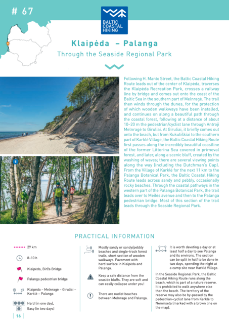
Klaipėda – Palanga Through the Seaside Regional Park
Following H. Manto Street, the Baltic Coastal Hiking Route leads out of the center of Klaipėda, traverses the Klaipėda Recreation Park, crosses a railway line by bridge and comes out onto the coast of the Baltic Sea in the southern part of Melnragė. The trail then winds through the dunes, for the protection of which wooden walkways have been installed, and continues on along a beautiful path through the coastal forest, following at a distance of about 10–20 m the pedestrian/cyclist lane through Antroji Melnragė to Giruliai. At Giruliai, it briefly comes out onto the beach, but from Kukuliškiai to the southern part of Karklė Village, the Baltic Coastal Hiking Route first passes along the incredibly beautiful coastline of the former Littorina Sea covered in primeval forest, and later, along a scenic bluff, created by the washing of waves; there are several viewing points along the way (including the Dutchman's Cap). From the Village of Karklė for the next 11 km to the Palanga Botanical Park, the Baltic Coastal Hiking Route leads across sandy and pebbly, occasionally rocky beaches. Through the coastal pathways in the western part of the Palanga Botanical Park, the trail leads over to Meilės avenue and then to the Palanga pedestrian bridge. Most of this section of the trail leads through the Seaside Regional Park.


