


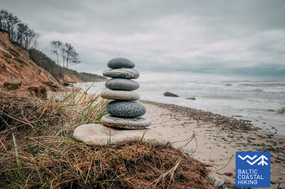
Tропa Балтийского взморья - Wheelchair accesible


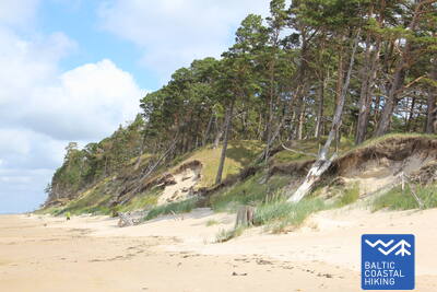
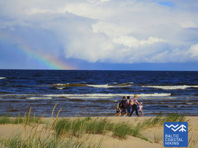
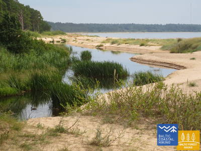
 2-й этап. Папе – Бернати.
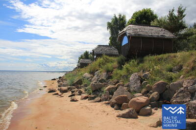
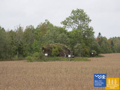
Самая западная точка Латвии
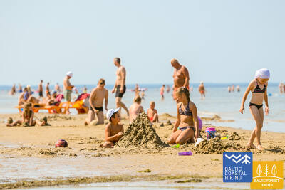
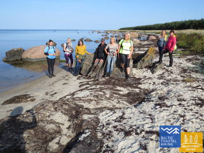
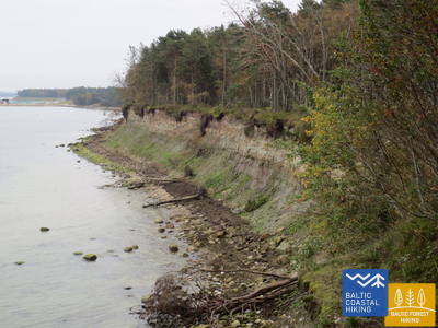
На протяжении всего отрезка пути Тропа Балтийского взморья идет по пляжу, который со стороны суши в окрестностях Папе окружают красивые дюны, а за поселком их сменяет омываемый морем берег протяженностью 10 км, поперек которого свалены стволы сосен. Пологие дюны снова появляются в окрестностях Юрмалциемса. За Юрмалциемсом продолжаются широкие намытые пляжи, а по мере приближения к утесу Бернату поднимается внушительный, поросший сосновым лесом и местами смытый крутой берег.
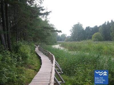
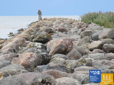
Bernāti Beach Boardwalk
Длина набережной пляжа Бернати составляет около 400 метров в одну сторону, ширина — от 1,2 до 1,6 метра. Она частично доступна для людей в инвалидных колясках и рекомендуется с посторонней помощью из-за уклонов, достигающих 12 процентов. Она также пригодна для использования родителями с колясками. В конце набережной есть смотровая площадка и зона отдыха. В сезон дощатая дорожка удлиняется, чтобы позволить людям в инвалидных колясках добраться до береговой линии. Рядом с набережной есть парковка (GPS: 56.366156, 20.976715) и сухой туалет (не адаптирован).


2-й этап. Папе – Бернати.
Самая западная точка Латвии
На протяжении всего отрезка пути Тропа Балтийского взморья идет по пляжу, который со стороны суши в окрестностях Папе окружают красивые дюны, а за поселком их сменяет омываемый морем берег протяженностью 10 км, поперек которого свалены стволы сосен. Пологие дюны снова появляются в окрестностях Юрмалциемса. За Юрмалциемсом продолжаются широкие намытые пляжи, а по мере приближения к утесу Бернату поднимается внушительный, поросший сосновым лесом и местами смытый крутой берег.
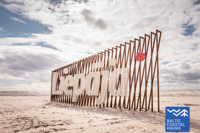
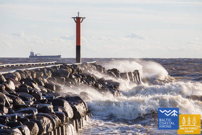
3-й этап. Бернати – Лиепая – Кароста.
Город, в котором рождается ветер
От Бернати до Лиепаи Тропа Балтийского взморья ведет по широкому пляжу, где со стороны суши сначала можно наблюдать смытый берег, а по мере приближения к Лиепае – высокие дюны, поросшие песчаным колосняком и аммофилой. Дальше она петляет через центральную часть Лиепаи – Вецлиепаю – и, пересекая канал Каростас, доходит до Каросты – комплекса военных и фортификационных сооружений, на осмотр которого стоит выделить минимум полдня. Обязательно надо попробовать особое лиепайское блюдо «Liepājas menciņi», которое готовится из копченой трески по древнему южно-курземскому рецепту.
The hiking route "Hear, Smell, Touch Liepāja."
Маршрут создан для слепых и слабовидящих людей, его ведет обученный слепой гид. Он включает посещение значимых культурных и исторических мест Лиепаи. Протяженность маршрута зависит от потребностей группы. Он расположен недалеко от Прибрежной тропы. В Лиепае разработано несколько тактильных карт, чтобы помочь людям с нарушениями зрения легче ориентироваться.
Liepāja Beach near the Central Rescue Station
На Лиепайском пляже около Центральной спасательной станции (GPS: 56.504199, 20.991922) обустроено помещение для людей с ограниченными возможностями. Оно включает в себя душевые, раздевалки и деревянные настилы, которые простираются до моря, позволяя инвалидам-колясочникам добираться до береговой линии. Доступны специальные инвалидные коляски, подходящие для купания в море. Для слепых и слабовидящих людей в море установлены звуковые буи, которые с помощью сигналов информируют о том, как далеко можно проплыть.


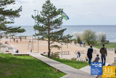
Liepāja Seaside Park.
В парке есть сеть троп длиной около 3 км, подходящих для людей в инвалидных колясках. Покрытие тропы разное: гравий, брусчатка, дощатые настилы и асфальт. Есть зоны отдыха, места для еды, парковки и туалеты. В парк можно попасть с пересечения улиц Лиепу и Пелду (GPS: 56.506365, 20.997112). Он расположен недалеко от Прибрежной тропы.


Liepāja Lake Boardwalk
Набережная Лиепайского озера доступна для людей в инвалидных колясках и родителей с детскими колясками. Она широкая и оборудована бортиками, простирается примерно на 400 метров в одном направлении. Башня недоступна для людей в инвалидных колясках. Она расположена примерно в 2 км от Прибрежной тропы, GPS: 56.494511, 21.024515.


Liepāja Lake Horse Island Trail
Тропа острова коня на озере Лиепая имеет длину около 2 км в одном направлении. В начале тропы есть парковка (GPS: 56.516585, 21.032329) и Dabasmāja - Центр инноваций в области науки и образования (оборудован пандусами). Поверхность тропы состоит из дощатых настилов в начале, за которыми следует гравийная дорожка. Она доступна для людей в инвалидных колясках, хотя гравийный участок рекомендуется проходить с посторонней помощью. Она расположена в 1,3 км от Прибрежной тропы.


3-й этап. Бернати – Лиепая – Кароста.
Город, в котором рождается ветер
От Бернати до Лиепаи Тропа Балтийского взморья ведет по широкому пляжу, где со стороны суши сначала можно наблюдать смытый берег, а по мере приближения к Лиепае – высокие дюны, поросшие песчаным колосняком и аммофилой. Дальше она петляет через центральную часть Лиепаи – Вецлиепаю – и, пересекая канал Каростас, доходит до Каросты – комплекса военных и фортификационных сооружений, на осмотр которого стоит выделить минимум полдня. Обязательно надо попробовать особое лиепайское блюдо «Liepājas menciņi», которое готовится из копченой трески по древнему южно-курземскому рецепту.
 5-й этап. Зиемупе – Павилоста.
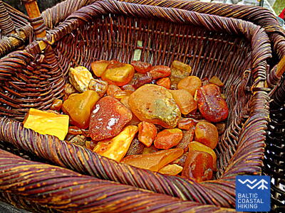
Поющие пески и янтарь
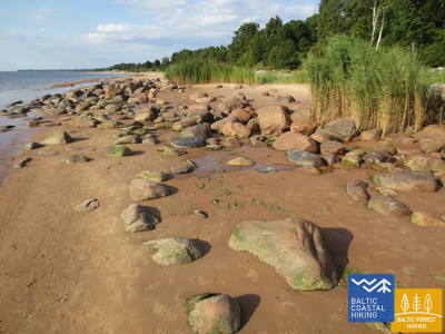
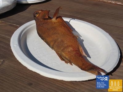
Немноголюдный пляж, где можно собирать янтарь и камешки с древними окаменелостями, слушать, как поет песок под ногами. В окрестностях Зиемупе появляются обрывы с промоинами, а дальше до Акменсрагса и Павилосты – красивые, с редкими промоинами дюны, поросшие колосняком и аммофилой. Местами можно увидеть серые дюны. Маяк Акменрагса станет хорошим местом отдыха. Обаятельный городок Павилоста с портом и ароматом копченой рыбы заставит вернуться от нетронутой природы к цивилизации.
Pāvilosta Pier Promenade
Часть променада Павилостского мола длиной около 200 метров доступна для людей в инвалидных колясках, но сам мол недоступен. Подходящей отправной точкой является Краеведческий музей Павилосты (GPS: 56.889365, 21.172837). Он расположен рядом с Прибрежной тропой.


Pāvilosta Beach Boardwalk
Пляжная набережная Павилоста знакомит посетителей с серой дюной и прибрежными дюнами. Это деревянная набережная шириной 1,2 метра, длиной полкилометра (туда и обратно). Тропа начинается с гравийной поверхности. Есть парковка (GPS: 56.892935, 21.185369). Тропа доступна для людей в инвалидных колясках с посторонней помощью, так как есть некоторые подъемы и спуски. Доступ к береговой линии невозможен.


5-й этап. Зиемупе – Павилоста.
Поющие пески и янтарь
Немноголюдный пляж, где можно собирать янтарь и камешки с древними окаменелостями, слушать, как поет песок под ногами. В окрестностях Зиемупе появляются обрывы с промоинами, а дальше до Акменсрагса и Павилосты – красивые, с редкими промоинами дюны, поросшие колосняком и аммофилой. Местами можно увидеть серые дюны. Маяк Акменрагса станет хорошим местом отдыха. Обаятельный городок Павилоста с портом и ароматом копченой рыбы заставит вернуться от нетронутой природы к цивилизации.
 6-й этап. Павилоста – Юркалне.
Самые впечатляющие обрывы Балтийского моря
К северо-западу от Павилосты можно увидеть великолепные пейзажи с серыми дюнами, а уже несколькими километрами дальше начинается один из красивейших отрезков Тропы Балтийского взморья с впечатляющими обрывами, которые протянулись более чем на 20 км. Самые интересные пейзажи с обрывами можно увидеть возле устья рек Странте, Улмале и Рива. Во многих местах, где берега в нижней части обвалились, летом цветут орхидеи. В Юркалне и окрестностях можно наблюдать «двойной закат»: первый – с пляжа, а второй – несколько мгновений спустя с вершины обрыва.
Pāvilosta Beach Boardwalk
Пляжная набережная Павилоста знакомит посетителей с серой дюной и прибрежными дюнами. Это деревянная набережная шириной 1,2 метра, длиной полкилометра (туда и обратно). Тропа начинается с гравийной поверхности. Есть парковка (GPS: 56.892935, 21.185369). Тропа доступна для людей в инвалидных колясках с посторонней помощью, так как есть некоторые подъемы и спуски. Доступ к береговой линии невозможен.
Pāvilosta Pier Promenade
Часть променада Павилостского мола длиной около 200 метров доступна для людей в инвалидных колясках, но сам мол недоступен. Подходящей отправной точкой является Краеведческий музей Павилосты (GPS: 56.889365, 21.172837). Он расположен рядом с Прибрежной тропой.
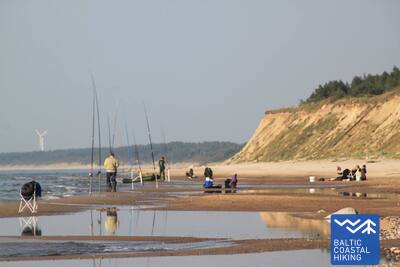
8-й этап. Сарнате – Ужава.
Самый красивый в Латвии прибрежный вид
В окрестностях Сарнате еще виден обрыв Балтийског моря, который к северу постепенно становится ниже и его сменяет омываемый морем дюнный вал. Между Вендзавас и маяком Ужавас вдоль берега моря можно наблюдать необычный для Латвии пейзаж, напоминающий песчано-каменистую пустыню со скудной растительностью, – бывший полигон Советской армии. Здесь и за маяком Ужавас на территориях бывшего полигона можно увидеть серые дюны. По мере приближения к устью Ужавы пляж становится все шире, а дюнный вал – все ниже. С романтического маяка Ужавас открывается самый красивый вид на Тропе Балтийского взморья.
Užava Creek beach boardwalk
Дощатая дорожка около устья реки Ужава у моря представляет собой деревянную дорожку длиной 0,5 км, предназначенную для инвалидов-колясочников. Ширина дощатой дорожки составляет 1,2 метра, вдоль нее есть зоны разъезда. Рядом есть парковка (GPS: 57.247001, 21.414652). Вдоль дорожки есть зона отдыха, хотя она недоступна для инвалидов-колясочников, а доступ к морю отсутствует. Дощатая дорожка расположена рядом с тропой Юртака.


9-й этап. Ужава – Вентспилс.
Собери свою коллекцию янтаря!
На этом этапе первые 6 км Тропы Балтийского взморья – это безлюдный участок берега с низкими дюнами, спины которых покрыты колосняком и аммофилой. За устьем ручья Медолес высится внушительный обрыв (~19 м) с узким каменистым пляжем. Обрыв быстро сходит на нет и снова поднимается двумя километрами дальше. Между обрывами находится бывший полигон Советской армии. Последние пять километров Тропы Балтийского взморья до Южного мола в Вентспилсе идут по просторному песчаному пляжу, который со стороны суши ограничен биотопами серых дюн.
Ventspils Seaside Park
В Вентспилсском приморском парке имеется сеть троп длиной около 3,5 км, в том числе Якорная тропа длиной 730 м. Тропы (за исключением Тропы джунглей) доступны для людей в инвалидных колясках и родителей с детскими колясками. Покрытие тропы состоит из гравия и асфальта (в начале). Удобной отправной точкой для осмотра парка является перекресток улиц Парка и Лочу (GPS: 57.389279, 21.537021), где есть парковка и туалет. Парк расположен рядом с Юртакской тропой. Для людей в инвалидных колясках и родителей с детскими колясками наиболее удобным выходом на пляж у моря является вход № 6, расположенный на территории парка.
9-й этап. Ужава – Вентспилс.
Собери свою коллекцию янтаря!
На этом этапе первые 6 км Тропы Балтийского взморья – это безлюдный участок берега с низкими дюнами, спины которых покрыты колосняком и аммофилой. За устьем ручья Медолес высится внушительный обрыв (~19 м) с узким каменистым пляжем. Обрыв быстро сходит на нет и снова поднимается двумя километрами дальше. Между обрывами находится бывший полигон Советской армии. Последние пять километров Тропы Балтийского взморья до Южного мола в Вентспилсе идут по просторному песчаному пляжу, который со стороны суши ограничен биотопами серых дюн.
10-й этап. Вентспилс – Сталдзене.
Через Вентспилс
Маршрут проходит через Вентспилс и окружающие его леса. Тропа Балтийского взморья от Южного мола ведет через исторический район Остгалс и Старый город, пересекает Венту и дальше через Парвенту по пешеходно-велосипедной дорожке продолжается в направлении Сталдзене, где, обогнув Вентспилсский порт, вновь возвращается на берег моря. Стоит взять один «выходной» и ознакомиться с самыми интересными местами города, а также посетить Приморский музей под открытым небом.
Lake Būšnieki Nature Trail
Тропа вокруг озера Бушниеки представляет собой 9-километровую петлю, доступную для инвалидов-колясочников и родителей с детскими колясками. Она оснащена аудиогидом, тактильной информацией и парковкой для людей с ограниченными возможностями. Рекомендуемая отправная точка — парковка на юго-восточной стороне озера (GPS: 57.437632, 21.656062). Тропа расположена примерно в 1 км от тропы Юртака.


15-й этап. Саунагс – Колка.
Сердце Европы – Колкасрагс
От Саунагса по маленьким проселочным и лесным дорогам Тропа Балтийского взморья вьется до Вайде, где снова возвращается на берег моря. До Колкасрагса тянутся широкие песчаные пляжи, переходящие в приземистые дюны, за которыми снова следуют дюны, поросшие лесом. На протяжении ~2 км – размытые дюны, за которыми поднимаются Думбркални. Колкасрагс, пограничная веха между Балтийским морем и Рижским заливом, является одним из популярнейших на Балтийском побережье мест наблюдения за птицами.
Kolka Pine Trail
Тропа протяженностью 1,8 км предназначена для изучения биоразнообразия прибрежных дюн. На ней есть две смотровые площадки, доступные для людей в инвалидных колясках. Сухие туалеты частично адаптированы для людей с функциональными нарушениями. Есть парковка (GPS: 57.756668, 22.591180). Тропа расположена рядом с тропой Юртака.


16-й этап. Колка – Гипка.
Вдоль «закрытого берега»
Если свернуть от Колкасрагса в сторону залива, то можно заметить различие между Балтийским морем и Рижским заливом. Первые 10 км Тропы Балтийского взморья ведут по побережью Национального парка «Слитере»: сначала вдоль выступающих в море сосен, вдоль зданий бывшего рыболовецкого колхоза, корабельной пристани и обрыва Эважу, в окрестностях которого расположен необычно узкий песчаный пляж со склоняющимися над ним стволами черной ольхи. И дальше по дороге до Гипки будет тянуться узкий песчаный пляж с многочисленными выходящими на поверхность родниками и устьями небольших (летом – мелких) рек. В советские времена берег Национального парка «Слитере» был дважды закрытой территорией – здесь находились приграничная режимная зона и природный резерват.
Ēvažu Nature Trail
Тропа предназначена для осмотра одного из редких крутых берегов Рижского залива. Для людей на инвалидных колясках открыт доступ к смотровой площадке, с которой открывается вид на Рижский залив. Длина тропы составляет 1,2 км в оба конца. Поверхность включает гравий в начале, затем следует протоптанная тропа и дощатые настилы с лестницами около крутого берега. На противоположной стороне дороги Тукумс - Колка есть парковка (GPS: 57.677789, 22.567982). Тропа расположена рядом с тропой Юртака.


17-й этап. Гипка – Калтене.
Каменистое взморье Курземе
От Гипки до Рои тянется песчаный, не слишком широкий пляж с красивыми дюнами и прибрежными сосновыми лесами, а перед Роей пляж зарос тростником. В свою очередь, отрезок пути между Роей и церковью в Калтене – самый своеобразный на всем латвийском побережье: берег здесь топорщится маленькими мысками и изрыт заливчиками с очень узким пляжем. Весь берег усыпан валунами разного размера, а над ними шепчет зеленая листва черной ольхи. В некоторых местах на берег вытягиваются широкие розетки корней деревьев, подмытых морем. Местами вдоль самого берега идет земляная дорога, вдоль которой тянутся ряды бывших рыбацких подворий.
Walking Path at Roja Beach
Деревянные настилы предназначены для инвалидов-колясочников и родителей с колясками. Есть информационный стенд со шрифтом Брайля и тактильная карта пляжа. Удобства включают адаптированный туалет и парковку (GPS: 57.510088, 22.799207). Длина настила составляет 0,5 км в одном направлении. Хотя инвалиды-колясочники могут пользоваться настилами, они не могут добраться до моря из-за отсутствия пандуса. Настилы широкие, с ограждениями по бокам и зонами для прохода.


17-й этап. Гипка – Калтене.
Каменистое взморье Курземе
От Гипки до Рои тянется песчаный, не слишком широкий пляж с красивыми дюнами и прибрежными сосновыми лесами, а перед Роей пляж зарос тростником. В свою очередь, отрезок пути между Роей и церковью в Калтене – самый своеобразный на всем латвийском побережье: берег здесь топорщится маленькими мысками и изрыт заливчиками с очень узким пляжем. Весь берег усыпан валунами разного размера, а над ними шепчет зеленая листва черной ольхи. В некоторых местах на берег вытягиваются широкие розетки корней деревьев, подмытых морем. Местами вдоль самого берега идет земляная дорога, вдоль которой тянутся ряды бывших рыбацких подворий.
18-й этап. Калтене – Мерсрагс.
Многоликий берег
Чрезвычайно многообразный отрезок Тропы Балтийского взморья в плане природы, культуры, истории и ландшафта. Возле Калтене взморье пестрит небольшими заливчиками и каменистыми пляжами, а дальше берег моря сильно зарос и по нему меж тростника и пышной растительности вьется узкая тропинка. Далее покрытый камнями морской берег сужается до нескольких метров, местами виднеются слои глины, тростниковые поля, кое-где его покрывают выброшенные морем водоросли. На участке пути от Валгалциемса до Мерсрагса снова появляются песчаные пляжи с морскими отмелями. За Мерсрагсом маршрут продолжается по дороге, а возле лютеранской церкви сворачивает в сторону моря и до самого центра Мерсрагса ведет вдоль Приморского луга.
Boardwalk in Upesgrīva
Расположен между кемпингом Lūši и морем (GPS: 57.381441, 23.025370). На набережной нет боковых ограждений и зон для прохода. Доступен для инвалидов-колясочников с помощником. Длина около 90 метров в одном направлении. Не обеспечивает доступа к морскому берегу. Расположен недалеко от Прибрежной тропы (Jūrtaka).


Boardwalk near Mērsrags Lighthouse
Расположен на улице Бакас, 60. Дощатый настил позволяет инвалидным коляскам проехать от парковки (GPS: 57.365315, 23.120436) до дюн, откуда видно море. Дощатый настил имеет частичное ограждение краев и не имеет зон разворота. Длина составляет около 150 м (туда и обратно). Он находится недалеко от Прибрежной тропы.


19-й этап. Мерсрагс – Энгуре.
В Энгурском природном парке
Из центра поселка до пляжа ведет лесная дорога, по обочинам которой растут сосны. Дальше Тропа Балтийского взморья изгибается между буйно заросшим тростником и другими растениями каменистым берегом моря и лесистыми приморскими дюнами. В некоторых местах пляж вымощен мелкими круглыми камешками, в других виднеются серые дюны с видовым разнообразием растений. В окрестностях Берзциемса раскинулись приморские луга, выходящие по отмелям далеко в море, которые являются хорошим местом для наблюдения за птицами. До Абрагциемса продолжается заросшее взморье, а от Абрагциемса до Энгуре идет пляж.
Engure Nature Trail
От парковки (GPS: 57.171428, 23.222504) на улице Слимницас через дюны к морю тянется деревянный дощатый настил, который предназначен для людей в инвалидных колясках. Из-за уклона может потребоваться помощь. Тропа составляет около 200 метров в одном направлении. Она расположена недалеко от Прибрежной тропы (Юртака).


20-й этап. Энгуре – Рагациемс.
Рыбацкие поселки и копченая рыба
Сначала Тропа Балтийского взморья проходит через поселок Энгуре, потом с одной ее стороны начинается сравнительно узкий пляж, а с другой – живописные лесистые приморские дюны, так тропа доходит до дюны Плиеньциема, где на последующем участке песчаный пляж становится все шире, а в море появляются широкие мели. В направлении суши здесь поднимаются заросшие обрывы с лестницами и благоустроенными мостками до шоссе Колка – Тукумс. Нужно учитывать, что в теплые летние дни здесь много отдыхающих. Последняя треть маршрута проходит по Национальному парку «Кемери».
Apšuciems
В Апшуциемсе есть две плавучие пляжные инвалидные коляски для людей с ограниченными возможностями передвижения. Их можно получить в школе Апшуциемса по предварительной договоренности по телефону +371 26132761. Пользователи должны предоставить своего собственного помощника, который поможет им добраться до воды и обратно, поплавать и вернуться. Также доступны спасательные жилеты. В настоящее время ведутся планы по строительству доступа к морю в 2025 году, который будет включать доступ для инвалидных колясок, жилеты, кабинки для переодевания и специальные коврики для загара. С помощью можно будет совершать небольшие поездки по твердому песчаному участку береговой линии. Он расположен на Балтийской морской тропе.

Плиенциемс Белые дюны Пограничная тропа
Тропа находится на южной границе Плиенциемса, идущего в направлении от Риги к Энгуре.
Название Плиенциемс происходит от балтийского слова «pliens» - известняк или мергелис. Впервые деревня упоминается в документах уже в 1551 году, а на картах как населенный пункт появляется с 1702 года. В середине XVIII века в Энгурском приходском регистре упоминается, что в Плиенциемсе было девять хозяйств, которые имели право ловить рыбу в море и Энгурском озере, а также собирать морскую траву.
Тропа ведет от дороги к морю, преодолевая дюнный вал. Поверхность тропы спроектирована таким образом, что по ней могут передвигаться инвалиды-колясочники (желательно с сопровождающим) и семьи с детьми в колясках. На пляже есть раздевалка и небольшая игровая площадка. На тропе нет специально отведенного места для обмена местами со встречным транспортом.


20-й этап. Энгуре – Рагациемс.
Рыбацкие поселки и копченая рыба
Сначала Тропа Балтийского взморья проходит через поселок Энгуре, потом с одной ее стороны начинается сравнительно узкий пляж, а с другой – живописные лесистые приморские дюны, так тропа доходит до дюны Плиеньциема, где на последующем участке песчаный пляж становится все шире, а в море появляются широкие мели. В направлении суши здесь поднимаются заросшие обрывы с лестницами и благоустроенными мостками до шоссе Колка – Тукумс. Нужно учитывать, что в теплые летние дни здесь много отдыхающих. Последняя треть маршрута проходит по Национальному парку «Кемери».
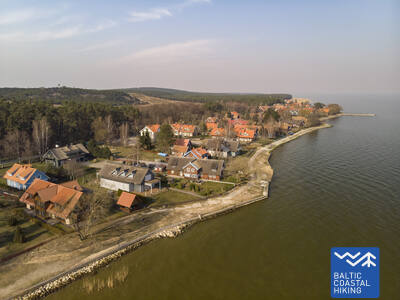
21-й этап. Рагациемс – Дубулти.
Исторический курорт Юрмалы
Из Рагациемса хорошо виден берег Юрмалы по всей его протяженности. Первая треть маршрута этого дня проходит по территории Национального парка «Кемери», где можно ознакомиться с историческими рыбацкими поселками, «Ragaciema sedums» и рыбным базарчиком, дюнными биотопами, а также понаблюдать за птицами в устье Старпиньупите. От Яункемери вплоть до Дубулти поход проходит по самому широкому пляжу Рижского морского залива, через исторические курорты Юрмалы и самый длинный город Латвии. В красивые и теплые летние дни нужно учитывать большое количество посетителей пляжа.
Jūrmalas pilsētas pludmales
Городские пляжи Юрмалы доступны для людей с функциональными нарушениями, в том числе для инвалидов-колясочников и пожилых людей. В Юрмале имеется 14 приспособленных точек доступа к морю для инвалидных колясок: линия 36, проспект Виенибас (2 точки доступа), улица Турайдас (2 точки доступа), улица Пилсону, улица Базницас, улица Кляву, улица Лигатнес, улица Дзимтенес, Вейу. улица, улица Атбалсс, улица Каптейня Золта и дорога Яункемери. Эти точки доступа разработаны так, чтобы подходить как для людей с функциональными нарушениями, так и для людей с колясками, с учетом поверхности и рельефа местности. Кроме того, в четырех местах — Вайвари, Кауггури, Яункемери и Яундубулты — есть расширенные и более удобные кабинки для переодевания.
Kupskalni Nature Trail
Тропа тянется на полкилометра вдоль правого берега реки Силиньупе и ведет от дороги Слока-Талси к морю. Она частично доступна для людей в инвалидных колясках с посторонней помощью, так как корни деревьев в начале тропы могут быть препятствием. Дальнейший участок тропы (широкие дощатые настилы с зонами разъезда) доступен. Частично доступен туалет. Прогулку можно начать от близлежащей заправочной станции (GPS: 56.992203, 23.522736).


22-й этап. Дубулти – Лиелупе – Булдури.
Самые популярные пляжи Латвии
Между Дубулти и Лиелупе раскинулся самый широкий пляж на побережье Рижского морского залива – главнейшая ценность города-курорта Юрмалы – с многочисленными пляжными кафе и разнообразными возможностями отдыха. Леса в прибрежных дюнах пронизаны плотной сетью тропинок, которые подходят для обычной и скандинавской ходьбы. Часть Тропы Балтийского взморья между пляжем Лиелупе и Юрмальским музеем под открытым небом проходит по территории природного парка «Рагакапас». Отсюда обратно в Булдури можно легко попасть по проспекту Булдуру и 5-й линии.
Jūrmalas pilsētas pludmales
Городские пляжи Юрмалы доступны для людей с функциональными нарушениями, в том числе для инвалидов-колясочников и пожилых людей. В Юрмале имеется 14 приспособленных точек доступа к морю для инвалидных колясок: линия 36, проспект Виенибас (2 точки доступа), улица Турайдас (2 точки доступа), улица Пилсону, улица Базницас, улица Кляву, улица Лигатнес, улица Дзимтенес, Вейу. улица, улица Атбалсс, улица Каптейня Золта и дорога Яункемери. Эти точки доступа разработаны так, чтобы подходить как для людей с функциональными нарушениями, так и для людей с колясками, с учетом поверхности и рельефа местности. Кроме того, в четырех местах — Вайвари, Кауггури, Яункемери и Яундубулты — есть расширенные и более удобные кабинки для переодевания.
23-й этап. Булдури – центр Риги.
Через леса – в Ригу
Маршрут является альтернативным способом попасть из Юрмалы в Ригу, идя по лесу. За Лиелупским мостом Тропа Балтийского взморья проходит через Приедайне с видами на деревянную застройку, идет параллельно правому берегу Лиелупе, потом поворачивает мимо южной части Болдерайской дюны и пересекает лес Клейсту, проходя вдоль кладбища Лачупес. Дальше тропа идет по историческим дорогам Пардаугавы – улицам Буллю и Даугавгривас через Дзегужкалнс, мимо канала Зундас и залива Агенскална, доходит до Даугавы, где по Каменному мосту пересекает Даугаву и останавливается на Ратушной площади.
Jūrmalas pilsētas pludmales
Городские пляжи Юрмалы доступны для людей с функциональными нарушениями, в том числе для инвалидов-колясочников и пожилых людей. В Юрмале имеется 14 приспособленных точек доступа к морю для инвалидных колясок: линия 36, проспект Виенибас (2 точки доступа), улица Турайдас (2 точки доступа), улица Пилсону, улица Базницас, улица Кляву, улица Лигатнес, улица Дзимтенес, Вейу. улица, улица Атбалсс, улица Каптейня Золта и дорога Яункемери. Эти точки доступа разработаны так, чтобы подходить как для людей с функциональными нарушениями, так и для людей с колясками, с учетом поверхности и рельефа местности. Кроме того, в четырех местах — Вайвари, Кауггури, Яункемери и Яундубулты — есть расширенные и более удобные кабинки для переодевания.
Babīte Rhododendron Nursery
Проложена тропа длиной 1,9 км, доступная для людей в инвалидных колясках и родителей с детскими колясками. Покрытие тропы асфальтовое. Есть выделенная парковка (GPS: 56.962330, 23.952280) и адаптированный туалет. Тропа расположена примерно в 2,7 км от тропы Юртака.
Daugavgrīva Nature Trail
Тропа начинается на парковке (GPS: 57.036769, 24.018166), около улицы Валентина Пикуля, и ведет через болото Даугавгрива к дюнам и морю. Поверхность тропы у моря асфальтирована, а асфальтированный участок доступен для людей в инвалидных колясках. Вдоль тропы построена башня для наблюдения за птицами, первый этаж которой доступен для людей в инвалидных колясках. Тропа находится примерно в 12,5 километрах от тропы Юртака, расположенной на берегу моря в Даугавгриве.

24-й этап. Центр Риги – Вецаки.
Вецрига – мировое наследие UNESCO
Сначала маршрут делает небольшой круг по центру Риги – Вецриге, ведет вдоль Городского канала, через парк Кронвалда, по улице Алберта (застройка в югендстиле) и дальше по улице Миера через Большое кладбище, проспекты Кокнесес и Остас через Межапарк доходит до Яунмилгрависа и пересекает Милгравис. Далее по проспекту Вецакю он проходит до Зимельблазмы и берегов Вецдаугавы, откуда до Вецаки всего лишь несколько километров. После двух дней похода через Ригу Тропа Балтийского взморья снова выходит на пляж.
Mangaļsala walking paths
Две тропы в Мангальсале ведут через дюнные зоны и прибрежные леса к морю. Первая тропа (GPS: 57.071642, 24.087599) рекомендуется для людей в инвалидных колясках с помощником, так как она ведет к морю, но не обеспечивает прямого доступа к пляжу. Вторая тропа (GPS: 57.062730, 24.055460) начинается как грунтовая дорога и затем продолжается как широкий деревянный настил, позволяющий инвалидам-колясочникам добраться до пляжа. Третья тропа (GPS: 57.061976, 24.041811) ведет к Восточному пирсу. Хотя она не предназначена специально для инвалидных колясок, по ней можно перемещаться с посторонней помощью, включая сам пирс, за исключением случаев сильного ветра или шторма. И на первой, и на второй тропах есть отдельная парковка и туалеты. Ближайшая тропа находится примерно в 3,5 км от Юртаки.


25-й этап. Вецаки – Царникава.
Меж устьев двух рек – Даугавы и Гауи
Этот отрезок Тропы Балтийского взморья представляет собой сравнительно короткий переход по красивому песчаному пляжу, который со стороны суши ограничен светлыми прибрежными сосновыми лесами с внушительными дюнами и дюнными валами. От пляжа до Царникавы Тропа Балтийского взморья ведет по променаду через лес. Дальше по защитной дамбе она огибает Вецгаую и доходит до пешеходного моста через Гаую. И в начале, и в конце пути приятно посидеть в одном из кабачков или летнем кафе на пляже Вецаки или Царникавы.
Garciems nature trail
Дощатый настил ведет к устью канала Эймури в море. Конец дощатого настила находится близко к берегу, и с помощью помощника можно добраться до моря. Подходит для людей в инвалидных колясках и родителей с детскими колясками. Есть парковка (GPS: 57.108161, 24.192324) и туалет. Длина в одном направлении — 0,7 км. Расположен рядом с Юртакой.
Carnikava Promenade
Соединяет Царникаву с морским побережьем. Тропа асфальтированная, а в песчаных дюнах - с деревянными мостиками. На берегу моря оборудованы дорожки и смотровые площадки с шезлонгами. Длина тропы в одну сторону – 1,8 км. Он доступен для людей в инвалидных колясках и родителей с колясками. На улице Лайву оборудована парковка (GPS: 57.133531, 24.265631), приспособленный туалет, информационные стенды и зоны отдыха. Песчаный участок морского побережья не доступен для инвалидов-колясочников. Последний участок набережной имеет уклон 9,2%. Юртака движется по набережной Царникавы. 2024/2025 г. на набережной Царникавы планируется создать специальный маршрут для специализированных внедорожных инвалидных колясок, который будет доступен их пользователям вместе с помощником.


26-й этап. Царникава–Саулкрасты.
Закатная тропа с романтическими видами заходящего солнца
Сначала маршрут проходит по защитным дамбам на Гауе в поселке Гауяс и доходит до устья Гауи, которое является хорошим местом наблюдения за птицами. Дальнейший путь пролегает по песчаному пляжу до устья Инчупе, перед которым нужно повернуть в сторону суши, чтобы дойти до моста и на протяжении следующих нескольких километров смотреть на пляж с вершин лесистых дюн Закатной тропы. После пересечения реки Петерупите (канатный мост) Тропа Балтийского взморья по пляжу доходит до «Морского парка» в Саулкрасты.
Lilaste Beach
Увозит в море. Его длина в одну сторону составляет 130 м. Начинается он у парковки (GPS: 57.187403, 24.329523), от которой человек в инвалидной коляске может добраться до пляжа с помощью помощника. Он расположен рядом с Юртакой.

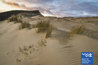
White Dune
Одна из самых живописных дюн Рижского залива. Доступен для людей в инвалидных колясках с ассистентом на смотровой площадке со стороны парковки (GPS: 57.233560, 24.393407). Балтас капа является частью маршрута Юртакас.
Path and wooden boardwalk network in the coastal dunes of Saulkrasti
Расположенная между улицами Райня и Бириню (Морской парк, Саулкрастский туристический информационный центр), тропа приспособлена для инвалидов-колясочников и родителей с детскими колясками. Она проходит параллельно тропе Юртака. Самый простой доступ к тропе и набережной — со стороны парковки (GPS: 57.267111, 24.413875).


26-й этап. Царникава–Саулкрасты.
Закатная тропа с романтическими видами заходящего солнца
Сначала маршрут проходит по защитным дамбам на Гауе в поселке Гауяс и доходит до устья Гауи, которое является хорошим местом наблюдения за птицами. Дальнейший путь пролегает по песчаному пляжу до устья Инчупе, перед которым нужно повернуть в сторону суши, чтобы дойти до моста и на протяжении следующих нескольких километров смотреть на пляж с вершин лесистых дюн Закатной тропы. После пересечения реки Петерупите (канатный мост) Тропа Балтийского взморья по пляжу доходит до «Морского парка» в Саулкрасты.
27-й этап. Саулкрасты – Лаучи.
Ворота каменистого Видземского взморья
Первые километры до Звейниекциемса можно пройти по пляжу или по тропе, которая идет через дюнный лес со старыми соснами с характерной «крокодиловой» корой. Здесь можно увидеть и старую деревянную хижину, предназначенную для рыболовных сетей и принадлежностей. Перед портом Скулте, на пляже Звейниекциемса, появляются первые камни. Обогнув устье Аге и порт, Тропа Балтийского взморья возвращается на пляж, где уже издалека виден мыс Арню, а за ним – коричневая спина Большого камня Лаучу. Многообразие приморских пейзажей.
Path and wooden boardwalk network in the coastal dunes of Saulkrasti
Расположенная между улицами Райня и Бириню (Морской парк, Саулкрастский туристический информационный центр), тропа приспособлена для инвалидов-колясочников и родителей с детскими колясками. Она проходит параллельно тропе Юртака. Самый простой доступ к тропе и набережной — со стороны парковки (GPS: 57.267111, 24.413875).
28-й этап. Лаучи – Туя.
Ушедшая эпоха парусников
Невероятно живописный участок Видземского побережья с многочисленными каменистыми мысами и валунами в море, которые перемежаются маленькими песчаными заливчиками, куда впадают заросшие и мелеющие летом маленькие речушки и ручьи. Местами пляж полностью покрывают лишь серые спины камней. Кое-где появляются и небольшие островки тростника, а у Туи – первые выходы на поверхность песчаника.
Munchausen’s Beer Mug Trail
Тропа длиной 1,3 км (в одну сторону) расположена в усадьбе Дунте и начинается около музея Минхаузена. Поверхность тропы состоит из деревянных дощатых настилов шириной 1,5 метра с несколькими зонами разъезда. Удобно начинать исследование тропы с парковки (GPS: 57.405620, 24.424681). Тропа расположена в 1,7 км от тропы Юртака.
29-й этап. Туя – Светциемс.
Каменистое взморье Видземе
Один из самых красивых этапов Тропы Балтийского взморья, который начинается с пересечения реки Закьупите. До маяка Кюрмрага преимущественно песчаные пляжи с небольшими каменистыми участками. Дальше начинается каменистое взморье Видземе, где мысы чередуются с небольшими заливчиками, а на берегу на высоту до 4 м поднимаются обнажения песчаника. За мысом Мелеку снова идет в основном песчаный пляж, а перед устьем Светупе – сильно заросший пляж и тростники, которые можно обойти по лесной дороге.
Rest area "Vasas"
Созданы смотровая площадка и парковка (GPS: 57.520544, 24.379052), доступные для людей в инвалидных колясках. Расположены рядом с тропой Юртака.
Veczemju Cliffs
Возле скал Вецземью есть пандус для инвалидов-колясочников с сопровождающим. Однако песчаный пляж не подходит для инвалидных колясок. Основание пандуса часто повреждается штормами. Он расположен недалеко от Балтийской прибрежной пешеходной тропы (Юртака).


30-й этап. Светциемс – Айнажи.
Королевство миноги
Пляж между Светциемсом и Салацгривой сильно зарос, поэтому Тропа Балтийского взморья идет по лесной дороге, которая вьется между дюнными валами. От Салацгривы до Куйвижи можно идти по песчаному пляжу или тоже по лесным тропам. Луга Ранду от Куйвижи до Веверупе нужно обойти по лесной дороге, которая идет по восточной стороне шоссе А1. За Веверупе Тропа Балтийского взморья возвращается на сильно заросший пляж, а потом вновь покидает его возле устья Блусупите, чтобы по улицам Капу и Валдемара дойти до Айнажского мола. Мы прошли ~580 км по территории Латвии и дошли до границы страны.
Salacgrīvas promenade
Около 260 метров в длину, благоустроенный променад (включая аллею Славаса) вдоль правого берега реки Салаца доступен для инвалидов-колясочников с помощью помощника. Вы можете начать исследование от парковки (GPS: 57.756060, 24.358155). Он расположен недалеко от Балтийской прибрежной пешеходной тропы (Юртака).


Monument "White Sun"
Расположен в Айнажи. Для осмотра сделана деревянная дорожка длиной около 150 метров (исходные координаты GPS: 57.859628, 24.347306). Доступно для инвалидов-колясочников с посторонней помощью и для родителей с детскими колясками. Расстояние от парковки до дорожки около 250 метров. Расположен недалеко от Прибрежной тропы.


Krasta ielas promenāde Salacgrīvā
Длиной около 0,8 км, он проложен вдоль левого берега Салацы от моста до улицы Межа, где расположены теннисные корты. Доступен для людей в инвалидных колясках. Созданы места для отдыха и просмотра, на улице Межа - приспособленный туалет. Покрытие – современный тротуар.


Laipas līdz Salacgrīvas pludmalei
От парковки на улице Юрмала (57.75083, 24.34911) до пляжа проложены два деревянных пешеходных мостика. Доступен для людей в инвалидных колясках с сопровождающим, так как место, где променад пересекает дюну, может содержать гнилой песок. На стоянке имеется туалет. Покрытие тротуара – дерево. Две инвалидные коляски не могут поменяться местами на тротуаре.


30-й этап. Светциемс – Айнажи.
Королевство миноги
Пляж между Светциемсом и Салацгривой сильно зарос, поэтому Тропа Балтийского взморья идет по лесной дороге, которая вьется между дюнными валами. От Салацгривы до Куйвижи можно идти по песчаному пляжу или тоже по лесным тропам. Луга Ранду от Куйвижи до Веверупе нужно обойти по лесной дороге, которая идет по восточной стороне шоссе А1. За Веверупе Тропа Балтийского взморья возвращается на сильно заросший пляж, а потом вновь покидает его возле устья Блусупите, чтобы по улицам Капу и Валдемара дойти до Айнажского мола. Мы прошли ~580 км по территории Латвии и дошли до границы страны.
32-й этап. Кабли – Хяэдемеэсте.
Птицы, дюны и леса
Маршрут особенно рекомендуется наблюдателям за птицами. Участок Тропы Балтийского взморья от Кабли до южной части Хяэдемеэсте нужно пройти по старой Рижской дороге, так как на берегу моря раскинулись луга с тростниковыми зарослями и лагунами. Перед Хяэдемеэсте Тропа Балтийского взморья сворачивает с шоссе и ведет по заповеднику Яагупи (огибает поселок с востока), взбегает на спины высоких дюн и бросается с них в глубокие ложбины, покрытые редким сосновым лесом. Это хорошие места для сбора грибов и ягод.
Kabli nature trail
Тропа знакомит посетителей с прибрежными дюнами и их природными ценностями. Она начинается на парковке (GPS: 58.019424, 24.450986), расположенной недалеко от центра для посетителей Кабли. Длина тропы составляет 1,8 км. Покрытие тропы включает гравий, лесные тропы и деревянные настилы шириной 1,5 м. Тропа доступна для инвалидов-колясочников, и есть адаптированный туалет. Информационные стенды расположены вдоль тропы, на которой также есть смотровая площадка и две вышки для наблюдения за птицами (недоступны для инвалидов-колясочников). Тропа расположена недалеко от прибрежной тропы.


34-й этап. Уулу – Пярну.
Вдоль болот в Пярну
Сначала Тропа Балтийского взморья идет по старым прибрежным дорогам, окруженным сосновыми лесами, а за парком Лоттемаа поворачивает к морю и выходит на пляж Рейю. Далее следует переход по заросшему пляжу (во время отлива – обширные мели), где через неполных 4 км нужно свернуть вглубь суши, пересечь поле для гольфа и повернуть в направлении Пярну. Возле района Раекюла маршрут петляет по маленькой тропинке, идущей по границе обширных прибрежных болотистых местностей и леса. Сделав круг ~6 км и обогнув заболоченные места, Тропа Балтийского взморья выходит на пляж Пярну. Дальнейший путь пролегает через западную часть Старого города Пярну, пересекает реки Пярну и Сауга и заканчивается в районе Вана-Пярну.
Pärnu Coastal Meadow Hiking Trail
Тропа исследует влажные прибрежные луга, лагуны, а также местную жизнь птиц и растений. Она спроектирована в форме овала со смотровой площадкой (доступен первый этаж) и тянется на 600 метров. Посещение можно удобно начать с близлежащей парковки (GPS: 58.372397, 24.507902). Поверхность тропы включает деревянные настилы с асфальтовыми дорожками возле парковки. Тропа доступна для людей в инвалидных колясках, хотя рекомендуется помощь, так как некоторые участки имеют уклон более 8%. Она расположена недалеко от прибрежной тропы.


Pärnu Beach Promenade
Тропа идет параллельно пляжу залива Пярну на протяжении полукилометра. Поверхность в основном представляет собой деревянный настил (шириной от 2,3 до 3,1 метра), с некоторыми участками мощения шириной до 4 метров. Тропа доступна для людей в инвалидных колясках. Тропу можно удобно начать с близлежащей парковки (GPS: 58.372397, 24.507902).
Access to the beach and rental of swimming aids
В 2024 году в отеле Hedon SPA & Hotel будет организован сезонный доступ к плавательным средствам и другому оборудованию, а также будет создана специальная поверхность для доступа к воде людей в инвалидных колясках.


Pärnu Beach Park
Парк, основанный в 1882 году, является популярной зоной отдыха как для гостей города, так и для местных жителей. Он представляет собой сеть из примерно 1 км дорожек (шириной около 3 м), которые доступны для пользователей инвалидных колясок. Покрытие дорожек включает гравий и асфальт. Платная парковка доступна по периметру парка. Он расположен недалеко от Юртака.


Pärnu Mole Boardwalk
Дощатая набережная начинается напротив пирса Пярну (GPS: 58.381941, 24.483994). Длина дощатой набережная составляет 0,6 км (в одну сторону) и доступна для людей в инвалидных колясках. Поверхность сделана из дерева, а ширина составляет 3 метра. В разных точках есть расширения дорожек и зоны отдыха. Она предлагает прекрасную возможность исследовать порт Пярну. Она расположена примерно в 350 метрах от Юртака.


35-й этап. Пярну – Лиу.
Красивейшие виды на залив Пярну и копченая рыба
Тропа Балтийского взморья изгибается по западному преддверию Пярну, пересекает реку Аудру и поворачивает в направлении Валгеранна, где с юга ее окаймляют березовая роща и белый песчаный пляж, а с севера – поле для гольфа. За Валгераннa Тропа Балтийского взморья проходит между польдерами по северной части залива Пярну. С польдеров Аудру открывается самый красивый вид на залив Пярну. За тростниковыми зарослями Аудру Тропа Балтийского взморья поворачивает на юг и проходит через прибрежные рыбацкие поселки с маленькими портами и лодочными пристанями. Здесь можно понаблюдать за бытом рыбаков и попробовать копченую рыбу.
Valgeranna Beach Promenade
Тропа соединяет парковку с пляжем. Поверхность включает мощение и деревянный настил шириной от 1,95 до 3 метров. Доступна для инвалидных колясок. Есть сухой туалет. Расположен рядом с Юртакой.


38-й этап. Тыстамаа – Матси.
Эстонская деревенская идиллия
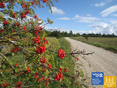
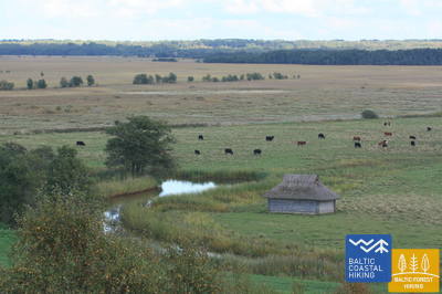
На этом этапе Тропы Балтийского взморья можно увидеть традиционный сельский ландшафт. Побережье прорезают многочисленные мелкие заливы, полуострова и мысы в окружении приморских лугов, тростниковых зарослей, мелких лагун, болот, а также труднодоступных островов. Если идти по маленьким сельским дорогам, над которыми по осени склоняются красные рябины, можно увидеть выглядящие экспонатами этнографического музея хутора, сельские хозяйства с коровами и козами. Хутора чередуются в пейзаже с остатками каменных заборов, сельскохозяйственными землями и зарослями можжевельника. Выход к морю и места отдыха расположены к югу от Раннику и возле поселка Кастна.
Matsi Port
Тропа знакомит посетителей с бывшим рыболовецким портом Матси. Ее длина составляет 500 метров (туда и обратно). Тропа начинается от парковки (GPS: 58.360251, 23.746683). Поверхность включает асфальт, бетон и гравий. В ветреную погоду тропа может быть покрыта песком, поэтому инвалидам-колясочникам может понадобиться помощь. Тропа снабжена тактильными объектами и информацией, написанной шрифтом Брайля. Доступен туалет. Он расположен рядом с Юртакой.


39-й этап. Матси – Варбла.
Пляж и леса
Пляж Матси – один из редких песчаных пляжей на дальнейшем отрезке тропы до Хаапсалу. Тропа Балтийского взморья делает круг через поселок Кулли и следующие 5 км ведет по маленьким, окруженным просторными лесами и дюнами дорогам, окрестности которых по осени богаты ягодами и грибами. Обогнув поместье Ууе-Варбла, тропа доходит до поселка Варбла.
Matsi Port
Тропа знакомит посетителей с бывшим рыболовецким портом Матси. Ее длина составляет 500 метров (туда и обратно). Тропа начинается от парковки (GPS: 58.360251, 23.746683). Поверхность включает асфальт, бетон и гравий. В ветреную погоду тропа может быть покрыта песком, поэтому инвалидам-колясочникам может понадобиться помощь. Тропа снабжена тактильными объектами и информацией, написанной шрифтом Брайля. Доступен туалет. Он расположен рядом с Юртакой.
45-й этап. Пенийое – Лайкюла.
Вокруг самого большого в Северной Европе участка заболоченных земель
Тропа Балтийского взморья огибает дельту реки Касари – место ее впадения в залив Матсалу, где образовалась одна из крупнейших в Северной Европе заболоченных площадей с обширными тростниковыми полями, приморскими лугами, старицами и мелкими заливами, являющаяся важным местом гнездования и отдыха птиц во время миграции. Большая часть маршрута проходит по сельскохозяйственным землям и маленьким поселкам. В окрестностях Кирбла видно повышение рельефа – остров, который когда-то находился в Балтийском ледниковом озере, с древним берегом в его северной части.
RMK Rannajõe Observation Platform
Тропа знакомит посетителей с пойменными лугами Национального парка Матсалу, где во время миграции собираются большие стаи птиц. Доступ к платформе осуществляется по деревянному настилу длиной 100 метров (шириной до 110 см). Людям в инвалидных колясках понадобится помощь, так как уклон пандуса достигает 32%. Она расположена по адресу (GPS: 58.816865, 23.781363) рядом с Юртакой.


48-й этап. Рохукюла – Хаапсалу – Ууемыйза.
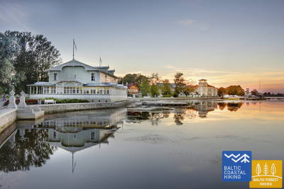
Популярный эстонский курорт Хаапсалу
Разнообразный отрезок Тропы Балтийского взморья. Первые три километра маршрута проходят по бывшей ширококолейной железной дороге Хаапсалу – Рохукюла, огибают залив Хаапсалу через мыс Пуллапяэ, пересекают прибрежные леса, где проложены тропы здоровья, и по прибрежным променадам и маленьким улочкам огибают город Хаапсалу. Пересекая небольшую заболоченную местность, этап тропы завершается в красивом парке Ууемыйза.
Paralepas dabas taka un pludmale
Природная тропа начинается на парковке (GPS: 58.940856, 23.515004) напротив пляжа Паралепа. Тропа идет параллельно береговой линии, огибает мелководный залив и пересекает небольшое водно-болотное угодье, достигая западной части города Хаапсалу. Длина тропы составляет 2 км в одном направлении. Покрытие: асфальт и деревянный настил. Вся тропа доступна для инвалидных колясок. Есть доступный туалет. Природная тропа совпадает с Юртакой.


Haapsalu Väike Viik
Mazais Vīks (Väike Viik) — это бывший залив, который в прежние времена был отделен от моря, а теперь популярен среди птиц. Он расположен в северной части Хаапсалу. Вокруг небольшого озера проложена тропа длиной около 2 км, по которой могут свободно передвигаться люди в инвалидных колясках и родители с детскими колясками. Поверхность покрыта гравием и асфальтом. Ближайший доступный туалет находится в туристическом информационном центре Хаапсалу. Тропа частично совпадает с тропой Юртака.


Haapsalu Promenade and Africa Beach
Один из самых красивых приморских променадов в Эстонии тянется вдоль восточного побережья Хаапсалу на протяжении 1,2 км. Поверхность вымощена булыжником. Вся длина променада подходит для людей в инвалидных колясках и родителей с детскими колясками. Рядом с пляжем Africa Beach находится детская игровая площадка и вышка для наблюдения за птицами. На дальней части тропы находится парк для обучения навыкам передвижения на инвалидной коляске, тренажеры и игровая площадка, адаптированная для детей с функциональными нарушениями. Тропа частично совпадает с тропой Юртака.


Uuemõisa Manor Park
Парк пересекает сеть троп, доступных для людей в инвалидных колясках. Общая длина троп составляет около 1,2 км. Покрытие тропы — гравий. Тропы частично пересекаются с тропой Юртака.


49-й этап. Ууемыйза – Элбику.
Вокруг залива Хаапсалу
В основном Тропа Балтийского взморья идет по обочине шоссе и только между поселками Ингкюла и Аулепа вьется по маленьким деревенским дорогам, где можно наслаждаться сельскими пейзажами с хуторами, валунами и пастбищами.
Uuemõisa Manor Park
Парк пересекает сеть троп, доступных для людей в инвалидных колясках. Общая длина троп составляет около 1,2 км. Покрытие тропы — гравий. Тропы частично пересекаются с тропой Юртака.
Silma Workshop and Nature Reserve
Silma Workshop — это природная школа, расположенная в природном заповеднике Silma. Из нее открывается вид на заросшие воды залива Хаапсалу и его ответвления, богатые птицами и растениями. Длина тропы составляет 0,4 км (туда и обратно) с поверхностью из протоптанной дорожки, гравия и травы. Мастерская доступна для инвалидных колясок, но требует помощи и предварительной регистрации, так как вдоль тропы есть ограждение. Она расположена примерно в 3,5 км от тропы Юртака.
51-й этап. Ригулди – Дирхами.
Место со следами метеорита
За исключением первых 3 км, маршрут идет вдоль берега моря. Преимущественно это песчаный пляж с красивыми дюнами (в том числе серыми) и валунами в море. На пляже могут быть выброшенные на берег водоросли, в некоторых местах он зарос густой растительностью. Напротив поселка Роослепа и в других местах в море и на берегу можно увидеть сильно выветрившиеся камни – т. н. брекчии, являющиеся сплавившимися в результате падения древнего метеорита и выветрившимися горными породами. В конце маршрута можно посидеть в кабачке, с террасы которого открывается красивый вид на море и порт.
Roosta Beach
От комплекса отдыха «Роста» к дюнам проложены дощатые настилы, доступные для людей на инвалидных колясках.


Dirhami Port
От парковки в порту (GPS: 59.209328, 23.497846), покрытой гравием (может потребоваться помощь), можно проследовать к рыболовецкому и торговому портовому причалу Дирхами. Примерно на протяжении 300 метров (по асфальту) вы можете наслаждаться видом на побережье Финского залива и гавань. Рядом находится очаровательный ресторан Дирхами, куда можно попасть по специальному пандусу. Он расположен недалеко от тропы Юртака.


52-й этап. Дирхами – Ныва.
Суровая северная природа
Невероятно разнообразный в плане пейзажей отрезок Тропы Балтийского взморья, где уже можно увидеть природу, характерную для северного побережья Эстонии. Маршрут практически постоянно идет вдоль берега моря, где по берегам заливов тянутся красивые песчаные пляжи, выступающие в море мысы покрыты валунами, а в северной части мыса Пыысаспеа (отличное место для наблюдения за птицами) на поверхность выходят доломитовые слои. Тропа Балтийского взморья проходит по природному заповеднику Ныва, где открываются потрясающие виды на белые и серые дюны. Пляж является популярным местом для рыбалки и кайтбординга.
Dirhami Port
От парковки в порту (GPS: 59.209328, 23.497846), покрытой гравием (может потребоваться помощь), можно проследовать к рыболовецкому и торговому портовому причалу Дирхами. Примерно на протяжении 300 метров (по асфальту) вы можете наслаждаться видом на побережье Финского залива и гавань. Рядом находится очаровательный ресторан Дирхами, куда можно попасть по специальному пандусу. Он расположен недалеко от тропы Юртака.
Peraküla beach and camping site
От зоны отдыха и парковки (GPS: 59.221567, 23.602891) по деревянному настилу (0,1 км) можно добраться до смотровой площадки, откуда открывается вид на побережье Финского залива. Может потребоваться помощь, так как настил иногда может быть занесен песком из-за ветра. Туалет частично доступен. Место находится недалеко от тропы Юртака.


58-й этап. Лауласмаа – Вяэна-Йыэсуу.
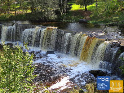
Самый красивый водопад в Эстонии
Живописный в плане ландшафта отрезок Тропы Балтийского взморья, подходящий для выносливых туристов. Здесь можно увидеть и каменистые, и песчаные пляжи и хорошие места для купания, красивые прибрежные сосновые леса, впечатляющую скальную стену Тюрисалу и огромные валуны. По тропам обширного лесопарка Кейла-Йоа можно дойти до водопада на реке Кейла, возле которого снимались фрагменты популярного латышского фильма «Слуги дьявола», а также ознакомиться с экспозицией, посвященной жизни рыбаков в прибрежном поселке Лохусалу.
RMK Keila-Joa Park nature trail
Тропа длиной 2,1 км знакомит посетителей с парком Кейла-Йоа, оформленным в английском стиле, и популярным водопадом Кейла. Первые 250 метров, начиная от парковки (GPS: 59.393587, 24.294767), доступны для людей в инвалидных колясках с помощником. Поверхность состоит из гравия, щебня и естественной тропы. Тропа расположена недалеко от тропы Юртака.


60-й этап. Табасалу – Таллинский порт.
Таллин – мировое наследие UNESCO
Возле Табасалу Тропа Балтийского взморья пересекает границу Таллина и через районы Тискре и Висмейстри выходит на пляж Какумяэ, где огибает окруженный скалами полуостров Какумяэ по его верхней лесистой части. Здесь открывается вид на залив Копли и Таллинский порт. Напротив района Ыйсмяэ вдоль берега моря идет великолепный променад. Обогнув Эстонский этнографический музей, Тропа Балтийского взморья по береговому променаду доходит до пляжа Строоми и идет дальше за район Пелгуранна по тротуарам до эстонского Морского музея, где по береговому променаду доходит до Таллинского порта – финиша Тропы Балтийского взморья. По территории Эстонии пройдено ~620 км.
Pēsakilas (Pääsküla) purva dabas taka
Тропа длиной 4 км знакомит посетителей с различными типами лесов и болотом. Два километра тропы доступны для людей в инвалидных колясках. Она расположена примерно в 8,5 км от тропы Юртака.


Pikakari beach
Пляж Пикакари предлагает плавательные средства, раздевалки и деревянный пандус для доступа к воде. Услугу необходимо забронировать заранее по телефону +372 5666 2455. Он расположен в 2,5 км от тропы Юртака.
64-й этап. Нида – Пярвалка.
Побережье Куршского залива
Морская тропа начинается в центре Ниды недалеко от порта. Далее она петляет вдоль побережья Куршского залива, откуда открывается прекрасный вид на широкие водные просторы вплоть до острова Русне на восточном берегу Куршского залива. В Ниде можно полюбоваться типичной для Куршской косы архитектурой: одноэтажные деревянные дома с черепичной или камышовой крышей, ставнями, выкрашенными в синий и белый цвета. От Ниды до мыса Бульвикис (перед мысом - взлетно-посадочная полоса заброшенного аэродрома) Морская тропа петляет по небольшим лесным тропинкам, ведущим вверх и вниз по поросшим соснами дюнам, местами выходит к покрытым скудной растительностью прибрежным лугам. Рядом с тропой есть места для отдыха и вышки для наблюдения за птицами. В следующем участке видны очень своеобразные открытые прибрежные луга, заросшие лишайниками и типичными для Куршской косы видами растений. В поселке Прейла Морская тропа проходит по променаду набережной. До посёлка Пярвалка она петляет по лесным тропам и пешеходным/велосипедным дорожкам, пока не достигает центра Пярвалки. Этот участок проходит через территорию национального парка «Куршская коса».
Nida Promenade
Нидский променад простирается примерно на 2 км от гавани Ниды вдоль Куршского залива, предназначен для пешеходов и велосипедистов. Он имеет хорошо оборудованные зоны отдыха. Поверхность вымощена современным асфальтом и доступна для людей в инвалидных колясках. Он совпадает с Прибрежной тропой.
65-й этап. Пярвалка – Юодкранте.
Через самые впечатляющие в Северной Европе песчаные дюны
За Пярвалкой Морская тропа по пешеходной дорожке пересекает Куршскую косу в направлении с востока на запад и выходит на побережье Балтийского моря. Следующий участок, протяженностью около 13 км, проходит по красивому песчаному пляжу, который с востока ограничен высоким, отвесным гребнем дюн. Он сформирован руками человека, чтобы защитить полуостров от сползания песка. Перед Юодкранте Морская тропа поворачивает на восток и через поросшие лесом крутые дюны снова пересекает Куршскую косу, выходя к Куршскому заливу. Небольшой участок Морской тропы совпадает с тропой Горы Ведьм. Далее тропа продолжается по променаду набережной Юодкранте и выходит к порту. Участок проходит через территорию национального парка Куршская коса.
Juodkrantė Promenade
Променад Юодкранте простирается примерно на 1,4 км от порта Юодкранте вдоль Куршского залива, предназначен для пешеходов и велосипедистов. Он оснащен благоустроенными зонами отдыха и имеет современное покрытие. Он доступен для людей в инвалидных колясках и совпадает с Прибрежной тропой.
66-й этап. Юодкранте – Клайпеда.
Клайпеда – морские ворота Литвы
Оставив позади променад вдоль набережной Юодкранте, Морская тропа пересекает Куршскую косу в северо-западном направлении, проходя по небольшим лесным тропинкам, которые петляют по крутым, поросшим соснами склонам дюн, пока снова не выходит на побережье Балтийского моря. Следующие 9 км Морская тропа проходит по побережью, по песчаным пляжам. С восточной стороны она ограничена крутой дюной, защищающей косу от переносимого ветром песка. За поселком Алкснинес (с берега не виден) Морская тропа поворачивает на восток, пересекая поросший горными соснами Pinus mugo лес и проходя мимо бывшей военной базы немецкой армии времён Второй мировой войны, пока не достигнет берега Куршского залива. Далее Морская тропа петляет по поросшим соснами дюнам, с которых открывается виды на Клайпедский порт. Маршрут между Новой и Старой паромной переправой сначала проходит по небольшой тропинке, а затем по променаду набережной. От Старой переправы, после переправы через Куршский залив, Морская тропа ведет к центру Клайпеды - по улице Данес до Биржевого моста. Участок до парома проходит по территории национального парка «Куршская коса».
Juodkrantė Promenade
Променад Юодкранте простирается примерно на 1,4 км от порта Юодкранте вдоль Куршского залива, предназначен для пешеходов и велосипедистов. Он оснащен благоустроенными зонами отдыха и имеет современное покрытие. Он доступен для людей в инвалидных колясках и совпадает с Прибрежной тропой.
67-й этап. Клайпеда – Паланга.
По территории Приморского регионального парка
По улице Х. Манто Морская тропа проходит через центр Клайпеды, пересекает Клайпедский парк отдыха, железную дорогу и в южной части поселка Мелнраге выходит на побережье Балтийского моря. Далее она продолжает петлять по прибрежному променаду и защищающим дюны деревянным тропинкам, и по уютной тропинке продолжается через прибрежные леса, находящиеся примерно в 10–20 м от пешеходной/велосипедной тропы через посёлок Вторая Мелнраге до Гируляй. Рядом с Гируляй тропа ненадолго выходит на пляж, а от Кукулишкес до южной части посёлка Каркле Морская тропа петляет вдоль очень красивого берега бывшего Литоринского моря, поросшего нетронутым лесом, а затем вдоль живописного, подмытого волнами склона с несколькими обзорными площадками (включая утёс Шляпа голландца). Следующие 11 км от поселка Каркле до Ботанического парка Паланги Морская тропа ведет по песчаным галечным пляжам, где встречаются и более крупные камни. Проходя по тропинкам западной части Ботанического парка Паланги, Морская тропа доходит до Аллеи любви и по ней ведёт до пешеходного моста Паланги. Большая часть этого участка проходит через Приморский региональный парк.
Palanga Sea Bridge
Единственное сооружение такого рода в странах Балтии. Поверхность состоит из современного мощения перед мостом и дерева на самом мосту. Он доступен для людей в инвалидных колясках. Главная пешеходная улица Паланги, улица Й. Басанавичюса, также доступна. Он расположен недалеко от Прибрежной тропы.

68-й этап. Паланга – граница Литвы и Латвии (Швянтойи).
По самым популярным курортам побережья Литвы
После пересечения по пешеходному мосту речки Раже, Морская тропа петляет по пешеходной (беговой) дорожке «Labrytys» и у улицы Контининку выходит на побережье. Следующие 9 км до старого мола в Швянтойи Морская тропа проходит по песчаному пляжу, омываемому морем. Потом она огибает устье реки Швянтойи, проходит через курортный городок, в конце улицы Копу пересекает реку Швянтойи по подвесному пешеходному мосту и снова выходит на пляж. У святилища «Žemaičių Alka» Морская тропа опять делает небольшую дугу и далее вдоль песчаного пляжа ведёт до находящейся в 3 км границы Литвы и Латвии.
Palanga Sea Bridge
Единственное сооружение такого рода в странах Балтии. Поверхность состоит из современного мощения перед мостом и дерева на самом мосту. Он доступен для людей в инвалидных колясках. Главная пешеходная улица Паланги, улица Й. Басанавичюса, также доступна. Он расположен недалеко от Прибрежной тропы.