


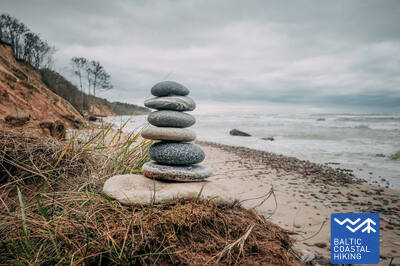
Baltic Coastal Hiking trail - Wheelchair accesible

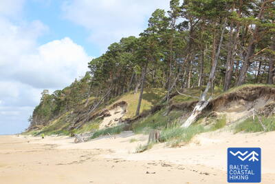
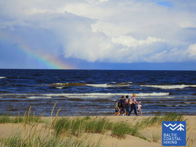
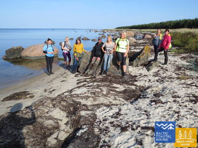
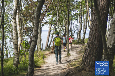
 2. posms. Pape - Bernāti.
Tālākais Latvijas rietumu punkts
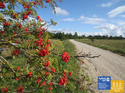
Ranniku matkaraja lõik kulgeb kogu pikkuses mööda randa, mis Pape ümbruses on ääristatud kaunite eelluidetega. Pärast küla asenduvad eelluited 10 km pikkuses langenud männitüvesid täis kaldapealsega. Lauged luited ilmuvad taas välja Jūrmalciemsi lähedal. Bernāti neeme lähistel kõrgub muljetavaldav männimetsaga kaetud ja paiguti mere poolt uhutud liivakivipaljand.
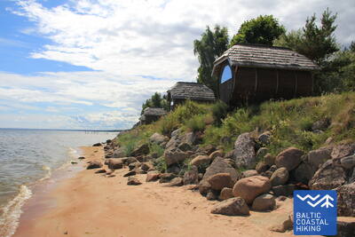
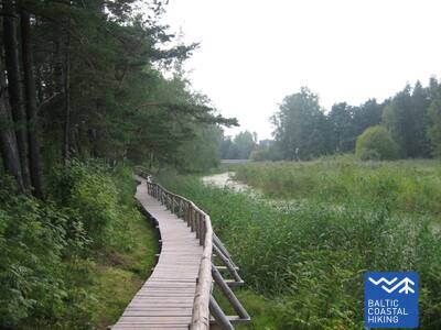
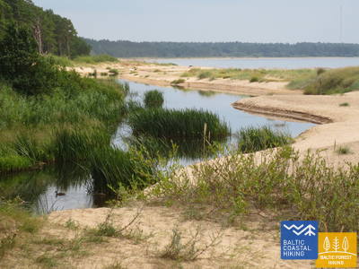
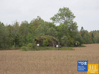
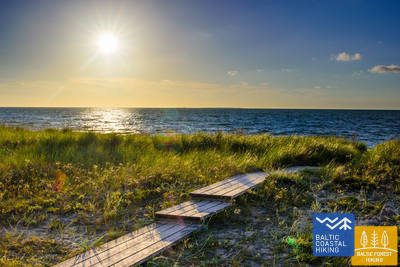
Bernātu pludmales laipa

Bernāti ranna laudtee on ühes suunas umbes 400 meetrit pikk, laiusega 1,2–1,6 meetrit. See on osaliselt ligipääsetav ratastoolis inimestele ja soovitatav abiga, kuna kalle ulatub kuni 12 protsendini. Seda saab kasutada ka vankriga vanematel. Laudtee lõpus on vaateplatvorm ja puhkeala. Hooajal pikendatakse laudteed, et ratastooliga kasutajad saaksid rannajoonele jõuda. Laudtee lähedal on parkla (GPS: 56.366156, 20.976715) ja kuivkäimla (mitte kohandatud).


2. posms. Pape - Bernāti.
Tālākais Latvijas rietumu punkts
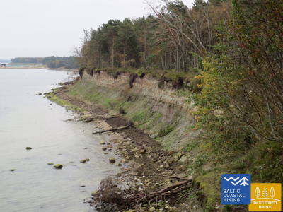
Ranniku matkaraja lõik kulgeb kogu pikkuses mööda randa, mis Pape ümbruses on ääristatud kaunite eelluidetega. Pärast küla asenduvad eelluited 10 km pikkuses langenud männitüvesid täis kaldapealsega. Lauged luited ilmuvad taas välja Jūrmalciemsi lähedal. Bernāti neeme lähistel kõrgub muljetavaldav männimetsaga kaetud ja paiguti mere poolt uhutud liivakivipaljand.
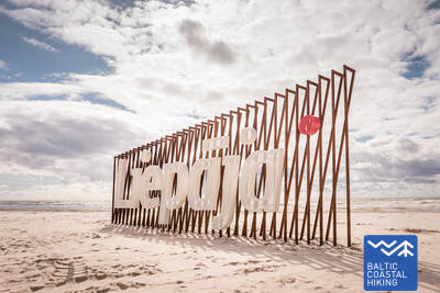
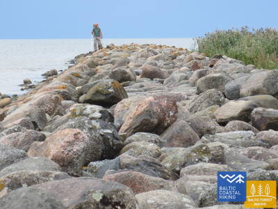
3. posms. Bernāti - Liepāja - Karosta.
Pilsēta, kurā piedzimst vējš
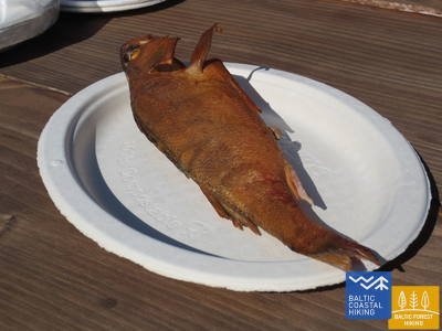
Ranniku matkarada kulgeb Bernātist Liepājani mööda laia rannariba, mida maismaa poolt ääristavad algul paiguti mere poolt uhutud liivakivipaljand, muutudes Liepāja lähedal kõrgeteks eelluideteks. Rada lookleb läbi Liepāja vanalinna ja üle Karosta kanali. Vana sõjasadama Karosta militaar - ja kaitserajatistega tutvumiseks soovitame võtta vähemalt pool päeva. Kindlasti soovitame maitsta Liepāja erirooga, Liepājas menciņi, vana Lõuna-Kuramaa retsepti järgi suitsutursast valmistatud toitu.
Pārgājienu maršruts "Sadzirdi, sasmaržo, satausti Liepāju"
Pimedate ja vaegnägijate jaoks loodud marsruuti juhendab väljaõppinud pime giid. See hõlmab Liepāja oluliste kultuuri- ja ajalooliste paikade külastusi. Marsruudi pikkus sõltub grupi vajadustest. See asub Rannaraja lähedal. Liepājas on välja töötatud mitmeid puutetundlikke kaarte, mis aitavad nägemispuudega inimestel hõlpsamini navigeerida.
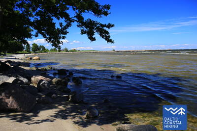
Liepājas pludmale pie Centrālās glābšanas stacijas
Liepāja rannas, keskpäästejaama lähedal (GPS: 56.504199, 20.991922), on rajatud puuetega inimestele mõeldud asutus. See hõlmab duširuume, riietusruume ja puidust laudteid, mis ulatuvad mereni, võimaldades ratastooliga kasutajatel kaldajoonele jõuda. Saadaval on spetsiaalsed meres ujumiseks sobivad ratastoolid. Pimedate ja vaegnägijate jaoks paigutatakse merre helipoid, mis annavad signaalide kaudu teavet selle kohta, kui kaugele tohib ujuda.


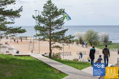
Liepājas Jūrmalas parks
Pargis on ligikaudu 3 km pikkune radade võrgustik, mis sobib ratastoolis inimestele. Raja pinnad on erinevad, sealhulgas kruus, sillutis, laudteed ja asfalt. Saadaval on puhkealad, söögikohad, parklad ja tualetid. Parki pääseb Liepu ja Peldu tänava ristmikult (GPS: 56.506365, 20.997112). See asub Rannaraja lähedal.


Liepājas ezera laipa
Liepāja järve laudtee on ligipääsetav ratastoolis inimestele ja jalutuskäruga vanematele. See on lai ja varustatud servadega, mis ulatuvad ühes suunas ligikaudu 400 meetrit. Torni ei pääse ratastooliga kasutajad. See asub Rannaradast ca 2 km kaugusel, GPS: 56.494511, 21.024515.


Liepājas ezera Zirgu salas taka
Liepāja järve hobuste saare rada on ühes suunas umbes 2 km pikk. Raja alguses on parkla (GPS: 56.516585, 21.032329) ja Dabasmāja – teaduse ja hariduse innovatsioonikeskus (varustatud kaldteedega). Raja pind koosneb alguses laudteedest, millele järgneb kruusatee. See on ligipääsetav ratastoolis inimestele, kuigi kruusaosa on soovitatav abiga. See asub 1,3 km kaugusel Coastal Trailist.


3. posms. Bernāti - Liepāja - Karosta.
Pilsēta, kurā piedzimst vējš
Ranniku matkarada kulgeb Bernātist Liepājani mööda laia rannariba, mida maismaa poolt ääristavad algul paiguti mere poolt uhutud liivakivipaljand, muutudes Liepāja lähedal kõrgeteks eelluideteks. Rada lookleb läbi Liepāja vanalinna ja üle Karosta kanali. Vana sõjasadama Karosta militaar - ja kaitserajatistega tutvumiseks soovitame võtta vähemalt pool päeva. Kindlasti soovitame maitsta Liepāja erirooga, Liepājas menciņi, vana Lõuna-Kuramaa retsepti järgi suitsutursast valmistatud toitu.
 5. posms. Ziemupe - Pāvilosta.
Dziedošās smiltis un dzintars
Ranniku matkaraja lõik saab alguse laulvate liivadega rannalt, kus võib leiduda merevaiku ja fossiilidega kivistisi. Ziemupe kandis on näha osaliselt lainete poolt uhutud liivakivipaljandit. Edasi laiuvad Akmensragsi neemeni ja Pāvilostani kaunid rannaluited ja vareskaerast läbikasvanud ning mere uhutud eelluited. Paiguti on näha ka halle luiteid. Akmenragsi tuletorni juures on hea jalgu puhata. Pāvilosta väikelinna sarm ning sadama ja suitsukala hõng toovad matkaja puutumata looduse rüpest tagasi tsivilisatsiooni juurde.
Pāvilostas mola promenāde
Pāvilosta mutipromenaadi umbes 200 meetri pikkune osa on ratastoolis inimestele ligipääsetav, kuid mutt ise mitte. Sobiv lähtekoht on Pāvilosta koduloomuuseum (GPS: 56.889365, 21.172837). See asub Rannikuraja kõrval.


Pāvilostas pludmales laipa
Pāvilosta ranna laudtee tutvustab külastajatele halli luite ja rannikulüütide elupaiku. Tegemist on 1,2 meetri laiuse puidust laudteega, mille pikkus on pool kilomeetrit (edasi-tagasi). Rada algab kruusakattega. Parkimiskoht on saadaval (GPS: 56.892935, 21.185369). Rada on ligipääsetav ka ratastoolis inimestele abiga, kuna seal on tõusud ja langused. Juurdepääs rannajoonele ei ole võimalik.


5. posms. Ziemupe - Pāvilosta.
Dziedošās smiltis un dzintars
Ranniku matkaraja lõik saab alguse laulvate liivadega rannalt, kus võib leiduda merevaiku ja fossiilidega kivistisi. Ziemupe kandis on näha osaliselt lainete poolt uhutud liivakivipaljandit. Edasi laiuvad Akmensragsi neemeni ja Pāvilostani kaunid rannaluited ja vareskaerast läbikasvanud ning mere uhutud eelluited. Paiguti on näha ka halle luiteid. Akmenragsi tuletorni juures on hea jalgu puhata. Pāvilosta väikelinna sarm ning sadama ja suitsukala hõng toovad matkaja puutumata looduse rüpest tagasi tsivilisatsiooni juurde.
 6. posms. Pāvilosta - Jūrkalne.
Izcilākie Baltijas jūras stāvkrasti
Ranniku matkaraja lõigul jäävad Pāvilostast kirdesse erakordsed vaated hallidele luidetele. Mõne kilomeetri pärast algab ka üks matkaraja kaunimaid lõike: 20 km uhkeid liivaklinte. Kõige huvitavamad rannikuvaated avanevad Strante, Ulmale ja Rīva jõesuudme juures. Varisenud ranniku alaosas õitsevad suviti orhideed. Jūrkalne kandis saab näha kahte päikeseloojangut – esimest rannajoonelt ning teist hetk hiljem kõrge pankranniku otsast vaadates.
Pāvilostas pludmales laipa
Pāvilosta ranna laudtee tutvustab külastajatele halli luite ja rannikulüütide elupaiku. Tegemist on 1,2 meetri laiuse puidust laudteega, mille pikkus on pool kilomeetrit (edasi-tagasi). Rada algab kruusakattega. Parkimiskoht on saadaval (GPS: 56.892935, 21.185369). Rada on ligipääsetav ka ratastoolis inimestele abiga, kuna seal on tõusud ja langused. Juurdepääs rannajoonele ei ole võimalik.
Pāvilostas mola promenāde
Pāvilosta mutipromenaadi umbes 200 meetri pikkune osa on ratastoolis inimestele ligipääsetav, kuid mutt ise mitte. Sobiv lähtekoht on Pāvilosta koduloomuuseum (GPS: 56.889365, 21.172837). See asub Rannikuraja kõrval.
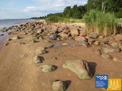
8. posms. Sārnate - Užava.
Skaistākais Latvijas piekrastes skats
Ranniku matkaraja Sārnate – Užava lõigul on Sārnate kandis näha Läänemere kõrget liivarannikut, mis põhja poole liikudes jääb järjest madalamaks, kuni muutub merre uhutud luitevalliks. Vendzavase ja Užava tuletorni vahel avanevad Läti jaoks ebatavalised vaated – loodus meenutab siin hõreda taimestikuga mahajäetud liiva-kivikõrbe – see on
nõukogude armee endine sõjaväepolügon. Užava jõe suudme lähedal muutub luiteala järjest laiemaks ja luitevall madalamaks. Romantilise Užava tuletorni juurest avaneb üks matkaraja kaunimaid vaateid.
Užavas grīvas pludmales laipa
Užava jõe suudme lähedal mere ääres kulgev laudtee on 0,5 km edasi-tagasi puidust rada, mis on mõeldud ratastoolikasutajatele. Laudtee on 1,2 meetrit lai, tee ääres on läbipääsualad. Läheduses on parkla (GPS: 57.247001, 21.414652). Raja ääres on puhkeala, kuhu ratastooliga ei pääse ja mereranda ei pääse. Laudtee asub Jūrtaka raja kõrval.


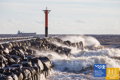
9. posms. Užava - Ventspils.
Savāc savu dzintaru kolekciju!
Ranniku matkaraja Užava – Ventspils lõigul kulgeb teekond esimesed 6 km mööda laiade rannaluidete ja madalate eelluidetega randa, mille seljandikke katavad hõbehallid rand-luidekaera ja liiv-vareskaera puhmad. Alates Medole oja suudmest kerkib muljetavaldav ligi 19 m kõrge, kitsa kivise merepiiriga liivakivipaljand. Kõrge rannik alaneb kiiresti, et kahe kilomeetri pärast taas tõusta. Kahe kõrge ranniku vahele jääb nõukogude armee endine sõjaväepolügon. Matkaraja viimased viis kilomeetrit kuni Ventspilsi lõunamuulini kulgevad mööda laia liivaluidet.
Ventspils Jūrmalas parks
Ventspilsi mereäärses pargis on umbes 3,5 km pikkune radade võrgustik, sealhulgas 730 m pikkune Ankrurada. Rajad (v.a. Džunglirada) on ligipääsetavad ratastoolis liikuvatele inimestele ja jalutuskäruga lapsevanematele. Raja pind koosneb kruusast ja asfaldist (alguses). Mugav alguspunkt pargiga tutvumiseks on Parka ja Loču tänavate ristmik (GPS: 57.389279, 21.537021), kus on parkimine ja WC. Park asub Jūrtaka raja kõrval. Ratastoolis inimestele ja jalutuskäruga lapsevanematele on sobivaim mereäärne randapääs pargis asuv 6. sissepääs.
9. posms. Užava - Ventspils.
Savāc savu dzintaru kolekciju!
Ranniku matkaraja Užava – Ventspils lõigul kulgeb teekond esimesed 6 km mööda laiade rannaluidete ja madalate eelluidetega randa, mille seljandikke katavad hõbehallid rand-luidekaera ja liiv-vareskaera puhmad. Alates Medole oja suudmest kerkib muljetavaldav ligi 19 m kõrge, kitsa kivise merepiiriga liivakivipaljand. Kõrge rannik alaneb kiiresti, et kahe kilomeetri pärast taas tõusta. Kahe kõrge ranniku vahele jääb nõukogude armee endine sõjaväepolügon. Matkaraja viimased viis kilomeetrit kuni Ventspilsi lõunamuulini kulgevad mööda laia liivaluidet.
10. posms. Ventspils - Staldzene.
Cauri Ventspilij!
Ranniku matkaraja lõik läbib Ventspilsi linna ja seda ümbritsevaid metsi. Matkarada lookleb lõunamuuli juurest läbi ajaloolise Ostgala linnaosa ja vanalinna, üle Venta jõe ning mööda kergliiklusteed läbi Pārventa linnaosa Staldzene poole. Tehes tiiru ümber Ventspilsi sadama naaseb rada taas mereranda. Nüüd tasub võtta üks matkavaba päev ja tutvuda põnevate paikadega Ventspilsi linnas ning külastada ka mereäärset vabaõhumuuseumi.
Būšnieku ezera dabas taka
Rada ümber Būšnieki järve on 9 km pikkune ring, kuhu pääsevad ratastoolikasutajad ja jalutuskäruga lapsevanemad. Sellel on audiogiid, puutetundlik teave ja parkimisala liikumispuudega inimestele. Soovitatav alguspunkt on järve kaguküljel asuv parkla (GPS: 57.437632, 21.656062). Rada asub Jūrtaka rajast ca 1 km kaugusel.


15. posms. Saunags - Kolka.
Eiropas sirds – Kolkasrags!
Über kleine Feldwege und Waldwege von Saunaga führt der Pfad Jūrtaka bis Vaide. Dort kehrt er wieder zur Meeresküste zurück. Bis Kolkasrags erstrecken sich breite, sandige Strände, die sich zu niedrigen Vordünen mit spärlicher Vegetation verflachen. Dahinter erfreuen erneut waldige Dünen das Auge. Auf einer Länge von etwa 2 Kilometern - weggespülte niedrige Dünen, hinter denen der Berg Dumbrkalni emporragt. Kolkasrags - die Grenzlinie zwischen dem Großmeer und Kleinmeer (Rigaer Meeresbucht) - ist einer der beliebtesten Vogelbeobachtungsorte an der Ostseeküste.
Kolkas priežu taka
Der 1,8 km lange Pfad dient der Erkundung der Artenvielfalt der Küstendünen. Er verfügt über zwei Aussichtsplattformen, die für Rollstuhlfahrer zugänglich sind. Die Trockentoiletten sind teilweise für Personen mit Funktionsbeeinträchtigungen angepasst. Es steht ein Parkplatz zur Verfügung (GPS: 57.756668, 22.591180). Der Pfad befindet sich neben dem Jūrtaka-Pfad.


16. posms. Kolka - Ģipka.
Gar "slēgto krastu"
Wenn man das Gesicht von Kolkasrags in Richtung Meeresbucht dreht, merkt man gleich den Unterschied zwischen dem “Großmeer“ und dem “Kleinmeer“. Die ersten zehn Kilometer des Baltischen Küstenwanderweges verlaufen entlang der Küste des Nationalparks Slītere. Der Pfad passiert die Bauten der ehemaligen Fischerkolchose, einen Schiffsliegeplatz und die Steilküste Ēvaži. Deren Umgebung wird von einem ungewöhnlich schmalen, sandigen Strand mit darüber hängenden Schwarzerlen geprägt. Auch weiter bis Ģipka erstreckt sich ein schmaler, sandiger Strand mit vielen Nassgallen, die durch den nah an die Oberfläche getretenen, wasserundurchlässigen Untergrund entstanden sind, und Mündungen von kleineren, im Sommer ganz seichten Flüsschen. Das Küstengebiet des Nationalparks Slītere war während der Sowjetzeit ein doppelt geschlossenes Territorium – es war Grenzzone und Naturschutzgebiet.
Ēvažu dabas taka
Der Weg ist für die Besichtigung einer der seltenen Steilküsten des Rigaischen Meerbusens konzipiert. Rollstuhlfahrer können die Aussichtsplattform erreichen, die einen Blick auf den Rigaischen Meerbusen bietet. Der Weg ist 1,2 km lang. Der Untergrund besteht zu Beginn aus Schotter, danach ausgetretener Pfad und Holzstege mit Treppen in der Nähe der Steilküste. Auf der gegenüberliegenden Seite der Straße Tukums-Kolka gibt es einen Parkplatz (GPS: 57.677789, 22.567982). Der Weg verläuft neben dem Jūrtaka-Weg.


17. posms. Ģipka - Kaltene.
Kurzemes akmeņainā jūrmala
Von Ģipka bis Roja erstreckt sich ein sandiger, nicht besonders breiter Strand mit bezaubernden Dünen und Strandkieferwäldern. Kurz vor Roja ist der Strand dicht mit Sandrohr bewachsen. Der Streckenabschnitt zwischen Roja und der Kirche in Kaltene ist der einzigartigste Strand Lettlands. Dort ist die Meeresküste mit einem sehr schmalen Strand von kleinen Küstenvorsprüngen und Golfen ausgekerbt. Am Strand sind Felsbrocken unterschiedlicher Größe zu beobachten, die sich unter dem grünen Laubwerk von Schwarzerlen verbergen. An einigen Stellen ragen weit ausgebreitete Wurzelrosette von Bäumen empor, die an den Strand angespült wurden. Streckenweise verläuft entlang der Küste ein Weg, an dem sich viele ehemalige Fischerhäuser aneinanderreihen.
Laipas Rojas kāpās
Die Holzstege sind für Rollstuhlfahrer und Eltern mit Kinderwagen geeignet. Es gibt einen Informationsstand in Blindenschrift und eine taktile Strandkarte. Zur Ausstattung gehören ein behindertengerechtes WC und ein Parkplatz (GPS: 57.510088, 22.799207). Die Promenade ist in eine Richtung 0,5 km lang. Rollstuhlfahrer können die Promenaden zwar benutzen, können das Meer jedoch nicht erreichen, da es keine Rampe gibt. Die Promenaden sind breit und verfügen über Geländer an den Seiten und Überholflächen.


17. posms. Ģipka - Kaltene.
Kurzemes akmeņainā jūrmala
Von Ģipka bis Roja erstreckt sich ein sandiger, nicht besonders breiter Strand mit bezaubernden Dünen und Strandkieferwäldern. Kurz vor Roja ist der Strand dicht mit Sandrohr bewachsen. Der Streckenabschnitt zwischen Roja und der Kirche in Kaltene ist der einzigartigste Strand Lettlands. Dort ist die Meeresküste mit einem sehr schmalen Strand von kleinen Küstenvorsprüngen und Golfen ausgekerbt. Am Strand sind Felsbrocken unterschiedlicher Größe zu beobachten, die sich unter dem grünen Laubwerk von Schwarzerlen verbergen. An einigen Stellen ragen weit ausgebreitete Wurzelrosette von Bäumen empor, die an den Strand angespült wurden. Streckenweise verläuft entlang der Küste ein Weg, an dem sich viele ehemalige Fischerhäuser aneinanderreihen.
18. posms. Kaltene - Mērsrags.
Daudzveidīgais krasts
In biologischer, kulturhistorischer und landschaftlicher Hinsicht ein sehr vielfältiger Küstenanschnitt des Baltischen Küstenwanderweges. In der Nähe von Kaltene ist die Meeresküste von winzigen Golfen mit steinigen Stränden bunt gemustert. Weiter erstreckt sich der mit Steinen bedeckte Strand nur ein paar Meter breit. Streckenweise ist er mit Lehmschichten, Rohrfeldern bedeckt, an einigen Stellen – mit angespülten Wasserpflanzen. Auf der Strecke von Valgalciems bis Mērsrags kommen wieder sandige Strände mit Sandbänken zum Vorschein. Hinter Mērsrags verläuft der Routenabschnitt über einen Weg, der an der lutheranischen Kirche in Richtung Meer abbiegt und bis zum Zentrum von Mērsrags einer Strandwiese entlang führt.
Laipa Upesgrīvā
Liegt zwischen dem Campingplatz Lūši und dem Meer (GPS: 57.381441, 23.025370). Der Promenadenweg hat keine Seitengeländer und keine Ausweichflächen. Er ist für Rollstuhlfahrer mit Assistent zugänglich. Seine Länge beträgt in eine Richtung etwa 90 Meter. Er bietet keinen Zugang zum Meeresufer. Er liegt in der Nähe des Küstenwanderwegs (Jūrtaka).


Laipa pie Mērsraga bākas
Befindet sich in der Bākas-Straße 60. Der Steg ermöglicht Rollstuhlfahrern, vom Parkplatz (GPS: 57.365315, 23.120436) zu den Dünen zu gelangen, von wo aus man das Meer sehen kann. Der Steg ist teilweise mit Kantenschutz versehen und hat keine Wendebereiche. Die Länge beträgt ungefähr 150 m (Hin- und Rückweg). Er befindet sich in der Nähe des Küstenwanderwegs.


19. posms. Mērsrags - Engure.
Engures dabas parkā
Vom Dorfzentrum bis zum Strand führt ein von Kiefern umschlossener Waldweg. Weiter windet sich der Baltische Küstenwanderweg zwischen einem von Sandrohr und anderen Pflanzen reichlich bewachsenen und steinigen Strand auf einer Seite und einer bewaldeten Düne auf der anderen Seite. Stellenweise ist der Strand mit kleinen, runden Kieselsteinen bedeckt, andernorts sind Graudünen mit üppiger Vegetation zu sehen. In der Umgebung von Bērzciems erstrecken sich Strandwiesen mit Sandbarren weit ins Meer. Sie sind ein guten Platz, um Vögel zu beobachten. Bis zum Dorf Abragciems setzt sich die bewachsene Meeresküste fort, die dann bis Engure durch einen Strand abgelöst wird.
Engures taka
Vom Parkplatz (GPS: 57.171428, 23.222504) in der Slimnīcas-Straße führt ein Holzsteg über die Dünen zum Meer. Er ist für Rollstuhlfahrer zugänglich. Aufgrund der Steigung kann Hilfe erforderlich sein. Der Weg ist in eine Richtung etwa 200 Meter lang. Er befindet sich in der Nähe des Küstenwanderwegs (Jūrtaka).


20. posms. Engure - Ragaciems.
Zvejniekciemi un kūpinātas zivis
Der Baltische Küstenwanderweg schlängelt sich zuerst durch das Dorf Engure, dann zwischen einem ziemlich schmalen Strand und bezaubernden, waldigen Dünen und führt bis zur Düne des Dorfes Plieņciems. Hinter der Düne wird der sandige Strand immer breiter und offenbart einen Blick auf breite Sandbänke. In Richtung Festland ragen hier bewachsene Steilküsten mit einem Treppenweg und gut ausgestatteten Stegen bis zur Landstraße Kolka – Tukums empor. Allerdings muss man damit rechnen, dass es hier an warmen Sommertagen viele Urlauber gibt. Das abschließende Drittel dieses Wegabschnitts liegt im Nationalpark Ķemeri.
Apšuciems
In Apšuciems stehen zwei schwimmende Strandrollstühle für Menschen mit eingeschränkter Mobilität zur Verfügung. Diese sind nach vorheriger Absprache unter +371 26132761 in der Apšuciems-Schule erhältlich. Benutzer müssen einen eigenen Assistenten mitbringen, der ihnen beim Hin- und Rückweg zum Wasser, beim Schwimmen und Zurückkommen hilft. Schwimmwesten sind ebenfalls erhältlich. Es gibt Pläne, im Jahr 2025 einen Zugang zum Meer zu bauen, der Rollstuhlzugang, Westen, Umkleidekabinen und spezielle Sonnenmatten umfassen wird. Mit Hilfe sind kleine Ausflüge entlang des harten Sandabschnitts der Küste möglich. Dieser befindet sich am Baltic Sea Trail.

Plieņciema Baltās kāpas Robežas taka
Der Weg befindet sich an der südlichen Grenze des Plieņciems, in Richtung Riga und Engure.
Der Name Plieņciems stammt von dem baltischen Wort „pliens“ - Kalkstein oder Mergelis. Die erste urkundliche Erwähnung des Dorfes stammt aus dem Jahr 1551, auf Landkarten taucht es jedoch erst ab 1702 als bewohnter Ort auf. In der Mitte des 18. Jahrhunderts erwähnt das Kirchenbuch von Engure, dass es in Plieņciems neun Bauernhöfe gab, die das Recht hatten, im Meer und im Engure-See zu fischen und Seegras zu sammeln.
Der Weg führt von der Straße zum Meer und führt die Wanderer über den Dünenwall. Die Oberfläche des Weges ist so gestaltet, dass er für Rollstuhlfahrer (vorzugsweise mit einer Begleitperson) und Familien mit Kindern in Kinderwagen zugänglich ist. Der Strand verfügt über einen Umkleideraum und einen kleinen Spielplatz. Auf dem Weg gibt es keine ausgewiesene Fläche für den Platztausch mit dem Gegenverkehr.


20. posms. Engure - Ragaciems.
Zvejniekciemi un kūpinātas zivis
Der Baltische Küstenwanderweg schlängelt sich zuerst durch das Dorf Engure, dann zwischen einem ziemlich schmalen Strand und bezaubernden, waldigen Dünen und führt bis zur Düne des Dorfes Plieņciems. Hinter der Düne wird der sandige Strand immer breiter und offenbart einen Blick auf breite Sandbänke. In Richtung Festland ragen hier bewachsene Steilküsten mit einem Treppenweg und gut ausgestatteten Stegen bis zur Landstraße Kolka – Tukums empor. Allerdings muss man damit rechnen, dass es hier an warmen Sommertagen viele Urlauber gibt. Das abschließende Drittel dieses Wegabschnitts liegt im Nationalpark Ķemeri.
21. posms. Ragaciems - Dubulti.
Vēsturiskais Jūrmalas kūrorts
Von Ragaciems eröffnet sich ein weiter Ausblick über die ganze Küste von Jūrmala. Das erste Drittel dieses Streckenabschnitts führt durch den Nationalpark Ķemeri. Dort kann man sich mit historischen Fischerdörfern, der ehemaligen Fischerbootsanlegestelle und dem Fischmarkt in Ragaciems sowie den Dünenbiotopen vertraut machen. Auch kann man Vögel im Mündungsgebiet des Flusses Starpiņupīte beobachten. Von Jaunķemeri bis Dubulti verläuft der Pfad entlang dem breitesten Sandstrand der Rigaer Meeresbucht durch den historischen Kurort der Stadt Jūrmala und die längste Stadt Lettlands. An warmen und schönen Sommertagen muss mit zahlreichen Strandbesuchern gerechnet werden.
Jūrmalas pilsētas pludmales
Die Stadtstrände von Jurmala sind für Menschen mit funktionellen Beeinträchtigungen zugänglich, darunter auch für Rollstuhlfahrer und Senioren. In Jūrmala gibt es 14 angepasste Zugangspunkte zum Meer für Rollstuhlfahrer: Linie 36, Vienības prospekts (2 Zugangspunkte), Turaidas iela (2 Zugangspunkte), Pilsonu iela, Baznīcas iela, Kļavu iela, Līgatnes iela, Dzimtenes iela, Vēju iela, Atbalss iela, Kapteiņa Zolta iela und Jaunķemeri-Straße. Diese Zugangspunkte sind unter Berücksichtigung des Untergrunds und des Geländes so konzipiert, dass sie sowohl für Personen mit Funktionseinschränkungen als auch für Personen mit Kinderwagen geeignet sind. Darüber hinaus stehen an vier Standorten – Vaivari, Kaugguri, Jaunķemeri und Jaundubulti – erweiterte und komfortablere Umkleidekabinen zur Verfügung.
Kupskalnu dabas taka
Der Weg erstreckt sich einen halben Kilometer am rechten Ufer des Flusses Siliņupe entlang und führt von der Straße Sloka-Talsi zum Meer. Er ist teilweise für Rollstuhlfahrer mit Hilfe zugänglich, da Baumwurzeln am Anfang des Weges ein Hindernis darstellen können. Der weitere Abschnitt des Weges (breite Promenaden mit Ausweichstellen) ist zugänglich. Teilweise sind Toiletten zugänglich. Die Wanderung kann von einer nahe gelegenen Tankstelle aus begonnen werden (GPS: 56.992203, 23.522736).


22. posms. Dubulti - Lielupe - Bulduri.
Populārākās Latvijas pludmales
Zwischen Dubulti und Lielupe erstreckt sich der breiteste Sandstrand der Rigaer Meeresbucht – es ist der wertvollste Schatz des Kurorts Jūrmala, in dem es zahlreiche Strandcafés und verschiedene Erholungsmöglichkeiten gibt, Die Wälder der Küstendünen sind von einem dichten Wegenetz durchzogen, das zum Joggen und Wandern geeignet ist. Der Baltische Küstenwanderweg führt zwischen dem Strand Lielupe und dem Freilichtmuseum Jūrmala durch den Naturpark Ragakāpa. Am bequemsten zurück nach Bulduri gelangt man über die Straßen Bulduru prospekts und 5. līnija.
Jūrmalas pilsētas pludmales
Die Stadtstrände von Jurmala sind für Menschen mit funktionellen Beeinträchtigungen zugänglich, darunter auch für Rollstuhlfahrer und Senioren. In Jūrmala gibt es 14 angepasste Zugangspunkte zum Meer für Rollstuhlfahrer: Linie 36, Vienības prospekts (2 Zugangspunkte), Turaidas iela (2 Zugangspunkte), Pilsonu iela, Baznīcas iela, Kļavu iela, Līgatnes iela, Dzimtenes iela, Vēju iela, Atbalss iela, Kapteiņa Zolta iela und Jaunķemeri-Straße. Diese Zugangspunkte sind unter Berücksichtigung des Untergrunds und des Geländes so konzipiert, dass sie sowohl für Personen mit Funktionseinschränkungen als auch für Personen mit Kinderwagen geeignet sind. Darüber hinaus stehen an vier Standorten – Vaivari, Kaugguri, Jaunķemeri und Jaundubulti – erweiterte und komfortablere Umkleidekabinen zur Verfügung.
23. posms. Bulduri - Rīgas centrs.
Cauri mežiem uz Rīgu!
Diese Route ist eine gute Alternative, wie man Rīga von Jūrmala her über einen Waldweg erreichen kann. Hinter der Brücke Lielupe schlängelt sich der Pfad Jūrtaka durch Priedaine und offenbart den Blick auf die herrliche Holzbebauung der Ortschaft. Der Pfad verläuft dem rechten Ufer des Flusses Lielupe entlang und biegt südlich der Düne Bolderāja ab. Dann führt der Pfad durch den Wald Kleisti in Richtung des Friedhofes Lāčupe. Weiter verläuft der Pfad über die historischen Landstraßen des Stadtteils Pārdaugava nach Dzegužkalns, dem Zunda-Kanal und der Bucht Āgenskalns entlang bis zur Daugava. Dort überquert er die Akmens tilts (Steinbrücke) und erreicht den Rathausplatz der Stadt Rīga.
Jūrmalas pilsētas pludmales
Die Stadtstrände von Jurmala sind für Menschen mit funktionellen Beeinträchtigungen zugänglich, darunter auch für Rollstuhlfahrer und Senioren. In Jūrmala gibt es 14 angepasste Zugangspunkte zum Meer für Rollstuhlfahrer: Linie 36, Vienības prospekts (2 Zugangspunkte), Turaidas iela (2 Zugangspunkte), Pilsonu iela, Baznīcas iela, Kļavu iela, Līgatnes iela, Dzimtenes iela, Vēju iela, Atbalss iela, Kapteiņa Zolta iela und Jaunķemeri-Straße. Diese Zugangspunkte sind unter Berücksichtigung des Untergrunds und des Geländes so konzipiert, dass sie sowohl für Personen mit Funktionseinschränkungen als auch für Personen mit Kinderwagen geeignet sind. Darüber hinaus stehen an vier Standorten – Vaivari, Kaugguri, Jaunķemeri und Jaundubulti – erweiterte und komfortablere Umkleidekabinen zur Verfügung.
Babītes rododendru audzētava
Es wurde ein 1,9 Kilometer langer Pfad angelegt, der für Rollstuhlfahrer und Eltern mit Kinderwagen zugänglich ist. Die Oberfläche des Pfades ist asphaltiert. Es gibt einen ausgewiesenen Parkplatz (GPS: 56.962330, 23.952280) und eine behindertengerechte Toilette. Der Pfad liegt etwa 2,7 Kilometer vom Jūrtaka-Pfad entfernt.
Daugavgrīvas dabas taka
Der Weg beginnt am Parkplatz (GPS: 57.036769, 24.018166) in der Nähe der Valentīna Pikuļa-Straße und führt über das Daugavgrīva-Sumpfgebiet zu den Dünen und zum Meer. Der Weg ist in Meeresnähe asphaltiert und der asphaltierte Abschnitt ist für Rollstuhlfahrer zugänglich. Entlang des Weges wurde ein Vogelbeobachtungsturm errichtet, dessen erste Etage für Rollstuhlfahrer zugänglich ist. Der Weg ist etwa 12,5 Kilometer vom Jūrtaka-Weg entfernt, der an der Meeresküste in Daugavgrīva liegt.

24. posms. Rīgas centrs - Vecāķi.
Vecrīga – UNESCO pasaules mantojuma vieta
Der Routenabschnitt verläuft durch das Stadtzentrum von Rīga - die Altstadt, den Stadtkanal entlang, durch den Kronvalda-Park, die Alberta-Straße (Jugendstilbauten) und dann weiter durch die Miera-Straße über den Großen Friedhof, die Alleen Kokneses prospekts und Ostas prospekts und den Mežaparks (Kaiserwald) hindurch erreicht man den Stadtteil Jaunmīlgrāvis und passiert den Stadtteil Mīlgrāvis. Über die Allee Vecāķu prospekts führt der Weg weiter bis nach Ziemeļblāzma und zum Ufer der Vecdaugava, wovon Vecāķi nur wenige Kilometer entfernt ist. Nach einer zweitägigen Wanderung durch die Stadt Rīga führt der Pfad Jūrtaka wieder zum Strand zurück.
Mangaļsalas pastaigu takas
Zwei Wanderwege in Mangaļsala führen durch Dünengebiete und Küstenwälder zum Meer. Der erste Wanderweg (GPS: 57.071642, 24.087599) wird Rollstuhlfahrern mit Begleitperson empfohlen, da er zum Meer führt, aber keinen direkten Zugang zum Strand bietet. Der zweite Wanderweg (GPS: 57.062730, 24.055460) beginnt als unbefestigter Weg und wird später zu einem breiten Holzsteg, über den Rollstuhlfahrer den Strand erreichen können. Der dritte Wanderweg (GPS: 57.061976, 24.041811) führt zum Ostpier. Obwohl er nicht speziell für Rollstuhlfahrer konzipiert ist, kann er, einschließlich des Piers selbst, mit Begleitperson befahren werden, außer bei starkem Wind oder Sturm. Sowohl der erste als auch der zweite Wanderweg verfügen über eigene Parkplätze und WC-Anlagen. Der nächste Wanderweg ist etwa 3,5 km von Jūrtaka entfernt.


25. posms. Vecāķi - Carnikava.
Starp divu upju – Daugavas un Gaujas grīvām
Dieser Abschnitt des Baltischen Küstenwanderweges ist eine verhältnismäßig kurze Wanderung entlang eines bezaubernden Sandstrandes. Von der Festlandseite ist er durch lichterfüllte Kiefernwälder mit eindrucksvollen Dünen und Dünenwallen abgegrenzt. Vom Strand bis Carnikava führt der Pfad durch eine Waldpromenade. Über einen Schutzdamm verläuft der Pfad um den Fluss Vecgauja herum und erreicht die Fußgängerbrücke über die Gauja. Vor Beginn oder zum Abschluss der Wanderung lohnt es sich, die Atmosphäre Kneipen oder Sommercafés am Strand Vecāķi oder in Carnikava gemütlich zu genießen.
Garciema dabas taka
Der Holzsteg führt zur Mündung des Eimuri-Kanals am Meer. Das Ende des Holzstegs liegt nahe am Ufer und mit Hilfe eines Assistenten kann das Meer erreicht werden. Er ist für Rollstuhlfahrer und Eltern mit Kinderwagen geeignet. Ein Parkplatz (GPS: 57.108161, 24.192324) und WC sind vorhanden. Die Länge in eine Richtung beträgt 0,7 km. Er befindet sich neben Jūrtaka.
Carnikavas promenāde
Verbindet Carnikava mit der Meeresküste. Der Weg ist gepflastert, aber in den Sanddünen – mit Holzstegen. Am Meeresufer gibt es Gehwege und Aussichtsplattformen mit Liegestühlen. Die Länge der Strecke in eine Richtung beträgt 1,8 km. Es ist für Rollstuhlfahrer und Eltern mit Kinderwagen zugänglich. In der Laivu-Straße wurden ein Parkplatz (GPS: 57.133531, 24.265631), angepasste Toiletten, Informationsstände und Rastplätze eingerichtet. Der sandige Bereich des Meeresufers ist nicht für Rollstuhlfahrer zugänglich. Der letzte Abschnitt der Promenade weist eine Steigung von 9,2 % auf. Jurtaka bewegt sich entlang der Carnikava-Promenade. 2024/2025 G. An der Carnikava-Promenade ist die Einrichtung einer speziellen Route für spezielle Geländerollstühle geplant, die ihren Benutzern zusammen mit einem Assistenten zur Verfügung stehen.


26. posms. Carnikava - Saulkrasti.
Saulrieta taka ar romantiskākajiem saulrietu skatiem
Anfangs führt der Routenabschnitt über den Schutzdamm der Gauja im Dorf Gauja. Dann erreicht das Mündungsgebiet des Flusses, was eine ausgezeichneter Stelle zur Vogelbeobachtung ist. Weiter verläuft der Wanderweg über einen sandigen Strand bis zur Mündung des Flusses Inčupe. Um die Brücke erreichen zu können, muss man kurz vor der Mündung in Richtung Festland abbiegen. Die nächsten paar Kilometer verlaufen über die waldreichen Dünengipfel des Sonnenuntergangspfades (Saulrieta taka), die eine wunderbare Aussicht auf den Strand offenbaren. Nach der Überquerung des Flusses Pēterupe (Seilbrücke) erreicht der Pfad Jūrtaka den Meerespark “Jūras parks” in Saulkrasti.
Lilastes pludmales laipa
Nimmt ans Meer. Seine Länge in eine Richtung beträgt 130 m. Los geht es am Parkplatz (GPS: 57.187403, 24.329523), von dem aus eine Person im Rollstuhl mit Hilfe eines Helfers zum Strand gelangen kann. Es liegt neben Jurtaka.

Baltā kāpa
Eine der malerischsten Dünen der Rigaer Bucht. Für Rollstuhlfahrer mit Begleitperson zur Aussichtsplattform vom Parkplatz aus zugänglich (GPS: 57.233560, 24.393407). Baltas Kapa ist Teil der Jūrtakas-Route.
Gājēju celiņš un koka laipu tīkls Saulkrastu piekrastes kāpās
Der Weg liegt zwischen der Raiņa-Straße und der Bīriņu-Straße (Seepark, Tourismusinformationszentrum Saulkrasti) und ist für Rollstuhlfahrer und Eltern mit Kinderwagen geeignet. Er verläuft parallel zum Jūrtaka-Pfad. Der einfachste Zugang zum Weg und zur Promenade erfolgt vom Parkplatz aus (GPS: 57.267111, 24.413875).


26. posms. Carnikava - Saulkrasti.
Saulrieta taka ar romantiskākajiem saulrietu skatiem
Anfangs führt der Routenabschnitt über den Schutzdamm der Gauja im Dorf Gauja. Dann erreicht das Mündungsgebiet des Flusses, was eine ausgezeichneter Stelle zur Vogelbeobachtung ist. Weiter verläuft der Wanderweg über einen sandigen Strand bis zur Mündung des Flusses Inčupe. Um die Brücke erreichen zu können, muss man kurz vor der Mündung in Richtung Festland abbiegen. Die nächsten paar Kilometer verlaufen über die waldreichen Dünengipfel des Sonnenuntergangspfades (Saulrieta taka), die eine wunderbare Aussicht auf den Strand offenbaren. Nach der Überquerung des Flusses Pēterupe (Seilbrücke) erreicht der Pfad Jūrtaka den Meerespark “Jūras parks” in Saulkrasti.
27. posms. Saulkrasti - Lauči.
„Vārti” uz Vidzemes akmeņaino jūrmalu
Die ersten Kilometer bis Zvejniekciems können dem Strand entlang zurückgelegt werden. Oder auch über einen Pfad, der sich durch einen Dünenwald mit alten Kiefern windet. Für diese ist eine “krokodilartige“ Borke charakteristisch. Hier kommt man auch an einer alten Holzhütte mit Fischernerzen und Fischerzubehör vorbei. Kurz vor dem Hafen Skulte kommen am Strand Zvejniekciems die ersten Steine zum Vorschein. Nachdem er das Mündungsgebiet des Flusses Aģe und den Hafen umbiegt, führt der Baltische Küstenwanderweg zurück zum Strand. Von dort ist das Kap Ārņu bereits aus der Ferne zu sehen. Die Vielfältigkeit der Küstenlandschaften.
Gājēju celiņš un koka laipu tīkls Saulkrastu piekrastes kāpās
Der Weg liegt zwischen der Raiņa-Straße und der Bīriņu-Straße (Seepark, Tourismusinformationszentrum Saulkrasti) und ist für Rollstuhlfahrer und Eltern mit Kinderwagen geeignet. Er verläuft parallel zum Jūrtaka-Pfad. Der einfachste Zugang zum Weg und zur Promenade erfolgt vom Parkplatz aus (GPS: 57.267111, 24.413875).
28. posms. Lauči - Tūja.
Aizgājušais burinieku laikmets
Eine herrliche Küstenlandschaft der Region Vidzeme mit vielen steinreichen Erdzungen und Steinen im Meer. Sie werden von kleinen, sandigen Buchten abgelöst, in denen die im Sommer austrocknenden Bäche und kleinen Flüsschen münden. An einigen Stellen ist der Strand vollständig mit grauen Steinen bedeckt. Allmählich kommen auch mit Sandrohr bewachsene Flächen zum Vorschein. Kurz vor Tūja finden sich die ersten Sandsteinfreilegungen.
Minhauzena alus kausa taka
Der 1,3 km lange Weg (einfache Strecke) befindet sich am Dunte Manor und beginnt in der Nähe des Minhauzens Museums. Der Weg besteht aus 1,5 m breiten Holzstegen mit mehreren Ausweichstellen. Die Erkundung des Weges kann bequem vom Parkplatz aus beginnen (GPS: 57.405620, 24.424681). Der Weg liegt 1,7 km vom Jūrtaka-Weg entfernt.
29. posms. Tūja - Svētciems.
Vidzemes akmeņainā jūrmala
Einer der schönsten Abschnitte des Pfades Jūrtaka beginnt nach der Überquerung des Flusses Zaķupīte. Bis zum Leuchtturm Ķurmrags erstrecken sich vorwiegend sandige Strände mit kleinen steinreichen Stellen. Danach beginnt der Steinstrand von Vidzeme, wo sich Erdzungen und kleine Buchten ablösen. Am Strand ragen bis zu 4 Meter hohe Sandsteinfreilegungen empor. Hinter dem Meleku-Kap führt der Pfad wieder über einen vorwiegend sandigen Strand, der kurz vor der Mündung des Flusses Svētupe dicht bewachsen ist. Dazu kommt Schilfrohr, das man über einen Waldweg umlaufen muss.
Atpūtas vieta "Vasas"
Es wurden eine Aussichtsplattform und ein Parkplatz (GPS: 57.520544, 24.379052) angelegt, die für Rollstuhlfahrer zugänglich sind. Sie befinden sich neben dem Jūrtaka-Wanderweg.
Veczemju klintis
In der Nähe der Veczemju-Klippen gibt es eine Rampe für Rollstuhlfahrer mit Hilfe. Der Strandsand ist jedoch nicht für Rollstuhlfahrer geeignet. Die Basis der Rampe wird häufig durch Stürme beschädigt. Sie befindet sich in der Nähe des Baltischen Küstenwanderwegs (Jūrtaka).


30. posms. Svētciems - Ainaži.
Nēģu karaliste
Der Strand zwischen Svētciems und Salacgrīva ist dicht bewachsen. Der Pfad Jūrtaka verläuft deshalb über einen Waldweg, der sich zwischen den Dünenwällen windet. Von Salacgrīva kann das Dorf Kuiviži über einen sandigen Strand oder Waldpfade erreicht werden. Um die Randu-Wiesen von Kuiviži bis Vēverupe muss man einen Umweg über einen Waldweg machen, der sich auf der östlichen Seite der Landstraße A1 befindet. Hinter dem Fluss Vēverupe führt der Pfad zurück zu einem sehr dicht bewachsenen Strand. Bei der Mündung des Flusses Blusupīte verlässt er diesen wieder, um über die Kāpu-Straße und Valdemāra-Straße das Pier Ainaži zu erreichen. In Lettland waren ~ 580 km zurückgelegt und nun die Staatsgrenze erreicht.
Salacgrīvas promenāde
Die etwa 260 Meter lange, gepflegte Promenade (einschließlich der Slavas-Allee) am rechten Ufer des Flusses Salaca ist für Rollstuhlfahrer mit Hilfe eines Helfers zugänglich. Sie können Ihre Erkundungstour vom Parkplatz aus beginnen (GPS: 57.756060, 24.358155). Sie befindet sich in der Nähe des Baltischen Küstenwanderwegs (Jūrtaka).


Piemineklis "Baltā saule"
Befindet sich in Ainaži. Zur Besichtigung wurde ein etwa 150 Meter langer Holzsteg angelegt (GPS-Ausgangspunkt: 57.859628, 24.347306). Er ist für Rollstuhlfahrer mit Hilfe und für Eltern mit Kinderwagen zugänglich. Die Entfernung vom Parkplatz zum Steg beträgt etwa 250 Meter. Er befindet sich in der Nähe des Küstenwanderwegs.


Krasta ielas promenāde Salacgrīvā
Umbes 0,8 km pikkune see on loodud piki Salaca vasakut kallast sillast kuni Meža tänavani, kus asuvad tenniseväljakud. Juurdepääs ratastoolis inimestele. Loodud on puhke- ja vaatamiskohad, Meža tänavale - kohandatud WC. Katte - kaasaegne sillutis.


Laipas līdz Salacgrīvas pludmalei
Jūrmala tänava parklast (57.75083, 24.34911) randa on loodud kaks puidust jalgsilda. Ratastooliga inimestele ligipääsetav koos abilisega, kuna laudtee düüniga ülekäigukoht võib sisaldada mäda liiva. Parklas on tualett. Laudtee kate - puit. Kaks ratastooli ei saa laudteel vahetada.


30. posms. Svētciems - Ainaži.
Nēģu karaliste
Ranniku matkarada kulgeb Svētciemsi – Salacgrīva lõigul mööda luitevallide vahel looklevat metsarada, sest rannariba on tihedalt rohtunud ja sisuliselt läbimatu. Salacgrīvast Kuivižisse võib minna mööda liivaranda või metsateid. Ümber Kuiviži ja Vēverupe vaheliste rannaniitude saab mööda metsateed, mis asub A1 maanteest idas. Pärast Vēverupet naaseb matkarada rohtunud randa, lahkudes sealt Blusupīte jõesuudmes, et jõuda mööda Kāpu ja Valdemāra tänavaid Ainaži muulini. Selja taha on jäänud ligi 580 km Lätimaad ja avastamist ootab Eestimaa.
32. posms. Kabli - Häädemeeste.
Putni, kāpas un meži!
Ranniku matkaraja lõik Kablist Häädemeeste lõunaosani tuleb läbida mööda vana Riia maanteed, sest teest mereni laiuvad roostunud ja abajatega rannaniidud. Antud lõik sobib eriti hästi linnuvaatluseks. Vahetult enne Häädemeestet keerab matkarada maanteelt kõrvale, lookleb Jaagupi hoiualal ja teeb lääne poolt alevikule tiiru peale, ronib kord kõrgele luitenõlvale ja laskub siis taas alla luidete vahelisse kõrgesse männikusse. Matkaraja ääres on head marja- ja seenemetsad.
Kabli dabas taka
Rada tutvustab külastajatele rannaluiteid ja nende loodusväärtusi. Algab parklast (GPS: 58.019424, 24.450986), mis asub Kabli külastuskeskuse lähedal. Raja pikkus on 1,8 km. Rajapinnad on kruusa, metsarajad ja 1,5 m laiused puidust laudteed. Rada on ligipääsetav ratastoolikasutajatele ning olemas on kohandatud WC. Raja ääres asuvad infostendid, millel on ka vaateplatvorm ja kaks linnuvaatlustorni (ratastooliga pole ligipääsetav). See asub Coastal Traili lähedal.


34. posms. Uulu - Pärnu.
Gar mitrājiem uz Pērnavu!
Ranniku matkaraja Uulu - Pärnu lõik kulgeb alguses männimetsade vahel olevaid vanu mereäärseid teid pidi, kuid pärast Lottemaa teemaparki keerab mere poole jõudes Reiu randa. Edasi tuleb kõndida mööda võsastuvat luidet ning umbes 4 km pärast pöörata sisemaa suunas, läbida golfiväljaku äärne territoorium ja võtta suund Pärnu linnale. Raeküla linnaosas kulgeb matkarada piki märgala ja metsa piiri. Umbes 6 km pikkuse tiiru järel ümber märgalade jõuab rada Pärnu randa. Edasi viib teekond läbi Pärnu linna, Vallikääru aasa, üle Pärnu ja Sauga jõgede ja lõpeb Vana-Pärnus.
Pērnavas piekrastes pļavu dabas taka
Rajal tutvutakse märgade rannaniitude, laguunide ning kohaliku linnu- ja taimestikuga. See on kujundatud ovaalse kujuga, vaateplatvormiga (pääsetav esimesele korrusele) ja ulatub 600 meetrini. Külastust saab mugavalt alustada lähedalasuvast parklast (GPS: 58.372397, 24.507902). Raja katteks on puidust laudteed, parkla lähedal asfaltkattega teed. Rada on ligipääsetav ratastoolikasutajatele, kuid abi on soovitatav, kuna mõnel lõigul on kalle üle 8%. See asub Coastal Traili lähedal.


Pērnavas pludmales promenāde
Rada kulgeb poole kilomeetri ulatuses paralleelselt Pärnu lahe rannaga. Pinnaks on valdavalt puidust laudtee (laius 2,3–3,1 meetrit), mõne sillutisega, laiusega kuni 4 meetrit. See on ligipääsetav ratastoolikasutajatele. Rada saab mugavalt alustada lähedalasuvast parklast (GPS: 58.372397, 24.507902).
Pieeja pie jūras, peldratu noma
2024. aastal võimaldatakse Hedon SPA & Hotellis hooajaline ligipääs ujumisvahenditele ja muule varustusele ning luuakse spetsiaalne pind, mis võimaldab ratastooliga sõitjatel vette pääseda.


Pērnavas pludmales parks
1882. aastal rajatud park on populaarne puhkeala nii linnakülalistele kui ka kohalikele elanikele. Sellel on ligikaudu 1 km pikkune radade võrgustik (umbes 3 m laiused), mis on ligipääsetavad ratastoolikasutajatele. Raja katted on killustik ja asfalt. Tasuline parkimine on saadaval pargi perimeetri ümber. See asub Jūrtaka lähedal.


Koka laipa uz Pērnavas molu
Laudtee algab Pärnu muuli vastas (GPS: 58.381941, 24.483994). Laudtee on 0,6 km pikkune (üks suund) ja ratastoolikasutajatele ligipääsetav. Pind on puidust ja laius on 3 meetrit. Erinevates punktides on teepikendused ja puhkealad. See pakub suurepärast võimalust tutvuda Pärnu sadamaga. See asub umbes 350 meetri kaugusel Jūrtakast.


35. posms. Pärnu - Liu.
Skaistākie Pērnavas līča skati un kūpinātas zivis!
Ranniku matkaraja Pärnu – Liu lõik lookleb läbi Pärnu läänepoolse eeslinna ja üle Audru jõe Valgeranna poole. Rada ääristab lõuna poolt mets ja valge liivarand, põhja poolt aga Valgeranna golfiväljak. Valgerannast edasi kulgeb rada Pärnu lahe põhjakülje poldrite vahel, Audru poldritelt avanevad kaunid vaated Pärnu lahele. Audru roostiku tagant keerab rada lõunasse ning kulgeb läbi rannakülade ja väikeste kalasadamate, kus saab jälgida kalurite argitoimetusi ja kui veab, siis maitsta ka suitsukala.
Valgreannas pludmales promenāde
Rada ühendab parkla rannaga. Pinnas on sillutis ja puidust laudtee laiusega 1,95-3 meetrit. See on ligipääsetav ratastoolikasutajatele. Olemas kuivkäimla. See asub Jūrtaka kõrval.


38. posms. Tõstamaa - Matsi.
Igaunijas lauku idille
Ranniku matkaraja Tõstamaa – Matsi lõigul näeb tõelist maaelu idülli. Rannajoont liigendavad paljud madalad lahesopid ja poolsaared, mille vahel on rannaniidud, roostikud ja abajad, aga ka ligipääsmatud laiud. Liikudes mööda väikeseid külavaheteid, mida ääristavad sügiseti punetavad pihlakad, saab näha talumajasid ning karjamaid lehmade ja kitsedega. Taluhoovid vahelduvad kiviaedade, põldude ja kadakasaludega. Pääs mere äärde ja puhkekohad asuvad matkarajast lõuna pool, Kastna küla lähedal.
Matsi ostas taka
Rada tutvustab külastajatele endist Matsi kalasadamat. See on 500 meetrit pikk (edasi-tagasi). Rada algab parklast (GPS: 58.360251, 23.746683). Pinnas on asfalt, betoon ja killustik. Tuulise ilmaga võib rada olla kaetud liivaga, mistõttu ratastoolikasutajad võivad abi vajada. Rajal on puutetundlikud objektid ja teave punktkirjas. Olemas on ligipääsetav WC. See asub Jūrtaka kõrval.


39. posms. Matsi - Varbla.
Pludmale un meži!
Ranniku matkaraja Matsi – Varbla lõik teeb tiiru läbi Kulli küla ja kulgeb edasi 5 km mööda kohalikke metsade ja luidetega ääristatud teid. See piirkond on sügiseti marja- ja seenerohke. Olles teinud tiiru ümber Uue-Varbla mõisa, jõuab matkarada Varbla külla. Matkaraja lõigul asuv Matsi rand on kuni Haapsaluni üks vähestest liivarandadest.
Matsi ostas taka
Rada tutvustab külastajatele endist Matsi kalasadamat. See on 500 meetrit pikk (edasi-tagasi). Rada algab parklast (GPS: 58.360251, 23.746683). Pinnas on asfalt, betoon ja killustik. Tuulise ilmaga võib rada olla kaetud liivaga, mistõttu ratastoolikasutajad võivad abi vajada. Rajal on puutetundlikud objektid ja teave punktkirjas. Olemas on ligipääsetav WC. See asub Jūrtaka kõrval.
45. posms. Penijõe - Laiküla.
Apkārt Ziemeļeiropas lielākajam mitrājam
Ranniku matkaraja Penijõe – Laiküla lõik teeb tiiru ümber Kasari jõe delta. Kasari jõgi suubub Matsalu lahte, moodustades ühe Põhja-Euroopa suurimatest märgaladest. Laiadest roostikest, rannaniitudest, jõesängist ja madala lahe vetest koosnev ala on oluline puhke- ja pesitsuspaik rändlindudele. Suurem osa matkarajast kulgeb läbi avarate põldude ja väikeste külade. Kirbla kandis on näha kõrgendik – see on kunagise Balti jääpaisjärve saare põhjarannik.
Rannajõe (Rannajē) skatu platforma
Rada tutvustab külastajatele Matsalu rahvuspargi lamminiite, kuhu rände ajal kogunevad suured linnuparved. Platvormile pääseb 100 meetri pikkuse puidust laudtee kaudu (laiusega kuni 110 cm). Ratastoolikasutajad vajavad abi, kuna kaldtee kalle on 32%. See asub aadressil (GPS: 58.816865, 23.781363) Jūrtaka kõrval.


48. posms. Rohuküla - Haapsalu - Uuemõisa.
Populārais Igaunijas kūrorts - Hāpsalu
Ranniku matkaraja Rohuküla – Haapsalu – Uuemõisa lõik on mitmekülgne. Raja kolm esimest kilomeetrit kulgevad mööda endist Haapsalu – Rohuküla raudteetammi. Seejärel teeb rada tiiru ümber Haapsalu lahe ja Pullapää neeme, väisab rannaäärseid terviseradadega metsi ning liigub mööda promenaadi ja väikeseid tänavaid läbi Haapsalu linna ja lõppeb kaunis Uuemõisa pargis.
Paralepas dabas taka un pludmale
Loodusrada saab alguse Paralepa ranna vastas olevast parklast (GPS: 58.940856, 23.515004). Rada kulgeb paralleelselt rannajoonega, kulgeb ümber madala lahe ja läbib väikese märgala, ulatudes Haapsalu linna lääneossa. Rada on ühes suunas 2 km pikk. Pind: asfalt ja puitlaudtee. Kogu rada on ligipääsetav ratastooliga. Olemas ligipääsetav WC. Loodusrada ühtib Jūrtakaga.


Mazā Vīka taka
Mazais Vīks (Väike Viik) on kunagine laht, mis oli varasematel aegadel merest eraldatud ja on praegu lindude seas populaarne. Asub Haapsalu põhjaosas. Ümber väikese järve on loodud umbes 2 km pikkune rada, kuhu pääsevad täielikult nii ratastoolis inimesed kui ka vankriga lapsevanemad. Kattekiht koosneb kruusast ja asfaldist. Lähim ligipääsetav WC asub Haapsalu turismiinfokeskuses. Rada kattub osaliselt Jūrtaka rajaga.


Hāpsalas promenāde un Āfrikas pludmale
Piki Haapsalu idarannikut kulgeb 1,2 km ulatuses Eesti üks ilusamaid mereäärseid promenaade. Pind on sillutatud tänavakiviga. Promenaad on kogu pikkuses sobilik nii ratastoolis inimestele kui ka käruga lapsevanematele. Africa Beachi lähedal on laste mänguväljak ja linnuvaatlustorn. Raja kaugemal lõigul on ratastoolioskuste treeningpark, trenažöörid, tegevuspuudega lastele kohandatud mänguväljak. Rada kattub osaliselt Jūrtaka rajaga.


Ūemeizas (Uuemõisa) muižas parks
The park is crisscrossed by a network of trails that are accessible to people in wheelchairs. The total length of the trails is approximately 1.2 km. The path surface is gravel. The trails partially overlap with the Jūrtaka Trail.


49. posms. Uuemõisa - Elbiku.
Apkārt Hāpsalu līcim
The Baltic Coastal Hiking Route mainly goes along the side of the road and it only winds through smaller country roads between Ingküla and Aulepa Villages, where you can enjoy rural landscapes with individual farmsteads, boulders and pastures.
Ūemeizas (Uuemõisa) muižas parks
The park is crisscrossed by a network of trails that are accessible to people in wheelchairs. The total length of the trails is approximately 1.2 km. The path surface is gravel. The trails partially overlap with the Jūrtaka Trail.
Silma darbnīca
Silma Workshop is a nature school located within the Silma Nature Reserve. It offers views of the overgrown waters of Haapsalu Bay and its branches, rich in birds and plants. The trail is 0.4 km long (round trip) with a surface of a worn path, gravel, and grass. The workshop is wheelchair accessible but requires assistance and prior registration, as there is a barrier along the path. It is located about 3.5 km from the Jūrtaka Trail.
51. posms. Riguldi - Dirhami.
Vieta ar meteorīta krišanas pēdām
With the exception of the first 3 km, the itinerary goes along the seashore. It is mainly a sandy beach with beautiful foredunes, grey dunes and sea boulders. The beach may be covered in algae that has been washed ashore and it is occasionally overgrown with dense vegetation. Opposite Rooslepa village and in other places in the sea and on the coast, there are badly weathered stones or the so-called breccias that have melted and weathered as a result of an ancient meteorite explosion. At the destination of the itinerary, you can spend some time in a pub and from its terrace you will have a beautiful view of the sea and the port.
Rostas (Roostas) pludmale
From the Rosta Recreation Complex, boardwalks have been installed leading to the dunes, which are accessible for people in wheelchairs.


Dirhami osta
From the harbor parking lot (GPS: 59.209328, 23.497846), which is covered with gravel (assistance may be needed), you can proceed to the Dirhami fishing and trading port dock. For about 300 meters (paved), you can enjoy views of the Gulf of Finland coastline and the harbor. Nearby is the charming Dirhami restaurant, which is accessible via a special board ramp. It is located near the Jūrtaka Trail.


52. posms. Dirhami - Nõva.
Skarbā ziemeļu daba
An exceptionally multifaceted section of the Baltic Coastal Hiking Route in terms of landscapes, where you can already get an insight of the nature characteristic to the north coast of Estonia. The itinerary leads you along the seacoast for almost its entire length, where you will find beautiful sandy beaches near coves, beaches covered in boulders at capes, while dolomite layers uncover themselves in the northern part of Cape Põõsaspea (an excellent birdwatching site). The Baltic Coastal Hiking Route goes through Nõva Nature reserve where you will have exceptional views of the white and grey dunes. The beaches are popular for fishing and kite-boarding.
Dirhami osta
From the harbor parking lot (GPS: 59.209328, 23.497846), which is covered with gravel (assistance may be needed), you can proceed to the Dirhami fishing and trading port dock. For about 300 meters (paved), you can enjoy views of the Gulf of Finland coastline and the harbor. Nearby is the charming Dirhami restaurant, which is accessible via a special board ramp. It is located near the Jūrtaka Trail.
Perakilas (Peraküla) pludmale
From the rest area and parking lot (GPS: 59.221567, 23.602891), you can reach a viewing platform via a wooden boardwalk (0.1 km), offering views of the Gulf of Finland coastline. Assistance may be needed, as the boardwalk can sometimes be covered with sand due to the wind. The WC is partially accessible. The location is near the Jūrtaka Trail.


58. posms. Laulasmaa - Vääna-Jõesuu.
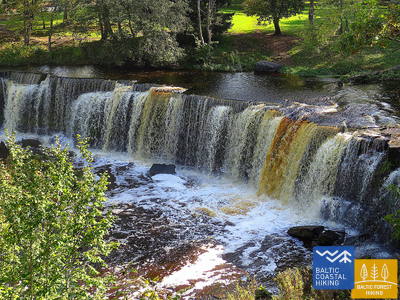
Skaistākais Igaunijas ūdenskritums
A multifaceted section of the Baltic Coastal Hiking Route in terms of landscape that is suitable for hardy hikers. There are both rocky and sandy beaches and good swimming areas, fascinating coastal pine forests, the astounding Türisalu Cliff wall and giant sea boulders. By taking the trails of the vast Keila forest park, you can go to the Keila waterfall, near which some fragments of the popular Latvian feature film Vella kalpi (Devil’s servants) were shot, and you can also get to know the exhibition dedicated to the life of coastal fishermen in Lohusalu village.
Keilas parka taka
The 2.1 km long trail introduces visitors to the Keila-Joa Park, designed in the English style, and the popular Keila Waterfall. The first 250 meters, starting from the parking lot (GPS: 59.393587, 24.294767), are accessible for people in wheelchairs with an assistant. The surface consists of gravel, crushed stone, and a natural path. The trail is located near the Jūrtaka Trail.


60. posms. Tabasalu - Tallinas osta.
Tallina – UNESCO pasaules mantojuma vieta
Near Tabasalu, the Baltic Coastal Hiking Route crosses the boundary of Tallinn and goes through the Tiskre and Vismeistri districts to reach Kakumäe beach, where it takes you on a stroll around the wooded upper part of the Kakumäe Peninsula surrounded by cliffs. Here, you will have a vista of the Port of Tallinn across Kopli Bay. Opposite the Õismäe district, an excellent promenade goes along the seashore. After bypassing the Estonian Open-Air Museum, the Baltic Coastal Hiking Route winds along the coastal promenade up to Stroomi beach and after passing the Pelguranna district it takes pedestrian sidewalks to the Estonian Maritime Museum, where it leads you, via the coastal promenade, to the Port of Tallinn, marking the end of the Baltic Coastal Hiking Route. You have covered ~ 620 km in Estonia.
Pēsakilas (Pääsküla) purva dabas taka
The 4 km long trail introduces visitors to various types of forests and a bog. Two kilometers of the trail are accessible for people in wheelchairs. It is located about 8.5 km from the Jūrtaka Trail.


Pikakari pludmale
Pikakari Beach offers swimming aids, changing rooms, and a wooden ramp for access to the water. The service needs to be booked in advance at +372 5666 2455. It is located 2.5 km from the Jūrtaka Trail.
64. posms. Nida – Pervalka.
Gar Kuršu jomas krastu
The Baltic Coastal Hiking Route starts in the center of Nida, by the port. In Nida, the trail winds along the Curonian Lagoon walkway which offers beautiful views of the expansive waters all the way to Rusnė Island on the east coast of the Curonian Lagoon. Nida features the typical architecture of the Curonian Spit region — one-storey wooden buildings with tile or reed roofs and window shutters painted blue and white. From Nida to Bulvikis Cape (shortly before the cape there is an abandoned runway), the Baltic Coastal Hiking Route winds through single-track forest trails up and down the pine-covered dunes, occasionally coming out onto beachside meadows with scarce vegetation. Rest spots and bird watching towers are available along the trail. The next section features unique open seaside meadows covered in lichens and vegetation characteristic to the Curonian Spit. The Baltic Coastal Hiking Route follows the coastal walkway in the village of Preila. It then winds through forest trails, briefly also following a pedestrian/cyclist lane and coastal paths, eventually reaching Pervalka. This section leads through the Curonian Spit National Park.
Nidas promenāde
The Nida Promenade extends approximately 2 km from Nida Harbor along the Curonian Lagoon, designed for pedestrians and cyclists. It features well-equipped rest areas. The surface is modern paving and is accessible for people in wheelchairs. It coincides with the Coastal Trail.
65. posms. Pervalka – Juodkrantė.
Gar Ziemeļeiropas iespaidīgākajām smilšu kāpām
Having departed Pervalka, the Baltic Coastal Hiking Route follows a pedestrian path to cross the Curonian Spit in an east–western direction, arriving at the coast of the Baltic Sea. The next section of 13 km leads along a beautiful, sandy beach protected by high and steep sand dunes on the east. It is called the protective dune ridge and it has been man-made in order to protect the inland from the movement of sand. Entering Juodkrantė, the Baltic Coastal Hiking Route turns eastward and crosses the Curonian Spit once again over wooded and steep dunes, to reach the Curonian Lagoon coast. The Baltic Coastal Hiking Route briefly coincides with the Hill of Witches trail. It then follows the Juodkrantė beachside walkway to the port. This section leads through the Curonian Spit National Park.
Jodkrantes (Juodkrante) promenāde
The Juodkrantė Promenade extends approximately 1.4 km from Juodkrantė Harbor along the Curonian Lagoon, designed for pedestrians and cyclists. It features well-equipped rest areas and has a modern paving surface. It is accessible for people in wheelchairs and coincides with the Coastal Trail.
66. posms. Juodkrantė – Klaipėda.
Klaipēda – Lietuvas jūras vārti
Having left the Juodkrantė beachside walkway, the Baltic Coastal Hiking Route crosses the Curonian Spit in a southeast–northwest direction leading along single-track forest trails that wind through the steep, pine-covered dunes until it eventually comes back out onto the coast of the Baltic Sea. For the next 9 km, the Baltic Coastal Hiking Route follows the coastline along sandy beaches. The steep foredune on the eastern side protects the inland from the moving sand. After Alksnynė village (not seen from the beach), the Baltic Coastal Hiking Route turns eastward, crossing a hillock covered in Pinus mugo pines and a World War II German army base, eventually approaching the coast of the Curonian Lagoon. Then the trail winds across the ridges of pine-covered dunes, providing regular views of Klaipėda Port. The route between the New and Old Ferry Port first follows a single-track path, and later a beachside walkway. Having crossed the Curonian Lagoon from the Old Ferry Port, the Baltic Coastal Hiking Route arrives in the center of Klaipėda where it follows Danės Street to the Birža Bridge. The section until Smiltynė leads through the Curonian Spit National Park.
Jodkrantes (Juodkrante) promenāde
No Jodkrantes ostas apmēram 1,4 km garumā gar Kuršu jomu virzās Jodkrantes promenāde, kas ir izveidota gājējiem un velobraucējiem. Labiekārtotas atpūtas vietas. Segums: mūsdienu bruģis. Pieejama cilvēkiem ratiņkrēslā. Sakrīt ar Jūrtaku.
67. posms. Klaipėda – Palanga.
Cauri Piejūras reģionālajam parkam
Gar H. Manto ielu Jūrtaka izved no Klaipēdas centra, šķērso Klaipēdas atpūtas parku, pa tiltu šķērso dzelzceļa līniju un Melnrages ciema dienviddaļā iznāk Baltijas jūras krastā. Tālāk tā izvijas cauri kāpām, kuru saudzēšanas nolūkā ir izveidotas koka laipas, un turpinās pa jauku taku cauri piekrastes mežiem, ap 10–20 m attālumā no gājēju/velobraucēju celiņa cauri Antroji Melnragė līdz Giruliai ciemam. Pie Giruliai tā īsu brīdi iznāk pludmalē, bet no Kukuliškiai līdz Karkles ciema dienviddaļai Jūrtaka sākumā virzās gar ļoti skaistu bijušās Litorīnas jūras krastu, kas apaudzis ar pirmatnēju mežu, bet tālāk – gar ainavisku, viļņu noskalotu stāvkrastu ar vairākām skatu vietām (t.sk. – Olando kepurė). No Karkles ciema nākamos 11 km līdz Palangas Botānikas parkam Jūrtaka ved pa smilšaini oļainām pludmalēm, kuras vietumis klāj arī akmeņi. Pa piekrastes takām Palangas Botānikas parka rietumdaļā Jūrtaka aizvijas līdz Meilės alejai un tālāk – līdz Palangas gājēju tiltam. Posma lielākā daļa ietilpst Piejūras (Pajūrio regioninis parkas) reģionālajā parkā.
Palangas Jūras tilts
Vienīgais šāda veida objekts Baltijas valstīs. Segums: pirms tilta - mūsdienu bruģis, uz tilta - koks. Pieejama cilvēkiem ar ratiņkrēslu. Tāpat pieejama arī galvenā Palangas gājēju iela - J. Basanavičiaus gatve. Atrodas pie Jūrtakas.

68. posms. Palanga – Lietuvas-Latvijas robeža (Šventoji).
Gar Lietuvas populārākajiem piekrastes kūrortiem
Pa gājēju tiltiņu šķērsojusi Rąžė upīti, Jūrtaka aizlokās pa gājēju/skrējēju taku “Labrytys” un pie Kontininkų ielas iznāk jūras krastā. Nākamos 9 km līdz Sventājas vecajam molam Jūrtaka aizstiepjas pa smilšainu, jūras apskalotu liedagu. Tālāk tā apmet loku Sventājas upes grīvai, izved cauri kūrortpilsētiņai, Kopų ielas galā pa trosu gājēju tiltu šķērso Sventājas upi un atkal iznāk pludmalē. Pie Žemaišu upurkalna svētvietas Jūrtaka vēlreiz izmet nelielu loku “iekšzemē” un tālāk pa smilšainu pludmali aizved līdz 3 km attālajai Lietuvas-Latvijas robežai.
Palangas Jūras tilts
Vienīgais šāda veida objekts Baltijas valstīs. Segums: pirms tilta - mūsdienu bruģis, uz tilta - koks. Pieejama cilvēkiem ar ratiņkrēslu. Tāpat pieejama arī galvenā Palangas gājēju iela - J. Basanavičiaus gatve. Atrodas pie Jūrtakas.