


Baltic Coastal Hiking trail - Nature delight

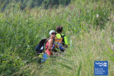
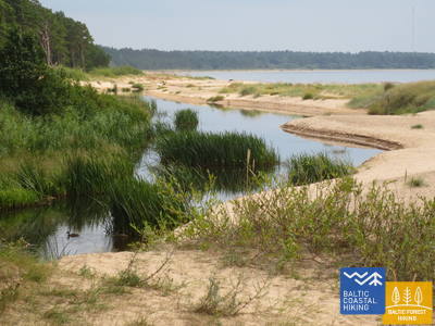
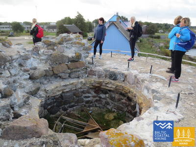
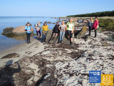
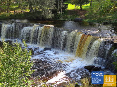
 1. Etappe. Nida - Pape.
Der kiesreichste Strand Lettlands
Der Grenzpfahl an der lettisch-litauischen Grenze markiert den Beginn des Baltischen Küstenwanderweges. Der Pfad führt uns durch den Naturpark Pape hindurch, der sich in einem breiten, vom Großmeer umspülten Küstenbereich entlang einer mit Strandroggen und Strandhafer bedeckten Vorküste ausgebreitet hat. Diese Pfadstrecke zeichnet sich durch einen mit Kies bedeckten Strand, kleine Torfaufschlüsse und die unberührte Natur aus. Hinter einer Windung des Kanals Pape erfreut das Auge eine für das Küstentiefland charakteristische Landschaft. Darin liegt im Rohrgebüsch versteckt der See Pape. Der Baltische Küstenwanderweg schlängelt sich weiter durch das Dorf Pape und führt am Leuchtturm Pape zurück zum Strand.

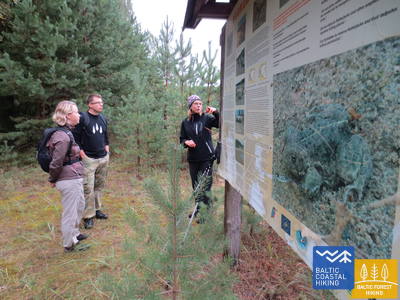
Ein sehr abgelegener Abschnitt der Route, auf dem der Jūrtaka-Pfad entlang der Küste des Naturparks „Pape“ und des Kieselstrandes Nida verläuft, der ein geologisches Naturschutzgebiet ist. In den Pape-Dünen gibt es eine ornithologische Station, wo Vögel beringt werden.
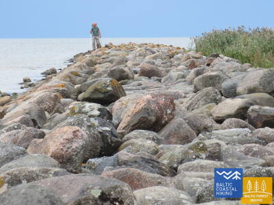
 2. Etappe. Pape - Bernāti.
Der am, westlichsten gelegene Punkt Lettlands
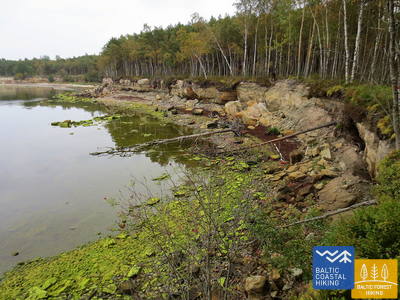
Der Baltische Küstenwanderweg führt auf der ganzen Strecke am Strand entlang, der auf der Festlandseite in der Umgebung von Pape von einer wunderschönen Vordüne umschlossen ist. Hinter dem Dorf wird er auf einer Länge von fast 10 km von einem abgespülten Uferstreifen abgelöst, auf dem Kiefernstämme umgestürzt herumliegen. Die Flachdüne kommt in der Umgebung des Dorfes Jūrmalciems wieder zum Vorschein. Hinter Jūrmalciems erstrecken sich weitläufig Strände. Nähert man sich dem Kap Bernātu ragt eine eindrucksvolle, mit einem Kieferwald bewachsene und streckenweise durch die Meeresbrandung ausgehöhlte Steilküste empor.
In diesem Abschnitt verläuft der Jūrtaka-Pfad weiter entlang der Küsten der Naturparks „Pape“ und „Bernāti“, wo beeindruckende, waldbedeckte Dünen parallel zum Meer aufragen, darunter einige der höchsten Dünen der lettischen Küste. Entlang der Küste sind mehr als 10 Kilometer erodierte Klippen zu sehen, die durch die Meereserosion entstanden sind. Die Route bietet auch Einblicke in andere bedeutende Dünenlebensräume und zeigt eine reiche Vielfalt an Pflanzen, Insekten und Vögeln. Bernāti markiert den westlichsten Punkt Lettlands.
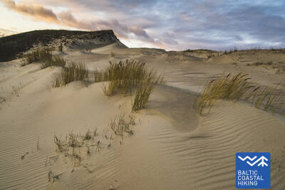
5. Etappe. Ziemupe - Pāvilosta.
Der singende Sand und Bernstein
Ein von Reisenden nur wenig besuchter Strand, wo man Bernstein und Steine mit Fossilien sammeln und dem Klang des Sandes lauschen kann. In der Umgebung von Ziemupe kommt die durch die Meeresbrandung ausgehöhlte Steilküste zum Vorschein. Danach folgen weiter von Akmensrags bis Pāvilosta schöne, streckenweise abgespülte Vordünen, die mit Strandroggen und Strandhafer bedeckt sind. An einigen Stellen sind Graudünen zu sehen. Der Leuchtturm Akmeņrags ist der beste Rastplatz. Pāvilosta mit seinem Kleinstadt-Flair, den Häfen und dem Aroma der geräucherten Fische bringt Besucher von der unberührten Natur wieder in die Zivilisation zurück.
Die wunderschönen Ziemupe-Klippen und der leere Strand mit dem Leuchtturm Akmeņrags gehören zu den abgeschiedensten Orten an der lettischen Küste. Hier können Sie Dünenlebensräume mit ihren charakteristischen Pflanzen und Insekten erkunden. Akmeņrags ist ein idealer Ort zur Vogelbeobachtung. Ein Teil des Gebiets liegt im Ziemupe-Naturschutzgebiet. Am Ufer finden Sie möglicherweise angeschwemmten Bernstein und Fossilien.
 6. Etappe. Pāvilosta - Jūrkalne.
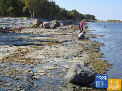
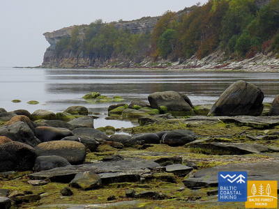
Die hervorragendsten Steilküsten der Ostsee
Im Nordosten von Pāvilosta erfreut eine an Graudünen reiche Landschaft das Auge. Doch nur einige Kilometer weiter beginnt eine der schönsten Abschnitte des Pfades Jūrtaka mit ihren hervorragenden Steilküsten, die sich auf einer Länge von mehr als 20 km erstrecken. Die bezauberndste, von Steilküsten geprägte Landschaften ist in der Nähe der Mündung der Flüsse Strante, Ulmale und Rīva zu beobachten. An vielen Stellen unterhalb des steilen Küstenabfalls blühen im Sommer die Orchideen. In Dorf Jūrkalne und dessen Umgebung kann man „zwei Sonnenuntergänge“ genießen - den ersten am Strand, den zweiten - einen kurzen Moment später - oben von der Spitze der Steilküste.
Einer der bemerkenswertesten Klippenabschnitte Lettlands beginnt gleich hinter Pāvilosta und erstreckt sich über fast 30 Kilometer. In der Nähe von Pāvilosta finden Sie graue Dünenhabitate. Dieses Gebiet ist ein idealer Ort, um etwas über geologische Prozesse und Küstenerosion zu lernen.
7. Etappe. Jūrkalne - Sārnate.
Der Ort, von dem aus Menschen mit Booten die Ostsee überquert haben
Auf diesem Abschnitt des Baltischen Küstenwanderweges setzt sich die eindrucksvolle Steilküste der Ostsee
fort. Nahe Ošvalki verflacht sich die Steilküste und wird zu einer etwas höheren Vordüne, die von einer dichten Weidenbaumkrone bedeckt wird. Gegenüber Sārnate kann man wieder eine ausgeprägte Steilküste sehen. Auf dieser verhältnismäßig kurzen Strecke erfreuen das Auge eindrucksvolle Landschaften einige.
Einer der bemerkenswertesten Klippenabschnitte Lettlands beginnt gleich hinter Pāvilosta und erstreckt sich über fast 30 Kilometer. Er ist ein hervorragender Ort zum Studium geologischer Prozesse und Küstenerosion.
8. Etappe. Sārnate - Užava.
Die schönste Landschaft des lettischen Küstengebietes
In der Umgebung von Sārnate kann man noch immer die baltische Steilküste genießen. In Richtung Norden verflacht sie allmählich wird und durch einen vom Wasser ausgehöhlten Vordünenwall abgelöst. Zwischen Vendzavas und dem Leuchtturm Užava erstreckt sich der Meeresküste entlang eine für Lettland nicht typische Landschaft, die an eine sandig-steinige Wüste mit spärlicher Vegetation erinnert. Hier befindet sich das ehemalige Übungsgelände der Sowjetarmee. An dieser Stelle und hinter Užava können auf dem Gebiet des ehemaligen Übungsgeländes Graudünen beobachtet werden. Nähert man sich der Mündung des Flusses Užava wird der Strand immer breiter und der Dünenwall immer flacher. Vom romantischen Leuchtturm Užava offenbart sich dem Wanderer der schönste Anblick des Baltischen Küstenwanderweges.
Ein abgelegener Küstenabschnitt mit außergewöhnlichen grauen Dünen und zerklüfteten Küstenhabitaten innerhalb des Naturschutzgebiets „Užava“ und darüber hinaus. Vom Leuchtturm von Užava aus hat man einen der schönsten Ausblicke auf die Ostsee. Die Küste weist stellenweise noch einige Klippen auf. Es ist ein ausgezeichneter Ort zum Fotografieren von Pflanzen, Insekten und anderen Naturelementen.
11. Etappe. Staldzene - Oviši.
Endziel: Kap Ovišrags
Bereits beim Absteigen zum Strand Staldzene ist die mehrere Meter hohe, teilweise offene Steilküste sichtbar, die allmählich immer höher wird (maximale Höhe – Kokkalns, 29 m). Rund 3–4 km nordöstlich von Staldzene hat sich ein schmaler Strandstreifen mit einer Steilküste herausgebildet, die beim starken Wind von Wellen umspült wird. Hinter Liepene wird die bespülte Küste langsam niedriger, und nach Jaunupe hat sich bis Ovišrags ein breiter Strand entwickelt, der seine größte Breite am Ende des Kaps Ovišrags erreicht.
Die Klippen von Staldzenes sind nicht nur aus geologischer Sicht faszinierend, sondern auch landschaftlich atemberaubend und beeindruckend groß. In der Nähe von Oviši bilden sich ausgedehnte Sandstrände. Dieser Abschnitt ist ideal für einsame Naturerlebnisse, die Erkundung von Küstendünenlebensräumen und ihren Bewohnern sowie zum Fotografieren.
12. Etappe. Oviši - Miķeļtornis.
Zwischen den Leuchttürmen Oviši und Miķeļbāka
Der Baltische Küstenwanderweg führt durch das Naturschutzgebiet Oviši, dessen Küstenlandschaft von breiten, sandigen Stränden und Dünen geprägt ist. Natürliche Materialien – Kieselsteine und Sand – bilden an diesem Strand ein großes und natürliches Mosaik. In Lūžņa wecken militärische Objekte aus unterschiedlichen Zeiten das Interesse der Reisenden. An der Mündung des Flusses Lūžupe müssen alle saisonalen Beschränkungen zum Schutz der Nistvögel eingehalten werden: Vom 01.04. bis 01.08. ist der Aufenthalt im Schutzgebiet verboten. Um das Gebiet muss umgangen werden, indem man den Wegweisern des Baltischen Küstenwanderweges folgt. Der Zielpunkt der Wanderung ist der Leuchtturm Miķeļbāka, der bereits aus weiter Ferne erkennbar ist.
Der Jūrtaka-Pfad führt durch das Naturschutzgebiet „Oviši“, das zum Schutz der Küstenlebensräume eingerichtet wurde.
13. Etappe. Miķeļtornis - Sīkrags.
Zielpunkt – der Nationalpark Slītere
Auf dem Streckenabschnitt von Miķeļtornis bis zur Abbiegung zur Schrägseilbrücke Irbe öffnet sich der Ausblick auf einen breiten Strand mit niedrigen, durch spärliche Vegetation gekennzeichneten Vordünen. Auf einer Länge von etwa 4,5 Kilometern führt die Wanderroute um die Mündung des Flusses Irbe herum. Dort befindet sich ein saisonales, zum Schutz von nistenden Vögeln gegründetes Schongebiet. Darin ist der Aufenthalt im Zeitraum 01.04. – 1.08. untersagt. Auf der Umgehung windet sich der Pfad Jūrtaka durch einen bezaubernden Kieferwald mit hohen Dünen, deren Abhänge reich an Pilzen und Beeren sind. Hinter der Mündung des Flusses Irbe bis zum Dorf Sīkrags erstreckt sich ein breiter, sandiger Strand. Etwa 1 Kilometer vor Sīkrags wird er vom Bach Ķikans durchschnitten wird. Der Bach markiert die Grenze des Nationalparks Slītere.
Der Abschnitt des Jūrtaka-Wanderwegs schlängelt sich zunächst durch das Naturschutzgebiet „Oviši“ und endet im Nationalpark Slītere. Die Wälder zwischen der neuen Irbe-Brücke und Jaunciems eignen sich ideal zum Beerenpflücken, Pilze sammeln, Erkunden der Küstennatur und Fotografieren. Dieses Gebiet markiert den Beginn der sogenannten Livländischen Küste, die sich bis nach Ģipka erstreckt.
15. Etappe. Saunags - Kolka.
Das Herz Europas – Kolkasrags
Über kleine Feldwege und Waldwege von Saunaga führt der Pfad Jūrtaka bis Vaide. Dort kehrt er wieder zur Meeresküste zurück. Bis Kolkasrags erstrecken sich breite, sandige Strände, die sich zu niedrigen Vordünen mit spärlicher Vegetation verflachen. Dahinter erfreuen erneut waldige Dünen das Auge. Auf einer Länge von etwa 2 Kilometern - weggespülte niedrige Dünen, hinter denen der Berg Dumbrkalni emporragt. Kolkasrags - die Grenzlinie zwischen dem Großmeer und Kleinmeer (Rigaer Meeresbucht) - ist einer der beliebtesten Vogelbeobachtungsorte an der Ostseeküste.
Der Abschnitt des Jūrtaka-Wanderwegs führt durch Küstenkiefernwälder und Sandstrände. Kolkasrags ist eine der beliebtesten Attraktionen in Nordkurland, wo die Ostsee auf den Rigaischen Meerbusen trifft. Es ist ein beliebter Ort zur Vogel- und Sturmbeobachtung. Auf dem Kiefernpfad können Sie Küstenlebensräume und ihre Bewohner erkunden.
16. Etappe. Kolka - Ģipka.
Entlang der „gesperrten Küste“
Wenn man das Gesicht von Kolkasrags in Richtung Meeresbucht dreht, merkt man gleich den Unterschied zwischen dem “Großmeer“ und dem “Kleinmeer“. Die ersten zehn Kilometer des Baltischen Küstenwanderweges verlaufen entlang der Küste des Nationalparks Slītere. Der Pfad passiert die Bauten der ehemaligen Fischerkolchose, einen Schiffsliegeplatz und die Steilküste Ēvaži. Deren Umgebung wird von einem ungewöhnlich schmalen, sandigen Strand mit darüber hängenden Schwarzerlen geprägt. Auch weiter bis Ģipka erstreckt sich ein schmaler, sandiger Strand mit vielen Nassgallen, die durch den nah an die Oberfläche getretenen, wasserundurchlässigen Untergrund entstanden sind, und Mündungen von kleineren, im Sommer ganz seichten Flüsschen. Das Küstengebiet des Nationalparks Slītere war während der Sowjetzeit ein doppelt geschlossenes Territorium – es war Grenzzone und Naturschutzgebiet.
Ein landschaftlich schöner und abwechslungsreicher Küstenabschnitt mit bewaldeten Dünen, malerischen Vordünen, den Ēvaži-Klippen (mit einem Naturpfad und einem Aussichtspunkt) und kleinen Bächen, die in den Rigaer Meerbusen münden. In einigen Bereichen umfasst die schmale Küstenlinie kleine Teiche, die wichtige Lebensräume für Amphibien, Insekten, Pflanzen und Vögel sind.
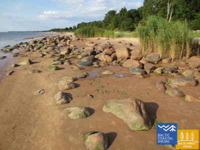
17. Etappe. Ģipka - Kaltene.
Der steinreichste Strand in Kurland
Von Ģipka bis Roja erstreckt sich ein sandiger, nicht besonders breiter Strand mit bezaubernden Dünen und Strandkieferwäldern. Kurz vor Roja ist der Strand dicht mit Sandrohr bewachsen. Der Streckenabschnitt zwischen Roja und der Kirche in Kaltene ist der einzigartigste Strand Lettlands. Dort ist die Meeresküste mit einem sehr schmalen Strand von kleinen Küstenvorsprüngen und Golfen ausgekerbt. Am Strand sind Felsbrocken unterschiedlicher Größe zu beobachten, die sich unter dem grünen Laubwerk von Schwarzerlen verbergen. An einigen Stellen ragen weit ausgebreitete Wurzelrosette von Bäumen empor, die an den Strand angespült wurden. Streckenweise verläuft entlang der Küste ein Weg, an dem sich viele ehemalige Fischerhäuser aneinanderreihen.
In Bezug auf die Artenvielfalt zeichnet sich der Abschnitt des Jūrtaka-Wanderwegs zwischen Ģipka und Rojas vor allem durch Sandstrände mit Dünenhabitaten aus. Jenseits von Rojas geht die Küste in felsige Abschnitte über, die von zahlreichen Landformationen geprägt und mit Erlenhainen bedeckt sind. Dieses Gebiet eignet sich gut zum Erkunden und Beobachten von Pflanzen, Insekten und Vögeln.
18. Etappe. Kaltene - Mērsrags.
Die vielfältige Küste
In biologischer, kulturhistorischer und landschaftlicher Hinsicht ein sehr vielfältiger Küstenanschnitt des Baltischen Küstenwanderweges. In der Nähe von Kaltene ist die Meeresküste von winzigen Golfen mit steinigen Stränden bunt gemustert. Weiter erstreckt sich der mit Steinen bedeckte Strand nur ein paar Meter breit. Streckenweise ist er mit Lehmschichten, Rohrfeldern bedeckt, an einigen Stellen – mit angespülten Wasserpflanzen. Auf der Strecke von Valgalciems bis Mērsrags kommen wieder sandige Strände mit Sandbänken zum Vorschein. Hinter Mērsrags verläuft der Routenabschnitt über einen Weg, der an der lutheranischen Kirche in Richtung Meer abbiegt und bis zum Zentrum von Mērsrags einer Strandwiese entlang führt.
Dieser Küstenabschnitt ist für Lettland relativ ungewöhnlich. In der Gegend von Kaltene dominieren felsige Küsten mit üppiger Vegetation. In Richtung Mērsrags tauchen allmählich Sandstrände auf, und um Mērsrags herum ist die Küste eine Mischung aus Sand- und Felsgebieten. Dieser Abschnitt eignet sich ideal zum Beobachten von Pflanzen und Vögeln sowie zum Erkunden verschiedener Küstenlebensräume.
19. Etappe. Mērsrags - Engure.
Im Naturpark Engure
Vom Dorfzentrum bis zum Strand führt ein von Kiefern umschlossener Waldweg. Weiter windet sich der Baltische Küstenwanderweg zwischen einem von Sandrohr und anderen Pflanzen reichlich bewachsenen und steinigen Strand auf einer Seite und einer bewaldeten Düne auf der anderen Seite. Stellenweise ist der Strand mit kleinen, runden Kieselsteinen bedeckt, andernorts sind Graudünen mit üppiger Vegetation zu sehen. In der Umgebung von Bērzciems erstrecken sich Strandwiesen mit Sandbarren weit ins Meer. Sie sind ein guten Platz, um Vögel zu beobachten. Bis zum Dorf Abragciems setzt sich die bewachsene Meeresküste fort, die dann bis Engure durch einen Strand abgelöst wird.
Dieser Abschnitt des Jūrtaka-Wanderwegs ist in Bezug auf Landschaft, Geologie und Lebensraumtypen abwechslungsreich und weist verschiedene Arten von Küstenlinien auf, darunter sandige, felsige und überwucherte Gebiete. Um Bērzciems herum bildet das Meer Untiefen mit saisonalen Lagunen, was es zu einem hervorragenden Ort für die Vogelbeobachtung macht. Das Gebiet ist Teil des Naturparks „Engure Lake“.
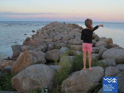
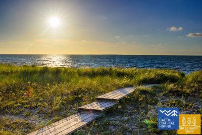
26. Etappe. Carnikava - Saulkrasti.
Der Sonnenuntergangspfad mit Blick auf romantische Sonnenuntergänge
Anfangs führt der Routenabschnitt über den Schutzdamm der Gauja im Dorf Gauja. Dann erreicht das Mündungsgebiet des Flusses, was eine ausgezeichneter Stelle zur Vogelbeobachtung ist. Weiter verläuft der Wanderweg über einen sandigen Strand bis zur Mündung des Flusses Inčupe. Um die Brücke erreichen zu können, muss man kurz vor der Mündung in Richtung Festland abbiegen. Die nächsten paar Kilometer verlaufen über die waldreichen Dünengipfel des Sonnenuntergangspfades (Saulrieta taka), die eine wunderbare Aussicht auf den Strand offenbaren. Nach der Überquerung des Flusses Pēterupe (Seilbrücke) erreicht der Pfad Jūrtaka den Meerespark “Jūras parks” in Saulkrasti.
Die Gaujai-Mündung (rechtes Ufer, da das linke Ufer während der Brutzeit ein Vogelschutzgebiet ist und nicht zugänglich ist) zeichnet sich durch Dünenhabitate und Küstenwälder aus, die für die Erhaltung der biologischen Vielfalt von entscheidender Bedeutung sind.
28. Etappe. Lauči - Tūja.
Die vergangene Ära der Segelschiffe
Eine herrliche Küstenlandschaft der Region Vidzeme mit vielen steinreichen Erdzungen und Steinen im Meer. Sie werden von kleinen, sandigen Buchten abgelöst, in denen die im Sommer austrocknenden Bäche und kleinen Flüsschen münden. An einigen Stellen ist der Strand vollständig mit grauen Steinen bedeckt. Allmählich kommen auch mit Sandrohr bewachsene Flächen zum Vorschein. Kurz vor Tūja finden sich die ersten Sandsteinfreilegungen.
Dieser Abschnitt bietet eine abwechslungsreiche Landschaft mit kleinen Buchten und Landformationen, Sand- und Felsküsten sowie Sandsteinfelsen in der Nähe von Tūja. Es ist ein idealer Ort zum Fotografieren, für Fotoshootings, Geotourismus und Naturerkundungen.
29. Etappe. Tūja - Svētciems.
Der steinreichste Strand in Vidzeme
Einer der schönsten Abschnitte des Pfades Jūrtaka beginnt nach der Überquerung des Flusses Zaķupīte. Bis zum Leuchtturm Ķurmrags erstrecken sich vorwiegend sandige Strände mit kleinen steinreichen Stellen. Danach beginnt der Steinstrand von Vidzeme, wo sich Erdzungen und kleine Buchten ablösen. Am Strand ragen bis zu 4 Meter hohe Sandsteinfreilegungen empor. Hinter dem Meleku-Kap führt der Pfad wieder über einen vorwiegend sandigen Strand, der kurz vor der Mündung des Flusses Svētupe dicht bewachsen ist. Dazu kommt Schilfrohr, das man über einen Waldweg umlaufen muss.
Dieser Abschnitt der felsigen Küste von Vidzeme weist eine sehr abwechslungsreiche Küstenlinie mit kleinen Landformationen, Buchten, felsigen Stränden und Aufschlüssen aus der Devonzeit auf – Ergebnisse der Meereserosion. Er ist Teil des Naturschutzgebiets „Felsenküste von Vidzeme“. Dieses Gebiet eignet sich ideal zur Naturbeobachtung, zum Sammeln von Pilzen und Beeren, zum Fotografieren und Filmen, insbesondere bei stürmischem Wetter. In der Nähe der Mündung des Flusses Svētupe beginnt die Küste mit einer üppig bewachsenen Küstenlinie. Es ist auch ein großartiger Ort zur Vogelbeobachtung. Der Abschnitt des Jūrtaka-Wanderwegs liegt im Biosphärenreservat Nordvidzeme.
30. Etappe. Svētciems - Ainaži.
Das Königsreich der Neunaugen
Der Strand zwischen Svētciems und Salacgrīva ist dicht bewachsen. Der Pfad Jūrtaka verläuft deshalb über einen Waldweg, der sich zwischen den Dünenwällen windet. Von Salacgrīva kann das Dorf Kuiviži über einen sandigen Strand oder Waldpfade erreicht werden. Um die Randu-Wiesen von Kuiviži bis Vēverupe muss man einen Umweg über einen Waldweg machen, der sich auf der östlichen Seite der Landstraße A1 befindet. Hinter dem Fluss Vēverupe führt der Pfad zurück zu einem sehr dicht bewachsenen Strand. Bei der Mündung des Flusses Blusupīte verlässt er diesen wieder, um über die Kāpu-Straße und Valdemāra-Straße das Pier Ainaži zu erreichen. In Lettland waren ~ 580 km zurückgelegt und nun die Staatsgrenze erreicht.
Dieser Abschnitt führt durch eine mit dichter Vegetation bewachsene Küste, sodass der Jūrtaka-Pfad hauptsächlich kleinen Waldpfaden folgt, die sich gelegentlich entlang der Küste winden. Zwischen Kuivieži und Ainaži finden Sie das Naturschutzgebiet Randu Meadows, eines der reichsten Gebiete an Artenvielfalt an der lettischen Küste, das für seine Pflanzen und Vögel bekannt ist. Es ist ein ausgezeichneter Ort zur Vogelbeobachtung, da es einen Naturpfad und einen Vogelbeobachtungsturm gibt. Zwischen Svētciems und Salacgrīva eignet sich das Gebiet gut zum Beerenpflücken und Pilze sammeln. Außerdem gibt es am Fluss Svētupe einen Angelpfad für Neunaugen. Dieser Abschnitt des Jūrtaka-Pfades ist Teil des Biosphärenreservats Nordvidzeme.
31. Etappe. Ikla - Kabli.
Durch den historischen Kurort
IIn Ikla beginnt der durch Estland verlaufende Abschnitt des Baltischen Küstenwanderweges. Auf der Strecke Ikla-Treimani führt der Pfad auf der sogenannten alten Rigaer Landstraße entlang. Hier erstrecken sich weite Wiesen und ein Rohrgebüsch an der Meeresküste. Hinter Treimani biegt der Pfad in Richtung Meer ab. Die nächsten 2,8 km verlaufen über einen schmalen, sandigen oder steinigen Strand, der streckenweise dicht bewachsen ist. Der Pfad umkreist den Orajõe-Bach und führt am Parkplatz wieder zum Strand zurück. Dem Strand entlang muss man ~ 4 Kilometer bis zum Lepanina-Hotel zurücklegen. Dann kehrt der Pfad zurück auf die alte Rigaer Landstraße, die bis Kabli führt. Auf diesem Wegabschnitt gibt es großartige Orte zur Vogelbeobachtung. Die Strecke bis Pärnu ist ein sehr beliebter Erholungs- und Badeort.
Die Gegend um Kabli eignet sich gut zur Vogelbeobachtung. Es wurden ein Naturlehrpfad und ein Naturzentrum eingerichtet. Die Küstenwälder eignen sich zum Pilze- und Beerensammeln.
32. Etappe. Kabli - Häädemeeste.
Vögel, Dünen und Wälder
Dieser Streckenabschnitt ist für Vogelbeobachter besonders empfehlenswert. Die Küste ist an dieser Stelle durch weite mit Rohrgebüsch bedeckte Wiesen und Lagunen gekennzeichnet. Deshalb verläuft der Baltische Küstenwanderweg von Kabli bis zum südlichen Teil von Häädemeeste der alten Rigaer Landstraße entlang. Kurz vor Häädemeeste biegt der Baltische Küstenwanderweg von der Landstraße in das Naturschutzgebiet Jaagupie ein (das Dorf bleibt westlich liegen). Dann schlängelt er sich die hohen Dünen hinauf und führt steil nach unten in die tiefen, von einem gelichteten Kieferwald bedeckten Senken zwischen den Dünen. Hier gibt es gute Orte zum Sammeln von Beeren und Pilzen.
Kabli-Naturzentrum mit einem Naturlehrpfad und Ausstellungen. In Häädemeeste und Rannametsa gibt es Küstenwiesen mit großer natürlicher Vielfalt. In der Gegend sind Umweltführer erhältlich.
33. Etappe. Häädemeeste - Uulu.
Durch Wälder und Sümpfe
Dieser Abschnitt des Baltischen Küstenwanderweges ist für ausdauernde Wanderer geeignet, die eine Wanderung durch unbewohnte Ortschaften genießen. Der Pfad führt durch das Naturschutzgebiet Luitemaa mit schönen Nadelwäldern bis zu den Binnendünen, die von einem weißen Teppich aus Rentierflechten bedeckt sind. Im Sommer und im Herbst ist das Gebiet ein guter Ort zur Vogelbeobachtung sowie zum Sammeln von Pilzen und Beeren. Der Baltische Küstenwanderweg windet sich durch den westlichen Teil des Maarjapeakse-Sumpfes und abgeholzte Flächen der Waldmosaik bis zu den Dörfern Lepaküla und Uulu.
Der Küstenabschnitt führt durch das Naturschutzgebiet Luitemaa mit wunderschönen Nadelwäldern auf Binnendünen, die mit weißen Teppichen aus Rentierflechten bedeckt sind. Im Sommer und Herbst eignet sich dieses Gebiet zur Vogel- und Tierbeobachtung sowie zum Pilze- und Beerensammeln. In Soometsa wurde ein Moorsteg angelegt.
36. Etappe. Liu - Munalaid.
Buchten, Inseln und Vögel
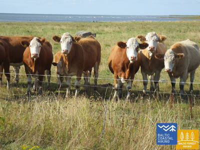
Dieser Streckenabschnitt ist sehr zur Vogelbeobachtung geeignet. Entlang der Küste erstrecken sich Küstenwiesen, Rohrgebüsch und seichte Buchten. Der Baltische Küstenwanderweg führt daher über andere Wege und Pfade. Hinter dem Liu-Hafens wechselt der Pfad oft die Richtung, weil die Küste schwer zugänglich ist und es eine komplizierten Küstenlinie gibt. Die Routenführung muss daher angepasst und etwas korrigiert werden . Die besten Orte zur Landschafts- und Vogelbeobachtung befinden sich am Kavaru-Dorf, in der Umgebung der Häfen Peerni und Munalaid. Von dort aus offenbart sich dem Wanderer ein Blick auf die weite Landschaft der Pärnu-Bucht und Kihnu-Meerenge mit ihren zahlreichen Inseln (Sorgu saar, Manilaid, Kihnu) sowie auf die Küstenwiesen, auf denen Hausvieh weidet.
Die Route eignet sich zur Vogelbeobachtung. Vom Küstenpfad aus können Sie Küstenwiesen, Schilfgebiete sowie flache und bewachsene Buchten sehen. Die besten Beobachtungs- und Vogelbeobachtungsplätze befinden sich in der Nähe des Dorfes Kavaru, rund um den Hafen von Peerni und in der Nähe des Hafens von Munalaid, von wo aus Sie einen weiten Blick auf die Bucht von Pärnu und die Meerenge von Kihnu mit Inseln sowie Küstenwiesen haben, auf denen Vieh weidet.

39. Etappe. Matsi - Varbla.
Strände und Wälder
Der Strand Matsi ist einer der wenigen Sandstrände auf dem Streckenabschnitt bis Haapsalu. Der Baltische Küstenwanderweg windet sich durch das Dorf Kulli und verläuft auf einer Länge von 5 Kilometer auf kleinen, von weiten Wäldern und Dünen umschlossenen Wegen. Deren Umgebung ist im Herbst reich an Beeren und Pilzen. Danach läuft er im Bogen um das Uue-Varbla-Gutshaus herum und erreicht das Dorf Varbla.
Die umliegenden Wälder eignen sich zum Pilze- und Beerensammeln sowie zur Naturbeobachtung.
40. Etappe. Varbla - Pivarootsi.
Landgüter an der Küste
Der Baltische Küstenwanderweg verläuft weiter auf Küstenwegen. Das Meer ist jedoch nur an zwei Stellen zu sehen, weil die Küste mit wasserarmen Buchten, kleinen Inseln, feuchten Küstenwiesen, Rohrgebüsch, Lagunen, Sümpfen und vom offenen Meer abgetrennten Seen gesprenkelt ist. In der Umgebung Varbla-Allika eröffnet sich ein Blick auf eine herrliche Landschaft voller landwirtschaftlichen Flächen. Der Routenabschnitt Allika-Tamba verläuft vorwiegend durch schöne Wälder. Dann führt der Pfad um die Gutshäuser Paatsalu und Illuste herum und überquert auf der Nehatu-Landstraße das unter Naturschutz stehende Feuchtgebiet. Vom Dorf Muriste aus windet er sich auf einem Weg weiter, an dessen Rand ein eindrucksvoller Steinzaun steht. Kurz vor dem Pivarootsi-Gutshaus bietet sich ein schöner Blick auf das weite Weideland und die Meeresbucht.
Die Wacholderhaine und Feuchtgebiete rund um den Küstenpfad sind ein guter Ort zur Beobachtung verschiedener wilder Orchideen und Vögel.
41. Etappe. Pivarootsi - Virtsu.
Das Tor zu den estnischen Inseln
Auf dieser Strecke verläuft ein ~ 3,7 km langer Wegabschnitt der ehemaligen Schmalspurbahnlinie Virtsu-Rapla entlang. Der interessanteste Ort dieser Strecke ist die Halbinsel-Insel Puhtulaiu, die heutzutage mit dem Festland zusammengewachsen ist. Die Insel ist von einem breitblättrigen Laubwald bedeckt, unter dessen Kronen sich interessante Pflanzen- und Pilzarten, Jahrhundertbäume und Gedenkstätte bedeutender Menschen verbergen. Zwischen dem Hafen von Virtsu und der Insel Muhu verkehrt die Fähre. Muhu ist mit der Insel Saarema durch einen Damm verbunden.
Der interessanteste Ort auf diesem Abschnitt des Jūrtaka-Pfades ist die Halbinsel Puhtulaiu (Naturschutzgebiet) – eine Insel, die jetzt mit dem Festland verbunden ist. Sie ist mit Laubwald bedeckt, in dem es interessante Pflanzen- und Pilzarten, alte Bäume, bedeutende Gedenkstätten, einen Naturpfad, einen Vogelbeobachtungsturm und vieles mehr gibt. Bemerkenswert ist auch der ehemalige Schmalspurbahndamm, der eine flache Bucht überquert und sich gut zur Vogelbeobachtung eignet.
42. Etappe. Virtsu - Kuke.
Durch Orchideen und Wacholderfelder
Der Baltische Küstenwanderweg krümmt sich durch das Dorf Virtsu hindurch, hinter dem er auf einer Länge von 3 km der Landstraße entlang verläuft. Danach biegt er im rechten Winkel nach Nordwesten ab und schlängelt sich durch den Windpark und den ehemaligen sowjetischen Militärflughafen weiter. In dessen Umgebung blühen im Sommer reichlich Orchideen. Weiter bietet sich ein Blick auf die Suur Väin-Meeresenge und auf wunderschöne Wacholderfelder. Kurz vor dem Bach Jõeoja verläuft der Pfad auf einer Länge von etwa 1 Kilometer dem oberen Teil der alten Küste entlang.
Ein Teil der Route führt durch Küstenwacholderwiesen und Trockenwiesen, die eine reiche Vielfalt an Orchideenarten beherbergen. In der Nähe des Uisu-Aufschlusses sind interessante Fossilien zu sehen.
43. Etappe. Kuke - Meelva.
Durch Orchideen und Wacholderfelder
Der Baltische Küstenwanderweg verläuft auf kleinen Waldwegen. Auf diesem offenbaren sich dem Auge eine Landschaft mit Einzelhöfen und bearbeitetem Boden . Kommt man näher an die Matsalu-Bucht, kommen die ersten Feuchtgebiete zum Vorschein - dicht bewachsene Seen, die einst vom Meer als Buchten und Küstenwiesen für Weidevieh abgetrennt wurden. Unweit der Dörfer Mõisaküla (Beginn des Nationalparks Matsalu) und Salevere erblickt der Wanderer ausgeprägte Hügel. Sie waren vor mehr als 10 000 Jahren die Inseln des Baltischen Eissees.
Der größte Teil des Küstenabschnitts führt durch den Matsalu-Nationalpark, der sich besonders während der Vogelwanderungen im Frühjahr und Herbst gut zur Tier- und Vogelbeobachtung eignet. Außerdem wurde ein Geologiepfad angelegt, der die Entwicklungsstufen der Ostsee und die Artenvielfalt vorstellt.
44. Etappe. Meelva - Penijõe.
Auf den Spuren von Heinrichs Livländischer Chronik
Dieser Abschnitt des Baltischen Küstenwanderweges beginnt und endet im Nationalpark Matsalu. Er verläuft jedoch zum größten Teil außerhalb des Parkterritoriums. Die Aufmerksamkeit des Wanderers fesseln hier kleine Dörfer und Waldwege mit gepflegten Gehöften und schönen rustikalen Landschaften, wo Pferde und Schafe grasen. Gleiches gilt für Lihula, die erste Hauptstadt des Bistums Ösel-Wiek (Saare-Lääne). Sie wird in Heinrichs Livländischer Chronik mittelbar im Zusammenhang mit den Geschehnissen des Jahres 1211 erwähnt, als Abt Theoderich von Dünamünde zum ersten Bischof Estlands erhoben wurde.
Das Ende des Abschnitts befindet sich im Matsalu-Nationalpark, wo sich das Besucherzentrum des Parks sowie ein Naturlehrpfad mit Rastplätzen und einem Vogelbeobachtungsturm befinden. Es ist ein geeigneter Ort zur Vogelbeobachtung und zur Erkundung der Lebensräume der Küstenauenwiesen.
46. Etappe. Haeska - Puise.
Vogel- und Naturbeobachtung im Nationalpark Matsalu
Eines der bezauberndsten Strecken des Baltischen Küstenwanderweges im Nationalpark Matsalu. Sie führt durch landwirtschaftliche Nutzflächen und Küstenwiesen, auf denen sich im Herbst tausende von ziehenden Kranichen und Gänsen sammeln. Das Dorf Haeska (Küstenwiesen, wasserarme Buchten, kleine Inseln und Weiden) und die Umgebung des Puise-Kaps (Küstenwiesen mit Weiden und Sandbarren) sind ausgezeichnete Orte zur Vogelbeobachtung. Dazu wurden mehrere Türme aufgestellt. Aus den Dörfern Põgari-Sassi und Puise nina heraus bietet sich malerischer Aussichten auf das Meer und die Inselketten.
Der Küstenwanderweg führt an mehreren Stellen entlang der Küste entlang, wo Sie eine flache Bucht mit Steinen, kleinen Inseln und Küstenwiesen sehen können, die sich gut zur Vogelbeobachtung eignen. Die Wanderung kann den Wanderweg des Nationalparks zwischen Kiideva und Puise nina umfassen. Es wurden Türme und Plattformen zur Vogelbeobachtung errichtet.
51. Etappe. Riguldi - Dirhami.
Ein Ort mit Meteoritenspuren
Mit Ausnahme der ersten drei Kilometer verläuft der Routenabschnitt der Meeresküste entlang. Vorwiegend erstreckt sich hier ein sandiger Strand mit herrlichen Vordünen, Graudünen und Feldsteinen im Meereswasser. Am Strand können zusammengetriebene Wasserpflanzen liegen; stellenweise ist er mit dichter Vegetation bewachsen. Gegenüber dem Dorf Rooslepa, aber auch im Meer und an der Küste kommen verwitterte Steine bzw. Brekzien zum Vorschein, die infolge einer alten Meteoritenexplosion zusammengeschmolzen und verwittert sind. Zum Abschluss kann man eine Kneipe besuchen, von deren Terrasse aus sich ein schöner Blick auf die Meeres - und Hafenlandschaft offenbart.
Es können verschiedene Dünenhabitate (weiße Dünen, graue Dünen) sowie verschiedene Strandarten (sandig, bewachsen) und wunderschöne Küstenkieferwälder mit kleinen Pfaden erkundet werden. Die Route eignet sich zum Entdecken der natürlichen Vielfalt, der Pflanzen, Vögel und Geologie. An der Küste und im Meer können Sie Brekzien sehen – Gestein, das infolge einer Meteoritenexplosion in der Antike verschmolzen und zerfallen ist. Die Küstenwälder eignen sich zum Pilze- und Beerensammeln.
52. Etappe. Dirhami - Nõva.
Die raue Natur des Nordens
Ein Streckenabschnitt mit sehr vielfältigen Landschaften, der dem Wanderer die Natur der Nordküste Estlands nahebringt. Der Baltische Küstenwanderweg verläuft zum größten Tel der Meeresküste entlang, wo es in den Buchten herrliche Sandstrände und auf den Erdzungen mit Feldsteinen bedeckte Strände gibt. Im nördlichen Teil des Põõsaspea neem-Kaps (ein hervorragender Ort zur Vogelbeobachtung) sind Dolomit-Freilegungen zu sehen. Danach windet sich der Pfad durch das Naturschutzgebiet Nõva, wo sich ein hervorragender Blick auf weiße und graue Dünen bietet. Der Strand ist ein beliebter Ort für Fischer und Kitesurfer.
Es können verschiedene Dünenhabitate (weiße Dünen, graue Dünen) sowie verschiedene Strandarten (sandig, bewachsen, felsig, mit Dolomit bedeckt) und wunderschöne Küstenwälder mit kleinen Pfaden erkundet werden. Die Route eignet sich zum Entdecken der natürlichen Vielfalt (Rastplätze, Aussichtsplattformen, Naturpfade), der Pflanzen, Vögel (Põõsaspea neem – ein ausgezeichneter Ort zur Vogelbeobachtung) und der Geologie. Die Küstenwälder eignen sich zum Pilze- und Beerensammeln.
53. Etappe. Nõva - Vihterpalu.
Dem Finnischen Meerbusen entlang
Von Rannaküla aus läuft der Baltische Küstenwanderweg im Bogen um ein Feuchtgebiet herum, überquert das Flüsschen Nõva und stößt auf den Strand der Keibu-Bucht (am Anfang dicht bewachsen). Dort erstreckt sich ein sandiger Strand mit Dünen. Am Keibu-Bach biegt der Pfad in Richtung Binnenland ein, wo er weiter mit dem markierten Pfad der estnischen Forstverwaltung zusammenfällt: Peraküla – Aegviidu – Ähijärve. Der Pfad schlängelt sich durch das Dorf Keibu und führt gegenüber dem Dorf Alliklepa zum Meer. In der Umgebung gibt es wunderschöne Wacholderfelder. Der Streckenabschnitt verläuft weiter zwischen dem Meer und zwei kleinen Seen, die früher Buchten waren. Gegenüber den Seen wurden Dolomitschichten freigelegt. Bis zum Dorf Vintse verläuft die Strecke auf einem schmalen Küstenweg (vom hier aus sind die Pakri-Inseln sichtbar), bis sie in Richtung Vihterpalu abbiegt.
Es können verschiedene Dünenhabitate (weiße Dünen, graue Dünen) sowie verschiedene Strandarten (sandig, bewachsen, felsig, mit Kieselsteinen und Dolomit bedeckt) und wunderschöne Küstenwälder mit kleinen Pfaden und Wacholderfeldern erkundet werden. Die Route eignet sich zum Entdecken der natürlichen Vielfalt, Pflanzen, Vögel und Geologie. Die Küstenwälder eignen sich zum Pilze- und Beerensammeln.
56. Etappe. Paldiski - Kersalu.
Felsen, ein Leuchtturm und das Militärerbe
Der Baltische Küstenwanderweg führt um die Pakri-Halbinsel herum, von der aus sich ein Blick auf die
schönsten Landschaften der nordwestlichen Küste Estlands bietet. Der Pfad führt durch das Zentrum der
Stadt Paldiski und biegt an der Bastion des Zaren Peter des Großen in Richtung des Leuchtturm von Pakri ab. Bis zum Leuchtturm verläuft der Weg auf dem Rücken der eindrucksvollen Pakri-Felsen. Weiter bis zum Ort Kersalu führt der Pfad mal steil bergauf über die Felsen, mal bergab zu einem sandig-steinigen Strand und einem wunderschönen Kiefernwald. Die Pakri-Felsen offenbaren ihren Reiz im kalten Winter, wenn sich hier eindrucksvolle Eisabbrüche herausbilden, wie auch im Herbst, wenn die Blätter bunt sind.
Dieser Abschnitt umfasst die beeindruckendsten Klippen und steilen Ufer des Küstenpfads (in allen baltischen Ländern), die die Halbinsel Pakri umgeben. Sie bieten zu verschiedenen Jahreszeiten fantastische Ausblicke. Es ist ein geeigneter Ort für Geotourismus, um verschiedene geologische Objekte wie Felsvorsprünge, Schichten aus verschiedenen geologischen Perioden, Felsbrocken und mehr zu erkunden.
58. Etappe. Laulasmaa - Vääna-Jõesuu.
Der schönste Wasserfall Estlands
Aus landschaftlicher Sicht ist es der vielfältigste Abschnitt des Baltischen Küstenwanderweges. Geeignet ist er für ausdauernde Wanderer. Zu sehen bekommt man sowohl steinige Strände als auch Sandstrände und gute Badeorte, herrliche Kiefernwälder und den eindrucksvolle Türisalu-Fels sowie Jahrhundertsteine. Auf den kleinen Pfaden des Keila-Waldparks kann man den Keila-Wasserfall erreichen. Auch kann man die dem Leben der Küstenfischer gewidmete Ausstellung im Dorf Lohusalu besuchen.
Verschiedene Arten von Stränden – Sand- und Felsstrände, eine von Buchten und Halbinseln gesäumte Küste, eine große Vielfalt an geologischen Denkmälern – einer der malerischsten Wasserfälle Estlands, die beliebte Tirisalu-Klippe. Ein geeigneter Abschnitt zum Erkunden der Geologie, Pflanzenwelt und Küstenlebensräume.
59. Etappe. Vääna - Jõesuu - Tabasalu.
Die sagenumwobene Suurupi-Halbinsel
Eine der schwierigsten Strecken des Baltischen Küstenwanderweges. Sie ist nur für erfahrene Wanderer geeignet. Der Pfadabschnitt läuft im Boden der Suurupi Halbinsel herum, in deren dichten Wälder das militärische Erbe verschiedener historischer Epochen verborgen ist. Der Baltische Küstenwanderweg schlängelt sich durch dicht bewachsene und steinige Strände, Birkenhaine, dann weiter entlang ehemaliger Pionierlagern und den von Sandsteinfelsen beschützten Buchten mit spitzen Erdzungen. An einigen Stellen sieht man im Meer Freilegungen des Dolomitgesteins und “Inseln” aus Feldsteinen. Am Ende des Streckenabschnittes ragt eine der eindrucksvollsten Freilegungen der estnischen Küste empor – die Felsen von Rannamõisa. Von den Felsen aus eröffnet sich ein herrlicher Blick auf die Kakumäe-Bucht und die Türme der Altstadt von Tallinn.
Obwohl dieser abgeschiedene Abschnitt des Küstenwanderwegs in der Nähe von Tallinn liegt, zeichnet er sich durch eine einzigartig gegliederte Küste mit Sandsteinfelsen (Suurupi-Klippe) und den beeindruckenden Rannameisa-Klippen aus. Entlang der Küste finden sich interessante Felsformationen. Es ist ein geeigneter Ort zum Pilze- und Beerensammeln sowie zur Vogel- und Pflanzenbeobachtung.
65. Etappe. Pervalka (dt.Perwelk)- Juodkrantė (dt. Schwarzort).
Durch die imposantesten Sanddünen Nordeuropas
Hinter der Pervalka überquert der "Meeresweg" (lt. "Jūrų takas") die Kurische Nehrung in Ost-West-Richtung und erreicht die Küste der Ostsee. Eine weitere Strecke von ca. 13 km führt zu einem wunderschönen Sandstrand, der im Osten durch einem hohen Dünenrücken eingegrenzt wird. Der Dünenrücken wurde von Menschenhand geschaffen, um die Halbinsel vor Sandrutschen zu schützen. Vor dem Ort Juodkrantė biegt der Meeresweg nach Osten ab und überquert erneut die Kurische Nehrung durch steile, mit Wäldern zugewachsenen Dünen und führt weiter in die Richtung des Kurischen Haffs. Ein kleiner Abschnitt des Meeresweges schließt sich mit dem Weg über den Hexenberg (lt. Raganų kalnas) zusammen. Weiter geht es über die Uferpromenade von Juodkrantė zum Hafen. Die Strecke verläuft durch den romantischen Nationalpark der Kurischen Nehrung (lt. Kuršių nerijos nacionalinis parkas).
Der Abschnitt der Kurischen Nehrung (Kuršių nerija), in dem Sie sowohl offene Sanddünen und ihre Formationen auf dem Naglių rezervato gamtos takas als auch bereits bewaldete Dünen und ihre Kämme auf dem Hexenhügel (Raganų kalnas) erkunden können. Die Kormoran- und Reiherkolonie ist ein geeigneter Ort zur Vogelbeobachtung. An der Küste kann man Bernstein finden. Dieser Abschnitt ist Teil des Nationalparks Kurische Nehrung (Kuršių nerijos).
66. Etappe. Juodkrantė (dt. Schwarzort) – Klaipėda (dt. Memel).
Klaipėda – Seetor Litauens
Fortführend von der Küstenpromenade des Ortes Juodkrantė überquert der "Meeresweg" (lt. "Jūrų takas") die Kurische Nehrung in nordwestlicher Richtung auf kleinen Waldwegen, die sich entlang steiler, mit Kiefern bewachsener Dünenhänge schlängeln, bis man wieder an der Ostseeküste ankommt. Weitere 9 km verläuft der Meeresweg an den Sandstränden entlang. Auf der Ostseite wird er durch eine steile Düne, die die Nehrung vor durch den Wind verwehten Sand schützt, begrenzt. Außerhalb der Siedlung Alksnynė (vom Ufer aus unsichtbar) biegt er nach Osten ab und in den Wald der Latschenkiefer Pinus Mugo, den Militärstützpunkt der deutschen Armee während des Zweiten Weltkriegs durchquert, und sich den Ufern des Kurischen Haffs nähert. Danach verläuft der Meeresweg weiterhin durch die mit Kiefern bedeckten Dünen, von denen ein Ausblick auf die Stadt Klaipėda sich eröffnet. Die Route zwischen der neuen und alten Fähre verläuft zunächst über einen kleinen Pfad und dann über die Küstenpromenade. Von der alten Fähre überquert der Meeresweg (mit der Fähre) das Kurische Haff und endet im Zentrum von Klaipėda - auf der Danės-Straße bis zur Biržos-Brücke (dt. Brücke der Börse). Der Abschnitt bis zur Fähre passiert den Nationalpark der Kurischen Nehrung (lt. Kuršių nerijos nacionalinis parkas).
In diesem Abschnitt können verschiedene Lebensräume der Kurischen Nehrung (Kuršių nerija) erkundet werden – Sandstrände, Vordünen, bewaldete Dünen (mit Kiefern und Bergkiefern), Brandflächen und mehr. Es ist ein geeigneter Ort zum Vogelbeobachten, Pilzesammeln und Beerenpflücken. Dieser Abschnitt ist Teil des Nationalparks Kurische Nehrung (Kuršių nerija).
69. Etappe. Insel von Rusnė (dt. Ruß).
Insel von Rusnė ist ein großartiger Ort zum Beobachten der Wildtiere
Hier in der Stadt Rusnė, auf der Insel Rusnė beginnt der Meeresweg (lt. Jūrų takas). Er führt durch die Straßen Neringos und K. Jukštaičio zur Küstenpromenade des Flüsschens Rusnė (dt. Ruß) - die sich entlang des Flusses Pakalnė, einem der Zweige des Nemunas-Deltas, erstreckt. Danach schlängelt der Meeresweg über den Hafen von Rusnė, durch die Böschungen der Polder - bis zum Dorf Pakalnė und schenkt uns schöne Ausblicke auf die farbenfrohe Bebauung der Insel und die Weiden, die über das Wasser der Pakalne lauern. Außerhalb des Dorfes Pakalnė führt der Weg weiter durch die Polder zu der niedrigsten Stelle Litauens (Rusnė ist ein Ort unter dem Meeresspiegel). Die Böschungen der Polder schützen diesen Ort vor Überschwemmungen. Anschließend präsentiert sich hocherhaben der Leuchtturm von Uostadvaris. Von dem Leuchtturm aus, bis zur Stadt Rusnė (mit Ausnahme von Uostadvaris selbst), wo der Weg am Ufer des Atmata-Flusspolders verläuft, führt der Meeresweg an dem Rand einer Asphaltstraße. In der Stadt Rusnė, den Ausgangspunkt der Route, ist über die Straße, Kuršmarių und Taikos zu erreichen. Die Insel Rusnė liegt im Regionalpark von Nemunas-Delta. Die Böschungen der Polder sind wunderbare Plätze um die Wildtiere, Hirsche, Elche und Vögel während der Frühjahrs- und Herbstwanderungen auf der Ebenen der Insel zu beobachten.
Der Abschnitt des Küstenwanderwegs liegt im Regionalpark Nemunas-Delta. Die Insel Rusnė ist von Gewässern und Poldern umgeben und eignet sich gut zur Vogelbeobachtung (vor allem während der Migrationszeit) und zur Beobachtung von Wildtieren sowie zur Naturfotografie.
71. Etappe. Šilutė (dt. Heydekrug) – Ventė (dt. Windenburg).
Durch den Regionalpark Nemunas
Durch die Straßen Klaipėdos und Aukštumalės verlässt der Meeresweg die Stadt Šilutė und biegt in die Richtung Kintai ab (Straße Nr. 4217). Weiter führt der Weg auf den Polder-Damm (von dem aus ist das Tiefland des Nemunas-Deltas, das im Frühjahr überflutet wird, sichtbar), danach schlingert er der Schotterstraße entlang und kehrt zur Aukštumalės-Straße (Nr. 4217) zurück. Um auf die Straße Šilutė – Kintai zurückzukehren, biegt der Meeresweg nach etwa 6 km an der Kreuzung des Dorfes Rūgailiai links in die Richtung Minija ab, danach nach 1,5 km wieder rechts und das Ziel ist erreicht. Danach überquert eine hohe und lange Brücke den Minija-Fluss und die Kintai-Teiche, und ermöglicht dadurch auf der Route weiter zu wandern. Die Strecke erlaubt einen Einblick in die ungewöhnlichsten Landschaften der litauischen Küste mit breiten Panorama des Tieflands und der verschiedenen Gewässern. Vor dem Dorf Povilai biegt der Meeresweg nach links ab und führt etwa 5 km durch Weiden, in denen die Vögel während des Zugs beobachtet werden können. Weiterhin, folgt dann die Route der Küstenstraße (Marių-Straße Nr. 2201) entlang, die nach 5 km das Ventės Ragas (dt. Windenburger Kap) erreicht. Ab diesem malerischen Landschaftsabschnitt eröffnet sich die Aussicht auf die Kurische Nehrung, die an dem anderen Ufer des Kurischen Haffs (deren Breite hier 8-9 km beträgt) liegt. Die Wanderer sind sowohl von den ehemaligen Fischerdörfern als auch von den mit dekorativen Elementen in verschiedenen Farben verzierten Gebäuden begeistert. Der Abschnitt führt durch den Regionalpark Nemunas-Delta (lt.Nemuno deltos regionins parkas).
Der Abschnitt des Küstenwanderwegs zwischen dem Kintai-Teich und dem Kap Ventė ist ein beliebter Ort zur Vogelbeobachtung und Fotografie, insbesondere während der Vogelzugzeiten. Am Kap Ventė befindet sich eine Vogelwarte. Die offene Küstenlandschaft eignet sich gut zum Beobachten und Fotografieren von Wildtieren. Dieser Abschnitt ist Teil des Regionalparks Nemunas-Delta.