


Jūrtaka - Dabas skaistums

 1. posms. Nida - Pape.
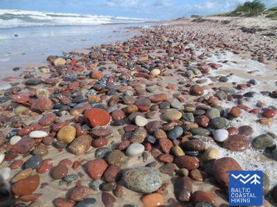
Oļainākā Latvijas pludmale
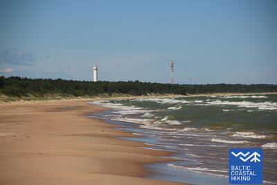
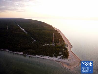
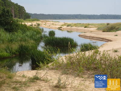
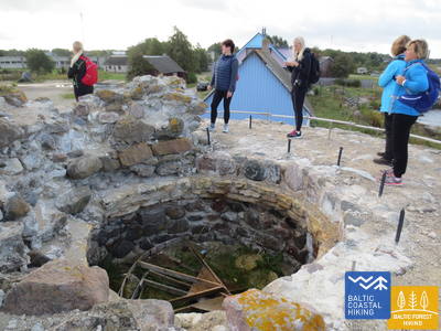
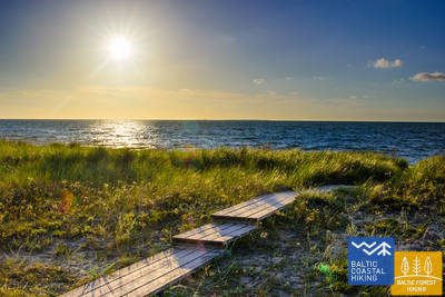
Latvijas-Lietuvas robežstabs ir Jūrtakas sākums. Tā ved cauri Papes dabas parkam pa plašu, Dižjūras apskalotu liedagu, gar skaistām, ar smiltāju kāpukviešiem un kāpuniedrēm apaugušām priekškāpām. Šim posmam raksturīga oļiem klāta pludmale, nelieli kūdras atsegumi un neskartība. Apmetot līkumu Papes kanālam, redzama izteikta Piejūras zemienes ainava, kur starp niedrājiem ieslēpies Papes ezers. Jūrtaka izlīkumo cauri Papes ciemam un pie Papes bākas atgriežas pludmalē.
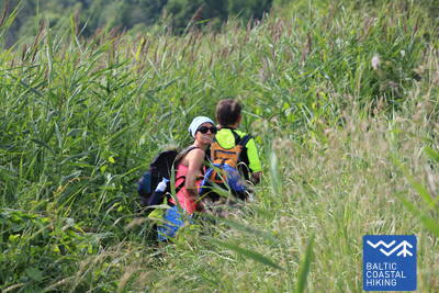
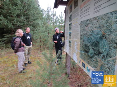
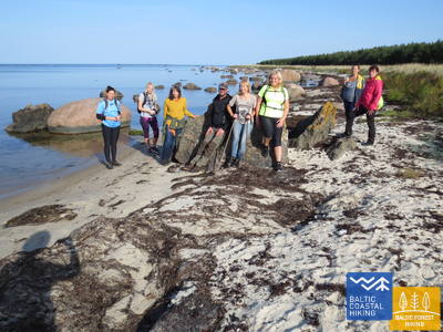
Ļoti nomaļš maršruta posms, kur Jūrtaka iet gar dabas parka "Pape" piekrasti un pa Nidas oļaino pludmali, kas ir ģeoloģisks dabas liegums. Papes kāpās atrodas Ornitoloģiskā stacija, kur gredzeno putnus.
 2. posms. Pape - Bernāti.
Tālākais Latvijas rietumu punkts
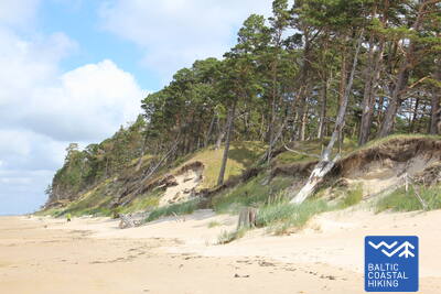
Visā posma garumā Jūrtaka stiepjas pa liedagu, kuru no sauszemes puses Papes apkaimē ieskauj skaistas priekškāpas, bet aiz ciema nomaina noskalots krasts turpat 10 km garumā, pār kuru sagāzušies priežu stumbri. Lēzenas kāpas atkal parādās Jūrmalciema apkaimē. Aiz Jūrmalciema turpinās plaši saskaloti liedagi, bet, tuvojoties Bernātu ragam, paceļas iespaidīgs, ar priežu mežu apaudzis un vietām noskalots stāvkrasts.
Jūrtaka arī šajā posmā iet pa dabas parka "Pape" un dabas parka "Bernāti" piekrasti, kur paralēli jūras krastam stiepjas un paceļas iespaidīgas, mežiem klātas kāpas, t.sk. - vienas no augstākajām Latvijas piekrastē. Savukārt, jūras krastā vairāk kā 10 km garumā redzami noskaloti stāvkrasti - jūras erozijas darbības rezultāts. Iepazīstami arī citi nozīmīgi kāpu biotopi, liela dabas - augu, kukaiņu un putnu daudzveidība. Bernāti - tālākais Latvijas rietumu punkts.
5. posms. Ziemupe - Pāvilosta.
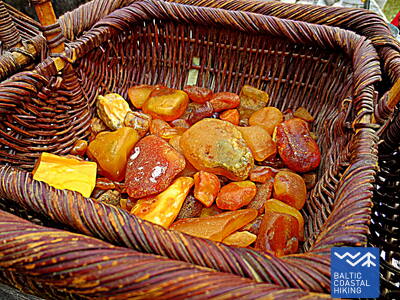
Dziedošās smiltis un dzintars
Cilvēku maz apmeklēta pludmale, kur var lasīt dzintarus un akmentiņus ar fosilijām, dzirdēt dziedošās smiltis zem kājām. Ziemupes apkaimē parādās jūras noskaloti stāvkrasti, bet tālāk līdz Akmensragam un Pāvilostai – skaistas, vietām noskalotas priekškāpas, kas noaugušas ar smiltāju kāpukviešiem un kāpuniedrēm. Vietām redzamas pelēkās kāpas. Akmeņraga bāka būs labs atpūtas punkts. Pāvilosta ar savu mazpilsētas šarmu, ostas un kūpinātu zivju smaržu liks atgriezties no neskartās dabas civilizācijā.
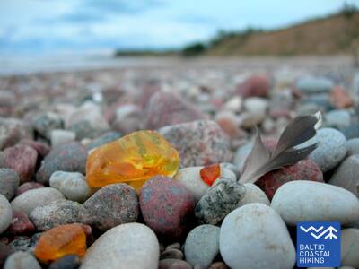
Skaistie Ziemupes stāvkrasti, tukšā pludmale ar Akmeņraga bāku ir viens no vientulīgākajiem Latvijas piekrastē. Iepazīstami kāpu biotopi ar tiem raksturīgajiem augiem, kukaiņiem. Akmeņrags - piemērota putnu vērošanas vieta. Daļa no teritorijas ietilpst Ziemupes dabas lieguma teritorijā. Liedagā var atrast izskalotu dzintaru un fosilijas.
 6. posms. Pāvilosta - Jūrkalne.
Izcilākie Baltijas jūras stāvkrasti
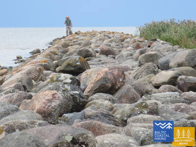
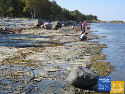
Ziemeļaustrumos no Pāvilostas ir apskatāmas izcilas pelēko kāpu ainavas, bet jau dažus kilometrus tālāk sākas viens no skaistākajiem Jūrtakas posmiem ar izciliem stāvkrastiem vairāk nekā 20 km garumā. Interesantākās stāvkrastu ainavas ir redzamas pie Strantes, Ulmales un Rīvas ietekas. Daudzviet krasta nobrukumu lejasdaļā vasarā zied orhidejas. Jūrkalnē un tās apkaimē var vērot „divus saulrietus”, - pirmo no pludmales, bet otru – īsu mirkli vēlāk - no stāvkrasta augšas.
Viens no izcilākajiem Latvijas stāvkrastu posmiem, kas sākas aiz Pāvilostas un turpinās gandrīz 30 km garumā. Pie Pāvilostas - pelēko kāpu biotopi. Piemērota vieta ģeoloģijas un krasta erozijas procesu iepazīšanai.
7. posms. Jūrkalne - Sārnate.
Vieta, kur cilvēki laivās šķērsoja Baltijas jūru
Šajā Jūrtakas posmā turpinās iespaidīgais Baltijas jūras stāvkrasts. Ošvalku apkaimē tas "nolaižas" lejā, pārvēršoties par stāvāku priekškāpu, ko nosedz biezi kārklu vainagi, taču iepretim Sārnatei atkal vērojami izteikti stāvkrasti. Šeit samērā īsā gājiena posmā redzami vairāki iespaidīgi dabas skati.
Viens no izcilākajiem Latvijas stāvkrastu posmiem, kas sākas aiz Pāvilostas un turpinās gandrīz 30 km garumā. Piemērota vieta ģeoloģijas un krasta erozijas procesu iepazīšanai.
8. posms. Sārnate - Užava.
Skaistākais Latvijas piekrastes skats
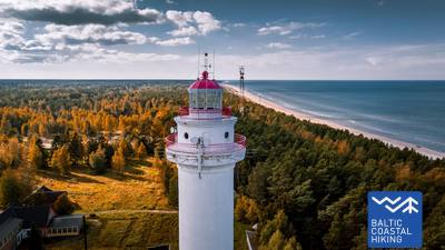
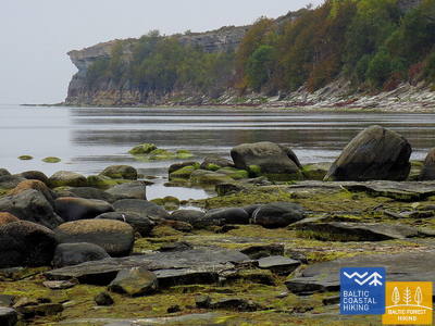
Sārnates apkaimē vēl ir redzams Baltijas jūras stāvkrasts, kas ziemeļu virzienā pamazām kļūst zemāks, un to nomaina noskalots priekškāpu valnis. Starp Vendzavām un Užavas bāku gar jūras krastu ir novērojami Latvijai neparasti skati, kas atgādina smilšaini – akmeņainus tuksnešus ar nabadzīgu veģetāciju – bijušās Padomju armijas poligons. Šeit un arī aiz Užavas bākas bijušo poligonu teritorijās mūsdienās ir redzamas pelēkās kāpas. Tuvojoties Užavas ietekai, liedags kļūst aizvien plašāks un kāpu vaļņi – zemāki. No romantiskās Užavas bākas paveras skaistākais Jūrtakas skats.
Vientuļš piekrastes posms ar izciliem pelēko kāpu un cietiem piekrastes biotopiem dabas lieguma "Užava" teritorijā un citur. No Užavas bākas paveras viens no skaistākajiem Dižjūras skatiem. Vēl joprojām jūras krastā vietām ir stāvkrasti. Piemērota vieta augu, kukaiņu un citu dabas elementu fotografēšanai.
11. posms. Staldzene - Oviši.
Galamērķis - Ovišrags
Jau nokāpjot Staldzenes pludmalē, redzams dažus metrus augsts, vietām klajš stāvkrasts, kas pamazām kļūst aizvien augstāks (maksimālais punkts – Kokkalns, 29 m). 3 - 4 km ZA no Staldzenes izveidojies šaurs liedaga posms ar stāvkrastu, ko stipra vēja laikā apskalo viļņi. Aiz Liepenes noskalotais jūras krasts pamazām kļūst zemāks un aiz Jaunupes līdz pat Ovišragam izveidojušies plaši liedagi, kas visliekāko platumu sasniedz Ovišraga galā. No Ovišu bākas paveras lielisks skats pāri koku galotnēm.
Lībiešu valodā Oviši senais nosaukums Paţīkmō.
Staldzenes stāvkrasti ir interesanti ne tikai no ģeoloģiskā viedokļa, bet arī ir ainaviski skaisti un izmēros iespaidīgi. Pie Ovišiem jau veidojas plašas, smilšainas pludmales. Posms piemērots vientuļai dabas baudīšanai, piekrastes kāpu biotopu un to iedzīvotāju izziņai, fotografēšanai.
12. posms. Oviši - Miķeļtornis.
Starp Ovišu bāku un Miķeļbāku
Jūrtaka ved cauri Ovišu dabas liegumam, kur raksturīgu krasta ainavu veido plaši, smilšaini liedagi un kāpas. Šejienes liedagā dabas materiāli – oļi un smiltis – veido lielas, dabiskas mozaīkas. Lūžņā interesi piesaista dažādu laiku militārā mantojuma objekti, bet pie Lūžupes grīvas ir jāievēro sezonālais liegums ligzdojošo putnu aizsardzībai: 01.04. – 01.08. šeit uzturēties aizliegts. Vieta ir jāapiet, sekojot Jūrtakas marķējuma norādēm. Maršruta galapunkts - Miķeļbāka - ir redzama jau iztālēm.
Lībiešu valodā Oviši senais nosaukums Paţīkmō, Lūžņa - Lūž un Miķeļtornis - Pizā.
Jūrtakas posms vijas cauri dabas liegumam "Oviši", kas veidots piekrastes biotopu aizsardzībai.
13. posms. Miķeļtornis - Sīkrags.
Galamērķis – Slīteres Nacionālais parks!
No Miķeļtorņa līdz pat pagriezienam uz Irbes trošu tiltu, skatam paveras plašs liedags ar zemām un skrajām priekškāpām. ~ 4,5 km garumā maršruts ved apkārt Irbes grīvai - sezonālam dabas liegumam, kas veidots ligzdojošo putnu aizsardzībai, un kur uzturēšanās aizliegta 01.04. – 1.08. Jūrtaka apkārtceļā ved pa skaistu priežu mežu ar augstām kāpām, kuru nogāzes ir bagātas ar sēnēm un ogām. Aiz Irbes ietekas līdz pat Sīkragam stiepjas plašs, smilšains liedags, ko ~ 1 km pirms Sīkraga šķērso Ķikana strauts – Slīteres Nacionālā parka robeža. Arī Ķikana strauta apkārtnē ligzdo upes zīriņš, tāpēc no 1.04. līdz 1.08. aicinām pārvietoties pēc iespējas tuvāk ūdens malai.
Lībiešu valodā Miķeļtornis senais nosaukums Pizā, Lielirbe / Īra, Jaunciems / Ūžkilā un Sīkrags / Sīkrõg.
Jūrtakas posms, kas sākotnēji vijas cauri dabas liegumam "Oviši", bet tā finišs ir Slīteres Nacionālajā parkā. Meži starp Irbes jauno tiltu un Jaunciemu - piemērota vieta ogošanai, sēņošanai, piekrastes dabas izziņai un fotografēšanai. Šeit sākas t.s. Lībiešu krasts, kas turpinās līdz Ģipkai.
15. posms. Saunags - Kolka.
Eiropas sirds – Kolkasrags!
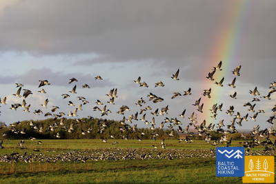
Jūrtakas posms, kas piemērots ikviena vecuma un sagatavotības gājējam. No Saunaga pa maziem lauku un meža ceļiem Jūrtaka izlokas līdz Vaidei, kur tā atkal atgriežas jūras krastā. Līdz Kolkasragam aizstiepjas plaši, smilšaini liedagi, kas pāriet zemās, skrajās priekškāpās, aiz kurām atkal seko mežainas jūrmalas kāpas, bet ~ 2 km garumā – noskalotas kāpas, aiz kurām paceļas Dumbrkalni. Ir veikti ~ 250 km un sasniegts Kolkasrags – robežšķirtne starp Dižjūru un Mazjūru – Rīgas jūras līci. Kolkasrags ir viena no Baltijas piekrastes populārākajām putnu vērošanas vietām.
Lībiešu valodā Saunags senais nosaukums Sǟnag, Vaide / Vaid un Kolka / Kūolka.
Jūrtakas posms ved gan pa piekrastes priežu mežiem, gan smilšainām pludmalēm. Kolkasrags ir viens no populārākajiem Ziemeļkurzemes apskates objektiem, kur satiekas Dižjūra ar Mazjūru. Populāra putnu un vētru vērošanas vieta. Priežu takā var iepazīt piekrastes biotopus un to iemītniekus.
16. posms. Kolka - Ģipka.
Gar "slēgto krastu"
Pagriežoties no Kolkasraga uz līča pusi, manāma atšķirība starp Dižjūru un Mazjūru. Jūrtakas pirmie 10 km ved pa Slīteres nacionālā parka piekrasti: sākumā gar jūrā ieskalotajām priedēm, gar kādreizējām zvejas kolhoza ēkām, kuģu piestātni un Ēvažu stāvkrastu, kura apkaimē ir neparasti šaurs, smilšains liedags ar tam pāri līkstošiem melnalkšņiem. Arī tālākajā posmā līdz Ģipkai raksturīgs šaurs, smilšains liedags ar bagātīgo avoksnāju veidotām lāmām un nelielu, vasarā – seklu upīšu ietekām. Slīteres krasts kādreiz bija divkārt slēgta teritorija – te bija pierobežas režīma zona un dabas rezervāts.
Lībiešu valodā Kolka senais nosaukums Kūolka, Melnsils / Mustānum un Ģipka / Gipk.
Ainaviski skaists un dažāds krasta posms ar mežainām kāpām, skaistām priekškāpām, Ēvažu stāvkrastu (izveidota dabas taka un skatu vieta) un mazām upītēm, kas ieplūst Rīgas jūras līcī. Vietām šaurs liedags ar nelielām lāmām, kas ir nozīmīga dzīves vide abiniekiem, kukaiņiem, augiem un putniem.
17. posms. Ģipka - Kaltene.
Kurzemes akmeņainā jūrmala
No Ģipkas līdz Rojai stiepjas smilšaina, ne pārāk plata pludmale ar skaistām kāpām un piekrastes priežu mežiem, bet pirms Rojas – tā ir aizaugusi ar niedrēm. Savukārt, posms starp Roju un Kaltenes baznīcu ir savdabīgākais visā Latvijas piekrastē, kur jūras krasts ir izrobots ar maziem zemesragiem un līcīšiem ar ļoti šauru pludmali, kuru viscaur klāj dažādu izmēru laukakmeņu krāvumi, virs kuriem līkst melnalkšņu zaļā lapotne. Dažviet krastā slejas izskaloto koku plašās sakņu rozetes. Vietām gar pašu krastu iet zemes ceļš, gar kuru rindojas daudzas bijušās zvejnieku sētas. Maršruts piemērots aktīviem un izveicīgiem gājējiem!
Lībiešu valodā Ģipka senais nosaukums Gipk.
Dabas daudzveidības ziņā - Jūrtakas posms ar atšķirīgiem dabas apstākļiem. Starp Ģipku un Roju ir g.k. smilšainas pludmales ar kāpu biotopiem, bet aiz Rojas sākas akmeņiem klāti krasta posmi, kas izroboti ar daudziem zemesragiem, pār kuriem līkst melnalkšņu audzes. Piemērota vieta augu, kukaiņu, putnu izziņai un vērošanai.
18. posms. Kaltene - Mērsrags.
Daudzveidīgais krasts
Maršruts piemērots aktīviem un izveicīgiem gājējiem! Dabas, kultūrvēstures pieminekļu un ainavu ziņā – ļoti daudzveidīgs Jūrtakas posms. Pie Kaltenes jūras krastu izraibina nelieli līcīši ar akmeņainām pludmalēm, bet tālāk seko ļoti aizaudzis jūras krasts, kur starp niedrēm un bagātīgi sazēlušo augāju iemīta šaura taciņa. Tālāk akmeņiem klātais jūras krasts ir tikai dažus metrus plats, vietām ar māla slāņiem, niedru laukiem, citviet ar izskalotajām aļģēm klāts. Posmā no Valgalciema līdz Mērsragam atkal parādās smilšaini liedagi ar sēkļiem jūrā. Aiz Mērsraga maršruts turpinās pa ceļu, bet pie luterāņu baznīcas – nogriežas uz jūras pusi un līdz pat Mērsraga centram iet gar Piejūras pļavu.
Latvijas piekrastei samērā neraksturīgs posms. Kaltenes apkaimē dominē akmeņainas un ar veģetāciju bagātīgi aizaugušas krastmalas. Virzienā uz Mērsragu pamazām parādās smilšainas pludmales, bet ap Mērsragu - smilšaini - akmeņainas. Posms piemērots augu un putnu vērošanai, dažādu piekrastes biotopu iepazīšanai.
19. posms. Mērsrags - Engure.
Engures dabas parkā
Maršruts piemērots aktīviem gājējiem. No ciema centra līdz pludmalei aizved meža ceļs, ko ieskauj priežu mežs. Tālāk Jūrtaka ved pa takām, kas izlokas starp niedrēm un citiem zālaugiem bagātīgi apaugušo un akmeņaino jūras krastu vienā un mežainām jūrmalas kāpām – otrā pusē. Dažviet liedags ir nobruģēts ar maziem, apaļiem akmeņiem, citur redzamas pelēkās kāpas ar bagātīgu augu sugu klāstu. Bērzciema apkaimē plešas piejūras pļavas ar sēkļiem tālu jūrā, kas ir laba putnu vērošanas vieta. Līdz Abragciemam turpinās aizaugušais jūras krasts, bet no Abragciema līdz Engurei ir liedags.
Ainaviskā, ģeoloģiskā un biotopu daudzveidības ziņā - dažāds Jūrtakas posms ar dažāda tipa liedagiem - smilšainiem, akmeņainiem, aizaugušiem. Bērzciema apkaimē jūrā veidojas sēkļi ar sezonālām lagūnām. Piemērota vieta putnu vērošanai. Ietilpst dabas parkā "Engures ezers".
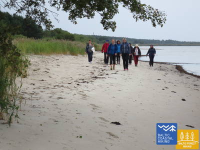
26. posms. Carnikava - Saulkrasti.
Saulrieta taka ar romantiskākajiem saulrietu skatiem
Sākotnēji maršruts ved pa Gaujas aizsargdambjiem Gaujas ciemā, sasniedzot Gaujas grīvu, kas ir laba putnu vērošanas vieta. Tālākais gājiens norit pa smilšainu pludmali līdz Inčupes ietekai, pirms kuras jāpagriežas uz iekšzemi, lai nokļūtu līdz tiltam un turpmākos dažus kilometrus uz pludmali nolūkotos no Saulrieta takas mežaino kāpu virsotnēm. Pēc Pēterupes šķērsošanas (trošu tilts) pa pludmali Jūrtaka sasniedz Saulkrastu “Jūras parku”.
Gaujas grīva (labais krasts, jo kreisā sezonas laikā ir putnu liegums, ko nevar apmeklēt), kāpu biotopi un piekrastes meži ir nozīmīgi bioloģiskās daudzveidības uzturēšanai.
28. posms. Lauči - Tūja.
Aizgājušais burinieku laikmets
Izcili ainavisks Vidzemes krasta posms ar daudziem akmeņainiem zemesragiem un akmeņu „amfiteātriem” jūrā, kas mijas ar maziem, smilšainiem līcīšiem, kuros ietek mazu upīšu un urgu vasarā izsīkstošās tērcītes. Piemērots aktīviem gājējiem ar piemērotiem apaviem, jo vietām liedagu pilnībā klāj tikai akmeņu pelēkās muguras. Dažviet parādās arī nelieli niedru pleķīši, bet pie Tūjas – pirmie smilšakmens atsegumi.
Ainaviski daudzveidīgs posms ar maziem līcīšiem un zemesragiem, smilšainiem un akmeņainiem liedagiem un smilšakmens atsegumiem pie Tūjas. Piemērota vieta fotografēšanai, fotosesijām, ģeotūrismam, dabas izziņai.
29. posms. Tūja - Svētciems.
Vidzemes akmeņainā jūrmala
Maršruts piemērots aktīviem un izturīgiem gājējiem! Viens no skaistākajiem Jūrtakas posmiem, kas sākas ar Zaķupītes šķērsošanu. Līdz Ķurmraga bākai pārsvarā ir smilšaini liedagi ar nelieliem akmeņainiem posmiem. Tālāk sākas Vidzemes akmeņainā jūrmala, kur zemesragi mijas ar nelieliem līcīšiem, bet krastā paceļas līdz 4 m augsti smilšakmens atsegumi. Aiz Meleku raga atkal seko galvenokārt smilšains liedags, bet pirms Svētupes ietekas – stipri aizaugusi pludmale un niedrājs, kas apejams pa meža ceļu.
Akmeņainās Vidzemes jūrmalas posms, kas ietver ļoti daudzveidīgu jūras krastu ar maziem zemesragiem, līcīšiem, akmeņainu pludmali un devona perioda atsegumiem - jūras erozijas darbības rezultātu. Ietilpst dabas liegumā "Vidzemes akmeņainā jūrmala". Piemērota vieta dabas vērošanai, sēņošanai, ogošanai, fotografēšanai un filmēšanai, īpaši - vētru laikā. Pie Svētupes ietekas - sākās ar bagātīgu veģetāciju aizaudzis krasts. Piemērota putnu vērošanas vieta. Jūrtakas posms ietilpst Ziemeļvidzemes biosfēras rezervātā.
30. posms. Svētciems - Ainaži.
Nēģu karaliste
Daudzveidīgs Jūrtakas posms, kas piemērots aktīviem un izturīgiem gājējiem un putnu vērotājiem. Pludmale starp Svētciemu un Salacgrīvu ir stipri aizaugusi, tādēļ Jūrtaka iet pa meža ceļu, kas izvijas starp kāpu vaļņiem. No Salacgrīvas līdz Kuivižiem var doties pa smilšaino pludmali, vai arī pa meža takām. Randu pļavas no Kuivižiem līdz Vēverupei ir jāapiet pa meža ceļu, kas iet līdztekus A1 autoceļa austrumu pusē. Aiz Vēverupes Jūrtaka atgriežas stipri aizaugušā pludmalē, ko atkal pamet pie Blusupītes ietekas, lai tālāk pa Kāpu un Valdemāra ielu sasniegtu Ainažu molu. Latvijā ir veikti ap 580 km un sasniegta valsts robeža.
G.k. ar bagātīgu veģetāciju aizaudzis krasta posms, tādēļ Jūrtaka ved pa maziem meža ceļiem, tikai vietām izlocīdamās jūras krastā. Starp Kuiviežiem un Ainažiem atrodas t.sk. Randu pļavas (dabas liegums), kas ir dabas daudzveidības (augi, putni) ziņā viens no bagātākajiem Latvijas piekrastē. Piemērota vieta putnu vērošanai, izveidota dabas taka un putnu vērošanas tornis. Starp Svētciemu un Salacgrīvu - laba vieta ogošanai un sēņošanai. Uz Svētupes uzbūvēts nēģu tacis. Jūrtakas posms ietilpst Ziemeļvidzemes biosfēras rezervātā.
31. posms. Ikla - Kabli.
Pa vēsturiskā kūrorta takām!
Ikla ir Jūrtakas sākums Igaunijā. Ikla – Treimani posmā tā ved pa tā saukto veco Rīgas ceļu, jo jūras krastā plešas pļavas un niedrāji. Aiz Treimani maršruts pagriežas uz jūras pusi un turpmākie 2,8 km ved pa šauru, smilšainu, vai akmeņainu un vietām stipri aizaugušu liedagu. Apmetot loku apkārt Orajõe strautam, pie autostāvvietas tā atkal atgriežas liedagā, pa kuru seko gājiens ~ 4 km garumā līdz Lepanina hotelim, kur atkal jāatgriežas uz vecā Rīgas ceļa, kas aizved līdz Kabli. Maršrutā labas putnu vērošanas
vietas. Piekrastes posms līdz Pērnavai ir populāra atpūtas un peldvieta. Maršruts piemērots ikviena vecuma un sagatavotības gājējam, kam interesē piekrastes kūrorta, zvejniecības un kuģniecības vēsture.
Kabli apkārtne ir laba vieta putnu vērošanai. Izveidota dabas mācību taka un Dabas centrs. Piekrastes meži piemēroti sēņošanai, ogošanai.
32. posms. Kabli - Häädemeeste.
Putni, kāpas un meži!
Maršruts piemērots ikviena vecuma un sagatavotības gājējam, taču īpaši ieteicams putnu vērotājiem. Jūrtakas posmu no Kabli līdz Häädemeeste dienviddaļai ir jāturpina pa veco Rīgas ceļu, jo jūras krastā plešas pļavas ar niedrājiem un lagūnām. Pirms Häädemeeste Jūrtaka nogriežas no autoceļa un aizlīkumo pa Jaagupi dabas liegumu (apmet loku ciemam no austrumiem), uzskriedama augsto kāpu mugurās un mezdamās lejup dziļajās starpkāpu ieplakās, kuras klāj skrajš priežu mežs. Te ir labas ogošanas un sēņošanas vietas.
Kabli dabas centrs ar izglītojošu dabas taku un izstādēm. Hēdemēstē un Rannametsā ir piekrastes pļavas ar lielu dabas daudzveidību. Apkārtnē pieejami vides gidi.
33. posms. Häädemeeste - Uulu.
Cauri mežiem un purviem!
Jūrtakas posms piemērots aktīviem un izturīgiem gājējiem, kam patīk būt vienatnē ar dabu un ceļot pa neapdzīvotām un cilvēka mazskartām vietām. Maršruts ved pa Luitemaa dabas liegumu ar skaistiem skujkoku mežiem uz iekšzemes kāpām, kuras klāj briežu ķērpju baltie paklāji. Vasarās un rudeņos šeit ir piemērotas vietas putnu un zvēru vērošanai, kā arī sēņu un ogu vākšanai. Jūrtaka izlokas gar Maarjapeakse purva rietumu malu un, izskriedama cauri mežu un izcirtumu mozaīkai, aizved līdz Lepaküla un Uulu ciemiem.
Jūrtakas posms ved pa Luitemaa dabas liegumu ar skaistiem skujkoku mežiem uz iekšzemes kāpām, kuras klāj briežu ķērpju baltie paklāji. Vasarās un rudeņos šeit ir piemērotas vietas putnu un zvēru vērošanai, kā arī sēņu un ogu vākšanai. Soometsā izveidota purva laipa.
36. posms. Liu - Munalaid.
Līči, salas un putni!
Maršruts piemērots putnu vērošanai. Jūrtaka iet pa ceļiem un takām, jo jūras krastā plešas piejūras pļavas, niedrāji, sekli un aizauguši līči. Aiz Liu ostas Jūrtaka bieži maina virzienu, jo grūti pieejamā un sarežģītā krasta līnija ievieš korekcijas maršrutā. Labākās skatu un putnu vērošanas vietas ir pie Kavaru ciema, Peerni ostas apkaimē un pie Munalaid ostas, kur redzami plašie Pērnavas līča un Kihnu jūras šauruma skati ar salām (Sorgu saar, Manilaid, Kihnu), kā arī piejūras pļavām, kurās ganās mājlopi.
Maršruts piemērots putnu vērošanai. No Jūrtakas redzamas piejūras pļavas, niedrāji, sekli un aizauguši līči. Labākās skatu un putnu vērošanas vietas ir pie Kavaru ciema, Peerni ostas apkaimē un pie Munalaid ostas, kur redzami plašie Pērnavas līča un Kihnu jūras šauruma skati ar salām, kā arī piejūras pļavām, kurās ganās mājlopi.

39. posms. Matsi - Varbla.
Pludmale un meži!
Matsi pludmale ir viena no retajām smilšainajām pludmalēm takas turpmākajā posmā līdz Hāpsalai. Jūrtaka izmet loku caur Kulli ciemu un turpmākos 5 km ved pa maziem, plašu mežu un kāpu ieskautiem ceļiem, kuru apkaime rudeņos ir bagāta ar ogām un sēnēm. Apmetusi loku apkārt Uue-Varbla muižai, taka sasniedz Varbla ciemu.
Apkaimes meži ir piemēroti sēņošanai un ogošanai, dabas vērošanai.
40. posms. Varbla - Pivarootsi.
Piekrastes muižas
Jūrtaka iet pa piekrastes ceļiem, taču jūra ir redzama tikai divās vietās, jo tās krasts ir seklu līču, mazu saliņu, mitru piejūras pļavu, niedrāju, lagūnu, purvu un no jūras atdalījušos ezeru izraibināts. Varbla-Allika apkaimē paveras lauksaimniecības zemju ainavas, Allika-Tamba posms pārsvarā iet cauri skaistiem mežiem. Apmetusi loku Paatsalu un Illuste muižām, Jūrtaka pa ceļu šķērso Nehatu dabas liegumā esošu mitrāju un pie Muriste ciema aizlokās pa ceļu, kura malā ir iespaidīgs akmeņu žogs. Pirms Pivarootsi muižas skatam paveras plašas ganības un skats uz līci.
Jūrtakai apkaimē esošās kadiķu audzes un mitrāji ir laba vieta dažādu savvaļas orhideju un putnu vērošanai.
41. posms. Pivarootsi - Virtsu.
Vārti uz Igaunijas salām
Maršruts piemērots tādiem nesteidzīgiem dabas vērotājiem, kam interesē arī industriālais mantojums, jo ~ 3,7 km gara Jūrtakas daļa iet pa bijušo Virtsu – Rapla šaursliežu dzelzceļu. Šī posma interesantākā vieta ir Puhtulaiu pussala – sala, kas mūsdienās saaugusi ar kontinentu. To klāj platlapju mežs ar interesantām augu un sēņu sugām, dižkokiem un nozīmīgu cilvēku piemiņas vietām. No Virtsu ostas prāmji kursē uz Muhu salu, ko ar Saaremaa salu savieno dambis.
Šī Jūrtakas posma interesantākā vieta ir Puhtulaiu pussala (dabas liegums) – sala, kas mūsdienās savienojusies ar kontinentu. To klāj platlapju mežs ar interesantām augu un sēņu sugām, dižkokiem un nozīmīgu cilvēku piemiņas vietām, dabas taku, putnu vērošanas torni u.c. Interesants ir arī bijušais šarusliežu dzelzceļa dambis, kas šķērso seklu līci - piemērotu puntu vērošanas vietu.
42. posms. Virtsu - Kuke.
Cauri orhideju un kadiķu laukiem
Maršruts piemērots tiem, kam iešanu patīk apvienot ar izziņu. Jūrtaka izlokās cauri Virtsu ciemam, aiz kura 3 km garumā virzās gar šosejas malu un tad taisnā leņķī pagriežas uz ziemeļrietumiem, izlīkumojot cauri vēja parkam un bijušajam padomju armijas militārajam lidlaukam, kura apkaimē vasarā bagātīgi zied orhidejas. Tālāk skatam paveras Suur Väin jūras šaurums un skaisti kadiķu lauki. Pirms Jõeoja strauta ~ 1 km garumā ceļš iet pa jūras senkrasta augšdaļu.
Daļa no maršruta virzās pa piekrastes kadiķu pļavām un sausieņu pļavām, kurās aug bagātīgs orhideju sugu klāsts. Uisu atseguma apkaimē ir redzamas interesantas fosīlijas.
43. posms. Kuke - Meelva.
Gar Baltijas ledus ezera salām
Maršruts piemērots aktīviem gājējiem. Jūrtaka iet pa nelieliem lauku ceļiem, kur paveras ainavas ar viensētām un apstrādātām zemēm. Tuvojoties Matsalu līcim, parādās mitrāji – aizaugoši ezeri, kas kādreiz atdalījušies no jūras kā līči un mājlopu noganītās piejūras pļavas. Pie Mõisaküla (sākas Matsalu nacionālais parks) un Salevere ciemiem redzami izteikti reljefa paaugstinājumi, kas pirms vairāk nekā 10 000 gadiem bija salas Baltijas ledus ezera ūdeņos.
Jūrtakas posma lielākā daļa ved pa Matsalu Nacionālo parku, kas ir piemērota vieta zvēru un putnu vērošanai, īpaši - putnu pavasara un rudens migrāciju laikā. Izveidota arī ģeoloģijas taka, kas iepazīstina ar Baltijas jūras stadijām un bioloģisko daudzveidību.
44. posms. Meelva - Penijõe.
Pa Livonijas Indriķa hronikas pēdām
Maršruts, kas izvietojies dienvidos no Matsalu līča, piemērots aktīviem gājējiem. Jūrtakas šīsdienas posma sākuma un beigu punkti atrodas Matsalu Nacionālajā parkā, taču lielākā tās daļa – ārpus parka teritorijas. Ceļotāju uzmanību piesaistīs mazie ciemi un lauku ceļi ar skaistām viensētām un lauku ainavām, kurās ganās zirgi un aitas, kā arī Lihula – Sāmsalas-Vīkas bīskapijas pirmā galvaspilsēta, kas netieši pieminēta Livonijas Indriķa hronikā saistībā ar 1211. gada notikumiem, kad Daugavgrīvas (pie Rīgas) klostera abatu Teoderihu iesvētīja par pirmo Igaunijas bīskapu.
Posma noslēgums atrodas Matsalu Nacionālajā parkā, kur atrodas parka apmeklētāju centrs un izveidota dabas taka ar aptūtas vietām un putnu vērošanas torni. Piemērota vieta putnu vērošanai un piekrastes palieņu pļavu biotopu iepazīšanai.
46. posms. Haeska - Puise.
Putnu un dabas vērošana Matsalu nacionālajā parkā
Viens no skaistākajiem Matsalu nacionālā parka Jūrtakas posmiem, kas ved cauri Matsalu līča apkaimes lauksaimniecības zemēm un piejūras pļavām, kur rudeņos pulcējas tūkstošiem migrējošo dzērvju un zosu. Pie Haeska ciema (piejūras pļavas, sekli līči, mazas saliņas, mājlopu ganības) un Puise ragā (piejūras pļavas ar ganībām, sēkļi) ir izcilas putnu vērošanas vietas, kur uzcelti torņi. Ainaviski skaistākie skati uz jūru un salu virtenēm paveras Põgari - Sassi un Puise nina apkaimē.
Jūrtakas posms ietver vairākas vietas jūras krastā, kur redzams seklais līcis ar akmeņiem, mazām saliņām un piejūras pļavas, kas ir labas putnu vērošanas vietas. Gājienā var iekļaut nacionālā parka veidoto taku starp Kiideva un Puise nina. Izveidoti putnu vērošanas torņi, platformas.
51. posms. Riguldi - Dirhami.
Vieta ar meteorīta krišanas pēdām
Maršruts piemērots ikviena vecuma un sagatavotības gājējam. Izņemot pirmos 3 km, maršruts iet gar jūras krastu. Pārsvarā tas ir smilšains liedags ar skaistām priekškāpām, pelēkajām kāpām un laukakmeņiem jūrā. Liedagā var būt saskalotas aļģes, dažviet tas aizaudzis ar blīvu augāju. Iepretim Rooslepa ciemam un citviet jūrā un krastā redzami stipri sadēdējuši akmeņi – t.s. brekčijas, kas ir sena meteorīta sprādziena rezultātā sakusuši un sadēdējuši ieži. Maršruta galapunktā var pasēdēt krodziņā, no kura terases paveras skaists skats uz jūru un ostu.
Iepazīstami dažādi kāpu biotopi (baltās kāpas, pelēkās kāpas), dažāda tipa pludmales (smilšainas, aizaugušas), skaisti piekrastes priežu meži ar nelieliem ceļiem. Maršruts piemērots dabas daudzveidības, augu, putnu, ģeoloģijas izziņai. Liedagā un jūrā redzamas brekčijas - sena meteorīta sprādziena rezultātā sakusuši un sadēdējuši ieži. Piekrastes meži piemēroti sēņošanai un ogošanai.
52. posms. Dirhami - Nõva.
Skarbā ziemeļu daba
Maršruts piemērots ikviena vecuma un sagatavotības gājējam. Ainavu ziņā izcili daudzveidīgs Jūrtakas posms, kurā jau ir apjaušama Igaunijas ziemeļu piekrastei raksturīgā daba. Maršruts gandrīz visā garumā ved gar jūras krastu, kur līčos ir skaisti, smilšaini liedagi, zemesragos – laukakmeņiem klāti krasti, bet Põõsaspea neem raga (izcila putnu vērošanas vieta) ziemeļdaļā atsedzas dolomīta slāņi. Jūrtaka iet pa Nõva dabas liegumu, kur redzami izcili balto un pelēko kāpu skati. Pludmales ir populāra makšķerēšanas un kaitborda vieta.
Iepazīstami dažādi kāpu biotopi (baltās kāpas, pelēkās kāpas), dažāda tipa pludmales (smilšainas, aizaugušas, akmeņainas, ar dolomītu klātas), skaisti piekrastes meži ar nelieliem ceļiem. Maršruts piemērots dabas daudzveidības (atpūtas vietas, skatu platformas, dabas takas), augu, putnu (Põõsaspea neem - izcila putnoušanas vieta), ģeoloģijas izziņai. Piekrastes meži piemēroti sēņošanai un ogošanai.
53. posms. Nõva - Vihterpalu.
Gar Somu jūras līci
No Rannaküla, apmetot loku mitrājam, Jūrtaka šķērso Nõva upīti un izved Keibu līča pludmalē (sākumā – aizaugusi), kur plešas smilšains liedags ar kāpām. Pie Keibu strauta tā nogriežas iekšzemē, kur tālāk sakrīt ar Igaunijas valsts mežu marķēto taku: Peraküla – Aegviidu – Ähijärve. Taka izvijas cauri Keibu ciematiņam un iznāk pie jūras iepretim Alliklepa ciemam, kur ir skaisti kadiķu lauki. Tālāk taka ved starp jūru un diviem maziem ezeriņiem, kas kādreiz bijuši līči. Tiem iepretim jūras gultnē atsedzas dolomīts. Tālāk līdz pat Vintse ciemam taka iet pa mazu jūras krasta ceļu (redzamas Pakri salas), līdz nogriežas uz Vihterpalu pusi.
Iepazīstami dažādi kāpu biotopi (baltās kāpas, pelēkās kāpas), dažāda tipa pludmales (smilšainas, aizaugušas, akmeņainas, ar oļiem un dolomītu klātas), skaisti piekrastes meži ar nelieliem ceļiem, kadiķu lauki. Maršruts piemērots dabas daudzveidības, augu, putnu ģeoloģijas izziņai. Piekrastes meži piemēroti sēņošanai un ogošanai.
56. posms. Paldiski - Kersalu.
Klintis, bāka un militārais mantojums
Jūrtaka ved apkārt Pakri pussalai, no kuras klinšainajiem krastiem atklājas skaistākās ziemeļrietumu Igaunijas piekrastes ainavas. Tā iziet cauri Paldiski centram un pie Pētera I cietokšņa bastioniem nogriežas uz Pakri bākas pusi, līdz kurienei virzās pa iespaidīgo Pakri klinšu augšdaļu. Tālāk līdz Kersalu ir gan kāpumi – klintis, gan kritumi, kur Jūrtaka vijas gar smilšaini akmeņainu krastmalu un skaistu priežu mežu. Pakri klintis ir interesantas arī aukstās ziemās, kad šeit veidojas iespaidīgi leduskritumi, gan rudens krāsaino lapu laikā. Maršruts piemērots aktīviem un izturīgiem gājējiem.
Šajā posmā ir iespaidīgākās Jūrtakas (visās Baltijas valstīs) klintis un stāvkrasti, kas apjož Pakri pussalu. No tām paveras fantastiski skati dažādos gadalaikos. Piemērota vieta ģeotūrismam, dažādu ģeoloģisku objektu - atsegumu, dažādu ģeoloģisko periodu slāņu, laukakmeņu u.c. izziņai.
58. posms. Laulasmaa - Vääna-Jõesuu.
Skaistākais Igaunijas ūdenskritums
Ainaviski daudzveidīgs Jūrtakas posms, kas piemērots izturīgiem gājējiem. Redzamas gan akmeņainas, gan smilšainas pludmales un labas peldvietas, skaisti piekrastes priežu meži, iespaidīgā Türisalu klints siena un dižakmeņi. Pa plašā Keilas Mežaparka takām var aiziet līdz Keilas ūdenskritumam, pie kura uzņemti fragmenti populārajai latviešu mākslas filmai „Vella kalpi”, kā arī iepazīt piekrastes zvejnieku dzīvei veltīto ekspozīciju Lohusalu ciemā.
Dažādi pludmaļu tipi - smilšainas, akmeņainas, līčiem un pussalām izrobota piekraste, liela ģeoloģisko pieminekļu daudzveidība - viens no Igaunijas ainaviskākajiem ūdenskritumiem, populārā Tirisalu klints. Piemērots posms ģeoloģijas izziņai, augu un piekrastes biotopu izziņai.
59. posms. Vääna - Jõesuu - Tabasalu.
Nostāstiem apvītā Suurupi pussala
Viens no sarežģītākajiem Jūrtakas posmiem, piemērots tikai pieredzējušiem gājējiem. Maršruts apmet loku ap Suurupi pussalu, kuras biezie meži slēpj dažādu vēsturisko periodu militāro mantojumu. Jūrtaka līkumo pa aizaugušām un akmeņainām krastmalām, bērzu birzīm, gar bijušajām pionieru nometnēm un smilšakmens klinšu pasargātiem līcīšiem ar asiem zemesragiem. Dažviet jūrā atsedzas dolomīta pamatne, bet citur redzamas laukakmeņu „salas”. Maršruta noslēgumā jūras krastā paceļas viens no iespaidīgākajiem Igaunijas piekrastes atsegumiem – Rannamõisa klintis, no kurām paveras skats uz Kakumäe līci un pussalu un Tallinas vecpilsētas torņiem.
Kaut arī no Tallinas netālu esošs, tomēr vientuļš Jūrtakas posms ar ļoti savdabīgi izrobotu jūras krastu un smilšakmens atsegumiem tajā (Sūrupi stāvkrasts) un iespaidīgajām Rannameizas klintīm. Jūras krastā interesanti laukakmeņu krāvumi. Piemērota vieta sēņošanai, ogošanai, putnu un augu vērošanai.
65. posms. Pervalka – Juodkrantė.
Gar Ziemeļeiropas iespaidīgākajām smilšu kāpām
Pametusi Pervalku, Jūrtaka pa gājēju celiņu šķērso Kuršu kāpu austrumu–rietumu virzienā, nonākot Baltijas jūras krastā. Tālākais posms ap 13 km garumā ved pa skaistu, smilšainu pludmali, kuru no austrumiem norobežo augsta un stāva kāpu grēda. Tā ir cilvēku izveidota, lai pasargātu iekšzemi no smilšu kustības. Iepretī Jodkrantei Jūrtaka pagriežas austrumu virzienā un pa mežainu un stāvu kāpu masīvu atkal šķērso Kuršu kāpu, nonākot Kuršu jomas (līča) pusē. Nelielā posmā Jūrtaka sakrīt ar Raganu kalna taku. Tālāk gar Jodkrantes krasta promenādi tā aizved līdz ostai. Posms ietilpst Kuršu kāpu Nacionālajā parkā.
Kuršu kāpu posms, kurā var iepazīt gan klajas, smilšainas kāpas un to veidojumus Nagļu rezervāta dabas takā, gan jau apmežotas kāpas un to vaļņus Raganu kalnā. Jūraskraukļu un zivju gārņu kolonija - piemērota putnu vērošanas vieta. Jūras krastā var atrast dzintaru. Posms ietilpst Kuršu kāpu Nacionālajā parkā.
66. posms. Juodkrantė – Klaipėda.
Klaipēda – Lietuvas jūras vārti
Atstājusi Jodkrantes krasta promenādi, Jūrtaka dienvidaustrumu-ziemeļrietumu virzienā šķērso Kuršu kāpu, virzoties pa mazām meža takām, kuras izvijās pa stāvo, priedēm apaugušo kāpu nogāzēm, līdz atkal iznāk Baltijas jūras krastā. Tālākos 9 km Jūrtaka ved gar krastu pa smilšainām pludmalēm. Austrumu pusē to ieskauj stāva kāpa, kas sargā iekšzemi no kustīgajām smiltīm. Aiz Alksnīnes ciema (no krasta nav redzams) Jūrtaka pagriežas uz austrumiem, šķērso kalnu priežu Pinus mugo audzi un Otrā pasaules kara laika vācu armijas militāro bāzi, līdz pietuvojas Kuršu jomas (līča) krastam. Tālāk Jūrtaka izlokās pa priedēm apaugušu kāpu mugurām, ik pa brīdim atklādama skatus uz Klaipēdas ostu. Maršruts starp Jauno un Veco pārceltuvi sākumā ved pa mazu taku, bet tālāk – pa krasta promenādi. No Vecās pārceltuves šķērsojot Kuršu jomu, Jūrtaka nonāk Klaipēdas centrā, kur gar Danės gatvi aizved līdz Biržas tiltam. Posms līdz Smiltīnei ietilpst Kuršu kāpu Nacionālajā parkā.
Iepazīstami dažādi Kuršu kāpu biotopi - smilšainā pludmale, priekškāpas, apmežotas kāpas (ar parasto priedi un kalnu priedi), degumi u.c. Piemērota putnu vērošanas vieta, sēņošanas, ogošanas vietas. Posms ietilpst Kuršu kāpu Nacionālajā parkā.
69. posms. Rusnes sala.
Rusnė sala – izcila dzīvnieku vērošanas vieta
Jūrtakas sākums atrodas Rusnes ciemā uz Rusnes salas. Jūrtaka pa Neringos un K. Jukštaičio ielām izved uz Rusnes ciema krasta promenādi, kas stiepjas gar Pakalnes upi – vienu no Nemunas deltas attekām. Tālāk Jūrtaka izved cauri Rusnes ostiņai un līdz pat Pakalnes ciemam izlokās pa Rusnes polderu dambjiem, atklādama skaistus skatus uz krāsaino salas apbūvi un vītoliem, kas līgst pāri Pakalnes ūdeņiem. Arī aiz Pakalnes ciema līdz pat Uostadvario bākai maršruts g.k. ved pa Rusnes polderu dambjiem, kuri apjož un caurauž zemo salu, (salā ir vieta, kas atrodas zem jūras līmeņa) pasargājot to no applūšanas. No bākas līdz pat Rusnes ciemam (izņemot pašu Uostadvaris ciemu, kur taka iet gar Atmatas upes krasta poldera dambi), Jūrtaka ved gar asfaltētā ceļa malu. Rusnes ciemā pa Kuršmarių un Taikos ielām tā aizved uz sākuma punktu. Rusnes sala atrodas Nemunas deltas reģionālajā parkā. Polderu dambji ir lieliska vieta, no kuriem zemajā līdzenumā var vērot savvaļas dzīvniekus – stirnas, aļņus un putnus pavasara un rudens migrāciju laikā.
Jūrtakas posms atrodas Nemunas deltas reģionālajā parkā. Rusnes sala ir ieskauta ar ūdeņiem un polderiem un ir piemērota vieta putnu vērošanai (īpaši - migrācijas laikā) un zvēru vērošanai, kā arī dabas fotografēšanai.
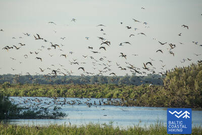
71. posms. Šilutė – Ventė.
Cauri Nemunas reģionālajam parkam
Pa Klaipėdos un Aukštumalės ielām Jūrtaka iziet no Šilutes pilsētas Kintu virzienā (ceļš Nr. 4217), īsu brīdi virzās pa polderu dambja augšpusi (labi redzama Nemunas deltas zemiene, kas pavasaros applūst), izlokās pa lauku ceļu un atkal atgriežas uz Aukštmalės ielas (Nr. 4217). Pēc nepilniem 6 km Rūgailiai ciemā ceļa krustojumā Jūrtaka izmet loku pa kreisi Minijas virzienā, un pēc 1,5 km virzās pa labi, atkal atgriežoties uz Šilutė–Kintai ceļa. Pa augstu un garu tiltu Jūrtaka šķērso Minijas upi un Kintu dīķus. No šejienes paveras viena no neparastākajām Lietuvas piekrastes ainavām ar plašu zemienes un ūdeņu panorāmu. Pirms Poviliai ciema Jūrtaka nogriežas pa kreisi un turpmākos nepilnus 5 km virzās cauri lauksaimniecības zemēm, kur migrāciju laikā var vērot putnus. Tālāk Jūrtaka nogriežas uz piekrastes ceļa (Marių gatve, ceļš Nr. 2201), pa kuru pēc 5 km sasniedz Ventes ragu. No šī ainaviskā ceļa posma paveras plaši skati pāri Kuršu jomai (līča platums šeit ir 8–9 km) uz Kuršu kāpu. Gājējus priecē arī bijušie zvejniekciemi un dažādu krāsu, ar dekoratīviem elementiem rotātās ēkas. Posms ietilpst Nemunas deltas reģionālajā parkā.
Jūrtakas posma daļa starp Kintu dīķi un Ventes ragu ir populāra putnu vērošanas un fotografēšanas vieta, īpaši - migrāciju laikā. Ventes ragā atrodas ornitoloģiskā stacija. Klajā Piejūras līdzenuma ainava ir piemērota zvēru vērošanai un fotografēšanai. Ietilpst Nemunas deltas reģionālajā parkā.