


Section 82. Žemaičių Kalvarija – Paplatelė. Žemaitija ethnographic region.
Section 82. Žemaičių Kalvarija – Paplatelė.
Žemaičių Kalvarija – Paplatelė Along the beautiful hills of the Žemaitija Upland
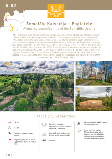
The Forest Trail exits Žemaičių Kalvarija village along Pagardinio, Alsėdžių and Platelių streets. About 6.5 km from the village centre the Forest Trail, along a scenic road surrounded by hills (No. 3210), enters the parking lot. At the parking lot, it turns left to the south, enters the forest and crosses the Gegrėnai archaeological complex. Leaving the forest, the Forest Trail continues along Ežero street, after a short time crosses Dvaro street, turns to Paežerės street and after 5 km reaches Žemaičių Kalvarijos road (No. 2302). Here the Forest Trail turns left again and follows the pedestrian / bicycle paths. After 1.7 km, it reaches the junction with Plokštinės street and turns right to the south. After 1.8 km the Forest Trail reaches the village of Paplatelė. This section is located in the Žemaitija National Park and introduces the landscapes and natural diversity of the northwestern part of the Žemaitija Upland.


