Baltic Forest Hiking - North Estonian coastline

North Estonian Coastline
LAHEMAA NATIONAL PARK, WATERFALLS, STONES AND CLIFF
Kuremäe – Tallinn, 344 km, Day 34 – 50
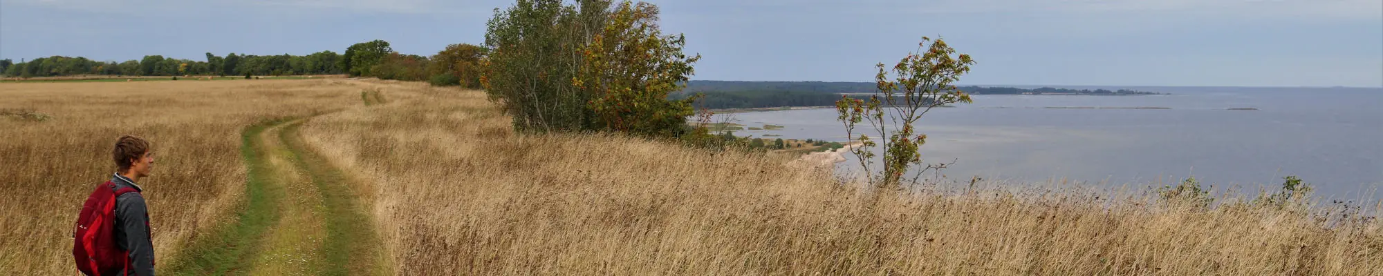
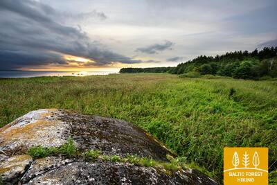
In the Northern Estonia section of the route, nature becomes harsher and increasingly Nordic. Here you can see the glacial boulders the size of a house, sparsely populated islands with pristine scenery, as well as waterfalls that are quite wide and tall for the Baltic region. The North Estonian Klint is a long rocky outcrop on the coast of the Baltic Sea. Walking on the shore of the Gulf of Finland a spectacular landscape of both rocky and sandy beaches may be observed. Lahemaa National Park is characterised by many bays, peninsulas, forests and villages of rich cultural heritage. Forest trail passes through the typical Estonian juniper fields and into the suburbs and the centre of Tallinn.
Highlights: The North Estonian Klint - the most impressive outcrop in the Baltics, Waterfalls and the largest boulders of Northern Europe, Industrial heritage in Kunda, Lahemaa – the oldest national park in the Baltic States, Altja – a traditional fishing village, Käsmu – a popular Estonian sea captains´ village, Purrekkari Cape – the northernmost point of the Estonian mainland, Military heritage – coastal fortifications, Pirita – the most popular resort and Olympic centre in Tallinn, Old Town of Tallinn – UNESCO heritage site.
 Section 34. Kuremäe‒Vasavere.
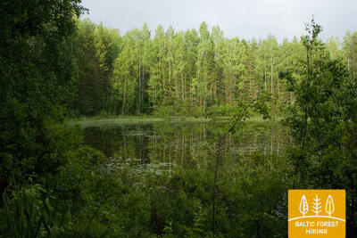
Through the Kurtna Protected Landscape Area
Having left the Kuremäe Convent hill, the Forest Trail continues along the picturesque Kurtna landscape reserve (part of Alutaguse national park), ornamented by the mirror surfaces of its many lakes (42 lakes in total, the highest density in Estonia) among beautiful, bright coniferous forests. Wooden footbridges pass through the wetter areas, while bridges are built over ditches and small rivers. A network of hiking and Nordic walking trails has been established in the vicinity of the Alutaguse recreation and sports centre.
Section 35. Vasavere‒Toila.
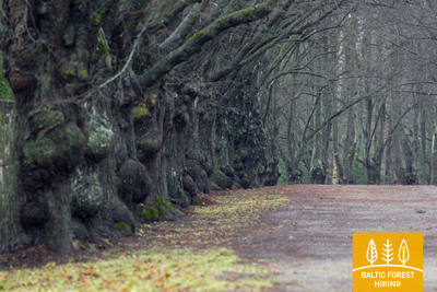
Towards the rocky coast of Northern Estonia near Toila
Behind Vasavere, the Forest Trail continues through the Kurtna landscape reserve, encircles over a peat bog, crosses the town of Oru, passes through the Voka River valley and arrives at the Baltic Sea, where it turns west. Here, on the coast of the Gulf of Finland, rises the North-Estonian Klint – a steep, rocky and forest-covered cliff that stretches non-continuously to Tallinn and further to the islands of West-Estonia. The Forest Trail runs on top of the cliff and occasionally descends into valleys. It crosses the deep and vast Pühajõgi valley in the Toila-Oru park and comes to Toila, a popular coastal resort.
 Section 36. Toila‒Saka.
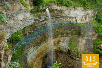
The scenic North-Estonian Klint between Toila and Saka
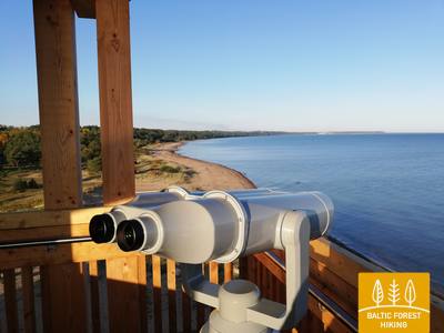
One of the most unusual sections of the Forest Trail in Northern Estonia, which leads along the foot of the impressive North- Estonian Klint in good weather, then climbs to the top of the klint in the villages of Valaste and Saka, revealing breath-taking views of the Gulf of Finland from the so-called Viru Rise. In the Saka‒Ontika‒Toila section (about 23 km), the maximum height of the North-Estonian Klint reaches 55 m. If the weather is clear, you can see the isles named Great and Small Tütarsaar, which belong to Russia, at a 50 km distance.
Section 37. Saka‒Aseri.
Millions of years old fossils on the seashore
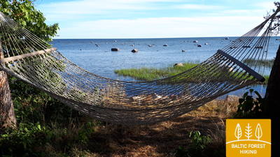
At Saka manor, the Forest Trail ventures down a steep staircase to the seashore, where it continues along the beach for less than 6 km. At the villages of Moldova and Jabara, the Forest Trail moves back up the North-Estonian Klint (great scenery from the Viru Rise), passes through the village of Purtse, circles around the Purtse River and moves further down the narrow seacoast to Aseri. Shortly before arriving at the town, it climbs the slope of the klint again. Animal fossils can be observed by the seashore below the North-Estonian Klint, some of them hundreds of millions of years old.
 Section 38. Aseri‒Mahu.
Towards Aseri, the capital of Estonia’s brick production
Before you continue the hike, consider visiting the seaside to take a look at the giant quarries. These quarries have produced clay for brick production for a very long time and are still used today. Behind Aseri, the Forest Trail passes through a former Soviet military territory, moves along the top of the North-Estonian Klint for about a kilometre, offering beautiful views of the Gulf of Finland, passes the Kalvi manor and continues further along the road towards Mahu. It crosses a beautiful forested area behind the Pada River (nature reserve), then comes to the seashore and continues through coastal forests until Mahu.
Section 39. Mahu‒Kunda.
Experiencing the Kunda industrial heritage
From Mahu to Letipea village, the Forest Trail runs along small coastal roads close to the sea and along the coastline for a stretch of road. It may be worth taking a 2 km detour (there and back) to the Ehalkivi Boulder. For the next three kilometres from Simunamäe, the Forest Trail leads along the foot of the North-Estonian Klint, which is covered by a primary forest. The coastline is about a kilometre away from here. Information boards about the history of Kunda have been placed in the territory surrounding the Lontova manor. You can also visit the many objects located in the city and along the river that are related to the historical development of the city cement plant.
Section 40. Kunda‒Eisma.
Coastal fishing traditions and art in Karepa
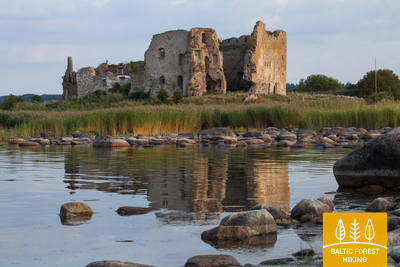
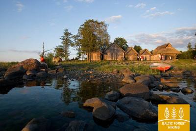
After leaving Kunda, the Forest Trail comes out by the North-Estonian Klint and follows along its surface for the next two kilometres. From there on the trail often goes by the paved road with traffic. Be aware of cars! In the village of Toolse, it is worth taking a two-kilometre detour to visit the romantic Toolse castle ruins. Lamprey catching traps, which is a rare type of fishing in Estonia, are sometimes placed near the bridge over the Selja River. They are owned by the museum, located in a beautiful farmhouse on the right bank of the river, which can be seen from the Selja bridge. From Toolse to Eisma, the Forest Trail runs along the road, making a brief detour on a beautiful, rock-covered beach before Eisma.
Section 41. Eisma‒Oandu.
Along the trails of Lahemaa National Park
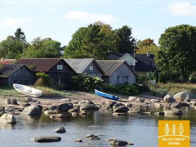
Behind the village of Vainupea, the Forest Trail enters the first Estonian national park ‒ Lahemaa, which means “the land of bays” in Estonian. For the next five and a half days, the Forest Trail will continue along the bays and peninsulas of Lahemaa national park, introducing the hikers to its most significant natural and cultural heritage. Special attention must be paid to the rules of the park. On this day, the Forest Trail passes through beautiful and quiet coastal forests, where mushrooms grow abundantly in autumn. It passes through the scenic Altja fishing village. The section comes to an end at Oandu in the visitor centre of the Estonian State Forest Management (RMK), where hikers can learn more about forest habitat types and forest management traditions.
Section 42. Oandu‒Käsmu.
Käsmu captains' village and ship building site
The next 9 kilometres of the Forest Trail between Oandu and Võsu coincide with the RMK trail, so be aware of the change of the signs. The trail goes through a beautiful, wooded inland dune area, where hikers can see cuts on pine trees, used to extract resin from the trees. Resin was obtained in the Baltic States using this method up to the 1960s-1970s. Trees are richly covered in lichen, indicating that the air is clean. In autumn, mushrooms and blueberries adorn the edges of the trail. After passing through Võsu village (a popular resort), the Forest Trail continues along a beautiful coastal forest promenade to Käsmu village. It is worth walking an additional extra kilometre to the Vana-Jüri rocks and the historical sites of Käsmu at the tip of the peninsula.
Section 43. Käsmu‒Viinistu.
In the kingdom of the giant rocks of the Käsmu Peninsula
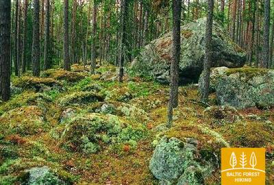
The first part of this section passes through the fairytale-like Käsmu Peninsula with its wooded dunes and moss-covered rock fields. From Eru it continues along the Võsu‒Kotka road for 2 km, passes through Vihasoo village and further along the road, from where you can see Eru Bay and the Käsmu Peninsula. The section features some of the most impressive boulders in Lahemaa national park, the Tammispea and Jaani-Tooma boulders, which resemble huge monoliths. From Viinistu, you can spot the Mohni Island and its lighthouse in the distance.
Section 44. Viinistu‒Loksa.
Purekkari ‒ the northernmost point of the Estonian mainland
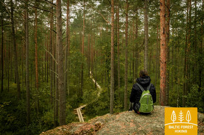
The forest trail continues around the Pärispea Peninsula, which is part of Lahemaa national park, until it reaches Purekkari Cape. In windless weather, you can take a walk along the kilometre-long pebble-covered cape and visit the impressive Purekkari stone. From there, the Forest Trail follows down the winding coast of Hara Bay through former Soviet military bases and then passes through Loksa, where a brick factory used to operate (historical buildings). It curves through the centre of the town until it reaches the finish point, half a kilometre away from a fantastic beach.
Section 45. Loksa‒Tsitre.
Through the forests and swamps of the Juminda Peninsula
On this day, the Forest Trail crosses the Juminda Peninsula. After leaving Loksa, in 7 km it passes by a Soviet-era military object, the Hara Submarine Port. To visit it, you have to take a two-kilometre detour and buy a ticket. The Forest Trail goes through an area of beautiful forests and marshes, with high, dense forested sand dunes at the western end of the territory. It continues down the road from Pedaspea to Tsitre and passes a small section of the North-Estonian Klint just before Tsitre, where the Muuksi stronghold hill is located. The Tsitre picnic area is located 0.2 km from the sea.
Section 46. Tsitre‒ Kaberneeme.
Sandy beaches and isles in Kolga Bay
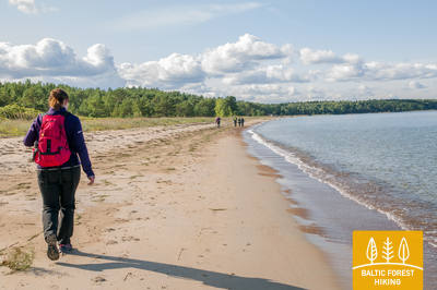
A harbour was established at the Tsitre village as early as the Viking times. The first 4 km of the Forest Trail in this section pass through the territory of the Lahemaa national park. Between the villages of Muuksi and Soorinna, the road crosses an oval plateau, the klint elevation of northern Estonia, covered with scenic juniper fields. At the village of Põhja, the trail passes by the coastal wetland, and comes out by the sea behind the Salmistu harbour. From here, look out for the 1.3 km distant Pedassaar isle to the northeast, and the Umblu and Rohusi isles to the northwest. On Valkla beach, a nice beach restaurant awaits hikers. In Haapse the beach you can swim, sea gets quickly deep.
Section 47. Kaberneeme ‒ Jõelähtme.
Along the banks of the Jägala River
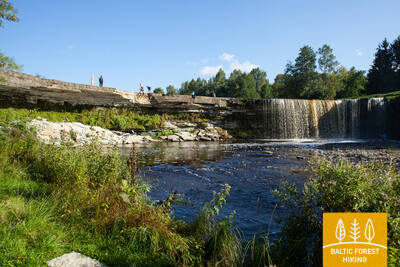
From Kaberneeme the route runs through a forest where you can see piles of stones carried here during the last ice-age. Soon the trail climbs about 20 m up to the hiking trail which runs on the old shore line of Lake Ancylus. Trail crosses the Kaberla-Kaberneeme road and follows over a small sandy canyon of the Kaberla stream, before arriving at the Kalevi-Liiva memorial of holocaust. The trail continues to the Linnamäe HES and a suspension bridge. Follow the trail over the ancient fortress hill of Linnamäe and continue on the right bank of the Jägala river, until reaching the Jägala waterfall. The Suka bridge is about 500 meters up from the waterfall. After crossing the river, the trail strolls through the Jägala waterfall park. Finally, the trail runs through the village of Koogi and arrives at Jõelähtme.
Section 48. Jõelähtme - Muuga.
Through Maardu, the phosphorite mining area
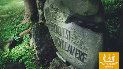
The Forest Trail passes the village of Jõelähtme, then turns northwest 1 km before the sea and follows the North-Estonian Klint for the next 3 kilometres. Behind Ülgase, the Forest Trail passes through Kallavere, Maardu and Muuga, the suburb of Tallinn. It takes a few hours to get from Muuga to Old Tallinn, but the Forest Trail takes a two-day detour through the Viimsi Peninsula before arriving at the capital of Estonia.
Section 49. Muuga‒Püünsi.
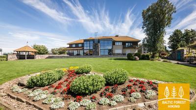
Through the magnificent Viimsi Peninsula
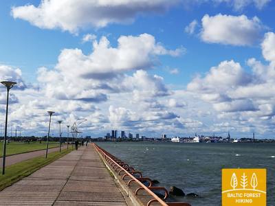
The Forest Trail passes through the most densely forested area of the Viimsi Peninsula, where several nature protection areas have been established. It crosses the former Soviet-era military territory in Rohuneeme. On this day, the Forest Trail follows along pedestrian sidewalks and the many roads running through the peninsula. It turns south at Püünsi village, where towers, skyscrapers and the Port of Tallinn with ferries can be seen in the distance across the Gulf.
Section 50. Püünsi‒Tallinn.
Most beautiful sights of Old Tallinn
The Forest Trail passes by the Gulf of Tallinn, and beautiful views of the towers, harbour and skyscrapers of the city can be seen as early as in Püünsi. The Forest Trail turns into a beautiful pine forest before Pirita, then follows along a sandy beach for 2 km. Behind Pirita all the way to the Port of Tallinn, the Forest Trail takes you along the beautiful city waterfront promenade, which overlooks the city’s most important cultural and historical sites, and offers beautiful views of the sea and the port. The final destination of the Forest Trail is located in the Port of Tallinn, next to the Old Town. You can spend another day or two visiting various tourist locations of Tallinn.