


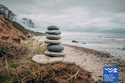
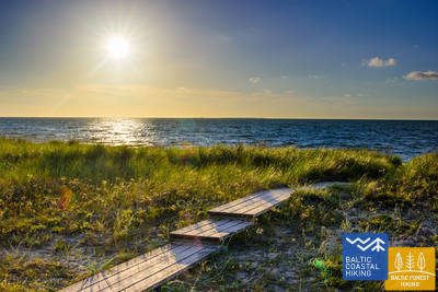
Baltic Coastal Hiking trail - Dream tour

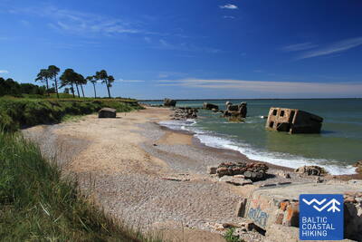
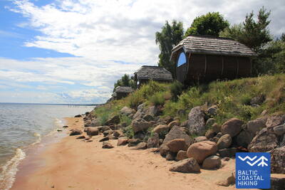
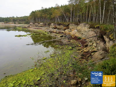
 4. Etappe. Karosta - Ziemupe.
Karosta - ein Militärerbe an der Ostsee
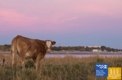
Die ersten vier Kilometer des Baltischen Küstenwanderweges sind mit den Überresten vieler Forts und Küstenschutzbatterien besonders für Enthusiasten der Militärgeschichte ein echtes Vergnügen. Aus gehtechnischer Sicht ist diese kurländische Küstenstrecke am anspruchsvollsten. Hinter dem Festungskanal schlängelt sich der Pfad für eine kurze Zeit entlang einer Küstenwiese, dann führt er zum Strand hinaus und läuft weiter bis Ziemupe. Der Strand ist breit, bei etwas stärkerem Wind verengt er sich zwischen den Flüssen Lenkupe und Kārļupīte. Streckenweise gibt es eine nicht besonders hohe Steilküste, an einigen Stellen passiert man hohe, teilweise ausgehöhlte Vordünen. Vom Hörensagen weiß man, dass im Fluss Ziemupe viele Schiffe versunken liegen, eines davon sogar mit Bronzekanonen an Bord.

Der erste Abschnitt des Küstenwanderwegs verläuft durch das Karosta von Liepāja, vorbei an den nördlichen Festungen und durch eine einzigartige Küstenlandschaft. Die Küsten von Liepāja und Ziemupe sind reich an militärischem Erbe. Im Gebiet von Ziemupe finden Sie beeindruckende, durch Erosion geformte Küstenklippenlandschaften.
 5. Etappe. Ziemupe - Pāvilosta.
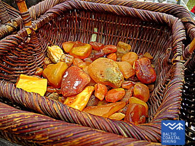
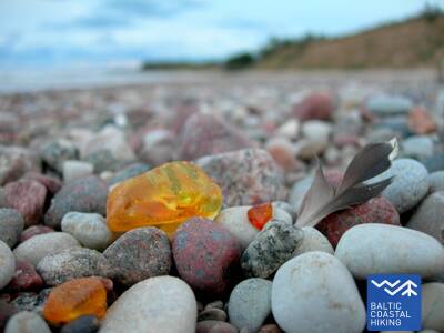
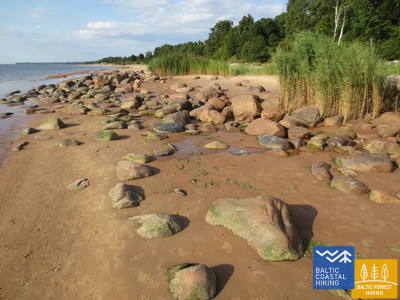
Der singende Sand und Bernstein
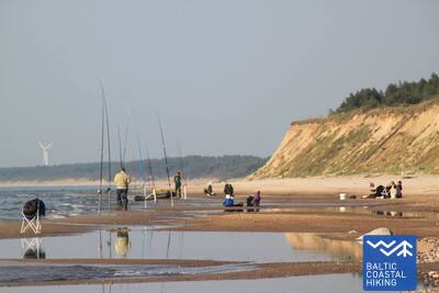
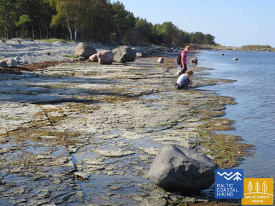
Ein von Reisenden nur wenig besuchter Strand, wo man Bernstein und Steine mit Fossilien sammeln und dem Klang des Sandes lauschen kann. In der Umgebung von Ziemupe kommt die durch die Meeresbrandung ausgehöhlte Steilküste zum Vorschein. Danach folgen weiter von Akmensrags bis Pāvilosta schöne, streckenweise abgespülte Vordünen, die mit Strandroggen und Strandhafer bedeckt sind. An einigen Stellen sind Graudünen zu sehen. Der Leuchtturm Akmeņrags ist der beste Rastplatz. Pāvilosta mit seinem Kleinstadt-Flair, den Häfen und dem Aroma der geräucherten Fische bringt Besucher von der unberührten Natur wieder in die Zivilisation zurück.
Der Abschnitt von Jurtaka zwischen Ziemupi und Pāvilost ist dünn besiedelt. Während der Besatzung war es, wie der Rest der Küste von Dijon, eine Zone des Grenzregimes, ein für Besucher gesperrtes Gebiet.
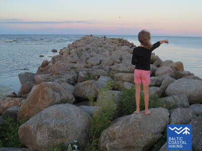
6. Etappe. Pāvilosta - Jūrkalne.
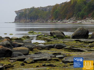
Die hervorragendsten Steilküsten der Ostsee
Im Nordosten von Pāvilosta erfreut eine an Graudünen reiche Landschaft das Auge. Doch nur einige Kilometer weiter beginnt eine der schönsten Abschnitte des Pfades Jūrtaka mit ihren hervorragenden Steilküsten, die sich auf einer Länge von mehr als 20 km erstrecken. Die bezauberndste, von Steilküsten geprägte Landschaften ist in der Nähe der Mündung der Flüsse Strante, Ulmale und Rīva zu beobachten. An vielen Stellen unterhalb des steilen Küstenabfalls blühen im Sommer die Orchideen. In Dorf Jūrkalne und dessen Umgebung kann man „zwei Sonnenuntergänge“ genießen - den ersten am Strand, den zweiten - einen kurzen Moment später - oben von der Spitze der Steilküste.
Einer der eigenartigsten Abschnitte der lettischen Küste mit hervorragenden Steilufern bei Strantes, Ulmala, Jūrkalne usw.
7. Etappe. Jūrkalne - Sārnate.
Der Ort, von dem aus Menschen mit Booten die Ostsee überquert haben
Auf diesem Abschnitt des Baltischen Küstenwanderweges setzt sich die eindrucksvolle Steilküste der Ostsee
fort. Nahe Ošvalki verflacht sich die Steilküste und wird zu einer etwas höheren Vordüne, die von einer dichten Weidenbaumkrone bedeckt wird. Gegenüber Sārnate kann man wieder eine ausgeprägte Steilküste sehen. Auf dieser verhältnismäßig kurzen Strecke erfreuen das Auge eindrucksvolle Landschaften einige.
Ein landschaftlich hervorragender Abschnitt, an dem sich die Steilküste der Ostsee fortsetzt, wo aktive Meereserosionsprozesse stattfinden.
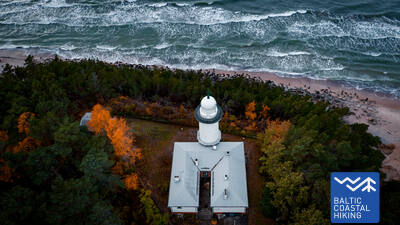
8. Etappe. Sārnate - Užava.
Die schönste Landschaft des lettischen Küstengebietes
In der Umgebung von Sārnate kann man noch immer die baltische Steilküste genießen. In Richtung Norden verflacht sie allmählich wird und durch einen vom Wasser ausgehöhlten Vordünenwall abgelöst. Zwischen Vendzavas und dem Leuchtturm Užava erstreckt sich der Meeresküste entlang eine für Lettland nicht typische Landschaft, die an eine sandig-steinige Wüste mit spärlicher Vegetation erinnert. Hier befindet sich das ehemalige Übungsgelände der Sowjetarmee. An dieser Stelle und hinter Užava können auf dem Gebiet des ehemaligen Übungsgeländes Graudünen beobachtet werden. Nähert man sich der Mündung des Flusses Užava wird der Strand immer breiter und der Dünenwall immer flacher. Vom romantischen Leuchtturm Užava offenbart sich dem Wanderer der schönste Anblick des Baltischen Küstenwanderweges.
Ein abgelegener Abschnitt des Küstenwanderwegs, der einige der ungewöhnlichsten grauen Dünenlandschaften entlang der lettischen Küste zeigt, deren Dünenbiotope erhalten bleiben.
 9. Etappe. Užava - Ventspils.
Stelle deine eigene Bernsteinsammlung zusammen!
Die ersten 6 Kilometer dieses Streckenabschnitts des Baltischen Küstenwanderweges führen durch ein einsames Küstengebiet mit einem breiten Strand und niedrigen, mit Strandroggen und Strandhafer bedeckten Vordünen dar. Hinder der Mündung des Baches Medole erhebt sich eine eindrucksvolle Steilküste (~ 19 m) mit einem engen, steinigen Strand. Die Steilküste verflacht sich bald und steigt nach etwa zwei Kilometern wieder an. Zwischen den Steilküsten befindet sich ein ehemaliges Übungsgelände der Sowjetarmee. Die letzten fünf Kilometer bis zum Südpier in Ventspils verlaufen über einen breiten, sandigen Strand. Auf der Festlandseite wird er von Graudünen abgegrenzt.
In der Gegend von Užava bietet ein abgelegener Abschnitt des Küstenwanderwegs dramatische Klippen und ausgedehnte Sandstrände in der Nähe von Ventspils. Ventspils bietet eine breite Palette an Aktivitäten und Annehmlichkeiten.
14. Etappe. Sīkrags - Saunags.
An der livländischen Küste
Von Sīkrags bis zum Strand Mazirbe erstreckt sich ein sandiger Strand, der vom Flüsschen Mazirbe durchschnitten wird. Der Pfad Jūrtaka führt bis zum Zentrum Mazirbe, wo das Volkshaus der Liven zu besichtigen ist. Der Pfad schlängelt sich weiter durch kleine Wälder und Landwege, der ehemaligen Seefahrtschule Mazirbe entlang. Er passiert die kleinen livländischen Dörfer Košrags, Pitrags, bis er dann Saunags erreicht. Die livländische Küste ist der einzige Ort, an dem das kulturgeschichtliche Erbe der Liven, eines der kleinsten Völker der Welt, erkundet werden kann. Die Wegweiser sind auf Lettisch und Livisch.
Einer der am dichtesten besiedelten Abschnitte der Küste Nordkurlands, der von ehemaligen livländischen Fischerdörfern gebildet wird. Er ist Teil des Slītere-Nationalparks und des Livländischen Küstengebiets.
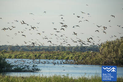
15. Etappe. Saunags - Kolka.
Das Herz Europas – Kolkasrags
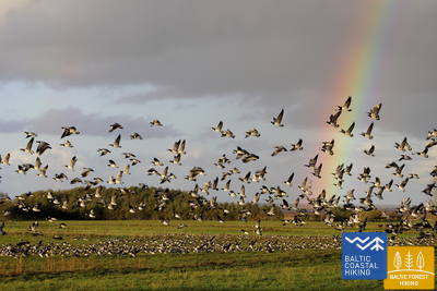
Über kleine Feldwege und Waldwege von Saunaga führt der Pfad Jūrtaka bis Vaide. Dort kehrt er wieder zur Meeresküste zurück. Bis Kolkasrags erstrecken sich breite, sandige Strände, die sich zu niedrigen Vordünen mit spärlicher Vegetation verflachen. Dahinter erfreuen erneut waldige Dünen das Auge. Auf einer Länge von etwa 2 Kilometern - weggespülte niedrige Dünen, hinter denen der Berg Dumbrkalni emporragt. Kolkasrags - die Grenzlinie zwischen dem Großmeer und Kleinmeer (Rigaer Meeresbucht) - ist einer der beliebtesten Vogelbeobachtungsorte an der Ostseeküste.
Der Küstenwanderweg endet in Kolkasrags und ist eine der beliebtesten Attraktionen in Nordkurland, wo die Ostsee auf den Rigaer Meerbusen trifft. Er liegt im Nationalpark Slītere und im Küstengebiet von Lībiešu.
16. Etappe. Kolka - Ģipka.
Entlang der „gesperrten Küste“
Wenn man das Gesicht von Kolkasrags in Richtung Meeresbucht dreht, merkt man gleich den Unterschied zwischen dem “Großmeer“ und dem “Kleinmeer“. Die ersten zehn Kilometer des Baltischen Küstenwanderweges verlaufen entlang der Küste des Nationalparks Slītere. Der Pfad passiert die Bauten der ehemaligen Fischerkolchose, einen Schiffsliegeplatz und die Steilküste Ēvaži. Deren Umgebung wird von einem ungewöhnlich schmalen, sandigen Strand mit darüber hängenden Schwarzerlen geprägt. Auch weiter bis Ģipka erstreckt sich ein schmaler, sandiger Strand mit vielen Nassgallen, die durch den nah an die Oberfläche getretenen, wasserundurchlässigen Untergrund entstanden sind, und Mündungen von kleineren, im Sommer ganz seichten Flüsschen. Das Küstengebiet des Nationalparks Slītere war während der Sowjetzeit ein doppelt geschlossenes Territorium – es war Grenzzone und Naturschutzgebiet.
Der Abschnitt des Küstenwanderwegs, der am Kap Kolka beginnt – einer der beliebtesten Sehenswürdigkeiten in Nord-Kurzem, wo die Ostsee auf den Rigaischen Meerbusen trifft – verläuft im Slītere-Nationalpark und der Region der Livländischen Küste.
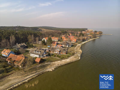
19. Etappe. Mērsrags - Engure.
Im Naturpark Engure
Vom Dorfzentrum bis zum Strand führt ein von Kiefern umschlossener Waldweg. Weiter windet sich der Baltische Küstenwanderweg zwischen einem von Sandrohr und anderen Pflanzen reichlich bewachsenen und steinigen Strand auf einer Seite und einer bewaldeten Düne auf der anderen Seite. Stellenweise ist der Strand mit kleinen, runden Kieselsteinen bedeckt, andernorts sind Graudünen mit üppiger Vegetation zu sehen. In der Umgebung von Bērzciems erstrecken sich Strandwiesen mit Sandbarren weit ins Meer. Sie sind ein guten Platz, um Vögel zu beobachten. Bis zum Dorf Abragciems setzt sich die bewachsene Meeresküste fort, die dann bis Engure durch einen Strand abgelöst wird.
Entlang der Küste reihen sich benachbarte Fischerdörfer aneinander, die ihre traditionellen Berufe wie Fischerei, Fischverarbeitung und lokale Dialekte bewahren. In Bezug auf die Verfügbarkeit von Dienstleistungen ist es ein ausgezeichnetes Reiseziel.
28. Etappe. Lauči - Tūja.
Die vergangene Ära der Segelschiffe
Eine herrliche Küstenlandschaft der Region Vidzeme mit vielen steinreichen Erdzungen und Steinen im Meer. Sie werden von kleinen, sandigen Buchten abgelöst, in denen die im Sommer austrocknenden Bäche und kleinen Flüsschen münden. An einigen Stellen ist der Strand vollständig mit grauen Steinen bedeckt. Allmählich kommen auch mit Sandrohr bewachsene Flächen zum Vorschein. Kurz vor Tūja finden sich die ersten Sandsteinfreilegungen.
Ein optisch abwechslungsreicher Abschnitt mit kleinen Buchten und Landzungen, Sand- und Felsstränden sowie Sandsteinfelsen in der Nähe von Tūja. Es ist ein idealer Ort für Fotografie, Fotosessions und Geotourismus.
29. Etappe. Tūja - Svētciems.
Der steinreichste Strand in Vidzeme
Einer der schönsten Abschnitte des Pfades Jūrtaka beginnt nach der Überquerung des Flusses Zaķupīte. Bis zum Leuchtturm Ķurmrags erstrecken sich vorwiegend sandige Strände mit kleinen steinreichen Stellen. Danach beginnt der Steinstrand von Vidzeme, wo sich Erdzungen und kleine Buchten ablösen. Am Strand ragen bis zu 4 Meter hohe Sandsteinfreilegungen empor. Hinter dem Meleku-Kap führt der Pfad wieder über einen vorwiegend sandigen Strand, der kurz vor der Mündung des Flusses Svētupe dicht bewachsen ist. Dazu kommt Schilfrohr, das man über einen Waldweg umlaufen muss.
Der felsige Küstenabschnitt von Vidzeme weist eine sehr abwechslungsreiche Küstenlinie mit kleinen Landzungen, Buchten, felsigen Stränden und Felsvorsprüngen aus der Devonzeit auf – Ergebnisse der Meereserosion. In einigen Gebieten verläuft ein kleiner Pfad entlang der Küste und bietet eine alternative Route.
34. Etappe. Uulu - Pärnu.
Durch Feuchtgebiete nach Pärnu
Anfangs verläuft der Baltische Küstenwanderweg durch die alten, von einem Kiefernwald umschlungenen Küstenwege. Nach dem Lottemaa-Park biegt der Pfad in Richtung Meer und stößt auf den Reiu-Strand. Weiter führt der Streckenabschnitt durch einen überwachsenden Strand (bei ablandigem Wind - breite Flachwasserzonen). Nach knapp 4 Kilometern muss man in Richtung Binnenland abbiegen, einen Golfplatz überqueren und den Weg nach Pärnu einschlagen. In der Umgebung von Raeküla schlängelt sich der Pfad auf einem kleinen Wanderweg, der das Feuchtgebiet vom Wald abgrenzt. Dann läuft er in einem etwa 6 Kilometer langen Bogen um das Feuchtgebiet herum und erreicht den Strand Pärnu. Weiter führt der Pfad durch den westlichen Teil der Altstadt von Pärnu, überquert die Flüsse Pärnu und Sauga und mündet in der Umgebung von Vana-Pärnu.
Ein sehr abwechslungsreicher Abschnitt des Küstenwanderwegs, der mit Feuchtgebieten, Möglichkeiten zur Vogel- und Naturbeobachtung (mit speziell konzipierter Infrastruktur) beginnt und mit Pärnu endet – dem beliebtesten Badeort Estlands und dem historischen Zentrum der Stadt.
46. Etappe. Haeska - Puise.
Vogel- und Naturbeobachtung im Nationalpark Matsalu
Eines der bezauberndsten Strecken des Baltischen Küstenwanderweges im Nationalpark Matsalu. Sie führt durch landwirtschaftliche Nutzflächen und Küstenwiesen, auf denen sich im Herbst tausende von ziehenden Kranichen und Gänsen sammeln. Das Dorf Haeska (Küstenwiesen, wasserarme Buchten, kleine Inseln und Weiden) und die Umgebung des Puise-Kaps (Küstenwiesen mit Weiden und Sandbarren) sind ausgezeichnete Orte zur Vogelbeobachtung. Dazu wurden mehrere Türme aufgestellt. Aus den Dörfern Põgari-Sassi und Puise nina heraus bietet sich malerischer Aussichten auf das Meer und die Inselketten.
Einer der schönsten Abschnitte des Küstenwanderwegs im Matsalu-Nationalpark (Matsalu rahvuspark), der durch den nördlichen Teil des Parks verläuft und die Küste sowie Vogelbeobachtungsplätze umfasst. Die Aussicht hier ist während des Vogelzugs besonders beeindruckend.
48. Etappe. Rohuküla - Haapsalu - Uuemõisa.
Haapsalu, der beliebteste Strand Estlands
Eine vielfältige Strecke des Baltischen Küstenwanderweges. Die ersten drei Kilometer verlaufen der ehemaligen Breitspurbahnlinie Haapsalu-Rohuküla entlang. Dann umkreist der über Pullapää neem die Haapsalu-Bucht und überquert die Küstenwälder, in denen Gesundheitspfade eingerichtet sind. Danach verläuft er im Bogen auf den Küstenpromenaden und kleinen Straßen um die Stadt Haapsalu herum. Nach dem Überqueren eines kleinen Feuchtgebietes jenseits der Stadt mündet der Pfadabschnitt im herrlichen Uuemõisa-Park.
Ein sehr abwechslungsreicher und farbenfroher Abschnitt des Jūrtaka-Pfades, auf dem Sie die Küstennatur genießen, entlang der wunderschönen Küstenpromenaden von Haapsalu spazieren, das historische Stadtzentrum und die mittelalterliche Burg erkunden und in einem der historischen Holzgebäude übernachten können. Es besteht auch die Möglichkeit, etwas über das militärische und industrielle Erbe zu erfahren – den Bahnhof Haapsalu, die Burg Ugru usw.
51. Etappe. Riguldi - Dirhami.
Ein Ort mit Meteoritenspuren
Mit Ausnahme der ersten drei Kilometer verläuft der Routenabschnitt der Meeresküste entlang. Vorwiegend erstreckt sich hier ein sandiger Strand mit herrlichen Vordünen, Graudünen und Feldsteinen im Meereswasser. Am Strand können zusammengetriebene Wasserpflanzen liegen; stellenweise ist er mit dichter Vegetation bewachsen. Gegenüber dem Dorf Rooslepa, aber auch im Meer und an der Küste kommen verwitterte Steine bzw. Brekzien zum Vorschein, die infolge einer alten Meteoritenexplosion zusammengeschmolzen und verwittert sind. Zum Abschluss kann man eine Kneipe besuchen, von deren Terrasse aus sich ein schöner Blick auf die Meeres - und Hafenlandschaft offenbart.
Ein außergewöhnlich schöner, landschaftlich reizvoller und naturreicher Abschnitt, bei dem der Küstenweg direkt am Meeresufer entlangführt. Am Ende der Route besteht die Möglichkeit, in einer Taverne direkt am Meer zu sitzen und Fisch zu genießen.
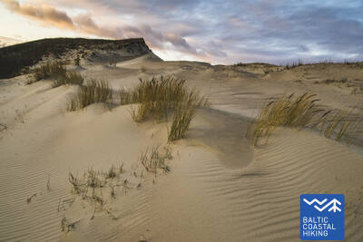
52. Etappe. Dirhami - Nõva.
Die raue Natur des Nordens
Ein Streckenabschnitt mit sehr vielfältigen Landschaften, der dem Wanderer die Natur der Nordküste Estlands nahebringt. Der Baltische Küstenwanderweg verläuft zum größten Tel der Meeresküste entlang, wo es in den Buchten herrliche Sandstrände und auf den Erdzungen mit Feldsteinen bedeckte Strände gibt. Im nördlichen Teil des Põõsaspea neem-Kaps (ein hervorragender Ort zur Vogelbeobachtung) sind Dolomit-Freilegungen zu sehen. Danach windet sich der Pfad durch das Naturschutzgebiet Nõva, wo sich ein hervorragender Blick auf weiße und graue Dünen bietet. Der Strand ist ein beliebter Ort für Fischer und Kitesurfer.
Ein außergewöhnlich schöner, landschaftlich reizvoller und naturreicher Abschnitt, wo der Küstenweg direkt am Meeresufer entlangführt. Es ist ein geeigneter Ort für verschiedene Aktivitäten in der Natur sowie für sportliche Erholung.
53. Etappe. Nõva - Vihterpalu.
Dem Finnischen Meerbusen entlang
Von Rannaküla aus läuft der Baltische Küstenwanderweg im Bogen um ein Feuchtgebiet herum, überquert das Flüsschen Nõva und stößt auf den Strand der Keibu-Bucht (am Anfang dicht bewachsen). Dort erstreckt sich ein sandiger Strand mit Dünen. Am Keibu-Bach biegt der Pfad in Richtung Binnenland ein, wo er weiter mit dem markierten Pfad der estnischen Forstverwaltung zusammenfällt: Peraküla – Aegviidu – Ähijärve. Der Pfad schlängelt sich durch das Dorf Keibu und führt gegenüber dem Dorf Alliklepa zum Meer. In der Umgebung gibt es wunderschöne Wacholderfelder. Der Streckenabschnitt verläuft weiter zwischen dem Meer und zwei kleinen Seen, die früher Buchten waren. Gegenüber den Seen wurden Dolomitschichten freigelegt. Bis zum Dorf Vintse verläuft die Strecke auf einem schmalen Küstenweg (vom hier aus sind die Pakri-Inseln sichtbar), bis sie in Richtung Vihterpalu abbiegt.
Ein abgeschiedener Abschnitt des Küstenwanderwegs, der überwiegend an der Küste entlang oder durch wunderschöne Küstenwälder führt. Geeignet zum gemütlichen Entspannen und Erkunden der Natur.
56. Etappe. Paldiski - Kersalu.
Felsen, ein Leuchtturm und das Militärerbe
Der Baltische Küstenwanderweg führt um die Pakri-Halbinsel herum, von der aus sich ein Blick auf die
schönsten Landschaften der nordwestlichen Küste Estlands bietet. Der Pfad führt durch das Zentrum der
Stadt Paldiski und biegt an der Bastion des Zaren Peter des Großen in Richtung des Leuchtturm von Pakri ab. Bis zum Leuchtturm verläuft der Weg auf dem Rücken der eindrucksvollen Pakri-Felsen. Weiter bis zum Ort Kersalu führt der Pfad mal steil bergauf über die Felsen, mal bergab zu einem sandig-steinigen Strand und einem wunderschönen Kiefernwald. Die Pakri-Felsen offenbaren ihren Reiz im kalten Winter, wenn sich hier eindrucksvolle Eisabbrüche herausbilden, wie auch im Herbst, wenn die Blätter bunt sind.
In Bezug auf die Naturlandschaften (Pakri-Klippen) einer der ungewöhnlichsten Abschnitte entlang des gesamten Küstenwanderwegs. Zu jeder Jahreszeit interessant und anders: Eisfälle in kalten Wintern, wunderschöne Blattfarben an Bäumen im Herbst usw.
58. Etappe. Laulasmaa - Vääna-Jõesuu.
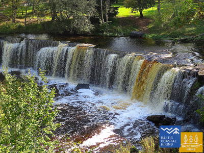
Der schönste Wasserfall Estlands
Aus landschaftlicher Sicht ist es der vielfältigste Abschnitt des Baltischen Küstenwanderweges. Geeignet ist er für ausdauernde Wanderer. Zu sehen bekommt man sowohl steinige Strände als auch Sandstrände und gute Badeorte, herrliche Kiefernwälder und den eindrucksvolle Türisalu-Fels sowie Jahrhundertsteine. Auf den kleinen Pfaden des Keila-Waldparks kann man den Keila-Wasserfall erreichen. Auch kann man die dem Leben der Küstenfischer gewidmete Ausstellung im Dorf Lohusalu besuchen.
Ein sehr schöner und landschaftlich reizvoller Abschnitt des Küstenwanderwegs, reich an Naturdenkmälern, darunter der Keila-Wasserfall und -Park, die Tirisalu-Klippen sowie Sand- und Felsstrände.
59. Etappe. Vääna - Jõesuu - Tabasalu.
Die sagenumwobene Suurupi-Halbinsel
Eine der schwierigsten Strecken des Baltischen Küstenwanderweges. Sie ist nur für erfahrene Wanderer geeignet. Der Pfadabschnitt läuft im Boden der Suurupi Halbinsel herum, in deren dichten Wälder das militärische Erbe verschiedener historischer Epochen verborgen ist. Der Baltische Küstenwanderweg schlängelt sich durch dicht bewachsene und steinige Strände, Birkenhaine, dann weiter entlang ehemaliger Pionierlagern und den von Sandsteinfelsen beschützten Buchten mit spitzen Erdzungen. An einigen Stellen sieht man im Meer Freilegungen des Dolomitgesteins und “Inseln” aus Feldsteinen. Am Ende des Streckenabschnittes ragt eine der eindrucksvollsten Freilegungen der estnischen Küste empor – die Felsen von Rannamõisa. Von den Felsen aus eröffnet sich ein herrlicher Blick auf die Kakumäe-Bucht und die Türme der Altstadt von Tallinn.
Ein landschaftlich reizvoller Abschnitt des Küstenwanderwegs mit vielen geologischen Denkmälern und Naturschutzgebieten (einschließlich eines Naturpfads) mit Aussichtspunkten. Interessante Stätten des militärischen Kulturerbes.
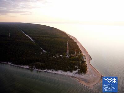
64. Etappe. Nida (dt. Nidden) - Pervalka (dt. Perwelk).
An den Ufern des Kurischen Haffs
Der Meeresweg (lt. Jūrų takas) beginnt im Zentrum von Nida in der Nähe des Hafens. Er schlängelt sich weiter am Ufer des Kurischen Haffs entlang und öffnet einen schönen Blick auf das weite Wasser, das bis zum Ostufer des Kurischen Haffs liegende Insel Rusnė reicht. In Nida bestaunt man die typische Architektur der Kurischen Nehrung: einstöckige Holzbauten mit Dachziegel oder mit Schilf bedeckt, die Fensterläden in blau-weiß gestrichen. Weiter von Nida aus führt der Meeresweg zu dem Kap von Bulvikis hin (gegenüber dem Kap richtet sich der Blick auf eine Start-Landebahn des verwahrlosen Flughafens). Danach windet er sich auf kleineren Waldwegen, durch mit Kiefern bewachsenen Dünen auf und ab. Stellenweise schlängelt er sich über die Küstenwiesen mit ganz bescheidener Vegetation. Neben dem Weg sind Rastplätze und Vogelbeobachtungstürme eingerichtet. Im folgendem Abschnitt sind sehr eigentümliche, mit Flechten und Flora der Kurischen Nehrung typischer Art, bewachsene offene Küstenwiesen zu beobachten. In der Siedlung von Preila verläuft der Meeresweg an der Promenade entlang. Bis zu Pervalka schlängelt er sich über die Waldwege, Wander- /und Radwege bis in das Zentrum der Pervalka. Dieser Abschnitt verläuft durch den Nationalpark der Kurischen Nehrung (lt. Kuršių nerijos nacionalinis parkas).
Die Kurische Nehrung ist eine der eindrucksvollsten Küstenformationen im Baltikum mit Wanderdünen, bewaldeten Dünen, Dünenwällen, Sandhabitaten und einzigartigen Landschaften. Der Küstenwanderweg (Jūrtaka) schlängelt sich entlang der Küste oder über kleine Pfade zwischen den Dünen. Die Landschaft der Kurischen Nehrung wird durch die ehemaligen Fischerdörfer von Kursenieki mit ihrer unverwechselbaren Architektur und Tradition wunderschön ergänzt. Sie ist Teil des Nationalparks Kurische Nehrung.
65. Etappe. Pervalka (dt.Perwelk)- Juodkrantė (dt. Schwarzort).
Durch die imposantesten Sanddünen Nordeuropas
Hinter der Pervalka überquert der "Meeresweg" (lt. "Jūrų takas") die Kurische Nehrung in Ost-West-Richtung und erreicht die Küste der Ostsee. Eine weitere Strecke von ca. 13 km führt zu einem wunderschönen Sandstrand, der im Osten durch einem hohen Dünenrücken eingegrenzt wird. Der Dünenrücken wurde von Menschenhand geschaffen, um die Halbinsel vor Sandrutschen zu schützen. Vor dem Ort Juodkrantė biegt der Meeresweg nach Osten ab und überquert erneut die Kurische Nehrung durch steile, mit Wäldern zugewachsenen Dünen und führt weiter in die Richtung des Kurischen Haffs. Ein kleiner Abschnitt des Meeresweges schließt sich mit dem Weg über den Hexenberg (lt. Raganų kalnas) zusammen. Weiter geht es über die Uferpromenade von Juodkrantė zum Hafen. Die Strecke verläuft durch den romantischen Nationalpark der Kurischen Nehrung (lt. Kuršių nerijos nacionalinis parkas).
Die Kurische Nehrung ist eine der eindrucksvollsten Küstenformationen im Baltikum mit Wanderdünen, Walddünen, Dünenwällen, Sandhabitaten und einzigartigen Landschaften. Der Küstenwanderweg (Jūrtaka) folgt der Küste oder kleinen Pfaden durch die Dünen. Die Landschaft der Kurischen Nehrung wird durch die ehemaligen Fischerdörfer von Kursenieki mit ihrer unverwechselbaren Architektur und Tradition wunderschön ergänzt. Sie ist Teil des Nationalparks Kurische Nehrung.
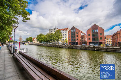
66. Etappe. Juodkrantė (dt. Schwarzort) – Klaipėda (dt. Memel).
Klaipėda – Seetor Litauens
Fortführend von der Küstenpromenade des Ortes Juodkrantė überquert der "Meeresweg" (lt. "Jūrų takas") die Kurische Nehrung in nordwestlicher Richtung auf kleinen Waldwegen, die sich entlang steiler, mit Kiefern bewachsener Dünenhänge schlängeln, bis man wieder an der Ostseeküste ankommt. Weitere 9 km verläuft der Meeresweg an den Sandstränden entlang. Auf der Ostseite wird er durch eine steile Düne, die die Nehrung vor durch den Wind verwehten Sand schützt, begrenzt. Außerhalb der Siedlung Alksnynė (vom Ufer aus unsichtbar) biegt er nach Osten ab und in den Wald der Latschenkiefer Pinus Mugo, den Militärstützpunkt der deutschen Armee während des Zweiten Weltkriegs durchquert, und sich den Ufern des Kurischen Haffs nähert. Danach verläuft der Meeresweg weiterhin durch die mit Kiefern bedeckten Dünen, von denen ein Ausblick auf die Stadt Klaipėda sich eröffnet. Die Route zwischen der neuen und alten Fähre verläuft zunächst über einen kleinen Pfad und dann über die Küstenpromenade. Von der alten Fähre überquert der Meeresweg (mit der Fähre) das Kurische Haff und endet im Zentrum von Klaipėda - auf der Danės-Straße bis zur Biržos-Brücke (dt. Brücke der Börse). Der Abschnitt bis zur Fähre passiert den Nationalpark der Kurischen Nehrung (lt. Kuršių nerijos nacionalinis parkas).
Die Kurische Nehrung ist eine der eindrucksvollsten Küstenformationen im Baltikum mit Wanderdünen, Walddünen, Dünenwällen, Sandhabitaten und einzigartigen Landschaften. Der Küstenwanderweg (Jūrtaka) schlängelt sich entlang der Küste oder über kleine Pfade zwischen den Dünen. Die Landschaft der Kurischen Nehrung wird durch die ehemaligen Fischerdörfer von Kursenieki mit ihrer unverwechselbaren Architektur und Tradition wunderschön ergänzt. Sie ist Teil des Nationalparks Kurische Nehrung.
69. Etappe. Insel von Rusnė (dt. Ruß).
Insel von Rusnė ist ein großartiger Ort zum Beobachten der Wildtiere
Hier in der Stadt Rusnė, auf der Insel Rusnė beginnt der Meeresweg (lt. Jūrų takas). Er führt durch die Straßen Neringos und K. Jukštaičio zur Küstenpromenade des Flüsschens Rusnė (dt. Ruß) - die sich entlang des Flusses Pakalnė, einem der Zweige des Nemunas-Deltas, erstreckt. Danach schlängelt der Meeresweg über den Hafen von Rusnė, durch die Böschungen der Polder - bis zum Dorf Pakalnė und schenkt uns schöne Ausblicke auf die farbenfrohe Bebauung der Insel und die Weiden, die über das Wasser der Pakalne lauern. Außerhalb des Dorfes Pakalnė führt der Weg weiter durch die Polder zu der niedrigsten Stelle Litauens (Rusnė ist ein Ort unter dem Meeresspiegel). Die Böschungen der Polder schützen diesen Ort vor Überschwemmungen. Anschließend präsentiert sich hocherhaben der Leuchtturm von Uostadvaris. Von dem Leuchtturm aus, bis zur Stadt Rusnė (mit Ausnahme von Uostadvaris selbst), wo der Weg am Ufer des Atmata-Flusspolders verläuft, führt der Meeresweg an dem Rand einer Asphaltstraße. In der Stadt Rusnė, den Ausgangspunkt der Route, ist über die Straße, Kuršmarių und Taikos zu erreichen. Die Insel Rusnė liegt im Regionalpark von Nemunas-Delta. Die Böschungen der Polder sind wunderbare Plätze um die Wildtiere, Hirsche, Elche und Vögel während der Frühjahrs- und Herbstwanderungen auf der Ebenen der Insel zu beobachten.
Ein sehr interessantes Gebiet, das durch das langfristige Zusammenwirken natürlicher Kräfte – Meer, Fluss Nemunas und menschliche Bemühungen, dem Wasser Land abzugewinnen – geformt wurde. Es ist ein idealer Ort für Natur- und Vogelbeobachtungen. Es ist Teil des Regionalparks Rusnė.