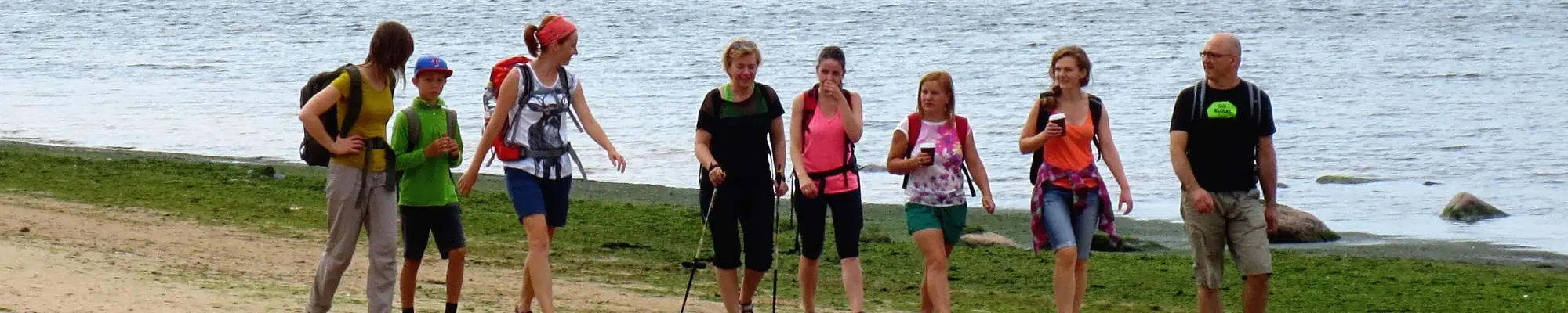

Jūrų takas - Wheelchair accesible


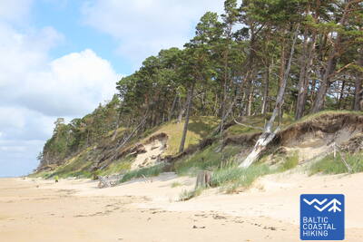
 Atkarpa 2. Pape - Bernāti.
Tolimiausias vakarų Latvijos taškas
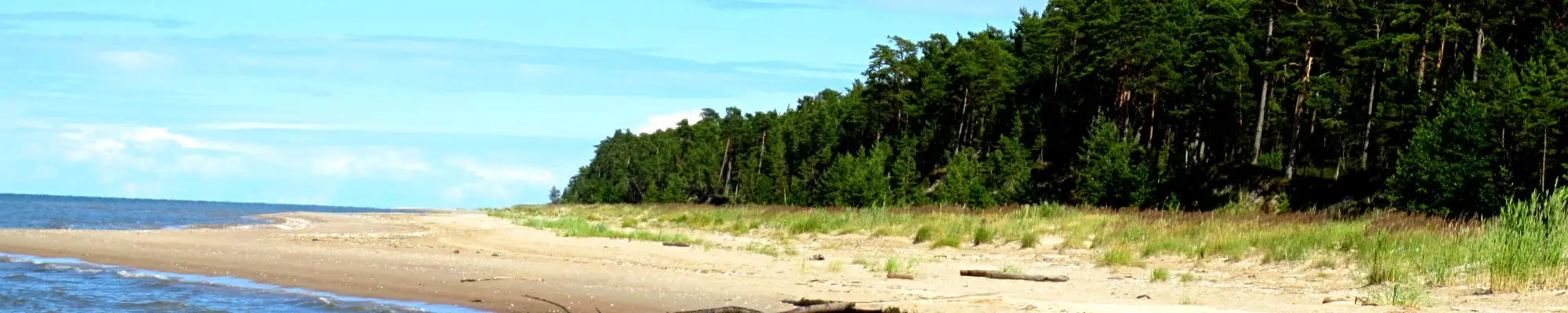
Der Baltische Küstenwanderweg führt auf der ganzen Strecke am Strand entlang, der auf der Festlandseite in der Umgebung von Pape von einer wunderschönen Vordüne umschlossen ist. Hinter dem Dorf wird er auf einer Länge von fast 10 km von einem abgespülten Uferstreifen abgelöst, auf dem Kiefernstämme umgestürzt herumliegen. Die Flachdüne kommt in der Umgebung des Dorfes Jūrmalciems wieder zum Vorschein. Hinter Jūrmalciems erstrecken sich weitläufig Strände. Nähert man sich dem Kap Bernātu ragt eine eindrucksvolle, mit einem Kieferwald bewachsene und streckenweise durch die Meeresbrandung ausgehöhlte Steilküste empor.
Bernāti Beach Boardwalk
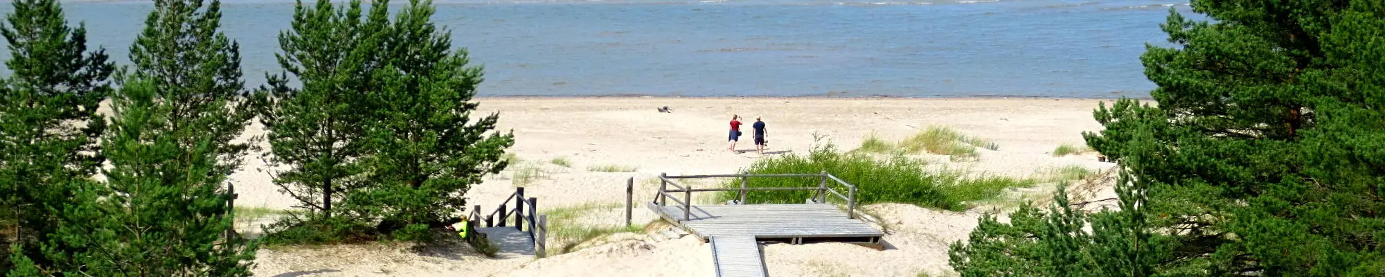
Die Strandpromenade am Bernāti Beach ist in eine Richtung etwa 400 Meter lang und 1,2 bis 1,6 Meter breit. Sie ist teilweise für Rollstuhlfahrer zugänglich und aufgrund der Steigungen von bis zu 12 Prozent wird eine Nutzung mit Hilfe empfohlen. Sie ist auch für Eltern mit Kinderwagen benutzbar. Am Ende der Strandpromenade gibt es eine Aussichtsplattform und einen Loungebereich. Während der Saison wird die Strandpromenade verlängert, damit Rollstuhlfahrer das Ufer erreichen können. In der Nähe der Strandpromenade gibt es einen Parkplatz (GPS: 56.366156, 20.976715) und eine Trockentoilette (nicht angepasst).


Atkarpa 2. Pape - Bernāti.
Tolimiausias vakarų Latvijos taškas
Der Baltische Küstenwanderweg führt auf der ganzen Strecke am Strand entlang, der auf der Festlandseite in der Umgebung von Pape von einer wunderschönen Vordüne umschlossen ist. Hinter dem Dorf wird er auf einer Länge von fast 10 km von einem abgespülten Uferstreifen abgelöst, auf dem Kiefernstämme umgestürzt herumliegen. Die Flachdüne kommt in der Umgebung des Dorfes Jūrmalciems wieder zum Vorschein. Hinter Jūrmalciems erstrecken sich weitläufig Strände. Nähert man sich dem Kap Bernātu ragt eine eindrucksvolle, mit einem Kieferwald bewachsene und streckenweise durch die Meeresbrandung ausgehöhlte Steilküste empor.

Atkarpa 3. Bernāti - Liepāja - Karosta (Karinis uostas).
Miestas, kuriame gimsta vėjas
Von Bernāti bis Liepāja führt der Baltische Küstenwanderweg an einem breiten Strand entlang. Dort erfreuen auf der Festlandseite anfangs eine abgespülte Küste das Auge, später dann beim Herankommen an die Stadt Liepāja hohe, mit Strandroggen und Strandhafer bewachsene Vordünen. Der Pfad windet sich weiter durch den zentralen Teil der Stadt Liepāja – Vecliepāja und kurz nach dem Passieren des Karosta-Kanals (Kriegshafenkanal) erreicht man Karosta – einen Komplex von Militär- und Fortifikationsbauten. Um ihn genauer zu erkunden, sollte man mindestens einen halben
Tag einplanen. Unbedingt probieren sollte man die Spezialität von Liepāja – ”Liepājas menciņi”, geräucherten Dorsch, zubereitet nach einem alten südkurländischen Rezept.
The hiking route "Hear, Smell, Touch Liepāja."
Die Route wurde für blinde und sehbehinderte Menschen konzipiert und wird von einem ausgebildeten blinden Führer geleitet. Sie umfasst Besuche bedeutender kultureller und historischer Stätten in Liepāja. Die Länge der Route hängt von den Bedürfnissen der Gruppe ab. Sie befindet sich in der Nähe des Küstenwanderwegs. In Liepāja wurden mehrere taktile Karten entwickelt, die sehbehinderten Menschen die Orientierung erleichtern.
Liepāja Beach near the Central Rescue Station
Am Strand von Liepāja in der Nähe der zentralen Rettungsstation (GPS: 56.504199, 20.991922) wurde eine Einrichtung für Menschen mit Behinderungen eingerichtet. Sie umfasst Duschen, Umkleidekabinen und Holzstege, die bis zum Meer reichen und Rollstuhlfahrern den Zugang zum Ufer ermöglichen. Es stehen spezielle Rollstühle zur Verfügung, die zum Schwimmen im Meer geeignet sind. Für blinde und sehbehinderte Menschen wurden Audiobojen im Meer angebracht, die durch Signale Informationen darüber geben, wie weit man schwimmen kann.


Liepāja Seaside Park.
Der Park verfügt über ein etwa 3 km langes Wegenetz, das für Rollstuhlfahrer geeignet ist. Die Wege weisen unterschiedliche Oberflächen auf, darunter Kies, Pflaster, Promenaden und Asphalt. Es gibt Rastplätze, Essensmöglichkeiten, Parkplätze und Toiletten. Der Park ist von der Kreuzung der Straßen Liepu und Peldu aus zugänglich (GPS: 56.506365, 20.997112). Er liegt in der Nähe des Küstenwanderwegs.


Liepāja Lake Boardwalk
Die Promenade am Liepāja-See ist für Rollstuhlfahrer und Eltern mit Kinderwagen zugänglich. Sie ist breit und mit Kanten versehen und erstreckt sich in eine Richtung etwa 400 Meter. Der Turm ist für Rollstuhlfahrer nicht zugänglich. Er liegt etwa 2 km vom Küstenwanderweg entfernt, GPS: 56.494511, 21.024515.


Liepāja Lake Horse Island Trail
Der Wanderweg „Pferdeinsel am Liepāja-See“ ist in eine Richtung etwa 2 km lang. Am Anfang des Wanderwegs gibt es einen Parkplatz (GPS: 56.516585, 21.032329) und das Dabasmāja – Wissenschafts- und Bildungsinnovationszentrum (mit Rampen ausgestattet). Die Wegoberfläche besteht am Anfang aus Holzstegen, danach kommt ein Schotterweg. Der Wanderweg ist für Rollstuhlfahrer zugänglich, obwohl der Schotterabschnitt mit Hilfe empfohlen wird. Er liegt 1,3 km vom Küstenwanderweg entfernt.


Atkarpa 3. Bernāti - Liepāja - Karosta (Karinis uostas).
Miestas, kuriame gimsta vėjas
Von Bernāti bis Liepāja führt der Baltische Küstenwanderweg an einem breiten Strand entlang. Dort erfreuen auf der Festlandseite anfangs eine abgespülte Küste das Auge, später dann beim Herankommen an die Stadt Liepāja hohe, mit Strandroggen und Strandhafer bewachsene Vordünen. Der Pfad windet sich weiter durch den zentralen Teil der Stadt Liepāja – Vecliepāja und kurz nach dem Passieren des Karosta-Kanals (Kriegshafenkanal) erreicht man Karosta – einen Komplex von Militär- und Fortifikationsbauten. Um ihn genauer zu erkunden, sollte man mindestens einen halben
Tag einplanen. Unbedingt probieren sollte man die Spezialität von Liepāja – ”Liepājas menciņi”, geräucherten Dorsch, zubereitet nach einem alten südkurländischen Rezept.
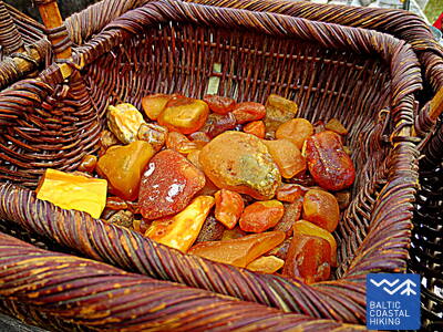
 Atkarpa 5. Ziemupe - Pāvilosta.
Dainuojantis smėlis ir gintaras
Ein von Reisenden nur wenig besuchter Strand, wo man Bernstein und Steine mit Fossilien sammeln und dem Klang des Sandes lauschen kann. In der Umgebung von Ziemupe kommt die durch die Meeresbrandung ausgehöhlte Steilküste zum Vorschein. Danach folgen weiter von Akmensrags bis Pāvilosta schöne, streckenweise abgespülte Vordünen, die mit Strandroggen und Strandhafer bedeckt sind. An einigen Stellen sind Graudünen zu sehen. Der Leuchtturm Akmeņrags ist der beste Rastplatz. Pāvilosta mit seinem Kleinstadt-Flair, den Häfen und dem Aroma der geräucherten Fische bringt Besucher von der unberührten Natur wieder in die Zivilisation zurück.
Pāvilosta Pier Promenade
Ein etwa 200 Meter langer Abschnitt der Promenade der Mole von Pāvilosta ist für Rollstuhlfahrer zugänglich, die Mole selbst jedoch nicht. Ein geeigneter Ausgangspunkt ist das Heimatmuseum von Pāvilosta (GPS: 56.889365, 21.172837). Es liegt neben dem Küstenwanderweg.


Pāvilosta Beach Boardwalk
Der Strandweg von Pāvilosta führt Besucher in die Graue Düne und die Küstendünen ein. Es handelt sich um einen 1,2 Meter breiten Holzsteg, der einen halben Kilometer lang ist (Hin- und Rückweg). Der Weg beginnt mit einer Schotteroberfläche. Es gibt einen Parkplatz (GPS: 56.892935, 21.185369). Der Weg ist für Rollstuhlfahrer mit Hilfe zugänglich, da es einige Steigungen und Gefälle gibt. Der Zugang zur Küste ist nicht möglich.


Atkarpa 5. Ziemupe - Pāvilosta.
Dainuojantis smėlis ir gintaras
Ein von Reisenden nur wenig besuchter Strand, wo man Bernstein und Steine mit Fossilien sammeln und dem Klang des Sandes lauschen kann. In der Umgebung von Ziemupe kommt die durch die Meeresbrandung ausgehöhlte Steilküste zum Vorschein. Danach folgen weiter von Akmensrags bis Pāvilosta schöne, streckenweise abgespülte Vordünen, die mit Strandroggen und Strandhafer bedeckt sind. An einigen Stellen sind Graudünen zu sehen. Der Leuchtturm Akmeņrags ist der beste Rastplatz. Pāvilosta mit seinem Kleinstadt-Flair, den Häfen und dem Aroma der geräucherten Fische bringt Besucher von der unberührten Natur wieder in die Zivilisation zurück.
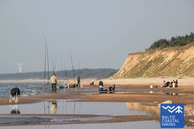
 Atkarpa 6. Pāvilosta - Jūrkalne.
Įspūdingiausi Baltijos jūros šlaitai
Im Nordosten von Pāvilosta erfreut eine an Graudünen reiche Landschaft das Auge. Doch nur einige Kilometer weiter beginnt eine der schönsten Abschnitte des Pfades Jūrtaka mit ihren hervorragenden Steilküsten, die sich auf einer Länge von mehr als 20 km erstrecken. Die bezauberndste, von Steilküsten geprägte Landschaften ist in der Nähe der Mündung der Flüsse Strante, Ulmale und Rīva zu beobachten. An vielen Stellen unterhalb des steilen Küstenabfalls blühen im Sommer die Orchideen. In Dorf Jūrkalne und dessen Umgebung kann man „zwei Sonnenuntergänge“ genießen - den ersten am Strand, den zweiten - einen kurzen Moment später - oben von der Spitze der Steilküste.
Pāvilosta Beach Boardwalk
Der Strandweg von Pāvilosta führt Besucher in die Graue Düne und die Küstendünen ein. Es handelt sich um einen 1,2 Meter breiten Holzsteg, der einen halben Kilometer lang ist (Hin- und Rückweg). Der Weg beginnt mit einer Schotteroberfläche. Es gibt einen Parkplatz (GPS: 56.892935, 21.185369). Der Weg ist für Rollstuhlfahrer mit Hilfe zugänglich, da es einige Steigungen und Gefälle gibt. Der Zugang zur Küste ist nicht möglich.
Pāvilosta Pier Promenade
Ein etwa 200 Meter langer Abschnitt der Promenade der Mole von Pāvilosta ist für Rollstuhlfahrer zugänglich, die Mole selbst jedoch nicht. Ein geeigneter Ausgangspunkt ist das Heimatmuseum von Pāvilosta (GPS: 56.889365, 21.172837). Es liegt neben dem Küstenwanderweg.
Atkarpa 8. Sārnate - Užava.
Vaizdingiausias Latvijos pajūrio peizažas
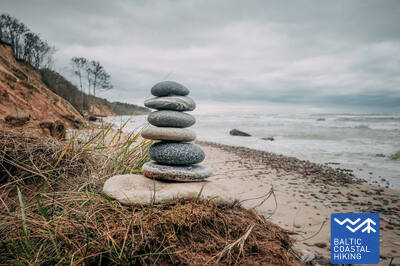
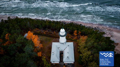
In der Umgebung von Sārnate kann man noch immer die baltische Steilküste genießen. In Richtung Norden verflacht sie allmählich wird und durch einen vom Wasser ausgehöhlten Vordünenwall abgelöst. Zwischen Vendzavas und dem Leuchtturm Užava erstreckt sich der Meeresküste entlang eine für Lettland nicht typische Landschaft, die an eine sandig-steinige Wüste mit spärlicher Vegetation erinnert. Hier befindet sich das ehemalige Übungsgelände der Sowjetarmee. An dieser Stelle und hinter Užava können auf dem Gebiet des ehemaligen Übungsgeländes Graudünen beobachtet werden. Nähert man sich der Mündung des Flusses Užava wird der Strand immer breiter und der Dünenwall immer flacher. Vom romantischen Leuchtturm Užava offenbart sich dem Wanderer der schönste Anblick des Baltischen Küstenwanderweges.
Užava Creek beach boardwalk
Der Holzsteg an der Mündung des Flusses Užava am Meer ist ein 0,5 km langer Rundweg aus Holz, der für Rollstuhlfahrer geeignet ist. Der Holzsteg ist 1,2 Meter breit und hat Ausweichstellen. In der Nähe gibt es einen Parkplatz (GPS: 57.247001, 21.414652). Entlang des Weges gibt es einen Rastplatz, der jedoch nicht für Rollstuhlfahrer zugänglich ist, und es gibt keinen Zugang zum Meeresufer. Der Holzsteg liegt neben dem Jūrtaka-Wanderweg.


Atkarpa 9. Užava - Ventspils.
Surink savo gintaro kolekciją!
На этом этапе первые 6 км Тропы Балтийского взморья – это безлюдный участок берега с низкими дюнами, спины которых покрыты колосняком и аммофилой. За устьем ручья Медолес высится внушительный обрыв (~19 м) с узким каменистым пляжем. Обрыв быстро сходит на нет и снова поднимается двумя километрами дальше. Между обрывами находится бывший полигон Советской армии. Последние пять километров Тропы Балтийского взморья до Южного мола в Вентспилсе идут по просторному песчаному пляжу, который со стороны суши ограничен биотопами серых дюн.
Ventspils Seaside Park
В Вентспилсском приморском парке имеется сеть троп длиной около 3,5 км, в том числе Якорная тропа длиной 730 м. Тропы (за исключением Тропы джунглей) доступны для людей в инвалидных колясках и родителей с детскими колясками. Покрытие тропы состоит из гравия и асфальта (в начале). Удобной отправной точкой для осмотра парка является перекресток улиц Парка и Лочу (GPS: 57.389279, 21.537021), где есть парковка и туалет. Парк расположен рядом с Юртакской тропой. Для людей в инвалидных колясках и родителей с детскими колясками наиболее удобным выходом на пляж у моря является вход № 6, расположенный на территории парка.
Atkarpa 9. Užava - Ventspils.
Surink savo gintaro kolekciją!
На этом этапе первые 6 км Тропы Балтийского взморья – это безлюдный участок берега с низкими дюнами, спины которых покрыты колосняком и аммофилой. За устьем ручья Медолес высится внушительный обрыв (~19 м) с узким каменистым пляжем. Обрыв быстро сходит на нет и снова поднимается двумя километрами дальше. Между обрывами находится бывший полигон Советской армии. Последние пять километров Тропы Балтийского взморья до Южного мола в Вентспилсе идут по просторному песчаному пляжу, который со стороны суши ограничен биотопами серых дюн.
Atkarpa 10. Ventspils - Staldzene.
Ventspilio miestu
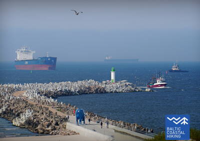
Маршрут проходит через Вентспилс и окружающие его леса. Тропа Балтийского взморья от Южного мола ведет через исторический район Остгалс и Старый город, пересекает Венту и дальше через Парвенту по пешеходно-велосипедной дорожке продолжается в направлении Сталдзене, где, обогнув Вентспилсский порт, вновь возвращается на берег моря. Стоит взять один «выходной» и ознакомиться с самыми интересными местами города, а также посетить Приморский музей под открытым небом.
Lake Būšnieki Nature Trail
Тропа вокруг озера Бушниеки представляет собой 9-километровую петлю, доступную для инвалидов-колясочников и родителей с детскими колясками. Она оснащена аудиогидом, тактильной информацией и парковкой для людей с ограниченными возможностями. Рекомендуемая отправная точка — парковка на юго-восточной стороне озера (GPS: 57.437632, 21.656062). Тропа расположена примерно в 1 км от тропы Юртака.


Atkarpa 15. Saunags kaimas – Kolka.
Europos širdis: Kolka iškyšulys
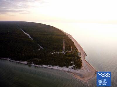
От Саунагса по маленьким проселочным и лесным дорогам Тропа Балтийского взморья вьется до Вайде, где снова возвращается на берег моря. До Колкасрагса тянутся широкие песчаные пляжи, переходящие в приземистые дюны, за которыми снова следуют дюны, поросшие лесом. На протяжении ~2 км – размытые дюны, за которыми поднимаются Думбркални. Колкасрагс, пограничная веха между Балтийским морем и Рижским заливом, является одним из популярнейших на Балтийском побережье мест наблюдения за птицами.
Kolka Pine Trail
Тропа протяженностью 1,8 км предназначена для изучения биоразнообразия прибрежных дюн. На ней есть две смотровые площадки, доступные для людей в инвалидных колясках. Сухие туалеты частично адаптированы для людей с функциональными нарушениями. Есть парковка (GPS: 57.756668, 22.591180). Тропа расположена рядом с тропой Юртака.


Atkarpa 16. Kolka - Ģipka.
Palei "uždarą pakrantę"
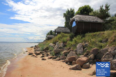
Если свернуть от Колкасрагса в сторону залива, то можно заметить различие между Балтийским морем и Рижским заливом. Первые 10 км Тропы Балтийского взморья ведут по побережью Национального парка «Слитере»: сначала вдоль выступающих в море сосен, вдоль зданий бывшего рыболовецкого колхоза, корабельной пристани и обрыва Эважу, в окрестностях которого расположен необычно узкий песчаный пляж со склоняющимися над ним стволами черной ольхи. И дальше по дороге до Гипки будет тянуться узкий песчаный пляж с многочисленными выходящими на поверхность родниками и устьями небольших (летом – мелких) рек. В советские времена берег Национального парка «Слитере» был дважды закрытой территорией – здесь находились приграничная режимная зона и природный резерват.
Ēvažu Nature Trail
Тропа предназначена для осмотра одного из редких крутых берегов Рижского залива. Для людей на инвалидных колясках открыт доступ к смотровой площадке, с которой открывается вид на Рижский залив. Длина тропы составляет 1,2 км в оба конца. Поверхность включает гравий в начале, затем следует протоптанная тропа и дощатые настилы с лестницами около крутого берега. На противоположной стороне дороги Тукумс - Колка есть парковка (GPS: 57.677789, 22.567982). Тропа расположена рядом с тропой Юртака.


Atkarpa 17. Ģipka - Kaltene.
Akmenuotas Kuržemės paplūdimys
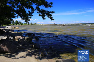
От Гипки до Рои тянется песчаный, не слишком широкий пляж с красивыми дюнами и прибрежными сосновыми лесами, а перед Роей пляж зарос тростником. В свою очередь, отрезок пути между Роей и церковью в Калтене – самый своеобразный на всем латвийском побережье: берег здесь топорщится маленькими мысками и изрыт заливчиками с очень узким пляжем. Весь берег усыпан валунами разного размера, а над ними шепчет зеленая листва черной ольхи. В некоторых местах на берег вытягиваются широкие розетки корней деревьев, подмытых морем. Местами вдоль самого берега идет земляная дорога, вдоль которой тянутся ряды бывших рыбацких подворий.
Walking Path at Roja Beach
Деревянные настилы предназначены для инвалидов-колясочников и родителей с колясками. Есть информационный стенд со шрифтом Брайля и тактильная карта пляжа. Удобства включают адаптированный туалет и парковку (GPS: 57.510088, 22.799207). Длина настила составляет 0,5 км в одном направлении. Хотя инвалиды-колясочники могут пользоваться настилами, они не могут добраться до моря из-за отсутствия пандуса. Настилы широкие, с ограждениями по бокам и зонами для прохода.


Atkarpa 17. Ģipka - Kaltene.
Akmenuotas Kuržemės paplūdimys
От Гипки до Рои тянется песчаный, не слишком широкий пляж с красивыми дюнами и прибрежными сосновыми лесами, а перед Роей пляж зарос тростником. В свою очередь, отрезок пути между Роей и церковью в Калтене – самый своеобразный на всем латвийском побережье: берег здесь топорщится маленькими мысками и изрыт заливчиками с очень узким пляжем. Весь берег усыпан валунами разного размера, а над ними шепчет зеленая листва черной ольхи. В некоторых местах на берег вытягиваются широкие розетки корней деревьев, подмытых морем. Местами вдоль самого берега идет земляная дорога, вдоль которой тянутся ряды бывших рыбацких подворий.
Atkarpa 18. Kaltene - Mērsrags.
Įvairialypis krantas
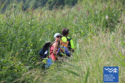
Чрезвычайно многообразный отрезок Тропы Балтийского взморья в плане природы, культуры, истории и ландшафта. Возле Калтене взморье пестрит небольшими заливчиками и каменистыми пляжами, а дальше берег моря сильно зарос и по нему меж тростника и пышной растительности вьется узкая тропинка. Далее покрытый камнями морской берег сужается до нескольких метров, местами виднеются слои глины, тростниковые поля, кое-где его покрывают выброшенные морем водоросли. На участке пути от Валгалциемса до Мерсрагса снова появляются песчаные пляжи с морскими отмелями. За Мерсрагсом маршрут продолжается по дороге, а возле лютеранской церкви сворачивает в сторону моря и до самого центра Мерсрагса ведет вдоль Приморского луга.
Boardwalk in Upesgrīva
Расположен между кемпингом Lūši и морем (GPS: 57.381441, 23.025370). На набережной нет боковых ограждений и зон для прохода. Доступен для инвалидов-колясочников с помощником. Длина около 90 метров в одном направлении. Не обеспечивает доступа к морскому берегу. Расположен недалеко от Прибрежной тропы (Jūrtaka).


Boardwalk near Mērsrags Lighthouse
Расположен на улице Бакас, 60. Дощатый настил позволяет инвалидным коляскам проехать от парковки (GPS: 57.365315, 23.120436) до дюн, откуда видно море. Дощатый настил имеет частичное ограждение краев и не имеет зон разворота. Длина составляет около 150 м (туда и обратно). Он находится недалеко от Прибрежной тропы.


Atkarpa 19. Mērsrags - Engure.
Engurės gamtos parke
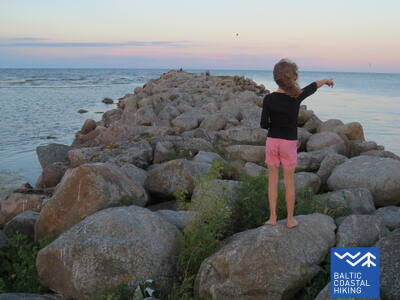
Из центра поселка до пляжа ведет лесная дорога, по обочинам которой растут сосны. Дальше Тропа Балтийского взморья изгибается между буйно заросшим тростником и другими растениями каменистым берегом моря и лесистыми приморскими дюнами. В некоторых местах пляж вымощен мелкими круглыми камешками, в других виднеются серые дюны с видовым разнообразием растений. В окрестностях Берзциемса раскинулись приморские луга, выходящие по отмелям далеко в море, которые являются хорошим местом для наблюдения за птицами. До Абрагциемса продолжается заросшее взморье, а от Абрагциемса до Энгуре идет пляж.
Engure Nature Trail
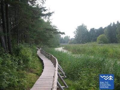
От парковки (GPS: 57.171428, 23.222504) на улице Слимницас через дюны к морю тянется деревянный дощатый настил, который предназначен для людей в инвалидных колясках. Из-за уклона может потребоваться помощь. Тропа составляет около 200 метров в одном направлении. Она расположена недалеко от Прибрежной тропы (Юртака).


Atkarpa 20. Engure - Ragaciems.
Žvejų kaimai ir rūkyta žuvis
Iš pradžių Baltijos pajūrio pėsčiųjų maršrutas vingiuoja per Engurės kaimą, tada iš vienos pusės veda per palyginti siaurą paplūdimį, o kitoje pusėje – gražias sumedėjusias pajūrio kopas ir pasiekia Plienciemo kopą, po kurios smėlėtas paplūdimys tampa vis platesnis ir jūroje atsiranda didelių seklumos. . Pakrantėje prieš akis iškyla apaugę slenksčiai su laiptais ir lentų takais, kurie driekiasi iki pat kelio, jungiančio Kolką ir Tukumą. Reikia atsižvelgti į tai, kad šiltomis vasaros dienomis čia užsuka daug poilsiautojų. Paskutinis maršruto trečdalis yra Ķemeri nacionaliniame parke.
Apšuciems
Apšucieme yra du plaukiojantys paplūdimio vežimėliai žmonėms su judėjimo negalia. Juos galima gauti Apšuciemo mokykloje iš anksto susitarus telefonu +371 26132761. Naudotojai turi pasirūpinti savo asistentu, kuris padėtų patekti į vandenį ir iš jo, plaukti ir grįžti. Galimos ir gelbėjimosi liemenės. 2025 m. planuojama įrengti prieigą prie jūros, kuri apims prieigą prie neįgaliųjų vežimėlių, liemenes, persirengimo kabinas ir specializuotus deginimosi kilimėlius. Su pagalba bus įmanomos nedidelės išvykos palei kieto smėlio pakrantės dalį. Tai yra Baltijos jūros taku.

Plieņciemo baltųjų kopų pasienio takas
Takas yra prie pietinės Plieņciemo ribos, einantis Rygos-Engurės kryptimi.
Plieņciemo pavadinimas kilęs iš baltiško žodžio „pliens“ - kalkakmenis arba mergelis. Pirmą kartą dokumentuose kaimas paminėtas dar 1551 m., tačiau žemėlapiuose kaip apgyvendinta vietovė jis atsiranda nuo 1702 m. XVIII a. viduryje Engure parapijos registre minima, kad Plieņcieme buvo devyni ūkiai, kurie turėjo teisę žvejoti jūroje ir Engure ežere, taip pat rinkti jūros žolę.
Nuo kelio į jūrą veda takas, vedantis pėsčiuosius per kopų pylimą. Tako danga suprojektuota taip, kad juo galėtų naudotis neįgaliojo vežimėliu judantys asmenys (pageidautina su palydovu) ir šeimos su vaikais vežimėliuose. Paplūdimyje yra persirengimo kabina ir nedidelė žaidimų aikštelė. Take nėra nustatytos vietos, kurioje būtų galima apsikeisti vietomis su priešpriešiais atvažiuojančiais automobiliais.


Atkarpa 20. Engure - Ragaciems.
Žvejų kaimai ir rūkyta žuvis
Iš pradžių Baltijos pajūrio pėsčiųjų maršrutas vingiuoja per Engurės kaimą, tada iš vienos pusės veda per palyginti siaurą paplūdimį, o kitoje pusėje – gražias sumedėjusias pajūrio kopas ir pasiekia Plienciemo kopą, po kurios smėlėtas paplūdimys tampa vis platesnis ir jūroje atsiranda didelių seklumos. . Pakrantėje prieš akis iškyla apaugę slenksčiai su laiptais ir lentų takais, kurie driekiasi iki pat kelio, jungiančio Kolką ir Tukumą. Reikia atsižvelgti į tai, kad šiltomis vasaros dienomis čia užsuka daug poilsiautojų. Paskutinis maršruto trečdalis yra Ķemeri nacionaliniame parke.
Atkarpa 21. Ragaciems - Dubulti.
Istorinis Jūrmalos kurortas
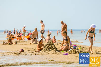
Ragaciemo kaime aiškiai matosi visa Jūrmalos pakrantė. Pirmasis šios dienos maršruto trečdalis – Ķemerių nacionalinio parko dalis, kur galima pažinti istorinius žvejų kaimelius, Ragaciemo kaimo žvejų zoną su tinkliniais nameliais ir žuvų turgumi, kopų buveines, taip pat stebėti paukščius žiotyse. Starpiņupės upė. Pradedant nuo Jaunķemeri iki Dubultų, pėsčiomis pasieksite plačiausią smėlėtą Rygos įlankos paplūdimį per istorinį Jūrmalos kurortą ir ilgiausią Latvijos miestą. Turėkite omenyje, kad šiltomis ir saulėtomis vasaros dienomis paplūdimyje bus daug lankytojų.
Jūrmalas pilsētas pludmales
Jūrmalos miesto paplūdimiai yra prieinami žmonėms, turintiems funkcinių sutrikimų, įskaitant neįgaliųjų vežimėlius ir senjorus. Jūrmaloje yra 14 neįgaliųjų vežimėliams pritaikytų prieigos prie jūros taškų: 36 linija, Vienības prospekts (2 prieigos taškai), Turaidas iela (2 prieigos taškai), Pilsonu iela, Baznīcas iela, Kļavu iela, Līgatnes iela, Dzimtenes iela, Vēju iela iela, Atbalss iela, Kapteiņa Zolta iela ir Jaunķemeri kelias. Šie prieigos taškai, atsižvelgiant į paviršių ir reljefą, sukurti taip, kad būtų tinkami tiek žmonėms, turintiems funkcinių sutrikimų, tiek su vežimėliais. Be to, yra keturios vietos – Vaivari, Kaugguri, Jaunķemeri ir Jaundubulti – kur yra išplėstos ir patogesnės persirengimo kabinos.
Kupskalni Nature Trail
Takas tęsiasi pusę kilometro dešiniuoju Siliņupės upės krantu ir veda nuo kelio Sloka-Talsi iki jūros. Jį iš dalies gali pasiekti žmonės vežimėliuose su pagalba, nes tako pradžioje gali trukdyti medžių šaknys. Tolimesnė tako atkarpa (platūs lentiniai takai su pravažiavimo vietomis) pasiekiama. Galimas dalinis tualeto prieinamumas. Pasivaikščiojimą galima pradėti iš netoliese esančios degalinės (GPS: 56.992203, 23.522736).


Atkarpa 22. Dubulti - Lielupe - Bulduri.
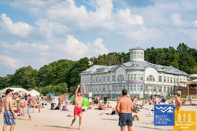
Populiariausi paplūdimiai Latvijoje
Plačiausias Rygos įlankos smėlio paplūdimys driekiasi nuo Dubultų iki Lielupės upės. Tai didžiausia Jūrmalos kurorto vertybė, siūlanti daugybę paplūdimio kavinių ir įvairių poilsio galimybių. Pakrantės kopų miškus juosia tankus takų tinklas, skirtas tiek pasivaikščiojimams, tiek šiaurietiškam ėjimui. Jūrų tako dalis nuo Lielupės paplūdimio iki Jūrmalos buities muziejaus priskiriama Ragakapos gamtos parkui. Iš čia atgal į Buldurus galima patogiai patekti einant Buldurų prospektu ir 5. līnija.
Jūrmalas pilsētas pludmales
Jūrmalos miesto paplūdimiai yra prieinami žmonėms, turintiems funkcinių sutrikimų, įskaitant neįgaliųjų vežimėlius ir senjorus. Jūrmaloje yra 14 neįgaliųjų vežimėliams pritaikytų prieigos prie jūros taškų: 36 linija, Vienības prospekts (2 prieigos taškai), Turaidas iela (2 prieigos taškai), Pilsonu iela, Baznīcas iela, Kļavu iela, Līgatnes iela, Dzimtenes iela, Vēju iela iela, Atbalss iela, Kapteiņa Zolta iela ir Jaunķemeri kelias. Šie prieigos taškai, atsižvelgiant į paviršių ir reljefą, sukurti taip, kad būtų tinkami tiek žmonėms, turintiems funkcinių sutrikimų, tiek su vežimėliais. Be to, yra keturios vietos – Vaivari, Kaugguri, Jaunķemeri ir Jaundubulti – kur yra išplėstos ir patogesnės persirengimo kabinos.
Atkarpa 23. Buldurai – Rygos centras.
Per miškus į Rygą
Maršrutas yra alternatyvus būdas, norint iš Jūrmalos patekti į Rygą, einant mišku. Už Lielupės tilto Jūrų takas vingiuoja per Priedainę, kurioje galima pasigėrėti mediniais pastatais. Toliau maršrutas eina lygiagrečiai dešiniajam Lielupės krantui, tada pasuka palei pietinę Bolderajas kopos dalį ir kerta Kleistų mišką, vingiuodamas palei Lačupės kapines. Istoriniais Pardaugavos keliais – Buļļu ir Daugavgrīvas gatvėmis per Dzegužkalną, palei Zunda kanalą ir Agenskalno įlanką veda iki Dauguvos, kur Akmens tiltu kerta Dauguvą ir sustoja Rygos Rotušės aikštėje.
Jūrmalas pilsētas pludmales
Jūrmalos miesto paplūdimiai yra prieinami žmonėms, turintiems funkcinių sutrikimų, įskaitant neįgaliųjų vežimėlius ir senjorus. Jūrmaloje yra 14 neįgaliųjų vežimėliams pritaikytų prieigos prie jūros taškų: 36 linija, Vienības prospekts (2 prieigos taškai), Turaidas iela (2 prieigos taškai), Pilsonu iela, Baznīcas iela, Kļavu iela, Līgatnes iela, Dzimtenes iela, Vēju iela iela, Atbalss iela, Kapteiņa Zolta iela ir Jaunķemeri kelias. Šie prieigos taškai, atsižvelgiant į paviršių ir reljefą, sukurti taip, kad būtų tinkami tiek žmonėms, turintiems funkcinių sutrikimų, tiek su vežimėliais. Be to, yra keturios vietos – Vaivari, Kaugguri, Jaunķemeri ir Jaundubulti – kur yra išplėstos ir patogesnės persirengimo kabinos.
Babīte Rhododendron Nursery
Įrengtas 1,9 kilometro ilgio takas, prieinamas žmonėms su vežimėliais ir tėvams su vežimėliais. Tako danga asfaltuota. Yra numatyta automobilių stovėjimo aikštelė (GPS: 56.962330, 23.952280) ir pritaikytas tualetas. Takas yra apie 2,7 kilometro nuo Jūrtakos tako.
Daugavgrīva Nature Trail
Takas prasideda automobilių stovėjimo aikštelėje (GPS: 57.036769, 24.018166), netoli Valentīna Pikuļa gatvės ir veda per Daugavgryvos pelkę iki kopų ir jūros. Tako danga prie jūros yra asfaltuota, o asfaltuota atkarpa yra prieinama žmonėms su vežimėliais. Palei taką pastatytas paukščių stebėjimo bokštas, kurio pirmas aukštas pritaikytas žmonėms su vežimėliais. Takas yra apie 12,5 kilometro nuo Jūrtakos tako, esančio Daugavgryvoje, jūros pakrantėje.

Atkarpa 24. Rygos centras - Vecāķi.
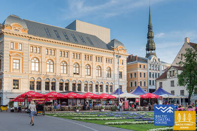
Rygos senamiestis - UNESCO pasaulio paveldo objektas
Iš pradžių kelionės programa nuves jus į nedidelį pasivaikščiojimą po Rygos centrą, Rygos senamiestį, veda palei miesto kanalą per Kronvalds parką, per Alberta gatvę (Art Nouveau pastatai) ir toliau per Miera gatvę per Lielie kapi kapines, per Kokneses ir Ostas prospektu per Mežaparką ir tada pasiekia Jaunmīlgrāvį ir kerta Mīlgravį . Toliau vingiuoja Vecāķu prospektu iki Ziemeļblāzmos ir Senosios Dauguvos (Vecdaugavos) krantų, kuriuos nuo Vecākių skiria vos pora kilometrų. Po dviejų dienų žygio per Rygą Baltijos pakrantės žygių maršrutas vėl nuves į paplūdimį.
Mangaļsala walking paths
Du Mangaļsalos takai veda per kopas ir pakrantės miškus iki jūros. Pirmasis takas (GPS: 57.071642, 24.087599) rekomenduojamas žmonėms su vežimėliais su asistentu, nes jis veda prie jūros, bet nesuteikia tiesioginio priėjimo prie paplūdimio. Antrasis takas (GPS: 57.062730, 24.055460) prasideda kaip purvo kelias, o vėliau tęsiasi kaip platus medinis lentų takas, leidžiantis neįgaliųjų vežimėliams pasiekti paplūdimį. Trečiasis takas (GPS: 57.061976, 24.041811) veda į Rytų molą. Nors jis nėra specialiai sukurtas neįgaliųjų vežimėliams, jį galima važiuoti su pagalba, įskaitant pačią prieplauką, išskyrus stiprų vėją ar audras. Tiek pirmame, tiek antrame take yra automobilių stovėjimo aikštelė ir tualetas. Artimiausias takas yra maždaug už 3,5 km nuo Jūrtakos.


Atkarpa 25. Vecāķi - Carnikava.
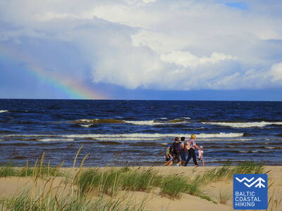
Tarp dviejų upių - Dauguvos ir Gaujos - žiočių
Šios Baltijos pajūrio žygių maršruto atkarpos – tai palyginti trumpas žygis nuostabiu smėlio paplūdimiu, kurio pakrantės pusę riboja ryškiaspalviai pušynai su įspūdingomis kopomis ir kopų užtvankomis. Norėdami patekti iš paplūdimio į Carnikavą, Baltijos pajūrio pėsčiųjų maršrutas nuves jus per mišką promenada. Tada per užtvanką pasivaikščiojama aplink Senąją Gaują ir pasiekiamas pėsčiųjų tiltas per Gaują. Pradedant ir baigiant žygį malonu prisėsti vienoje iš Vecāķi paplūdimyje ir Carnikavos mieste esančių užeigų ir vasaros kavinių.
Atkarpa 25. Vecāķi - Carnikava.
Tarp dviejų upių - Dauguvos ir Gaujos - žiočių
Šios Baltijos pajūrio žygių maršruto atkarpos – tai palyginti trumpas žygis nuostabiu smėlio paplūdimiu, kurio pakrantės pusę riboja ryškiaspalviai pušynai su įspūdingomis kopomis ir kopų užtvankomis. Norėdami patekti iš paplūdimio į Carnikavą, Baltijos pajūrio pėsčiųjų maršrutas nuves jus per mišką promenada. Tada per užtvanką pasivaikščiojama aplink Senąją Gaują ir pasiekiamas pėsčiųjų tiltas per Gaują. Pradedant ir baigiant žygį malonu prisėsti vienoje iš Vecāķi paplūdimyje ir Carnikavos mieste esančių užeigų ir vasaros kavinių.
Garciems nature trail
Lentų takas veda prie Eimurio kanalo žiočių prie jūros. Lentinio tako galas yra arti kranto, o su asistento pagalba galbūt pavyks pasiekti jūrą. Tinka žmonėms su vežimėliais ir tėvams su vežimėliais. Yra automobilių stovėjimo aikštelė (GPS: 57.108161, 24.192324) ir WC. Ilgis viena kryptimi 0,7 km. Jis yra šalia Jūrtakos.
Carnikava Promenade
Sujungia Carnikavą su jūros pakrante. Takas asfaltuotas, bet smėlynuose - mediniais liepteliais. Pajūryje įrengti takai ir apžvalgos aikštelės su gultais. Tako ilgis viena kryptimi – 1,8 km. Į jį gali patekti žmonės vežimėliuose ir tėvai su vežimėliais. Sukurta automobilių stovėjimo aikštelė (GPS: 57.133531, 24.265631) Laivų gatvėje, pritaikytas WC, informaciniai stendai ir poilsio aikštelės. Smėlėta pajūrio zona neprieinama neįgaliųjų vežimėliams. Paskutinė promenados atkarpa turi 9,2% nuolydį. Jurtaka juda Carnikavos promenada. 2024/2025 m g. Carnikavos promenadoje planuojama sukurti specialų maršrutą specializuotiems bekelės vežimėliams, kuriais galės naudotis jų naudotojai kartu su asistentu.


Atkarpa 26. Carnikava - Saulkrasti.
Saulėlydžio takas, užburiantis romantiškais vaizdais
Iš pradžių maršrutas veda per Gaujos upės užtvankas Gaujos kaime iki Gaujos upės žiočių, kuri yra gera vieta paukščių stebėjimui. Žygis tęsiasi smėlėtu paplūdimiu iki Inčupės upės žiočių, prieš kurią reikia pasukti į sausumą, kad patektumėte iki tilto ir įveiktumėte artimiausius porą kilometrų miškingomis Saulėlydžio tako kopų viršūnėmis su vaizdu į papludimys. Perplaukus Pēterupės upę (lynų tiltą), Baltijos pajūrio žygių maršrutas tęsiasi palei paplūdimį ir pasiekia Jūrų parką Saulkrastuose.
Lilaste Beach
Veža prie jūros. Jo ilgis viena kryptimi – 130 m. Prasideda prie automobilių stovėjimo aikštelės (GPS: 57.187403, 24.329523), iš kurios su asistento pagalba į paplūdimį gali patekti žmogus vežimėlyje. Jis yra šalia Jurtakos.

White Dune
Viena vaizdingiausių Rygos įlankos kopų. Prie apžvalgos platformos iš automobilių stovėjimo aikštelės gali patekti žmonės vežimėliuose su padėjėju (GPS: 57.233560, 24.393407). Balta kapa yra Jūrtakos maršruto dalis.
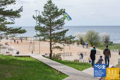
Path and wooden boardwalk network in the coastal dunes of Saulkrasti
Tarp Raiņa gatvės ir Bīriņu gatvių (Jūros parkas, Saulkrastų turizmo informacijos centras) esantis takas pritaikytas neįgaliųjų vežimėliams ir tėvams su vežimėliais. Jis eina lygiagrečiai su Jūrtakos taku. Lengviausias privažiavimas prie tako ir lentinio tako yra iš automobilių stovėjimo aikštelės (GPS: 57.267111, 24.413875).


Atkarpa 26. Carnikava - Saulkrasti.
Saulėlydžio takas, užburiantis romantiškais vaizdais
Iš pradžių maršrutas veda per Gaujos upės užtvankas Gaujos kaime iki Gaujos upės žiočių, kuri yra gera vieta paukščių stebėjimui. Žygis tęsiasi smėlėtu paplūdimiu iki Inčupės upės žiočių, prieš kurią reikia pasukti į sausumą, kad patektumėte iki tilto ir įveiktumėte artimiausius porą kilometrų miškingomis Saulėlydžio tako kopų viršūnėmis su vaizdu į papludimys. Perplaukus Pēterupės upę (lynų tiltą), Baltijos pajūrio žygių maršrutas tęsiasi palei paplūdimį ir pasiekia Jūrų parką Saulkrastuose.
Atkarpa 27. Saulkrasti – Lauči.
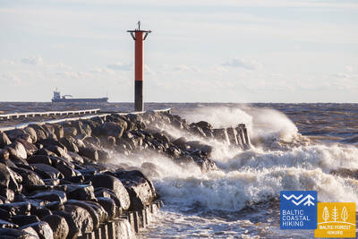
"Vartai" į uolėtą Vidžemės pakrantę
Pirmuosius kilometrus iki Žvejniekciemo galima įveikti paplūdimiu arba taku, vingiuojančiu per kopų mišką su senomis pušimis, kurių žievė atrodo kaip krokodilo oda. Čia taip pat galima pamatyti seną medinę trobelę su žvejybos tinklais ir įrankiais. Dar nepasiekus Skultės uosto, Žvejniekciemo paplūdimyje pasirodo pirmosios uolos. Apvažiavus Age upės žiotis ir uostą, Baltijos pakrantės pėsčiųjų maršrutas grįžta į paplūdimį, kur jau iš tolo matosi Arnių kyšulys, o už jo atsiveria rudas Didžiojo Lauči jūros riedulio nugara. Įvairūs pakrančių kraštovaizdžiai.
Path and wooden boardwalk network in the coastal dunes of Saulkrasti
Tarp Raiņa gatvės ir Bīriņu gatvių (Jūros parkas, Saulkrastų turizmo informacijos centras) esantis takas pritaikytas neįgaliųjų vežimėliams ir tėvams su vežimėliais. Jis eina lygiagrečiai su Jūrtakos taku. Lengviausias privažiavimas prie tako ir lentinio tako yra iš automobilių stovėjimo aikštelės (GPS: 57.267111, 24.413875).
Atkarpa 28. Lauči - Tūja.
Burlaivių laikus prisimenant...
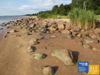
Ši Vidžemės pajūrio atkarpa yra išskirtinio vaizdingo grožio, jūroje daug uolėtų kyšulių ir riedulių, besikeičiančių su mažomis smėlėtomis įlankomis, į kurias įteka vasarą išdžiūvantys upeliai ir upeliai. Retkarčiais paplūdimį visiškai dengia pilkos akmenų nugarėlės. Vietomis išryškėja nedideli nendrių lopinėliai, o prie Tūjos pamatysite pirmąsias smiltainio atodangas.
Munchausen’s Beer Mug Trail
1,3 km ilgio takas (į vieną pusę) yra Duntės dvare ir prasideda netoli Minhauzens muziejaus. Tako paviršių sudaro 1,5 metro pločio mediniai lentų takai su keliomis pravažiavimo zonomis. Pradėti tyrinėti taką patogu nuo automobilių stovėjimo aikštelės (GPS: 57.405620, 24.424681). Takas yra 1,7 km nuo Jūrtakos tako.
Atkarpa 29. Tūja - Svētciems.
Uolėtas Vidžemės paplūdimys
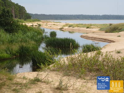
Viena gražiausių Baltijos pajūrio pėsčiųjų maršruto atkarpų, kuri prasideda kertant Zaķupytės upę. Iki Ķurmrags švyturio daugiausia yra smėlio paplūdimių su nedidelėmis akmenų dalimis. Toliau prasideda Vidžemės uolėtas pajūris: kyšuliai kaitaliojasi su nedidelėmis įlankomis, o pakrantėje išnyra 4 m aukščio smiltainio atodangos. Pravažiavus Meleki kyšulį ir toliau vyrauja smėlio paplūdimiai, o prieš Šventupės žiotis paplūdimys yra tankiai apaugęs ir nendrėtas, todėl jį reikia aplenkti miško taku.
Rest area "Vasas"
Sukurta apžvalgos aikštelė ir automobilių stovėjimo aikštelė (GPS: 57.520544, 24.379052), prieinama žmonėms su vežimėliais. Jis yra šalia Jūrtakos tako.
Veczemju Cliffs
Netoli Veczemju uolų yra rampa, skirta neįgaliųjų vežimėliams su pagalba. Tačiau paplūdimio smėlis nepritaikytas neįgaliųjų vežimėliams. Audros dažnai pažeidžia rampos pagrindą. Jis yra šalia Baltijos pajūrio pėsčiųjų tako (Jūrtaka).


Atkarpa 30. Svētciems - Ainaži.
Nėgių karalystė
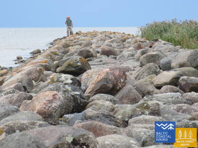
Paplūdimys tarp Svētciemo kaimo ir Salacgryvos yra tankiai apaugęs, todėl Baltijos pajūrio žygių maršrutas tęsiasi miško takeliu, vingiuojančiu tarp kopų. Iš Salacgrivos į Kuivižius galite nuvykti smėlio paplūdimiu arba miško takais. Nuo Kuivižių iki Vėverupės upės Randu pievas tenka aplenkti miško keliuku, esančiu rytinėje A1 kelio pusėje. Pravažiavus Vēverupės upę, Baltijos pakrantės žygių maršrutas grįžta į tankiai apaugusį paplūdimį ir iš jo išeina šalia Blusupites upės žiočių, kad pasiektų Ainaži prieplauką, eidami Kāpu ir Valdemāra gatve. Latvijoje įveikėte ~ 580 km ir pasiekėte valstybės sieną.
Salacgrīvas promenade
Maždaug 260 metrų ilgio sutvarkyta promenada (įskaitant Slavų alėją) palei dešinįjį Salacos upės krantą yra prieinama neįgaliųjų vežimėliams su pagalbininko pagalba. Pradėti tyrinėti galite nuo automobilių stovėjimo aikštelės (GPS: 57.756060, 24.358155). Jis yra šalia Baltijos pajūrio pėsčiųjų tako (Jūrtaka).


Monument "White Sun"
Įsikūręs Ainažuose. Jį apžiūrėti sukurtas maždaug 150 metrų ilgio medinis takas (pradedantis GPS: 57.859628, 24.347306). Jį gali pasiekti neįgaliojo vežimėlio naudotojai su pagalba ir tėvai su vežimėliais. Atstumas nuo automobilių stovėjimo aikštelės iki pėsčiųjų tako apie 250 metrų. Jis yra netoli Pajūrio tako.


Krasta ielas promenāde Salacgrīvā
Maždaug 0,8 km ilgio, suformuotas kairiajame Salacos krante nuo tilto iki Meža gatvės, kur yra teniso kortai. Prieinamos žmonėms su vežimėliais. Sukurtos vietos poilsiui ir apžiūrai, Meža gatvėje - pritaikytas WC. Danga – moderni danga.


Laipas līdz Salacgrīvas pludmalei
Nuo Jūrmalos gatvės automobilių stovėjimo aikštelės (57.75083, 24.34911) į paplūdimį sukurti du mediniai liepteliai. Prieinama neįgaliojo vežimėliams su asistentu, nes lentinio tako per kopą vietoje gali būti supuvusio smėlio. Automobilių stovėjimo aikštelėje yra tualetas. Lentinio tako danga - medinė. Dviejų neįgaliųjų vežimėlių ant lentinio tako sukeisti negalima.


Atkarpa 30. Svētciems - Ainaži.
Nėgių karalystė
Paplūdimys tarp Svētciemo kaimo ir Salacgryvos yra tankiai apaugęs, todėl Baltijos pajūrio žygių maršrutas tęsiasi miško takeliu, vingiuojančiu tarp kopų. Iš Salacgrivos į Kuivižius galite nuvykti smėlio paplūdimiu arba miško takais. Nuo Kuivižių iki Vėverupės upės Randu pievas tenka aplenkti miško keliuku, esančiu rytinėje A1 kelio pusėje. Pravažiavus Vēverupės upę, Baltijos pakrantės žygių maršrutas grįžta į tankiai apaugusį paplūdimį ir iš jo išeina šalia Blusupites upės žiočių, kad pasiektų Ainaži prieplauką, eidami Kāpu ir Valdemāra gatve. Latvijoje įveikėte ~ 580 km ir pasiekėte valstybės sieną.
Atkarpa 32. Kabli - Häädemeeste.
Paukščiai, kopos ir miškai
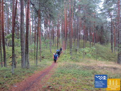
Šis maršrutas ypač rekomenduojamas paukščių stebėtojams. Norėdami įveikti Baltijos pakrantės pėsčiųjų maršruto atkarpą, jungiančią Kabli ir Hademeeste pietus, turėsite važiuoti senuoju Pernu–Rygos keliu, nes per pajūrį driekiasi nendrinės pievos ir lagūnos. Prieš pasiekiant Häädemeeste, Baltijos pakrantės pėsčiųjų maršrutas atsišakoja nuo kelio ir vingiuoja per Jaagupi gamtos rezervatą (aplink rytinę gyvenvietės pusę), eidamas aukštų kopų gale ir nusileisdamas žemyn iki gilių duburių tarp kopų, uždengtų retas pušynas. Čia rasite gerų vietų uogauti ir grybauti.
Kabli nature trail
Takas supažindina lankytojus su pajūrio kopomis ir jų gamtos vertybėmis. Jis prasideda automobilių stovėjimo aikštelėje (GPS: 58.019424, 24.450986), esančioje netoli Kablio lankytojų centro. Tako ilgis 1,8 km. Tako dangos – žvyro, miško takai, 1,5 m pločio mediniai lentų takai. Takas pritaikytas neįgaliųjų vežimėliams, yra pritaikytas tualetas. Informaciniai stendai yra įrengti palei taką, kuriame taip pat yra apžvalgos aikštelė ir du paukščių stebėjimo bokštai (negalima neįgaliojo vežimėliu). Jis yra netoli Pakrantės tako.


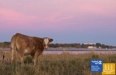
Atkarpa 34. Uulu - Pärnu.
Palei raistus į Pernu
Pirmiausia Baltijos pajūrio pėsčiųjų maršrutas eina senais pakrantės keliais, apsuptais pušynų, tačiau pravažiavus Lottemaa parką pasuka jūros link ir išeina į Reiu paplūdimį. Toliau žygis tęsiasi per apaugusį paplūdimį (plačios seklumos, kai vėjas sukuria vandens nutekėjimą) ir už kiek mažiau nei 4 km reikia sukti į vidų, kirsti golfo aikštyną ir sukti Pernu kryptimi. Netoli Raeküla rajono, jis gyvatės nedideliu takeliu, sudarantis ribą tarp didelės pakrantės pelkės ir miško. Apėjus šlapžemę ~ 6 km, Pernu paplūdimyje išnyra Baltijos pajūrio žygių maršrutas. Toliau kelias eina per vakarinę Pernu senamiesčio dalį, kerta Pernu ir Saugos upes ir baigiasi Vana-Pernu rajone.
Pärnu Coastal Meadow Hiking Trail
Taku tyrinėjamos drėgnos pakrantės pievos, lagūnos, vietinis paukščių ir augalų gyvenimas. Jis suprojektuotas ovalo formos su apžvalgos platforma (galima patekti į pirmąjį aukštą) ir tęsiasi 600 metrų. Apsilankymą patogiai galima pradėti iš šalia esančios automobilių stovėjimo aikštelės (GPS: 58.372397, 24.507902). Tako dangą sudaro mediniai lentų takai, šalia automobilių stovėjimo aikštelės yra asfaltuoti takai. Takas yra prieinamas neįgaliųjų vežimėliams, tačiau rekomenduojama padėti, nes kai kurių atkarpų nuolydis viršija 8%. Jis yra netoli Pakrantės tako.


Pärnu Beach Promenade
Takas pusę kilometro eina lygiagrečiai su Pernu įlankos paplūdimiu. Paviršius daugiausia medinis lentų takas (2,3–3,1 metro pločio), su kai kuriomis trinkelėmis, iki 4 metrų pločio. Jis prieinamas neįgaliųjų vežimėliams. Taką patogiai galima pradėti iš šalia esančios automobilių stovėjimo aikštelės (GPS: 58.372397, 24.507902).
Access to the beach and rental of swimming aids
2024 metais viešbutyje „Hedon SPA & Hotel“ bus suteikta sezoninė prieiga prie pagalbinių plaukimo priemonių ir kitos įrangos, taip pat bus sukurta speciali danga, kad neįgaliojo vežimėliuose būtų galima pasiekti vandenį.


Pärnu Beach Park
1882 m. įkurtas parkas yra populiari rekreacinė zona tiek miesto lankytojams, tiek vietos gyventojams. Jame yra apie 1 km ilgio (apie 3 m pločio) takų tinklas, pritaikytas neįgaliųjų vežimėliams. Tako paviršių sudaro žvyras ir asfaltas. Aplink parko perimetrą yra mokama automobilių stovėjimo aikštelė. Jis yra netoli Jūrtakos.


Pärnu Mole Boardwalk
Lentų takas prasideda priešais Pernu prieplauką (GPS: 58.381941, 24.483994). Lentų takas yra 0,6 km ilgio (į vieną pusę) ir yra prieinamas neįgaliųjų vežimėliams. Paviršius medinis, plotis 3 metrai. Įvairiose vietose yra takų pratęsimų ir poilsio zonų. Tai puiki galimybė apžiūrėti Pernu uostą. Jis yra apie 350 metrų nuo Jūrtakos.


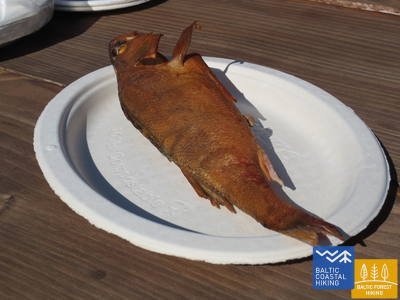
Atkarpa 35. Pärnu - Liu.
Gražiausios Pernu įlankos vietos ir rūkyta žuvis
Baltijos pakrantės pėsčiųjų maršrutas vingiuoja Pernu vakarinėje dalyje, kerta Audru upę ir pasuka link Valgeranos, kurios pietinė pusė yra apsupta tankaus miško ir balto smėlio paplūdimio, o šiaurėje rasite golfo aikštyną. kursą. Pravažiavus Valgeraną, Baltijos pakrantės žygių maršrutas driekiasi tarp polderių per šiaurinę Pernu įlankos dalį. Iš Audru polderių atsiveria įspūdingiausi Pernu įlankos vaizdai. Už Audrų nendrynų Baltijos pajūrio žygių maršrutas pasuka į pietus ir veda per pakrančių žvejų kaimelius su nedideliais uosteliais ir krantinėmis. Čia galima pamatyti žvejų kasdienybę, o jei pasiseks, paragauti ir rūkytos žuvies.
Valgeranna Beach Promenade
Takas jungia automobilių stovėjimo aikštelę su paplūdimiu. Paviršių sudaro grindinys ir medinis lentų takas, kurio plotis svyruoja nuo 1,95 iki 3 metrų. Jis prieinamas neįgaliųjų vežimėliams. Yra sausas tualetas. Jis yra šalia Jūrtakos.


Atkarpa 38. Tõstamaa - Matsi.
Estijos kaimo idilė
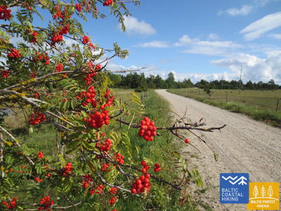
Šioje Baltijos pajūrio pėsčiųjų maršruto atkarpoje pamatysite tradicinį kaimo kraštovaizdį. Pamario raištis – seklios įlankos, pusiasaliai ir kyšuliai, apsupti pajūrio pievų, nendrių, seklių lagūnų, pelkių, taip pat sunkiai prieinamų salų. Einant nedideliais kaimo keliukais, rudeniškai nusėtais raudonų šermukšnių, galima pamatyti etnografiškai primenančias individualias sodybas ir fermas su karvėmis ir ožkomis. Sodybų kraštovaizdžiai keičiasi su uolų tvorų liekanomis, dirbama žeme ir kadagių miškais. Prieiga prie jūros ir poilsio zonos yra į pietus nuo Ranniku ir netoli Kastnos kaimo.
Matsi Port
Takas supažindina lankytojus su buvusiu Matsi žvejybos uostu. Jis yra 500 metrų ilgio (atgal į abi puses). Takas prasideda automobilių stovėjimo aikštelėje (GPS: 58.360251, 23.746683). Paviršius sudarytas iš asfalto, betono ir žvyro. Vėjuotomis sąlygomis takas gali būti padengtas smėliu, todėl neįgaliojo vežimėliams gali prireikti pagalbos. Take yra lytėjimo objektai ir informacija Brailio raštu. Yra prieinamas tualetas. Jis yra šalia Jūrtakos.


Atkarpa 39. Matsi - Varbla.
Paplūdimiai ir miškai
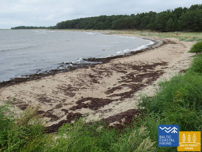
Matsi paplūdimys yra vienas iš retų smėlio paplūdimių tolesnėje tako dalyje, vedančioje į Haapsalu. Baltijos pakrantės žygių maršrutas nuves jus į nedidelį pasivaikščiojimą per Kulli kaimą, o kitus 5 km veda nedideliais takais, apsuptais plačių miškų ir kopų. Rudenį jų apylinkėse gausu uogų ir grybų. Aplenkus Uue-Varbla dvarą, takas pasiekia Varblos kaimą.
Matsi Port
Takas supažindina lankytojus su buvusiu Matsi žvejybos uostu. Jis yra 500 metrų ilgio (atgal į abi puses). Takas prasideda automobilių stovėjimo aikštelėje (GPS: 58.360251, 23.746683). Paviršius sudarytas iš asfalto, betono ir žvyro. Vėjuotomis sąlygomis takas gali būti padengtas smėliu, todėl neįgaliojo vežimėliams gali prireikti pagalbos. Take yra lytėjimo objektai ir informacija Brailio raštu. Yra prieinamas tualetas. Jis yra šalia Jūrtakos.
Atkarpa 45. Penijõe - Laiküla.
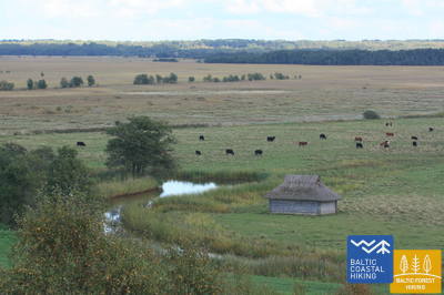
Aplink didžiausią pelkę Šiaurės Europoje
Baltijos pakrantės žygių maršrutas leidžia pasivaikščioti po Kasario upės deltą, kur ji įteka į Matsalu įlanką ir kur susiformavo viena didžiausių šlapžemių Šiaurės Europoje su dideliais nendrių laukais, pakrantės pievomis, ežerais ir vandeniu iš seklios įlankos. , yra svarbi migruojančių paukščių lizdų ir sustojimo vieta. Maršrutas daugiausia veda per dirbamos žemės kraštovaizdžius ir mažus kaimelius. Kirblos apylinkėse galite pamatyti reljefo aukštį, kuris yra buvusi Baltijos ledo ežero sala su senovine pakrante šiaurėje.
RMK Rannajõe Observation Platform
Takas supažindina lankytojus su Matsalu nacionalinio parko salpų pievomis, kuriose migruojant susirenka dideli paukščių būriai. Į platformą patenkama 100 metrų ilgio mediniu lentiniu taku (iki 110 cm pločio). Neįgaliųjų vežimėlių naudotojams reikės pagalbos, nes rampos nuolydis siekia 32%. Jis yra adresu (GPS: 58.816865, 23.781363) šalia Jūrtakos.


Atkarpa 48. Rohuküla - Haapsalu - Uuemõisa.
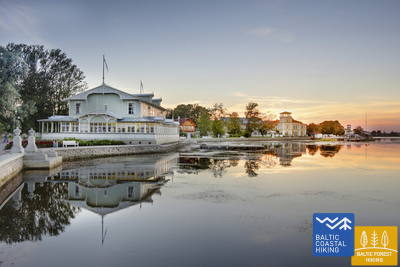
Populiariausias Estijos kurortas - Hapsalu
Įvairi Baltijos pakrantės pėsčiųjų maršruto atkarpa. Pirmieji trys maršruto kilometrai eina palei buvusią Haapsalu – Rohuküla plačiojo geležinkelio liniją, pasivaikščioti Haapsalu įlanka per Pulapė ragą, kerta pakrantės miškus, kuriuose yra sveikatingumo takai, o toliau – pakrantės promenadomis ir nedidelėmis gatvelėmis aplinkui. Haapsalu miestas. Pervažiavus nedidelę pelkę už miestelio, ši tako atkarpa baigiasi nuostabiame Uuemõisa parke.
Paralepas dabas taka un pludmale
Pažintinis takas prasideda automobilių stovėjimo aikštelėje (GPS: 58.940856, 23.515004) priešais Paralepos paplūdimį. Takas eina lygiagrečiai pakrantei, vingiuoja aplink seklią įlanką ir kerta nedidelę pelkę, pasiekiančią vakarinę Haapsalu miesto dalį. Tako ilgis 2 km viena kryptimi. Paviršius: asfaltuotas ir medinis lentų takas. Visas takas pasiekiamas neįgaliojo vežimėliu. Yra prieinamas tualetas. Pažintinis takas sutampa su Jūrtaka.


Haapsalu Väike Viik
Mažasis Vīks (Väike Viik) – buvusi įlanka, kuri anksčiau buvo atskirta nuo jūros, o dabar pamėgta paukščių. Jis yra šiaurinėje Haapsalu dalyje. Aplink nedidelį ežerėlį sukurtas apie 2 km ilgio takas, į kurį pilnai galės patekti ir žmonės vežimėliuose, ir tėveliai su vežimėliais. Paviršius sudarytas iš žvyro ir asfalto. Artimiausias prieinamas tualetas yra Haapsalu turizmo informacijos centre. Takas iš dalies persidengia su Jūrtakos taku.


Haapsalu Promenade and Africa Beach
Viena gražiausių pajūrio promenadų Estijoje driekiasi rytine Haapsalu pakrante 1,2 km. Paviršius išklotas trinkelėmis. Promenada per visą ilgį pritaikyta žmonėms su vežimėliais ir tėvams su vežimėliais. Netoli Afrikos paplūdimio yra vaikų žaidimų aikštelė ir paukščių stebėjimo bokštas. Tolimesnėje tako atkarpoje įrengtas neįgaliųjų vežimėlių įgūdžių lavinimo parkas, treniruokliai, žaidimų aikštelė, pritaikyta vaikams su funkcine negalia. Takas iš dalies persidengia su Jūrtakos taku.


Uuemõisa Manor Park
Parką kerta takų tinklas, prieinamas žmonėms su vežimėliais. Bendras takų ilgis apie 1,2 km. Tako paviršius žvyras. Takai iš dalies persidengia su Jūrtakos taku.


Atkarpa 49. Uuemõisa - Elbiku.
Aplink Hapsalu įlanką
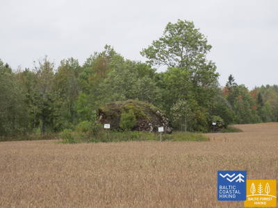
Baltijos pajūrio pėsčiųjų maršrutas daugiausia eina kelio pakraščiu ir vingiuoja tik mažesniais kaimo keliukais tarp Ingküla ir Aulepa kaimų, kur galėsite mėgautis kaimo kraštovaizdžiu su individualiomis sodybomis, rieduliais ir ganyklomis.
Uuemõisa Manor Park
Parką kerta takų tinklas, prieinamas žmonėms su vežimėliais. Bendras takų ilgis apie 1,2 km. Tako paviršius žvyras. Takai iš dalies persidengia su Jūrtakos taku.
Silma Workshop and Nature Reserve
Silmos dirbtuvės yra gamtos mokykla, įsikūrusi Silmos gamtos rezervate. Iš jo atsiveria vaizdas į apaugusį Haapsalu įlanką ir jos šakas, kuriose gausu paukščių ir augalų. Takas yra 0,4 km ilgio (atgal) su susidėvėjusio tako, žvyro ir žolės danga. Dirbtuvės yra pritaikytos neįgaliųjų vežimėliams, tačiau jai reikia pagalbos ir išankstinės registracijos, nes palei taką yra užtvara. Jis yra apie 3,5 km nuo Jūrtakos tako.
Atkarpa 51. Riguldi - Dirhami.
Vieta, paženklinta meteoritų
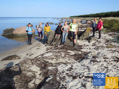
Išskyrus pirmus 3 km, maršrutas eina pajūriu. Tai daugiausia smėlėtas paplūdimys su gražiais priešakiais, pilkomis kopomis ir jūros rieduliais. Paplūdimys gali būti padengtas į krantą išplautos dumbliais ir retkarčiais apaugęs tankia augmenija. Priešais Rooslepos kaimą ir kitose vietose jūroje ir pajūryje stūkso prastai aptrupėję akmenys arba vadinamosios brekčios, kurios išsilydė ir aptrupėjo dėl senovinio meteorito sprogimo. Kelionės tikslo vietoje galite praleisti laiką užeigoje, o iš jos terasos atsiveria nuostabus vaizdas į jūrą ir uostą.
Roosta Beach
Nuo Rosta poilsio komplekso įrengti lentiniai takai, vedantys į kopas, į kuriuos gali patekti žmonės su vežimėliais.


Dirhami Port
Iš uosto automobilių stovėjimo aikštelės (GPS: 59.209328, 23.497846), kuri yra padengta žvyru (gali prireikti pagalbos), galite nuvykti į Dirhami žvejybos ir prekybos uosto doką. Už maždaug 300 metrų (asfaltuotas) galėsite mėgautis Suomijos įlankos pakrantės ir uosto vaizdais. Netoliese yra žavus Dirhami restoranas, į kurį galima patekti per specialią lentų rampą. Jis yra šalia Jūrtakos tako.


Atkarpa 52. Dirhami - Nõva.
Atšiauri Šiaurės gamta
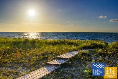
Kraštovaizdžiu išskirtinai įvairialypė Baltijos pajūrio pėsčiųjų maršruto atkarpa, kurioje jau galima pažvelgti į šiaurinei Estijos pakrantei būdingą gamtą. Maršrutas veda palei jūros pakrantę beveik visą ilgį, kur rasite nuostabių smėlio paplūdimių prie įlankų, paplūdimių, padengtų rieduliais prie kyšulių, o dolomito sluoksniai atsiskleidžia šiaurinėje Põõsaspea kyšulio dalyje (puiki paukščių stebėjimo vieta). Baltijos pajūrio žygių maršrutas eina per Nõvos gamtos rezervatą, kur atsiveria išskirtiniai baltųjų ir pilkųjų kopų vaizdai. Paplūdimiai yra populiarūs žvejybai ir jėgos aitvarams.
Dirhami Port
Iš uosto automobilių stovėjimo aikštelės (GPS: 59.209328, 23.497846), kuri yra padengta žvyru (gali prireikti pagalbos), galite nuvykti į Dirhami žvejybos ir prekybos uosto doką. Už maždaug 300 metrų (asfaltuotas) galėsite mėgautis Suomijos įlankos pakrantės ir uosto vaizdais. Netoliese yra žavus Dirhami restoranas, į kurį galima patekti per specialią lentų rampą. Jis yra šalia Jūrtakos tako.
Peraküla beach and camping site
Iš poilsio zonos ir automobilių stovėjimo aikštelės (GPS: 59.221567, 23.602891) mediniu lentiniu taku (0,1 km) pasieksite apžvalgos platformą, nuo kurios atsiveria vaizdas į Suomijos įlankos pakrantę. Gali prireikti pagalbos, nes dėl vėjo lentų takas kartais gali būti padengtas smėliu. WC yra dalinai prieinama. Vieta šalia Jūrtakos tako.


Atkarpa 58. Laulasmaa - Vääna-Jõesuu.
Gražiausias krioklys Estijoje
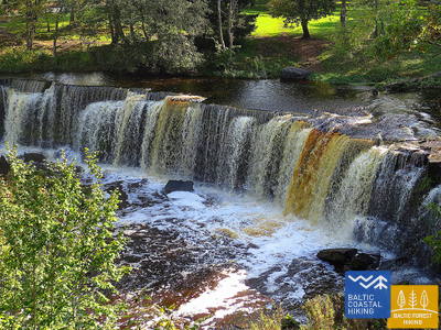
Kraštovaizdžiu įvairialypė Baltijos pajūrio pėsčiųjų maršruto atkarpa, tinkanti ištvermingiems žygeiviams. Čia yra ir akmenuotų, ir smėlėtų paplūdimių, puikių maudymosi vietų, žavingų pakrantės pušynų, stulbinančios Türisalu skardžio sienos ir milžiniškų jūros riedulių. Važiuojant didžiulio Keilos miško parko takais galima nukeliauti prie Keilos krioklio, prie kurio buvo nufilmuoti populiaraus latvių vaidybinio filmo „Vella kalpi“ („Velnio tarnai“) fragmentai, taip pat galima susipažinti su paroda, skirta pajūrio žvejų gyvenimas Lohusalu kaime.
RMK Keila-Joa Park nature trail
2,1 km ilgio takas lankytojus supažindina su angliškai suprojektuotu Keila-Joa parku ir populiariu Keilos kriokliu. Pirmieji 250 metrų, pradedant nuo automobilių stovėjimo aikštelės (GPS: 59.393587, 24.294767), yra prieinami žmonėms vežimėliuose su asistentu. Paviršius susideda iš žvyro, skaldos ir natūralaus tako. Takas yra šalia Jūrtakos tako.


Atkarpa 60. Tabasalu - Talino uostas.
Talinas - UNESCO pasaulio paveldo vieta
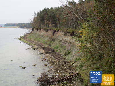
Netoli Tabasalu Baltijos pakrantės pėsčiųjų maršrutas kerta Talino ribą ir eina per Tiskre ir Vismeistri rajonus, kad pasiektų Kakumäe paplūdimį, kur galėsite pasivaikščioti po miškingą Kakumäe pusiasalio viršutinę dalį, apsuptą uolų. Čia atsiveria vaizdas į Talino uostą per Kopli įlanką. Priešais Õismäe rajoną palei pajūrį eina puiki promenada. Aplenkus Estijos muziejų po atviru dangumi, Baltijos pakrantės žygių maršrutas vingiuoja pakrantės promenada iki Stroomi paplūdimio, o pravažiavęs Pelguranos rajoną pėsčiųjų takais nukeliauja į Estijos jūrų muziejų, kur pakrantės promenada veda į. Talino uostą, žymintį Baltijos pajūrio žygių maršruto pabaigą. Estijoje įveikėte ~ 620 km.
Pēsakilas (Pääsküla) purva dabas taka
4 km ilgio takas lankytojus supažindina su įvairaus tipo miškais ir pelke. Du kilometrai tako pritaikyti žmonėms su vežimėliais. Jis yra apie 8,5 km nuo Jūrtakos tako.


Pikakari beach
Pikakari paplūdimyje yra pagalbinės plaukimo priemonės, persirengimo kambariai ir medinė rampa prieigai prie vandens. Paslaugą reikia užsisakyti iš anksto telefonu +372 5666 2455. Ji yra 2,5 km nuo Jūrtakos tako.
Atkarpa 64. Nida – Pervalka.
Kuršių marių pakrante
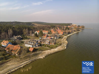
Jūrų takas prasideda Nidos centre prie uosto. Toliau jis vingiuoja Kuršių marių pakrante, nuo kurios atsiveria gražus vaizdas į plačius vandenis iki pat Rusnės salos Kuršių marių rytiniame krante. Nidoje galima pasigrožėti Kuršių nerijai būdinga architektūra: vieno aukšto mediniais pastatais su čerpių ar nendrių stogais, mėlynais ir baltais atspalviais dažytomis langinėmis. Nuo Nidos iki Bulvikio rago (prieš ragą – apleisto oro uosto kilimo takas) Jūrų takas vingiuoja mažais miško takeliais, vedančiais aukštyn ir žemyn per pušimis apaugusias kopas, vietomis išvesdamas į skurdžia augmenija pasidengusias pakrantės pievas. Šalia tako – poilsiavietės ir paukščių stebėjimo bokšteliai. Tolesnėje atkarpoje matomos labai savitos, kerpėmis ir Kuršių nerijai būdingų rūšių augalais apaugusios, atviros pakrantės pievos. Preilos gyvenvietėje Jūrų takas eina kranto promenada. Iki Pervalkos gyvenvietės jis vingiuoja miško takais ir pėsčiųjų / dviračių taku, kol pasiekia Pervalkos centrą. Ši atkarpa eina per Kuršių nerijos nacionalinį parką.
Nida Promenade
Maždaug 2 km nuo Nidos uosto palei Kuršių marias driekiasi Nidos promenada, skirta pėstiesiems ir dviratininkams. Jame yra gerai įrengtos poilsio zonos. Paviršius yra šiuolaikiškas grindinys ir yra prieinamas žmonėms su vežimėliais. Jis sutampa su Pajūrio taku.
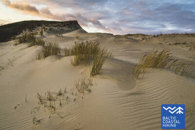
Atkarpa 65. Pervalka – Juodkrantė.
Per įspūdingiausias Šiaurės Europos smėlio kopas
Už Pervalkos Jūrų takas pėsčiųjų keliuku kerta Kuršių neriją rytų–vakarų kryptimi, pasiekiant Baltijos jūros pakrantę. Tolesnė atkarpa apie 13 km veda gražiu, smėlėtu paplūdimiu, kurį iš rytinės pusės riboja aukštas, status kopagūbris. Jis yra žmonių suformuotas, siekiant apsaugoti pusiasalį nuo smėlio slinkimo. Prieš Juodkrantę Jūrų takas pasisuka rytų kryptimi ir per miškais apaugusias stačias kopas vėl kerta Kuršių neriją, vesdamas Kuršių marių link. Nedidelė Jūrų tako atkarpa sutampa su Raganų kalno taku. Toliau Juodkrantės kranto promenada jis nuveda iki uosto. Atkarpa eina per Kuršių nerijos nacionalinį parką.
Juodkrantė Promenade
Juodkrantės promenada tęsiasi apie 1,4 km nuo Juodkrantės uosto palei Kuršių marias, skirta pėstiesiems ir dviratininkams. Jame yra gerai įrengtos poilsio zonos ir šiuolaikiška trinkelių danga. Jis yra prieinamas žmonėms su vežimėliais ir sutampa su Pajūrio taku.
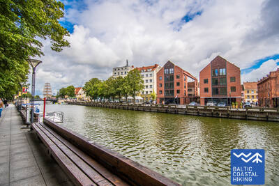
Atkarpa 66. Juodkrantė – Klaipėda.
Klaipėda – Lietuvos jūrų vartai
Palikęs Juodkrantės pakrantės promenadą, Jūrų takas šiaurės vakarų kryptimi kerta Kuršių neriją, eidamas mažais miško takais, kurie vingiuoja stačiais, pušimis apaugusiais kopų šlaitais, kol vėl išeina į Baltijos pajūrį. Tolesnius 9 km Jūrų takas veda pakrante, smėlėtais paplūdimiais. Rytinėje pusėje jį riboja stati kopa, sauganti neriją nuo vėjo pučiamo smėlio. Už Alksnynės gyvenvietės (nuo kranto nesimato) Jūrų takas pasisuka į rytus, kerta kalninių pušų Pinus mugo mišką ir Antrojo pasaulinio karo laikų vokiečių armijos karinę bazę, kol priartėja prie Kuršių marių kranto. Toliau Jūrų takas vingiuoja per pušimis apaugusias kopas, nuo kurių atsiveria vaizdai į Klaipėdos uostą. Maršrutas tarp Naujosios ir Senosios perkėlos iš pradžių veda mažu takeliu, o toliau – pamario promenada. Iš Senosios perkėlos, persikėlus per Kuršių marias, Jūrų takas veda į Klaipėdos centrą – Danės gatve iki Biržos tilto. Atkarpa iki kelto eina per Kuršių nerijos nacionalinį parką.
Juodkrantė Promenade
Juodkrantės promenada tęsiasi apie 1,4 km nuo Juodkrantės uosto palei Kuršių marias, skirta pėstiesiems ir dviratininkams. Jame yra gerai įrengtos poilsio zonos ir šiuolaikiška trinkelių danga. Jis yra prieinamas žmonėms su vežimėliais ir sutampa su Pajūrio taku.
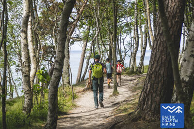
Atkarpa 67. Klaipėda – Palanga.
Pajūrio regioniniu parku
H. Manto gatve Jūrų takas veda per Klaipėdos centrą, kerta Klaipėdos poilsio parką, geležinkelį ir Melnragės gyvenvietės pietinėje dalyje išeina į Baltijos jūros pakrantę. Toliau jis vingiuoja pajūrio promenada ir kopas saugančiais mediniais takeliais, nusitęsia jaukiu takeliu per pajūrio miškus, einančiu apie 10–20 m atstumu nuo pėsčiųjų / dviračių tako per Antrąją Melnragę iki Girulių gyvenvietės. Prie Girulių jis trumpam išeina į paplūdimį, o nuo Kukuliškių iki Karklės gyvenvietės pietinės dalies Jūrų takas pradžioje vingiuoja labai gražiu buvusios Litorinos jūros krantu, apaugusiu neliestu mišku, toliau – palei vaizdingą, bangų nuskalautą skardį su keliomis regyklomis (įsk. Olando kepurę). Nuo Karklės gyvenvietės kitus 11 km iki Palangos Botanikos parko Jūrų takas veda smėlėtais, pilnais akmenukų paplūdimiais, kur vietomis pasitaiko ir didesnių akmenų. Einant Palangos Botanikos parko vakarinėje dalyje esančiais takeliais, Jūrų takas pasiekia Meilės alėją ir ja veda iki Palangos pėsčiųjų tilto. Didelė šios atkarpos dalis eina per Pajūrio regioninį parką.
Palanga Sea Bridge
Vienintelė tokio pobūdžio struktūra Baltijos šalyse. Paviršius susideda iš modernios grindinio prieš tiltą ir medžio ant paties tilto. Jis prieinamas žmonėms su vežimėliais. Taip pat pasiekiama pagrindinė Palangos pėsčiųjų gatvė J. Basanavičiaus gatvė. Jis yra netoli Pajūrio tako.

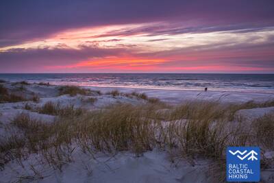
Atkarpa 68. Palanga – Lietuvos / Latvijos siena (Šventoji).
Populiariausiais Lietuvos pakrantės kurortais
Pėsčiųjų tilteliu kirtęs Rąžės upelį, Jūrų takas nuvingiuoja pėsčiųjų / bėgimo taku „Labrytys“ ir prie Kontininkų gatvės išeina į pajūrį. Kitus 9 km iki Šventosios senojo molo Jūrų takas tęsiasi smėlėtu, jūros skalaujamu paplūdimiu. Toliau jis daro lanką aplink Šventosios upės žiotis, veda per kurortinį miestelį, Kopų gatvės gale per kabančiu pėsčiųjų tiltu kerta Šventosios upę ir vėl išeina į paplūdimį. Prie šventvietės „Žemaičių Alka“ Jūrų takas dar kartą daro nedidelį lanką ir toliau smėlėtu paplūdimiu nuveda iki 3 km nutolusios Lietuvos–Latvijos sienos.
Palanga Sea Bridge
Vienintelė tokio pobūdžio struktūra Baltijos šalyse. Paviršius susideda iš modernios grindinio prieš tiltą ir medžio ant paties tilto. Jis prieinamas žmonėms su vežimėliais. Taip pat pasiekiama pagrindinė Palangos pėsčiųjų gatvė J. Basanavičiaus gatvė. Jis yra netoli Pajūrio tako.