


Baltic Forest Hiking - Banks of Nemunas

Along Nemunas river loops
Old forests around Punia, spectacular riverside bluffs and mineral water resorts
Nemunaitis – Alytus – Panemunis – Birštonas – Alksniakiemis – Pakuonis: 111 km, 5 or 6 days.
The Forest Trail meanders along the wooded banks of the Nemunas through Nemunas Loops Regional Park (Nemuno kilpų regioninis parkas). In the stretch of the Nemunas between Alytus and Pakuonis, where the river forms several large loops with outcrops up to 40 m high, exceptionally picturesque landscapes abound. Nemunaitis, like a majority of Lithuania’s small villages, features an impressive brick-and-stone church, while Alytus Castle-mound inhabited by ancient Lithuanians dates back to as early as the 14 th century. Today Alytus features the tallest pedestrian bridge in Lithuania and recreational parks. Birštonas, a resort town on the right bank of the Nemunas, is a popular mud therapy resort with springs of medicinal mineral water. At Birštonas, visitors can treat themselves with mineral water for free at specially designed public places.
 Section 57. Nemunaitis – Alytus.
Across the highest pedestrian bridge to Alytus
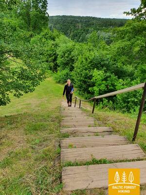
From Nemunaitis along Vytauto street and the Kaniūkai–Einorai–Nemunaitis road (no. 1102), the Forest Trail goes 1.5 km in northeast direction, then turns left to the north and after 3 km reaches Gečialaukis village. Then the Forest Trail turns right to the east and after 3.3 km meets the road No. 1102 again. After another 3.3 km, the Forest Trail reaches road No.128 and descends along the sidewalk in the Nemunas valley. From here, a beautiful trail in the Nemunas valley with a length of more than 3 km leads through the forest to a pedestrian bridge across the river. After a long ascent to the highest pedestrian bridge in Lithuania, there opens a view of the endless and mighty landscape of the Nemunas. After the bridge, the Forest Trail passes along the former railway dam, meanders along the streets of the Alytus resort park, and in the centre of the town, along S. Dariaus and S. Girėno street goes to the Old Town Square. The Alytus Tourism Information Center is located on its southern side.
 Section 58. Alytus – Panemunis.
Along the hills of the Dzūkija Upland
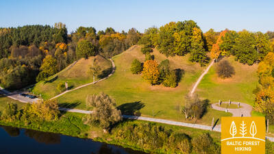
From Alytus, the Forest Trail takes you along Vilniaus street, crosses the Nemunas through the A. Juozapavičiaus Bridge, then turns left to the north along Jiezno street and further crosses the Normandy–Nemunas road along Miškininkų street (No. 1334). Having passed almost 2 km through the forest, the Forest Trail comes out on a small country road and goes another 8 km in a northern direction. There are vast and open landscapes of the Dzūkija Upland in this area. After Staniava village the Forest Trail leads down a beautiful forest road to the Nemunas and then up a steep slope to the Punia castle mound, which overlooks the river. Along the Punia church along Kauno, Šilo and Birštono streets, after less than 4 km, the Forest Trail reaches a larger forest massif. Crossing it, after 5 km the Forest Trail comes out to Nemajūnai village. 3.5 km away is the destination of this section.
Section 59. Panemunis – Birštonas.
Nemunas loops and ethnographic farmsteads
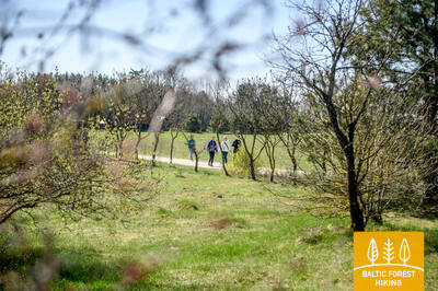
Repeating the loops of the Nemunas, the Forest Trail throws more than 20 km long bends in Nemunas Loops Regional Park, winding through open landscapes and small villages with typical wooden buildings painted in different shades. A larger forest massif there is only between Siponiai and Puzoniai villages, through which the route leads along small forest roads. Crossing the Vilnius–Marijampolė road (A16), the Forest Trail descends to the next circle of the Nemunas, where the popular Birštonas resort is located. Along the sidewalk of B. Sruogos street, the Forest Trail reaches the Birštonas Tourism Information Center.

Section 60. Birštonas – Alksniakiemis.
Through the Birštonas resort
After the Birštonas Tourist Information Centre, the Forest Trail leads for more than 1 km along the Nemunas bank promenade, then turns onto Algirdo street, crosses Vytautas Jurgis Meška Park, returns to the promenade and after 0.6 km turns onto the pedestrian and bicycle path. The path crosses the Žvėrinčiaus forest for about 5 km, and then the leads through the Paprienė recreation area, reaching the Greimų bridge over the Nemunas river. Behind the bridge the Forest Trail moves along the Vytauto, Nemuno, J. Zdebskio, Kęstučio, J. Basanavičiaus streets and along Kęstučio street (No. 3306) exits from the central part of Prienai. Along Paupio street, it forms a loop around the Nemunas and about 7 km from the centre of Prienai turns left to northeast towards Alksniakiemis. Part of this section is located in Nemunas Loops Regional Park.
Section 61. Alksniakiemis – Pakuonis.
Along the banks of the Nemunas through the Kalviai forest
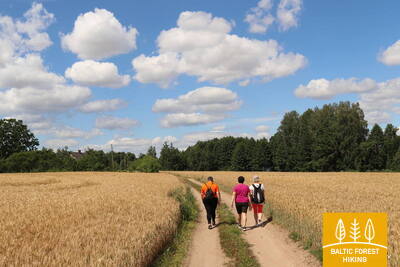
From Alksniakiemis, the Forest Trail winds along a small country road on the left bank of the Nemunas and forms a more than 7 km long loop of forest roads and trails through the Kalviai Forest Massif (Kalvių Miškas). From Vangai village to Pašventupys, about 3 km, the Forest Trail winds along the banks of the Nemunas, from which picturesque panoramas open. Hikers will be delighted by the ever-changing landscape: small villages with gardens and fields sinking in the flowers in spring and summer, as well as fishing boats or other little boats on the flat river bank. From Pašventupys village the Forest Trail by road No. 3313 after about 3 km reaches the centre of Pakuonis town.