Baltic Coastal Hiking trail - City hikes
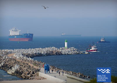
 Atkarpa 3. Bernāti - Liepāja - Karosta (Karinis uostas).
Miestas, kuriame gimsta vėjas
Nuo Bernatų iki Liepojos Baltijos pajūrio pėsčiųjų maršrutas veda plačiu paplūdimiu, kur iš pradžių pakrantę formuoja išplautos krantai, tačiau artėjant prie Liepojos akyse iškyla aukšti priedangos, apaugusios smėlynėmis svidrėmis ir marražolėmis. Vėliau takas vingiuoja per Liepojos senamiestį ir „Naująją Liepoją“, kertant Karinio jūrų laivyno uosto kanalą ir pasiekti Karinių jūrų pajėgų uostą: karinių ir fortifikacinių pastatų kompleksą, kurio apžiūra, tikėtina, užtruks pusę dienos. Neabejotinai turėtumėte paragauti ypatingo Liepojos patiekalo, vadinamo Liepājas menciņi , pagamintą iš rūkytos menkės pagal senovinį Pietų Kuržemės receptą.
Verta skirti bent 1-2 dienas apžiūrėti Liepojos istorinį centrą, įskaitant Prekybos kanalo pakrantes, Arklio salą, Liepojos fortus ir Karostą. Karosta yra vienas įspūdingiausių Latvijos karinio paveldo objektų, kuriame yra įvairių galios epochų liudininkai, pavyzdžiui, Karostos kalėjimas, Šiaurės fortai ir Oskaro Kalpako tiltas. Vietovė puikiai tinka fotosesijoms, fotografavimui, filmavimui ir tyrinėjimams.
 Atkarpa 10. Ventspils - Staldzene.
Ventspilio miestu
Maršrutas driekiasi per Ventspilį ir aplinkinius miškus. Baltijos pajūrio pėsčiųjų maršrutas vingiuoja nuo pietinio molo per istorinį Ostgalą ir senamiestį, kerta Ventos upę ir tęsiasi per Parventos rajoną pėsčiųjų ir dviratininkų taku Staldzenės kryptimi, kur apvažiuoja Ventspilio uostą ir grįžta į jūros pakrantė. Verta pasiimti vieną „laisvą dieną“ ir susipažinti su įdomiausiomis miesto vietomis, taip pat apsilankyti Pajūrio muziejuje po atviru dangumi.
Ventspilio istoriniame centre, jo apylinkėse ir pakrantėje gausu tiek kultūros ir pramonės paveldo, tiek karinės istorijos. Tai apima pakrančių gynybos baterijas, buvusius raketų laikymo bunkerius, paleidimo vietas ir kitas svarbias vietas. Vietovė siūlo intriguojančias galimybes miesto žygiams, tyrinėjimams, nuotraukų ir vaizdo sesijoms.
 Atkarpa 23. Buldurai – Rygos centras.
Per miškus į Rygą
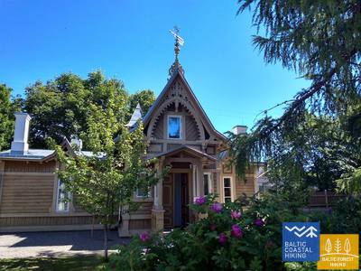
Maršrutas yra alternatyvus būdas, norint iš Jūrmalos patekti į Rygą, einant mišku. Už Lielupės tilto Jūrų takas vingiuoja per Priedainę, kurioje galima pasigėrėti mediniais pastatais. Toliau maršrutas eina lygiagrečiai dešiniajam Lielupės krantui, tada pasuka palei pietinę Bolderajas kopos dalį ir kerta Kleistų mišką, vingiuodamas palei Lačupės kapines. Istoriniais Pardaugavos keliais – Buļļu ir Daugavgrīvas gatvėmis per Dzegužkalną, palei Zunda kanalą ir Agenskalno įlanką veda iki Dauguvos, kur Akmens tiltu kerta Dauguvą ir sustoja Rygos Rotušės aikštėje.
Įdomi atkarpa tarp Jūrmalos ir centrinės Rygos apima: Priedainės istorinius pastatus, Spilvės pievas ir Kleistų mišką su I pasaulinio karo latvių šaulių mūšių vietomis, Pārdaugavos plėtrą, buvusią Iļģuciems pramoninę zoną (XIX-XX a.) su Dzegužkalnu, Zundos krantinę, Ķīpsalą. plėtra ir muziejai bei Agenskalno įlanka ir Dauguvos tiltai kaip pramonės paveldo pavyzdžiai.
 Atkarpa 24. Rygos centras - Vecāķi.
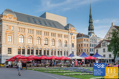
Rygos senamiestis - UNESCO pasaulio paveldo objektas
Iš pradžių kelionės programa nuves jus į nedidelį pasivaikščiojimą po Rygos centrą, Rygos senamiestį, veda palei miesto kanalą per Kronvalds parką, per Alberta gatvę (Art Nouveau pastatai) ir toliau per Miera gatvę per Lielie kapi kapines, per Kokneses ir Ostas prospektu per Mežaparką ir tada pasiekia Jaunmīlgrāvį ir kerta Mīlgravį . Toliau vingiuoja Vecāķu prospektu iki Ziemeļblāzmos ir Senosios Dauguvos (Vecdaugavos) krantų, kuriuos nuo Vecākių skiria vos pora kilometrų. Po dviejų dienų žygio per Rygą Baltijos pakrantės žygių maršrutas vėl nuves į paplūdimį.
Senoji Ryga (įtraukta į UNESCO pasaulio paveldo sąrašą), istorinis Rygos centras su bažnyčiomis, Kanalo krantine, Laisvės paminklu ir Alberto gatvė (žymima Art Nouveau architektūra). Taip pat įdomios Rygos „žaliosios zonos“ – Biķerniekų ir Šmerli miškai.
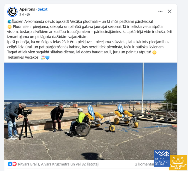
Izeja uz Vecāķu pludmali
Į Vecākių paplūdimį lengva patekti iš Selgas gatvės Vecākiuose. Yra automobilių stovėjimo aikštelė, privažiavimo takas prie jūros ir persirengimo kabina.
 Atkarpa 34. Uulu - Pärnu.
Palei raistus į Pernu
Pirmiausia Baltijos pajūrio pėsčiųjų maršrutas eina senais pakrantės keliais, apsuptais pušynų, tačiau pravažiavus Lottemaa parką pasuka jūros link ir išeina į Reiu paplūdimį. Toliau žygis tęsiasi per apaugusį paplūdimį (plačios seklumos, kai vėjas sukuria vandens nutekėjimą) ir už kiek mažiau nei 4 km reikia sukti į vidų, kirsti golfo aikštyną ir sukti Pernu kryptimi. Netoli Raeküla rajono, jis gyvatės nedideliu takeliu, sudarantis ribą tarp didelės pakrantės pelkės ir miško. Apėjus šlapžemę ~ 6 km, Pernu paplūdimyje išnyra Baltijos pajūrio žygių maršrutas. Toliau kelias eina per vakarinę Pernu senamiesčio dalį, kerta Pernu ir Saugos upes ir baigiasi Vana-Pernu rajone.
Pernu apylinkės, pakrantė, kurortas su moderniais SPA viešbučiais ir senais mediniais pastatais, miesto centras, senamiestis – tinkama vieta miesto žygiams, foto, video sesijoms.
 Atkarpa 48. Rohuküla - Haapsalu - Uuemõisa.
Populiariausias Estijos kurortas - Hapsalu
Įvairi Baltijos pakrantės pėsčiųjų maršruto atkarpa. Pirmieji trys maršruto kilometrai eina palei buvusią Haapsalu – Rohuküla plačiojo geležinkelio liniją, pasivaikščioti Haapsalu įlanka per Pulapė ragą, kerta pakrantės miškus, kuriuose yra sveikatingumo takai, o toliau – pakrantės promenadomis ir nedidelėmis gatvelėmis aplinkui. Haapsalu miestas. Pervažiavus nedidelę pelkę už miestelio, ši tako atkarpa baigiasi nuostabiame Uuemõisa parke.
Haapsalu miesto istoriją galima tyrinėti plačioje laiko juostoje – pradedant viduramžių pilies griuvėsiais, tęsiant istorinio Haapsalu kurorto gatvėmis ir jo mediniais pastatais ir baigiant modernia architektūra.
 Atkarpa 55. Padise - Paldiski.
Paldiski - buvęs uždaras ir ypatingai slaptas miestas
Baltijos pajūrio pėsčiųjų maršrutas, prasidėjęs nuo Padisės iki Karilės, vingiuoja nedideliais kaimo keliukais, o toliau iki Madisės eina pakraščiu. Nuo senovinės Madise bažnyčios kalvos pakrantės atsiveria nuostabūs Paldiski įlankos ir Pakri salų vaizdai. Nuo Madisės iki Paldiskio maršrutas tęsiasi aukščiau minėto kelio puse iki Pietų uosto ir juo einant pasiekiama pietinėje Paldiski dalyje esanti geležinkelio stotis. Sovietmečiu Paldiskis buvo uždaras miestelis su kariniu uostu ir šalia esančia atominių povandeninių laivų mokymo baze Pakri pusiasalyje, kuri veikė naudojant nedidelį branduolinį reaktorių.
Paldiski miestas ir jo apylinkės (pramoninė aplinka, ankstesnių amžių kultūros paminklai, geležinkelis), buvusių fortifikacinių sistemų liekanos, XX a. buvusios karinės teritorijos tinka miesto žygiams ir foto-video sesijoms. Sovietmečiu Pakri pusiasalis buvo uždara karinė teritorija.
 Atkarpa 60. Tabasalu - Talino uostas.
Talinas - UNESCO pasaulio paveldo vieta
Netoli Tabasalu Baltijos pakrantės pėsčiųjų maršrutas kerta Talino ribą ir eina per Tiskre ir Vismeistri rajonus, kad pasiektų Kakumäe paplūdimį, kur galėsite pasivaikščioti po miškingą Kakumäe pusiasalio viršutinę dalį, apsuptą uolų. Čia atsiveria vaizdas į Talino uostą per Kopli įlanką. Priešais Õismäe rajoną palei pajūrį eina puiki promenada. Aplenkus Estijos muziejų po atviru dangumi, Baltijos pakrantės žygių maršrutas vingiuoja pakrantės promenada iki Stroomi paplūdimio, o pravažiavęs Pelguranos rajoną pėsčiųjų takais nukeliauja į Estijos jūrų muziejų, kur pakrantės promenada veda į. Talino uostą, žymintį Baltijos pajūrio žygių maršruto pabaigą. Estijoje įveikėte ~ 620 km.
Labai įdomi atkarpa – tiek Talino miesto apylinkės, tiek centrinė dalis (Lėktuvų uostas, Patarei jūros tvirtovė, promenados), tiek istorinis Talino centras – UNESCO paveldo objektas, tinkantis bet kuriuo metų laiku pasivaikščioti miestu ir foto-video sesijos.
 Atkarpa 67. Klaipėda – Palanga.
Pajūrio regioniniu parku
H. Manto gatve Jūrų takas veda per Klaipėdos centrą, kerta Klaipėdos poilsio parką, geležinkelį ir Melnragės gyvenvietės pietinėje dalyje išeina į Baltijos jūros pakrantę. Toliau jis vingiuoja pajūrio promenada ir kopas saugančiais mediniais takeliais, nusitęsia jaukiu takeliu per pajūrio miškus, einančiu apie 10–20 m atstumu nuo pėsčiųjų / dviračių tako per Antrąją Melnragę iki Girulių gyvenvietės. Prie Girulių jis trumpam išeina į paplūdimį, o nuo Kukuliškių iki Karklės gyvenvietės pietinės dalies Jūrų takas pradžioje vingiuoja labai gražiu buvusios Litorinos jūros krantu, apaugusiu neliestu mišku, toliau – palei vaizdingą, bangų nuskalautą skardį su keliomis regyklomis (įsk. Olando kepurę). Nuo Karklės gyvenvietės kitus 11 km iki Palangos Botanikos parko Jūrų takas veda smėlėtais, pilnais akmenukų paplūdimiais, kur vietomis pasitaiko ir didesnių akmenų. Einant Palangos Botanikos parko vakarinėje dalyje esančiais takeliais, Jūrų takas pasiekia Meilės alėją ir ja veda iki Palangos pėsčiųjų tilto. Didelė šios atkarpos dalis eina per Pajūrio regioninį parką.
Istorinis Klaipėdos centras su įvairiais karinio paveldo laikotarpiais mieste, Kuršių nerijos (Kopgalio) šiaurine dalimi, Girulių apylinkėmis yra tinkama vieta apžiūrėti įvairius urbanistikos objektus, apžiūrėti, nuotr. , ir vaizdo sesijos.
 Atkarpa 73. Dreverna – Klaipėda.
Palei karaliaus Vilhelmo kanalą į Klaipėdą
Už Drevernos kaimo Jūrų takas Priekulės keliu (Nr. 2206) kerta Drevernos upę, Klišupę ir Karaliaus Vilhelmo kanalą, už kurio sukasi į kairę ir 9 km kaip medžių lapija padengta alėja vingiuoja palei rytinį istorinio kanalo krantą. Čia įrengtos poilsiavietės ir turizmo informacijos stendai, pasakojantys apie apylinkių gamtinę įvairovę. Dar po 4 km Jūrų takas pasiekia Kairių gatvę, o einant toliau galima grožėtis miesto aplinka. Nuo Jūrininkų prospekto iki Baltijos prospekto Jūrų takas vingiuoja miesto parkų pėsčiųjų takais, kirsdamas Sąjūdžio, Reikjaviko, Draugystės ir kt. parkus. Kirtęs Baltijos prospektą, maršrutas toliau veda Taikos prospekto pėsčiųjų takais ir šaligatviais, o už 3 km pasiekia Biržos tiltą.
Vilhelmo kanalas, Klaipėdos priemiestis su apylinkėmis, pasivaikščiojimas po miestą tinka urbanistinio kraštovaizdžio ir pramonės paveldo entuziastams.


