


Baltic Coastal Hiking trail - Winter bliss

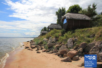
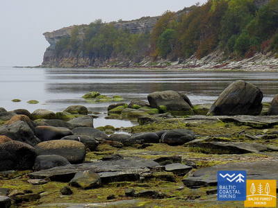
 Section 16. Kolka - Ģipka.
Along The “Closed Coast”
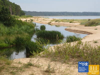
At Cape Kolka, when turning towards the Gulf, you can clearly see the difference between the “Great Sea” and the “Little Sea”. The first 10 km of the Baltic Coastal Hiking Route lead through the coastal area of the Slītere National Park: first, past pine trees that are washed into the sea, past the building of a former fishing kolkhoz, a ship berth and Ēvaži Bluff which is surrounded by an unusually narrow sandy beach with overhanging black alders. The next section of the trail leading to Ģipka also has a narrow sandy beach with pools created by the rich springfens and the mouths of small streams that are shallow in summer. During Soviet times, the seacoast of the Slītere National Park was a closed territory for two reasons: it was a frontier zone and a nature reserve.
If there is a sufficiently thick snow cover on the beach, you can ski from Ģipka to Kolka village using cross-country skis. Streams that flow into the sea should not be crossed on ice; instead, look for the nearest bridge.
 Section 18. Kaltene - Mērsrags.
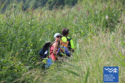
The Multifarious Coast
A truly multifaceted section of the Baltic Coastal Hiking Route in terms of nature, cultural history and scenery. Near Kaltene village, the seashore is speckled with small coves with rocky beaches followed by a thickly overgrown coast where a narrow trail winds its way through reeds and lush vegetation. Further on, the seacoast covered in stones is only a couple of meters wide, in some places it has layers of clay, fields of reeds, in other places, it is carpeted with the algae washed ashore. Sandy beaches with shoals in the sea reappear between Valgalciems village and Mērsrags village. After passing Mērsrags village, the itinerary continues on a road, but when you reach the Lutheran church it turns towards the sea and goes through the coastal meadows as far as the center of Mērsrags village.
If there is a sufficiently thick snow cover on the beach, you can ski from Valgalciems to Mērsrags using cross-country skis.
Section 19. Mērsrags - Engure.
In the Engure Nature Park
A forest trail surrounded by pine trees leads you from the center of the village to the beach. Next, the Baltic Coastal Hiking Route meanders between a rocky seacoast richly overgrown with reeds and other grasses on one side and wooded seaside dunes on the other side. In some places, the beach is paved with small round stones, in other places you can see grey dunes with a rich variety of plants. Near Bērzciems village, there are large coastal meadows with shoals appearing far away in the sea that are suited for birdwatching. Overgrown seacoast continues up to Abragciems village, while from Abragciems to Engure there is a beach.
If there is a sufficiently thick and durable snow cover on the beach and in the forest, you can ski from Mērsrags to Engure using cross-country skis. The route alternates between the beach and the old fishermen's trails that run parallel to the coast.
 Section 20. Engure - Ragaciems.
Fishing Villages And Smoked Fish
At first, the Baltic Coastal Hiking Route winds through Engure village, then leads through a comparatively narrow beach on one side and beautiful woody seaside dunes on the other side reaching Plieņciems Dune after which the sandy beach becomes increasingly wider and large shoals appear in the sea. On the coast, overgrown bluffs equipped with stairs and plank-ways rise before your eyes and stretch as far as the road connecting Kolka and Tukums. You have to take into consideration that on warm summer days a lot of holidaymakers come here. The last third of the itinerary is located in Ķemeri National Park.
If there is a sufficiently thick snow cover on the beach, you can ski from Engure to Ragaciems using cross-country skis. Note that the beach at Engure is rocky.
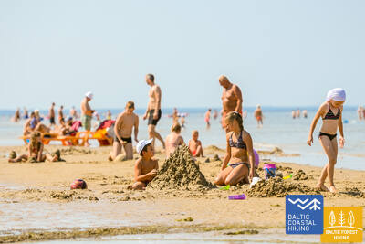
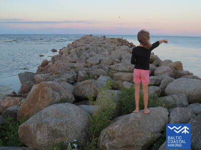
Section 21. Ragaciems - Dubulti.
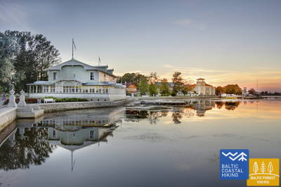
The Historic Resort of Jūrmala
In Ragaciems village, you can clearly see the whole length of the Jūrmala coast. The first third of this day's itinerary is part of the Ķemeri National Park where you can get to know historic fishing villages, the Ragaciems village fishing area with net huts and a fish market, dune habitats, as well as watch birds in the estuary of the Starpiņupe River. Starting from Jaunķemeri to Dubulti, the walk takes you across the widest sandy beach of the Gulf of Riga through the historic resort in Jūrmala and the longest city in Latvia. Keep in mind that on warm and sunny summer days there will be a lot of beachgoers.
The coastal stretch from Ragaciems to Bulduri along the shoreline (dunes) is suitable for skiing with cross-country skis or walking during the winter. This area is ideal for walks of varying lengths, with extensive public transportation options running parallel to the route.

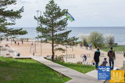
Section 22. Dubulti - Lielupe - Bulduri.
The Most Popular Beaches in Latvia
The widest sandy beach of the Gulf of Riga stretches from Dubulti to the Lielupe River. It is the main asset of the Jūrmala resort offering many beach cafés and different recreational possibilities. The coastal dune forests are permeated with a dense web of trails suitable for walking and stick-walking. The part of the Baltic Coastal Hiking Route located between the beach of the Lielupe River and Jūrmala beach is part of the Ragakāpa Nature Park. From here, you can easily get back to Bulduri by taking Bulduri prospekts and the 5th line.
The coastal stretch from Dubulti to Bulduri along the shoreline (dunes) is suitable for cross-country skiing or walking in winter. It is ideal for walks of varying lengths, with extensive public transportation options available along the route.
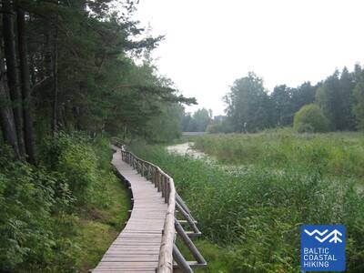
Section 25. Vecāķi - Carnikava.
Between The Estuaries Of Two Rivers: The Daugava River And The Gauja River
This sections of the Baltic Coastal Hiking Route is a comparatively short hike across a beautiful sandy beach, the coastal side of which is bounded by brightly colored pine forests with spectacular dunes and dams of dunes. To get from the beach to Carnikava, the Baltic Coastal Hiking Route will take you through a forest via a promenade. Then it takes a stroll around the Old Gauja River via a levee and reaches the pedestrian bridge over the Gauja River. Both as you start and end the hike, it is nice to sit in one of the pubs and summer cafés located on Vecāķi beach and in Carnikava.
If there is a sufficiently thick snow cover on the beach, you can ski from Vecāķi to the Carnikava promenade using cross-country skis.
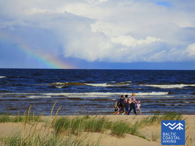
Section 26. Carnikava - Saulkrasti.
The Sunset Trail With Romantic Sunset Vistas
Initially, the itinerary leads you through the Gauja River levees in Gauja village reaching the estuary of the Gauja River, which is a good place for bird watching. The hike continues along a sandy beach up to the estuary of the Inčupe River, before which you have to turn inland to get to a bridge and to cover the next couple of kilometers across the wooded dune tops of the Sunset Trail with a view of the beach. After crossing the Pēterupe River (cable bridge), the Baltic Coastal Hiking Route continues along the beach and reaches the Sea Park in Saulkrasti.
If there is a sufficiently thick snow cover on the beach, you can ski from the Gaujai Estuary to Saulkrasti using cross-country skis. Small streams should be crossed using nearby bridges in winter (never attempt to cross them on ice!).
Section 28. Lauči - Tūja.
The Bygone Times Of Sailing Ships
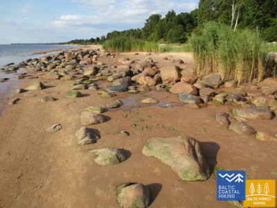
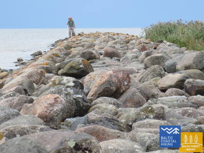
This section of the seacoast of Vidzeme is of outstanding scenic beauty with a lot of rocky capes and boulders in the sea alternating with small, sandy coves where the small streams and rivulets, which dry out in summer, flow into. Occasionally, the beach is completely covered with the gray backs of stones. In some places, small patches of reeds appear, while near Tūja you will see the first sandstone outcrops.
In winter, when there isn't deep snow but there has been frost, interesting ice formations can develop along the Gulf of Riga's coast, both on the shoreline and on the many rocks (such as icicles and other formations). This makes the area suitable for winter hiking.
Section 29. Tūja - Svētciems.
The Rocky Beach of Vidzeme
One of the most beautiful sections of the Baltic Coastal Hiking Route, which begins by crossing the Zaķupīte River. Up to the Ķurmrags Lighthouse, there are mostly sandy beaches with small sections of stones. Further on, the Rocky Seashore of Vidzeme starts: capes alternate with small coves, while 4 m high sandstone outcrops emerge on the coast. Sandy beaches continue to prevail after passing Cape Meleki, while before the mouth of the Svētupe River the beach is thickly overgrown and reedy, so it must be bypassed via a forest trail.
Between Veczemes and Meleki, there is a small path along the coastline that is suitable for winter walks.
Section 30. Svētciems - Ainaži.
The Lamprey Kingdom
The beach between Svētciems village and Salacgrīva is thickly overgrown, so the Baltic Coastal Hiking Route continues on a forest trail meandering among the dunes. To get from Salacgrīva to Kuiviži, you can take the sandy beach or forest trails. From Kuiviži to the Vēverupe River, you have to bypass the Randu Meadows via a forest road located on the east side of the A1 road. After passing the Vēverupe River, the Baltic Coastal Hiking Route returns to a thickly overgrown beach and then leaves it next to the estuary of the Blusupīte River to reach Ainaži Pier by going along Kāpu and Valdemāra iela. You have covered ~ 580 km in Latvia and reached the state border.
In winter, when there is no thick snow cover, the following areas are suitable for winter hiking.
Section 48. Rohuküla - Haapsalu - Uuemõisa.
The Most Popular Resort in Estonia - Haapsalu
A multifarious section of the Baltic Coastal Hiking Route. The first three kilometres of the itinerary go along the former Haapsalu – Rohuküla broad-gauge railway line, takes you on a stroll along Haapsalu Bay through Pullapää cape, crosses coastal forests, which contain health trails, and continues via coastal promenades and small streets around Haapsalu Town. After crossing a small wetland beyond the town, this section of the trail ends in the beautiful Uuemõisa Park.
In cold winters, when Haapsalu Bay freezes over, an official ice road is created across it (about one and a half kilometers long), which can be used by light vehicles.
Section 54. Vihterpalu - Padise.
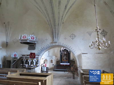
A Seven Centuries Old Church and Monastery
The south shore of the Kurkse Strait is covered in wetlands, so the Baltic Coastal Hiking Route turns inland. The greatest part of the Baltic Coastal Hiking Route leads you through large, sparsely inhabited tracts of forest (corresponding with the trail created by the Estonian State Forest Management Centre: Peraküla – Aegviidu – Ähijärve) and sometimes takes you to a more open space or a village.
In snowy winters, Padise has excellent ski trails. The pond behind Padise Manor also freezes over, creating a great natural ice rink.
Section 56. Paldiski - Kersalu.
Cliffs, a Lighthouse and Military Heritage
The Baltic Coastal Hiking Route leads around the Pakri Peninsula, from whose rocky shores you will discover the most beautiful coastal landscapes in northwest Estonia. It goes through the centre of Paldiski and, after having reached the fortress bastions of Peter I, it turns towards the Pakri Lighthouse going across the upper part of the impressive Pakri Cliffs. Further on up to Kersalu, there are both ups in the shape of rocks and downs where the Baltic Coastal Hiking Route meanders along a sandy and rocky seacoast and a beautiful pine forest. Pakri Cliffs are alluring both in cold winters, when impressive icefalls are formed here, and during the time of colourful leaves in autumn.
In cold winters, fantastic icefalls and other ice formations of incredible shapes form on the Pakri cliffs (a beautiful place for photography).