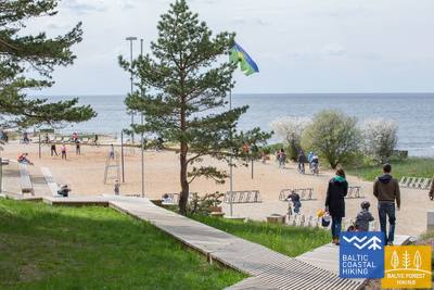
Baltic Coastal Hiking trail - Winter bliss
 16. posms. Kolka - Ģipka.
Gar "slēgto krastu"
Pagriežoties no Kolkasraga uz līča pusi, manāma atšķirība starp Dižjūru un Mazjūru. Jūrtakas pirmie 10 km ved pa Slīteres nacionālā parka piekrasti: sākumā gar jūrā ieskalotajām priedēm, gar kādreizējām zvejas kolhoza ēkām, kuģu piestātni un Ēvažu stāvkrastu, kura apkaimē ir neparasti šaurs, smilšains liedags ar tam pāri līkstošiem melnalkšņiem. Arī tālākajā posmā līdz Ģipkai raksturīgs šaurs, smilšains liedags ar bagātīgo avoksnāju veidotām lāmām un nelielu, vasarā – seklu upīšu ietekām. Slīteres krasts kādreiz bija divkārt slēgta teritorija – te bija pierobežas režīma zona un dabas rezervāts.
Lībiešu valodā Kolka senais nosaukums Kūolka, Melnsils / Mustānum un Ģipka / Gipk.
 18. posms. Kaltene - Mērsrags.
Daudzveidīgais krasts
Maršruts piemērots aktīviem un izveicīgiem gājējiem! Dabas, kultūrvēstures pieminekļu un ainavu ziņā – ļoti daudzveidīgs Jūrtakas posms. Pie Kaltenes jūras krastu izraibina nelieli līcīši ar akmeņainām pludmalēm, bet tālāk seko ļoti aizaudzis jūras krasts, kur starp niedrēm un bagātīgi sazēlušo augāju iemīta šaura taciņa. Tālāk akmeņiem klātais jūras krasts ir tikai dažus metrus plats, vietām ar māla slāņiem, niedru laukiem, citviet ar izskalotajām aļģēm klāts. Posmā no Valgalciema līdz Mērsragam atkal parādās smilšaini liedagi ar sēkļiem jūrā. Aiz Mērsraga maršruts turpinās pa ceļu, bet pie luterāņu baznīcas – nogriežas uz jūras pusi un līdz pat Mērsraga centram iet gar Piejūras pļavu.
 19. posms. Mērsrags - Engure.
Engures dabas parkā
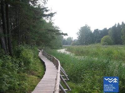
Maršruts piemērots aktīviem gājējiem. No ciema centra līdz pludmalei aizved meža ceļs, ko ieskauj priežu mežs. Tālāk Jūrtaka ved pa takām, kas izlokas starp niedrēm un citiem zālaugiem bagātīgi apaugušo un akmeņaino jūras krastu vienā un mežainām jūrmalas kāpām – otrā pusē. Dažviet liedags ir nobruģēts ar maziem, apaļiem akmeņiem, citur redzamas pelēkās kāpas ar bagātīgu augu sugu klāstu. Bērzciema apkaimē plešas piejūras pļavas ar sēkļiem tālu jūrā, kas ir laba putnu vērošanas vieta. Līdz Abragciemam turpinās aizaugušais jūras krasts, bet no Abragciema līdz Engurei ir liedags.
 20. posms. Engure - Ragaciems.
Zvejniekciemi un kūpinātas zivis
Maršruts, kura pēdējā trešdaļa atrodas Ķemeru nacionālajā parkā, piemērots aktīviem gājējiem. Sākotnēji Jūrtaka izvijas cauri Engures ciemam, tad pa salīdzinoši šauru liedagu vienā pusē un skaistām mežainām jūrmalas kāpām otrā pusē aizved līdz Plieņciema kāpai, kur tālākajā posmā smilšainais liedags kļūst aizvien plašāks, bet jūrā parādās plaši sēkļi. Sauszemes virzienā šeit paceļas apauguši stāvkrasti ar kāpnēm un labiekārtotām laipām līdz Kolkas - Tukuma autoceļam. Jārēķinās, ka siltās vasaras dienās šeit ir daudz atpūtnieku.
 21. posms. Ragaciems - Dubulti.
Vēsturiskais Jūrmalas kūrorts
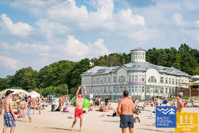
No Ragaciema labi redzams Jūrmalas krasts visā tā garumā. Šīs dienas posma pirmā trešdaļa ietilpst Ķemeru Nacionālajā parkā, kur var iepazīt vēsturiskos zvejniekciemus, Ragaciema sedumu un zivju tirdziņu, kāpu biotopus, kā arī vērot putnus Starpiņupītes grīvā. No Jaunķemeriem līdz pat Dubultiem gājiens norit pa Rīgas jūras līča platāko smilšu pludmali, cauri Jūrmalas vēsturiskajam kūrortam un Latvijas garākajai pilsētai. Skaistās un siltās vasaras dienās jārēķinās ar daudzajiem pludmales apmeklētājiem.
 22. posms. Dubulti - Lielupe - Bulduri.
Populārākās Latvijas pludmales
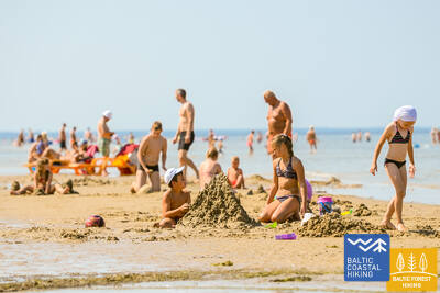
Maršruts piemērots ikviena vecuma un fiziskās sagatavotības gājējam. Starp Dubultiem un Lielupi plešas Rīgas jūras līča platākais smilšu liedags – Jūrmalas kūrorta nozīmīgākā vērtība ar daudzām pludmales kafejnīcām, dažādām atpūtas iespējām. Piekrastes kāpu mežus caurvij blīvs taku tīkls, kas piemērots iešanai un nūjošanai. Jūrtakas daļa starp Lielupes pludmali un Jūrmalas brīvdabas muzeju ietilpst Ragakāpas dabas parkā. No šejienes atpakaļ uz Bulduriem var ērti nokļūt pa Bulduru prospektu un 5. līniju.
 25. posms. Vecāķi - Carnikava.
Starp divu upju – Daugavas un Gaujas grīvām
Maršruts piemērots ikvienam, kas vēlas doties salīdzinoši īsā pārgājienā pa skaistu smilšainu pludmali, ko no sauszemes puses norobežo gaiši piekrastes priežu meži ar iespaidīgām kāpām un kāpu vaļņiem. No pludmales līdz Carnikavai Jūrtaka ved pa promenādi, kas iet cauri mežam. Tālāk pa aizsargdambi tā apmet loku Vecgaujai – Gaujas vecupei un sasniedz kājnieku tiltu pār Gauju. Gan uzsākot, gan nobeidzot gājienu, ir vērts pasēdēt kādā no Vecāķu pludmales vai Carnikavas krodziņiem un vasaras kafejnīcām.
 26. posms. Carnikava - Saulkrasti.
Saulrieta taka ar romantiskākajiem saulrietu skatiem
Sākotnēji maršruts ved pa Gaujas aizsargdambjiem Gaujas ciemā, sasniedzot Gaujas grīvu, kas ir laba putnu vērošanas vieta. Tālākais gājiens norit pa smilšainu pludmali līdz Inčupes ietekai, pirms kuras jāpagriežas uz iekšzemi, lai nokļūtu līdz tiltam un turpmākos dažus kilometrus uz pludmali nolūkotos no Saulrieta takas mežaino kāpu virsotnēm. Pēc Pēterupes šķērsošanas (trošu tilts) pa pludmali Jūrtaka sasniedz Saulkrastu “Jūras parku”.
 28. posms. Lauči - Tūja.
Aizgājušais burinieku laikmets
Izcili ainavisks Vidzemes krasta posms ar daudziem akmeņainiem zemesragiem un akmeņu „amfiteātriem” jūrā, kas mijas ar maziem, smilšainiem līcīšiem, kuros ietek mazu upīšu un urgu vasarā izsīkstošās tērcītes. Piemērots aktīviem gājējiem ar piemērotiem apaviem, jo vietām liedagu pilnībā klāj tikai akmeņu pelēkās muguras. Dažviet parādās arī nelieli niedru pleķīši, bet pie Tūjas – pirmie smilšakmens atsegumi.
 29. posms. Tūja - Svētciems.
Vidzemes akmeņainā jūrmala
Maršruts piemērots aktīviem un izturīgiem gājējiem! Viens no skaistākajiem Jūrtakas posmiem, kas sākas ar Zaķupītes šķērsošanu. Līdz Ķurmraga bākai pārsvarā ir smilšaini liedagi ar nelieliem akmeņainiem posmiem. Tālāk sākas Vidzemes akmeņainā jūrmala, kur zemesragi mijas ar nelieliem līcīšiem, bet krastā paceļas līdz 4 m augsti smilšakmens atsegumi. Aiz Meleku raga atkal seko galvenokārt smilšains liedags, bet pirms Svētupes ietekas – stipri aizaugusi pludmale un niedrājs, kas apejams pa meža ceļu.
 30. posms. Svētciems - Ainaži.
Nēģu karaliste
Daudzveidīgs Jūrtakas posms, kas piemērots aktīviem un izturīgiem gājējiem un putnu vērotājiem. Pludmale starp Svētciemu un Salacgrīvu ir stipri aizaugusi, tādēļ Jūrtaka iet pa meža ceļu, kas izvijas starp kāpu vaļņiem. No Salacgrīvas līdz Kuivižiem var doties pa smilšaino pludmali, vai arī pa meža takām. Randu pļavas no Kuivižiem līdz Vēverupei ir jāapiet pa meža ceļu, kas iet līdztekus A1 autoceļa austrumu pusē. Aiz Vēverupes Jūrtaka atgriežas stipri aizaugušā pludmalē, ko atkal pamet pie Blusupītes ietekas, lai tālāk pa Kāpu un Valdemāra ielu sasniegtu Ainažu molu. Latvijā ir veikti ap 580 km un sasniegta valsts robeža.
 48. posms. Rohuküla - Haapsalu - Uuemõisa.
Populārais Igaunijas kūrorts - Hāpsalu
Daudzveidīgs Jūrtakas posms, kas piemērots aktīviem gājējiem, kam interesē kūrorta vēsture un tradīcijas. Pirmie trīs maršruta kilometri iet pa bijušo Haapsalu – Rohuküla platsliežu dzelzceļu, izmet loku gar Haapsalu līci caur Pullapää neem, šķērso piekrastes mežus, kur izveidotas veselības takas un pa piekrastes promenādēm un mazajām ieliņām apmet loku apkārt Haapsalas pilsētai. Šķērsojot nelielu mitrāju aiz pilsētas, tā finišē skaistajā Uuemõisa parkā.
 54. posms. Vihterpalu - Padise.
Septiņus gadsimtus veca baznīca un klosteris
Kurkse väin šauruma dienvidu krasts ir klāts ar mitrājiem, tādēļ Jūrtaka aiziet iekšzemē. Jūrtakas lielāka daļa ved cauri mazapdzīvotiem mežu masīviem (sakrīt ar Igaunijas Valsts mežu veidoto taku: Peraküla – Aegviidu – Ähijärve), dažreiz izvedot kādā atklātākā vietā vai ciemā.
 56. posms. Paldiski - Kersalu.
Klintis, bāka un militārais mantojums
Jūrtaka ved apkārt Pakri pussalai, no kuras klinšainajiem krastiem atklājas skaistākās ziemeļrietumu Igaunijas piekrastes ainavas. Tā iziet cauri Paldiski centram un pie Pētera I cietokšņa bastioniem nogriežas uz Pakri bākas pusi, līdz kurienei virzās pa iespaidīgo Pakri klinšu augšdaļu. Tālāk līdz Kersalu ir gan kāpumi – klintis, gan kritumi, kur Jūrtaka vijas gar smilšaini akmeņainu krastmalu un skaistu priežu mežu. Pakri klintis ir interesantas arī aukstās ziemās, kad šeit veidojas iespaidīgi leduskritumi, gan rudens krāsaino lapu laikā. Maršruts piemērots aktīviem un izturīgiem gājējiem.


