


36-й этап. Тойла – Сака. Побережье северной Эстонии.
Побережье северной Эстонии.
36-й этап. Тойла – Сака.
Тойла – Сака Живописная часть Северо-Эстонского глинта между Тойла и Сака.

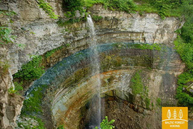
One of the most unusual sections of the Forest Trail in Northern Estonia, which leads along the foot of the impressive North- Estonian Klint in good weather, then climbs to the top of the klint in the villages of Valaste and Saka, revealing breath-taking views of the Gulf of Finland from the so-called Viru Rise. In the Saka‒Ontika‒Toila section (about 23 km), the maximum height of the North-Estonian Klint reaches 55 m. If the weather is clear, you can see the isles named Great and Small Tütarsaar, which belong to Russia, at a 50 km distance.


