


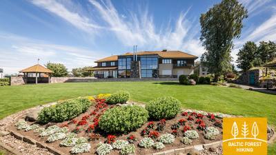
Mežtaka - Pieejams ratiņkrēslā


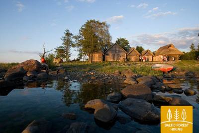
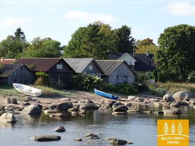
 Atkarpa 1. Rygos senamiestis - Baltezers.
Per Rygą – UNESCO pasaulio paveldo vietą

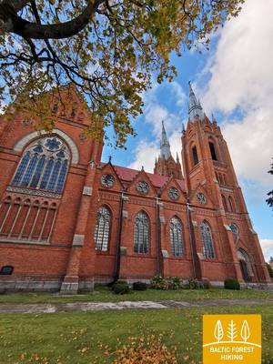
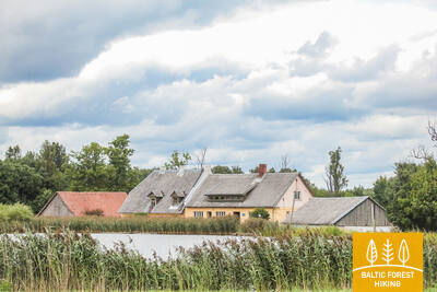
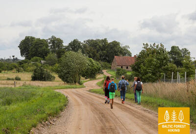
Miško tako pradžia Latvijoje yra pačioje Rygos senamiesčio širdyje, Rotušės aikštėje. Maršrutas veda Kaļķu gatve, eina pro Laisvės paminklą, per Vērmanės sodą ir palei istorinę Tērbatas gatvę. Tada jis vingiuoja per Zemitani geležinkelio stoties pėsčiųjų tiltą ir žengia į Biķerniekų ir Šmerlio miškus. Miško takas vingiuoja per Juglą, praeina Latvijos etnografinį muziejų po atviru dangumi ir eina pėsčiųjų-dviračių taku iki Baltezero.
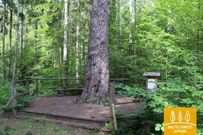
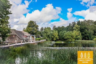
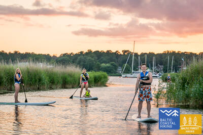
The "Feel Jugla" Walking Trail
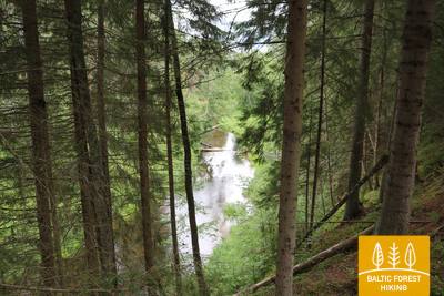
Juglos Juglos ežero šiaurės rytinėje dalyje įrengtas 250 metrų medinis lentų takas (į vieną pusę) su apžvalgos aikštele su vaizdu į Juglos ežerą, suoliukas, 20 lytėjimo erdvinių reljefų, vaizduojančių ežerui ir jo apylinkėms būdingas gyvūnų rūšis, informacija Brailio raštu. Jį gali pasiekti žmonės su vežimėliais. Aikštelė yra 0,5 kilometro nuo Mežtakos tako.


 Atkarpa 4. Rāmkalni - Sigulda.
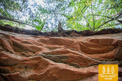
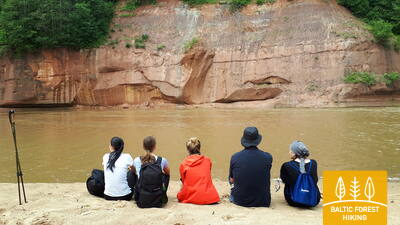
Nuostabus Gaujos upės slėnio kraštovaizdis netoli Siguldos
Pro „Rāmkalni“ Miško takas klaidžioja stačiais Gaujos slėnio krantais, eina pro Gaujos kaimą ir grįžta žemyn. Tada jis kerta Lorupės upę ir tęsiasi Gaujos vingiais, aplenkdamas vieną įspūdingiausių upės atodangų Velnalos uolas, kyla į Ķeizarskats apžvalgos aikštelę ir skrieja žemyn iki Ķeizarkrēsls, nuotykių parko „Mežakaķis“ prie Kaķīškalno ir Siguldos bobslėjaus ir rogučių trasa.
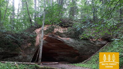
Trail to Gutman's cave
Nuo Gūtmanala Lankytojų centro automobilių stovėjimo aikštelės (GPS: 57.176245, 24.846747) takas veda į vieną populiariausių Gaujos nacionalinio parko lankytinų vietų – Gūtmanalą. Tako dangą sudaro žvyras, asfaltas nuo 1,15 iki 2 metrų pločio. Takas yra 0,5 kilometro ilgio (į abi puses) ir yra prieinamas žmonėms su vežimėliais su palydovu. Liftas tunelyje neveikia! Būtina pereiti gatvę, kur yra nedidelis bortelis! Yra pritaikytas tualetas. Takas yra 2,7 kilometro nuo Mežtakos tako.


Atkarpa 5. Sigulda - Līgatne.
Gaujos nacionalinio parko širdyje
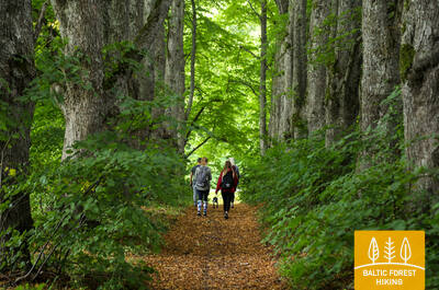
Pravažiavus Siguldą, Miško takas Vējupīte eina iki Paradīzes piliakalnio, kur statūs laiptai leidžiasi žemyn į Gaujos upės senslėnį ir Vējupytės daubą. Jis ir toliau vingiuoja mažesniais takeliais per pievas, kerta mažas upes, kurių krantuose atsiskleidžia smiltainio atodangos. Paskutiniai šeši kilometrai šios atkarpos eina mažesniu takeliu žemyn Līgatnės gamtos takais. Artėjant prie Līgatnės Miško takas pakyla į Gaujos slėnio kalvas, o paskui vėl leidžiasi žemyn į gilią Līgatnės upės daubą, kur yra buvęs Līgatnės popieriaus fabriko kaimas.
Trail to Paradise Hill
Iš Miera gatvės automobilių stovėjimo aikštelės (GPS: 57.170624, 24.862061) Gleznotājkalną galima apžiūrėti maždaug 2 kilometrų ilgio žiediniu maršrutu. Takas prieinamas žmonėms su vežimėliais ir tėvams su vežimėliais. Ant dangos yra asfaltas, žvyras, lentiniai takai (tiltai). Takas nepažymėtas, bet sankryžose yra ženklai. Atkarpa nuo automobilių stovėjimo aikštelės iki Gleznotājkalno sutampa su Mežtakos taku.
Līgatne Nature Trails
Līgatnės gamtos takai yra vienas populiariausių Gaujos nacionalinio parko traukos objektų, kuriame Latvijos miškams būdingi gyvūnai gyvena artimomis natūraliai buveinei. Dvi takų atkarpos iš „Pauguri“ lankytojų centro yra prieinamos žmonėms su vežimėliais: viena veda į meškų aptvarą (300 metrų į vieną pusę), kita – į lapių aptvarą (600 metrų į vieną pusę). Lankytojų centre yra pritaikyti tualetai ir skirta automobilių stovėjimo aikštelė (GPS: 57.248149, 25.014735). Jis yra šalia Mežtakos tako.


 Atkarpa 6. Līgatne - Cēsis.
Senuoju Cėsių keliu per Amatos upės slėnį
Viena vaizdingiausių Miško tako dalių driekiasi palei istorinį Līgatnės popieriaus fabriko kaimą, kerta Spriņģi uolą, vingiuoja palei Skalupės ir Mitologinį taką, sustoja vienoje slapčiausių vietų šioje Geležinės uždangos pusėje, Sovietinis bunkeris, toliau tęsiasi palei Roči gamtos rezervatą, kerta Amatą (gražiausia ir uoliausia upės dalis) ir galiausiai patenka į Zvārtes uolą. Toliau Miško takas driekiasi aukštais Amatos slėnio krantais ir eina istoriniu Cėsių–Rygos „greitkeliu“ (dabar nedidelis kaimo/miško keliukas su senais mylių stulpais) iki Rakšų, tada kyla į Vāļukalni kalvas ir Ozolkalns, eidami palei Gaujos upė iki Cīrulšių gamtos takų. Jis sustoja prie Gaujos gatvės, tačiau keliautojai taku gali tęstis dar 2,8 km iki Cėsių, ten pernakvoti ir kitą dieną toliau eiti.
The trail to Zvanu Cliff
900 metrų ilgio takas veda į pagrindinio Gaujos slėnio kranto šlaitą, kur kyla Žvanų skardžiai, įrengta apžvalgos aikštelė. Takas yra 1,5 metro pločio su mediniu lentiniu taku. Takas yra prieinamas žmonėms vežimėliuose su palydovo pagalba, nes norint patekti į taką reikia įveikti bordiūrą, o nuolydis vietomis per status. Nėra automobilių stovėjimo aikštelės ar tualeto. Šalia kelio yra smėlėta „kišenė“, kurioje galima palikti automobilį. Takas yra šalia Miško tako.


Atkarpa 7. Cēsis - Caunītes.
Įspūdingos smiltainio atodangos Gaujos upės pakrantėje
Miško takas eina mažais keliukais ir takeliais per mišką iki pat vandens turistų stovyklavietės „Lenči“, vingiuoja vis kitokiu reljefu pro Ērgeļu skardžius ir patenka į Gaujos upės senslėnį. Pravažiavus Ērgeļu skardžius, takas pasuka atgal link Cėsių, bet tada nusuka į Pieškalnyje esančią Rāmnieki pusę, kirsdamas upę. Po vandens turistinės stovyklos „Jāņarāmis“ Miško takas patenka į gražų, šviesų pušyną, eina per mišką, kol pasiekia „Caunītes“, kuri yra viena gražiausių vietų Gaujos upės pakrantėje.
Ērgļu (Ērģeļu) Cliffs Nature Trail
Takas supažindina lankytojus su viena įspūdingiausių smiltainio atodangų Latvijoje. Jis jungia uolas su automobilių stovėjimo aikštele (GPS: 57.357495, 25.262360). 460 metrų ilgio takas (į vieną pusę) eina miško taku ir tinkamas žmonėms su vežimėliais. Takas labai status! Yra pritaikytas tualetas. Takas sutampa su Mežtakos taku.


Atkarpa 9. Valmiera - Strenči.
Abulos upės pakrante iki Strenčių – plaustininkų sostinės
Takas eina per Valmieros istorinį centrą ir žygeivių bei šiaurietiškojo žygeivių pamėgtą Atpūtos parką, po to kerta kabantį tiltą, kerta Pauku priedes pušyną ir Bailių kalną. Iš ten eina Abulų takas, vingiuojantis palei upės krantus iki Brengulių alaus daryklos, o toliau, už Pūpolio, patenka į didžiulius, negyvenamus miškų plotus. Pirmoji šios atkarpos dalis eina pro daugybę nedidelių vasarnamių kaimelių su tokiais pavadinimais kaip Enerģētiķis, Saulītes, Sprīdītis, Gaujmaļi, Pūpoli ir Gaujaslāči, kurie iš pradžių buvo įkurti sovietmečiu kaip Valmieros ir aplinkinių teritorijų gyventojų vasarnamių rajonai. . Netoli Ūdrinių Miško takas veda upių vagų labirintu ir pasuka į šiaurę, kirsdamas Gaujos tiltą, kur įrengta poilsio ir plaukiojimo stotelė. Už 1,5 km yra Strenčių centras. Dalis ruožo eina per Šiaurės Gaujos saugomo kraštovaizdžio teritoriją.
Strenči Nature Trail and Wooden Sculpture Park
Tako tema – Gaujos plaustininkai, apie 30 skulptūrų. Taką galima pradėti nuo Ozolų gatvės automobilių stovėjimo aikštelės (GPS: 57.623436, 25.690133). Jame yra dvi 5 ir 7 kilometrų ilgio kilpos, tačiau atkarpa, pritaikyta žmonėms su vežimėliais su pagalba, yra gana trumpa. Jis yra 0,7 km nuo Miško tako.


Atkarpa 10. Strenči - Spicu tiltas.
Per gražius Vidžemės miškus
Miško tako pradžia šioje atkarpoje sutampa su Gaujos pažintiniu taku, einančiu pačiu upės krantu. Miško takas kerta A3 dviejose vietose (prieš posūkį į Sedą ir prieš Kaučią) (atsargiai!) ir toliau eina nedideliais miško keliukais, smėlio-žvyro karjeru, o toliau žvyrkeliu ties posūkiu į Olinas. Pavažiavę 3,5 km, vėl pasukite į dešinę ir nedideliais atokiais miško keliukais važiuokite link Spičų tilto, kur prie vadinamosios Zema salos (Žemos salos) atsiveria vieni gražiausių Šiaurės Gaujos („Žiemeļgauja“) saugomo kraštovaizdžio vietovės įžymybių. sala). Šios atkarpos pabaigoje, kur P24 kerta Spicu tiltą, yra vieta iškylai ir stovyklavietė.
The rest area by Spicu Bridge
Prie Miško tako įrengta poilsiavietė pritaikyta žmonėms su vežimėliais. Sumontuoti specialūs stalai, pritaikytas tualetas.


Atkarpa 11. Spicu tiltas - Zaķi.
Per didingas Cirgaļi kopas
Miško takas kerta Spičų tiltą ir veda prie keturių Kokšių ežerų (apie 4 km), kuriuos jungia nedidelis upelis. Čia rasite iškylų vietą, palapinių aikšteles ir pažintinį taką keliautojams. Aplink graži gamta, o miškuose gausu valgomųjų grybų. Pravažiavę paskutinį Kokši ežerą Dibeno ežerą, po valandos ar dviejų pasieksite Cirgalių kopų masyvą, kurį kirsite šiaurės-pietų kryptimi. Tolesnė Miško tako atkarpa kerta nemažą mišku apaugusią teritoriją, o šen bei ten matosi vieniša sodyba ar mažesnis ežerėlis. Atkarpa baigiasi mažame kaimelyje, pavadintame Zaķi. Kaime neteikiamos jokios paslaugos, todėl planuodami žygį būtinai apsvarstykite būtinus susitarimus ir apgyvendinimo galimybes. Atkarpa yra Šiaurės Gaujos („Žiemeļgauja“) saugomo kraštovaizdžio teritorijoje.
The rest area by Spicu Bridge
Prie Miško tako įrengta poilsiavietė pritaikyta žmonėms su vežimėliais. Sumontuoti specialūs stalai, pritaikytas tualetas.
Atkarpa 22. Ristipalo‒Mehikoorma.
Per Peipus ežero polderių pievas
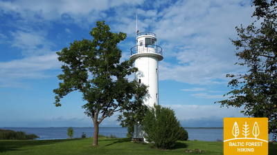
Beveik pusė šios atkarpos driekiasi tiesiais Peipuso ežero žemumos polderiniais keliais. Polderiai skirti apsaugoti aplinkinę žemę nuo potvynių pavasarį. Plokščios polderių pievos naudojamos žemės ūkiui ir gyvulių ganymui. Atkarpa nuo Naha iki Mehikoorma veda Räpina-Mehikoorma keliu. Nuo Mehikoorma švyturio atsiveria gražus Lämmijärv ežero vaizdas. Šis ežeras yra susiaurėjimas tarp Pskovo ir Peipuso ežerų. Rusija yra kitoje Lemmijärv ežero pusėje (1,7 km).
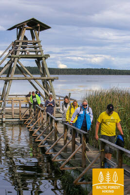
Mehikorma Harbor Shore Promenade
Tarp Mehikormos uosto ir švyturio įrengtas pažintinis takas ir promenada, 1,3 km atstumu supažindinantis su Peipuso ežero pakrante. Dalis jos, įskaitant promenadą ir lentų taką, yra prieinama žmonėms su vežimėliais, padedant palydovui. Jis yra šalia Miško tako.
Atkarpa 23. Mehikoorma‒Lääniste.
Aplink Emajõe-Suursoo pelkę
Etapas visiškai pateisina Miško tako pavadinimą, nes artimiausios trys dienos veda per vieną didžiausių Estijos pelkių – Emajõe-Suursoo pelkę, kurią supa dideli miškų plotai. Vienintelė gyvenvietė tarp Jõepera ir Ahja upės yra miškų apsupta Järvselja. Reljefas lygus, nes Miško takas iki šiol eina per Peipuso ežero žemumą. Tikslas yra prie Ahja upės, kuri garsėja vaizdingomis devono smiltainio atodangomis ir populiariu laivų maršrutu.
Mehikorma Harbor Shore Promenade
Tarp Mehikormos uosto ir švyturio įrengtas pažintinis takas ir promenada, 1,3 km atstumu supažindinantis su Peipuso ežero pakrante. Dalis jos, įskaitant promenadą ir lentų taką, yra prieinama žmonėms su vežimėliais, padedant palydovui. Jis yra šalia Miško tako.
Atkarpa 25. Kavastu‒Varnja.
Varnjos sentikių kaimo link
Miško takas jau trečias dienas sukasi aplink Emajõe-Suursoo (Peipsiveere gamtos rezervato dalis) pelkę. Įdomiausia pasivaikščiojimo dalis – atkarpa tarp Vanaussajos ir Varnja, kur Miško takas driekiasi mažais kaimo keliukais. Prieš Varnją jis pasiekia Peipuso (Peipsio) ežero pakrantę, ir čia tikrai galima pajusti tikrąjį ežero dydį. Atstumas nuo Varnjos iki Remniku Peipuso ežero pakrante ir aplinkine teritorija užtruks apie savaitę. Šią savaitę žygeiviai daugiau sužinos apie tradicinę Rytų Estijos kultūrą – svogūnų auginimą, žvejybą, kulinarinį paveldą, amatus ir sentikių kultūrą.
Emajõe-Suursoo trail
Emajegi-Suursoo centre prasideda 3 km ilgio takas, vedantis per miškingą reljefą ir pelkes palei Emajegi upės pakrantę. Medinė tako lentų tako atkarpa nuo pradžios iki antrosios laužavietės yra 700 metrų ilgio ir pritaikyta žmonėms su vežimėliais. Tako plotis šioje atkarpoje – 1,2 metro. Automobilių stovėjimo aikštelė yra čia: GPS: 58.382315, 27.105629. Jis yra maždaug 2,6 km nuo Miško tako.


Atkarpa 35. Vasavere‒Toila.
Link uolėtos Šiaurės Estijos pakrantės prie Toilos
Už Vasavere Miško takas tęsiasi per Kurtnos kraštovaizdžio draustinį, juosia per durpyną, kerta Oru miestelį, eina per Vokos upės slėnį ir pasiekia Baltijos jūrą, kur pasuka į vakarus. Čia, Suomijos įlankos pakrantėje, kyla Šiaurės Estijos klinta – stačias, uolėtas ir miškais apaugęs skardis, nenutrūkstamai besitęsiantis iki Talino ir toliau iki Vakarų Estijos salų. Miško takas eina ant skardžio ir retkarčiais leidžiasi į slėnius. Jis kerta gilų ir platų Pühajõgi slėnį Toila-Oru parke ir patenka į Toilą, populiarų pakrantės kurortą.
Toila - Oru Park
Iš dalies parką galima apžiūrėti su vežimėliu iš Karu vartų aikštelės palei liepų prospektą. Parke yra daugiausiai žvyruotų takų tinklas. Dėl vietinio reljefo reikalingas asistentas. Prie tvenkinio ir Hebeallika (Hõbeallika) šaltinio urvo neįgaliųjų vežimėliais negalima patekti. Miško takas kerta Toila – Oru parką. Automobilių stovėjimo aikštelė yra GPS: 59.418662, 27.531208.


Atkarpa 36. Toila‒Saka.
Vaizdinga Šiaurės Estijos glinto dalis tarp Toilos ir Sakos
Viena neįprastiausių Miško tako atkarpų Šiaurės Estijoje, kuri geru oru veda įspūdingos Šiaurės Estijos klintos papėde, o vėliau kyla į klintos viršūnę Valaste ir Sakos kaimuose, atskleidžiant kvapą gniaužiantį. Suomijos įlankos vaizdai iš vadinamojo Viru Rise. Saka‒Ontika‒Toila ruože (apie 23 km) didžiausias Šiaurės Estijos klintos aukštis siekia 55 m. Esant giedram orui, 50 km atstumu galite pamatyti Rusijai priklausančias Didžiosios ir Mažosios Tütarsaaro salas.
Toila - Oru Park
Iš dalies parką galima apžiūrėti su vežimėliu iš Karu vartų aikštelės palei liepų prospektą. Parke yra daugiausiai žvyruotų takų tinklas. Dėl vietinio reljefo reikalingas asistentas. Prie tvenkinio ir Hebeallika (Hõbeallika) šaltinio urvo neįgaliųjų vežimėliais negalima patekti. Miško takas kerta Toila – Oru parką. Automobilių stovėjimo aikštelė yra GPS: 59.418662, 27.531208.
Atkarpa 41. Eisma‒Oandu.
Lahemos nacionalinio parko takais
Už Vainupea kaimo Miško takas patenka į pirmąjį Estijos nacionalinį parką – Lahemaa, estiškai reiškiantį „įlankų žemė“. Kitas penkias su puse dienos Miško takas tęsis Lahemaa nacionalinio parko įlankomis ir pusiasaliais, supažindindamas žygeivius su reikšmingiausiu jo gamtos ir kultūros paveldu. Ypatingas dėmesys turi būti skiriamas parko taisyklėms. Šią dieną Miško takas eina gražiais ir ramiais pamario miškais, kuriuose rudenį gausiai auga grybai. Jis eina per vaizdingą Altjos žvejų kaimelį. Atkarpa baigiasi Estijos valstybinio miškotvarkos (RMK) lankytojų centre esančiame Oandu mieste, kur žygeiviai gali daugiau sužinoti apie miško buveinių tipus ir miškotvarkos tradicijas.
Sagadi - Oandu Forest Fairy Tale Trail
5,6 km ilgio takas jungia Oandu lankytojų centrą su Sagadi dvaru Lahemaa nacionaliniame parke. Pirmieji 3 km tako yra pritaikyti žmonėms su vežimėliais. Takas prasideda Oandu lankytojų centre, kur yra automobilių stovėjimo aikštelė (GPS: 59.565440, 26.099671) ir pritaikytas tualetas. Jis yra šalia Miško tako.


Atkarpa 42. Oandu‒Käsmu.
Käsmu – „kapitonų kaimas“ ir laivų statybos vieta
Kiti 9 kilometrai Miško tako tarp Oandu ir Võsu sutampa su RMK taku, todėl atkreipkite dėmesį į ženklų pasikeitimą. Takas eina per gražią, miškingą vidaus kopų zoną, kur žygeiviai gali pamatyti pušies pušies pušies, naudotos iš medžių sakai išgauti. Tokiu būdu derva Baltijos šalyse buvo gaunama iki 1960-1970 m. Medžiai gausiai padengti kerpėmis, o tai rodo, kad oras yra švarus. Rudenį tako pakraščius puošia grybai ir mėlynės. Pravažiavus Võsu kaimą (populiarų kurortą), Miško takas tęsiasi gražia pakrantės miško promenada iki Käsmu kaimo. Verta nueiti dar papildomą kilometrą iki Vana-Jüri uolų ir istorinių Käsmu vietų pusiasalio gale.
Sagadi - Oandu Forest Fairy Tale Trail
5,6 km ilgio takas jungia Oandu lankytojų centrą su Sagadi dvaru Lahemaa nacionaliniame parke. Pirmieji 3 km tako yra pritaikyti žmonėms su vežimėliais. Takas prasideda Oandu lankytojų centre, kur yra automobilių stovėjimo aikštelė (GPS: 59.565440, 26.099671) ir pritaikytas tualetas. Jis yra šalia Miško tako.
Atkarpa 45. Loksa‒Tsitre.
Jumindos pusiasalio miškais ir pelkėmis
Šią dieną Miško takas kerta Jumindos pusiasalį. Išplaukus iš Loksos, už 7 km jis eina pro sovietmečio karinį objektą – Haros povandeninį laivų uostą. Norint jį aplankyti, reikia apvažiuoti du kilometrus ir nusipirkti bilietą. Miško takas eina per gražių miškų ir pelkių teritoriją, o vakariniame teritorijos gale yra aukštų, tankių miškingų smėlio kopų. Jis tęsiasi keliu iš Pedaspea į Tsitre ir kerta nedidelę Šiaurės Estijos klints atkarpą prieš pat Tsitre, kur yra Muuksi tvirtovės kalva. Tsitre iškylų zona yra 0,2 km nuo jūros.
Viru Bog Nature Trail
3,5 km taku tyrinėjama aukštapelkė ir jai būdingas kraštovaizdis bei biologinė įvairovė. 1,3 km ilgio atkarpa iki bokšto yra prieinama žmonėms su vežimėliais. Taip pat pasiekiama pirmoji apžvalgos bokšto platforma ir sausas tualetas. Jis yra apie 10 km nuo Miško tako.


Tsitre Tree Trail
1 km takas supažindina lankytojus su Tsitrės vasaros dvaro parko ir jo apylinkių istorija bei biologine įvairove. Jame įrengti 29 informacijos taškai. Maždaug 150 metrų tako sudaro iki 1 metro pločio lentiniai takai, kurie yra prieinami žmonėms su vežimėliais. Yra pritaikytas tualetas. Takas prasideda automobilių stovėjimo aikštelėje (GPS: 59.518268, 25.510726). Jis yra šalia Miško tako.


Atkarpa 46. Tsitre‒ Kaberneeme.
Smėlėti paplūdimiai ir salos Kolgos įlankoje
Tsitre kaime dar vikingų laikais buvo įkurtas uostas. Pirmieji 4 km Miško tako šioje atkarpoje eina per Lahemaa nacionalinio parko teritoriją. Tarp Muuksi ir Soorinna kaimų kelias kerta ovalią plokščiakalnį, šiaurės Estijos klinto aukštį, padengtą vaizdingais kadagių laukais. Šiaurės kaime takas eina pro pakrantės pelkę ir išeina prie jūros už Salmistu uosto. Iš čia atkreipkite dėmesį į 1,3 km nutolusią Pedassaar salą šiaurės rytuose ir Umblu bei Rohusi salas šiaurės vakaruose. Valklos paplūdimyje žygeivių laukia gražus paplūdimio restoranas. Haapse paplūdimyje galima maudytis, jūra greitai gilėja.
Tsitre Tree Trail
1 km takas supažindina lankytojus su Tsitrės vasaros dvaro parko ir jo apylinkių istorija bei biologine įvairove. Jame įrengti 29 informacijos taškai. Maždaug 150 metrų tako sudaro iki 1 metro pločio lentiniai takai, kurie yra prieinami žmonėms su vežimėliais. Yra pritaikytas tualetas. Takas prasideda automobilių stovėjimo aikštelėje (GPS: 59.518268, 25.510726). Jis yra šalia Miško tako.
Atkarpa 49. Muuga‒Püünsi.
Didingu Viimsi pusiasaliu
Miško takas eina per tankiausiai miškais apaugusį Viimsi pusiasalio rajoną, kuriame įsteigtos kelios gamtos apsaugos zonos. Jis kerta buvusią sovietmečio karinę teritoriją Rohuneeme. Šią dieną Miško takas eina pėsčiųjų šaligatviais ir daugybe kelių, einančių per pusiasalį. Jis pasuka į pietus ties Püünsi kaimu, kur tolumoje per įlanką matosi bokštai, dangoraižiai ir Talino uostas su keltais.
Tedu (Tädu) Nature Trail.
3,1 km ilgio takas lankytojus supažindina su miškininkystės tradicijomis. Visa tako danga yra žvyruota ir prieinama žmonėms su vežimėliais. Yra automobilių stovėjimo aikštelė (GPS: 59.520475, 24.895883). Jis yra šalia Miško tako.


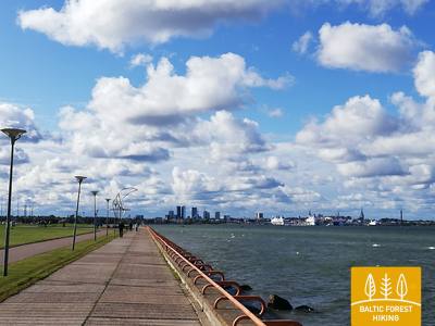
Atkarpa 50. Püünsi‒Tallinn.
Gražiausi Talino senamiesčio vaizdai
Miško takas eina pro Talino įlanką, o puikūs miesto bokštų, uosto ir dangoraižių vaizdai atsiveria jau Püünsi mieste. Miško takas prieš Piritą virsta nuostabiu pušynu, paskui 2 km eina smėlėtu paplūdimiu. Už Piritos iki pat Talino uosto, Miško takas veda nuostabia miesto pakrantės promenada, iš kurios atsiveria vaizdas į svarbiausias miesto kultūrines ir istorines vietas, atsiveria nuostabūs jūros ir uosto vaizdai. Galutinis Miško tako tikslas yra Talino uoste, šalia senamiesčio. Dar vieną ar dvi dienas galite praleisti aplankydami įvairias turistines Talino vietas.
Pirita Promenade
Maždaug 3 km ilgio, gerai prižiūrima promenada jungia Talino uosto rajoną su Pirita, besitęsiančia jūros pakrante. Jis turi dviratininkams ir aktyvaus laisvalaikio mėgėjams pritaikytą dangą ir per visą jos ilgį yra prieinamas žmonėms su vežimėliais. Piritos paplūdimyje yra pagalbinės plaukimo priemonės, persirengimo patalpos, medinė rampa, iš kurios galima patekti į vandenį. Paslaugas reikia rezervuoti iš anksto: +372 5425 0424. Piritos promenada sutampa su Miško taku.


Atkarpa 59. Panemunis – Birštonas.
Nemuno kilpomis pro etnografinius vienkiemius
Atkartodamas Nemuno kilpas, Miško takas suformuoja daugiau kaip 20 km ilgio vingį Nemuno kilpų regioniniame parke, vingiuodamas per gražiausius gamtos kampelius ir mažus kaimelius su šioms vietovėms būdingais įvairiomis spalvomis nudažytais mediniais pastatais. Didesnis miško masyvas yra tik tarp Siponių ir Puzonių kaimų, per kuriuos maršrutas veda nedideliais miško keliukais. Kirtus Vilnius–Marijampolė kelią (A16), Miško takas pasiekia kitą Nemuno vingį, kuriame įsikūręs balneologinis Birštono kurortas. B. Sruogos gatve jis nuveda iki Birštono turizmo informacijos centro.
Birštonas Nemunas krasta promenāde un gājēju celiņš
Už Birštono turizmo informacijos centro Nemuno promenada driekiasi Mežtakos takas daugiau nei 1 kilometrą. Tada įsuka į Algirdo gatvę, kerta Vytauto Jurgio Meškos parką, grįžta į promenadą, o už 0,6 kilometro išsuka į pėsčiųjų ir dviračių taką. Maždaug 5 kilometrų ilgio takas kerta Žvėrinčiaus girią, toliau pėsčiųjų takas eina per Paprienės rekreacinę zoną, iki Greimų tilto per Nemuną. Promenada ir pėsčiųjų takas beveik visu ilgiu pasiekiami žmonėms su vežimėliais. Danga daugiausia asfaltuota, o Prienuose – žvyras. Takas sutampa su Mežtakos trasa.
Atkarpa 83. Paplatelė–Plateliai.
Tarp didžiausių Žemaitijos nacionalinio parko ežerų
Pirmuosius 3,5 km Miško takas veda per gražius spygliuočių miškus. Iki Šaltojo karo muziejaus jis eina Plokštinės pažintiniu taku, o 5 km nuo muziejaus – Plokštinės pėsčiųjų ir dviračių taku. Prie kelio Nr. 3202 (Malūno gatvė) maršrutas pasuka kairėn į pietryčius ir iškart už 0,3 km dešinėn į pietus-pietvakarius. Po maždaug 0,5 km pasiekia Ilgio ežero gatvę. Toliau net 5,5 km maršrutas suka platų ratą aplink Ilgio ir Beržoro ežerus, kol pasiekia Beržoro kaimą. Toliau paėjėjus 2 km Plungės gatve, Miško takas atveda į Platelių centrą ir apsuka dar vieną ratą Ežero gatve iki Šeirės pažintinio tako, atskleisdamas vaizdingą kraštovaizdį. Toliau Ežero, Naująja ir Žemaičių Kalvarijos gatvėmis grįžta į miesto centrą.
Šeire's Educational Trail
Tako ilgis yra apie 7 kilometrai, tačiau yra įrengta apžvalgos aikštelė, skirta žmonėms su vežimėliais, nuo kurios atsiveria vaizdas į Platelių ežerą ir jo salas. Plateliai yra Žemaitijos nacionaliniame parke. Informacinėje lentoje yra apčiuopiamas ežero su salomis žemėlapis, leidžiantis jį tyrinėti žmonėms su regėjimo negalia. Automobilių stovėjimo aikštelė yra čia: GPS 56.048355, 21.826901. Jis yra šalia Mežtakos tako.


Atkarpa 84. Plateliai–Salantai.
Link Pajūrio žemumos
Miško takas 6 km eina kelio Plateliai-Salantai (Nr. 2302) pakraščiu. Šioje atkarpoje maršrutas leidžiasi Žemaičių aukštumos vakarine dalimi. Keliaujant link Pajūrio žemumos atsiveria graži kraštovaizdžio panorama. Gintališkės kaimo centre Miško takas veda kairėn į pietvakarius ir 2,4 km vingiuoja keliu Nr. 3216, po to suka dešinėn į vakarus, kur kerta didžiausią miško masyvą šioje atkarpoje. Sovietmečiu čia buvo raketų bazė, tai rodo betoninėmis plokštėmis klotas kelias. Toliau maršrutas eina Plungės–Salantų keliu (Nr. 169) ir už 1,4 km nuveda kairėn. Iki pat Salantų jis vingiuoja nedideliu keliuku, o miestelio centrą pasiekia Žemaitės ir M. Valančiaus gatvėmis. Maršruto pradžia – Žemaitijos nacionaliniame parke, o pabaiga – Salantų regioniniame parke.
Šeire's Educational Trail
Tako ilgis yra apie 7 kilometrai, tačiau yra įrengta apžvalgos aikštelė, skirta žmonėms su vežimėliais, nuo kurios atsiveria vaizdas į Platelių ežerą ir jo salas. Plateliai yra Žemaitijos nacionaliniame parke. Informacinėje lentoje yra apčiuopiamas ežero su salomis žemėlapis, leidžiantis jį tyrinėti žmonėms su regėjimo negalia. Automobilių stovėjimo aikštelė yra čia: GPS 56.048355, 21.826901. Jis yra šalia Mežtakos tako.
Atkarpa 85. Salantai–Mosėdis.
Salantų regioniniu parku
Nuo Salantų miestelio Miško takas eina M. Valančiaus, Padvaralio ir Ilgąja gatvėmis. Likus 100 m iki kelio Nr. 169 jis veda kairėn į kaimo keliuką, už 3,5 km pasiekia Erlos gatvę ir pasuka kairėn į vakarus. Už 0,4 km eina dešinėn į šiaurę ir atveda į Šatraminių kaimą, kur suka dešinėn į pietvakarius, už 2,9 km kerta Salantų–Skuodo kelią (Nr. 169) ir Šaukliuose veda kairėn į šiaurę. Už 3,8 km pasiekia šios atkarpos galutinį tikslą – Mosėdį. Didžioji atkarpos dalis, išskyrus Šatraminių apylinkes, eina Salantų regioninio parko teritorija.
The Šauklių Nature Trail
2,7 kilometro ilgio takas supažindina su Salantų regioninio parko kraštovaizdžiu, apaugusiu rieduliais ir kadagiais, demonstruojant jo biologinę įvairovę. Tako paviršių sudaro gerai nutiestas takas ir lentiniai takai. Dalis lentinio tako yra prieinama žmonėms su vežimėliais. Lankytojai turi iš anksto informuoti parko direkciją, kad būtų galima atidaryti vartus. Automobilių stovėjimo aikštelė yra čia: GPS 56.125202, 21.592115 ir yra 1,2 kilometro nuo Mežtakos tako.

Atkarpa 87. Lietuvos ir Latvijos siena–Gramzda.
Banguojančia Vartajos lyguma
Lietuvos ir Latvijos valstybinė siena eina Apšės upės vaga, kurią kelio Skuodas–Priekulė (P114) tiltu kerta Miško tako maršrutas. Jis iš pradžių vingiuoja kelio pakraščiu, o po 1,7 km pasuka žvyrkeliu Kalėtų kryptimi. Uozuolų kaimo apylinkėse atsiveria vaizdas į gražias ir plačias Kuršo aukštumos vakarinės dalies banguojančias Vartajos lygumas. Uozuolų kaime 0,5 km maršrutas eina keliu V1217, po to pasuka į dešinę ir po 2 km pasiekia kelią Barta–Kalėtai–Gramzda (V1218), kas atveda į Gramzdą.
Gramzdas mežaparka taka
Gramzdos miško parke sukurtas apie 2 kilometrų ilgio takas. Jis nepažymėtas, o dangą sudaro žvyras, asfaltas, paprasti gerai nueiti takai. Takas iš dalies prieinamas žmonėms su vežimėliais ir tėvams su vežimėliais. Tinkamas atspirties taškas – aikštelė prie „Aibės“ parduotuvės (GPS: 56.369134, 21.604151). Gramzdos parapijos administracijos pastate yra pritaikytas tualetas. Pro Gramzdos miško parką eina Mežtakos takas.


Atkarpa 88. Gramzda–Priekulė.
Į pasakomis turtingą Priekulę
Nuo Gramzdos Miško takas vingiuoja mažais takeliais palei smėlio ir žvyro karjerus, eina per ūkininkų laukus šiaurės rytų link. Prie „Lejasbunči“ sodybos maršrutas pasuka Mazgramzdos link ir prieš pat miestelį kerta gilų ir pavėsingą Runiupės slėnį. Už Mazgramzdos eina palei kelią Gramzda–Priekulė (P114), nuo kurio atsiveria gražios ir plačios Kuršo aukštumos vakarinės dalies banguojančios Vartajos lygumos. Kirtus šį kelią, Miško tako maršrutas keliauja per buvusį aerodromą, Priekulės–Purmsatų–Kalėjų keliu (V1211) ir nedideliu lanku per miškelį. Vingiuotu Virgos upelio krantu Miško takas per miško parką „Priekules Priediens“ atveda iki Priekulės liuteronų bažnyčios.
Gramzdas mežaparka taka
Gramzdos miško parke sukurtas apie 2 kilometrų ilgio takas. Jis nepažymėtas, o dangą sudaro žvyras, asfaltas, paprasti gerai nueiti takai. Takas iš dalies prieinamas žmonėms su vežimėliais ir tėvams su vežimėliais. Tinkamas atspirties taškas – aikštelė prie „Aibės“ parduotuvės (GPS: 56.369134, 21.604151). Gramzdos parapijos administracijos pastate yra pritaikytas tualetas. Pro Gramzdos miško parką eina Mežtakos takas.
Atkarpa 91. Aizputė–Snėpelė.
Barono fon Manteifelio takais
Miško tako maršrutas Atmodas ir Jelgavas gatvelėmis vingiuoja per Aizputę, už Lažos tvenkinio pasuka į dešinę ir dideliu lanku artėja prie Kazdangos dvaro parko iš pietų pusės. Mažais takeliais palei Dzirnavų ežerą maršrutas veda per dvaro parką, aplink dvaro pastatus ir Zenų tvenkinį, 0,7 km eina Kazdangos–Cildų keliu (V1200) ir pasuka dešinėn į Snėpelės–Kazdangos (V1296) kelią. Iki sodybos „Zemturi“ Miško takas pamažu pakyla į Vakarų Kuršo aukštumos Bandavos kalvyną, kur atsiveria gražus apylinkių vaizdas. Ši vieta yra net 81 m virš jūros lygio. Nuo sodybos maršrutas apie 12 km veda per retai apgyvendintas miškingas vietoves ir tik paskutinius 3 km vėl išeina į atviresnę vietą ir ūkininkų žemes, kol pasiekia Snėpelę.
Kazdangas parka dabas takas
Kazdangos parkas yra vienas turtingiausių Latvijos dvarų parkų dendrologine įvairove. Parke yra tankus takų tinklas, besitęsiantis iki 9 kilometrų. Tako paviršius apima žvyrą, gerai numintus takus ir medinius lentų takus. Kelkraščiai nukreipia lankytojus į įvairias lankytinas vietas. Parko pažinimo pradžiai įrengta automobilių stovėjimo aikštelė (GPS: 56.732242, 21.733626). Parko takai yra prieinami žmonėms su vežimėliais su pagalbininko pagalba, taip pat patogūs tėvams su vežimėliais. Yra pritaikytas tualetas. Pro Kazdangos parką eina Mežtakos takas.


Atkarpa 92. Snėpelė–Kuldyga.
Į Kuldygą – žaviausią viduramžių Kuržemės miestą
Pagrindine Snėpelės gatve Miško takas veda į kelią V1294 ir po 0,3 km priešais Kepšų ežerą pasuka dešinėn į nedidelį kaimo kelią. Šiuo keliu maršrutas pasiekia Slipinciemą, prieš tai kirtus Sprincupės užtvanką ir eina palei tvenkinį. Toliau pasuka Pelčių kryptimi, kur vingiuoja palei Dambų tvenkinius, veda iki Kuldygos–Pelčių kelio (V1293) ir tęsiasi per Kuldygos sodus „Kurzemīte“ ir „Rumba“, kol pasiekia Ventos upę ir Kuldygos aplinkkelį. Nuo jo iki Senojo plytų tilto 2,4 km maršrutas veda gražiu Ventos pakrantės taku, kur drėgnesnė vietose ir per upelius nutiesti mediniai tilteliai.
The walking trail along the Venta River in Kuldīga
Takas driekiasi kairiuoju Ventos upės krantu nuo Kuldygos miesto sodo iki naujojo Kuldygos tilto, įveikdamas 2,4 kilometro. Palei taką įrengtos poilsio zonos ir informacinės lentos. Dėl lygaus paviršiaus, kurį sudaro smulkus, kietas žvyras, jis prieinamas žmonėms su vežimėliais, nors kai kuriose atkarpose dėl nuolydžių gali prireikti pagalbos. Takas platus, o ten, kur kerta nedideles upelių daubas, nutiesti mediniai lentų takai, tilteliai. Ši Mežtakos tako atkarpa driekiasi Kuldygos promenados taku. Galimi pritaikyti tualetai. Įrengta automobilių stovėjimo aikštelė prie GPS: 56.973354, 21.977798.


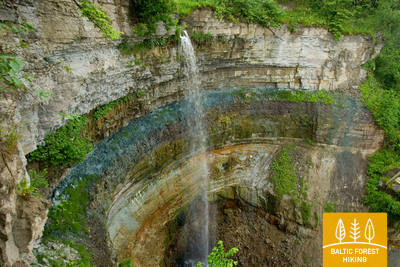
The Mārtiņsala Nature Trail
Maždaug 1 kilometro ilgio takas yra Mārtiņsaloje ir supažindina lankytojus su Ventos Rumbos kriokliu. Paviršius sudarytas iš žvyro (1,60 m pločio) arba lentinio tako (95 cm pločio) be pravažiavimo zonų. Kai kurios sekcijos yra prieinamos žmonėms su vežimėliais. Galimi pritaikyti tualetai. Automobilių stovėjimo aikštelė yra prie GPS: 56.970622, 21.980747. Mārtiņsala gamtos takas yra šalia Mežtakos tako.


Atkarpa 93. Kuldyga–Renda.
Ventos slėniu ir Riežupės gamtos parku
Už senojo plytų tilto per Ventą Miško takas trumpai eina daubų išraižytu dešiniuoju upės krantu, Krasta gatve ir keliu Vetklinika–Paleja, tuomet kerta Kalnmuižos mišką, Riežupę ir toliau iki Mazrendos driekiasi plačiais Rendos miško keliais. Reljefas čia lygus, nes atkarpa yra Kuršo žemumos Pieventos lygumoje. Mazrendoje maršrutas pereina smėlio ir žvyro karjerą ir Kuldigas gatve veda į Rendos centrą. Visas maršrutas eina Ventos slėnio gamtos rezervato ir Riežupės gamtos parko teritorija.
The Mārtiņsala Nature Trail
Maždaug 1 kilometro ilgio takas yra Mārtiņsaloje ir supažindina lankytojus su Ventos Rumbos kriokliu. Paviršius sudarytas iš žvyro (1,60 m pločio) arba lentinio tako (95 cm pločio) be pravažiavimo zonų. Kai kurios sekcijos yra prieinamos žmonėms su vežimėliais. Galimi pritaikyti tualetai. Automobilių stovėjimo aikštelė yra prie GPS: 56.970622, 21.980747. Mārtiņsala gamtos takas yra šalia Mežtakos tako.
Atkarpa 95. Sabilė–Kandava.
Vienu gražiausiu Kuržemės gamtos parku
Miško takas eina Abavos kairiuoju krantu – Kr. Barona gatve. Toliau kaip mažas takelis jis vingiuoja Abavos senvagės slėnio pievomis ir miškeliais, kol pasiekia kalvą, vadinamą Švedų kepure. Už jos mažu takeliu nuveda iki Plostų–Pūcės kelio (V1471), kerta Amulą ir prie Kalnmuižos pakyla į Abavos senvagės viršų, kur toliau 6 km driekiasi iki Aizdzirės dvaro parko. Šiaurės kryptimi 1 km maršrutas vingiuoja Abavos senvagės slėniu, kuriame atsiveria vieni gražiausių šio slėnio vaizdų. Abavos senvagė šioje vietoje yra 40 m gylio. Už Zvejniekų tilto maršrutas pakyla senvagės šiauriniu krantu, kur auga vynuogynai. Toliau už miško kerta kelią Kandava–Renda (P130) ir Sabiles gatve pasiekia Kandavą. Šio vaizdingo miestelio Lauku, Ozola, Zīļu, Sabiles ir Pils gatvėmis eina iki Riterių piliakalnio. Visą laiką maršrutas vingiuoja Abavos senvage.
The "Fairy Tale Forest" play trail
Prie kavinės „Plostkrogs“ (GPS: 57.020908, 22.645401) sukurtas „Pasakų miško“ žaidimų takas, kuriame yra įvairių miško gyvūnų figūrėlių, medinių namelių, kitų žaidimų vaikams. Tako ilgis 1,6 km. Yra tam tikrų kliūčių, pavyzdžiui, medžių šaknys ir įėjimas per medinį namą, tačiau su asistentu neįgaliojo vežimėliuose sėdintys žmonės gali apžiūrėti „Pasakų mišką“. Jis yra už 1,2 km nuo Mežtakos tako.
Atkarpa 96. Kandava–Jaunmuokos.
Pūrė – vieta, kur gaminamas šokoladas
Jelgavos gatve, kirtus senąjį akmeninį tiltą per Abavą, Miško takas Daigones gatve ir toliau žvyrkeliu 5 km veda iki Daiguonės kaimelio. Toliau Dzilkalnų–Pūrės keliu (V1464) nusileidžia į Abavos senvagės slėnį. Už tilto per upę maršrutas pasuka dešinėn ir mažu takeliu pasiekia Pūrę. Apsukęs Pūrės dvarą, Zemeniu gatve ir Pūrės–Jaunsatų (C004) keliu 5 km eina iki Galciemo kaimo. Apylinkėse kasamas smėlis ir žvyras. Galciemo mieste Miško takas pasuka kairėn į nedidelį žvyrkelį, kuris po 3,5 km susijungia su Jaunmuokų–Jaunsatų keliu (V1444). Dar po 3 km maršrutas kerta Rygos–Ventspilio plentą ir mažais medžių apsuptais keliukais pasiekia Jaunmuokų pilį. Artėjant prie jos nuo Jaunsatų pusės, atsiveria gražus kraštovaizdis, kur Rytų Kuršo Sparnenės banguojančią lygumą keičia Vanemos kalvynas.
Čužu Marsh Nature Trail
Žiedinis takas Čužu pelkėje supažindina lankytojus su unikaliu laukiniu krūmynų spanguolių atsiradimu, kalkingąja pelke, buvusia mineralinio vandens poilsiaviete. Maždaug 1 kilometro ilgio medinė lentų tako atkarpa su apvadu pritaikyta žmonėms su vežimėliais. Lentų takas jungiasi su 0,5 kilometro žvyruotu taku su specialiai suprojektuota automobilių stovėjimo aikštele (GPS: 57.026431, 22.785473) ir pritaikytais tualetais. Dėl kai kurių vietų nuolydžio gali prireikti pagalbos. Takas yra apie 0,8 kilometro nuo Mežtakos tako.


Jaunmoku Castle Trail
Takas supažindina lankytojus su maždaug 1,5 kilometro ilgio dvaro kompleksu ir parku. Jį gali pasiekti žmonės su vežimėliais. Tako dangą sudaro asfaltas, grindinys ir žvyras. Automobilių stovėjimo aikštelė yra prie GPS: 56.982423, 23.053098. Skambučio mygtuku lankytojai gali išsikviesti darbuotojus, kurie padėtų patekti į pastatą ir apžiūrėti jį iš vidaus. Takas yra šalia Mežtakos tako. Galimi pritaikyti tualetai.


Atkarpa 97. Jaunmuokos–Tukumas.
Į Tukumą - miestu pasigrožėti!
Jaunmuokų pilies apylinkės džiugina Rytų Kuršo aukštumos Vanemos kalvyno kraštovaizdžiu. Miško takas vingiuoja žemyn iki Berų vandens malūno. Toliau maršrutas veda apie 3 km iki pat Vecmuokų ir 50 m už jo, atskleisdamas gražų kraštovaizdį ir platų Sluocenės slėnį pietuose. Už Vecmuokų dvaro alėjos maršrutas kerta Tukumo–Lazdos kelią (V1442), praeina pro keletą viensėdžių ir tiesiu miško keliu veda pietryčių kryptimi palei Seklio ežerą, prie kurio galima prieiti mažais takeliais. Sveikuolių kaimeliu maršrutas eina miško takais ir ties Uozuolinių kapinėmis pasiekia Tukumo–Kesterciemo–Kolkos kelią (P131), kur prasideda Tukumo miestas. Raudas, Kurzemes Meža ir Melnezera gatvėmis maršrutas atveda prie Saulės kalno.
Jaunmoku Castle Trail
Takas supažindina lankytojus su maždaug 1,5 kilometro ilgio dvaro kompleksu ir parku. Jį gali pasiekti žmonės su vežimėliais. Tako dangą sudaro asfaltas, grindinys ir žvyras. Automobilių stovėjimo aikštelė yra prie GPS: 56.982423, 23.053098. Skambučio mygtuku lankytojai gali išsikviesti darbuotojus, kurie padėtų patekti į pastatą ir apžiūrėti jį iš vidaus. Takas yra šalia Mežtakos tako. Galimi pritaikyti tualetai.
Atkarpa 99. Janiukruogas–Bigaunciemas.
Kemerių nacionaliniu parku
Kirtus vietovę su keliomis sodybomis, Miško takas vingiuoja gražiais spygliuočių miškais ir dar 6,5 km Čaukciemu, kol pasuka į Žaliąją kopą. Toliau eina Antinciemo–Smardės kelkraščiu. Vietovė lygi, nes maršrutas eina Pajūrio žemumos Engurės lyguma. Nuo Žaliosios kopos atsiveria platūs Žaliosios ir Raganų pelkių vaizdai. Nedidelis miško keliukas vingiuoja kopos apatine dalimi ir dviejose vietose pelkę kerta mediniais takeliais. Kemeriuose maršrutas eina Partizānu, Robežu, A. Upīša, Katedrāles ir E. Dārziņa gatvėmis, pro parko lankytojų centrą „Meža māja“ ir Veršupytę, į kurią įteka sieringų šaltinių vandenys. Kirtus Tūristu gatvę, maršrutas eina Dūņu keliu iki Sluokos ežero. Toliau Miško takas prieina Veršupytės raistą – vieną puikiausių šlapių miškų buveinių visoje Kuržemėje. Prie Melnezero ežero maršrutas pasuka senojo Kemerių kelio link ir po 2 km pasiekia Bigaunciemą. Už Talsų plento (P128) Miško tako maršrutas prieina Rygos įlanką ir susijungia su Jūros tako maršrutu (E9). Miško takas visą atkarpą eina per Kemerių nacionalinį parką (KNP).
The Melnalkšņu Swamp Boardwalk
Netoli Ķemeru nacionalinio parko lankytojų centro esantis takas supažindina lankytojus su viena iš parkui būdingų buveinių – drėgnais miškais. 0,6 kilometro lentinio tako takas yra iškilęs ant medinių polių ir kerta pavasarį užliejančią pelkę. Lentų takas yra 1,2 metro pločio be pravažiavimo zonų, todėl svarbu laikytis nurodytos važiavimo krypties. Jį gali pasiekti žmonės vežimėliuose su pagalba. Tako pradžioje ir pabaigoje danga – žvyras ir asfaltas. Yra pritaikytas tualetas, o automobilių stovėjimo aikštelė yra GPS: 56.951980, 23.512914. Takas yra šalia Mežtakos tako ir yra atnaujinamas po 2024 metų vasaros audros.


Atkarpa 100. Bigauņciemas– Dubultai.
Istoriniu Jūrmalos kurortu
Nuo Bigauņciemo aiškiai matosi visas Jūrmalos krantas. Šios dienos atkarpos pirma dalis driekiasi Kemerių nacionaliniu parku. Nuo Jaunkemerių iki pat Dubultų einama plačiausiu Rygos įlankos smėlio paplūdimiu, per istorinį Jūrmalos kurortą ir ilgiausią Latvijos miestą. Verta prisiminti, kad gražiomis ir šiltomis vasaros dienomis būna daug paplūdimio lankytojų.
Kupskalni Nature Trail
Takas tęsiasi pusę kilometro dešiniuoju Siliņupės upės krantu ir veda nuo kelio Sloka-Talsi iki jūros. Jį iš dalies gali pasiekti žmonės vežimėliuose su pagalba, nes tako pradžioje gali trukdyti medžių šaknys. Tolimesnė tako atkarpa (platūs lentiniai takai su pravažiavimo vietomis) pasiekiama. Galimas dalinis tualeto prieinamumas. Pasivaikščiojimą galima pradėti iš netoliese esančios degalinės (GPS: 56.992203, 23.522736).


Jūrmalas pilsētas pludmales
Jūrmalos miesto paplūdimiai yra prieinami žmonėms, turintiems funkcinių sutrikimų, įskaitant neįgaliųjų vežimėlius ir senjorus. Jūrmaloje yra 14 neįgaliųjų vežimėliams pritaikytų prieigos prie jūros taškų: 36 linija, Vienības prospekts (2 prieigos taškai), Turaidas iela (2 prieigos taškai), Pilsonu iela, Baznīcas iela, Kļavu iela, Līgatnes iela, Dzimtenes iela, Vēju iela iela, Atbalss iela, Kapteiņa Zolta iela ir Jaunķemeri kelias. Šie prieigos taškai, atsižvelgiant į paviršių ir reljefą, sukurti taip, kad būtų tinkami tiek žmonėms, turintiems funkcinių sutrikimų, tiek su vežimėliais. Be to, yra keturios vietos – Vaivari, Kaugguri, Jaunķemeri ir Jaundubulti – kur yra išplėstos ir patogesnės persirengimo kabinos.

Atkarpa 101. Dubulti - Lielupe - Bulduri.
Populiariausi paplūdimiai Latvijoje
Plačiausias Rygos įlankos smėlio paplūdimys driekiasi nuo Dubultų iki Lielupės upės. Tai didžiausia Jūrmalos kurorto vertybė, siūlanti daugybę paplūdimio kavinių ir įvairių poilsio galimybių. Pakrantės kopų miškus juosia tankus takų tinklas, skirtas tiek pasivaikščiojimams, tiek šiaurietiškam ėjimui. Jūrų tako dalis nuo Lielupės paplūdimio iki Jūrmalos buities muziejaus priskiriama Ragakapos gamtos parkui. Iš čia atgal į Buldurus galima patogiai patekti einant Buldurų prospektu ir 5. līnija.
Jūrmalas pilsētas pludmales
Jūrmalos miesto paplūdimiai yra prieinami žmonėms, turintiems funkcinių sutrikimų, įskaitant neįgaliųjų vežimėlius ir senjorus. Jūrmaloje yra 14 neįgaliųjų vežimėliams pritaikytų prieigos prie jūros taškų: 36 linija, Vienības prospekts (2 prieigos taškai), Turaidas iela (2 prieigos taškai), Pilsonu iela, Baznīcas iela, Kļavu iela, Līgatnes iela, Dzimtenes iela, Vēju iela iela, Atbalss iela, Kapteiņa Zolta iela ir Jaunķemeri kelias. Šie prieigos taškai, atsižvelgiant į paviršių ir reljefą, sukurti taip, kad būtų tinkami tiek žmonėms, turintiems funkcinių sutrikimų, tiek su vežimėliais. Be to, yra keturios vietos – Vaivari, Kaugguri, Jaunķemeri ir Jaundubulti – kur yra išplėstos ir patogesnės persirengimo kabinos.
Atkarpa 102. Buldurai – Rygos centras.
Per miškus į Rygą
Maršrutas yra alternatyvus būdas, norint iš Jūrmalos patekti į Rygą, einant mišku. Už Lielupės tilto Jūrų takas vingiuoja per Priedainę, kurioje galima pasigėrėti mediniais pastatais. Toliau maršrutas eina lygiagrečiai dešiniajam Lielupės krantui, tada pasuka palei pietinę Bolderajas kopos dalį ir kerta Kleistų mišką, vingiuodamas palei Lačupės kapines. Istoriniais Pardaugavos keliais – Buļļu ir Daugavgrīvas gatvėmis per Dzegužkalną, palei Zunda kanalą ir Agenskalno įlanką veda iki Dauguvos, kur Akmens tiltu kerta Dauguvą ir sustoja Rygos Rotušės aikštėje.
Babīte Rhododendron Nursery
Įrengtas 1,9 kilometro ilgio takas, prieinamas žmonėms su vežimėliais ir tėvams su vežimėliais. Tako danga asfaltuota. Yra numatyta automobilių stovėjimo aikštelė (GPS: 56.962330, 23.952280) ir pritaikytas tualetas. Takas yra apie 2,7 kilometro nuo Jūrtakos tako.
Daugavgrīva Nature Trail
Takas prasideda automobilių stovėjimo aikštelėje (GPS: 57.036769, 24.018166), netoli Valentīna Pikuļa gatvės ir veda per Daugavgryvos pelkę iki kopų ir jūros. Tako danga prie jūros yra asfaltuota, o asfaltuota atkarpa yra prieinama žmonėms su vežimėliais. Palei taką pastatytas paukščių stebėjimo bokštas, kurio pirmas aukštas pritaikytas žmonėms su vežimėliais. Takas yra apie 12,5 kilometro nuo Jūrtakos tako, esančio Daugavgryvoje, jūros pakrantėje.

Jūrmalas pilsētas pludmales
Jūrmalos miesto paplūdimiai yra prieinami žmonėms, turintiems funkcinių sutrikimų, įskaitant neįgaliųjų vežimėlius ir senjorus. Jūrmaloje yra 14 neįgaliųjų vežimėliams pritaikytų prieigos prie jūros taškų: 36 linija, Vienības prospekts (2 prieigos taškai), Turaidas iela (2 prieigos taškai), Pilsonu iela, Baznīcas iela, Kļavu iela, Līgatnes iela, Dzimtenes iela, Vēju iela iela, Atbalss iela, Kapteiņa Zolta iela ir Jaunķemeri kelias. Šie prieigos taškai, atsižvelgiant į paviršių ir reljefą, sukurti taip, kad būtų tinkami tiek žmonėms, turintiems funkcinių sutrikimų, tiek su vežimėliais. Be to, yra keturios vietos – Vaivari, Kaugguri, Jaunķemeri ir Jaundubulti – kur yra išplėstos ir patogesnės persirengimo kabinos.