


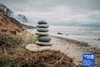
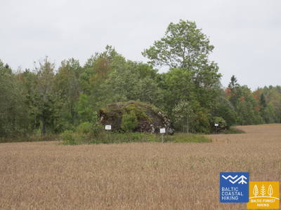
Ranniku matkarada - Ratastooliga läbitav

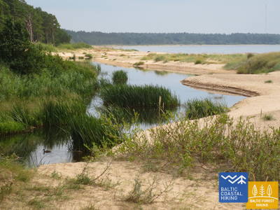
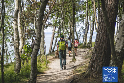
 2. päev. Pape - Bernāti.
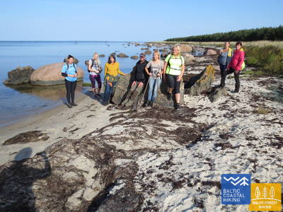
Läti läänepoolseim tipp
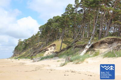
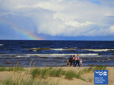
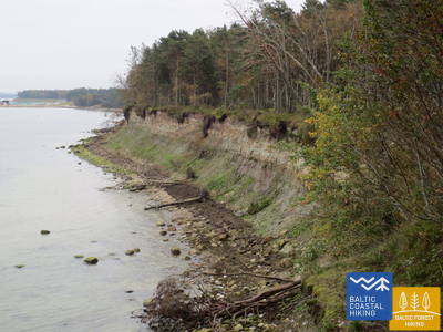
Ranniku matkaraja lõik kulgeb kogu pikkuses mööda randa, mis Pape ümbruses on ääristatud kaunite eelluidetega. Pärast küla asenduvad eelluited 10 km pikkuses langenud männitüvesid täis kaldapealsega. Lauged luited ilmuvad taas välja Jūrmalciemsi lähedal. Bernāti neeme lähistel kõrgub muljetavaldav männimetsaga kaetud ja paiguti mere poolt uhutud liivakivipaljand.
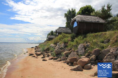
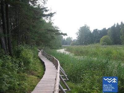
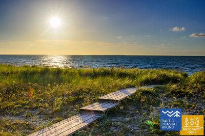
Bernāti Beach Boardwalk

Bernāti ranna laudtee on ühes suunas umbes 400 meetrit pikk, laiusega 1,2–1,6 meetrit. See on osaliselt ligipääsetav ratastoolis inimestele ja soovitatav abiga, kuna kalle ulatub kuni 12 protsendini. Seda saab kasutada ka vankriga vanematel. Laudtee lõpus on vaateplatvorm ja puhkeala. Hooajal pikendatakse laudteed, et ratastooliga kasutajad saaksid rannajoonele jõuda. Laudtee lähedal on parkla (GPS: 56.366156, 20.976715) ja kuivkäimla (mitte kohandatud).


2. päev. Pape - Bernāti.
Läti läänepoolseim tipp
Ranniku matkaraja lõik kulgeb kogu pikkuses mööda randa, mis Pape ümbruses on ääristatud kaunite eelluidetega. Pärast küla asenduvad eelluited 10 km pikkuses langenud männitüvesid täis kaldapealsega. Lauged luited ilmuvad taas välja Jūrmalciemsi lähedal. Bernāti neeme lähistel kõrgub muljetavaldav männimetsaga kaetud ja paiguti mere poolt uhutud liivakivipaljand.
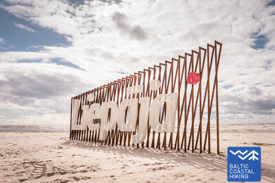
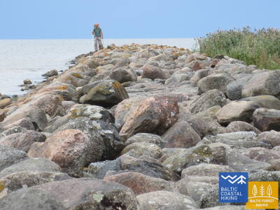
3. päev. Bernāti - Liepāja - Karosta.
Linn, kus sünnib tuul
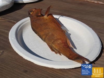
Ranniku matkarada kulgeb Bernātist Liepājani mööda laia rannariba, mida maismaa poolt ääristavad algul paiguti mere poolt uhutud liivakivipaljand, muutudes Liepāja lähedal kõrgeteks eelluideteks. Rada lookleb läbi Liepāja vanalinna ja üle Karosta kanali. Vana sõjasadama Karosta militaar - ja kaitserajatistega tutvumiseks soovitame võtta vähemalt pool päeva. Kindlasti soovitame maitsta Liepāja erirooga, Liepājas menciņi, vana Lõuna-Kuramaa retsepti järgi suitsutursast valmistatud toitu.
The hiking route "Hear, Smell, Touch Liepāja."
Pimedate ja vaegnägijate jaoks loodud marsruuti juhendab väljaõppinud pime giid. See hõlmab Liepāja oluliste kultuuri- ja ajalooliste paikade külastusi. Marsruudi pikkus sõltub grupi vajadustest. See asub Rannaraja lähedal. Liepājas on välja töötatud mitmeid puutetundlikke kaarte, mis aitavad nägemispuudega inimestel hõlpsamini navigeerida.
Liepāja Beach near the Central Rescue Station
Liepāja rannas, keskpäästejaama lähedal (GPS: 56.504199, 20.991922), on rajatud puuetega inimestele mõeldud asutus. See hõlmab duširuume, riietusruume ja puidust laudteid, mis ulatuvad mereni, võimaldades ratastooliga kasutajatel kaldajoonele jõuda. Saadaval on spetsiaalsed meres ujumiseks sobivad ratastoolid. Pimedate ja vaegnägijate jaoks paigutatakse merre helipoid, mis annavad signaalide kaudu teavet selle kohta, kui kaugele tohib ujuda.


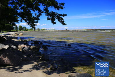
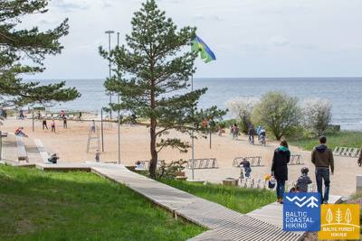
Liepāja Seaside Park.
Pargis on ligikaudu 3 km pikkune radade võrgustik, mis sobib ratastoolis inimestele. Raja pinnad on erinevad, sealhulgas kruus, sillutis, laudteed ja asfalt. Saadaval on puhkealad, söögikohad, parklad ja tualetid. Parki pääseb Liepu ja Peldu tänava ristmikult (GPS: 56.506365, 20.997112). See asub Rannaraja lähedal.


Liepāja Lake Boardwalk
Liepāja järve laudtee on ligipääsetav ratastoolis inimestele ja jalutuskäruga vanematele. See on lai ja varustatud servadega, mis ulatuvad ühes suunas ligikaudu 400 meetrit. Torni ei pääse ratastooliga kasutajad. See asub Rannaradast ca 2 km kaugusel, GPS: 56.494511, 21.024515.


Liepāja Lake Horse Island Trail
Liepāja järve hobuste saare rada on ühes suunas umbes 2 km pikk. Raja alguses on parkla (GPS: 56.516585, 21.032329) ja Dabasmāja – teaduse ja hariduse innovatsioonikeskus (varustatud kaldteedega). Raja pind koosneb alguses laudteedest, millele järgneb kruusatee. See on ligipääsetav ratastoolis inimestele, kuigi kruusaosa on soovitatav abiga. See asub 1,3 km kaugusel Coastal Trailist.


3. päev. Bernāti - Liepāja - Karosta.
Linn, kus sünnib tuul
Ranniku matkarada kulgeb Bernātist Liepājani mööda laia rannariba, mida maismaa poolt ääristavad algul paiguti mere poolt uhutud liivakivipaljand, muutudes Liepāja lähedal kõrgeteks eelluideteks. Rada lookleb läbi Liepāja vanalinna ja üle Karosta kanali. Vana sõjasadama Karosta militaar - ja kaitserajatistega tutvumiseks soovitame võtta vähemalt pool päeva. Kindlasti soovitame maitsta Liepāja erirooga, Liepājas menciņi, vana Lõuna-Kuramaa retsepti järgi suitsutursast valmistatud toitu.
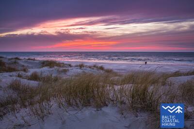
 5. päev. Ziemupe - Pāvilosta.
Laulvad liivad ja merevaik
Ranniku matkaraja lõik saab alguse laulvate liivadega rannalt, kus võib leiduda merevaiku ja fossiilidega kivistisi. Ziemupe kandis on näha osaliselt lainete poolt uhutud liivakivipaljandit. Edasi laiuvad Akmensragsi neemeni ja Pāvilostani kaunid rannaluited ja vareskaerast läbikasvanud ning mere uhutud eelluited. Paiguti on näha ka halle luiteid. Akmenragsi tuletorni juures on hea jalgu puhata. Pāvilosta väikelinna sarm ning sadama ja suitsukala hõng toovad matkaja puutumata looduse rüpest tagasi tsivilisatsiooni juurde.
Pāvilosta Pier Promenade
Pāvilosta mutipromenaadi umbes 200 meetri pikkune osa on ratastoolis inimestele ligipääsetav, kuid mutt ise mitte. Sobiv lähtekoht on Pāvilosta koduloomuuseum (GPS: 56.889365, 21.172837). See asub Rannikuraja kõrval.


Pāvilosta Beach Boardwalk
Pāvilosta ranna laudtee tutvustab külastajatele halli luite ja rannikulüütide elupaiku. Tegemist on 1,2 meetri laiuse puidust laudteega, mille pikkus on pool kilomeetrit (edasi-tagasi). Rada algab kruusakattega. Parkimiskoht on saadaval (GPS: 56.892935, 21.185369). Rada on ligipääsetav ka ratastoolis inimestele abiga, kuna seal on tõusud ja langused. Juurdepääs rannajoonele ei ole võimalik.


5. päev. Ziemupe - Pāvilosta.
Laulvad liivad ja merevaik
Ranniku matkaraja lõik saab alguse laulvate liivadega rannalt, kus võib leiduda merevaiku ja fossiilidega kivistisi. Ziemupe kandis on näha osaliselt lainete poolt uhutud liivakivipaljandit. Edasi laiuvad Akmensragsi neemeni ja Pāvilostani kaunid rannaluited ja vareskaerast läbikasvanud ning mere uhutud eelluited. Paiguti on näha ka halle luiteid. Akmenragsi tuletorni juures on hea jalgu puhata. Pāvilosta väikelinna sarm ning sadama ja suitsukala hõng toovad matkaja puutumata looduse rüpest tagasi tsivilisatsiooni juurde.
 6. päev. Pāvilosta - Jūrkalne.
Läänemere uhkeimad liivaklindid
Ranniku matkaraja lõigul jäävad Pāvilostast kirdesse erakordsed vaated hallidele luidetele. Mõne kilomeetri pärast algab ka üks matkaraja kaunimaid lõike: 20 km uhkeid liivaklinte. Kõige huvitavamad rannikuvaated avanevad Strante, Ulmale ja Rīva jõesuudme juures. Varisenud ranniku alaosas õitsevad suviti orhideed. Jūrkalne kandis saab näha kahte päikeseloojangut – esimest rannajoonelt ning teist hetk hiljem kõrge pankranniku otsast vaadates.
Pāvilosta Beach Boardwalk
Pāvilosta ranna laudtee tutvustab külastajatele halli luite ja rannikulüütide elupaiku. Tegemist on 1,2 meetri laiuse puidust laudteega, mille pikkus on pool kilomeetrit (edasi-tagasi). Rada algab kruusakattega. Parkimiskoht on saadaval (GPS: 56.892935, 21.185369). Rada on ligipääsetav ka ratastoolis inimestele abiga, kuna seal on tõusud ja langused. Juurdepääs rannajoonele ei ole võimalik.
Pāvilosta Pier Promenade
Pāvilosta mutipromenaadi umbes 200 meetri pikkune osa on ratastoolis inimestele ligipääsetav, kuid mutt ise mitte. Sobiv lähtekoht on Pāvilosta koduloomuuseum (GPS: 56.889365, 21.172837). See asub Rannikuraja kõrval.
8. päev. Sārnate - Užava.
Läti ranniku kauneimad vaated
Ranniku matkaraja Sārnate – Užava lõigul on Sārnate kandis näha Läänemere kõrget liivarannikut, mis põhja poole liikudes jääb järjest madalamaks, kuni muutub merre uhutud luitevalliks. Vendzavase ja Užava tuletorni vahel avanevad Läti jaoks ebatavalised vaated – loodus meenutab siin hõreda taimestikuga mahajäetud liiva-kivikõrbe – see on
nõukogude armee endine sõjaväepolügon. Užava jõe suudme lähedal muutub luiteala järjest laiemaks ja luitevall madalamaks. Romantilise Užava tuletorni juurest avaneb üks matkaraja kaunimaid vaateid.
Užava Creek beach boardwalk
Užava jõe suudme lähedal mere ääres kulgev laudtee on 0,5 km edasi-tagasi puidust rada, mis on mõeldud ratastoolikasutajatele. Laudtee on 1,2 meetrit lai, tee ääres on läbipääsualad. Läheduses on parkla (GPS: 57.247001, 21.414652). Raja ääres on puhkeala, kuhu ratastooliga ei pääse ja mereranda ei pääse. Laudtee asub Jūrtaka raja kõrval.


9. päev. Užava - Ventspils.
Nopi rannast oma merevaigukogu!
Ranniku matkaraja Užava – Ventspils lõigul kulgeb teekond esimesed 6 km mööda laiade rannaluidete ja madalate eelluidetega randa, mille seljandikke katavad hõbehallid rand-luidekaera ja liiv-vareskaera puhmad. Alates Medole oja suudmest kerkib muljetavaldav ligi 19 m kõrge, kitsa kivise merepiiriga liivakivipaljand. Kõrge rannik alaneb kiiresti, et kahe kilomeetri pärast taas tõusta. Kahe kõrge ranniku vahele jääb nõukogude armee endine sõjaväepolügon. Matkaraja viimased viis kilomeetrit kuni Ventspilsi lõunamuulini kulgevad mööda laia liivaluidet.
Ventspils Seaside Park
Ventspilsi mereäärses pargis on umbes 3,5 km pikkune radade võrgustik, sealhulgas 730 m pikkune Ankrurada. Rajad (v.a. Džunglirada) on ligipääsetavad ratastoolis liikuvatele inimestele ja jalutuskäruga lapsevanematele. Raja pind koosneb kruusast ja asfaldist (alguses). Mugav alguspunkt pargiga tutvumiseks on Parka ja Loču tänavate ristmik (GPS: 57.389279, 21.537021), kus on parkimine ja WC. Park asub Jūrtaka raja kõrval. Ratastoolis inimestele ja jalutuskäruga lapsevanematele on sobivaim mereäärne randapääs pargis asuv 6. sissepääs.
9. päev. Užava - Ventspils.
Nopi rannast oma merevaigukogu!
Ranniku matkaraja Užava – Ventspils lõigul kulgeb teekond esimesed 6 km mööda laiade rannaluidete ja madalate eelluidetega randa, mille seljandikke katavad hõbehallid rand-luidekaera ja liiv-vareskaera puhmad. Alates Medole oja suudmest kerkib muljetavaldav ligi 19 m kõrge, kitsa kivise merepiiriga liivakivipaljand. Kõrge rannik alaneb kiiresti, et kahe kilomeetri pärast taas tõusta. Kahe kõrge ranniku vahele jääb nõukogude armee endine sõjaväepolügon. Matkaraja viimased viis kilomeetrit kuni Ventspilsi lõunamuulini kulgevad mööda laia liivaluidet.
10. päev. Ventspils - Staldzene.
Läbi Ventspilsi linna
Ranniku matkaraja lõik läbib Ventspilsi linna ja seda ümbritsevaid metsi. Matkarada lookleb lõunamuuli juurest läbi ajaloolise Ostgala linnaosa ja vanalinna, üle Venta jõe ning mööda kergliiklusteed läbi Pārventa linnaosa Staldzene poole. Tehes tiiru ümber Ventspilsi sadama naaseb rada taas mereranda. Nüüd tasub võtta üks matkavaba päev ja tutvuda põnevate paikadega Ventspilsi linnas ning külastada ka mereäärset vabaõhumuuseumi.
Lake Būšnieki Nature Trail
Rada ümber Būšnieki järve on 9 km pikkune ring, kuhu pääsevad ratastoolikasutajad ja jalutuskäruga lapsevanemad. Sellel on audiogiid, puutetundlik teave ja parkimisala liikumispuudega inimestele. Soovitatav alguspunkt on järve kaguküljel asuv parkla (GPS: 57.437632, 21.656062). Rada asub Jūrtaka rajast ca 1 km kaugusel.


15. päev. Saunags - Kolka.
Kolka neem – Euroopa süda
Ranniku matkaraja lõik lookleb mööda väikeseid põllu- ja metsateid Saunagsist Vaideni, kus pöördub tagasi mereranda. Kolka neemeni sirutuvad laiad, liivased rannaribad, vaheldudes madalate ja hõreda taimestikuga eelluidetega, mille järel ilmuvad taas metsatukkadega kaetud rannaluited. Ligikaudu 2 km jagu on lainete uhutud liivaranda, mille taga kerkivad Dumbrkalni künkad. Kolka neem – Läänemere ja Liivi lahe vaheline piirineem – on Läänemere ranniku üks populaarsemaid linnuvaatluspiirkondi.
Kolka Pine Trail
1,8 km pikkune rada on mõeldud rannaluidete elurikkuse avastamiseks. Sellel on kaks vaateplatvormi, mis on ligipääsetavad ratastoolis inimestele. Kuivkäimlad on osaliselt kohandatud funktsioonipuudega inimestele. Parkimiskoht on saadaval (GPS: 57.756668, 22.591180). Rada asub Jūrtaka raja kõrval.


16. päev. Kolka - Ģipka.
Mööda „suletud randa“
Ranniku matkaraja lõigul Kolkast Ģipka suunas märkab Kolka neemelt ära pöörates selget erinevust Läänemere ja Liivi lahe vahel. Matkaraja esimesed 10 km kulgevad piki Slītere rahvuspargi rannikut, mida iseloomustavad merre uhutud männitüved, kunagise kalurikolhoosi tootmishooned, sadamakai ja Ēvaži pankrannik. Viimase lähistel on ebatavaliselt kitsas liivane rannariba, mille kohale on kaardunud sanglepad. Ka edasist lõiku kuni Ģipkani iseloomustab kitsas, liivane ja siia suubuvate väikeste ojadega rannariba (suviti on veetase väga madal). Slītere rahvuspargi rannik oli nõukogude ajal kahekordne keeluala – siin oli looduskaitseala ja piiritsoon.
Ēvažu Nature Trail
Rada on mõeldud Liivi lahe ühe haruldase järsu ranniku vaatamiseks. Ratastooliga kasutajad pääsevad vaateplatvormile, kust avaneb vaade Liivi lahele. Rada on 1,2 km edasi-tagasi. Pinnale kuulub alguses kruus, millele järgneb kulunud rada ja järsu kalda lähedal treppidega laudteed. Tukums - Kolka maantee vastasküljel on parkla (GPS: 57.677789, 22.567982). Rada asub Jūrtaka raja kõrval.


17. päev. Ģipka - Kaltene.
Kuramaa kivine rand
Ranniku matkaraja lõik Ģipkast kuni Rojani kulgeb liivarannal, kus on kaunid luited ja männimetsad. Vahetult enne Rojat on rand kõrkjatesse kasvanud. Roja ja Kaltene kiriku vaheline lõik on aga kogu Läti rannajoone üks omapärasemaid, sest siin sirutuvad merre paljud väikesed maaninad, moodustades lahtesid ja kitsa siksakilise mereranna. Rand on tihedalt täis erinevas suuruses maakive, mille kohale kaarduvad sangleppade võrad. Paiguti kulgeb ranna lähedal kruusatee, mida ääristavad endised kalurite elamud.
Walking Path at Roja Beach
Puidust laudteed on mõeldud ratastoolikasutajatele ja jalutuskäruga lapsevanematele. Olemas on punktkirjas infostend ja kombatav rannakaart. Teenuste hulka kuulub kohandatud WC ja parkla (GPS: 57.510088, 22.799207). Laudtee on 0,5 km pikkune ühes suunas. Kui ratastooliga kasutajad saavad laudteid kasutada, siis kaldtee puudumise tõttu mere äärde ei pääse. Laudteed on laiad, külgedel ja läbipääsualadel kaitsepiiretega.


17. päev. Ģipka - Kaltene.
Kuramaa kivine rand
Ranniku matkaraja lõik Ģipkast kuni Rojani kulgeb liivarannal, kus on kaunid luited ja männimetsad. Vahetult enne Rojat on rand kõrkjatesse kasvanud. Roja ja Kaltene kiriku vaheline lõik on aga kogu Läti rannajoone üks omapärasemaid, sest siin sirutuvad merre paljud väikesed maaninad, moodustades lahtesid ja kitsa siksakilise mereranna. Rand on tihedalt täis erinevas suuruses maakive, mille kohale kaarduvad sangleppade võrad. Paiguti kulgeb ranna lähedal kruusatee, mida ääristavad endised kalurite elamud.
18. päev. Kaltene - Mērsrags.
Mitmekülgne rannajoon
Ranniku matkaraja Kaltene – Mērsrags lõigu muudavad eriti mitmekülgseks selle loodus, kultuuri- ja ajaloopärand ning kaunid vaated. Kaltene lähistel rikastavad rannajoont väikesed lahesopid ja kivised kaldad. Edasi kulgeb matkarada kõrkjatest ja taimestikust kinnikasvanud randa. Hiljem on kivine rannariba kohati vaid paari meetri laiune, paiguti savine, kõrkjatest läbikasvanud ning tihti täis adruvalle. Valgaciemsi ja Mērsragsi vahel muutub rand jälle liivaseks.
Boardwalk in Upesgrīva
Asub Lūši kämpingu ja mere vahel (GPS: 57.381441, 23.025370). Laudteel puuduvad külgrööpad ja läbisõidualad. Siia pääsevad ratastoolikasutajad koos assistendiga. Selle pikkus on ühes suunas ligikaudu 90 meetrit. See ei võimalda juurdepääsu mere kaldale. See asub rannaraja (Jūrtaka) lähedal.


Boardwalk near Mērsrags Lighthouse
Asub aadressil Bākas tänav 60. Laudtee võimaldab ratastoolikasutajatel liikuda parklast (GPS: 57.365315, 23.120436) luideteni, kust paistab meri. Laudteel on osaline servakaitse ja puuduvad ümberpöördealad. Pikkus on umbes 150 m (edasi-tagasi). See asub rannaraja lähedal.


19. päev. Mērsrags - Engure.
Engure looduspargis
Ranniku matkaraja Mērsrags – Engure lõigul viib tee Mērsragsi külakeskusest läbi männimetsa randa. Edasi jääb matkarajast ühele poole rohtu ja kõrkjatesse kasvanud kivine rannariba ning teisele poole metsaga kaetud rannaluited. Kohati on rand justkui sillutatud väikeste ümarate kividega, teisalt kohtab liigirikkaid halle luiteid. Bērzciemsi juures avanevad rannaniidud ja kaugele merre ulatuvad madalikud (populaarne linnuvaatluskoht). Kinnikasvanud rand jätkub kuni Abragciemsini, edasi kuni Engureni on liivaluited.
Engure Nature Trail
Parklast (GPS: 57.171428, 23.222504) Slimnīcase tänaval ulatub üle luidete mere äärde puidust laudtee, mis on mõeldud ratastoolikasutajatele ligipääsetavaks. Kalde tõttu võib vaja minna abi. Rada on ühes suunas ligikaudu 200 meetrit. See asub rannaraja (Jūrtaka) lähedal.


20. päev. Engure - Ragaciems.
Kalurikülad ja suitsukala
Ranniku matkaraja Engure – Ragaciems lõigu algus lookleb rannamändide vahel, mööda suhteliselt kitsast rannariba läbi Engure küla. Plieņciemsi luite juures muutub liivariba üha laiemaks. Maismaa pool kõrguvad kuni Kolka – Tukumsi maanteeni taimestikuga kaetud ja treppidega varustatud kaldad. Soojadel suvepäevadel on siin palju puhkajaid. Marsruudi viimane kolmandik asub Ķemeri rahvuspargis.
Apšuciems
Apšuciemsis on liikumispuudega inimestele saadaval kaks ujuvat rannaratastooli. Neid saab Apšuciemi koolist eelneval kokkuleppel numbril +371 26132761. Kasutajad peavad tagama oma abilise, kes aitab neil vette ja sealt tulla, ujuda ja tagasi pöörduda. Saadaval on ka päästevestid. 2025. aastal on plaanis rajada merepääs, mis hõlmab ratastooliga ligipääsu, veste, riietuskabiini ja spetsiaalseid päevitusmatte. Abiga on võimalik teha väikseid väljasõite mööda rannajoone kõva liivaosa. See asub Läänemere rajal.

Plieņciems Valged luited piirirada
Rada asub Plieņciemsi lõunapiiril, mis kulgeb Riiast Engure suunas.
Nimi Plieņciems tuleneb balti sõnast „pliens“ - lubjakivi või mergelis. Küla on esimest korda dokumentides mainitud juba 1551. aastal, kuid kaardil on see asustatud kohana märgitud alates 1702. aastast. 18. sajandi keskel mainitakse Engure kihelkonnaregistris, et Plieņciemsis oli üheksa talu, millel oli õigus kalastada meres ja Engure järves ning koguda mereheina.
Tee juurest viib jalutuskäijaid üle düünide valli mere äärde. Rada on projekteeritud nii, et see on ligipääsetav ratastooliga liiklejatele (soovitavalt koos kaaslasega) ja lastega peredele, kellel on lapsevankrid. Rannas on riietusruum ja väike mänguväljak. Rajal ei ole vastassuunavööndiga kohtade vahetamiseks ettenähtud ala.


20. päev. Engure - Ragaciems.
Kalurikülad ja suitsukala
Ranniku matkaraja Engure – Ragaciems lõigu algus lookleb rannamändide vahel, mööda suhteliselt kitsast rannariba läbi Engure küla. Plieņciemsi luite juures muutub liivariba üha laiemaks. Maismaa pool kõrguvad kuni Kolka – Tukumsi maanteeni taimestikuga kaetud ja treppidega varustatud kaldad. Soojadel suvepäevadel on siin palju puhkajaid. Marsruudi viimane kolmandik asub Ķemeri rahvuspargis.
21. päev. Ragaciems - Dubulti.
Jūrmala – ajalooline kuurortlinn
Ranniku matkaraja Ragaciems – Dubulti vahelise lõigu esimene kolmandik kulgeb Ķemersi rahvuspargis, kus saab tutvuda ajalooliste kalurikülade, paadikuuride ja kalaturuga. Starpiņupīte jõe suudmeala on populaarne linnuvaatluskoht. Ragaciemsi külast paistab hästi ka kogu Jūrmala rannajoon. Jaunķemerist kuni Dubultini kulgeb rada mööda Liivi lahe kõige laiemat liivaranda ja läbi Jūrmala ajaloolise kuurortlinna, mis on ühtlasi Läti pikim linn. Ilusate suviste ilmadega on siinses rannas palju suvitajaid.
Jūrmalas pilsētas pludmales
Jurmala linnarandadesse pääsevad funktsionaalse puudega inimesed, sealhulgas ratastoolis ja pensionärid. Jūrmalas on ratastoolidele 14 kohandatud juurdepääsupunkti merele: liin 36, Vienības prospekts (2 juurdepääsupunkti), Turaidas iela (2 juurdepääsupunkti), Pilsonu iela, Baznīcas iela, Kļavu iela, Līgatnes iela, Dzimtenes iela, Vēju iela iela, Atbalss iela, Kapteiņa Zolta iela ja Jaunķemeri tee. Need juurdepääsupunktid on loodud nii, et need sobiksid pinnast ja maastikku arvestades nii funktsionaalse puudega inimestele kui ka jalutuskäruga inimestele. Lisaks on neljas kohas – Vaivari, Kaugguri, Jaunķemeri ja Jaundubulti –, kus on saadaval laiendatud ja mugavamad riietuskabiinid.
Kupskalni Nature Trail
Rada ulatub pool kilomeetrit mööda Siliņupe jõe paremkallast ja viib Sloka-Talsi maanteelt mere äärde. See on osaliselt ligipääsetav abistamisega ratastoolis inimestele, kuna raja alguses võivad puujuured takistada. Raja edasine lõik (laiad laudteed läbipääsualadega) on ligipääsetav. Tualettruumi osaline juurdepääs on saadaval. Jalutuskäiku saab alustada lähedal asuvast tanklast (GPS: 56.992203, 23.522736).


22. päev. Dubulti - Lielupe - Bulduri.
Läti populaarseimad supelrannad
Ranniku matkaraja lõigul Dubulti ja Lielupe vahel paikneb Liivi lahe kõige laiem liivarand – oma lugematute rannakohvikute ja puhkamisvõimalustega on see Jūrmala kuurortlinna suurim väärtus ja tõmbenumber. Rannaäärsetes luitemetsades on tihe rajavõrgustik, mis sobib hästi jalutamiseks ja kepikõnni harrastamiseks. Lielupe ranna ja Jūrmala vabaõhumuuseumi vaheline matkaraja lõik kulgeb Ragakāpa looduspargi territooriumil. Buldurisse saab mugavalt tagasi kõndida mööda Bulduri avenüüd või 5. liini.
Jūrmalas pilsētas pludmales
Jurmala linnarandadesse pääsevad funktsionaalse puudega inimesed, sealhulgas ratastoolis ja pensionärid. Jūrmalas on ratastoolidele 14 kohandatud juurdepääsupunkti merele: liin 36, Vienības prospekts (2 juurdepääsupunkti), Turaidas iela (2 juurdepääsupunkti), Pilsonu iela, Baznīcas iela, Kļavu iela, Līgatnes iela, Dzimtenes iela, Vēju iela iela, Atbalss iela, Kapteiņa Zolta iela ja Jaunķemeri tee. Need juurdepääsupunktid on loodud nii, et need sobiksid pinnast ja maastikku arvestades nii funktsionaalse puudega inimestele kui ka jalutuskäruga inimestele. Lisaks on neljas kohas – Vaivari, Kaugguri, Jaunķemeri ja Jaundubulti –, kus on saadaval laiendatud ja mugavamad riietuskabiinid.
23. päev. Bulduri – Riia kesklinn.
Läbi metsade Riia poole
Ranniku matkaraja lõik kulgeb Jūrmalast läbi metsaste alade Riia suunas. Pärast Lielupe jõe silda lookleb rada läbi puithoonestusega Priedaine linnaosa, piki Lielupe jõe paremkallast ja keerab Bolderāja luite lõunaosa suunas. Põigates läbi Kleistu metsa ja kulgedes paralleelselt Lāčupe kalmistuga jätkub matkarada ajaloolises Pārdaugava linnaosas – mööda Buļļi ja Daugavgrīva tänavaid ning läbides Dzegužkalnsi. Möödudes Zunda kanalist ja Āgenskalnsi lahest jõuab matkaja Daugava jõeni, ületab vana kivisilla ja on matkapäeva lõpuks jõudnud Riia raekoja platsile.
Jūrmalas pilsētas pludmales
Jurmala linnarandadesse pääsevad funktsionaalse puudega inimesed, sealhulgas ratastoolis ja pensionärid. Jūrmalas on ratastoolidele 14 kohandatud juurdepääsupunkti merele: liin 36, Vienības prospekts (2 juurdepääsupunkti), Turaidas iela (2 juurdepääsupunkti), Pilsonu iela, Baznīcas iela, Kļavu iela, Līgatnes iela, Dzimtenes iela, Vēju iela iela, Atbalss iela, Kapteiņa Zolta iela ja Jaunķemeri tee. Need juurdepääsupunktid on loodud nii, et need sobiksid pinnast ja maastikku arvestades nii funktsionaalse puudega inimestele kui ka jalutuskäruga inimestele. Lisaks on neljas kohas – Vaivari, Kaugguri, Jaunķemeri ja Jaundubulti –, kus on saadaval laiendatud ja mugavamad riietuskabiinid.
Babīte Rhododendron Nursery
Rajatud on 1,9 kilomeetri pikkune rada, kuhu pääsevad ratastoolis inimesed ja käruga lapsevanemad. Raja katteks on asfalt. Olemas on määratud parkla (GPS: 56.962330, 23.952280) ja kohandatud tualettruum. Rada asub Jūrtaka rajast ca 2,7 kilomeetri kaugusel.
Daugavgrīva Nature Trail
Rada algab parklast (GPS: 57.036769, 24.018166), Valentīna Pikuļa tänava lähedalt ning viib üle Daugavgrīva soo luidete ja mereni. Mereäärne rajapind on asfalteeritud ning asfalteeritud lõik on ligipääsetav ratastooliga inimestele. Raja äärde on ehitatud linnuvaatlustorn, mille esimene korrus on ligipääsetav ratastoolis inimestele. Rada asub Daugavgrīvas mere rannikul asuvast Jūrtaka rajast ligikaudu 12,5 kilomeetri kaugusel.

24. päev. Riia kesklinn – Vecāķi.
Riia vanalinn – UNESCO maailmapärandi hulka arvatud paik
Ranniku matkarada teeb alguses väikese tiiru Riia kesklinnas – vanalinnas ja kanali ääres, jätkub läbi Kronvaldsi pargi, mööda juugendstiilis Alberti tänavat kuni Miera tänavani, liikudes edasi läbi suure kalmistu (Lielie kapi) ning piki Koknese ja Osta puiesteid. Läbides Mežaparksi linnaosa jõuab rada Jaunmīlgrāvisesse ja ületab Mīlgrāvise kanali. Edasi lookleb rada mööda Vecāķi puiesteed kuni Ziemeļblāzma kultuurikeskuseni ja Vecdaugava jõe kallasteni, millest mõne kilomeetri kaugusele jääb Vecāķi asula. Pärast kahepäevast teekonda läbi Riia linna jõuab matkarada tagasi randa.
Mangaļsala walking paths
Mangaļsalas viivad kaks rada läbi luitealade ja rannikumetsade mere äärde. Esimene rada (GPS: 57.071642, 24.087599) on soovitatav ratastoolis sõitjatele koos abilisega, kuna see viib mere äärde, kuid ei anna otsepääsu randa. Teine rada (GPS: 57.062730, 24.055460) algab pinnasteena ja jätkub hiljem laia puidust laudteena, mis võimaldab ratastooliga sõitjatel randa jõuda. Kolmas rada (GPS: 57.061976, 24.041811) viib idakaile. Kuigi see pole spetsiaalselt ette nähtud ratastooliga ligipääsuks, saab sellel navigeerida abiga, sealhulgas muulil endal, välja arvatud tugeva tuule või tormi ajal. Nii esimesel kui ka teisel rajal on spetsiaalne parkimine ja WC. Lähim rada asub Jūrtakast ca 3,5 km kaugusel.


25. päev. Vecāķi - Carnikava.
Kahe jõe – Daugava ja Gauja (Koiva) – suudmealade vahel
Ranniku matkaraja Vecāķi – Carnikava lõik algab piki kaunist liivaranda. Maismaa poolt piiravad randa muljetavaldavate luitevallidega valgusküllased rannamännikud. Edasi jätkub matkarada metsateel kuni Carnikavani, teeb tiiru mööda tammi ümber Vecgauja ja jõuab Koiva jõe jalakäijate sillani. Nii matkapäeva alguses kui lõpus on mõnus istuda kas mõnes Vecāķi rannakohvikus või Carnikava kõrtsis.
Garciems nature trail
Laudtee viib Eimuri kanali suudmesse mere äärde. Laudtee ots on kalda lähedal ja abilise abiga saab ehk mere äärde. See sobib ratastoolis inimestele ja jalutuskäruga vanematele. Saadaval on parkla (GPS: 57.108161, 24.192324) ja WC. Pikkus ühes suunas on 0,7 km. See asub Jūrtaka kõrval.
Carnikava Promenade
Ühendab Carnikavat mere rannikuga. Tee on asfalteeritud, kuid liivaluidetes - puidust jalgsillaga. Merekaldal on käiguteed ja vaateplatvormid lamamistoolidega. Raja pikkus ühes suunas on 1,8 km. Sinna pääsevad ratastoolis inimesed ja lapsevankriga vanemad. Laivu tänavale on rajatud parkla (GPS: 57.133531, 24.265631), kohandatud WC, infostendid ja puhkealad. Mereäärne liivane ala ei ole ratastooliga ligipääsetav. Promenaadi viimane lõik on 9,2% kaldega. Jurtaka liigub mööda Carnikava promenaadi. 2024/2025 g. Carnikava promenaadile on kavas luua spetsiaalne maastikuratastoolide marsruut, mis on nende kasutajate käsutuses koos abilisega.


26. päev. Carnikava - Saulkrasti.
Romantiliste päikeseloojangutega rada
Ranniku matkaraja Carnikava – Saulkrasti lõik viib läbi Gauja küla Koiva jõe suudmealale, mis on suurepärane linnuvaatluspiirkond. Edasi kulgeb matkarada mööda liivaranda kuni Inčupe jõe suudmeni. Enne suudmeala tuleb keerata maismaa suunas, et jõuda sillani. Pēterupe jõe rippsilla ületamise järel jõuab matkarada piki mereranda Saulkrasti rannaparki (Jūras parks).
Lilaste Beach
Viib mere äärde. Selle pikkus ühes suunas on 130 m. Algab parklast (GPS: 57.187403, 24.329523), kust ratastoolis inimene saab abilise abiga randa. See asub Jurtaka kõrval.

White Dune
Üks Liivi lahe maalilisemaid luiteid. Pääseb ratastoolis inimestele koos abilisega parklast vaateplatvormile (GPS: 57.233560, 24.393407). Baltas kapa on osa Jūrtakase marsruudist.
Path and wooden boardwalk network in the coastal dunes of Saulkrasti
Raiņa tänava ja Bīriņu tänava (Merepark, Saulkrasti turismiinfokeskus) vahel asuv rada on kohandatud ratastoolikasutajatele ja jalutuskäruga vanematele. See kulgeb paralleelselt Jūrtaka rajaga. Lihtsaim juurdepääs rajale ja laudteele on parklast (GPS: 57.267111, 24.413875).


26. päev. Carnikava - Saulkrasti.
Romantiliste päikeseloojangutega rada
Ranniku matkaraja Carnikava – Saulkrasti lõik viib läbi Gauja küla Koiva jõe suudmealale, mis on suurepärane linnuvaatluspiirkond. Edasi kulgeb matkarada mööda liivaranda kuni Inčupe jõe suudmeni. Enne suudmeala tuleb keerata maismaa suunas, et jõuda sillani. Pēterupe jõe rippsilla ületamise järel jõuab matkarada piki mereranda Saulkrasti rannaparki (Jūras parks).
27. päev. Saulkrasti - Lauči.
Vidzeme kiviste randade värav
Ranniku matkaraja Saulkrasti – Lauči lõigu esimesed kilomeetrid kuni Zvejniekciemsini võib läbida mööda randa või liikuda läbi rannikuäärse männimetsa. Teele jääb vana kalavõrkude ja –tarvikute hoiustamise kuur. Enne Skulte sadamat ilmestavad Zvejniekciemsi rannikut ka kivid. Tehes tiiru ümber Aģe jõe suudmeala ja sadama, naaseb matkarada mereranda, kus juba kaugelt paistab Ārņu neem ja selle taga suure pruuni kivirahnu selg – Lielais Lauču akmens. Matkaraja lõigule jäävad mitmekülgsed rannikuvaated.
Path and wooden boardwalk network in the coastal dunes of Saulkrasti
Raiņa tänava ja Bīriņu tänava (Merepark, Saulkrasti turismiinfokeskus) vahel asuv rada on kohandatud ratastoolikasutajatele ja jalutuskäruga vanematele. See kulgeb paralleelselt Jūrtaka rajaga. Lihtsaim juurdepääs rajale ja laudteele on parklast (GPS: 57.267111, 24.413875).
28. päev. Lauči - Tūja.
Kadunud purjelaevade ajastu
Ranniku matkaraja Lauči – Tūja idülliliste vaadetega Vidzeme rannalõigul vahelduvad kivised maaninad ja meres asuvad rändrahnud väikeste liivaste abajatega, kuhu suubuvad tillukeste jõgede ja suviti kuivama kippuvate ojade veed. Kohati on kogu rannariba kaetud hallide kividega. Paiguti ilmuvad väiksemad kõrkjatihnikud. Tūja kandis võib märgata esimesi liivakivipaljandeid.
Munchausen’s Beer Mug Trail
1,3 km pikkune rada (üks suund) asub Dunte mõisa juures ja saab alguse Minhauzensi muuseumi lähedalt. Raja pind koosneb 1,5 meetri laiustest puidust laudteedest, millel on mitu läbimisala. Rajaga tutvumist on mugav alustada parklast (GPS: 57.405620, 24.424681). Rada asub 1,7 km kaugusel Jūrtaka rajast.
29. päev. Tūja - Svētciems.
Vidzeme kivine rand
Ranniku matkaraja lõik Tūjast algab Zaķupīte jõe ületamisega. Kuni Ķurmragsi tuletornini jäävad teele valdavalt liivased, väiksemate kiviste lõikudega rannad. Hiljem jõuab rada Vidzeme kivisesse randa, kus maaninad vahelduvad väikeste abajatega, kuid kaldajoonelt kerkib ka kuni 4 m kõrgune liivakivipaljand. Meleki neeme järel liigutakse taas valdavalt liivarannal, mis on enne Svētupe jõe suudmeala tihedalt rohtukasvanud ja kaetud kõrkjatihnikuga. Rada on võimalik läbida ka ringiga mööda metsateed.
Rest area "Vasas"
Ratastooliga inimestele ligipääsetav on loodud vaateplatvorm ja parkla (GPS: 57.520544, 24.379052). See asub Jūrtaka raja kõrval.
Veczemju Cliffs
Veczemju kaljude lähedal on kaldtee ratastoolikasutajatele koos abiga. Kuid rannaliivad ei sobi ratastooliga ligipääsuks. Kaldtee alus on sageli tormikahjustustega. See asub Läänemere ranniku matkaraja (Jūrtaka) lähedal.


30. päev. Svētciems - Ainaži.
Silmude kuningriik
Ranniku matkarada kulgeb Svētciemsi – Salacgrīva lõigul mööda luitevallide vahel looklevat metsarada, sest rannariba on tihedalt rohtunud ja sisuliselt läbimatu. Salacgrīvast Kuivižisse võib minna mööda liivaranda või metsateid. Ümber Kuiviži ja Vēverupe vaheliste rannaniitude saab mööda metsateed, mis asub A1 maanteest idas. Pärast Vēverupet naaseb matkarada rohtunud randa, lahkudes sealt Blusupīte jõesuudmes, et jõuda mööda Kāpu ja Valdemāra tänavaid Ainaži muulini. Selja taha on jäänud ligi 580 km Lätimaad ja avastamist ootab Eestimaa.
Salacgrīvas promenade
Ligikaudu 260 meetri pikkune heakorrastatud promenaad (sh Slavase allee) piki Salaca jõe paremkallast on ratastoolikasutajatele ligipääsetav abistaja abiga. Uudistamist saab alustada parklast (GPS: 57.756060, 24.358155). See asub Läänemere ranniku matkaraja (Jūrtaka) lähedal.


Monument "White Sun"
Asub Ainažis. Selle vaatamiseks on loodud umbes 150 meetri pikkune puidust kõnnitee (algus GPS: 57.859628, 24.347306). See on ligipääsetav ratastoolikasutajatele abiga ja lapsevanematele jalutuskäruga. Parklast käiguteeni on ca 250 meetrit. See asub Rannaraja lähedal.


Krasta ielas promenāde Salacgrīvā
Umbes 0,8 km pikkune see on loodud piki Salaca vasakut kallast sillast kuni Meža tänavani, kus asuvad tenniseväljakud. Juurdepääs ratastoolis inimestele. Loodud on puhke- ja vaatamiskohad, Meža tänavale - kohandatud WC. Katte - kaasaegne sillutis.


Laipas līdz Salacgrīvas pludmalei
Jūrmala tänava parklast (57.75083, 24.34911) randa on loodud kaks puidust jalgsilda. Ratastooliga inimestele ligipääsetav koos abilisega, kuna laudtee düüniga ülekäigukoht võib sisaldada mäda liiva. Parklas on tualett. Laudtee kate - puit. Kaks ratastooli ei saa laudteel vahetada.


30. päev. Svētciems - Ainaži.
Silmude kuningriik
Ranniku matkarada kulgeb Svētciemsi – Salacgrīva lõigul mööda luitevallide vahel looklevat metsarada, sest rannariba on tihedalt rohtunud ja sisuliselt läbimatu. Salacgrīvast Kuivižisse võib minna mööda liivaranda või metsateid. Ümber Kuiviži ja Vēverupe vaheliste rannaniitude saab mööda metsateed, mis asub A1 maanteest idas. Pärast Vēverupet naaseb matkarada rohtunud randa, lahkudes sealt Blusupīte jõesuudmes, et jõuda mööda Kāpu ja Valdemāra tänavaid Ainaži muulini. Selja taha on jäänud ligi 580 km Lätimaad ja avastamist ootab Eestimaa.
32. päev. Kabli - Häädemeeste.
Linnud, luited ja metsad
Ranniku matkaraja lõik Kablist Häädemeeste lõunaosani tuleb läbida mööda vana Riia maanteed, sest teest mereni laiuvad roostunud ja abajatega rannaniidud. Antud lõik sobib eriti hästi linnuvaatluseks. Vahetult enne Häädemeestet keerab matkarada maanteelt kõrvale, lookleb Jaagupi hoiualal ja teeb lääne poolt alevikule tiiru peale, ronib kord kõrgele luitenõlvale ja laskub siis taas alla luidete vahelisse kõrgesse männikusse. Matkaraja ääres on head marja- ja seenemetsad.
Kabli nature trail
Rada tutvustab külastajatele rannaluiteid ja nende loodusväärtusi. Algab parklast (GPS: 58.019424, 24.450986), mis asub Kabli külastuskeskuse lähedal. Raja pikkus on 1,8 km. Rajapinnad on kruusa, metsarajad ja 1,5 m laiused puidust laudteed. Rada on ligipääsetav ratastoolikasutajatele ning olemas on kohandatud WC. Raja ääres asuvad infostendid, millel on ka vaateplatvorm ja kaks linnuvaatlustorni (ratastooliga pole ligipääsetav). See asub Coastal Traili lähedal.


34. päev. Uulu - Pärnu.
Märgaladest mööda Pärnusse
Ranniku matkaraja Uulu - Pärnu lõik kulgeb alguses männimetsade vahel olevaid vanu mereäärseid teid pidi, kuid pärast Lottemaa teemaparki keerab mere poole jõudes Reiu randa. Edasi tuleb kõndida mööda võsastuvat luidet ning umbes 4 km pärast pöörata sisemaa suunas, läbida golfiväljaku äärne territoorium ja võtta suund Pärnu linnale. Raeküla linnaosas kulgeb matkarada piki märgala ja metsa piiri. Umbes 6 km pikkuse tiiru järel ümber märgalade jõuab rada Pärnu randa. Edasi viib teekond läbi Pärnu linna, Vallikääru aasa, üle Pärnu ja Sauga jõgede ja lõpeb Vana-Pärnus.
Pärnu Coastal Meadow Hiking Trail
Rajal tutvutakse märgade rannaniitude, laguunide ning kohaliku linnu- ja taimestikuga. See on kujundatud ovaalse kujuga, vaateplatvormiga (pääsetav esimesele korrusele) ja ulatub 600 meetrini. Külastust saab mugavalt alustada lähedalasuvast parklast (GPS: 58.372397, 24.507902). Raja katteks on puidust laudteed, parkla lähedal asfaltkattega teed. Rada on ligipääsetav ratastoolikasutajatele, kuid abi on soovitatav, kuna mõnel lõigul on kalle üle 8%. See asub Coastal Traili lähedal.


Pärnu Beach Promenade
Rada kulgeb poole kilomeetri ulatuses paralleelselt Pärnu lahe rannaga. Pinnaks on valdavalt puidust laudtee (laius 2,3–3,1 meetrit), mõne sillutisega, laiusega kuni 4 meetrit. See on ligipääsetav ratastoolikasutajatele. Rada saab mugavalt alustada lähedalasuvast parklast (GPS: 58.372397, 24.507902).
Access to the beach and rental of swimming aids
2024. aastal võimaldatakse Hedon SPA & Hotellis hooajaline ligipääs ujumisvahenditele ja muule varustusele ning luuakse spetsiaalne pind, mis võimaldab ratastooliga sõitjatel vette pääseda.


Pärnu Beach Park
1882. aastal rajatud park on populaarne puhkeala nii linnakülalistele kui ka kohalikele elanikele. Sellel on ligikaudu 1 km pikkune radade võrgustik (umbes 3 m laiused), mis on ligipääsetavad ratastoolikasutajatele. Raja katted on killustik ja asfalt. Tasuline parkimine on saadaval pargi perimeetri ümber. See asub Jūrtaka lähedal.


Pärnu Mole Boardwalk
Laudtee algab Pärnu muuli vastas (GPS: 58.381941, 24.483994). Laudtee on 0,6 km pikkune (üks suund) ja ratastoolikasutajatele ligipääsetav. Pind on puidust ja laius on 3 meetrit. Erinevates punktides on teepikendused ja puhkealad. See pakub suurepärast võimalust tutvuda Pärnu sadamaga. See asub umbes 350 meetri kaugusel Jūrtakast.


35. päev. Pärnu - Liu.
Kaunimad vaated Pärnu lahele
Ranniku matkaraja Pärnu – Liu lõik lookleb läbi Pärnu läänepoolse eeslinna ja üle Audru jõe Valgeranna poole. Rada ääristab lõuna poolt mets ja valge liivarand, põhja poolt aga Valgeranna golfiväljak. Valgerannast edasi kulgeb rada Pärnu lahe põhjakülje poldrite vahel, Audru poldritelt avanevad kaunid vaated Pärnu lahele. Audru roostiku tagant keerab rada lõunasse ning kulgeb läbi rannakülade ja väikeste kalasadamate, kus saab jälgida kalurite argitoimetusi ja kui veab, siis maitsta ka suitsukala.
Valgeranna Beach Promenade
Rada ühendab parkla rannaga. Pinnas on sillutis ja puidust laudtee laiusega 1,95-3 meetrit. See on ligipääsetav ratastoolikasutajatele. Olemas kuivkäimla. See asub Jūrtaka kõrval.


38. päev. Tõstamaa - Matsi.
Eesti maaelu idüll
Ranniku matkaraja Tõstamaa – Matsi lõigul näeb tõelist maaelu idülli. Rannajoont liigendavad paljud madalad lahesopid ja poolsaared, mille vahel on rannaniidud, roostikud ja abajad, aga ka ligipääsmatud laiud. Liikudes mööda väikeseid külavaheteid, mida ääristavad sügiseti punetavad pihlakad, saab näha talumajasid ning karjamaid lehmade ja kitsedega. Taluhoovid vahelduvad kiviaedade, põldude ja kadakasaludega. Pääs mere äärde ja puhkekohad asuvad matkarajast lõuna pool, Kastna küla lähedal.
Matsi Port
Rada tutvustab külastajatele endist Matsi kalasadamat. See on 500 meetrit pikk (edasi-tagasi). Rada algab parklast (GPS: 58.360251, 23.746683). Pinnas on asfalt, betoon ja killustik. Tuulise ilmaga võib rada olla kaetud liivaga, mistõttu ratastoolikasutajad võivad abi vajada. Rajal on puutetundlikud objektid ja teave punktkirjas. Olemas on ligipääsetav WC. See asub Jūrtaka kõrval.


39. päev. Matsi - Varbla.
Rannad ja metsad
Ranniku matkaraja Matsi – Varbla lõik teeb tiiru läbi Kulli küla ja kulgeb edasi 5 km mööda kohalikke metsade ja luidetega ääristatud teid. See piirkond on sügiseti marja- ja seenerohke. Olles teinud tiiru ümber Uue-Varbla mõisa, jõuab matkarada Varbla külla. Matkaraja lõigul asuv Matsi rand on kuni Haapsaluni üks vähestest liivarandadest.
Matsi Port
Rada tutvustab külastajatele endist Matsi kalasadamat. See on 500 meetrit pikk (edasi-tagasi). Rada algab parklast (GPS: 58.360251, 23.746683). Pinnas on asfalt, betoon ja killustik. Tuulise ilmaga võib rada olla kaetud liivaga, mistõttu ratastoolikasutajad võivad abi vajada. Rajal on puutetundlikud objektid ja teave punktkirjas. Olemas on ligipääsetav WC. See asub Jūrtaka kõrval.
45. päev. Penijõe - Laiküla.
Ümber Põhja-Euroopa suurima märgala
Ranniku matkaraja Penijõe – Laiküla lõik teeb tiiru ümber Kasari jõe delta. Kasari jõgi suubub Matsalu lahte, moodustades ühe Põhja-Euroopa suurimatest märgaladest. Laiadest roostikest, rannaniitudest, jõesängist ja madala lahe vetest koosnev ala on oluline puhke- ja pesitsuspaik rändlindudele. Suurem osa matkarajast kulgeb läbi avarate põldude ja väikeste külade. Kirbla kandis on näha kõrgendik – see on kunagise Balti jääpaisjärve saare põhjarannik.
RMK Rannajõe Observation Platform
Rada tutvustab külastajatele Matsalu rahvuspargi lamminiite, kuhu rände ajal kogunevad suured linnuparved. Platvormile pääseb 100 meetri pikkuse puidust laudtee kaudu (laiusega kuni 110 cm). Ratastoolikasutajad vajavad abi, kuna kaldtee kalle on 32%. See asub aadressil (GPS: 58.816865, 23.781363) Jūrtaka kõrval.


48. päev. Rohuküla - Haapsalu - Uuemõisa.
Armastatud Eesti supluslinn Haapsalu
Ranniku matkaraja Rohuküla – Haapsalu – Uuemõisa lõik on mitmekülgne. Raja kolm esimest kilomeetrit kulgevad mööda endist Haapsalu – Rohuküla raudteetammi. Seejärel teeb rada tiiru ümber Haapsalu lahe ja Pullapää neeme, väisab rannaäärseid terviseradadega metsi ning liigub mööda promenaadi ja väikeseid tänavaid läbi Haapsalu linna ja lõppeb kaunis Uuemõisa pargis.
Paralepas dabas taka un pludmale
Loodusrada saab alguse Paralepa ranna vastas olevast parklast (GPS: 58.940856, 23.515004). Rada kulgeb paralleelselt rannajoonega, kulgeb ümber madala lahe ja läbib väikese märgala, ulatudes Haapsalu linna lääneossa. Rada on ühes suunas 2 km pikk. Pind: asfalt ja puitlaudtee. Kogu rada on ligipääsetav ratastooliga. Olemas ligipääsetav WC. Loodusrada ühtib Jūrtakaga.


Haapsalu Väike Viik
Mazais Vīks (Väike Viik) on kunagine laht, mis oli varasematel aegadel merest eraldatud ja on praegu lindude seas populaarne. Asub Haapsalu põhjaosas. Ümber väikese järve on loodud umbes 2 km pikkune rada, kuhu pääsevad täielikult nii ratastoolis inimesed kui ka vankriga lapsevanemad. Kattekiht koosneb kruusast ja asfaldist. Lähim ligipääsetav WC asub Haapsalu turismiinfokeskuses. Rada kattub osaliselt Jūrtaka rajaga.


Haapsalu Promenade and Africa Beach
Piki Haapsalu idarannikut kulgeb 1,2 km ulatuses Eesti üks ilusamaid mereäärseid promenaade. Pind on sillutatud tänavakiviga. Promenaad on kogu pikkuses sobilik nii ratastoolis inimestele kui ka käruga lapsevanematele. Africa Beachi lähedal on laste mänguväljak ja linnuvaatlustorn. Raja kaugemal lõigul on ratastoolioskuste treeningpark, trenažöörid, tegevuspuudega lastele kohandatud mänguväljak. Rada kattub osaliselt Jūrtaka rajaga.


Uuemõisa Manor Park
Parki läbib ratastooliga inimestele ligipääsetav radade võrgustik. Radade kogupikkus on ligikaudu 1,2 km. Tee pind on killustik. Rajad kattuvad osaliselt Jūrtaka rajaga.


49. päev. Uuemõisa - Elbiku.
Ümber Haapsalu lahe
Ranniku matkaraja Uuemõisa – Elbiku lõik kulgeb valdavalt mööda maantee serva. Ingküla ja Aulepa vahel lookleb rada mööda väiksemaid kruusateid, mille ääres on talud ja kivised karjamaad.
Uuemõisa Manor Park
Parki läbib ratastooliga inimestele ligipääsetav radade võrgustik. Radade kogupikkus on ligikaudu 1,2 km. Tee pind on killustik. Rajad kattuvad osaliselt Jūrtaka rajaga.
Silma Workshop and Nature Reserve
Silma Töökoda on Silma looduskaitsealal asuv looduskool. Sealt avaneb vaade Haapsalu lahe ja selle okste kinnikasvanud, linnu- ja taimerikkale veele. Rada on 0,4 km pikkune (edasi-tagasi) kulunud raja, kruusa ja muruga. Töötuba on ratastooliga ligipääsetav, kuid nõuab abi ja eelnevat registreerimist, kuna tee ääres on tõkkepuu. See asub umbes 3,5 km kaugusel Jūrtaka rajast.
51. päev. Riguldi - Dirhami.
Meteoriidijälgedega paik
Ranniku matkaraja Riguldi – Dirhami lõigust enamus kulgeb mööda liivaranda. Randa võib olla uhutud vetikaid ja kohati on luited kaetud tiheda taimestikuga. Rooslepa küla lähedal võib meres silmata bretšasid ehk kivimeid, mis on moodustunud meteoriidiplahvatuse tagajärjel. Teekonna lõpus saab jalgu puhata kohvikus, mille terrassilt avaneb kena vaade merele ja sadamale.
Roosta Beach
Rosta puhkekompleksist on paigaldatud luideteni viivad laudteed, kuhu pääsevad ratastoolis inimesed.


Dirhami Port
Sadama parklast (GPS: 59.209328, 23.497846), mis on kaetud kruusaga (võib vaja minna abi), saab edasi Dirhami kala- ja kaubasadama dokki. Umbes 300 meetri ulatuses (sillutisega) saate nautida vaateid Soome lahe rannajoonele ja sadamale. Lähedal asub võluv Dirhami restoran, kuhu pääseb spetsiaalse kaldtee kaudu. See asub Jūrtaka raja lähedal.


52. päev. Dirhami - Nõva.
Põhjamaiselt karge loodus
Ranniku matkaraja Dirhami – Nõva mitmekesise maastikuga lõigul saab näha Eesti põhjarannikule omast loodust. Teekond kulgeb peaaegu kogu pikkuses mere ääres, mööda kauneid liivarandasid ja kividega kaetud maaninasid. Põõsaspea neemel paljanduvad dolomiidikihid (see on suurepärane paik linnuvaatluseks). Matkarada kulgeb Nõva looduskaitsealal, kus on erakordsed valged ja hallid luited. Siinseid randu armastavad nii puhkajad kui ka kalamehed ja lohesurfarid.
Dirhami Port
Sadama parklast (GPS: 59.209328, 23.497846), mis on kaetud kruusaga (võib vaja minna abi), saab edasi Dirhami kala- ja kaubasadama dokki. Umbes 300 meetri ulatuses (sillutisega) saate nautida vaateid Soome lahe rannajoonele ja sadamale. Lähedal asub võluv Dirhami restoran, kuhu pääseb spetsiaalse kaldtee kaudu. See asub Jūrtaka raja lähedal.
Peraküla beach and camping site
Puhkekohast ja parklast (GPS: 59.221567, 23.602891) pääseb mööda puidust laudteed (0,1 km) vaateplatvormile, kust avaneb vaade Soome lahe rannajoonele. Abi võib vaja minna, sest kohati võib laudtee tuule tõttu liivaga katta. WC on osaliselt ligipääsetav. Asukoht on Jūrtaka raja lähedal.


58. päev. Laulasmaa - Vääna-Jõesuu.
Eesti kauneim juga
Ranniku matkaraja Laulasmaa – Vääna-Jõesuu lõik on maaliline ja mitmekülgne ning sobib vastupidavatele matkajatele. Siin kohtab nii kiviseid kui ka liivarandu, häid ujumiskohti ja ilusaid rannikuäärseid männimetsi, teele jäävad ka Türisalu pank ja kivirahnud. Laiad Keila parkmetsa rajad viivad Keila joani. Lohusalus saab tutvuda näitusega rannakalurite elust.
RMK Keila-Joa Park nature trail
2,1 km pikkune rada tutvustab külastajatele inglise stiilis kujundatud Keila-Joa parki ja populaarset Keila juga. Esimesed 250 meetrit, alustades parklast (GPS: 59.393587, 24.294767), pääsevad ratastoolis inimesed koos abilisega. Pind koosneb kruusast, killustikku ja looduslikust rajast. Rada asub Jūrtaka raja lähedal.


60. päev. Tabasalu - Tallinna sadam.
Tallinn – UNESCO maailmapärandi hulka arvatud paik
Ranniku matkaraja Tabasalu – Tallinna sadama lõigul, Tabasalu juures, ületab rada Tallinna linna piiri ning jõuab läbi Tiskre ja Vismeistri elurajoonide Kakumäe randa, kus teeb metsas tiiru peale pankrannikuga ümbritsetud Kakumäe poolsaarele. Siit avaneb vaade üle Kopli lahe Tallinna sadamale. Õismäe elamurajooni lähedal kulgeb mere ääres suurepärane rannapromenaad. Rada viib kaarega ümber Eesti vabaõhumuuseumi, piki promenaadi Stroomi randa ja sealt edasi läbi Pelguranna mööda kõnniteid Eesti meremuuseumini Lennusadamas. Kulgedes rannapromenaadil Tallinna sadamani, jõuab matkarada lõpp-punktini. Eestimaal on seljataha jäänud ligi 620 km.
Pēsakilas (Pääsküla) purva dabas taka
4 km pikkune rada tutvustab külastajatele erinevat tüüpi metsi ja raba. Kaks kilomeetrit rada on ligipääsetavad ratastoolis inimestele. See asub umbes 8,5 km kaugusel Jūrtaka rajast.


Pikakari beach
Pikakari rannas on ujumisvahendid, riietusruumid ja puidust kaldtee vette pääsemiseks. Teenus tuleb eelnevalt broneerida telefonil +372 5666 2455. Asub 2,5 km kaugusel Jūrtaka rajast.
64. päev. Nida – Pervalka.
Along the coast of the Curonian Lagoon
Läänemere ranniku matkatee saab alguse Nida kesklinnast, sadama juurest. Nidas lookleb rada mööda Kura lahe jalutusrada, kust avanevad kaunid vaated laiuvatele vetele kuni Rusnė saareni Kura lahe idakaldal. Nida iseloomustab Kura sääre piirkonnale omane arhitektuur – ühekorruselised kivi- või pillirookatuse ja sinimustvalgeks värvitud aknaluugid. Nidast Bulviki neemeni (veidi enne neeme on mahajäetud lennurada) lookleb Balti ranniku matkatee läbi üherajaliste metsaradade mööda männikutega kaetud luiteid üles-alla, väljudes aeg-ajalt vähese taimestikuga rannaniitudele. Raja ääres on puhkekohad ja linnuvaatlustornid. Järgmisel lõigul on ainulaadsed avatud mereäärsed niidud, mis on kaetud Kuramaale iseloomuliku samblike ja taimestikuga. Läänemere ranniku matkatee kulgeb mööda rannikut Preila külas. Edasi lookleb see läbi metsaradade, lühidalt ka mööda jalakäijate/ratturite rada ja rannikuäärseid radu, jõudes lõpuks Pervalkani. See lõik viib läbi Kura sääre rahvuspargi.
Nida Promenade
Nida Promenaad ulatub Nida sadamast ligikaudu 2 km kaugusele piki Kura lahte, mis on mõeldud jalakäijatele ja jalgratturitele. Seal on hästi varustatud puhkealad. Pind on kaasaegse sillutisega ja on ligipääsetav ratastoolis inimestele. See langeb kokku Rannikurajaga.
65. päev. Pervalka – Juodkrantė.
Along the most majestic sand dunes in Northern Europe
Pervalkast väljunud Läänemere ranniku matkatee kulgeb mööda jalakäijate rada, et ületada Kura sääre ida-lääne suunas, jõudes Läänemere rannikule. Järgmine 13 km pikkune lõik kulgeb mööda kaunist liivaranda, mida kaitsevad idast kõrged ja järsud liivaluited. Seda nimetatakse kaitsvaks luiteharjaks ja see on inimese loodud selleks, et kaitsta sisemaad liiva liikumise eest. Juodkrantėsse sisenedes pöörab Balti ranniku matkatee itta ja läbib üle metsaste ja järskude luidete veel kord Kuramaa, et jõuda Kura lahe rannikule. Läänemere ranniku matkatee ühtib põgusalt Nõiamäe rajaga. Seejärel kulgeb see Juodkrantė rannaäärset kõnniteed mööda sadamasse. See lõik viib läbi Kura sääre rahvuspargi.
Juodkrantė Promenade
Juodkrantė promenaad ulatub umbes 1,4 km kaugusele Juodkrantė sadamast piki Kura laguuni, mis on mõeldud jalakäijatele ja jalgratturitele. Sellel on hästi varustatud puhkealad ja kaasaegne sillutispind. See on ligipääsetav ratastoolis inimestele ja ühtib Rannarajaga.
66. päev. Juodkrantė – Klaipėda.
Klaipėda — Lithuania’s gate to the sea
Juodkrantė rannaäärsest kõnniteest väljudes läbib Balti ranniku matkatee kagu-loode suunas Kuramaa, mis kulgeb mööda üherajalisi metsaradasid, mis looklevad läbi järskude mändidega kaetud luidete, kuni jõuab lõpuks tagasi mere rannikule. Läänemeri. Järgmise 9 km jooksul kulgeb Balti ranniku matkatee mööda rannajoont mööda liivarandu. Idakülje järsk eesluu kaitseb sisemaad liikuva liiva eest. Pärast Alksnynė küla (rannast ei nähta) pöördub Balti ranniku matkatee itta, ületades Pinus mugo mändide ja II maailmasõja aegse Saksa sõjaväebaasi, lähenedes lõpuks Kura lahe rannikule. Seejärel lookleb rada üle mändidega kaetud luidete seljandiku, kust avaneb korrapärane vaade Klaipėda sadamale. Uue ja vana parvlaevasadama vaheline marsruut kulgeb esmalt mööda üherajalist rada ja hiljem mööda rannaäärset kõnniteed. Vanast parvlaevasadamast Kura laguuni ületanud Balti ranniku matkatee jõuab Klaipėda kesklinna, kus kulgeb mööda Danės tänavat Birža sillani. Lõik kuni Smiltynėni viib läbi Kura sääre rahvuspargi.
Juodkrantė Promenade
Juodkrantė promenaad ulatub umbes 1,4 km kaugusele Juodkrantė sadamast piki Kura laguuni, mis on mõeldud jalakäijatele ja jalgratturitele. Sellel on hästi varustatud puhkealad ja kaasaegne sillutispind. See on ligipääsetav ratastoolis inimestele ja ühtib Rannarajaga.
67. päev. Klaipėda – Palanga.
Through the Seaside Regional Park
Mööda H. Manto tänavat kulgeb Läänemere ranniku matkatee Klaipėda kesklinnast välja, läbib Klaipėda puhkeparki, ületab sillaga raudteeliini ja väljub Melnragė lõunaosas Läänemere rannikule. Edasi lookleb rada läbi luidete, mille kaitseks on rajatud puidust kõnniteed ning kulgeb edasi mööda kaunist rada läbi rannikumetsa, järgides umbes 10–20 m kaugusel jalakäijate/ratturite rada läbi Antroji Melnragė kuni Giruliai. Giruliai juures jõuab see korraks randa, kuid Kukuliškiaist Karklė küla lõunaossa kulgeb Läänemere ranniku matkatee esmalt mööda imekaunist ürgmetsaga kaetud kunagise Litoriina mere rannajoont ja hiljem mööda maalilist bluff, mis on loodud lainete pesemisel; tee ääres on mitu vaatepunkti (sh Hollandi müts). Karklė külast järgmise 11 km kaugusel Palanga botaanikaparki viib Balti ranniku matkarada mööda liiva- ja kiviklibuseid, kohati kiviseid randu. Läbi Palanga botaanikapargi lääneosas asuvate rannikuradade viib rada üle Meilėse puiestee ja sealt edasi Palanga jalakäijate sillani. Suurem osa sellest raja lõigust viib läbi Mereäärse regionaalpargi.
Palanga Sea Bridge
Ainuke omataoline struktuur Balti riikides. Pind koosneb kaasaegsest sillutisest enne silda ja puidust sillal endal. See on ligipääsetav ratastoolis inimestele. Juurdepääs on ka Palanga peamisele jalakäijate tänavale J. Basanavičiause tänavale. See asub Rannaraja lähedal.

68. päev. Palanga – Latvia-Lithuania border (Šventoji).
Through the most popular seaside resorts of Lithuania
Pärast väikese Rąžė jõe ületamist kulgeb Balti ranniku matkatee Labrytyse jalakäijate/jooksjate rada ja väljub Kontininkų tänavalt randa. Järgmised 9 km kuni vana Šventoji kaini viib rada üle liivase merega uhutud ranna. Seejärel teeb see tiiru ümber Šventoji jõe suudme, viib läbi kuurortlinna ja Kopų tänava lõpus ületab Šventoji jõe üle rippuva jalgsilla, et tulla tagasi randa. Žemaičių Alka parklas teeb Balti ranniku matkatee veel väikese tiiru “sisemaale” ja kulgeb mööda liivaranda 3 km kaugusel asuva Läti-Leedu piirini.
Palanga Sea Bridge
Ainuke omataoline struktuur Balti riikides. Pind koosneb kaasaegsest sillutisest enne silda ja puidust sillal endal. See on ligipääsetav ratastoolis inimestele. Juurdepääs on ka Palanga peamisele jalakäijate tänavale J. Basanavičiause tänavale. See asub Rannaraja lähedal.