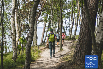
Baltic Coastal Hiking trail - Easy hike
 10. Etappe. Ventspils - Staldzene.
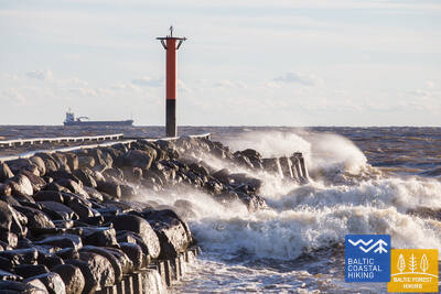
Durch die Stadt Ventspils
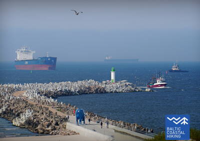
Weiter führt die Wanderroute durch die Stadt Ventspils und die umliegenden Wälder. Der Pfad Jūrtaka schlängelt sich vom Südpier durch das historische Hafenende Ostgals und die Altstadt, überquert den Fluss Venta und setzt seinen Lauf über einen Fußgänger- und Radweg durch Pārventa in Richtung Staldzene fort, Nachdem er einen Bogen um den Hafen herum gemacht hat, führt er wieder zum Strand zurück. Es lohnt sich, „einen Tag frei“ zu nehmen und die interessantesten Orte der Stadt kennenzulernen sowie das Freilichtmuseum am Meer zu besuchen.
Zu den Orten, die sich für kurze Spaziergänge und Wanderungen eignen, gehören der Seaside Park, das Seaside Open-Air Museum, die Südmole, der Strand von Ventspils und die Altstadt.
 15. Etappe. Saunags - Kolka.
Das Herz Europas – Kolkasrags
Über kleine Feldwege und Waldwege von Saunaga führt der Pfad Jūrtaka bis Vaide. Dort kehrt er wieder zur Meeresküste zurück. Bis Kolkasrags erstrecken sich breite, sandige Strände, die sich zu niedrigen Vordünen mit spärlicher Vegetation verflachen. Dahinter erfreuen erneut waldige Dünen das Auge. Auf einer Länge von etwa 2 Kilometern - weggespülte niedrige Dünen, hinter denen der Berg Dumbrkalni emporragt. Kolkasrags - die Grenzlinie zwischen dem Großmeer und Kleinmeer (Rigaer Meeresbucht) - ist einer der beliebtesten Vogelbeobachtungsorte an der Ostseeküste.
In der Gegend von Kolkasrags, insbesondere am Küstenabschnitt zwischen Kolka und Kolkasrags, befindet sich der Pine Nature Trail, der sich für Spaziergänge und kurze Wanderungen mit Rückführung zum Ausgangspunkt eignet.
 22. Etappe. Dubulti - Lielupe - Bulduri.
Die beliebtesten Strände Lettlands
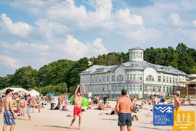
Zwischen Dubulti und Lielupe erstreckt sich der breiteste Sandstrand der Rigaer Meeresbucht – es ist der wertvollste Schatz des Kurorts Jūrmala, in dem es zahlreiche Strandcafés und verschiedene Erholungsmöglichkeiten gibt, Die Wälder der Küstendünen sind von einem dichten Wegenetz durchzogen, das zum Joggen und Wandern geeignet ist. Der Baltische Küstenwanderweg führt zwischen dem Strand Lielupe und dem Freilichtmuseum Jūrmala durch den Naturpark Ragakāpa. Am bequemsten zurück nach Bulduri gelangt man über die Straßen Bulduru prospekts und 5. līnija.
Jūrmala eignet sich gut für leichte und kurze Wanderungen entlang des Sandstrands, durch mit Kiefernwäldern bedeckte Dünen (mit einem Wegenetz) oder entlang der Fußgängerzonen und Parks der Stadt. Sie können Spaziergänge unterschiedlicher Länge wählen und diese mit Bahnfahrten (mit Haltestellen im Abstand von 1,5 bis 2 km) oder Stadtbussen kombinieren.
 24. Etappe. Stadtzentrum Rīga - Vecāķi.
Die Altstadt - Teil des UNESCO-Weltkulturerbe
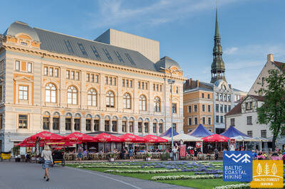
Der Routenabschnitt verläuft durch das Stadtzentrum von Rīga - die Altstadt, den Stadtkanal entlang, durch den Kronvalda-Park, die Alberta-Straße (Jugendstilbauten) und dann weiter durch die Miera-Straße über den Großen Friedhof, die Alleen Kokneses prospekts und Ostas prospekts und den Mežaparks (Kaiserwald) hindurch erreicht man den Stadtteil Jaunmīlgrāvis und passiert den Stadtteil Mīlgrāvis. Über die Allee Vecāķu prospekts führt der Weg weiter bis nach Ziemeļblāzma und zum Ufer der Vecdaugava, wovon Vecāķi nur wenige Kilometer entfernt ist. Nach einer zweitägigen Wanderung durch die Stadt Rīga führt der Pfad Jūrtaka wieder zum Strand zurück.
Im Mežapark, durch den der Küstenwanderweg verläuft, gibt es ein dichtes Wegenetz, das für Eltern mit Kinderwagen geeignet ist. Jeder kann je nach seinen Vorlieben und Fähigkeiten eine Spazier- oder Wanderroute wählen.
 25. Etappe. Vecāķi - Carnikava.
Zwischen den Mündungsgebieten der Flüsse Daugava und Gauja
Dieser Abschnitt des Baltischen Küstenwanderweges ist eine verhältnismäßig kurze Wanderung entlang eines bezaubernden Sandstrandes. Von der Festlandseite ist er durch lichterfüllte Kiefernwälder mit eindrucksvollen Dünen und Dünenwallen abgegrenzt. Vom Strand bis Carnikava führt der Pfad durch eine Waldpromenade. Über einen Schutzdamm verläuft der Pfad um den Fluss Vecgauja herum und erreicht die Fußgängerbrücke über die Gauja. Vor Beginn oder zum Abschluss der Wanderung lohnt es sich, die Atmosphäre Kneipen oder Sommercafés am Strand Vecāķi oder in Carnikava gemütlich zu genießen.
Die Gebiete Vecāķi, Kalngale und Carnikava (einschließlich der Carnikava-Promenade) eignen sich für Spaziergänge und kurze Wanderungen unterschiedlicher Länge, sowohl entlang der Küste als auch durch die lichten Kiefernwälder. Die Eisenbahn ist bequem erreichbar, Haltestellen befinden sich etwa alle 2,5 - 3,5 km.
 27. Etappe. Saulkrasti - Lauči.
Das Tor zum steinreichsten Strand in Vidzeme
Die ersten Kilometer bis Zvejniekciems können dem Strand entlang zurückgelegt werden. Oder auch über einen Pfad, der sich durch einen Dünenwald mit alten Kiefern windet. Für diese ist eine “krokodilartige“ Borke charakteristisch. Hier kommt man auch an einer alten Holzhütte mit Fischernerzen und Fischerzubehör vorbei. Kurz vor dem Hafen Skulte kommen am Strand Zvejniekciems die ersten Steine zum Vorschein. Nachdem er das Mündungsgebiet des Flusses Aģe und den Hafen umbiegt, führt der Baltische Küstenwanderweg zurück zum Strand. Von dort ist das Kap Ārņu bereits aus der Ferne zu sehen. Die Vielfältigkeit der Küstenlandschaften.
Saulkrasti – sowohl die mit Kiefern bewachsenen Dünen als auch der Strand – eignen sich für Spaziergänge und kurze Wanderungen unterschiedlicher Länge, die mit den öffentlichen Verkehrsmitteln der Stadt kombiniert werden können.
 34. Etappe. Uulu - Pärnu.
Durch Feuchtgebiete nach Pärnu
Anfangs verläuft der Baltische Küstenwanderweg durch die alten, von einem Kiefernwald umschlungenen Küstenwege. Nach dem Lottemaa-Park biegt der Pfad in Richtung Meer und stößt auf den Reiu-Strand. Weiter führt der Streckenabschnitt durch einen überwachsenden Strand (bei ablandigem Wind - breite Flachwasserzonen). Nach knapp 4 Kilometern muss man in Richtung Binnenland abbiegen, einen Golfplatz überqueren und den Weg nach Pärnu einschlagen. In der Umgebung von Raeküla schlängelt sich der Pfad auf einem kleinen Wanderweg, der das Feuchtgebiet vom Wald abgrenzt. Dann läuft er in einem etwa 6 Kilometer langen Bogen um das Feuchtgebiet herum und erreicht den Strand Pärnu. Weiter führt der Pfad durch den westlichen Teil der Altstadt von Pärnu, überquert die Flüsse Pärnu und Sauga und mündet in der Umgebung von Vana-Pärnu.
Die Parks, Küstenpromenaden und der Strand in Pärnu eignen sich für Wanderungen und Spaziergänge unterschiedlicher Länge.
 48. Etappe. Rohuküla - Haapsalu - Uuemõisa.
Haapsalu, der beliebteste Strand Estlands
Eine vielfältige Strecke des Baltischen Küstenwanderweges. Die ersten drei Kilometer verlaufen der ehemaligen Breitspurbahnlinie Haapsalu-Rohuküla entlang. Dann umkreist der über Pullapää neem die Haapsalu-Bucht und überquert die Küstenwälder, in denen Gesundheitspfade eingerichtet sind. Danach verläuft er im Bogen auf den Küstenpromenaden und kleinen Straßen um die Stadt Haapsalu herum. Nach dem Überqueren eines kleinen Feuchtgebietes jenseits der Stadt mündet der Pfadabschnitt im herrlichen Uuemõisa-Park.
In den Wäldern rund um Haapsalu wurden Wanderwege angelegt. Die Stadt ist mit einem Netz aus Fußgängerwegen und Strandpromenaden durchzogen. Hier können Sie Spaziergänge und Wanderungen unterschiedlicher Länge unternehmen.
 57. Etappe. Kersalu - Laulasmaa.
Strände, Badeorte und ein Kurort
Der Pfad führt der Meeresküste entlang durch kleine Küstendörfer. In der Nähe des Dorfes Kersalu stößt der Baltische Küstenwanderweg auf eine steinige Küste, an der mehrere Meter hohe, hinter dem Laub verborgene Felsen emporragen. Nähert man sich dem Dorf Kloogaranna, kommt ein breiter Sandstrand mit Dünen zum Vorschein. Am Strand Kloogaranna biegt der Baltische Küstenwanderweg in Richtung Dorf ab, macht einen 3 Kilometer langen Bogen durch das Binnenland und führt wieder zurück zur Meeresküste.
Ein kurzer Abschnitt mit Stränden und Fußgängerwegen, Holzstegen, wo jeder, je nach Fähigkeiten, Spaziergänge oder Wanderungen unterschiedlicher Länge wählen kann.
 58. Etappe. Laulasmaa - Vääna-Jõesuu.
Der schönste Wasserfall Estlands
Aus landschaftlicher Sicht ist es der vielfältigste Abschnitt des Baltischen Küstenwanderweges. Geeignet ist er für ausdauernde Wanderer. Zu sehen bekommt man sowohl steinige Strände als auch Sandstrände und gute Badeorte, herrliche Kiefernwälder und den eindrucksvolle Türisalu-Fels sowie Jahrhundertsteine. Auf den kleinen Pfaden des Keila-Waldparks kann man den Keila-Wasserfall erreichen. Auch kann man die dem Leben der Küstenfischer gewidmete Ausstellung im Dorf Lohusalu besuchen.
Der Keila-Park eignet sich für Spaziergänge unterschiedlicher Länge.
 59. Etappe. Vääna - Jõesuu - Tabasalu.
Die sagenumwobene Suurupi-Halbinsel
Eine der schwierigsten Strecken des Baltischen Küstenwanderweges. Sie ist nur für erfahrene Wanderer geeignet. Der Pfadabschnitt läuft im Boden der Suurupi Halbinsel herum, in deren dichten Wälder das militärische Erbe verschiedener historischer Epochen verborgen ist. Der Baltische Küstenwanderweg schlängelt sich durch dicht bewachsene und steinige Strände, Birkenhaine, dann weiter entlang ehemaliger Pionierlagern und den von Sandsteinfelsen beschützten Buchten mit spitzen Erdzungen. An einigen Stellen sieht man im Meer Freilegungen des Dolomitgesteins und “Inseln” aus Feldsteinen. Am Ende des Streckenabschnittes ragt eine der eindrucksvollsten Freilegungen der estnischen Küste empor – die Felsen von Rannamõisa. Von den Felsen aus eröffnet sich ein herrlicher Blick auf die Kakumäe-Bucht und die Türme der Altstadt von Tallinn.
Das Gebiet verfügt über ein dichtes Netz an Wanderwegen und kleinen Pfaden sowie Fußgängerwegen, die sich für kleinere Wanderungen und Spaziergänge eignen.
 60. Etappe. Tabasalu - Tallinna sadam.
Tallinn - Teil des UNESCO-Weltkulturerbes
Bei Tabasalu überquert der Baltische Küstenwanderweg die Stadtgrenze von Tallinn und führt durch die Stadtteile Tiskre und Vismeistri zum Strand Kakumäe. Von dort läuft er im Bogen um die felsumschlungene Kakumäe-Halbinsel und deren vom Wald bedeckten Spitze herum Von hier aus bietet sich ein schöner Ausblick auf den Hafen von Tallinn. Gegenüber dem Stadtteil Õismäe verläuft eine herrliche Strandpromenade. Der Pfad umkreist das Freilichtmuseum Estlands und schlängelt sich der Strandpromenade entlang bis zum Strand Stroomi. Weiter verläuft der Routenabschnitt auf den Gehwegen des Stadtviertels Pelguranna bis zum Estnischen Meeresmuseum. Von dort aus führt der Pfad der Strandpromenade entlang und erreicht den Hafen von Tallinn – den Endpunkt des Baltischen Küstenwanderweges. Durch Estland sind ~ 620 Kilometer zurückgelegt worden.
Der Gesundheitspfad Harku, das Estnische Freilichtmuseum, die Promenade „Rocca al Mare“ und die Altstadt eignen sich für Spaziergänge und Wanderungen unterschiedlicher Länge.
 64. Etappe. Nida (dt. Nidden) - Pervalka (dt. Perwelk).
An den Ufern des Kurischen Haffs
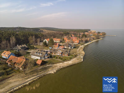
Der Meeresweg (lt. Jūrų takas) beginnt im Zentrum von Nida in der Nähe des Hafens. Er schlängelt sich weiter am Ufer des Kurischen Haffs entlang und öffnet einen schönen Blick auf das weite Wasser, das bis zum Ostufer des Kurischen Haffs liegende Insel Rusnė reicht. In Nida bestaunt man die typische Architektur der Kurischen Nehrung: einstöckige Holzbauten mit Dachziegel oder mit Schilf bedeckt, die Fensterläden in blau-weiß gestrichen. Weiter von Nida aus führt der Meeresweg zu dem Kap von Bulvikis hin (gegenüber dem Kap richtet sich der Blick auf eine Start-Landebahn des verwahrlosen Flughafens). Danach windet er sich auf kleineren Waldwegen, durch mit Kiefern bewachsenen Dünen auf und ab. Stellenweise schlängelt er sich über die Küstenwiesen mit ganz bescheidener Vegetation. Neben dem Weg sind Rastplätze und Vogelbeobachtungstürme eingerichtet. Im folgendem Abschnitt sind sehr eigentümliche, mit Flechten und Flora der Kurischen Nehrung typischer Art, bewachsene offene Küstenwiesen zu beobachten. In der Siedlung von Preila verläuft der Meeresweg an der Promenade entlang. Bis zu Pervalka schlängelt er sich über die Waldwege, Wander- /und Radwege bis in das Zentrum der Pervalka. Dieser Abschnitt verläuft durch den Nationalpark der Kurischen Nehrung (lt. Kuršių nerijos nacionalinis parkas).
Die Promenade des Kurischen Haffs (Kuršių marios) in Nida eignet sich für kurze Spaziergänge.
 65. Etappe. Pervalka (dt.Perwelk)- Juodkrantė (dt. Schwarzort).
Durch die imposantesten Sanddünen Nordeuropas
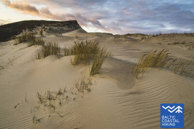
Hinter der Pervalka überquert der "Meeresweg" (lt. "Jūrų takas") die Kurische Nehrung in Ost-West-Richtung und erreicht die Küste der Ostsee. Eine weitere Strecke von ca. 13 km führt zu einem wunderschönen Sandstrand, der im Osten durch einem hohen Dünenrücken eingegrenzt wird. Der Dünenrücken wurde von Menschenhand geschaffen, um die Halbinsel vor Sandrutschen zu schützen. Vor dem Ort Juodkrantė biegt der Meeresweg nach Osten ab und überquert erneut die Kurische Nehrung durch steile, mit Wäldern zugewachsenen Dünen und führt weiter in die Richtung des Kurischen Haffs. Ein kleiner Abschnitt des Meeresweges schließt sich mit dem Weg über den Hexenberg (lt. Raganų kalnas) zusammen. Weiter geht es über die Uferpromenade von Juodkrantė zum Hafen. Die Strecke verläuft durch den romantischen Nationalpark der Kurischen Nehrung (lt. Kuršių nerijos nacionalinis parkas).
Für kurze Spaziergänge eignen sich die Kurische Haff-Promenade von Jodkrantė und die Wanderwege auf dem Hexenhügel.
 67. Etappe. Klaipėda (dt. Memel) – Palanga (dt. Polangen).
Durch den Regionalpark der Küste
Zuerst führt der Meeresweg (lt. Jūrų takas) der H. Manto Straße, durch das Zentrum der Stadt Klaipėda entlang, dann überquert er den Erholungspark und die Eisenbahn und an der Südseite der Siedlung Melnragė bevor er wieder an der Küste der Ostsee ankommt. Danach führt er weiter an der Strandpromenade und den schmalen, die Dünen schützenden Holzpfaden (Knüppelpfad) vorbei und erstreckt sich dann auf einem gemütlichen Weg, der ca. 10–20 m vom Wander- / Radweg entfernt durch die Wälder der Küste verläuft und die Zweite Melnragė hinter sich lässt - bis die Siedlung Giruliai erreicht ist. In der Nähe von Giruliai bevorzugt er für einen kurzen Augenblick den Genuss eines Strandes, dann führt er vom Ort Kukuliškės bis südlich von Karklė und anschließend dem sehr schönen Ufer des ehemaligen Litorina-Meeres, das mit unberührtem Wald bewachsen ist. Weiter verläuft er neben der malerischen, von den Wellen durchfluteten Klippe mit mehreren Aufsichtsplattformen inkl. den "Olando kepurė" (dt. Hut/ Mütze des Holländers ) in Richtung Karklė. Folgende 11 km von der Siedlung Karkle bis zum Botanischen Park verläuft der Meeresweg an sandigen Kiesstränden mit ihren wunderschönen großen Steinen. Dem Pfad im westlichen Teil des botanischen Parks folgend, erreicht der Meeresweg die "Meilės Alėja" (dt. Allee der Liebe) und führt zur Fußgängerbrücke von Palanga. Ein Großteil dieser Strecke passiert den Regionalen Park der Küstenregion (lt.Pajūrio regioninis parkas).
Der Botanische Park Palanga eignet sich für kurze Spaziergänge und Wanderungen.


