Mežtaka - Pielāgots redzes ierobežojumiem
 Section 1. Old Riga - Baltezers.
Through Riga – UNESCO World Heritage Site

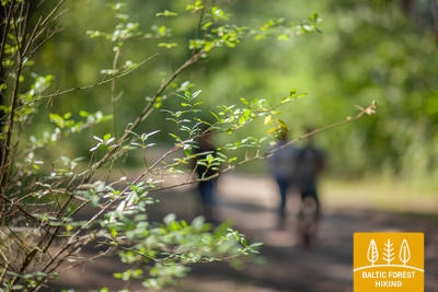
Miško tako pradžia Latvijoje yra pačioje Rygos senamiesčio širdyje, Rotušės aikštėje. Maršrutas veda Kaļķu gatve, eina pro Laisvės paminklą, per Vērmanės sodą ir palei istorinę Tērbatas gatvę. Tada jis vingiuoja per Zemitani geležinkelio stoties pėsčiųjų tiltą ir žengia į Biķerniekų ir Šmerlio miškus. Miško takas vingiuoja per Juglą, praeina Latvijos etnografinį muziejų po atviru dangumi ir eina pėsčiųjų-dviračių taku iki Baltezero.
The "Feel Jugla" Walking Trail
Juglos Juglos ežero šiaurės rytinėje dalyje įrengtas 250 metrų medinis lentų takas (į vieną pusę) su apžvalgos aikštele su vaizdu į Juglos ežerą, suoliukas, 20 lytėjimo erdvinių reljefų, vaizduojančių ežerui ir jo apylinkėms būdingas gyvūnų rūšis, informacija Brailio raštu. Jį gali pasiekti žmonės su vežimėliais. Aikštelė yra 0,5 kilometro nuo Mežtakos tako.


Taktilais Brīvības piemineklis
Avati Läti sünnipäeval – 18. novembril 2022 – Brīvības väljakul Kārlis Zāles loodud originaali vastas ja avati 18. novembril 1935. Selle erilise pronksist miniatuuri lõi skulptor Ivars Miķelsons mõõtkavas 1:50.


Section 83. Paplatelė – Plateliai.
Around the largest lakes in the Žemaitija National Park
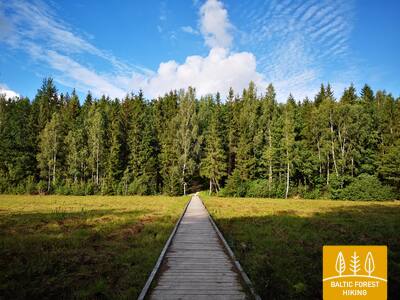
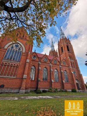
Pirmuosius 3,5 km Miško takas veda per gražius spygliuočių miškus. Iki Šaltojo karo muziejaus jis eina Plokštinės pažintiniu taku, o 5 km nuo muziejaus – Plokštinės pėsčiųjų ir dviračių taku. Prie kelio Nr. 3202 (Malūno gatvė) maršrutas pasuka kairėn į pietryčius ir iškart už 0,3 km dešinėn į pietus-pietvakarius. Po maždaug 0,5 km pasiekia Ilgio ežero gatvę. Toliau net 5,5 km maršrutas suka platų ratą aplink Ilgio ir Beržoro ežerus, kol pasiekia Beržoro kaimą. Toliau paėjėjus 2 km Plungės gatve, Miško takas atveda į Platelių centrą ir apsuka dar vieną ratą Ežero gatve iki Šeirės pažintinio tako, atskleisdamas vaizdingą kraštovaizdį. Toliau Ežero, Naująja ir Žemaičių Kalvarijos gatvėmis grįžta į miesto centrą.
Šeire's Educational Trail
Tako ilgis yra apie 7 kilometrai, tačiau yra įrengta apžvalgos aikštelė, skirta žmonėms su vežimėliais, nuo kurios atsiveria vaizdas į Platelių ežerą ir jo salas. Plateliai yra Žemaitijos nacionaliniame parke. Informacinėje lentoje yra apčiuopiamas ežero su salomis žemėlapis, leidžiantis jį tyrinėti žmonėms su regėjimo negalia. Automobilių stovėjimo aikštelė yra čia: GPS 56.048355, 21.826901. Jis yra šalia Mežtakos tako.


Plokštines militārā pilsēta
С 1993 года бывший объект Советской Армии находится в ведении Дирекции национального парка Жемайтия. Многие здания на территории военного городка были снесены в 2017 году из-за их ветхого состояния. В настоящее время на территории сохранилось около 10 зданий, которые посетители могут осмотреть снаружи. Имеются информационные стенды, рассказывающие о бывших зданиях и их назначении. Установлен тактильный стенд — карта, знакомящая со зданиями, их расположением и функциями.


Section 84. Plateliai – Salantai.
Towards the Pajūris Lowland
Metsa matkarada kulgeb 6 km Plateliai–Salantai tee (nr 2302) ääres. Siit avanevad hurmavad vaated Pajūrise madalikule ja sellega piirnevale Žemaitija kõrgustiku lääneosale. Gintališkė külas keerab rada vasakule, et suunduda edelasse viivale teel nr 3216. 2,4 km pärast teeb matkarada pöörde paremale, kust rada viib metsa. Nõukogude ajal oli siin raketibaas, sellest ajast annab tunnistust ka betoonplaatidega kaetud tee. Nüüd keerab Metsa matkarada 1,4 kilomeetriks Plungė–Salantai teele (nt 169), kuni keerab vasakule. Seejärel viib rada mööda väikest külateed Salantai suunas. Alevikeskusesse kulgeb matkarada piki Žemaitėse ja M. Valančiause tänavaid. Selle päeva teekonna esimene pool möödub Žemaitija rahvuspargis, teine aga Salantai regionaalpargis.
Šeire's Educational Trail
Rada on ligikaudu 7 kilomeetrit pikk, kuid seal on ratastoolis inimestele ligipääsetav vaateplatvorm, kust avaneb vaade Plateliai järvele ja selle saartele. Plateliai asub Žemaitija rahvuspargis. Infotahvlil on puutetundlik kaart järvest koos saartega, mis võimaldab nägemispuudega inimestel seda uudistada. Parkla asub siin: GPS 56.048355, 21.826901. See asub Mežtaka raja kõrval.
Section 92. Snēpele – Kuldīga.
Venta valley and Riežupe Nature Park
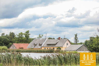
Snēpele peatänavalt suundub Metsa matkarada teele nr V1294 ja 300 meetri pärast, Ķepšu järve kohal, keerab rada paremale, väiksele külateele. Tee viib Slipiņciemsi ning ületab seejärel tammi kaudu Sprincupe jõe. Siis võtab rada suuna Pelči poole. Pelči küla lähedal lookleb Metsa matkarada Pelči tammitiikide kallastel, viib Kuldīga–Pelči teele (V1293) ja sealt edasi Kuldīga aianduspiirkondadesse, mis kannavad nimesid “Kurzemīte” ja “Rumba”, kuni jõuab Venta jõe kallastele ja Kuldīga ringteele. Järgmised 2,4 km, kuni vana kivisillani, mööduvad ilusal Venta jõe äärsel kallasrajal, kus väiksed puust sillakesed ja purded viivad üle ojade ja niiskemate kohtade.
The walking trail along the Venta River in Kuldīga
Rada kulgeb mööda Venta jõe vasakut kallast Kuldīga linnaaiast kuni uue Kuldīga sillani, läbides 2,4 kilomeetrit. Raja äärde on paigutatud puhkekohad ja infotahvlid. See on ratastoolis inimestele ligipääsetav tänu oma siledale pinnale, mis koosneb peenest kõvast kruusast, kuigi mõned lõigud võivad kallakute tõttu abi vajada. Rada on lai ning väikeste ojakurgude ristuvatele kohtadele on rajatud puidust laudteed ja sillad. See Mežtaka raja lõik kulgeb mööda Kuldīga promenaadi rada. Saadaval on kohandatud tualetid. GPS-i juurde on rajatud parkla: 56.973354, 21.977798.


 Section 93. Kuldīga – Renda.
Venta valley and Riežupe Nature Park
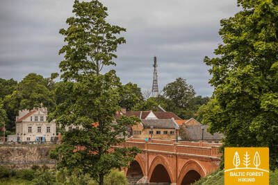
Pärast pikka kivisilda, mis viib matkaja üle Venta jõe, kulgeb Metsa matkarada lühikest aega Venta jõe paremkaldal, mida liigestavad jäärakud, keerab seejärel Krasta tänavale ja Vetklīnika–Paleja teele, ning viib läbi Kalnmuiža metsa, Riežupe ja suure Renda metsa edasi Mazrenda küla poole. Maastik on siin tasane, sest tegemist on Kursa madalikul asuva Pieventa tasandikuga. Mazrendas kulgeb Metsa matkarada üle liiva-kruusakarjääri ning jõuab Kuldīga tänavat kaudu Renda külla. Selle päeva teekond kulgeb esiti Venta jõe oru looduskaitsealal ja hiljem Riežupe looduspargi territooriumil.
Audio guide "Through Mežtaka in Kuldīga for People with Visual Impairments"
2024. aastal on valminud audiogiid pealkirjaga "Läbi Mežtaka Kuldīgas nägemispuudega inimestele". See algab Kuldīga vaatetorni juurest, ületab vana telliskivisilda üle Venta jõe ja aitab kasutajatel tutvuda Kuldīga promenaadiga mööda Ventat. Teave vaatetorni ja selle läheduses on punktkirjas. GPS-i juurde on rajatud parkla: 56.973354, 21.977798.


Section 100. Bigauņciems – Dubulti.
The historic resort of Jūrmala
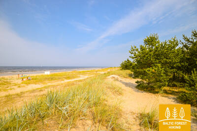
In Bigauņciema village, you can clearly see the whole length of the Jūrmala coast. The first third of this day’s itinerary is part of the Ķemeri National Park where you can get to know historic fishing villages, the Ragaciems village fishing area with net huts and a fish market, dune habitats, as well as watch birds in the estuary of the Starpiņupe River. Starting from Jaunķemeri to Dubulti, the walk takes you across the widest sandy beach of the Gulf of Riga through the historic resort in Jūrmala and the longest city in Latvia. Keep in mind that on warm and sunny summer days there will be a lot of beachgoers.
The Dubulti Coastal Dunes Trail
Along the Jūrmala coastline, in the dune zone from Baznīcas Street in Dubulti to Amatas Street in Pumpuri, a nature trail about two kilometres long has been created. It is intended for peaceful recreation, getting to know the surrounding environment, and various movement activities.
The trail is convenient for walking enthusiasts, Nordic walkers, and runners alike. Along the route you can experience the characteristic coastal dune landscape and its changing terrain.
Along the way, there are boundary elements, three rest benches, a wooden-deck area with a picnic table and seating, a viewing platform, and a terrace with a stretched net. There is also a special sensory section where you can feel different natural materials — sand, pebbles, and pinecones. Two outdoor exercise machines are placed along the trail, offering the opportunity to move and work out. The route is equipped with signs, as well as information stands about local nature, healthy lifestyles, and the importance of physical activity for human well-being.
The information stands on the Wellness Nature Trail include tactile maps for people with visual impairments. Using touch, they allow visitors to understand the trail, its placement in relation to the surrounding streets, and the maps also include information in Braille.
The map design and production were created by the company Socintegra, which specialises in providing a wide range of environmental accessibility services.
An audio guide about the trail is available in the Izi.Travel app (“Labsajūtas dabas taka / Wellness Nature Trail”) in Latvian and English, allowing users to listen to the information from the trail’s info stands in audio format.


Section 101. Dubulti - Lielupe - Bulduri.
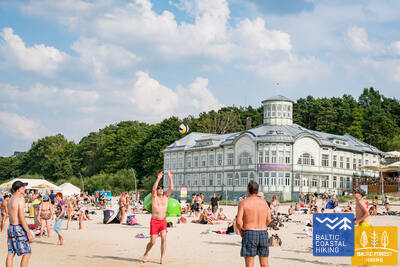
The Most Popular Beaches in Latvia
The widest sandy beach of the Gulf of Riga stretches from Dubulti to the Lielupe River. It is the main asset of the Jūrmala resort offering many beach cafés and different recreational possibilities. The coastal dune forests are permeated with a dense web of trails suitable for walking and stick-walking. The part of the Baltic Coastal Hiking Route located between the beach of the Lielupe River and Jūrmala beach is part of the Ragakāpa Nature Park. From here, you can easily get back to Bulduri by taking Bulduri prospekts and the 5th line.
The Dubulti Coastal Dunes Trail
Along the Jūrmala coastline, in the dune zone from Baznīcas Street in Dubulti to Amatas Street in Pumpuri, a nature trail about two kilometres long has been created. It is intended for peaceful recreation, getting to know the surrounding environment, and various movement activities.
The trail is convenient for walking enthusiasts, Nordic walkers, and runners alike. Along the route you can experience the characteristic coastal dune landscape and its changing terrain.
Along the way, there are boundary elements, three rest benches, a wooden-deck area with a picnic table and seating, a viewing platform, and a terrace with a stretched net. There is also a special sensory section where you can feel different natural materials — sand, pebbles, and pinecones. Two outdoor exercise machines are placed along the trail, offering the opportunity to move and work out. The route is equipped with signs, as well as information stands about local nature, healthy lifestyles, and the importance of physical activity for human well-being.
The information stands on the Wellness Nature Trail include tactile maps for people with visual impairments. Using touch, they allow visitors to understand the trail, its placement in relation to the surrounding streets, and the maps also include information in Braille.
The map design and production were created by the company Socintegra, which specialises in providing a wide range of environmental accessibility services.
An audio guide about the trail is available in the Izi.Travel app (“Labsajūtas dabas taka / Wellness Nature Trail”) in Latvian and English, allowing users to listen to the information from the trail’s info stands in audio format.