


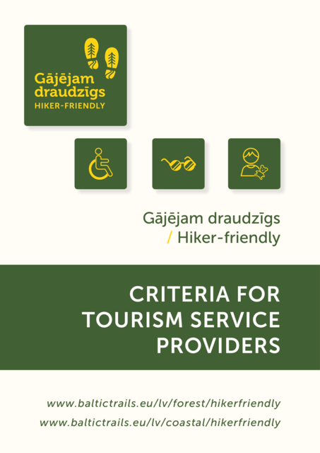
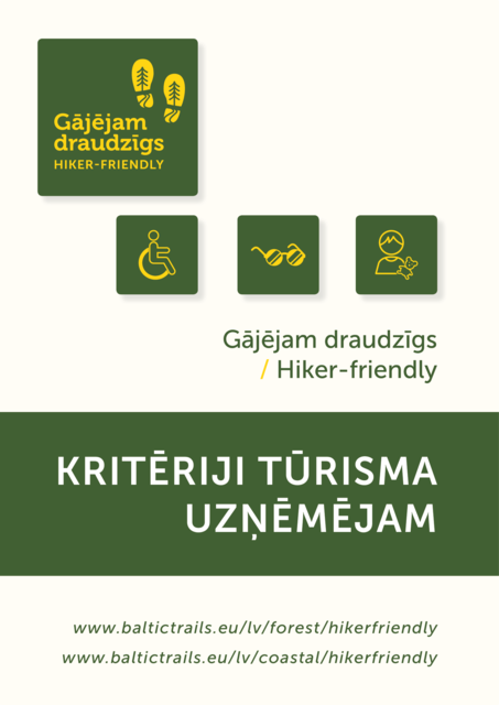
Baltic Coastal Hiking Route - Marketing
This website section summarizes general information about the Baltic Coastal Hiking route in English language, which is meant for coastal area tourism information centers, accommodation and other entrepreneur informative brochures and leaflets. There are banners for your homepages available as well as official logos in Latvian, English, Russian, German, Estonian and Lithuanian languages. We kindly ask you to use the relevant logos with the relevant languages.
Brief, concise description
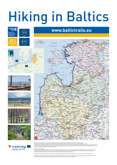
Baltic Coastal Hiking is a long distance hiking route part of E9 along the coast of the Baltic Sea. The hiking route starts at the Russian-Lithuanian border in the village of Nida in Lithuania and finishes at the Port of Tallinn in Estonia. The total length of the route is 1419 km, of which 216 km are in Lithuania, 581 km are in Latvia, and 622 km in Estonia. The Baltic Coastal Hiking trail can be started at any point and done in either direction. The trail is marked in both directions and Tallinn can also be a starting point. The route is divided into days and difficulty levels, which allows you to choose the most suitable section for yourself. Join Baltic Coastal Hiking whenever you want, take a break whenever you like and return when you feel it is the right time for hiking!
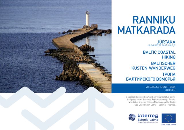
The Baltic Coastal Hiking Trail, Southern part

English
Latvian
In Estonian
Broad, detailed description
Baltic Coastal Hiking is a long distance hiking route, part of E9, along the coast of the Baltic Sea. The hiking route starts at the Russian-Lithuanian border in the village of Nida in Lithuania and finishes at the Port of Tallinn in Estonia. The total length of the route is 1419 km, of which 216 km are in Lithuania, 581 km are in Latvia, and 622 km in Estonia. The route can be done in both directions and Tallinn can also be the starting point.
How do you go on the Baltic Coastal Hiking route?
Baltic Coastal Hiking consists of 73 separate one-day or two-day hiking route sections. Each day is considered to be a separate, independent route. By combining days, it is possible to complete routes of several days. Baltic Coastal Hiking can be started in any physically accessible place and go in one direction or the other, there are markers in both directions. The guide marks the recommended start and finish point of each day. Depending on your interests and possibilities, some sections can be covered by public transport, not on foot, or you can make a deal with the owners of accommodation places to arrange personal and luggage transport. To help you get your bearings in nature, there are markings (white – blue – white) on trees, stones and other nature objects and Baltic Coastal Hiking route stickers on road signs, electricity poles, bridge parapets in villages and cities, as well as reference road signs. In places where Baltic Coastal Hiking goes along the beach and continues straight forward for a long distance, it is not marked. Along the shore of the Great Sea (the Kurzeme coast of the Baltic Sea) and the Little Sea (the Kurzeme coast of the Gulf of Riga), large wooden signs are placed in the dunes near populated areas, providing information about the specific populated area, as well as indicating the distance to the closest village in both directions. You will also see information stands placed along Baltic Coastal Hiking.
Specifics of the route
In Lithuania, the Baltic Coastal Hiking mainly goes along sandy beaches, sidewalks and trails. In some places, the trail goes along asphalt and gravel roads. For short distances, the trail goes on dirt roads, wooden paths, seaside meadows and pebble beaches. In Latvia, Baltic Coastal Hiking mainly goes along sandy beaches, in some places, rocky beaches, and for short stretches, through coastal meadows. Sandy dune habitats are characteristic to the Latvian coast. There are well-trodden trails and small roads in the seaside forests. In Estonia, Baltic Coastal Hiking goes along the very seashore for around 100 km, mainly between Haapsalu and Tallinn. In other places, crossing the coastline becomes difficult as it is shaped by numerous capes, peninsulas, wetlands with reeds, floodplains, lagoons and shallow coves, which is why the remaining distance of around 500 km has to be covered via seaside trails, roads and along motor roads. In cities and populated areas, Baltic Coastal Hiking goes along pedestrian pavements.
Baltic Coastal Hiking in 4 seasons
You can go Baltic Coastal Hiking in all 4 seasons. Summer is the tourist season in Lithuania, Latvia and Estonia, when more people come to the sea coast in comparison to other times of the year. As a result, accommodation near the sea can be fully booked some time in advance, and near the biggest cities you may have to wait longer to receive the meal you ordered. In the summer, you can swim, walk through the water barefoot and also wade across the streams and brooks located along the route. Summer can also have longer periods of rain and lower air temperatures (around +13 °C), so it is certainly recommended to check the weather forecast in advance. In autumn, you can see more colours when going through the woods, especially in Estonia. Leaves are changing colour and you can find mushrooms, berries and nuts. Birds migrate south. During storms, amber is washed ashore. In this period, some of the accommodation and catering places may be closed. The itinerary can also be completed in winter, but you must keep in mind that most of the services are not available at this time of year. In the case of lasting snow and cold, several sections, for example, the sea coast of Vidzeme, can be covered using skis. Ice formations can be seen on the Pakri peninsula. When starting the hike in spring, the awakening of nature can be observed: the colour green starts to prevail, lilac blossoms spread their scent along the sea coast, and the birds return home. The streams and brooks that you can wade through easily in summer can have a high water level in spring, so you will have to look for the closest bridge. The number of accommodation and catering places offered is still limited.
Useful advice
It is recommended that you take some cash (EUR) with you on the trip, as in some places credit cards are not accepted and ATMs are not available. When crossing a country border or when you are near a border, you have to carry identity documents that are valid for travel. When going through stony and rocky sections, you should wear closed footwear, while in places with an overgrown coast, water-resistant footwear will come in handy. Water and wind resistant clothing will also prove useful. A medical kit is advisable. You will need a power bank for your phone as there are several long sections where it is not possible to charge electrical devices. In some places, mobile network coverage may be unavailable. Most accommodation and catering facilities offer Wi-Fi. Cliffs and bluffs consist of unconsolidated sedimentary rocks and landslides and landfalls may occur near them. In times of strong winds, it is not safe to approach places where the bluffs are washed by waves; they should be bypassed.
Join Baltic Coastal Hiking whenever you want, take a break whenever you like and return when you feel it is the right time for hiking! More information www.coastalhiking.eu.
A brief description of the most interesting facts.
Baltic Coastal Hiking is a long distance hiking route, part of E9, along the Baltic Sea coast. The hiking route starts at the Russian-Lithuanian border in the village of Nida in Lithuania and finishes at the Port of Tallinn in Estonia. The route can be taken in both directions and Tallinn can also be a starting point. The route is divided into days and difficulty levels, which allows you to choose the most suitable distance for yourself.
- Length: 1419 km, of which 216 km are in Lithuania, 581 km are in Latvia, and 622 km in Estonia.
- Two capital cities whose old towns have received UNESCO site status: Riga, Tallinn. The Curonian Spit National Park is also on the UNESCO list.
- Territory: The Baltic Sea littoral, Gulf of Riga and Gulf of Finland coastline.
- Itinerary: Nida (Lithuania) – Klaipėda – Palanga – Nida (Latvia) – Liepāja – Ventspils – Cape Kolka – Jūrmala – Riga – Saulkrasti – Ainaži – Ikla (Estonia) – Pärnu – Virtsu – Lihula – Haapsalu – Paldiski – Tallinn (Estonia).
- Highest points: Curonian Spit in Lithuania (up to 67 m altitude on the route), Rannamõisa cliff (Rannamõisa pank) located 35 m a. s. l., the Pakri Lighthouse viewing platform together with the height of Pakri cliff: around 70 m a. s. l., situated in Estonia.
- Time required to complete the route: around 70-72 days. Experienced walkers can cover it in a shorter period of time.
- What to see: more than 600 natural, historical and cultural objects.
- The Estonian islands situated close to Baltic Coastal Hiking: Kihnu, Saaremaa, Muhu, Hiiumaa, Vormsi, Osmussaar, Naisaar.
Join Baltic Coastal Hiking whenever you want, take a break whenever you like and return when you feel it is the right time for hiking! More information www.coastalhiking.eu.
Detailed descriptions of each day in 6 languages are available on our website, and you can safely use them for marketing purposes, by choosing the appropriate route days near you - https://baltictrails.eu/en/coastal/itinerary
Logo files in raster and vector formats
Vector file and usage guidelines can also be found here Baltic Coastal Hiking Style Book


.png?dsp=a)
_black.png?dsp=a)
.png?dsp=a)
_black.png?dsp=a)
.png?dsp=a)
_black.png?dsp=a)
.png?dsp=a)
_melns.png?dsp=a)
.png?dsp=a)
_melns.png?dsp=a)
.png?dsp=a)
_melns.png?dsp=a)
.png?dsp=a)
_melns.png?dsp=a)
.png?dsp=a)
_black.png?dsp=a)
.png?dsp=a)
_black.png?dsp=a)
_logo(clear).png?dsp=a)
_logo(clear)_black.png?dsp=a)
_logo.png?dsp=a)
_logo_black.png?dsp=a)