


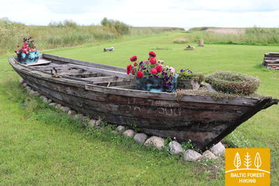
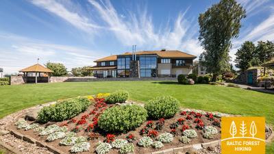
Лесная тропа прибалтики - Wheelchair accesible


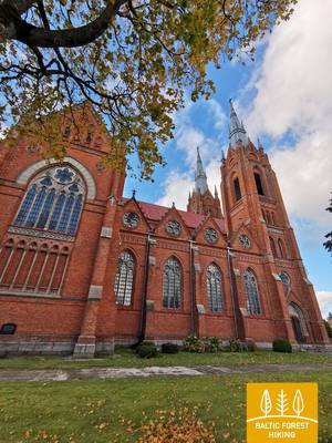
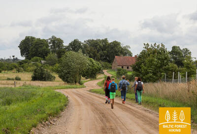
 1-й этап. Старая Рига – Балтэзерс.
Сквозь Ригу – объект Всемирного наследия ЮНЕСКО
В Латвии Лесная тропа начинается в самом сердце Старой Риги – на Ратушной площади. Тропа идет по улице Калькю, мимо Памятника Свободы, через Верманский парк и по исторической улице Тербатас. Далее она устремляется к пешеходному мосту, пересекает железнодорожную станцию «Земитану» и продолжается в Бикерниекском лесу и лесном массиве Шмерлис. Лесная тропа проходит через Юглу, мимо Латвийского этнографического музея под открытым небом и по пешеходно-велосипедным дорожкам приводит в Балтэзерс.
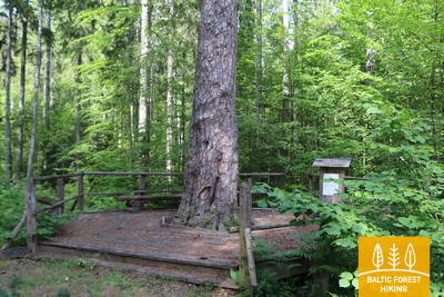
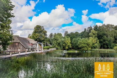
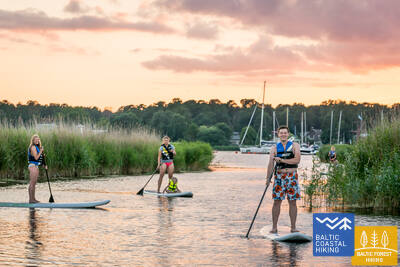
The "Feel Jugla" Walking Trail
В северо-восточной части озера Югла в Югле создан 250-метровый деревянный настил (односторонний) со смотровой площадкой с видом на озеро Югла, скамейкой, 20 тактильными пространственными рельефами, изображающими характерные виды животных озера и его окрестностей, а также информацией на языке Брайля. Он доступен для людей в инвалидных колясках. Объект расположен в 0,5 км от тропы Межтака.


 4-й этап. Рамкални – Сигулда.
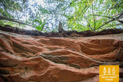
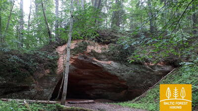
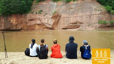
Красивейшие виды древнего русла Гауи возле Сигулды
Покинув парк Рамкални, Лесная тропа поднимается на высокий, крутой склон древней долины Гауи, проходит через поселок Гауя и устремляется вниз. Далее тропа пересекает речку Лорупе, проходит по изгибам Гауи и приводит к одному из самых впечатляющих береговых обнажений на Гауе – утесу Чертовой пещеры. Затем тропа ведет к таким достопримечательностям как Кейзарскатс, делает круг до Кейзаркреслса, Межакакиса на горе Какишкалнс, Сигулдской санно-бобслейной трассы и достигает центра Сигулды.
Trail to Gutman's cave
От парковки Центра посетителей Гутманяла (GPS: 57.176245, 24.846747) тропа ведет к одной из самых популярных достопримечательностей Национального парка Гауя — Гутманяле. Покрытие тропы — гравий, асфальт шириной от 1,15 до 2 метров. Длина тропы составляет 0,5 километра (туда и обратно), она доступна для людей в инвалидных колясках с сопровождающим. Лифт в туннеле не работает! Необходимо перейти дорогу, где есть небольшой бордюр! Доступен адаптированный туалет. Тропа расположена в 2,7 километрах от тропы Межтака.


5-й этап. Сигулда – Лигатне.
В самом сердце Национального парка Гауя
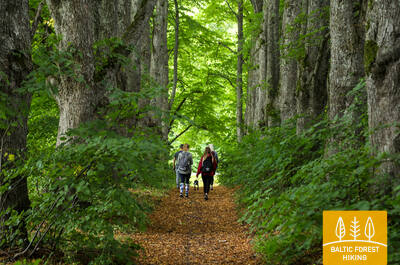
Сделав круг через Сигулду, Лесная тропа по верхней части склона оврага Вейупите приводит путников к горе Парадизес, затем спускается по крутой лестнице к древней долине Гауи и оврагу Вейупите. Основную часть дальнейшего этапа составляют небольшие одинокие тропинки, ведущие через лес и луга (на которых в июне цветет смолка). Далее Лесная тропа пересекает ущелья многих небольших рек, на склонах которых виднеются обнажения песчаника. Последние шесть километров этапа – природные тропы Лигатне. На подступах к городу Лигатне Лесная тропа поднимается по склону древней долины Гауи, а в Лигатне спускается в глубокий овраг реки Лигатне, на склонах которого находится поселок бывшей бумажной фабрики.
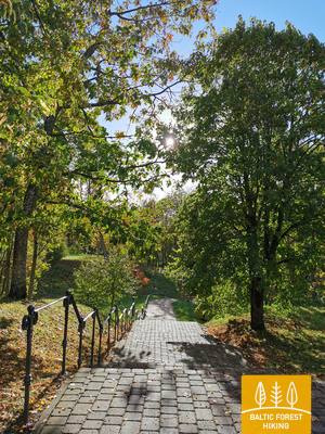
Trail to Paradise Hill
От парковки на улице Миера (GPS: 57.170624, 24.862061) вы можете исследовать Глезнотайкалнс по кольцевому маршруту длиной около 2 километров. Тропа доступна для людей в инвалидных колясках и родителей с детскими колясками. Поверхность включает асфальт, гравий и дощатые настилы (мосты). Тропа не размечена, но на перекрестках есть знаки. Участок от парковки до Глезнотайкалнса совпадает с тропой Межтака.
Līgatne Nature Trails
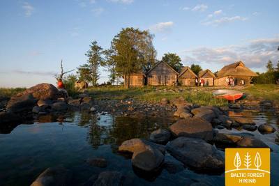
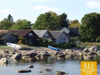
Природные тропы Лигатне являются одними из самых популярных достопримечательностей Национального парка Гауя, где в условиях, приближенных к их естественной среде обитания, обитают типичные для латвийских лесов животные. Два участка троп от Центра посетителей «Паугури» доступны для людей в инвалидных колясках: один ведет к вольеру медведей (300 метров в одну сторону), а другой — к вольеру лис (600 метров в одну сторону). В Центре посетителей есть адаптированные туалеты и выделенная парковка (GPS: 57.248149, 25.014735). Он расположен рядом с тропой Межтака.


 6-й этап. Лигатне – Цесис.
По старой цесисской дороге через долину реки Амата
Один из самых живописных участков Лесной тропы проходит через исторический поселок бумажной фабрики Лигатне, мимо геологического обнажения Сприньгю, по извилистым тропинкам Скальупе и Мифологической тропе. Заглянув в Советский бункер (один из секретных объектов периода Железного занавеса), Лесная тропа доходит до заповедника Рочу, пересекает реку Амата, по геологической тропе (самый красивый и скалистый участок у берегов Аматы) приводит к геологическому образованию Звартес. Далее Лесная тропа устремляется на высокий склон долины Аматы и по исторической дороге (ранее столбовая дорога Цесис – Рига, ныне небольшая проселочная и лесная дорога со старыми дорожными столбами) приводит в Ракши. Далее Тропа поднимается на холм Валюкалнс и из Озолкалнса идет по извилистым природным тропам Цирулиши, вдоль берегов Гауи, где находится множество родников и отложений песчаника. Этап завершается на улице Гауяс, по которой путешественники, преодолев 2,8 км, могут дойти до Старого города, провести день в Цесисе и продолжить путь.
The trail to Zvanu Cliff
Тропа длиной 900 метров ведет к склону главного берега долины Гауи, где возвышаются скалы Звану, и расположена смотровая площадка. Ширина тропы составляет 1,5 метра, покрытие — из досок. Тропа доступна для людей в инвалидных колясках с помощью сопровождающего, так как для доступа к тропе необходимо преодолеть бордюр, а склон местами слишком крутой. Парковки и туалета нет. На обочине дороги рядом с ней есть песчаный «карман», где можно оставить машину. Тропа расположена рядом с Лесной тропой.


7-й этап. Цесис – Цаунитес.
Впечатляющие обнажения песчаника на берегах Гауи
К базе водного туризма Ленчи Лесная тропа проходит по небольшим дорогам и тропам, пролегающим в лесу, вдоль излучины Гауи и древних речных долин. Не доходя до скал Эргелю, Лесная тропа сливается с выразительным рельефом местности, поднимается и спускается по склонам древней долины Гауи, изборожденной небольшими ручьями. Миновав скалы Эргелю, Лесная тропа слегка отклоняется в сторону Цесиса, в Пиешкални делает поворот в направлении Рамниеки, где пересекает мост через Гаую. Оставив позади базу водного туризма Яньрамис, Лесная тропа, будто стремясь оправдать свое название, устремляется в светлохвойный лес. Затем тропа приводит путников в Цаунитес, где находится одно из красивейших мест отдыха на берегах Гауи.
Ērgļu (Ērģeļu) Cliffs Nature Trail
Тропа знакомит посетителей с одним из самых впечатляющих обнажений песчаника в Латвии. Она соединяет скалы с парковкой (GPS: 57.357495, 25.262360). Тропа длиной 460 метров (в одну сторону) идет по лесной тропе и подходит для людей в инвалидных колясках с посторонней помощью. Тропа очень крутая! Доступен адаптированный туалет. Тропа совпадает с тропой Межтака.


9-й этап. Валмиера – Стренчи.
Вдоль берегов реки Абула – в Стренчи, город плотогонов
Заглянув в исторический центр Валмиеры и Парк отдыха, где созданы трассы для пеших прогулок и скандинавской ходьбы, Лесная тропа пересекает Вантовый мост и уводит к соснам Пауку и горе Байлю. По тропе Абула, пролегающей вдоль крутых первозданных речных берегов, Лесная тропа ведет к пивоварне Бренгелю, и далее, миновав Пуполи, – к малонаселенным местам и обширным лесным массивам. Первая половина этапа представлена небольшими дачными поселками Энергетик, Саулитис, Спридитис, Гауймали, Пуполи и Гауяслачи, созданными в советское время для работников промышленных предприятий Валмиеры и ее окрестностей. В районе Удрини Лесная тропа проходит через лабиринты старых речных долин, поворачивает на север, пересекает мост через Гаую, возле которого находится база отдыха и лодочного спорта. Расстояние отсюда до центра Стренчи составляет около 1,5 км. Часть пути находится в заповедной зоне Северной Гауи.
Strenči Nature Trail and Wooden Sculpture Park
Тема тропы — плотогоны Гауи, на ней изображено около 30 скульптур. Тропа начинается с парковки на улице Озолу (GPS: 57.623436, 25.690133). Она имеет два кольца длиной 5 и 7 километров, но участок, подходящий для людей в инвалидных колясках с посторонней помощью, относительно короткий. Он расположен в 0,7 км от Лесной тропы.


10-й этап. Стренчи – мост Спицу.
Через прекрасные грибные и ягодные леса Видземе
Начальный участок этого этапа проходит по природной тропе Гауя, ведущей вдоль берега реки. Лесная тропа в двух местах (перед поворотами на Седу и на Каучи) пересекает автодорогу А3 (будьте осторожны!), затем проходит по лесным дорожкам, вдоль песчано-гравийного карьера, а возле поворота к поселку Олиняс выходит на гравийную дорогу. Через 3,5 км тропа снова поворачивает направо и следующую часть пути (до моста Спицу) ведет по небольшим и отдаленным лесным дорогам. В этом месте, за островом Зема, находится одно из самых красивых мест охраняемой природной территории "Ziemeļgauja". На завершающем участке этапа, там, где дорога P24 проходит по мосту Спицу, находится база отдыха и водного туризма.
The rest area by Spicu Bridge
Зона отдыха, расположенная у Лесной тропы, доступна для людей в инвалидных колясках. Установлены специальные столики, а также адаптирован туалет.


11-й этап. Мост Спицу – Заки.
По живописным дюнным окрестностям Циргали
Лесная тропа пересекает мост Спицу и приводит к четырем озерам Кокшу (протяженность – около 4 км), которые связаны небольшим ручьем. В их окрестностях находятся база отдыха, кемпинг и природная тропа. Местность славится прекрасными пейзажами и богатыми грибными лесами. Миновав озеро Дибена (последнее из озер Кокшу) и совершив 1,5-2-часовой переход, путники попадают в дюнный массив Циргалю. Далее путь ведет в направлении север-юг. Лесная тропа пересекает большой лесной участок, проходит мимо хутора или маленького озера. Этап завершается в небольшом поселке Заки, где нет туристических услуг. Поэтому перед походом следует продумать этап и возможности ночлега. Этап находится в охраняемой ландшафтной зоне "Ziemeļgauja".
The rest area by Spicu Bridge
Зона отдыха, расположенная у Лесной тропы, доступна для людей в инвалидных колясках. Установлены специальные столики, а также адаптирован туалет.
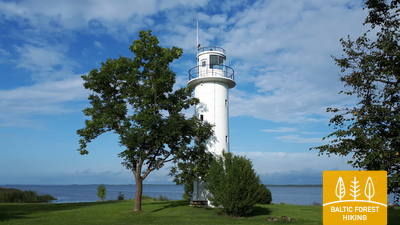
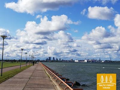
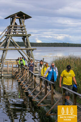
22-й этап. Ристипало – Мехикоорма.
Через польдерные луга Чудского озера
Почти половина этапа проходит по равнинным польдерным участкам побережья Чудского озера (Peipsi järv). Польдеры созданы для защиты прилегающих земель от затопления во время весеннего половодья. Равнинные польдерные луга используют для создания сельскохозяйственных полей и выпаса скота. На участке от Наха до Мехикоорма Лесная тропа идет вдоль автодороги Ряпина (Räpina) – Мехикоорма (Mehikoorma). Тропа приводит к маяку Мехикоорма, расположенному на берегу озера Ляммиярв (Lämmijärv), откуда открывается вид на живописную местность. Озеро Ляммиярв (Теплое озеро) соединяет Чудское и Псковское (Pihkva) озера. Восточный берег озера Ляммиярв (1,7 км) находится на территории России.
Mehikorma Harbor Shore Promenade
Между гаванью Мехикорма и маяком проложена природная тропа и променад, знакомящие с береговой линией Чудского озера на протяжении 1,3 км. Часть ее, включая променад и променад, доступна для людей в инвалидных колясках с помощью сопровождающего. Она расположена рядом с Лесной тропой.
23-й этап. Мехикоорма – Ляянисте (Lääniste).
Вокруг болотных угодий Эмайыэ-Суурсоо (Emajõe-Suursoo)
Этот трехдневный этап пролегает вокруг одного из крупнейших болот Эстонии – Эмайыэ-Суурсоо. Оправдывая свое название, Лесная тропа ведет через обширные лесные участки, окружающие болото. Единственный населенный пункт между речками Йыэпере (Jõepera) и Ахья (Ahja) – окруженное лесом село Ярвселья (Järvselja). Рельеф местности – равнинный: Лесная тропа проходит через Чудскую (Peipsi) приозерную низменность. Конечный пункт находится у реки Ахья, район среднего течения которой известен живописными обнажениями песчаника девонского периода. Река популярна также среди любителей водного спорта.
Mehikorma Harbor Shore Promenade
Между гаванью Мехикорма и маяком проложена природная тропа и променад, знакомящие с береговой линией Чудского озера на протяжении 1,3 км. Часть ее, включая променад и променад, доступна для людей в инвалидных колясках с помощью сопровождающего. Она расположена рядом с Лесной тропой.
25-й этап. Кавасту – Варнья (Varnja).
По дороге в старообрядческую деревню Варнья
Лесная тропа уводит в трехдневный поход вокруг болота Эмайыэ-Суурсоо (Emajõe-Suursoo), расположенного на территории природного заповедника Пейпсивеере (Peipsiveere). Особый интерес предоставляет участок пути между Ванауссайа (Vanaussaia) и Варнья, который Лесная тропа проходит по маленьким сельским улочкам. На подступах к Варнья Тропа достигает берегов Чудского озера, где можно, наконец, ощутить все его величие. Далее путников ждет недельный переход от Варнья до Ремнику. Дорога ведет вдоль побережья Чудского озера и по его ближайшим окрестностям. На этом этапе можно ознакомиться с культурой восточной части Эстонии, традициями местных жителей, связанными с выращиванием лука, рыболовством, ремеслами, кулинарией, а также с религиозными традициями старообрядцев.
Emajõe-Suursoo trail
В центре Эмаджеги-Суурсоо начинается тропа длиной 3 км, ведущая через лесную местность и водно-болотные угодья вдоль берега реки Эмаджеги. Деревянный настил тропы от начала до второго места для костра составляет 700 метров и доступен для людей в инвалидных колясках. Ширина тропы на этом участке составляет 1,2 метра. Парковка находится здесь: GPS: 58.382315, 27.105629. Она находится примерно в 2,6 км от Лесной тропы.


35-й этап. Васавере – Тойла.
На пути к скалистому побережью Северной Эстонии под Тойлой
Покинув Васавере, Лесная тропа преодолевает небольшой участок ландшафтного заповедника Куртна, огибает массив торфяных болот, проходит через поселок Ору, мимо долины реки Вока, выходит к Балтийскому морю и поворачивает на запад. Здесь, на берегу Финского залива, возвышается Северо-Эстонский глинт – крутой, скалистый поросший лесом уступ, который, разбиваясь на фрагменты различной длины, тянется вдоль побережья, достигает Таллинна и устремляется к островам Западной Эстонии. Лесная тропа проходит по вершине глинта, спускаясь к долинам рек. В парке Тойла-Ору тропа пересекает глубокую и широкую долину реки Пюхайыги (Pühajõgi) и приводит в Тойла – популярный приморский курорт.
Toila - Oru Park
Парк можно частично исследовать на инвалидной коляске от парковки Karu Gate вдоль липовой аллеи. В парке есть сеть преимущественно гравийных дорожек. Из-за особенностей рельефа местности необходим помощник. Доступа на инвалидной коляске к пруду и родниковой пещере Hebeallika (Hõbeallika) нет. Лесная тропа пересекает парк Toila - Oru. Парковка находится по координатам GPS: 59.418662, 27.531208.


36-й этап. Тойла – Сака.
Живописная часть Северо-Эстонского глинта между Тойла и Сака.
Это один из самых необычных этапов Лесной тропы в Северной Эстонии. При благоприятных погодных условиях Лесная тропа приглашает пройти у подножия Северо-Эстонского глинта. Возле поселков Валасте и Сака тропа уводит на вершину глинта, открывая прекрасные виды на Финский залив с подъема Виру. На участке Сака – Онтика – Тойла (протяженность около 23 км) высота Северо-Эстонского глинта достигает 55 м. В ясную погоду с края Северо-Эстонского глинта можно видеть удаленные на 50 км острова Суур-Тютарсаар и Вяйке-Тютарсаар (Suur Tütarsaar; Väike Tütarsaar), находящиеся на в российских территориальных водах.
Toila - Oru Park
Парк можно частично исследовать на инвалидной коляске от парковки Karu Gate вдоль липовой аллеи. В парке есть сеть преимущественно гравийных дорожек. Из-за особенностей рельефа местности необходим помощник. Доступа на инвалидной коляске к пруду и родниковой пещере Hebeallika (Hõbeallika) нет. Лесная тропа пересекает парк Toila - Oru. Парковка находится по координатам GPS: 59.418662, 27.531208.
41-й этап. Эйсма – Оанду.
По тропам Национального парка Лахемаа
Покинув поселок Вайнупеа, Лесная тропа направляется в Лахемаа (Lahemaa, в переводе с эстонского – «Земля залива») – первый национальный парк Эстонии. В течение пяти с половиной дней Лесная тропа знакомит путников с испещренной полуостровами и бухтами прибрежной территорией Национального парка, его наиболее значительными природными и культурно-историческими ценностями. В Национальном парке необходимо соблюдать правила внутреннего распорядка. В этот день Лесная тропа ведет по красивым и тихим прибрежным лесам, где осенью в изобилии растут грибы. Далее тропа пересекает живописный поселок Алтья. В Оанду, конечном пункте этапа, находится Гостевой центр Управления государственными лесами Эстонии (RMK), где можно получить информацию о лесных биотопах и традициях хозяйственного управления лесом.
Sagadi - Oandu Forest Fairy Tale Trail
Тропа протяженностью 5,6 км соединяет Центр для посетителей Оанду с усадьбой Сагади в национальном парке Лахемаа. Первые 3 км тропы доступны для людей в инвалидных колясках. Тропа начинается у Центра для посетителей Оанду, где есть парковка (GPS: 59.565440, 26.099671) и адаптированный туалет. Она расположена недалеко от Лесной тропы.


42-й этап. Оанду – Кясму (Käsmu).
Кясму – поселок капитанов и строительства парусников
На участке от Оанду до Вызу (Võsu) Лесная тропа проходит 9 км по территории внутриматериковых, поросших лесом дюн. На некоторых соснах можно видеть надрезы, оставленные сборщиками смолы. В странах Балтии смолу таким способом добывали вплоть до 60-70-х годов 20-го века. Деревья густо покрыты лишайником, что свидетельствует о чистоте воздуха. Осенью вдоль тропы растут грибы и черника. Заглянув в Вызу (популярный курорт), Лесная тропа по прекрасному прибережному лесному променаду приводит в поселок Кясму. Стоит пройти один километр, чтобы посмотреть на камни Вана-Йюри (Vana-Jüri), находящиеся на краю полуострова, а также совершить прогулку по историческим местам Кясму.
Sagadi - Oandu Forest Fairy Tale Trail
Тропа протяженностью 5,6 км соединяет Центр для посетителей Оанду с усадьбой Сагади в национальном парке Лахемаа. Первые 3 км тропы доступны для людей в инвалидных колясках. Тропа начинается у Центра для посетителей Оанду, где есть парковка (GPS: 59.565440, 26.099671) и адаптированный туалет. Она расположена недалеко от Лесной тропы.
45-й этап. Локса – Тситре.
Через леса и болота полуострова Юминда
В этот день Лесная тропа начинает путешествие по полуострову Юминда. Покинув Локса, Лесная тропа через 7 км проходит мимо бывшего советского военного порта – базы подводных лодок Хара. Чтобы побывать в порту (вход платный), нужно пройти еще 2 километра. Далее Лесная тропа пересекает очень красивый лес и болотистую местность. На западной стороне этой территории находятся высокие, поросшие лесом песчаные дюны. Участок Лесной тропы Педаспеа – Тситре ведет вдоль проезжей дороги, на подступах к Тситре тропа приближается к небольшому участку Северо-Эстонского глинта. В северной части этого участка находится городище Муукси. На расстоянии 0,2 км от моря находится центр отдыха Тситре.
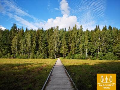
Viru Bog Nature Trail
Тропа длиной 3,5 км исследует верховое болото и его характерный ландшафт и биоразнообразие. Участок до башни длиной 1,3 км доступен для людей в инвалидных колясках с посторонней помощью. Первая платформа смотровой башни и сухой туалет также доступны. Он расположен примерно в 10 км от Лесной тропы.


Tsitre Tree Trail
Тропа протяженностью 1 км знакомит посетителей с историей и биоразнообразием парка летней усадьбы Цитре и его окрестностей. Она оборудована 29 информационными пунктами. Примерно 150 метров тропы состоят из дощатых настилов шириной до 1 метра, которые доступны для людей в инвалидных колясках. Есть адаптированный туалет. Тропа начинается от парковки (GPS: 59.518268, 25.510726). Она расположена недалеко от Лесной тропы.


46-й этап. Тситре – Кабернеэме (Kaberneeme).
Песчаные пляжи и острова залива Колга
Пристань у поселка Тситре появилась еще во времена викингов. Первые 4 км этого этапа Лесной тропы проходят по территории Национального парка Лахемаа. Путь между поселками Муукси и Сооринна проходит по платообразному овальному холму (возвышению Северо-Эстонского глинта), покрытому живописными зарослями можжевельника. Возле поселка Пыхья (Põhja) тропа пересекает прибрежную заболоченную местность, минует лодочную пристань в Салмисту и выходит к берегу моря. Отсюда хорошо виден остров Педассар (Pedassaar), расположенный на расстоянии 1,3 км в северо-восточном направлении. С этой точки можно рассмотреть также острова Умблу и Рохуси. Возле Валкла путники смогут посетить уютный пляжный ресторан. На пляже в Хаапсе оборудовано место для купания, где резко становится глубоко.
Tsitre Tree Trail
Тропа протяженностью 1 км знакомит посетителей с историей и биоразнообразием парка летней усадьбы Цитре и его окрестностей. Она оборудована 29 информационными пунктами. Примерно 150 метров тропы состоят из дощатых настилов шириной до 1 метра, которые доступны для людей в инвалидных колясках. Есть адаптированный туалет. Тропа начинается от парковки (GPS: 59.518268, 25.510726). Она расположена недалеко от Лесной тропы.
49-й этап. Мууга – Пююнси (Püünsi).
По сказочному полуострову Виймси (Viimsi)
Лесная тропа проходит через самую лесистую часть полуострова Виймси, где было создано несколько охраняемых природных территорий. В окрестностях Рохунеэме (Rohuneeme) тропа пересекает бывшую военную территорию советского периода. В этот день Лесная тропа ведет главным образом по тротуарам и вдоль дорог, пересекающих полуостров. В поселке Пююнси тропа поворачивает на юг. Отсюда можно видеть башни Старого города, высотные здания Таллинна возвышающиеся над водами Таллиннского залива, и порт с паромными маршрутами между Таллинном и Хельсинки.
Tedu (Tädu) Nature Trail.
Тропа протяженностью 3,1 км знакомит посетителей с традициями лесного хозяйства. Вся поверхность тропы гравийная и доступна для людей в инвалидных колясках. Есть парковка (GPS: 59.520475, 24.895883). Она расположена недалеко от Лесной тропы.


50-й этап. Пююнси (Püünsi) – Таллинн.
Самые красивые виды на Старый Таллинн
Лесная тропа проходит вдоль побережья Таллиннского залива, где в Пююнси открывается вид на башни Старого города, высотные здания и порт Таллинна. Приближаясь к Пирита (Pirita), Лесная тропа уводит в очаровательный сосновый лес, затем 2 километра по песчаному морскому пляжу. Путь от Пирита до Таллинна пролегает по прекрасному городскому променаду, откуда открываются виды на море и порт, а также культурно-исторические объекты. Лесная тропа завершает свой путь в Таллиннском порту, рядом с которым находится Старый город. На осмотр Старого города следует отвести один или два дня.
Pirita Promenade
Около 3 км длиной, ухоженный променад соединяет портовую зону Таллина с Пирита, пролегая вдоль морского побережья. Он имеет поверхность, подходящую для велосипедистов и любителей активного отдыха, и доступен для людей в инвалидных колясках на всем протяжении. На пляже Пирита есть плавательные средства, раздевалки и деревянный пандус, обеспечивающий доступ к воде. Услуги необходимо заказывать заранее: +372 5425 0424. Променад Пирита совпадает с Лесной тропой.


59-й этап. Panemunis – Birštonas.
Вдоль излучин реки Неман через этнографические хутора
Повторяя излучины реки Неман, Лесная тропа на территории Регионального парка излучин Немана образует изгиб длиной более 20 км, петляя по красивейшим природным уголкам и небольшим деревням с характерными для данной местности деревянными постройками, выкрашенными в разные цвета. Единственный на данном этапе крупный лесной массив, в котором маршрут пролегает по небольшим лесным дорожкам, расположен между деревнями Сипонис и Пузонис. После пересечения шоссе Вильнюс–Мариямполе (A16), Лесная тропа выходит к следующей излучине реки Неман, где располагается бальнеологический курорт Бирштонас. По улице Б. Сруогос тропа приводит к туристическому информационному центру Бирштонаса.
Birštonas Nemunas krasta promenāde un gājēju celiņš
За Бирштонским туристическим информационным центром тропа Межтака тянется более 1 км вдоль набережной реки Нямунас. Затем она поворачивает на улицу Альгирдо, пересекает парк Витаутаса Юргиса Мешки, возвращается на променад и через 0,6 км переходит в пешеходную и велосипедную дорожку. Тропа длиной около 5 км пересекает лес Жверинчюс, затем пешеходная тропа проходит через зону отдыха Паприене, доходя до моста Грейму через реку Нямунас. Променад и пешеходная дорожка доступны для людей в инвалидных колясках почти на всем протяжении. Покрытие в основном асфальтовое, а в Пренае — гравийное. Тропа совпадает с маршрутом Межтака.
83-й этап. Paplatelė – Plateliai.
Среди крупнейших озёр Жемайтийского национального парка
Первые 3,5 км Лесная тропа ведёт через красивейшие хвойные леса. До Музея холодной войны тропа совпадает с познавательной тропой Плокштине, а 5 км от музея – с пешеходной и велосипедной дорожкой Плокштине. У шоссе № 3202 (улица Малуно) маршрут сворачивает налево на юго-запад и сразу, через 0,3 км, направо на юго-юго-запад. Приблизительно через 0,5 км выходит на улицу Ильгё эжеро. Затем на протяжении 5,5 км маршрут делает широкий круг вокруг озёр Ильгис и Бержорас, пока не выведет к деревне Бержорас. Через 2 км по улице Плунге Лесная тропа приводит в центр Плателяй и делает ещё один круг по улице Эжеро до познавательной тропы Шейре, открывая живописный ландшафт. Далее по улицам Эжеро, Науёйи и Жямайчю Калвариёс возвращается в центр города.
Šeire's Educational Trail
Длина тропы составляет около 7 километров, но есть смотровая площадка, доступная для людей в инвалидных колясках, с которой открывается вид на озеро Плателяй и его острова. Плателяй находится в Национальном парке Жемайтия. На информационном щите размещена тактильная карта озера с островами, что позволяет людям с нарушениями зрения исследовать его. Парковка находится здесь: GPS 56.048355, 21.826901. Она расположена рядом с тропой Межтака.


84-й этап. Plateliai – Salantai.
В направлении Приморской низменности
Лесная тропа на протяжении 6 км проходит по бровке шоссе Плателяй–Салантай (№ 2302). На этом этапе маршрут спускается вниз по западной части Жемайтской возвышенности. Во время путешествия в направлении Приморской низменности открывается красивейшая панорама ландшафта. В центре деревни Гинталишке Лесная тропа уходит налево на юго-запад и 2,4 км петляет по шоссе № 3216, затем сворачивает направо на запад, где пересекает крупнейший на этом этапе лесной массив. В советские времена здесь находилась ракетная база, что доказывает выложенная бетонными плитами дорога. Затем маршрут совпадает с шоссе Плунге–Салантай (№ 169) и через 1,4 км уходит влево. До города Салантай тропа петляет по небольшой дорожке, а к центру города ведёт по улицам Жемайтес и М. Валанчяус. Начало маршрута – Жемайтийский национальный парк, окончание – Салантайский региональный парк.
Šeire's Educational Trail
Длина тропы составляет около 7 километров, но есть смотровая площадка, доступная для людей в инвалидных колясках, с которой открывается вид на озеро Плателяй и его острова. Плателяй находится в Национальном парке Жемайтия. На информационном щите размещена тактильная карта озера с островами, что позволяет людям с нарушениями зрения исследовать его. Парковка находится здесь: GPS 56.048355, 21.826901. Она расположена рядом с тропой Межтака.
85-й этап. Salantai – Mosėdis.
Через Салантайский региональный парк
Из городка Салантай Лесная тропа выбирается по улицам М. Валанчяус, Падваралё и Илгая. За 100 м до шоссе № 169 маршрут уходит влево на сельскую дорожку и через 3,5 км достигает улицы Эрлос, где сворачивает налево на запад. Ещё через 0,4 км уходит вправо на север и выводит в деревню Шатраминяй, где поворачивает направо на юго-запад, через 2,9 км пересекает шоссе Салантай–Скуодас (№ 169) и в Шаукляй уходит влево на север. Через 3,8 км достигает конечной точки данного этапа – Моседиса. Большая часть этапа, кроме участка в окрестностях Шатраминяй, пролегает по территории Салантайского регионального парка.
The Šauklių Nature Trail
Тропа длиной 2,7 км знакомит с ландшафтом регионального парка Салантай, покрытого валунами и можжевельником, демонстрирующим его биоразнообразие. Поверхность тропы состоит из хорошо протоптанной дорожки и дощатых настилов. Часть дощатого настила доступна для людей в инвалидных колясках. Посетителям необходимо заранее сообщить об этом руководству парка, чтобы ворота можно было открыть. Парковка находится здесь: GPS 56.125202, 21.592115, и в 1,2 км от тропы Межтака.

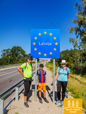
87-й этап. Lithuanian– Latvian border – Gramzda.
Завитая Вартайская равнина
Литовско-латвийская государственная граница проходит по руслу реки Апша, которую по мосту трассы Скуодас – Приекуле (P114) пересекает тропа Лесного маршрута. Сначала он петляет обочиной дороги и через 1,7 км сворачивает на гравийную дорогу в направлении Калети. Из окрестностей дер. Озоли открывается вид западной части Куршских холмов - широких и красивых волнистых равнин Вартайи. Этап маршрута в 0,5 км идёт дорогой V1217 через деревню Озолы, далее сворачивает вправо и через 2 км достигает дороги Барта – Калети – Грамзда (V1218). Далее маршрут ведёт к Грамзде.
Gramzdas mežaparka taka
В лесопарке Грамзда проложена тропа длиной около 2 километров. Она не размечена, а ее поверхность состоит из гравия, асфальта и простых протоптанных дорожек. Тропа частично доступна для людей в инвалидных колясках и родителей с детскими колясками. Удобной отправной точкой является парковка возле магазина «Aibe» (GPS: 56.369134, 21.604151). В здании администрации волости Грамзда есть адаптированный туалет. Тропа Межтака проходит через лесопарк Грамзда.


88-й этап. Gramzda – Priekule.
В богатую сказками Приекуле
От Грамзды Лесная тропа маленькими тропками петляет вдоль карьеров песка и гравия, проходит в северо-восточном направлении через фермерские поля. Возле усадьбы «Lejasbunči» («Леясбунчи – Нижний Бунчи») маршрут сворачивает к Мазграмзде и перед самым местечком пересекает глубокую и прохладную долину речки Рунюпе. За Мазграмздой маршрут пролегает вдоль трассы Грамзда – Приекуле (P114), от которой открывается вид волнистых равнин Вартаи в западной части широкой красивой Куршской возвышенности. После пересечения этой трассы, маршрут лесной тропы проходит через бывший аэродром, дорогой Приекуле - Пурмсати - Калейи (V1211) и небольшой дугой через лесок. Извилистым берегом речки Вирга лесная тропа, следуя через лесопарк «Priekules Priediens» («Приекулес Приеденс – Сосны Приекуле»), приводит к Лютеранской церкви в Приекуле.
Gramzdas mežaparka taka
В лесопарке Грамзда проложена тропа длиной около 2 километров. Она не размечена, а ее поверхность состоит из гравия, асфальта и простых протоптанных дорожек. Тропа частично доступна для людей в инвалидных колясках и родителей с детскими колясками. Удобной отправной точкой является парковка возле магазина «Aibe» (GPS: 56.369134, 21.604151). В здании администрации волости Грамзда есть адаптированный туалет. Тропа Межтака проходит через лесопарк Грамзда.
91-й этап. Aizpute – Snēpele.
Тропами барона фон Мантейфеля
Маршрут Лесной тропы улочками Атмодас и Елгава проходит через Айзпуте, за прудом Лажа сворачивает вправо и большой дугой приближается к парку поместья Казданга с южной стороны. Маленькими тропками вдоль озера Дзирнаву ведёт по парку вокруг строений поместья и пруда Зену, 0,7 км проходит дорогой Казданга - Цилду (V1200) и сворачивает вправо на дорогу Снепеле – Казданга (V1296). К усадьбе «Земтури» лесная тропа понемногу поднимается на Бандавские холмы Западно – Куршской возвышенности, откуда открывается красивейший вид окрестностей. Это место находится на высоте 81 м над уровнем моря. От усадьбы 12 км маршрута пролегают через малонаселённые лесистые места, и лишь последние 3 км выводят на открытую местность и фермерские земли, пока не дойдут до Снепеле.
Kazdangas parka dabas takas
Парк Казданга является одним из самых богатых латвийских усадебных парков с точки зрения дендрологического разнообразия. Парк отличается густой сетью троп, простирающейся до 9 километров. Покрытие троп включает гравий, хорошо утоптанные дорожки и деревянные настилы. Указатели направляют посетителей к различным достопримечательностям. В качестве отправной точки для исследования парка была создана парковка (GPS: 56.732242, 21.733626). Тропы парка доступны для людей в инвалидных колясках с помощью помощника, а также удобны для родителей с детскими колясками. Доступен адаптированный туалет. Тропа Межтака проходит через парк Казданга.


92-й этап. Snēpele – Kuldīga.
Кулдигa – самый очаровательный средневековый город Курземе
Лесная тропа ведёт по главной улице Снепеле к дороге V1294 и через 0,3 км перед озером Кепшу сворачивает вправо на деревенскую дорогу. По этой дороге маршрут достигает Слипинциемса, перед этим пересекая плотину Спринцупе, и проходит вдоль пруда. Далее маршрут поворачивает по направлению к Пелчи, где петляет вдоль Дамбовых прудов, ведет к дороге Кулдига – Пелчи (V1293) и продолжается через сады Кулдиги «Курземите» и «Румба», до реки Вента и Кулдигской объездной дороги. Этап маршрута длиной 2,4 км от объездной дороги до Старинного кирпичного моста ведёт по красивой прибрежной тропе реки Венты, где во влажных местах и через ручьи проложены деревянные мостки.
The walking trail along the Venta River in Kuldīga
Тропа тянется вдоль левого берега реки Вента от городского сада Кулдиги до нового моста Кулдиги, охватывая 2,4 километра. Вдоль тропы установлены места для отдыха и информационные щиты. Тропа доступна для людей в инвалидных колясках благодаря своей гладкой поверхности, состоящей из мелкого твердого гравия, хотя на некоторых участках может потребоваться помощь из-за уклонов. Тропа широкая, и там, где она пересекает небольшие овраги ручьев, построены деревянные настилы и мосты. Этот участок тропы Межтака проходит вдоль тропы променада Кулдиги. Доступны адаптированные туалеты. Оборудована парковка по координатам GPS: 56.973354, 21.977798.


The Mārtiņsala Nature Trail
Тропа длиной около 1 км расположена на Мартиньсале и знакомит посетителей с водопадом Вентас Румба. Поверхность состоит из гравия (ширина 1,60 метра) или дощатого настила (ширина 95 см) без зон для прохода. Некоторые участки доступны для людей в инвалидных колясках. Доступны адаптированные туалеты. Парковка находится по координатам GPS: 56.970622, 21.980747. Природная тропа Мартиньсалы расположена рядом с тропой Межтака.


93-й этап. Kuldīga – Renda.
По долине реки Вента и природному парку Риежупе
За старинным кирпичным мостом через Венту Лесная тропа ненадолго проходит по правому берегу реки, по ул. Краста и по дороге Ветклиника-Палея, затем пересекает Калнмуйжский лес, Риежупе и дальше до Мазренды тянется широкими лесными дорогами Ренды. Рельеф здесь ровный, поскольку отрезок пути пролегает по Пьевентской равнине Куршской низменности. В Мазренде маршрут проходит через песчано-гравийный карьер и по ул. Кулдигас ведёт в центр Ренды. Весь маршрут проходит по территории природного заповедника долины реки Вента и природного парка Риежупе.
The Mārtiņsala Nature Trail
Тропа длиной около 1 км расположена на Мартиньсале и знакомит посетителей с водопадом Вентас Румба. Поверхность состоит из гравия (ширина 1,60 метра) или дощатого настила (ширина 95 см) без зон для прохода. Некоторые участки доступны для людей в инвалидных колясках. Доступны адаптированные туалеты. Парковка находится по координатам GPS: 56.970622, 21.980747. Природная тропа Мартиньсалы расположена рядом с тропой Межтака.
95-й этап. Sabile – Kandava.
По одному из самых красивых природных парков Курземе
Лесная тропа проходит по левому берегу Абавы – по ул. Кр.Барона. Далее, переходя в небольшую тропку, она петляет через луга и леса долины старого русла Абавы, пока не достигает холма, называемого Шведской шапкой. За ним небольшая тропа ведёт к дороге Плости - Пуцес (V1471), пересекает Амулу и у Калнмуйжа поднимается на вершину старого русла Абавы, где продолжается 6 км до парка поместья Айздзире. В северном направлении маршрут протяженностью 1 км петляет по долине старого русла Абавы, откуда открываются одни из самых красивых видов на эту долину. Старое русло Абавы в этом месте достигает 40 метровой глубины. За Звейниекским мостом маршрут поднимается по северному берегу старого русла, где растут виноградники. Далее за лесом пересекает дорогу Кандава – Ренда (Р130) и по ул. Сабиле доходит до Кандавы. Улицы этого живописного городка - Лауку, Озола, Зилу, Сабилес и Пилс ведут к Рыцарскому городищу. Маршрут всё время петляет по старому руслу реки Абава.
The "Fairy Tale Forest" play trail
Рядом с кафе "Plostkrogs" (GPS: 57.020908, 22.645401) создана игровая тропа "Сказочный лес", на которой размещены различные фигурки лесных животных, деревянные домики и другие игры для детей. Длина тропы составляет 1,6 км. На ней есть некоторые препятствия, такие как корни деревьев и вход через деревянный дом, но с помощником люди в инвалидных колясках могут исследовать "Сказочный лес". Она расположена в 1,2 км от тропы Межтака.
96-й этап. Kandava – Jaunmokas.
Пуре – место, где делают шоколад
Пройдя по улице Елгава старый каменный мост через реку Абава, Лесная тропа по улице Дайгоне и далее 5 км по гравию ведёт к деревеньке Дайгоне. Далее дорогой Дзикални – Пуре (V1464) спускается в долину старого русла реки Абава. За мостом через реку маршрут сворачивает вправо и малой тропинкой доходит до Пуре. Обойдя поместье Пуре по улице Земеню и по дороге Пуре – Яунсати (C004), 5 км он идёт до деревни Цалциема. В окрестностях добывается песок и гравий. В Цалциеме лесная тропа сворачивает влево на небольшую дорогу из гравия и через 3,5 км соединяется с дорогой Яунмокас - Яунсати (V1444). Ещё через 3 км маршрут пересекает шоссе Рига - Вентспилс и небольшими, окруженными деревьями дорогами достигает замка Яунмокас. Приближаясь к нему со стороны Яунсати, открывается красивый ландшафт, где волнистую равнину Восточной Курши - Спарни сменяет возвышенность Ванеми.
Čužu Marsh Nature Trail
Круговая тропа в болоте Чужу знакомит посетителей с уникальным диким явлением кустарниковой клюквы, известковым болотом и бывшим курортом с минеральной водой. Деревянный дощатый настил длиной около 1 км с бортиками приспособлен для людей в инвалидных колясках. Дощатый настил соединяется с гравийной дорожкой длиной 0,5 км со специально спроектированной парковкой (GPS: 57.026431, 22.785473) и адаптированными туалетами. Из-за уклона в некоторых местах может потребоваться помощь. Тропа расположена примерно в 0,8 км от тропы Межтака.


Jaunmoku Castle Trail
Тропа знакомит посетителей с усадебным комплексом и парком, ее длина составляет около 1,5 км. Она доступна для людей в инвалидных колясках. Покрытие тропы включает асфальт, мощение и гравий. Парковка находится по координатам GPS: 56.982423, 23.053098. С помощью кнопки вызова посетители могут вызвать персонал, который поможет войти в здание и осмотреть его изнутри. Тропа проходит рядом с тропой Межтака. Доступны адаптированные туалеты.


97-й этап. Jaunmokas – Tukums.
В Тукумс - полюбоваться городом!
Окрестности замка Яунмоку восхищают пейзажем холмогорья Ванема на Восточно-Куршской возвышенности. Лесная тропа спускается к водяной мельнице Беро. Маршрут продолжается примерно 3 км до Вецмоку и 50 м за ним, открывая красивый пейзаж и широкую долину Слоцене на юге. За аллеей поместья Вецмоку маршрут пересекает дорогу Тукумс–Лаздас (V1442), проходит через несколько односемейных усадебных хозяйств и по прямой лесной дороге ведёт на юго-восток вдоль озера Секлис, к которому можно подойти по небольшим тропинкам. Лесными тропами маршрут проходит по деревyшке Свейкули и возле кладбища Озолиню достигает дороги Тукумс–Кестерциемс–Колка (P131), где начинается город Тукумс. Улицами Раудас, Курземес Межа и Мелнезера маршрут приводит к горе Саулескалнс.
Jaunmoku Castle Trail
Тропа знакомит посетителей с усадебным комплексом и парком, ее длина составляет около 1,5 км. Она доступна для людей в инвалидных колясках. Покрытие тропы включает асфальт, мощение и гравий. Парковка находится по координатам GPS: 56.982423, 23.053098. С помощью кнопки вызова посетители могут вызвать персонал, который поможет войти в здание и осмотреть его изнутри. Тропа проходит рядом с тропой Межтака. Доступны адаптированные туалеты.
99-й этап. Jāņukrogs – Bigauņciems.
По Кемерскому национальному парку
После пересечения территории с несколькими усадьбами, извилистая Лесная тропа проходит через красивые хвойные леса и еще 6,5 км по Чаукциемсу, пока не сворачивает к Зеленой дюне. Дальше идет по обочине дороги Антинциемс - Смарде. Местность ровная, так как маршрут пролегает по равнине Энгуре в прибрежной низменности. С Зеленой дюны открывается широкий вид на болото Заля (Зеленое) и Ведьмино болото. Небольшая извилистая лесная тропа проходит по нижней части дюны и в двух местах пересекает болото по деревянным мосткам. В Кемери маршрут пролегает по улицам партизану, Робежу, А. Упиша, Катедралес и E.Дарзина через информационный центр национального парка «Meža māja“ и Вершупите, в которую втекают воды серных источников. Маршрут пересекает улицу Туристу и дальше идет по дороге Дуну до озера Слокас. Дальше Лесная тропа доходит до болотистого леска Вершупите - одной из самых лучших сред обитания влажных лесов во всем Курземе. Возле озера Мелнэзерс маршрут сворачивает в сторону старой Кемерской дороги и через 2 км достигает Бигаунциемса. За трассой Слока-Талси (P128) маршрут Лесной тропы доходит до Рижского залива и соединяется с маршрутом тропы Балтийского взморья (E9). Весь этап пути Лесная тропа проходит через Кемерский национальный парк (КНП).
The Melnalkšņu Swamp Boardwalk
Расположенная недалеко от Центра посетителей национального парка Кемеру, тропа знакомит посетителей с одной из характерных сред обитания парка: влажными лесами. Тропа из дощатого настила длиной 0,6 км поднята на деревянных сваях и пересекает болото, которое разливается весной. Ширина дощатого настила составляет 1,2 метра без проходов, поэтому важно следовать указанному направлению движения. Она доступна для людей в инвалидных колясках с посторонней помощью. В начале и конце тропы поверхность из гравия и асфальта. Доступен адаптированный туалет, а парковка находится по координатам GPS: 56.951980, 23.512914. Тропа расположена недалеко от тропы Межтака и восстанавливается после летнего шторма 2024 года.


100-й этап. Bigauņciems – Dubulti.
По Юрмале – историческому курорту
С Бигаунциемса хорошо виден весь берег Юрмалы. Первая часть этапа пути на сегодняшний день лежит через Кемерский национальный парк. От Яункемери до Дубулты пеший маршрут проходит по самому широкому песчаному пляжу Рижского залива, через исторический курорт и самый длинный в Латвии город - Юрмалу. Стоит помнить, что в красивые и теплые летние дни на пляже бывает много отдыхающих.
Kupskalni Nature Trail
Тропа тянется на полкилометра вдоль правого берега реки Силиньупе и ведет от дороги Слока-Талси к морю. Она частично доступна для людей в инвалидных колясках с посторонней помощью, так как корни деревьев в начале тропы могут быть препятствием. Дальнейший участок тропы (широкие дощатые настилы с зонами разъезда) доступен. Частично доступен туалет. Прогулку можно начать от близлежащей заправочной станции (GPS: 56.992203, 23.522736).


Jūrmalas pilsētas pludmales
Городские пляжи Юрмалы доступны для людей с функциональными нарушениями, в том числе для инвалидов-колясочников и пожилых людей. В Юрмале имеется 14 приспособленных точек доступа к морю для инвалидных колясок: линия 36, проспект Виенибас (2 точки доступа), улица Турайдас (2 точки доступа), улица Пилсону, улица Базницас, улица Кляву, улица Лигатнес, улица Дзимтенес, Вейу. улица, улица Атбалсс, улица Каптейня Золта и дорога Яункемери. Эти точки доступа разработаны так, чтобы подходить как для людей с функциональными нарушениями, так и для людей с колясками, с учетом поверхности и рельефа местности. Кроме того, в четырех местах — Вайвари, Кауггури, Яункемери и Яундубулты — есть расширенные и более удобные кабинки для переодевания.

101-й этап. Дубулти – Лиелупе – Булдури.
Самые популярные пляжи Латвии
Между Дубулти и Лиелупе раскинулся самый широкий пляж на побережье Рижского морского залива – главнейшая ценность города-курорта Юрмалы – с многочисленными пляжными кафе и разнообразными возможностями отдыха. Леса в прибрежных дюнах пронизаны плотной сетью тропинок, которые подходят для обычной и скандинавской ходьбы. Часть Тропы Балтийского взморья между пляжем Лиелупе и Юрмальским музеем под открытым небом проходит по территории природного парка «Рагакапас». Отсюда обратно в Булдури можно легко попасть по проспекту Булдуру и 5-й линии.
Jūrmalas pilsētas pludmales
Городские пляжи Юрмалы доступны для людей с функциональными нарушениями, в том числе для инвалидов-колясочников и пожилых людей. В Юрмале имеется 14 приспособленных точек доступа к морю для инвалидных колясок: линия 36, проспект Виенибас (2 точки доступа), улица Турайдас (2 точки доступа), улица Пилсону, улица Базницас, улица Кляву, улица Лигатнес, улица Дзимтенес, Вейу. улица, улица Атбалсс, улица Каптейня Золта и дорога Яункемери. Эти точки доступа разработаны так, чтобы подходить как для людей с функциональными нарушениями, так и для людей с колясками, с учетом поверхности и рельефа местности. Кроме того, в четырех местах — Вайвари, Кауггури, Яункемери и Яундубулты — есть расширенные и более удобные кабинки для переодевания.
102-й этап. Булдури – центр Риги.
Через леса – в Ригу
Маршрут является альтернативным способом попасть из Юрмалы в Ригу, идя по лесу. За Лиелупским мостом Тропа Балтийского взморья проходит через Приедайне с видами на деревянную застройку, идет параллельно правому берегу Лиелупе, потом поворачивает мимо южной части Болдерайской дюны и пересекает лес Клейсту, проходя вдоль кладбища Лачупес. Дальше тропа идет по историческим дорогам Пардаугавы – улицам Буллю и Даугавгривас через Дзегужкалнс, мимо канала Зундас и залива Агенскална, доходит до Даугавы, где по Каменному мосту пересекает Даугаву и останавливается на Ратушной площади.
Babīte Rhododendron Nursery
Проложена тропа длиной 1,9 км, доступная для людей в инвалидных колясках и родителей с детскими колясками. Покрытие тропы асфальтовое. Есть выделенная парковка (GPS: 56.962330, 23.952280) и адаптированный туалет. Тропа расположена примерно в 2,7 км от тропы Юртака.
Daugavgrīva Nature Trail
Тропа начинается на парковке (GPS: 57.036769, 24.018166), около улицы Валентина Пикуля, и ведет через болото Даугавгрива к дюнам и морю. Поверхность тропы у моря асфальтирована, а асфальтированный участок доступен для людей в инвалидных колясках. Вдоль тропы построена башня для наблюдения за птицами, первый этаж которой доступен для людей в инвалидных колясках. Тропа находится примерно в 12,5 километрах от тропы Юртака, расположенной на берегу моря в Даугавгриве.

Jūrmalas pilsētas pludmales
Городские пляжи Юрмалы доступны для людей с функциональными нарушениями, в том числе для инвалидов-колясочников и пожилых людей. В Юрмале имеется 14 приспособленных точек доступа к морю для инвалидных колясок: линия 36, проспект Виенибас (2 точки доступа), улица Турайдас (2 точки доступа), улица Пилсону, улица Базницас, улица Кляву, улица Лигатнес, улица Дзимтенес, Вейу. улица, улица Атбалсс, улица Каптейня Золта и дорога Яункемери. Эти точки доступа разработаны так, чтобы подходить как для людей с функциональными нарушениями, так и для людей с колясками, с учетом поверхности и рельефа местности. Кроме того, в четырех местах — Вайвари, Кауггури, Яункемери и Яундубулты — есть расширенные и более удобные кабинки для переодевания.