


Baltischer Küstenwanderweg - Wheelchair accesible


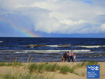
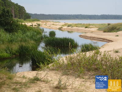
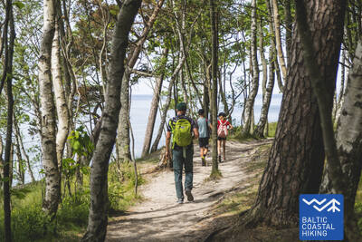
 2. Etappe. Pape - Bernāti.
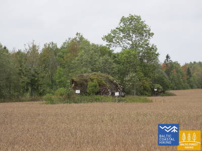
Der am, westlichsten gelegene Punkt Lettlands
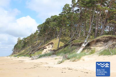
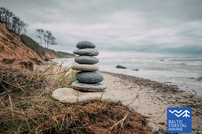
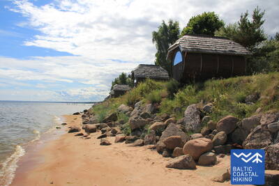
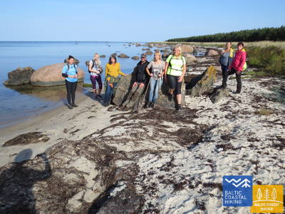
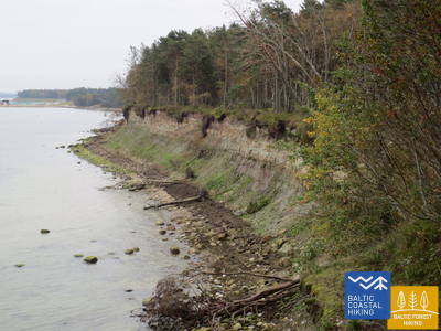
Der Baltische Küstenwanderweg führt auf der ganzen Strecke am Strand entlang, der auf der Festlandseite in der Umgebung von Pape von einer wunderschönen Vordüne umschlossen ist. Hinter dem Dorf wird er auf einer Länge von fast 10 km von einem abgespülten Uferstreifen abgelöst, auf dem Kiefernstämme umgestürzt herumliegen. Die Flachdüne kommt in der Umgebung des Dorfes Jūrmalciems wieder zum Vorschein. Hinter Jūrmalciems erstrecken sich weitläufig Strände. Nähert man sich dem Kap Bernātu ragt eine eindrucksvolle, mit einem Kieferwald bewachsene und streckenweise durch die Meeresbrandung ausgehöhlte Steilküste empor.
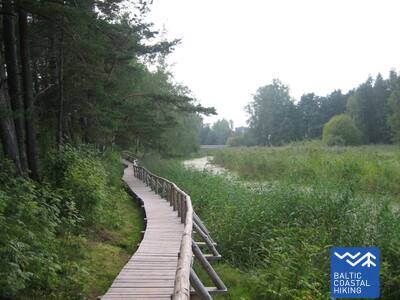
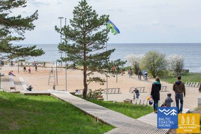
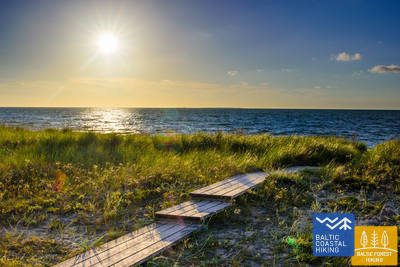
Bernāti Beach Boardwalk
Die Strandpromenade am Bernāti Beach ist in eine Richtung etwa 400 Meter lang und 1,2 bis 1,6 Meter breit. Sie ist teilweise für Rollstuhlfahrer zugänglich und aufgrund der Steigungen von bis zu 12 Prozent wird eine Nutzung mit Hilfe empfohlen. Sie ist auch für Eltern mit Kinderwagen benutzbar. Am Ende der Strandpromenade gibt es eine Aussichtsplattform und einen Loungebereich. Während der Saison wird die Strandpromenade verlängert, damit Rollstuhlfahrer das Ufer erreichen können. In der Nähe der Strandpromenade gibt es einen Parkplatz (GPS: 56.366156, 20.976715) und eine Trockentoilette (nicht angepasst).


2. Etappe. Pape - Bernāti.
Der am, westlichsten gelegene Punkt Lettlands
Der Baltische Küstenwanderweg führt auf der ganzen Strecke am Strand entlang, der auf der Festlandseite in der Umgebung von Pape von einer wunderschönen Vordüne umschlossen ist. Hinter dem Dorf wird er auf einer Länge von fast 10 km von einem abgespülten Uferstreifen abgelöst, auf dem Kiefernstämme umgestürzt herumliegen. Die Flachdüne kommt in der Umgebung des Dorfes Jūrmalciems wieder zum Vorschein. Hinter Jūrmalciems erstrecken sich weitläufig Strände. Nähert man sich dem Kap Bernātu ragt eine eindrucksvolle, mit einem Kieferwald bewachsene und streckenweise durch die Meeresbrandung ausgehöhlte Steilküste empor.
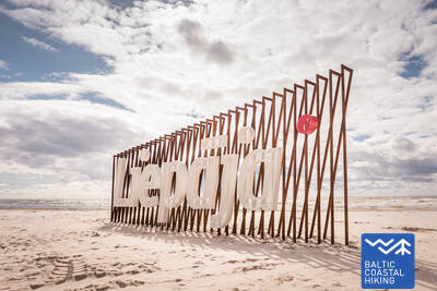
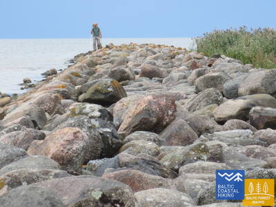
3. Etappe. Bernāti - Liepāja - Karosta.
Die Stadt, wo der Wind geboren ist
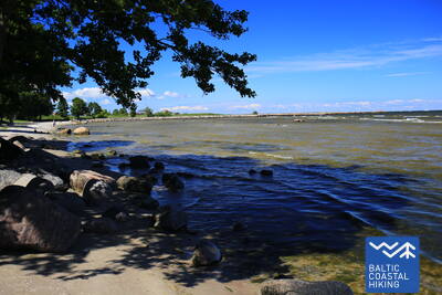
Von Bernāti bis Liepāja führt der Baltische Küstenwanderweg an einem breiten Strand entlang. Dort erfreuen auf der Festlandseite anfangs eine abgespülte Küste das Auge, später dann beim Herankommen an die Stadt Liepāja hohe, mit Strandroggen und Strandhafer bewachsene Vordünen. Der Pfad windet sich weiter durch den zentralen Teil der Stadt Liepāja – Vecliepāja und kurz nach dem Passieren des Karosta-Kanals (Kriegshafenkanal) erreicht man Karosta – einen Komplex von Militär- und Fortifikationsbauten. Um ihn genauer zu erkunden, sollte man mindestens einen halben
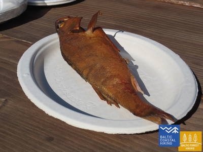
Tag einplanen. Unbedingt probieren sollte man die Spezialität von Liepāja – ”Liepājas menciņi”, geräucherten Dorsch, zubereitet nach einem alten südkurländischen Rezept.
The hiking route "Hear, Smell, Touch Liepāja."
Die Route wurde für blinde und sehbehinderte Menschen konzipiert und wird von einem ausgebildeten blinden Führer geleitet. Sie umfasst Besuche bedeutender kultureller und historischer Stätten in Liepāja. Die Länge der Route hängt von den Bedürfnissen der Gruppe ab. Sie befindet sich in der Nähe des Küstenwanderwegs. In Liepāja wurden mehrere taktile Karten entwickelt, die sehbehinderten Menschen die Orientierung erleichtern.
Liepāja Beach near the Central Rescue Station
Am Strand von Liepāja in der Nähe der zentralen Rettungsstation (GPS: 56.504199, 20.991922) wurde eine Einrichtung für Menschen mit Behinderungen eingerichtet. Sie umfasst Duschen, Umkleidekabinen und Holzstege, die bis zum Meer reichen und Rollstuhlfahrern den Zugang zum Ufer ermöglichen. Es stehen spezielle Rollstühle zur Verfügung, die zum Schwimmen im Meer geeignet sind. Für blinde und sehbehinderte Menschen wurden Audiobojen im Meer angebracht, die durch Signale Informationen darüber geben, wie weit man schwimmen kann.


Liepāja Seaside Park.
Der Park verfügt über ein etwa 3 km langes Wegenetz, das für Rollstuhlfahrer geeignet ist. Die Wege weisen unterschiedliche Oberflächen auf, darunter Kies, Pflaster, Promenaden und Asphalt. Es gibt Rastplätze, Essensmöglichkeiten, Parkplätze und Toiletten. Der Park ist von der Kreuzung der Straßen Liepu und Peldu aus zugänglich (GPS: 56.506365, 20.997112). Er liegt in der Nähe des Küstenwanderwegs.


Liepāja Lake Boardwalk
Die Promenade am Liepāja-See ist für Rollstuhlfahrer und Eltern mit Kinderwagen zugänglich. Sie ist breit und mit Kanten versehen und erstreckt sich in eine Richtung etwa 400 Meter. Der Turm ist für Rollstuhlfahrer nicht zugänglich. Er liegt etwa 2 km vom Küstenwanderweg entfernt, GPS: 56.494511, 21.024515.


Liepāja Lake Horse Island Trail
Der Wanderweg „Pferdeinsel am Liepāja-See“ ist in eine Richtung etwa 2 km lang. Am Anfang des Wanderwegs gibt es einen Parkplatz (GPS: 56.516585, 21.032329) und das Dabasmāja – Wissenschafts- und Bildungsinnovationszentrum (mit Rampen ausgestattet). Die Wegoberfläche besteht am Anfang aus Holzstegen, danach kommt ein Schotterweg. Der Wanderweg ist für Rollstuhlfahrer zugänglich, obwohl der Schotterabschnitt mit Hilfe empfohlen wird. Er liegt 1,3 km vom Küstenwanderweg entfernt.


3. Etappe. Bernāti - Liepāja - Karosta.
Die Stadt, wo der Wind geboren ist
Von Bernāti bis Liepāja führt der Baltische Küstenwanderweg an einem breiten Strand entlang. Dort erfreuen auf der Festlandseite anfangs eine abgespülte Küste das Auge, später dann beim Herankommen an die Stadt Liepāja hohe, mit Strandroggen und Strandhafer bewachsene Vordünen. Der Pfad windet sich weiter durch den zentralen Teil der Stadt Liepāja – Vecliepāja und kurz nach dem Passieren des Karosta-Kanals (Kriegshafenkanal) erreicht man Karosta – einen Komplex von Militär- und Fortifikationsbauten. Um ihn genauer zu erkunden, sollte man mindestens einen halben
Tag einplanen. Unbedingt probieren sollte man die Spezialität von Liepāja – ”Liepājas menciņi”, geräucherten Dorsch, zubereitet nach einem alten südkurländischen Rezept.
 5. Etappe. Ziemupe - Pāvilosta.
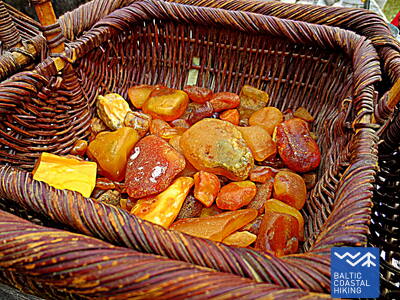
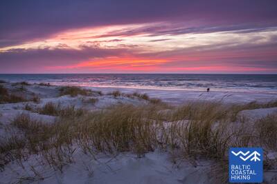
Der singende Sand und Bernstein
Ein von Reisenden nur wenig besuchter Strand, wo man Bernstein und Steine mit Fossilien sammeln und dem Klang des Sandes lauschen kann. In der Umgebung von Ziemupe kommt die durch die Meeresbrandung ausgehöhlte Steilküste zum Vorschein. Danach folgen weiter von Akmensrags bis Pāvilosta schöne, streckenweise abgespülte Vordünen, die mit Strandroggen und Strandhafer bedeckt sind. An einigen Stellen sind Graudünen zu sehen. Der Leuchtturm Akmeņrags ist der beste Rastplatz. Pāvilosta mit seinem Kleinstadt-Flair, den Häfen und dem Aroma der geräucherten Fische bringt Besucher von der unberührten Natur wieder in die Zivilisation zurück.
Pāvilosta Pier Promenade
Ein etwa 200 Meter langer Abschnitt der Promenade der Mole von Pāvilosta ist für Rollstuhlfahrer zugänglich, die Mole selbst jedoch nicht. Ein geeigneter Ausgangspunkt ist das Heimatmuseum von Pāvilosta (GPS: 56.889365, 21.172837). Es liegt neben dem Küstenwanderweg.


Pāvilosta Beach Boardwalk
Der Strandweg von Pāvilosta führt Besucher in die Graue Düne und die Küstendünen ein. Es handelt sich um einen 1,2 Meter breiten Holzsteg, der einen halben Kilometer lang ist (Hin- und Rückweg). Der Weg beginnt mit einer Schotteroberfläche. Es gibt einen Parkplatz (GPS: 56.892935, 21.185369). Der Weg ist für Rollstuhlfahrer mit Hilfe zugänglich, da es einige Steigungen und Gefälle gibt. Der Zugang zur Küste ist nicht möglich.


5. Etappe. Ziemupe - Pāvilosta.
Der singende Sand und Bernstein
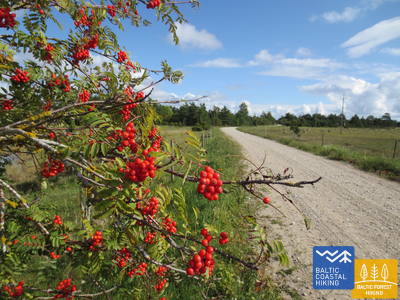
Ein von Reisenden nur wenig besuchter Strand, wo man Bernstein und Steine mit Fossilien sammeln und dem Klang des Sandes lauschen kann. In der Umgebung von Ziemupe kommt die durch die Meeresbrandung ausgehöhlte Steilküste zum Vorschein. Danach folgen weiter von Akmensrags bis Pāvilosta schöne, streckenweise abgespülte Vordünen, die mit Strandroggen und Strandhafer bedeckt sind. An einigen Stellen sind Graudünen zu sehen. Der Leuchtturm Akmeņrags ist der beste Rastplatz. Pāvilosta mit seinem Kleinstadt-Flair, den Häfen und dem Aroma der geräucherten Fische bringt Besucher von der unberührten Natur wieder in die Zivilisation zurück.
 6. Etappe. Pāvilosta - Jūrkalne.
Die hervorragendsten Steilküsten der Ostsee
Im Nordosten von Pāvilosta erfreut eine an Graudünen reiche Landschaft das Auge. Doch nur einige Kilometer weiter beginnt eine der schönsten Abschnitte des Pfades Jūrtaka mit ihren hervorragenden Steilküsten, die sich auf einer Länge von mehr als 20 km erstrecken. Die bezauberndste, von Steilküsten geprägte Landschaften ist in der Nähe der Mündung der Flüsse Strante, Ulmale und Rīva zu beobachten. An vielen Stellen unterhalb des steilen Küstenabfalls blühen im Sommer die Orchideen. In Dorf Jūrkalne und dessen Umgebung kann man „zwei Sonnenuntergänge“ genießen - den ersten am Strand, den zweiten - einen kurzen Moment später - oben von der Spitze der Steilküste.
Pāvilosta Beach Boardwalk
Der Strandweg von Pāvilosta führt Besucher in die Graue Düne und die Küstendünen ein. Es handelt sich um einen 1,2 Meter breiten Holzsteg, der einen halben Kilometer lang ist (Hin- und Rückweg). Der Weg beginnt mit einer Schotteroberfläche. Es gibt einen Parkplatz (GPS: 56.892935, 21.185369). Der Weg ist für Rollstuhlfahrer mit Hilfe zugänglich, da es einige Steigungen und Gefälle gibt. Der Zugang zur Küste ist nicht möglich.
Pāvilosta Pier Promenade
Ein etwa 200 Meter langer Abschnitt der Promenade der Mole von Pāvilosta ist für Rollstuhlfahrer zugänglich, die Mole selbst jedoch nicht. Ein geeigneter Ausgangspunkt ist das Heimatmuseum von Pāvilosta (GPS: 56.889365, 21.172837). Es liegt neben dem Küstenwanderweg.
8. Etappe. Sārnate - Užava.
Die schönste Landschaft des lettischen Küstengebietes
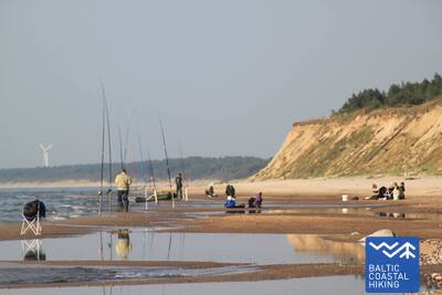
In der Umgebung von Sārnate kann man noch immer die baltische Steilküste genießen. In Richtung Norden verflacht sie allmählich wird und durch einen vom Wasser ausgehöhlten Vordünenwall abgelöst. Zwischen Vendzavas und dem Leuchtturm Užava erstreckt sich der Meeresküste entlang eine für Lettland nicht typische Landschaft, die an eine sandig-steinige Wüste mit spärlicher Vegetation erinnert. Hier befindet sich das ehemalige Übungsgelände der Sowjetarmee. An dieser Stelle und hinter Užava können auf dem Gebiet des ehemaligen Übungsgeländes Graudünen beobachtet werden. Nähert man sich der Mündung des Flusses Užava wird der Strand immer breiter und der Dünenwall immer flacher. Vom romantischen Leuchtturm Užava offenbart sich dem Wanderer der schönste Anblick des Baltischen Küstenwanderweges.
Užava Creek beach boardwalk
Der Holzsteg an der Mündung des Flusses Užava am Meer ist ein 0,5 km langer Rundweg aus Holz, der für Rollstuhlfahrer geeignet ist. Der Holzsteg ist 1,2 Meter breit und hat Ausweichstellen. In der Nähe gibt es einen Parkplatz (GPS: 57.247001, 21.414652). Entlang des Weges gibt es einen Rastplatz, der jedoch nicht für Rollstuhlfahrer zugänglich ist, und es gibt keinen Zugang zum Meeresufer. Der Holzsteg liegt neben dem Jūrtaka-Wanderweg.


9. Etappe. Užava - Ventspils.
Stelle deine eigene Bernsteinsammlung zusammen!
Die ersten 6 Kilometer dieses Streckenabschnitts des Baltischen Küstenwanderweges führen durch ein einsames Küstengebiet mit einem breiten Strand und niedrigen, mit Strandroggen und Strandhafer bedeckten Vordünen dar. Hinder der Mündung des Baches Medole erhebt sich eine eindrucksvolle Steilküste (~ 19 m) mit einem engen, steinigen Strand. Die Steilküste verflacht sich bald und steigt nach etwa zwei Kilometern wieder an. Zwischen den Steilküsten befindet sich ein ehemaliges Übungsgelände der Sowjetarmee. Die letzten fünf Kilometer bis zum Südpier in Ventspils verlaufen über einen breiten, sandigen Strand. Auf der Festlandseite wird er von Graudünen abgegrenzt.
Ventspils Seaside Park
Der Ventspils Seaside Park verfügt über ein etwa 3,5 km langes Wegenetz, darunter den 730 m langen Ankerweg. Die Wege (mit Ausnahme des Dschungelwegs) sind für Rollstuhlfahrer und Eltern mit Kinderwagen zugänglich. Die Wegoberfläche besteht aus Schotter und Asphalt (am Anfang). Ein bequemer Ausgangspunkt zur Erkundung des Parks ist die Kreuzung der Parka- und Loču-Straßen (GPS: 57.389279, 21.537021), wo es Parkplätze und ein WC gibt. Der Park liegt neben dem Jūrtaka-Weg. Für Rollstuhlfahrer und Eltern mit Kinderwagen ist der am besten geeignete Strandzugang in der Nähe des Meeres Eingang 6, der sich innerhalb des Parks befindet.
9. Etappe. Užava - Ventspils.
Stelle deine eigene Bernsteinsammlung zusammen!
Die ersten 6 Kilometer dieses Streckenabschnitts des Baltischen Küstenwanderweges führen durch ein einsames Küstengebiet mit einem breiten Strand und niedrigen, mit Strandroggen und Strandhafer bedeckten Vordünen dar. Hinder der Mündung des Baches Medole erhebt sich eine eindrucksvolle Steilküste (~ 19 m) mit einem engen, steinigen Strand. Die Steilküste verflacht sich bald und steigt nach etwa zwei Kilometern wieder an. Zwischen den Steilküsten befindet sich ein ehemaliges Übungsgelände der Sowjetarmee. Die letzten fünf Kilometer bis zum Südpier in Ventspils verlaufen über einen breiten, sandigen Strand. Auf der Festlandseite wird er von Graudünen abgegrenzt.
10. Etappe. Ventspils - Staldzene.
Durch die Stadt Ventspils
Weiter führt die Wanderroute durch die Stadt Ventspils und die umliegenden Wälder. Der Pfad Jūrtaka schlängelt sich vom Südpier durch das historische Hafenende Ostgals und die Altstadt, überquert den Fluss Venta und setzt seinen Lauf über einen Fußgänger- und Radweg durch Pārventa in Richtung Staldzene fort, Nachdem er einen Bogen um den Hafen herum gemacht hat, führt er wieder zum Strand zurück. Es lohnt sich, „einen Tag frei“ zu nehmen und die interessantesten Orte der Stadt kennenzulernen sowie das Freilichtmuseum am Meer zu besuchen.
Lake Būšnieki Nature Trail
Der Weg um den Būšnieki-See ist ein 9 km langer Rundweg, der für Rollstuhlfahrer und Eltern mit Kinderwagen zugänglich ist. Er verfügt über einen Audioguide, taktile Informationen und einen Parkplatz für Menschen mit eingeschränkter Mobilität. Ein empfohlener Ausgangspunkt ist der Parkplatz auf der Südostseite des Sees (GPS: 57.437632, 21.656062). Der Weg liegt etwa 1 km vom Jūrtaka-Weg entfernt.


15. Etappe. Saunags - Kolka.
Das Herz Europas – Kolkasrags
Über kleine Feldwege und Waldwege von Saunaga führt der Pfad Jūrtaka bis Vaide. Dort kehrt er wieder zur Meeresküste zurück. Bis Kolkasrags erstrecken sich breite, sandige Strände, die sich zu niedrigen Vordünen mit spärlicher Vegetation verflachen. Dahinter erfreuen erneut waldige Dünen das Auge. Auf einer Länge von etwa 2 Kilometern - weggespülte niedrige Dünen, hinter denen der Berg Dumbrkalni emporragt. Kolkasrags - die Grenzlinie zwischen dem Großmeer und Kleinmeer (Rigaer Meeresbucht) - ist einer der beliebtesten Vogelbeobachtungsorte an der Ostseeküste.
Kolka Pine Trail
Der 1,8 km lange Pfad dient der Erkundung der Artenvielfalt der Küstendünen. Er verfügt über zwei Aussichtsplattformen, die für Rollstuhlfahrer zugänglich sind. Die Trockentoiletten sind teilweise für Personen mit Funktionsbeeinträchtigungen angepasst. Es steht ein Parkplatz zur Verfügung (GPS: 57.756668, 22.591180). Der Pfad befindet sich neben dem Jūrtaka-Pfad.


16. Etappe. Kolka - Ģipka.
Entlang der „gesperrten Küste“
Wenn man das Gesicht von Kolkasrags in Richtung Meeresbucht dreht, merkt man gleich den Unterschied zwischen dem “Großmeer“ und dem “Kleinmeer“. Die ersten zehn Kilometer des Baltischen Küstenwanderweges verlaufen entlang der Küste des Nationalparks Slītere. Der Pfad passiert die Bauten der ehemaligen Fischerkolchose, einen Schiffsliegeplatz und die Steilküste Ēvaži. Deren Umgebung wird von einem ungewöhnlich schmalen, sandigen Strand mit darüber hängenden Schwarzerlen geprägt. Auch weiter bis Ģipka erstreckt sich ein schmaler, sandiger Strand mit vielen Nassgallen, die durch den nah an die Oberfläche getretenen, wasserundurchlässigen Untergrund entstanden sind, und Mündungen von kleineren, im Sommer ganz seichten Flüsschen. Das Küstengebiet des Nationalparks Slītere war während der Sowjetzeit ein doppelt geschlossenes Territorium – es war Grenzzone und Naturschutzgebiet.
Ēvažu Nature Trail
Der Weg ist für die Besichtigung einer der seltenen Steilküsten des Rigaischen Meerbusens konzipiert. Rollstuhlfahrer können die Aussichtsplattform erreichen, die einen Blick auf den Rigaischen Meerbusen bietet. Der Weg ist 1,2 km lang. Der Untergrund besteht zu Beginn aus Schotter, danach ausgetretener Pfad und Holzstege mit Treppen in der Nähe der Steilküste. Auf der gegenüberliegenden Seite der Straße Tukums-Kolka gibt es einen Parkplatz (GPS: 57.677789, 22.567982). Der Weg verläuft neben dem Jūrtaka-Weg.


17. Etappe. Ģipka - Kaltene.
Der steinreichste Strand in Kurland
Von Ģipka bis Roja erstreckt sich ein sandiger, nicht besonders breiter Strand mit bezaubernden Dünen und Strandkieferwäldern. Kurz vor Roja ist der Strand dicht mit Sandrohr bewachsen. Der Streckenabschnitt zwischen Roja und der Kirche in Kaltene ist der einzigartigste Strand Lettlands. Dort ist die Meeresküste mit einem sehr schmalen Strand von kleinen Küstenvorsprüngen und Golfen ausgekerbt. Am Strand sind Felsbrocken unterschiedlicher Größe zu beobachten, die sich unter dem grünen Laubwerk von Schwarzerlen verbergen. An einigen Stellen ragen weit ausgebreitete Wurzelrosette von Bäumen empor, die an den Strand angespült wurden. Streckenweise verläuft entlang der Küste ein Weg, an dem sich viele ehemalige Fischerhäuser aneinanderreihen.
Walking Path at Roja Beach
Die Holzstege sind für Rollstuhlfahrer und Eltern mit Kinderwagen geeignet. Es gibt einen Informationsstand in Blindenschrift und eine taktile Strandkarte. Zur Ausstattung gehören ein behindertengerechtes WC und ein Parkplatz (GPS: 57.510088, 22.799207). Die Promenade ist in eine Richtung 0,5 km lang. Rollstuhlfahrer können die Promenaden zwar benutzen, können das Meer jedoch nicht erreichen, da es keine Rampe gibt. Die Promenaden sind breit und verfügen über Geländer an den Seiten und Überholflächen.


17. Etappe. Ģipka - Kaltene.
Der steinreichste Strand in Kurland
Von Ģipka bis Roja erstreckt sich ein sandiger, nicht besonders breiter Strand mit bezaubernden Dünen und Strandkieferwäldern. Kurz vor Roja ist der Strand dicht mit Sandrohr bewachsen. Der Streckenabschnitt zwischen Roja und der Kirche in Kaltene ist der einzigartigste Strand Lettlands. Dort ist die Meeresküste mit einem sehr schmalen Strand von kleinen Küstenvorsprüngen und Golfen ausgekerbt. Am Strand sind Felsbrocken unterschiedlicher Größe zu beobachten, die sich unter dem grünen Laubwerk von Schwarzerlen verbergen. An einigen Stellen ragen weit ausgebreitete Wurzelrosette von Bäumen empor, die an den Strand angespült wurden. Streckenweise verläuft entlang der Küste ein Weg, an dem sich viele ehemalige Fischerhäuser aneinanderreihen.
18. Etappe. Kaltene - Mērsrags.
Die vielfältige Küste
In biologischer, kulturhistorischer und landschaftlicher Hinsicht ein sehr vielfältiger Küstenanschnitt des Baltischen Küstenwanderweges. In der Nähe von Kaltene ist die Meeresküste von winzigen Golfen mit steinigen Stränden bunt gemustert. Weiter erstreckt sich der mit Steinen bedeckte Strand nur ein paar Meter breit. Streckenweise ist er mit Lehmschichten, Rohrfeldern bedeckt, an einigen Stellen – mit angespülten Wasserpflanzen. Auf der Strecke von Valgalciems bis Mērsrags kommen wieder sandige Strände mit Sandbänken zum Vorschein. Hinter Mērsrags verläuft der Routenabschnitt über einen Weg, der an der lutheranischen Kirche in Richtung Meer abbiegt und bis zum Zentrum von Mērsrags einer Strandwiese entlang führt.
Boardwalk in Upesgrīva
Liegt zwischen dem Campingplatz Lūši und dem Meer (GPS: 57.381441, 23.025370). Der Promenadenweg hat keine Seitengeländer und keine Ausweichflächen. Er ist für Rollstuhlfahrer mit Assistent zugänglich. Seine Länge beträgt in eine Richtung etwa 90 Meter. Er bietet keinen Zugang zum Meeresufer. Er liegt in der Nähe des Küstenwanderwegs (Jūrtaka).


Boardwalk near Mērsrags Lighthouse
Befindet sich in der Bākas-Straße 60. Der Steg ermöglicht Rollstuhlfahrern, vom Parkplatz (GPS: 57.365315, 23.120436) zu den Dünen zu gelangen, von wo aus man das Meer sehen kann. Der Steg ist teilweise mit Kantenschutz versehen und hat keine Wendebereiche. Die Länge beträgt ungefähr 150 m (Hin- und Rückweg). Er befindet sich in der Nähe des Küstenwanderwegs.


19. Etappe. Mērsrags - Engure.
Im Naturpark Engure
Vom Dorfzentrum bis zum Strand führt ein von Kiefern umschlossener Waldweg. Weiter windet sich der Baltische Küstenwanderweg zwischen einem von Sandrohr und anderen Pflanzen reichlich bewachsenen und steinigen Strand auf einer Seite und einer bewaldeten Düne auf der anderen Seite. Stellenweise ist der Strand mit kleinen, runden Kieselsteinen bedeckt, andernorts sind Graudünen mit üppiger Vegetation zu sehen. In der Umgebung von Bērzciems erstrecken sich Strandwiesen mit Sandbarren weit ins Meer. Sie sind ein guten Platz, um Vögel zu beobachten. Bis zum Dorf Abragciems setzt sich die bewachsene Meeresküste fort, die dann bis Engure durch einen Strand abgelöst wird.
Engure Nature Trail
Vom Parkplatz (GPS: 57.171428, 23.222504) in der Slimnīcas-Straße führt ein Holzsteg über die Dünen zum Meer. Er ist für Rollstuhlfahrer zugänglich. Aufgrund der Steigung kann Hilfe erforderlich sein. Der Weg ist in eine Richtung etwa 200 Meter lang. Er befindet sich in der Nähe des Küstenwanderwegs (Jūrtaka).


20. Etappe. Engure - Ragaciems.
Fischerdörfer und geräuchertes Fisch
Der Baltische Küstenwanderweg schlängelt sich zuerst durch das Dorf Engure, dann zwischen einem ziemlich schmalen Strand und bezaubernden, waldigen Dünen und führt bis zur Düne des Dorfes Plieņciems. Hinter der Düne wird der sandige Strand immer breiter und offenbart einen Blick auf breite Sandbänke. In Richtung Festland ragen hier bewachsene Steilküsten mit einem Treppenweg und gut ausgestatteten Stegen bis zur Landstraße Kolka – Tukums empor. Allerdings muss man damit rechnen, dass es hier an warmen Sommertagen viele Urlauber gibt. Das abschließende Drittel dieses Wegabschnitts liegt im Nationalpark Ķemeri.
Apšuciems
In Apšuciems stehen zwei schwimmende Strandrollstühle für Menschen mit eingeschränkter Mobilität zur Verfügung. Diese sind nach vorheriger Absprache unter +371 26132761 in der Apšuciems-Schule erhältlich. Benutzer müssen einen eigenen Assistenten mitbringen, der ihnen beim Hin- und Rückweg zum Wasser, beim Schwimmen und Zurückkommen hilft. Schwimmwesten sind ebenfalls erhältlich. Es gibt Pläne, im Jahr 2025 einen Zugang zum Meer zu bauen, der Rollstuhlzugang, Westen, Umkleidekabinen und spezielle Sonnenmatten umfassen wird. Mit Hilfe sind kleine Ausflüge entlang des harten Sandabschnitts der Küste möglich. Dieser befindet sich am Baltic Sea Trail.

Plieņciems White Dunes Grenzpfad
Der Weg befindet sich an der südlichen Grenze des Plieņciems, in Richtung Riga und Engure.
Der Name Plieņciems stammt von dem baltischen Wort „pliens“ - Kalkstein oder Mergelis. Die erste urkundliche Erwähnung des Dorfes stammt aus dem Jahr 1551, auf Landkarten taucht es jedoch erst ab 1702 als bewohnter Ort auf. In der Mitte des 18. Jahrhunderts erwähnt das Kirchenbuch von Engure, dass es in Plieņciems neun Bauernhöfe gab, die das Recht hatten, im Meer und im Engure-See zu fischen und Seegras zu sammeln.
Der Weg führt von der Straße zum Meer und führt die Wanderer über den Dünenwall. Die Oberfläche des Weges ist so gestaltet, dass er für Rollstuhlfahrer (vorzugsweise mit einer Begleitperson) und Familien mit Kindern in Kinderwagen zugänglich ist. Der Strand verfügt über einen Umkleideraum und einen kleinen Spielplatz. Auf dem Weg gibt es keine ausgewiesene Fläche für den Platztausch mit dem Gegenverkehr.


20. Etappe. Engure - Ragaciems.
Fischerdörfer und geräuchertes Fisch
Der Baltische Küstenwanderweg schlängelt sich zuerst durch das Dorf Engure, dann zwischen einem ziemlich schmalen Strand und bezaubernden, waldigen Dünen und führt bis zur Düne des Dorfes Plieņciems. Hinter der Düne wird der sandige Strand immer breiter und offenbart einen Blick auf breite Sandbänke. In Richtung Festland ragen hier bewachsene Steilküsten mit einem Treppenweg und gut ausgestatteten Stegen bis zur Landstraße Kolka – Tukums empor. Allerdings muss man damit rechnen, dass es hier an warmen Sommertagen viele Urlauber gibt. Das abschließende Drittel dieses Wegabschnitts liegt im Nationalpark Ķemeri.
21. Etappe. Ragaciems - Dubulti.
Der historische Kurort Jūrmala
Von Ragaciems eröffnet sich ein weiter Ausblick über die ganze Küste von Jūrmala. Das erste Drittel dieses Streckenabschnitts führt durch den Nationalpark Ķemeri. Dort kann man sich mit historischen Fischerdörfern, der ehemaligen Fischerbootsanlegestelle und dem Fischmarkt in Ragaciems sowie den Dünenbiotopen vertraut machen. Auch kann man Vögel im Mündungsgebiet des Flusses Starpiņupīte beobachten. Von Jaunķemeri bis Dubulti verläuft der Pfad entlang dem breitesten Sandstrand der Rigaer Meeresbucht durch den historischen Kurort der Stadt Jūrmala und die längste Stadt Lettlands. An warmen und schönen Sommertagen muss mit zahlreichen Strandbesuchern gerechnet werden.
Jūrmalas pilsētas pludmales
Die Stadtstrände von Jurmala sind für Menschen mit funktionellen Beeinträchtigungen zugänglich, darunter auch für Rollstuhlfahrer und Senioren. In Jūrmala gibt es 14 angepasste Zugangspunkte zum Meer für Rollstuhlfahrer: Linie 36, Vienības prospekts (2 Zugangspunkte), Turaidas iela (2 Zugangspunkte), Pilsonu iela, Baznīcas iela, Kļavu iela, Līgatnes iela, Dzimtenes iela, Vēju iela, Atbalss iela, Kapteiņa Zolta iela und Jaunķemeri-Straße. Diese Zugangspunkte sind unter Berücksichtigung des Untergrunds und des Geländes so konzipiert, dass sie sowohl für Personen mit Funktionseinschränkungen als auch für Personen mit Kinderwagen geeignet sind. Darüber hinaus stehen an vier Standorten – Vaivari, Kaugguri, Jaunķemeri und Jaundubulti – erweiterte und komfortablere Umkleidekabinen zur Verfügung.
Kupskalni Nature Trail
Der Weg erstreckt sich einen halben Kilometer am rechten Ufer des Flusses Siliņupe entlang und führt von der Straße Sloka-Talsi zum Meer. Er ist teilweise für Rollstuhlfahrer mit Hilfe zugänglich, da Baumwurzeln am Anfang des Weges ein Hindernis darstellen können. Der weitere Abschnitt des Weges (breite Promenaden mit Ausweichstellen) ist zugänglich. Teilweise sind Toiletten zugänglich. Die Wanderung kann von einer nahe gelegenen Tankstelle aus begonnen werden (GPS: 56.992203, 23.522736).


22. Etappe. Dubulti - Lielupe - Bulduri.
Die beliebtesten Strände Lettlands
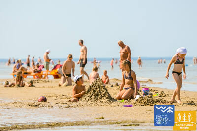
Zwischen Dubulti und Lielupe erstreckt sich der breiteste Sandstrand der Rigaer Meeresbucht – es ist der wertvollste Schatz des Kurorts Jūrmala, in dem es zahlreiche Strandcafés und verschiedene Erholungsmöglichkeiten gibt, Die Wälder der Küstendünen sind von einem dichten Wegenetz durchzogen, das zum Joggen und Wandern geeignet ist. Der Baltische Küstenwanderweg führt zwischen dem Strand Lielupe und dem Freilichtmuseum Jūrmala durch den Naturpark Ragakāpa. Am bequemsten zurück nach Bulduri gelangt man über die Straßen Bulduru prospekts und 5. līnija.
Jūrmalas pilsētas pludmales
Die Stadtstrände von Jurmala sind für Menschen mit funktionellen Beeinträchtigungen zugänglich, darunter auch für Rollstuhlfahrer und Senioren. In Jūrmala gibt es 14 angepasste Zugangspunkte zum Meer für Rollstuhlfahrer: Linie 36, Vienības prospekts (2 Zugangspunkte), Turaidas iela (2 Zugangspunkte), Pilsonu iela, Baznīcas iela, Kļavu iela, Līgatnes iela, Dzimtenes iela, Vēju iela, Atbalss iela, Kapteiņa Zolta iela und Jaunķemeri-Straße. Diese Zugangspunkte sind unter Berücksichtigung des Untergrunds und des Geländes so konzipiert, dass sie sowohl für Personen mit Funktionseinschränkungen als auch für Personen mit Kinderwagen geeignet sind. Darüber hinaus stehen an vier Standorten – Vaivari, Kaugguri, Jaunķemeri und Jaundubulti – erweiterte und komfortablere Umkleidekabinen zur Verfügung.
23. Etappe. Bulduri - Stadtzentrum Rīga.
Durch Wälder nach Rīga
Diese Route ist eine gute Alternative, wie man Rīga von Jūrmala her über einen Waldweg erreichen kann. Hinter der Brücke Lielupe schlängelt sich der Pfad Jūrtaka durch Priedaine und offenbart den Blick auf die herrliche Holzbebauung der Ortschaft. Der Pfad verläuft dem rechten Ufer des Flusses Lielupe entlang und biegt südlich der Düne Bolderāja ab. Dann führt der Pfad durch den Wald Kleisti in Richtung des Friedhofes Lāčupe. Weiter verläuft der Pfad über die historischen Landstraßen des Stadtteils Pārdaugava nach Dzegužkalns, dem Zunda-Kanal und der Bucht Āgenskalns entlang bis zur Daugava. Dort überquert er die Akmens tilts (Steinbrücke) und erreicht den Rathausplatz der Stadt Rīga.
Jūrmalas pilsētas pludmales
Die Stadtstrände von Jurmala sind für Menschen mit funktionellen Beeinträchtigungen zugänglich, darunter auch für Rollstuhlfahrer und Senioren. In Jūrmala gibt es 14 angepasste Zugangspunkte zum Meer für Rollstuhlfahrer: Linie 36, Vienības prospekts (2 Zugangspunkte), Turaidas iela (2 Zugangspunkte), Pilsonu iela, Baznīcas iela, Kļavu iela, Līgatnes iela, Dzimtenes iela, Vēju iela, Atbalss iela, Kapteiņa Zolta iela und Jaunķemeri-Straße. Diese Zugangspunkte sind unter Berücksichtigung des Untergrunds und des Geländes so konzipiert, dass sie sowohl für Personen mit Funktionseinschränkungen als auch für Personen mit Kinderwagen geeignet sind. Darüber hinaus stehen an vier Standorten – Vaivari, Kaugguri, Jaunķemeri und Jaundubulti – erweiterte und komfortablere Umkleidekabinen zur Verfügung.
Babīte Rhododendron Nursery
Es wurde ein 1,9 Kilometer langer Pfad angelegt, der für Rollstuhlfahrer und Eltern mit Kinderwagen zugänglich ist. Die Oberfläche des Pfades ist asphaltiert. Es gibt einen ausgewiesenen Parkplatz (GPS: 56.962330, 23.952280) und eine behindertengerechte Toilette. Der Pfad liegt etwa 2,7 Kilometer vom Jūrtaka-Pfad entfernt.
Daugavgrīva Nature Trail
Der Weg beginnt am Parkplatz (GPS: 57.036769, 24.018166) in der Nähe der Valentīna Pikuļa-Straße und führt über das Daugavgrīva-Sumpfgebiet zu den Dünen und zum Meer. Der Weg ist in Meeresnähe asphaltiert und der asphaltierte Abschnitt ist für Rollstuhlfahrer zugänglich. Entlang des Weges wurde ein Vogelbeobachtungsturm errichtet, dessen erste Etage für Rollstuhlfahrer zugänglich ist. Der Weg ist etwa 12,5 Kilometer vom Jūrtaka-Weg entfernt, der an der Meeresküste in Daugavgrīva liegt.

24. Etappe. Stadtzentrum Rīga - Vecāķi.
Die Altstadt - Teil des UNESCO-Weltkulturerbe
Der Routenabschnitt verläuft durch das Stadtzentrum von Rīga - die Altstadt, den Stadtkanal entlang, durch den Kronvalda-Park, die Alberta-Straße (Jugendstilbauten) und dann weiter durch die Miera-Straße über den Großen Friedhof, die Alleen Kokneses prospekts und Ostas prospekts und den Mežaparks (Kaiserwald) hindurch erreicht man den Stadtteil Jaunmīlgrāvis und passiert den Stadtteil Mīlgrāvis. Über die Allee Vecāķu prospekts führt der Weg weiter bis nach Ziemeļblāzma und zum Ufer der Vecdaugava, wovon Vecāķi nur wenige Kilometer entfernt ist. Nach einer zweitägigen Wanderung durch die Stadt Rīga führt der Pfad Jūrtaka wieder zum Strand zurück.
Mangaļsala walking paths
Zwei Wanderwege in Mangaļsala führen durch Dünengebiete und Küstenwälder zum Meer. Der erste Wanderweg (GPS: 57.071642, 24.087599) wird Rollstuhlfahrern mit Begleitperson empfohlen, da er zum Meer führt, aber keinen direkten Zugang zum Strand bietet. Der zweite Wanderweg (GPS: 57.062730, 24.055460) beginnt als unbefestigter Weg und wird später zu einem breiten Holzsteg, über den Rollstuhlfahrer den Strand erreichen können. Der dritte Wanderweg (GPS: 57.061976, 24.041811) führt zum Ostpier. Obwohl er nicht speziell für Rollstuhlfahrer konzipiert ist, kann er, einschließlich des Piers selbst, mit Begleitperson befahren werden, außer bei starkem Wind oder Sturm. Sowohl der erste als auch der zweite Wanderweg verfügen über eigene Parkplätze und WC-Anlagen. Der nächste Wanderweg ist etwa 3,5 km von Jūrtaka entfernt.


25. Etappe. Vecāķi - Carnikava.
Zwischen den Mündungsgebieten der Flüsse Daugava und Gauja
Dieser Abschnitt des Baltischen Küstenwanderweges ist eine verhältnismäßig kurze Wanderung entlang eines bezaubernden Sandstrandes. Von der Festlandseite ist er durch lichterfüllte Kiefernwälder mit eindrucksvollen Dünen und Dünenwallen abgegrenzt. Vom Strand bis Carnikava führt der Pfad durch eine Waldpromenade. Über einen Schutzdamm verläuft der Pfad um den Fluss Vecgauja herum und erreicht die Fußgängerbrücke über die Gauja. Vor Beginn oder zum Abschluss der Wanderung lohnt es sich, die Atmosphäre Kneipen oder Sommercafés am Strand Vecāķi oder in Carnikava gemütlich zu genießen.
Garciems nature trail
Der Holzsteg führt zur Mündung des Eimuri-Kanals am Meer. Das Ende des Holzstegs liegt nahe am Ufer und mit Hilfe eines Assistenten kann das Meer erreicht werden. Er ist für Rollstuhlfahrer und Eltern mit Kinderwagen geeignet. Ein Parkplatz (GPS: 57.108161, 24.192324) und WC sind vorhanden. Die Länge in eine Richtung beträgt 0,7 km. Er befindet sich neben Jūrtaka.
Carnikava Promenade
Verbindet Carnikava mit der Meeresküste. Der Weg ist gepflastert, aber in den Sanddünen – mit Holzstegen. Am Meeresufer gibt es Gehwege und Aussichtsplattformen mit Liegestühlen. Die Länge der Strecke in eine Richtung beträgt 1,8 km. Es ist für Rollstuhlfahrer und Eltern mit Kinderwagen zugänglich. In der Laivu-Straße wurden ein Parkplatz (GPS: 57.133531, 24.265631), angepasste Toiletten, Informationsstände und Rastplätze eingerichtet. Der sandige Bereich des Meeresufers ist nicht für Rollstuhlfahrer zugänglich. Der letzte Abschnitt der Promenade weist eine Steigung von 9,2 % auf. Jurtaka bewegt sich entlang der Carnikava-Promenade. 2024/2025 G. An der Carnikava-Promenade ist die Einrichtung einer speziellen Route für spezielle Geländerollstühle geplant, die ihren Benutzern zusammen mit einem Assistenten zur Verfügung stehen.


26. Etappe. Carnikava - Saulkrasti.
Der Sonnenuntergangspfad mit Blick auf romantische Sonnenuntergänge
Anfangs führt der Routenabschnitt über den Schutzdamm der Gauja im Dorf Gauja. Dann erreicht das Mündungsgebiet des Flusses, was eine ausgezeichneter Stelle zur Vogelbeobachtung ist. Weiter verläuft der Wanderweg über einen sandigen Strand bis zur Mündung des Flusses Inčupe. Um die Brücke erreichen zu können, muss man kurz vor der Mündung in Richtung Festland abbiegen. Die nächsten paar Kilometer verlaufen über die waldreichen Dünengipfel des Sonnenuntergangspfades (Saulrieta taka), die eine wunderbare Aussicht auf den Strand offenbaren. Nach der Überquerung des Flusses Pēterupe (Seilbrücke) erreicht der Pfad Jūrtaka den Meerespark “Jūras parks” in Saulkrasti.
Lilaste Beach
Nimmt ans Meer. Seine Länge in eine Richtung beträgt 130 m. Los geht es am Parkplatz (GPS: 57.187403, 24.329523), von dem aus eine Person im Rollstuhl mit Hilfe eines Helfers zum Strand gelangen kann. Es liegt neben Jurtaka.

White Dune
Eine der malerischsten Dünen der Rigaer Bucht. Für Rollstuhlfahrer mit Begleitperson zur Aussichtsplattform vom Parkplatz aus zugänglich (GPS: 57.233560, 24.393407). Baltas Kapa ist Teil der Jūrtakas-Route.
Path and wooden boardwalk network in the coastal dunes of Saulkrasti
Der Weg liegt zwischen der Raiņa-Straße und der Bīriņu-Straße (Seepark, Tourismusinformationszentrum Saulkrasti) und ist für Rollstuhlfahrer und Eltern mit Kinderwagen geeignet. Er verläuft parallel zum Jūrtaka-Pfad. Der einfachste Zugang zum Weg und zur Promenade erfolgt vom Parkplatz aus (GPS: 57.267111, 24.413875).


26. Etappe. Carnikava - Saulkrasti.
Der Sonnenuntergangspfad mit Blick auf romantische Sonnenuntergänge
Anfangs führt der Routenabschnitt über den Schutzdamm der Gauja im Dorf Gauja. Dann erreicht das Mündungsgebiet des Flusses, was eine ausgezeichneter Stelle zur Vogelbeobachtung ist. Weiter verläuft der Wanderweg über einen sandigen Strand bis zur Mündung des Flusses Inčupe. Um die Brücke erreichen zu können, muss man kurz vor der Mündung in Richtung Festland abbiegen. Die nächsten paar Kilometer verlaufen über die waldreichen Dünengipfel des Sonnenuntergangspfades (Saulrieta taka), die eine wunderbare Aussicht auf den Strand offenbaren. Nach der Überquerung des Flusses Pēterupe (Seilbrücke) erreicht der Pfad Jūrtaka den Meerespark “Jūras parks” in Saulkrasti.
27. Etappe. Saulkrasti - Lauči.
Das Tor zum steinreichsten Strand in Vidzeme
Die ersten Kilometer bis Zvejniekciems können dem Strand entlang zurückgelegt werden. Oder auch über einen Pfad, der sich durch einen Dünenwald mit alten Kiefern windet. Für diese ist eine “krokodilartige“ Borke charakteristisch. Hier kommt man auch an einer alten Holzhütte mit Fischernerzen und Fischerzubehör vorbei. Kurz vor dem Hafen Skulte kommen am Strand Zvejniekciems die ersten Steine zum Vorschein. Nachdem er das Mündungsgebiet des Flusses Aģe und den Hafen umbiegt, führt der Baltische Küstenwanderweg zurück zum Strand. Von dort ist das Kap Ārņu bereits aus der Ferne zu sehen. Die Vielfältigkeit der Küstenlandschaften.
Path and wooden boardwalk network in the coastal dunes of Saulkrasti
Der Weg liegt zwischen der Raiņa-Straße und der Bīriņu-Straße (Seepark, Tourismusinformationszentrum Saulkrasti) und ist für Rollstuhlfahrer und Eltern mit Kinderwagen geeignet. Er verläuft parallel zum Jūrtaka-Pfad. Der einfachste Zugang zum Weg und zur Promenade erfolgt vom Parkplatz aus (GPS: 57.267111, 24.413875).
28. Etappe. Lauči - Tūja.
Die vergangene Ära der Segelschiffe
Eine herrliche Küstenlandschaft der Region Vidzeme mit vielen steinreichen Erdzungen und Steinen im Meer. Sie werden von kleinen, sandigen Buchten abgelöst, in denen die im Sommer austrocknenden Bäche und kleinen Flüsschen münden. An einigen Stellen ist der Strand vollständig mit grauen Steinen bedeckt. Allmählich kommen auch mit Sandrohr bewachsene Flächen zum Vorschein. Kurz vor Tūja finden sich die ersten Sandsteinfreilegungen.
Munchausen’s Beer Mug Trail
Der 1,3 km lange Weg (einfache Strecke) befindet sich am Dunte Manor und beginnt in der Nähe des Minhauzens Museums. Der Weg besteht aus 1,5 m breiten Holzstegen mit mehreren Ausweichstellen. Die Erkundung des Weges kann bequem vom Parkplatz aus beginnen (GPS: 57.405620, 24.424681). Der Weg liegt 1,7 km vom Jūrtaka-Weg entfernt.
29. Etappe. Tūja - Svētciems.
Der steinreichste Strand in Vidzeme
Einer der schönsten Abschnitte des Pfades Jūrtaka beginnt nach der Überquerung des Flusses Zaķupīte. Bis zum Leuchtturm Ķurmrags erstrecken sich vorwiegend sandige Strände mit kleinen steinreichen Stellen. Danach beginnt der Steinstrand von Vidzeme, wo sich Erdzungen und kleine Buchten ablösen. Am Strand ragen bis zu 4 Meter hohe Sandsteinfreilegungen empor. Hinter dem Meleku-Kap führt der Pfad wieder über einen vorwiegend sandigen Strand, der kurz vor der Mündung des Flusses Svētupe dicht bewachsen ist. Dazu kommt Schilfrohr, das man über einen Waldweg umlaufen muss.
Rest area "Vasas"
Es wurden eine Aussichtsplattform und ein Parkplatz (GPS: 57.520544, 24.379052) angelegt, die für Rollstuhlfahrer zugänglich sind. Sie befinden sich neben dem Jūrtaka-Wanderweg.
Veczemju Cliffs
In der Nähe der Veczemju-Klippen gibt es eine Rampe für Rollstuhlfahrer mit Hilfe. Der Strandsand ist jedoch nicht für Rollstuhlfahrer geeignet. Die Basis der Rampe wird häufig durch Stürme beschädigt. Sie befindet sich in der Nähe des Baltischen Küstenwanderwegs (Jūrtaka).


30. Etappe. Svētciems - Ainaži.
Das Königsreich der Neunaugen
Der Strand zwischen Svētciems und Salacgrīva ist dicht bewachsen. Der Pfad Jūrtaka verläuft deshalb über einen Waldweg, der sich zwischen den Dünenwällen windet. Von Salacgrīva kann das Dorf Kuiviži über einen sandigen Strand oder Waldpfade erreicht werden. Um die Randu-Wiesen von Kuiviži bis Vēverupe muss man einen Umweg über einen Waldweg machen, der sich auf der östlichen Seite der Landstraße A1 befindet. Hinter dem Fluss Vēverupe führt der Pfad zurück zu einem sehr dicht bewachsenen Strand. Bei der Mündung des Flusses Blusupīte verlässt er diesen wieder, um über die Kāpu-Straße und Valdemāra-Straße das Pier Ainaži zu erreichen. In Lettland waren ~ 580 km zurückgelegt und nun die Staatsgrenze erreicht.
Salacgrīvas promenade
Die etwa 260 Meter lange, gepflegte Promenade (einschließlich der Slavas-Allee) am rechten Ufer des Flusses Salaca ist für Rollstuhlfahrer mit Hilfe eines Helfers zugänglich. Sie können Ihre Erkundungstour vom Parkplatz aus beginnen (GPS: 57.756060, 24.358155). Sie befindet sich in der Nähe des Baltischen Küstenwanderwegs (Jūrtaka).


Monument "White Sun"
Befindet sich in Ainaži. Zur Besichtigung wurde ein etwa 150 Meter langer Holzsteg angelegt (GPS-Ausgangspunkt: 57.859628, 24.347306). Er ist für Rollstuhlfahrer mit Hilfe und für Eltern mit Kinderwagen zugänglich. Die Entfernung vom Parkplatz zum Steg beträgt etwa 250 Meter. Er befindet sich in der Nähe des Küstenwanderwegs.


Krasta ielas promenāde Salacgrīvā
Die etwa 0,8 km lange Strecke erstreckt sich entlang des linken Salaca-Ufers von der Brücke bis zur Meža-Straße, wo sich die Tennisplätze befinden. Für Rollstuhlfahrer zugänglich. In der Meža-Straße wurden Orte zum Ausruhen und Betrachten geschaffen – ein angepasstes WC. Belag – modernes Pflaster.


Laipas līdz Salacgrīvas pludmalei
Vom Parkplatz in der Jūrmala-Straße (57.75083, 24.34911) zum Strand wurden zwei Holzstege angelegt. Für Rollstuhlfahrer mit Begleitperson zugänglich, da an der Stelle, an der der Steg die Düne überquert, verfaulter Sand enthalten sein kann. Am Parkplatz ist eine Toilette vorhanden. Gehwegbelag – Holz. Auf der Promenade dürfen sich zwei Rollstühle nicht austauschen.


30. Etappe. Svētciems - Ainaži.
Das Königsreich der Neunaugen
Der Strand zwischen Svētciems und Salacgrīva ist dicht bewachsen. Der Pfad Jūrtaka verläuft deshalb über einen Waldweg, der sich zwischen den Dünenwällen windet. Von Salacgrīva kann das Dorf Kuiviži über einen sandigen Strand oder Waldpfade erreicht werden. Um die Randu-Wiesen von Kuiviži bis Vēverupe muss man einen Umweg über einen Waldweg machen, der sich auf der östlichen Seite der Landstraße A1 befindet. Hinter dem Fluss Vēverupe führt der Pfad zurück zu einem sehr dicht bewachsenen Strand. Bei der Mündung des Flusses Blusupīte verlässt er diesen wieder, um über die Kāpu-Straße und Valdemāra-Straße das Pier Ainaži zu erreichen. In Lettland waren ~ 580 km zurückgelegt und nun die Staatsgrenze erreicht.
32. Etappe. Kabli - Häädemeeste.
Vögel, Dünen und Wälder
Dieser Streckenabschnitt ist für Vogelbeobachter besonders empfehlenswert. Die Küste ist an dieser Stelle durch weite mit Rohrgebüsch bedeckte Wiesen und Lagunen gekennzeichnet. Deshalb verläuft der Baltische Küstenwanderweg von Kabli bis zum südlichen Teil von Häädemeeste der alten Rigaer Landstraße entlang. Kurz vor Häädemeeste biegt der Baltische Küstenwanderweg von der Landstraße in das Naturschutzgebiet Jaagupie ein (das Dorf bleibt westlich liegen). Dann schlängelt er sich die hohen Dünen hinauf und führt steil nach unten in die tiefen, von einem gelichteten Kieferwald bedeckten Senken zwischen den Dünen. Hier gibt es gute Orte zum Sammeln von Beeren und Pilzen.
Kabli nature trail
Der Pfad macht die Besucher mit den Küstendünen und ihren Naturwerten bekannt. Er beginnt am Parkplatz (GPS: 58.019424, 24.450986), der sich in der Nähe des Besucherzentrums Kabli befindet. Der Pfad ist 1,8 km lang. Die Pfadoberflächen sind Schotterwege, Waldwege und 1,5 m breite Holzstege. Der Pfad ist für Rollstuhlfahrer zugänglich und es gibt ein angepasstes WC. Entlang des Pfads gibt es Informationsstände, auf dem sich auch eine Aussichtsplattform und zwei Vogelbeobachtungstürme befinden (nicht rollstuhlgerecht). Er liegt in der Nähe des Küstenpfads.


34. Etappe. Uulu - Pärnu.
Durch Feuchtgebiete nach Pärnu
Anfangs verläuft der Baltische Küstenwanderweg durch die alten, von einem Kiefernwald umschlungenen Küstenwege. Nach dem Lottemaa-Park biegt der Pfad in Richtung Meer und stößt auf den Reiu-Strand. Weiter führt der Streckenabschnitt durch einen überwachsenden Strand (bei ablandigem Wind - breite Flachwasserzonen). Nach knapp 4 Kilometern muss man in Richtung Binnenland abbiegen, einen Golfplatz überqueren und den Weg nach Pärnu einschlagen. In der Umgebung von Raeküla schlängelt sich der Pfad auf einem kleinen Wanderweg, der das Feuchtgebiet vom Wald abgrenzt. Dann läuft er in einem etwa 6 Kilometer langen Bogen um das Feuchtgebiet herum und erreicht den Strand Pärnu. Weiter führt der Pfad durch den westlichen Teil der Altstadt von Pärnu, überquert die Flüsse Pärnu und Sauga und mündet in der Umgebung von Vana-Pärnu.
Pärnu Coastal Meadow Hiking Trail
Der Weg führt durch die feuchten Küstenwiesen, Lagunen und die lokale Vogel- und Pflanzenwelt. Er ist oval angelegt und verfügt über eine Aussichtsplattform (erster Stock zugänglich) und ist 600 Meter lang. Der Besuch kann bequem vom nahe gelegenen Parkplatz aus begonnen werden (GPS: 58.372397, 24.507902). Der Weg ist mit Holzstegen bedeckt, in der Nähe des Parkplatzes sind die Wege asphaltiert. Der Weg ist für Rollstuhlfahrer zugänglich, allerdings wird Hilfe empfohlen, da einige Abschnitte eine Steigung von über 8 % aufweisen. Er befindet sich in der Nähe des Küstenwegs.


Pärnu Beach Promenade
Der Pfad verläuft einen halben Kilometer lang parallel zum Strand der Bucht von Pärnu. Der Untergrund besteht größtenteils aus Holzstegen (2,3 bis 3,1 Meter breit), einige Abschnitte sind gepflastert und bis zu 4 Meter breit. Er ist für Rollstuhlfahrer zugänglich. Der Pfad kann bequem vom nahe gelegenen Parkplatz aus begonnen werden (GPS: 58.372397, 24.507902).
Access to the beach and rental of swimming aids
Im Hedon SPA & Hotel wird es im Jahr 2024 saisonalen Zugang zu Schwimmhilfen und anderen Geräten geben und ein spezieller Boden wird geschaffen, der Rollstuhlfahrern den Zugang zum Wasser ermöglicht.


Pärnu Beach Park
Der 1882 gegründete Park ist ein beliebtes Erholungsgebiet für Stadtbesucher und Anwohner. Er verfügt über ein Netz von etwa 1 km langen Wegen (ca. 3 m breit), die für Rollstuhlfahrer zugänglich sind. Die Wege sind Schotter und Asphalt. Gebührenpflichtige Parkplätze stehen rund um den Park zur Verfügung. Der Park liegt in der Nähe der Jurtaka.


Pärnu Mole Boardwalk
Der Promenadenweg beginnt gegenüber der Mole von Pärnu (GPS: 58.381941, 24.483994). Der Promenadenweg ist 0,6 km lang (einfache Strecke) und für Rollstuhlfahrer zugänglich. Die Oberfläche besteht aus Holz und ist 3 Meter breit. An verschiedenen Stellen gibt es Verlängerungen und Rastplätze. Er bietet eine großartige Gelegenheit, den Hafen von Pärnu zu erkunden. Er liegt etwa 350 Meter von der Jūrtaka entfernt.


35. Etappe. Pärnu - Liu.
Die schönste Aussicht über die Pärnu-Bucht und geräucherter Fisch
Der Baltische Küstenwanderweg windet sich durch den westlichen Vorort von Pärnu, überquert den Fluss Audru und biegt in Richtung Valgeranna ab. Danach wird er auf der südlichen Seite von einem dichten Wald und einem weißen Sandstrand umschlungen, während sich auf der nördlichen Seite von ein Golfplatz befindet. Hinter Valgeranna verläuft der Baltische Küstenwanderweg zwischen den Poldern durch den nördlichen Teil der Pärnu-Bucht. Die Audru-Polder offenbaren einen herrlichen Blick auf die Pärnu-Bucht. Hinter dem Rohrgebüsch in Audru biegt der Pfad nach Süden ab und führt durch die an der Küste liegenden Fischerdörfer mit kleinen Häfen und Bootsanlegestellen. Hier kann man den Alltag eines Fischer kennenlernen und geräucherten Fisch probieren.
Valgeranna Beach Promenade
Der Weg verbindet den Parkplatz mit dem Strand. Die Oberfläche besteht aus Pflastersteinen und Holzstegen mit einer Breite von 1,95 bis 3 Metern. Er ist für Rollstuhlfahrer zugänglich. Es steht eine Trockentoilette zur Verfügung. Sie befindet sich neben der Jurtaka.


38. Etappe. Tõstamaa - Matsi.
Das estnische Landidyll
Auf diesem Abschnitt des Baltischen Küstenwanderweges ist eine traditionell ländliche Landschaft zu sehen. Wegen vieler flacher Buchten, Halbinseln und Erdzungen sieht die Küste wie ausgezickt aus. Dazwischen liegen Küstenwiesen, Rohrgebüsch, wasserarme Lagunen und Feuchtgebiete sowie schwer zugängliche Inseln. Folgt man dem Pfad auf den kleinen Dorfwegen, die im Herbst von roten Ebereschen umgeben sind, sieht man ethnographische Einzelhöfe, Landwirtschaften mit Kühen und Ziegen. Die Einzelhöfe sind von Resten von Steinzäunen, landwirtschaftlichen Nutzflächen und Wacholderheiden umgeben. Südlich des Dorfes Ranniku und in der Nähe des Dorfes Kastna gibt es einen Zugang zum Meer und Rastplätze.
Matsi Port
Der Weg führt die Besucher zum ehemaligen Fischereihafen Matsi. Er ist 500 Meter lang (Hin- und Rückweg). Der Weg beginnt am Parkplatz (GPS: 58.360251, 23.746683). Die Oberfläche besteht aus Asphalt, Beton und Schotter. Bei Wind kann der Weg mit Sand bedeckt sein, sodass Rollstuhlfahrer möglicherweise Hilfe benötigen. Der Weg verfügt über taktile Objekte und Informationen in Blindenschrift. Ein barrierefreies WC ist vorhanden. Es befindet sich neben der Jūrtaka.


39. Etappe. Matsi - Varbla.
Strände und Wälder
Der Strand Matsi ist einer der wenigen Sandstrände auf dem Streckenabschnitt bis Haapsalu. Der Baltische Küstenwanderweg windet sich durch das Dorf Kulli und verläuft auf einer Länge von 5 Kilometer auf kleinen, von weiten Wäldern und Dünen umschlossenen Wegen. Deren Umgebung ist im Herbst reich an Beeren und Pilzen. Danach läuft er im Bogen um das Uue-Varbla-Gutshaus herum und erreicht das Dorf Varbla.
Matsi Port
Der Weg führt die Besucher zum ehemaligen Fischereihafen Matsi. Er ist 500 Meter lang (Hin- und Rückweg). Der Weg beginnt am Parkplatz (GPS: 58.360251, 23.746683). Die Oberfläche besteht aus Asphalt, Beton und Schotter. Bei Wind kann der Weg mit Sand bedeckt sein, sodass Rollstuhlfahrer möglicherweise Hilfe benötigen. Der Weg verfügt über taktile Objekte und Informationen in Blindenschrift. Ein barrierefreies WC ist vorhanden. Es befindet sich neben der Jūrtaka.
45. Etappe. Penijõe - Laiküla.
Rund um das größte Feuchtgebiet Nordeuropas
Der Baltische Küstenwanderweg verläuft im Bogen um die Deltamündung des Flusses Kasari bis zu dessen Mündung in die Matsalu-Bucht. Dort hat sich eines der größten Feuchtgebieten Nordeuropas mit weiten Rohrfeldern, Küstenwiesen, alten Flussarmen und den flachen Gewässern der Bucht herausgebildet. Das Feuchtgebiet ist ein wichtiger Brutort und Rastplatz während des Vogelzugs. Der größte Teil des Streckenabschnitts verläuft durch landwirtschaftliche Nutzflächen und kleine Dörfer. In der Umgebung des Dorfes Kirbla kann es eine Geländeerhöhung erkennen- die ehemalige Insel des Baltischen Eissees mit dem Altufer auf deren nördlichen Seite.
RMK Rannajõe Observation Platform
Der Weg führt die Besucher in die Auen des Matsalu-Nationalparks, wo sich während der Migration große Vogelschwärme versammeln. Der Zugang zur Plattform erfolgt über einen 100 Meter langen Holzsteg (bis zu 110 cm breit). Rollstuhlfahrer benötigen Hilfe, da die Rampensteigung 32 % erreicht. Die Plattform befindet sich bei (GPS: 58.816865, 23.781363) neben dem Jūrtaka.


48. Etappe. Rohuküla - Haapsalu - Uuemõisa.
Haapsalu, der beliebteste Strand Estlands
Eine vielfältige Strecke des Baltischen Küstenwanderweges. Die ersten drei Kilometer verlaufen der ehemaligen Breitspurbahnlinie Haapsalu-Rohuküla entlang. Dann umkreist der über Pullapää neem die Haapsalu-Bucht und überquert die Küstenwälder, in denen Gesundheitspfade eingerichtet sind. Danach verläuft er im Bogen auf den Küstenpromenaden und kleinen Straßen um die Stadt Haapsalu herum. Nach dem Überqueren eines kleinen Feuchtgebietes jenseits der Stadt mündet der Pfadabschnitt im herrlichen Uuemõisa-Park.
Paralepas dabas taka un pludmale
Der Naturpfad beginnt am Parkplatz (GPS: 58.940856, 23.515004) gegenüber dem Strand Paralepa. Der Pfad verläuft parallel zur Küste, umrundet eine flache Bucht, durchquert ein kleines Feuchtgebiet und erreicht den westlichen Teil der Stadt Haapsalu. Der Pfad ist in eine Richtung 2 km lang. Oberfläche: Asphalt und Holzsteg. Der gesamte Pfad ist für Rollstuhlfahrer zugänglich. Es gibt ein behindertengerechtes WC. Der Naturpfad verläuft parallel zur Jurtaka.


Haapsalu Väike Viik
Mazais Vīks (Väike Viik) ist eine ehemalige Bucht, die früher vom Meer abgetrennt war und heute bei Vögeln beliebt ist. Sie liegt im nördlichen Teil von Haapsalu. Um den kleinen See herum wurde ein etwa 2 km langer Pfad angelegt, der für Rollstuhlfahrer und Eltern mit Kinderwagen vollständig zugänglich ist. Der Belag besteht aus Kies und Asphalt. Das nächste barrierefreie WC befindet sich im Touristeninformationszentrum von Haapsalu. Der Pfad überschneidet sich teilweise mit dem Jūrtaka-Pfad.


Haapsalu Promenade and Africa Beach
Eine der schönsten Strandpromenaden Estlands verläuft 1,2 km lang an der Ostküste von Haapsalu entlang. Der Belag ist mit Kopfsteinpflaster gepflastert. Die gesamte Länge der Promenade ist für Rollstuhlfahrer und Eltern mit Kinderwagen geeignet. In der Nähe des Africa Beach gibt es einen Kinderspielplatz und einen Vogelbeobachtungsturm. Im hinteren Teil des Weges gibt es einen Rollstuhl-Trainingspark, Trainingsgeräte und einen Spielplatz für Kinder mit Funktionsbehinderungen. Der Weg überschneidet sich teilweise mit dem Jūrtaka-Weg.


Uuemõisa Manor Park
Der Park ist von einem Netz aus Wegen durchzogen, die für Rollstuhlfahrer zugänglich sind. Die Gesamtlänge der Wege beträgt ca. 1,2 km. Die Wegoberfläche ist Schotter. Die Wege überschneiden sich teilweise mit dem Jūrtaka-Weg.


49. Etappe. Uuemõisa - Elbiku.
Um die Haapsalu-Bucht herum
Der Pfad verläuft vorwiegend der Landstraße entlang. Nur zwischen den Dörfern Ingküla und Aulepa schlängelt er sich auf kleinen Waldwegen an Gehöften, Felssteinen und Weiden vorbei.
Uuemõisa Manor Park
Der Park ist von einem Netz aus Wegen durchzogen, die für Rollstuhlfahrer zugänglich sind. Die Gesamtlänge der Wege beträgt ca. 1,2 km. Die Wegoberfläche ist Schotter. Die Wege überschneiden sich teilweise mit dem Jūrtaka-Weg.
Silma Workshop and Nature Reserve
Der Silma Workshop ist eine Naturschule im Naturschutzgebiet Silma. Er bietet Ausblicke auf die überwucherten Gewässer der Bucht von Haapsalu und ihre Seitenarme, die reich an Vögeln und Pflanzen sind. Der Weg ist 0,4 km lang (Hin- und Rückweg) und hat eine Oberfläche aus ausgetretenem Pfad, Kies und Gras. Der Workshop ist für Rollstuhlfahrer zugänglich, erfordert jedoch Hilfe und eine vorherige Anmeldung, da sich entlang des Weges eine Barriere befindet. Er liegt etwa 3,5 km vom Jūrtaka-Weg entfernt.
51. Etappe. Riguldi - Dirhami.
Ein Ort mit Meteoritenspuren
Mit Ausnahme der ersten drei Kilometer verläuft der Routenabschnitt der Meeresküste entlang. Vorwiegend erstreckt sich hier ein sandiger Strand mit herrlichen Vordünen, Graudünen und Feldsteinen im Meereswasser. Am Strand können zusammengetriebene Wasserpflanzen liegen; stellenweise ist er mit dichter Vegetation bewachsen. Gegenüber dem Dorf Rooslepa, aber auch im Meer und an der Küste kommen verwitterte Steine bzw. Brekzien zum Vorschein, die infolge einer alten Meteoritenexplosion zusammengeschmolzen und verwittert sind. Zum Abschluss kann man eine Kneipe besuchen, von deren Terrasse aus sich ein schöner Blick auf die Meeres - und Hafenlandschaft offenbart.
Roosta Beach
Vom Rosta Recreation Complex wurden Promenaden zu den Dünen angelegt, die für Rollstuhlfahrer zugänglich sind.


Dirhami Port
Vom mit Kies bedeckten Hafenparkplatz (GPS: 59.209328, 23.497846) (es kann Hilfe benötigt werden) können Sie zum Anlegeplatz des Fischerei- und Handelshafens Dirhami weitergehen. Auf einer Strecke von etwa 300 Metern (asphaltiert) können Sie die Aussicht auf die Küste des Finnischen Meerbusens und den Hafen genießen. In der Nähe befindet sich das charmante Restaurant Dirhami, das über eine spezielle Rampe erreichbar ist. Es befindet sich in der Nähe des Jūrtaka-Wanderwegs.


52. Etappe. Dirhami - Nõva.
Die raue Natur des Nordens
Ein Streckenabschnitt mit sehr vielfältigen Landschaften, der dem Wanderer die Natur der Nordküste Estlands nahebringt. Der Baltische Küstenwanderweg verläuft zum größten Tel der Meeresküste entlang, wo es in den Buchten herrliche Sandstrände und auf den Erdzungen mit Feldsteinen bedeckte Strände gibt. Im nördlichen Teil des Põõsaspea neem-Kaps (ein hervorragender Ort zur Vogelbeobachtung) sind Dolomit-Freilegungen zu sehen. Danach windet sich der Pfad durch das Naturschutzgebiet Nõva, wo sich ein hervorragender Blick auf weiße und graue Dünen bietet. Der Strand ist ein beliebter Ort für Fischer und Kitesurfer.
Dirhami Port
Vom mit Kies bedeckten Hafenparkplatz (GPS: 59.209328, 23.497846) (es kann Hilfe benötigt werden) können Sie zum Anlegeplatz des Fischerei- und Handelshafens Dirhami weitergehen. Auf einer Strecke von etwa 300 Metern (asphaltiert) können Sie die Aussicht auf die Küste des Finnischen Meerbusens und den Hafen genießen. In der Nähe befindet sich das charmante Restaurant Dirhami, das über eine spezielle Rampe erreichbar ist. Es befindet sich in der Nähe des Jūrtaka-Wanderwegs.
Peraküla beach and camping site
Vom Rastplatz und Parkplatz (GPS: 59.221567, 23.602891) aus gelangt man über einen Holzsteg (0,1 km) zu einer Aussichtsplattform mit Blick auf die Küste des Finnischen Meerbusens. Möglicherweise ist Hilfe erforderlich, da der Steg durch den Wind manchmal mit Sand bedeckt sein kann. Das WC ist teilweise zugänglich. Der Standort liegt in der Nähe des Jūrtaka-Wanderwegs.


58. Etappe. Laulasmaa - Vääna-Jõesuu.
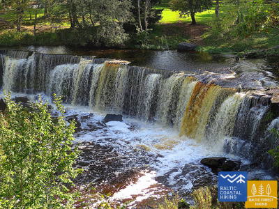
Der schönste Wasserfall Estlands
Aus landschaftlicher Sicht ist es der vielfältigste Abschnitt des Baltischen Küstenwanderweges. Geeignet ist er für ausdauernde Wanderer. Zu sehen bekommt man sowohl steinige Strände als auch Sandstrände und gute Badeorte, herrliche Kiefernwälder und den eindrucksvolle Türisalu-Fels sowie Jahrhundertsteine. Auf den kleinen Pfaden des Keila-Waldparks kann man den Keila-Wasserfall erreichen. Auch kann man die dem Leben der Küstenfischer gewidmete Ausstellung im Dorf Lohusalu besuchen.
RMK Keila-Joa Park nature trail
Der 2,1 km lange Weg führt die Besucher in den im englischen Stil gestalteten Keila-Joa-Park und zum beliebten Keila-Wasserfall. Die ersten 250 Meter vom Parkplatz (GPS: 59.393587, 24.294767) sind für Rollstuhlfahrer mit Assistent zugänglich. Die Oberfläche besteht aus Kies, Schotter und einem Naturpfad. Der Weg befindet sich in der Nähe des Jūrtaka-Weges.


60. Etappe. Tabasalu - Tallinna sadam.
Tallinn - Teil des UNESCO-Weltkulturerbes
Bei Tabasalu überquert der Baltische Küstenwanderweg die Stadtgrenze von Tallinn und führt durch die Stadtteile Tiskre und Vismeistri zum Strand Kakumäe. Von dort läuft er im Bogen um die felsumschlungene Kakumäe-Halbinsel und deren vom Wald bedeckten Spitze herum Von hier aus bietet sich ein schöner Ausblick auf den Hafen von Tallinn. Gegenüber dem Stadtteil Õismäe verläuft eine herrliche Strandpromenade. Der Pfad umkreist das Freilichtmuseum Estlands und schlängelt sich der Strandpromenade entlang bis zum Strand Stroomi. Weiter verläuft der Routenabschnitt auf den Gehwegen des Stadtviertels Pelguranna bis zum Estnischen Meeresmuseum. Von dort aus führt der Pfad der Strandpromenade entlang und erreicht den Hafen von Tallinn – den Endpunkt des Baltischen Küstenwanderweges. Durch Estland sind ~ 620 Kilometer zurückgelegt worden.
Pēsakilas (Pääsküla) purva dabas taka
Der 4 km lange Weg führt die Besucher in verschiedene Waldarten und ein Moor. Zwei Kilometer des Weges sind für Rollstuhlfahrer zugänglich. Er liegt etwa 8,5 km vom Jūrtaka-Weg entfernt.


Pikakari beach
Der Strand Pikakari bietet Schwimmhilfen, Umkleidekabinen und eine Holzrampe für den Zugang zum Wasser. Der Service muss im Voraus unter +372 5666 2455 gebucht werden. Er liegt 2,5 km vom Jūrtaka-Wanderweg entfernt.
64. Etappe. Nida (dt. Nidden) - Pervalka (dt. Perwelk).
An den Ufern des Kurischen Haffs
Der Meeresweg (lt. Jūrų takas) beginnt im Zentrum von Nida in der Nähe des Hafens. Er schlängelt sich weiter am Ufer des Kurischen Haffs entlang und öffnet einen schönen Blick auf das weite Wasser, das bis zum Ostufer des Kurischen Haffs liegende Insel Rusnė reicht. In Nida bestaunt man die typische Architektur der Kurischen Nehrung: einstöckige Holzbauten mit Dachziegel oder mit Schilf bedeckt, die Fensterläden in blau-weiß gestrichen. Weiter von Nida aus führt der Meeresweg zu dem Kap von Bulvikis hin (gegenüber dem Kap richtet sich der Blick auf eine Start-Landebahn des verwahrlosen Flughafens). Danach windet er sich auf kleineren Waldwegen, durch mit Kiefern bewachsenen Dünen auf und ab. Stellenweise schlängelt er sich über die Küstenwiesen mit ganz bescheidener Vegetation. Neben dem Weg sind Rastplätze und Vogelbeobachtungstürme eingerichtet. Im folgendem Abschnitt sind sehr eigentümliche, mit Flechten und Flora der Kurischen Nehrung typischer Art, bewachsene offene Küstenwiesen zu beobachten. In der Siedlung von Preila verläuft der Meeresweg an der Promenade entlang. Bis zu Pervalka schlängelt er sich über die Waldwege, Wander- /und Radwege bis in das Zentrum der Pervalka. Dieser Abschnitt verläuft durch den Nationalpark der Kurischen Nehrung (lt. Kuršių nerijos nacionalinis parkas).
Nida Promenade
Die Nida-Promenade erstreckt sich etwa 2 km vom Hafen Nida entlang des Kurischen Haffs und ist für Fußgänger und Radfahrer konzipiert. Sie verfügt über gut ausgestattete Rastplätze. Die Oberfläche ist modern gepflastert und für Rollstuhlfahrer zugänglich. Sie entspricht dem Küstenwanderweg.
65. Etappe. Pervalka (dt.Perwelk)- Juodkrantė (dt. Schwarzort).
Durch die imposantesten Sanddünen Nordeuropas
Hinter der Pervalka überquert der "Meeresweg" (lt. "Jūrų takas") die Kurische Nehrung in Ost-West-Richtung und erreicht die Küste der Ostsee. Eine weitere Strecke von ca. 13 km führt zu einem wunderschönen Sandstrand, der im Osten durch einem hohen Dünenrücken eingegrenzt wird. Der Dünenrücken wurde von Menschenhand geschaffen, um die Halbinsel vor Sandrutschen zu schützen. Vor dem Ort Juodkrantė biegt der Meeresweg nach Osten ab und überquert erneut die Kurische Nehrung durch steile, mit Wäldern zugewachsenen Dünen und führt weiter in die Richtung des Kurischen Haffs. Ein kleiner Abschnitt des Meeresweges schließt sich mit dem Weg über den Hexenberg (lt. Raganų kalnas) zusammen. Weiter geht es über die Uferpromenade von Juodkrantė zum Hafen. Die Strecke verläuft durch den romantischen Nationalpark der Kurischen Nehrung (lt. Kuršių nerijos nacionalinis parkas).
Juodkrantė Promenade
Die Juodkrantė-Promenade erstreckt sich etwa 1,4 km vom Hafen Juodkrantė entlang des Kurischen Haffs und ist für Fußgänger und Radfahrer konzipiert. Sie verfügt über gut ausgestattete Rastplätze und hat eine moderne Pflasteroberfläche. Sie ist für Rollstuhlfahrer zugänglich und verläuft parallel zum Küstenwanderweg.
66. Etappe. Juodkrantė (dt. Schwarzort) – Klaipėda (dt. Memel).
Klaipėda – Seetor Litauens
Fortführend von der Küstenpromenade des Ortes Juodkrantė überquert der "Meeresweg" (lt. "Jūrų takas") die Kurische Nehrung in nordwestlicher Richtung auf kleinen Waldwegen, die sich entlang steiler, mit Kiefern bewachsener Dünenhänge schlängeln, bis man wieder an der Ostseeküste ankommt. Weitere 9 km verläuft der Meeresweg an den Sandstränden entlang. Auf der Ostseite wird er durch eine steile Düne, die die Nehrung vor durch den Wind verwehten Sand schützt, begrenzt. Außerhalb der Siedlung Alksnynė (vom Ufer aus unsichtbar) biegt er nach Osten ab und in den Wald der Latschenkiefer Pinus Mugo, den Militärstützpunkt der deutschen Armee während des Zweiten Weltkriegs durchquert, und sich den Ufern des Kurischen Haffs nähert. Danach verläuft der Meeresweg weiterhin durch die mit Kiefern bedeckten Dünen, von denen ein Ausblick auf die Stadt Klaipėda sich eröffnet. Die Route zwischen der neuen und alten Fähre verläuft zunächst über einen kleinen Pfad und dann über die Küstenpromenade. Von der alten Fähre überquert der Meeresweg (mit der Fähre) das Kurische Haff und endet im Zentrum von Klaipėda - auf der Danės-Straße bis zur Biržos-Brücke (dt. Brücke der Börse). Der Abschnitt bis zur Fähre passiert den Nationalpark der Kurischen Nehrung (lt. Kuršių nerijos nacionalinis parkas).
Juodkrantė Promenade
Die Juodkrantė-Promenade erstreckt sich etwa 1,4 km vom Hafen Juodkrantė entlang des Kurischen Haffs und ist für Fußgänger und Radfahrer konzipiert. Sie verfügt über gut ausgestattete Rastplätze und hat eine moderne Pflasteroberfläche. Sie ist für Rollstuhlfahrer zugänglich und verläuft parallel zum Küstenwanderweg.
67. Etappe. Klaipėda (dt. Memel) – Palanga (dt. Polangen).
Durch den Regionalpark der Küste
Zuerst führt der Meeresweg (lt. Jūrų takas) der H. Manto Straße, durch das Zentrum der Stadt Klaipėda entlang, dann überquert er den Erholungspark und die Eisenbahn und an der Südseite der Siedlung Melnragė bevor er wieder an der Küste der Ostsee ankommt. Danach führt er weiter an der Strandpromenade und den schmalen, die Dünen schützenden Holzpfaden (Knüppelpfad) vorbei und erstreckt sich dann auf einem gemütlichen Weg, der ca. 10–20 m vom Wander- / Radweg entfernt durch die Wälder der Küste verläuft und die Zweite Melnragė hinter sich lässt - bis die Siedlung Giruliai erreicht ist. In der Nähe von Giruliai bevorzugt er für einen kurzen Augenblick den Genuss eines Strandes, dann führt er vom Ort Kukuliškės bis südlich von Karklė und anschließend dem sehr schönen Ufer des ehemaligen Litorina-Meeres, das mit unberührtem Wald bewachsen ist. Weiter verläuft er neben der malerischen, von den Wellen durchfluteten Klippe mit mehreren Aufsichtsplattformen inkl. den "Olando kepurė" (dt. Hut/ Mütze des Holländers ) in Richtung Karklė. Folgende 11 km von der Siedlung Karkle bis zum Botanischen Park verläuft der Meeresweg an sandigen Kiesstränden mit ihren wunderschönen großen Steinen. Dem Pfad im westlichen Teil des botanischen Parks folgend, erreicht der Meeresweg die "Meilės Alėja" (dt. Allee der Liebe) und führt zur Fußgängerbrücke von Palanga. Ein Großteil dieser Strecke passiert den Regionalen Park der Küstenregion (lt.Pajūrio regioninis parkas).
Palanga Sea Bridge
Das einzige Bauwerk dieser Art im Baltikum. Die Oberfläche besteht aus modernem Pflaster vor der Brücke und Holz auf der Brücke selbst. Die Brücke ist für Rollstuhlfahrer zugänglich. Die Hauptfußgängerzone von Palanga, die J. Basanavičiaus-Straße, ist ebenfalls zugänglich. Die Brücke liegt in der Nähe des Küstenwanderwegs.

68. Etappe. Palanga (dt. Polangen)– litauisch-lettische Grenze (Šventoji) (dt. Heiligenau).
Durch die beliebtesten Küstenkurorte Litauens
Nachdem der Meeresweg (lt. Jūrų takas) über eine Brücke das Flüsschen Rąžė überquert hat, schlängelt er sich weiter, der Fußgänger- / Joggingpfad "Labrytys" entlang und führt zum Meer in der Nähe der Kontininkų-Straße. Abwechslungsreich geht er dann 9 km am sandigen, vom Meer umgespültem Strand weiter bis zur alten Mole des Städtchen Šventoji, entlang. Anschließend windet er sich um die Mündung des Flusses Šventoji, führt durch das Kurort-Städtchen, am Ende der Kopų-Straße überquert er den Fluss mit einer Fußgänger - Hängebrücke und lotst wieder zum Strand hinaus. Der Meeresweg macht noch einmal einen kleinen Bogen in der Nähe des Heiligtums "Žemaičių Alka" um dann am Sandstrand entlang nach 3 km die litauisch-lettische Grenze zu erreichen.
Palanga Sea Bridge
Das einzige Bauwerk dieser Art im Baltikum. Die Oberfläche besteht aus modernem Pflaster vor der Brücke und Holz auf der Brücke selbst. Die Brücke ist für Rollstuhlfahrer zugänglich. Die Hauptfußgängerzone von Palanga, die J. Basanavičiaus-Straße, ist ebenfalls zugänglich. Die Brücke liegt in der Nähe des Küstenwanderwegs.