


66-й этап. Юодкранте – Клайпеда. The Curonian spit.
66-й этап. Юодкранте – Клайпеда.
Стоит увидеть
 Стоит увидеть
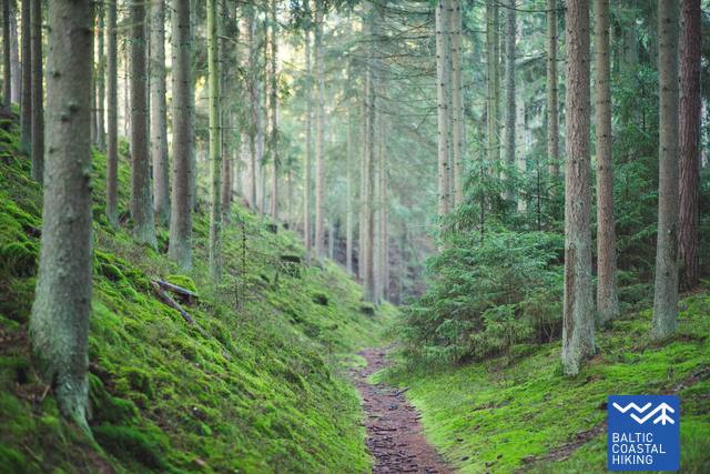
|
Formed in the 19th century, this promenade was the favorite spot for long walks in the historic resort town of Juodkrantė. The pathway has retained its name of Dendrological Trail due to the variety of non-local plants. |
|
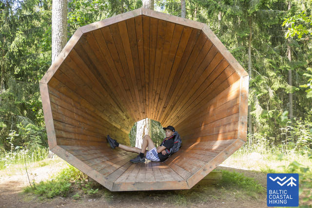
Forget your daily troubles and spend a minute or two listening to the sounds of the forest with the help of a sound catcher placed in the old forest of Juodkrantė. |
This is a place of legends and mysticism. Long ago, the entire Curonian Spit could be seen from atop of this hill. The Lighthouse of Juodkrantė stands here now. |
|
Amber was excavated here in the 19th century. |
|
This Defense Complex was built by the Germans to defend the City of Klaipėda against the Soviet artillery and air raids during the Second World War. |
|
|
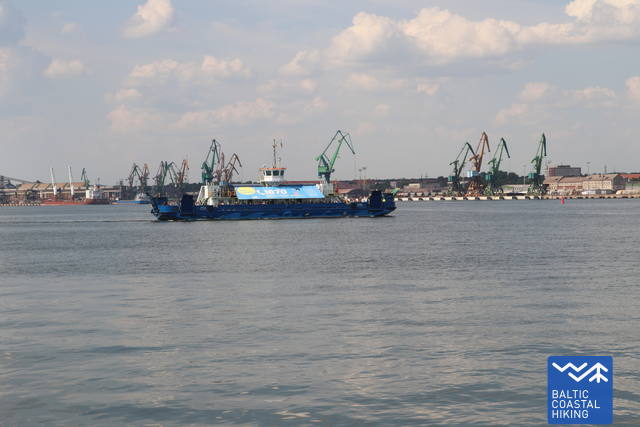
Kiaulės Nugara is the only island in the Curonian Lagoon. In 2014, the Independence LNG carrier was moored to the island. |
The museum is located in Kopgalis Fortress and has a large exhibition on the Baltic and other sea creatures. |
|
The history of the City of Klaipėda began here in 1252. Historical exhibitions can be visited in the dungeons of the castle. |
|
Timber framed houses and the defensive fortifications dating back to the 17th-18th century are the highlights of the Old Town of Klaipėda. |
|
|
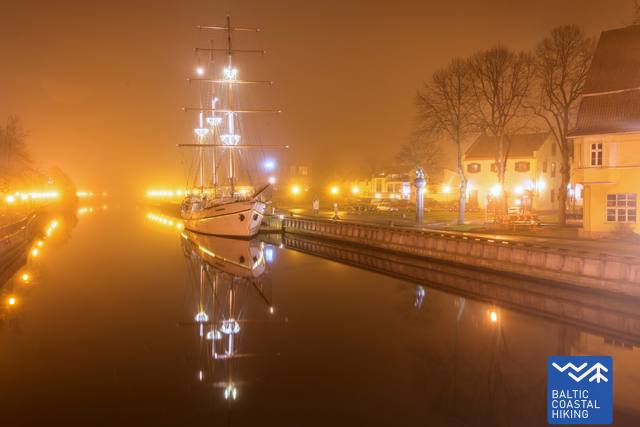
This wooden sailing ship has already become a symbol of the City of Klaipėda. |
www.klaipedatravel.lt |
1. Дендрологическая тропа (променад Блоксберга). Сформированный в XIX в променад был излюбленным местом прогулок на историческом курорте Юодкранте. Из-за видового разнообразия завезенных растений тропу еще называют дендрологической. GPS: 55.54725, 21.11867
2. Звуковая ловушка. Сбежать от повседневных забот и прислушаться к звукам леса Вам поможет звуковая ловушка, установленная в старом лесу Юодкранте. GPS: 55.55486, 21.12006
3. Гора Ведьм (Блоксберга). Это опутанное легендами и мистикой место. Когда-то с этой дюны можно было рассмотреть всю Куршскую косу. Теперь на вершине дюны установлен маяк Юодкранте. GPS: 55.55645, 21.11589
4. Янтарный залив. В XIX веке здесь копали янтарь. GPS: 55.55236, 21.12670
5. Оборонительный комплекс Алкснине. Это оборонительное укрепление, построенное немцами для защиты Клайпеды от налетов советской авиации и артиллерийских обстрелов во время Второй мировой войны. GPS: 55.65707, 21.12422
6. Остров «Спина свиньи» и „Independence“. Это единственный остров Куршской косы. В 2014 году к нему было пришвартовано судно-хранилище-терминал сжиженного газа “Independence”. GPS: 55.66217, 21.13723
7. Морской музей. В музее, расположенном в бывшей крепости «Копгалис», можно познакомиться с обитателями Балтийского и других морей. GPS: 55.71660, 21.09975
8. Место, где находился замок Клайпеды. Здесь в 1252 году началась история Клайпеды. В подземельях территории замка размещены исторические экспозиции. GPS: 55.70555, 21.12946
9. Старый город Клайпеды. В старом городе Клайпеды Вы увидите фахверковую архитектуру и уцелевшие оборонительные укрепления XVII–XVIII веков. GPS: 55.70869, 21.13324
10. Биржевой мост и „Meridianas“. Этот деревянный памятник стал символом города Клайпеда. GPS: 55.71007, 21.13347
Подробнее о посещаемых местах в Клайпеде: