


Baltic Coastal Hiking trail - The Vidzeme coast

The Vidzeme coast
The East coast of the Gulf of Riga
Vecāķi – Ainaži: 112 km, Day 25 – Day 30
In terms of landscapes and views, the most multifaceted section of the Baltic Coastal Hiking Route in Latvia, which includes both sandy and rocky beach, coastal meadows, reeds, dunes, sandstone outcrops, forests, capes and small coves, fishing villages, pubs, estuaries of small rivers. The Baltic Coastal Hiking Route winds through Carnikava, Saulkrasti, Zvejniekciems, Salacgrīva and Ainaži. It traverses small streams that you can wade across in the summer.
In this section of the Baltic Coastal Hiking Route you will find the estuaries of the Gauja River and the Salaca River which can be bypassed via bridges. Carnikava and Salacgrīva are famous for lampreys, which are cooked according to special recipes used by the local fishermen. In Dunte, you can visit the museum of the famous teller of tall tales, Baron Munchausen. Randu Meadows is a notable migratory and nesting site for birds. Shortly before reaching Estonia, the itinerary takes forest trails to pass around the coast overgrown in grass and reeds.
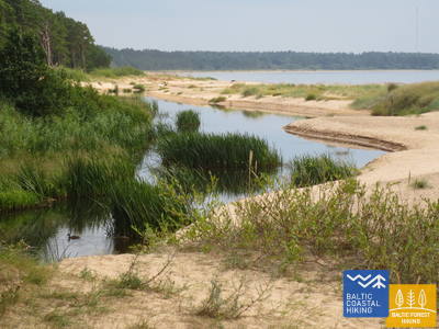
 Section 25. Vecāķi - Carnikava.
Between The Estuaries Of Two Rivers: The Daugava River And The Gauja River
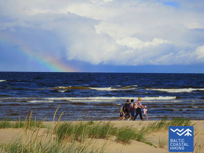
This sections of the Baltic Coastal Hiking Route is a comparatively short hike across a beautiful sandy beach, the coastal side of which is bounded by brightly colored pine forests with spectacular dunes and dams of dunes. To get from the beach to Carnikava, the Baltic Coastal Hiking Route will take you through a forest via a promenade. Then it takes a stroll around the Old Gauja River via a levee and reaches the pedestrian bridge over the Gauja River. Both as you start and end the hike, it is nice to sit in one of the pubs and summer cafés located on Vecāķi beach and in Carnikava.
 Section 26. Carnikava - Saulkrasti.
The Sunset Trail With Romantic Sunset Vistas
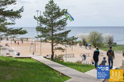
Initially, the itinerary leads you through the Gauja River levees in Gauja village reaching the estuary of the Gauja River, which is a good place for bird watching. The hike continues along a sandy beach up to the estuary of the Inčupe River, before which you have to turn inland to get to a bridge and to cover the next couple of kilometers across the wooded dune tops of the Sunset Trail with a view of the beach. After crossing the Pēterupe River (cable bridge), the Baltic Coastal Hiking Route continues along the beach and reaches the Sea Park in Saulkrasti.
Section 27. Saulkrasti – Lauči.
The Gate To The Rocky Seashore Of Vidzeme
The first kilometers leading up to Zvejniekciems can be covered via the beach or via a trail meandering through the dune forest with old pines whose bark looks like crocodile skin. Here you can also see an old wooden hut with fishing nets and tools. Before reaching the port of Skulte, the first rocks appear on the beach of Zvejniekciems. After making a detour around the estuary of the Aģe River and the port, the Baltic Coastal Hiking Route returns to the beach where you can already see Cape Ārņi from afar, while beyond it the brown back of the Big Lauči Sea Boulder comes into view. Varied coastal landscapes.
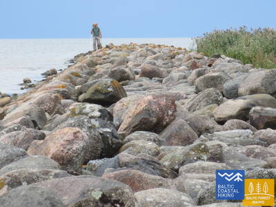
 Section 28. Lauči - Tūja.
The Bygone Times Of Sailing Ships
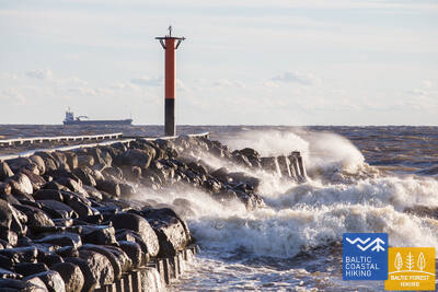
This section of the seacoast of Vidzeme is of outstanding scenic beauty with a lot of rocky capes and boulders in the sea alternating with small, sandy coves where the small streams and rivulets, which dry out in summer, flow into. Occasionally, the beach is completely covered with the gray backs of stones. In some places, small patches of reeds appear, while near Tūja you will see the first sandstone outcrops.
Section 29. Tūja - Svētciems.
The Rocky Beach of Vidzeme
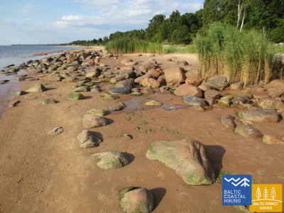
One of the most beautiful sections of the Baltic Coastal Hiking Route, which begins by crossing the Zaķupīte River. Up to the Ķurmrags Lighthouse, there are mostly sandy beaches with small sections of stones. Further on, the Rocky Seashore of Vidzeme starts: capes alternate with small coves, while 4 m high sandstone outcrops emerge on the coast. Sandy beaches continue to prevail after passing Cape Meleki, while before the mouth of the Svētupe River the beach is thickly overgrown and reedy, so it must be bypassed via a forest trail.
Section 30. Svētciems - Ainaži.
The Lamprey Kingdom
The beach between Svētciems village and Salacgrīva is thickly overgrown, so the Baltic Coastal Hiking Route continues on a forest trail meandering among the dunes. To get from Salacgrīva to Kuiviži, you can take the sandy beach or forest trails. From Kuiviži to the Vēverupe River, you have to bypass the Randu Meadows via a forest road located on the east side of the A1 road. After passing the Vēverupe River, the Baltic Coastal Hiking Route returns to a thickly overgrown beach and then leaves it next to the estuary of the Blusupīte River to reach Ainaži Pier by going along Kāpu and Valdemāra iela. You have covered ~ 580 km in Latvia and reached the state border.