


Section 76. Gaulėnai – Pavandenė. Žemaitija ethnographic region.
Section 76. Gaulėnai – Pavandenė.
Gaulėnai – Pavandenė To the place where the Žemaitijos witches gathered
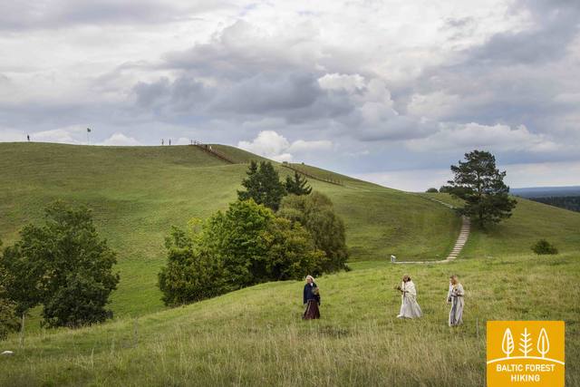
In this section of the Forest Trail, there is one of the highest regions of the Žemaitija Upland and one of the highest hills – Šatrija Hill, which offers an excellent landscape. The Žemaitija Upland are crossed by small, winding roads, which from time to time rise up to a high hill and soon descend again sharply. The first 2.4 km of the Forest Trail meanders along the Ramučiai–Luokė road (No. 2111), then it turns left to the south, settling a wide circle around Šatrija Hill. Approximately 2 km from Šatrija Hill, the Forest Trail reaches the Užmiestis, where it turns left again to the south and continues for about 10 km on the Luokė – Užventis road (No. 2114). Then it goes right to the southwest and after almost 7 km reaches the centre of Pavandenė. Throughout the route, open spaces alternate with wooded areas, creating a nice mosaic landscape.


