Miško takas - For visually impaired

 Section 1. Old Riga - Baltezers.
Through Riga – UNESCO World Heritage Site
The starting point of Forest Trail in Latvia is located in the heart of Old Riga, the Town Hall Square. The route leads along Kaļķu Street, passes the Monument of Freedom, through Vērmane Garden and along the historic Tērbatas street. Then it arches over the Zemitāni railway station pedestrian bridge and treads into Biķernieki and Šmerlis forests. The Forest Trail winds through Jugla, passes the Latvian Ethnographic Open-Air Museum and goes on along the pedestrian-bicycle path until Baltezers.
The "Feel Jugla" Walking Trail
In the northeastern part of Lake Jugla in Jugla, a 250-meter wooden boardwalk (one way) has been created with a viewing platform overlooking Lake Jugla, a bench, 20 tactile spatial reliefs depicting characteristic animal species of the lake and its surroundings, and information in Braille. It is accessible to people in wheelchairs. The site is located 0.5 kilometers from the Mežtaka trail.


Taktilais Brīvības piemineklis
Enthüllt an Lettlands Geburtstag – dem 18. November 2022 – im Brīvības laukums gegenüber dem von Kārlis Zāles geschaffenen und am 18. November 1935 enthüllten Original. Diese besondere Bronzeminiatur wurde vom Bildhauer Ivars Miķelsons im Maßstab 1:50 geschaffen.


Section 83. Paplatelė – Plateliai.
Around the largest lakes in the Žemaitija National Park
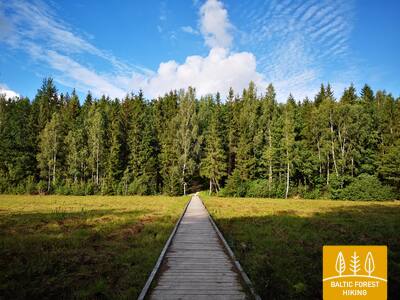
Die ersten 3,5 km führt der Wald-Wanderweg durch wunderschöne Wälder, die die Hänge des Hochlandes Žemaitija bedecken. Bis zum Museum des Kalten Krieges fällt er mit dem Erkenntnispfad Plokštinė zusammen. 5 km vom Museum folgt der Wald-Wanderweg der Landstraße Plokštinė, wo ein Fußgänger- / Fahrradweg angelegt wurde und bei der Annäherung zum Platelių-See in die Seesenke hinabsteigt. An der Straße Nr. 3202 (Malūno-Straße) biegt der Wald-Wanderweg links nach Südosten ab und gleich nach 0,3 km folgt eine Rechtskurve nach Süd-Südwest. Nach ca. 0,5 km erreicht er die Ilgio Ežero Straße. Die nächsten 5,5 km legt der Wald-Wanderweg einen weiten Bogen um die Seen Ilgis und Beržoras und erreicht dann das Dorf Beržoras. Nach dem Dorf verläuft der Wald-Wanderweg entlang der Plungės-Straße, erreicht nach 2 km das Stadtzentrum von Plateliai und macht entlang der Ežero-Straße einen weiteren Bogen zum Strand und zu den Erkundungspfaden von Šeirė. Weiter entlang der Straßen Ežero, Naujoji und Žemaičių Kalvarijos kehrt der Wald-Wanderweg ins Stadtzentrum zurück.
Šeire's Educational Trail
Der Weg ist etwa 7 Kilometer lang, es gibt jedoch eine Aussichtsplattform, die für Rollstuhlfahrer zugänglich ist und einen Blick auf den Plateliai-See und seine Inseln bietet. Plateliai liegt im Nationalpark Žemaitija. Auf der Informationstafel ist eine taktile Karte des Sees mit seinen Inseln angebracht, sodass auch Sehbehinderte ihn erkunden können. Der Parkplatz befindet sich hier: GPS 56.048355, 21.826901. Er liegt neben dem Mežtaka-Weg.


Plokštines militārā pilsēta
Seit 1993 wird die ehemalige Anlage der sowjetischen Armee von der Direktion des Nationalparks Samogitia verwaltet. Viele Gebäude auf dem Militärcampus wurden 2017 aufgrund ihres baufälligen Zustands abgerissen. Derzeit sind in dem Areal noch etwa 10 Gebäude erhalten, die von Besuchern von außen besichtigt werden können. Es gibt Informationstafeln, die über die ehemaligen Gebäude und ihren Zweck informieren. Es wurde ein taktiler Stand installiert – eine Karte, die die Gebäude, ihre Lage und Funktionen vorstellt.


Section 84. Plateliai – Salantai.
Towards the Pajūris Lowland
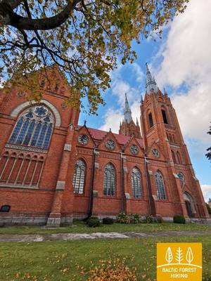
Der Wald-Wanderweg verläuft 6 km am Rand der Straße Plateliai – Salantai (Nr. 2302) entlang. In diesem Abschnitt öffnet sich ein Blick auf die Landschaften des westlichen Teiles des Hochlandes Žemaitija über die Tiefebene Pajūris. Im Zentrum des Dorfes Gintališkė biegt der Wald-Wanderweg links nach Südwesten ab und kommt auf die Straße Nr.3216. Nach 2,4 km biegt er rechts nach Westen ab, wo er das größte Waldmassiv dieses Abschnitts durchquert. Zu Sowjetzeiten befand sich hier ein Raketenstützpunkt, wie die mit Betonplatten gepflasterte Straße nachweist. Dann folgt der Wald-Wanderweg kurz der Straße Plungė – Salantai (Nr.169) und biegt nach 1,4 km links ab. Bis Salantai windet er sich auf einer kleinen Landstraße, aber das Zentrum der Kleinstadt erreicht man über die Straßen Žemaitės und M. Valančiaus. Der Anfang dieser Etappe befindet sich im Nationalpark Žemaitija, das Ziel ist jedoch im Regionalpark Salantai.
Šeire's Educational Trail
Der Weg ist etwa 7 Kilometer lang, es gibt jedoch eine Aussichtsplattform, die für Rollstuhlfahrer zugänglich ist und einen Blick auf den Plateliai-See und seine Inseln bietet. Plateliai liegt im Nationalpark Žemaitija. Auf der Informationstafel ist eine taktile Karte des Sees mit seinen Inseln angebracht, sodass auch Sehbehinderte ihn erkunden können. Der Parkplatz befindet sich hier: GPS 56.048355, 21.826901. Er liegt neben dem Mežtaka-Weg.
Section 92. Snēpele – Kuldīga.
Venta valley and Riežupe Nature Park
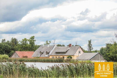
Entlang der Hauptstraße von Snēpeles führt der Wald-Wanderweg auf die Straße V1294 und biegt nach 0,3 km gegenüber dem See Ķepšu rechts auf eine kleine Landstraße ab. Über dieser Straße windet sich der Wald-Wanderweg bis zum Dorf Slipiņciems, davor überquert er den Fluss Sprincupe entlang dem Damm, wo ein Teich angelegt wurde. Dann geht der Wald-Wanderweg in Richtung Pelči. In der Umgebung von Pelči schlängelt sich der Wald-Wanderweg entlang der Damba-Teiche, führt zur Straße Kuldīga – Pelči (V1293) und führt weiter durch die Gartengebiete von Kuldīga – Kurzemīte und Rumba, bis er das Venta-Ufer und die Kuldīga Umgehungsstraße erreicht. Von dort zur Alten Backsteinbrücke führt der Wald-Wanderweg 2,4 km über einen schönen Uferpfad an der Venta, wo es an feuchteren Stellen und über Bäche Fußgängerbrücken und Holzstege gibt.
The walking trail along the Venta River in Kuldīga
Der Weg erstreckt sich am linken Ufer des Flusses Venta vom Stadtgarten Kuldīga bis zur neuen Kuldīga-Brücke und ist 2,4 Kilometer lang. Entlang des Weges gibt es Rastplätze und Informationstafeln. Er ist für Rollstuhlfahrer zugänglich, da er eine glatte Oberfläche aus feinem, hartem Kies hat, obwohl einige Abschnitte aufgrund von Steigungen möglicherweise Hilfe benötigen. Der Weg ist breit und an den Stellen, an denen er kleine Bachschluchten überquert, wurden Holzstege und Brücken angelegt. Dieser Abschnitt des Mežtaka-Weges verläuft entlang des Kuldīga-Promenadenwegs. Behindertengerechte Toiletten stehen zur Verfügung. Ein Parkplatz wurde bei GPS: 56.973354, 21.977798 eingerichtet.


 Section 93. Kuldīga – Renda.
Venta valley and Riežupe Nature Park
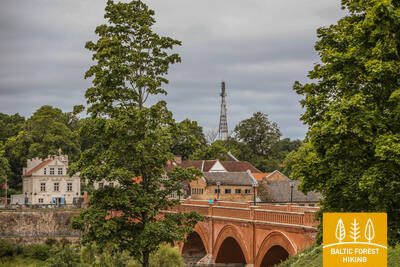
After the Old Brick Bridge across the Venta river, the Forest Trail continues for a short time on the right bank of the Venta, notched by ravines, then, along Krasta street and Vetklīnika–Paleja road, it crosses Kalnmuiža forest and Riežupe and further up to Mazrenda continues along the roads of the vast Renda forest massif. The terrain is flat here, because this section is part of the Pieventa plain of the Kursa Lowland. In Mazrenda, the Forest Trail crosses a sand-gravel quarry and takes you to the centre of Renda along Kuldīgas street. The section belongs to the territory of the nature reserve “Ventas ieleja” and the nature park “Riežupe”.
Audio guide "Through Mežtaka in Kuldīga for People with Visual Impairments"
In 2024, an audio guide titled "Through Mežtaka in Kuldīga for People with Visual Impairments" has been created. It starts at the Kuldīga Observation Tower, crosses the old brick bridge over the Venta River, and helps users explore the Kuldīga promenade trail along the Venta. Information at the observation tower and nearby is provided in Braille. A parking lot has been established at GPS: 56.973354, 21.977798.


Section 100. Bigauņciems – Dubulti.
The historic resort of Jūrmala
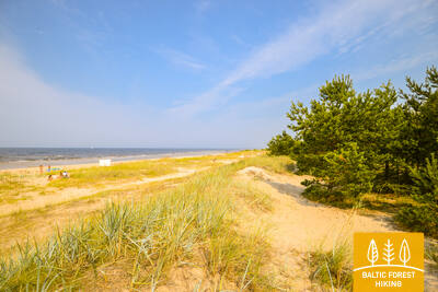
In Bigauņciema village, you can clearly see the whole length of the Jūrmala coast. The first third of this day’s itinerary is part of the Ķemeri National Park where you can get to know historic fishing villages, the Ragaciems village fishing area with net huts and a fish market, dune habitats, as well as watch birds in the estuary of the Starpiņupe River. Starting from Jaunķemeri to Dubulti, the walk takes you across the widest sandy beach of the Gulf of Riga through the historic resort in Jūrmala and the longest city in Latvia. Keep in mind that on warm and sunny summer days there will be a lot of beachgoers.
The Dubulti Coastal Dunes Trail
Along the Jūrmala coastline, in the dune zone from Baznīcas Street in Dubulti to Amatas Street in Pumpuri, a nature trail about two kilometres long has been created. It is intended for peaceful recreation, getting to know the surrounding environment, and various movement activities.
The trail is convenient for walking enthusiasts, Nordic walkers, and runners alike. Along the route you can experience the characteristic coastal dune landscape and its changing terrain.
Along the way, there are boundary elements, three rest benches, a wooden-deck area with a picnic table and seating, a viewing platform, and a terrace with a stretched net. There is also a special sensory section where you can feel different natural materials — sand, pebbles, and pinecones. Two outdoor exercise machines are placed along the trail, offering the opportunity to move and work out. The route is equipped with signs, as well as information stands about local nature, healthy lifestyles, and the importance of physical activity for human well-being.
The information stands on the Wellness Nature Trail include tactile maps for people with visual impairments. Using touch, they allow visitors to understand the trail, its placement in relation to the surrounding streets, and the maps also include information in Braille.
The map design and production were created by the company Socintegra, which specialises in providing a wide range of environmental accessibility services.
An audio guide about the trail is available in the Izi.Travel app (“Labsajūtas dabas taka / Wellness Nature Trail”) in Latvian and English, allowing users to listen to the information from the trail’s info stands in audio format.


Section 101. Dubulti - Lielupe - Bulduri.
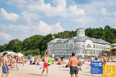
The Most Popular Beaches in Latvia
The widest sandy beach of the Gulf of Riga stretches from Dubulti to the Lielupe River. It is the main asset of the Jūrmala resort offering many beach cafés and different recreational possibilities. The coastal dune forests are permeated with a dense web of trails suitable for walking and stick-walking. The part of the Baltic Coastal Hiking Route located between the beach of the Lielupe River and Jūrmala beach is part of the Ragakāpa Nature Park. From here, you can easily get back to Bulduri by taking Bulduri prospekts and the 5th line.
The Dubulti Coastal Dunes Trail
Along the Jūrmala coastline, in the dune zone from Baznīcas Street in Dubulti to Amatas Street in Pumpuri, a nature trail about two kilometres long has been created. It is intended for peaceful recreation, getting to know the surrounding environment, and various movement activities.
The trail is convenient for walking enthusiasts, Nordic walkers, and runners alike. Along the route you can experience the characteristic coastal dune landscape and its changing terrain.
Along the way, there are boundary elements, three rest benches, a wooden-deck area with a picnic table and seating, a viewing platform, and a terrace with a stretched net. There is also a special sensory section where you can feel different natural materials — sand, pebbles, and pinecones. Two outdoor exercise machines are placed along the trail, offering the opportunity to move and work out. The route is equipped with signs, as well as information stands about local nature, healthy lifestyles, and the importance of physical activity for human well-being.
The information stands on the Wellness Nature Trail include tactile maps for people with visual impairments. Using touch, they allow visitors to understand the trail, its placement in relation to the surrounding streets, and the maps also include information in Braille.
The map design and production were created by the company Socintegra, which specialises in providing a wide range of environmental accessibility services.
An audio guide about the trail is available in the Izi.Travel app (“Labsajūtas dabas taka / Wellness Nature Trail”) in Latvian and English, allowing users to listen to the information from the trail’s info stands in audio format.