


Baltischer Küstenwanderweg - For visually impaired


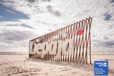
 3. Etappe. Bernāti - Liepāja - Karosta.
Die Stadt, wo der Wind geboren ist
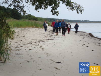
Von Bernāti bis Liepāja führt der Baltische Küstenwanderweg an einem breiten Strand entlang. Dort erfreuen auf der Festlandseite anfangs eine abgespülte Küste das Auge, später dann beim Herankommen an die Stadt Liepāja hohe, mit Strandroggen und Strandhafer bewachsene Vordünen. Der Pfad windet sich weiter durch den zentralen Teil der Stadt Liepāja – Vecliepāja und kurz nach dem Passieren des Karosta-Kanals (Kriegshafenkanal) erreicht man Karosta – einen Komplex von Militär- und Fortifikationsbauten. Um ihn genauer zu erkunden, sollte man mindestens einen halben
Tag einplanen. Unbedingt probieren sollte man die Spezialität von Liepāja – ”Liepājas menciņi”, geräucherten Dorsch, zubereitet nach einem alten südkurländischen Rezept.
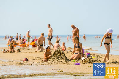
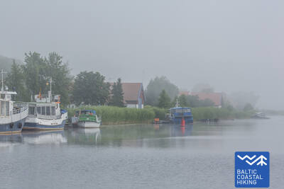
Liepāja Beach near the Central Rescue Station
Am Strand von Liepāja in der Nähe der zentralen Rettungsstation (GPS: 56.504199, 20.991922) wurde eine Einrichtung für Menschen mit Behinderungen eingerichtet. Sie umfasst Duschen, Umkleidekabinen und Holzstege, die bis zum Meer reichen und Rollstuhlfahrern den Zugang zum Ufer ermöglichen. Es stehen spezielle Rollstühle zur Verfügung, die zum Schwimmen im Meer geeignet sind. Für blinde und sehbehinderte Menschen wurden Audiobojen im Meer angebracht, die durch Signale Informationen darüber geben, wie weit man schwimmen kann.


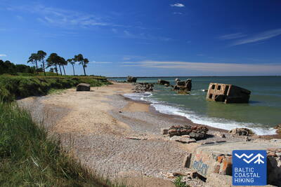
 4. Etappe. Karosta - Ziemupe.
Karosta - ein Militärerbe an der Ostsee
Die ersten vier Kilometer des Baltischen Küstenwanderweges sind mit den Überresten vieler Forts und Küstenschutzbatterien besonders für Enthusiasten der Militärgeschichte ein echtes Vergnügen. Aus gehtechnischer Sicht ist diese kurländische Küstenstrecke am anspruchsvollsten. Hinter dem Festungskanal schlängelt sich der Pfad für eine kurze Zeit entlang einer Küstenwiese, dann führt er zum Strand hinaus und läuft weiter bis Ziemupe. Der Strand ist breit, bei etwas stärkerem Wind verengt er sich zwischen den Flüssen Lenkupe und Kārļupīte. Streckenweise gibt es eine nicht besonders hohe Steilküste, an einigen Stellen passiert man hohe, teilweise ausgehöhlte Vordünen. Vom Hörensagen weiß man, dass im Fluss Ziemupe viele Schiffe versunken liegen, eines davon sogar mit Bronzekanonen an Bord.
Paths at Dvēseles Veldzes Dārzs
Der Garten Dvēseles Veldzes (GPS: 56.728534, 21.092676) bietet zwei kurze Naturpfade für Sehbehinderte und Blinde – den Barfußpfad (530 m), den Sensorikpark und ein Labyrinth. Die Oberfläche des Barfußpfads ändert sich alle 10 Meter und enthält Hindernisse unterschiedlicher Schwierigkeitsgrade. Der Standort bietet einen ausgewiesenen Parkplatz, eine barrierefreie Toilette, taktile Objekte, Audioinformationen und Informationen in Blindenschrift. Er liegt etwa 2,5 km vom Küstenpfad entfernt.


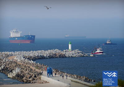
 10. Etappe. Ventspils - Staldzene.
Durch die Stadt Ventspils
Weiter führt die Wanderroute durch die Stadt Ventspils und die umliegenden Wälder. Der Pfad Jūrtaka schlängelt sich vom Südpier durch das historische Hafenende Ostgals und die Altstadt, überquert den Fluss Venta und setzt seinen Lauf über einen Fußgänger- und Radweg durch Pārventa in Richtung Staldzene fort, Nachdem er einen Bogen um den Hafen herum gemacht hat, führt er wieder zum Strand zurück. Es lohnt sich, „einen Tag frei“ zu nehmen und die interessantesten Orte der Stadt kennenzulernen sowie das Freilichtmuseum am Meer zu besuchen.
Lake Būšnieki Nature Trail
Der Weg um den Būšnieki-See ist ein 9 km langer Rundweg, der für Rollstuhlfahrer und Eltern mit Kinderwagen zugänglich ist. Er verfügt über einen Audioguide, taktile Informationen und einen Parkplatz für Menschen mit eingeschränkter Mobilität. Ein empfohlener Ausgangspunkt ist der Parkplatz auf der Südostseite des Sees (GPS: 57.437632, 21.656062). Der Weg liegt etwa 1 km vom Jūrtaka-Weg entfernt.


17. Etappe. Ģipka - Kaltene.
Der steinreichste Strand in Kurland
Von Ģipka bis Roja erstreckt sich ein sandiger, nicht besonders breiter Strand mit bezaubernden Dünen und Strandkieferwäldern. Kurz vor Roja ist der Strand dicht mit Sandrohr bewachsen. Der Streckenabschnitt zwischen Roja und der Kirche in Kaltene ist der einzigartigste Strand Lettlands. Dort ist die Meeresküste mit einem sehr schmalen Strand von kleinen Küstenvorsprüngen und Golfen ausgekerbt. Am Strand sind Felsbrocken unterschiedlicher Größe zu beobachten, die sich unter dem grünen Laubwerk von Schwarzerlen verbergen. An einigen Stellen ragen weit ausgebreitete Wurzelrosette von Bäumen empor, die an den Strand angespült wurden. Streckenweise verläuft entlang der Küste ein Weg, an dem sich viele ehemalige Fischerhäuser aneinanderreihen.
Walking Path at Roja Beach
Die Holzstege sind für Rollstuhlfahrer und Eltern mit Kinderwagen geeignet. Es gibt einen Informationsstand in Blindenschrift und eine taktile Strandkarte. Zur Ausstattung gehören ein behindertengerechtes WC und ein Parkplatz (GPS: 57.510088, 22.799207). Die Promenade ist in eine Richtung 0,5 km lang. Rollstuhlfahrer können die Promenaden zwar benutzen, können das Meer jedoch nicht erreichen, da es keine Rampe gibt. Die Promenaden sind breit und verfügen über Geländer an den Seiten und Überholflächen.
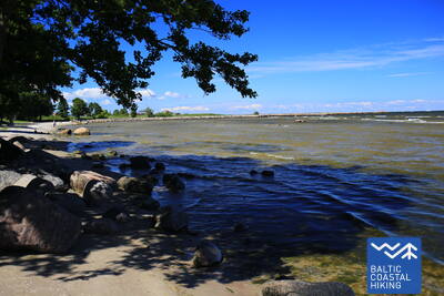
21. Etappe. Ragaciems - Dubulti.
Der historische Kurort Jūrmala
Von Ragaciems eröffnet sich ein weiter Ausblick über die ganze Küste von Jūrmala. Das erste Drittel dieses Streckenabschnitts führt durch den Nationalpark Ķemeri. Dort kann man sich mit historischen Fischerdörfern, der ehemaligen Fischerbootsanlegestelle und dem Fischmarkt in Ragaciems sowie den Dünenbiotopen vertraut machen. Auch kann man Vögel im Mündungsgebiet des Flusses Starpiņupīte beobachten. Von Jaunķemeri bis Dubulti verläuft der Pfad entlang dem breitesten Sandstrand der Rigaer Meeresbucht durch den historischen Kurort der Stadt Jūrmala und die längste Stadt Lettlands. An warmen und schönen Sommertagen muss mit zahlreichen Strandbesuchern gerechnet werden.
The Dubulti Coastal Dunes Trail
Im Jahr 2024/2025 wird ein Abschnitt des Jūrtaka-Pfades als spezielle Route für Menschen mit Sehbehinderung angelegt und angepasst.


22. Etappe. Dubulti - Lielupe - Bulduri.
Die beliebtesten Strände Lettlands
Zwischen Dubulti und Lielupe erstreckt sich der breiteste Sandstrand der Rigaer Meeresbucht – es ist der wertvollste Schatz des Kurorts Jūrmala, in dem es zahlreiche Strandcafés und verschiedene Erholungsmöglichkeiten gibt, Die Wälder der Küstendünen sind von einem dichten Wegenetz durchzogen, das zum Joggen und Wandern geeignet ist. Der Baltische Küstenwanderweg führt zwischen dem Strand Lielupe und dem Freilichtmuseum Jūrmala durch den Naturpark Ragakāpa. Am bequemsten zurück nach Bulduri gelangt man über die Straßen Bulduru prospekts und 5. līnija.
The Dubulti Coastal Dunes Trail
Im Jahr 2024/2025 wird ein Abschnitt des Jūrtaka-Pfades als spezielle Route für Menschen mit Sehbehinderung angelegt und angepasst.
31. Etappe. Ikla - Kabli.
Durch den historischen Kurort
IIn Ikla beginnt der durch Estland verlaufende Abschnitt des Baltischen Küstenwanderweges. Auf der Strecke Ikla-Treimani führt der Pfad auf der sogenannten alten Rigaer Landstraße entlang. Hier erstrecken sich weite Wiesen und ein Rohrgebüsch an der Meeresküste. Hinter Treimani biegt der Pfad in Richtung Meer ab. Die nächsten 2,8 km verlaufen über einen schmalen, sandigen oder steinigen Strand, der streckenweise dicht bewachsen ist. Der Pfad umkreist den Orajõe-Bach und führt am Parkplatz wieder zum Strand zurück. Dem Strand entlang muss man ~ 4 Kilometer bis zum Lepanina-Hotel zurücklegen. Dann kehrt der Pfad zurück auf die alte Rigaer Landstraße, die bis Kabli führt. Auf diesem Wegabschnitt gibt es großartige Orte zur Vogelbeobachtung. Die Strecke bis Pärnu ist ein sehr beliebter Erholungs- und Badeort.
Kabli
Im Jahr 2024/2025 soll in Kabļi ein Pfad mit Informationsständen und einem Audioguide für sehbehinderte Menschen entstehen. Er wird entlang des Küstenpfads verlaufen.
38. Etappe. Tõstamaa - Matsi.
Das estnische Landidyll
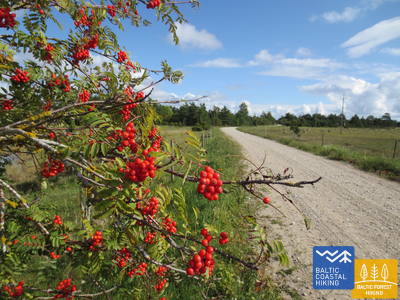
Auf diesem Abschnitt des Baltischen Küstenwanderweges ist eine traditionell ländliche Landschaft zu sehen. Wegen vieler flacher Buchten, Halbinseln und Erdzungen sieht die Küste wie ausgezickt aus. Dazwischen liegen Küstenwiesen, Rohrgebüsch, wasserarme Lagunen und Feuchtgebiete sowie schwer zugängliche Inseln. Folgt man dem Pfad auf den kleinen Dorfwegen, die im Herbst von roten Ebereschen umgeben sind, sieht man ethnographische Einzelhöfe, Landwirtschaften mit Kühen und Ziegen. Die Einzelhöfe sind von Resten von Steinzäunen, landwirtschaftlichen Nutzflächen und Wacholderheiden umgeben. Südlich des Dorfes Ranniku und in der Nähe des Dorfes Kastna gibt es einen Zugang zum Meer und Rastplätze.
Matsi Port
Der Weg führt die Besucher zum ehemaligen Fischereihafen Matsi. Er ist 500 Meter lang (Hin- und Rückweg). Der Weg beginnt am Parkplatz (GPS: 58.360251, 23.746683). Die Oberfläche besteht aus Asphalt, Beton und Schotter. Bei Wind kann der Weg mit Sand bedeckt sein, sodass Rollstuhlfahrer möglicherweise Hilfe benötigen. Der Weg verfügt über taktile Objekte und Informationen in Blindenschrift. Ein barrierefreies WC ist vorhanden. Es befindet sich neben der Jūrtaka.


39. Etappe. Matsi - Varbla.
Strände und Wälder
Der Strand Matsi ist einer der wenigen Sandstrände auf dem Streckenabschnitt bis Haapsalu. Der Baltische Küstenwanderweg windet sich durch das Dorf Kulli und verläuft auf einer Länge von 5 Kilometer auf kleinen, von weiten Wäldern und Dünen umschlossenen Wegen. Deren Umgebung ist im Herbst reich an Beeren und Pilzen. Danach läuft er im Bogen um das Uue-Varbla-Gutshaus herum und erreicht das Dorf Varbla.
Matsi Port
Der Weg führt die Besucher zum ehemaligen Fischereihafen Matsi. Er ist 500 Meter lang (Hin- und Rückweg). Der Weg beginnt am Parkplatz (GPS: 58.360251, 23.746683). Die Oberfläche besteht aus Asphalt, Beton und Schotter. Bei Wind kann der Weg mit Sand bedeckt sein, sodass Rollstuhlfahrer möglicherweise Hilfe benötigen. Der Weg verfügt über taktile Objekte und Informationen in Blindenschrift. Ein barrierefreies WC ist vorhanden. Es befindet sich neben der Jūrtaka.
70. Etappe. Rusnė (dt. Ruß) – Šilutė (dt. Heydekrug).
Šilutė ist ein authentisch charmantes Städtchen
Durch die Straßen Taikos und Kuršmarių des Städtchens Rusnė, führt der Meeresweg zur Brücke von Rusnė, überquert den Fluss Atmata - einen von mehreren Zweigen des Nemunas-Deltas. Weiterhin, erstreckt sich neben der Hauptstraße ein separater Fußgängerweg, dieser führt bis in die Stadt Šilutė. Ein Stück der Route verläuft der befahrbaren Straße entlang, hier sollte man den Straßenrand nutzen. In Šilutė überquert der Meeresweg den Fluss Šyša über eine historische Brücke und die Rusnės Straße, die die Insel Rusnė mit Šilutė verbindet, führt direkt in das Stadtzentrum. Bis zu der Grenze der Stadt Šilutė zählt der Meeresweg zu dem Regionalpark des Nemunas-Deltas (lt. Nemuno deltos regioninis parkas). Die unteren Ebenen des Nemunas, die jetzigen Weiden und Sumpfwälder ("Žalgirių miškas (dt. "Grünwald"), werden jedes Frühjahr überflutet.
Šilute
Die beiden zentralen Straßen der Stadt – die Lietuvininkų-Straße und die Tilžės-Straße – sind mit taktilen Leitlinien für Menschen mit Sehbehinderungen ausgestattet. Dies ermöglicht eine Route durch die Stadt von etwa 1,5 Kilometern. Sie befindet sich in der Nähe des Küstenwanderwegs.
71. Etappe. Šilutė (dt. Heydekrug) – Ventė (dt. Windenburg).
Durch den Regionalpark Nemunas
Durch die Straßen Klaipėdos und Aukštumalės verlässt der Meeresweg die Stadt Šilutė und biegt in die Richtung Kintai ab (Straße Nr. 4217). Weiter führt der Weg auf den Polder-Damm (von dem aus ist das Tiefland des Nemunas-Deltas, das im Frühjahr überflutet wird, sichtbar), danach schlingert er der Schotterstraße entlang und kehrt zur Aukštumalės-Straße (Nr. 4217) zurück. Um auf die Straße Šilutė – Kintai zurückzukehren, biegt der Meeresweg nach etwa 6 km an der Kreuzung des Dorfes Rūgailiai links in die Richtung Minija ab, danach nach 1,5 km wieder rechts und das Ziel ist erreicht. Danach überquert eine hohe und lange Brücke den Minija-Fluss und die Kintai-Teiche, und ermöglicht dadurch auf der Route weiter zu wandern. Die Strecke erlaubt einen Einblick in die ungewöhnlichsten Landschaften der litauischen Küste mit breiten Panorama des Tieflands und der verschiedenen Gewässern. Vor dem Dorf Povilai biegt der Meeresweg nach links ab und führt etwa 5 km durch Weiden, in denen die Vögel während des Zugs beobachtet werden können. Weiterhin, folgt dann die Route der Küstenstraße (Marių-Straße Nr. 2201) entlang, die nach 5 km das Ventės Ragas (dt. Windenburger Kap) erreicht. Ab diesem malerischen Landschaftsabschnitt eröffnet sich die Aussicht auf die Kurische Nehrung, die an dem anderen Ufer des Kurischen Haffs (deren Breite hier 8-9 km beträgt) liegt. Die Wanderer sind sowohl von den ehemaligen Fischerdörfern als auch von den mit dekorativen Elementen in verschiedenen Farben verzierten Gebäuden begeistert. Der Abschnitt führt durch den Regionalpark Nemunas-Delta (lt.Nemuno deltos regionins parkas).
Šilute
Die beiden zentralen Straßen der Stadt – die Lietuvininkų-Straße und die Tilžės-Straße – sind mit taktilen Leitlinien für Menschen mit Sehbehinderungen ausgestattet. Dies ermöglicht eine Route durch die Stadt von etwa 1,5 Kilometern. Sie befindet sich in der Nähe des Küstenwanderwegs.