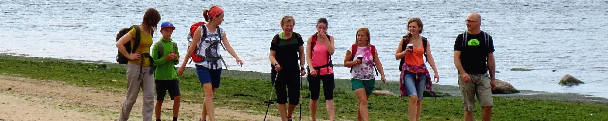

Baltischer Küstenwanderweg - For visually impaired


 3. päev. Bernāti - Liepāja - Karosta.
Linn, kus sünnib tuul
Ranniku matkarada kulgeb Bernātist Liepājani mööda laia rannariba, mida maismaa poolt ääristavad algul paiguti mere poolt uhutud liivakivipaljand, muutudes Liepāja lähedal kõrgeteks eelluideteks. Rada lookleb läbi Liepāja vanalinna ja üle Karosta kanali. Vana sõjasadama Karosta militaar - ja kaitserajatistega tutvumiseks soovitame võtta vähemalt pool päeva. Kindlasti soovitame maitsta Liepāja erirooga, Liepājas menciņi, vana Lõuna-Kuramaa retsepti järgi suitsutursast valmistatud toitu.
Liepāja Beach near the Central Rescue Station
Liepāja rannas, keskpäästejaama lähedal (GPS: 56.504199, 20.991922), on rajatud puuetega inimestele mõeldud asutus. See hõlmab duširuume, riietusruume ja puidust laudteid, mis ulatuvad mereni, võimaldades ratastooliga kasutajatel kaldajoonele jõuda. Saadaval on spetsiaalsed meres ujumiseks sobivad ratastoolid. Pimedate ja vaegnägijate jaoks paigutatakse merre helipoid, mis annavad signaalide kaudu teavet selle kohta, kui kaugele tohib ujuda.


 4. päev. Karosta - Ziemupe.
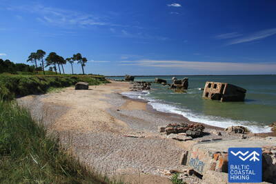
Karosta – Läänemere äärne militaarpärand
Ranniku matkaraja esimesel neljal kilomeetril kohtab erinevaid kaitserajatisi ja rannapatareide varemeid, mis võivad huvi pakkuda sõjaajaloo huvilistele, kuid matkamiseks on tegu kõige keerulisema lõiguga Kuramaa rannikul. Kindluse taga, pärast Cietokšņa kanalit, lookleb rada lühikest aega rannaäärsel niidul, jõudes seejärel rannaribale ja jätkudes mööda randa kuni Ziemupeni. Rannariba on lai, muutudes tugeva tuulega Lenkupe ja Kārļupīte jõgede vahel kitsamaks. Kohati on teel väiksemaid pankrannikuid, kuid valdavalt kulgeb tee mööda kõrgeid, paiguti merre uhutud eelluiteid. Räägitakse, et Ziemupe sügavikus on hukkunud palju laevu ning üks olla põhja läinud koguni koos pronkskahuritega.
Paths at Dvēseles Veldzes Dārzs
Dvēseles Veldzese aias (GPS: 56.728534, 21.092676) on kaks lühikest loodusrada, mis on mõeldud vaegnägijatele ja pimedatele – Paljajalu rada (530 m), Sensoorpark ja Labürint. Paljasjalu raja pind muutub iga 10 meetri järel ja sisaldab erineva raskusastmega takistusi. Sellel saidil on määratud parkla, juurdepääsetav tualettruum, puutetundlikud esemed, heliteave ja punktkirjas teave. See asub Rannaradast umbes 2,5 km kaugusel.


 10. päev. Ventspils - Staldzene.
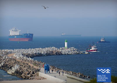
Läbi Ventspilsi linna
Ranniku matkaraja lõik läbib Ventspilsi linna ja seda ümbritsevaid metsi. Matkarada lookleb lõunamuuli juurest läbi ajaloolise Ostgala linnaosa ja vanalinna, üle Venta jõe ning mööda kergliiklusteed läbi Pārventa linnaosa Staldzene poole. Tehes tiiru ümber Ventspilsi sadama naaseb rada taas mereranda. Nüüd tasub võtta üks matkavaba päev ja tutvuda põnevate paikadega Ventspilsi linnas ning külastada ka mereäärset vabaõhumuuseumi.
Lake Būšnieki Nature Trail
Rada ümber Būšnieki järve on 9 km pikkune ring, kuhu pääsevad ratastoolikasutajad ja jalutuskäruga lapsevanemad. Sellel on audiogiid, puutetundlik teave ja parkimisala liikumispuudega inimestele. Soovitatav alguspunkt on järve kaguküljel asuv parkla (GPS: 57.437632, 21.656062). Rada asub Jūrtaka rajast ca 1 km kaugusel.


17. päev. Ģipka - Kaltene.
Kuramaa kivine rand
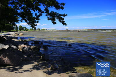
Ranniku matkaraja lõik Ģipkast kuni Rojani kulgeb liivarannal, kus on kaunid luited ja männimetsad. Vahetult enne Rojat on rand kõrkjatesse kasvanud. Roja ja Kaltene kiriku vaheline lõik on aga kogu Läti rannajoone üks omapärasemaid, sest siin sirutuvad merre paljud väikesed maaninad, moodustades lahtesid ja kitsa siksakilise mereranna. Rand on tihedalt täis erinevas suuruses maakive, mille kohale kaarduvad sangleppade võrad. Paiguti kulgeb ranna lähedal kruusatee, mida ääristavad endised kalurite elamud.
Walking Path at Roja Beach
Puidust laudteed on mõeldud ratastoolikasutajatele ja jalutuskäruga lapsevanematele. Olemas on punktkirjas infostend ja kombatav rannakaart. Teenuste hulka kuulub kohandatud WC ja parkla (GPS: 57.510088, 22.799207). Laudtee on 0,5 km pikkune ühes suunas. Kui ratastooliga kasutajad saavad laudteid kasutada, siis kaldtee puudumise tõttu mere äärde ei pääse. Laudteed on laiad, külgedel ja läbipääsualadel kaitsepiiretega.


17. päev. Ģipka - Kaltene.
Kuramaa kivine rand
Ranniku matkaraja lõik Ģipkast kuni Rojani kulgeb liivarannal, kus on kaunid luited ja männimetsad. Vahetult enne Rojat on rand kõrkjatesse kasvanud. Roja ja Kaltene kiriku vaheline lõik on aga kogu Läti rannajoone üks omapärasemaid, sest siin sirutuvad merre paljud väikesed maaninad, moodustades lahtesid ja kitsa siksakilise mereranna. Rand on tihedalt täis erinevas suuruses maakive, mille kohale kaarduvad sangleppade võrad. Paiguti kulgeb ranna lähedal kruusatee, mida ääristavad endised kalurite elamud.
Walking Path at Roja Beach
Puidust laudteed on mõeldud ratastoolikasutajatele ja jalutuskäruga lapsevanematele. Olemas on punktkirjas infostend ja kombatav rannakaart. Teenuste hulka kuulub kohandatud WC ja parkla (GPS: 57.510088, 22.799207). Laudtee on 0,5 km pikkune ühes suunas. Kui ratastooliga kasutajad saavad laudteid kasutada, siis kaldtee puudumise tõttu mere äärde ei pääse. Laudteed on laiad, külgedel ja läbipääsualadel kaitsepiiretega.
21. päev. Ragaciems - Dubulti.
Jūrmala – ajalooline kuurortlinn
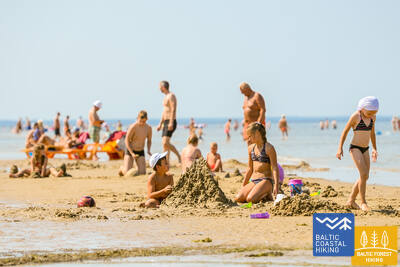
Ranniku matkaraja Ragaciems – Dubulti vahelise lõigu esimene kolmandik kulgeb Ķemersi rahvuspargis, kus saab tutvuda ajalooliste kalurikülade, paadikuuride ja kalaturuga. Starpiņupīte jõe suudmeala on populaarne linnuvaatluskoht. Ragaciemsi külast paistab hästi ka kogu Jūrmala rannajoon. Jaunķemerist kuni Dubultini kulgeb rada mööda Liivi lahe kõige laiemat liivaranda ja läbi Jūrmala ajaloolise kuurortlinna, mis on ühtlasi Läti pikim linn. Ilusate suviste ilmadega on siinses rannas palju suvitajaid.
The Dubulti Coastal Dunes Trail
Aastal 2024/2025 luuakse Jūrtaka raja lõik, mis kohandatakse spetsiaalseks marsruutiks nägemispuudega inimestele.


22. päev. Dubulti - Lielupe - Bulduri.
Läti populaarseimad supelrannad
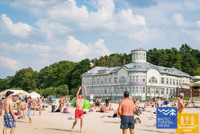
Ranniku matkaraja lõigul Dubulti ja Lielupe vahel paikneb Liivi lahe kõige laiem liivarand – oma lugematute rannakohvikute ja puhkamisvõimalustega on see Jūrmala kuurortlinna suurim väärtus ja tõmbenumber. Rannaäärsetes luitemetsades on tihe rajavõrgustik, mis sobib hästi jalutamiseks ja kepikõnni harrastamiseks. Lielupe ranna ja Jūrmala vabaõhumuuseumi vaheline matkaraja lõik kulgeb Ragakāpa looduspargi territooriumil. Buldurisse saab mugavalt tagasi kõndida mööda Bulduri avenüüd või 5. liini.
The Dubulti Coastal Dunes Trail
Aastal 2024/2025 luuakse Jūrtaka raja lõik, mis kohandatakse spetsiaalseks marsruutiks nägemispuudega inimestele.
31. päev. Ikla - Kabli.
Ajaloolise supluspiirkonna radadel
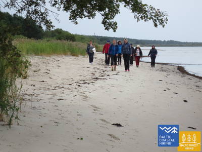
Ranniku matkarada algab Eestis Iklast. Ikla – Treimani lõigul kulgeb teekond mööda vana Riia maanteed. Peale Treimani keerab rada mere poole ja kulgeb järgnevad 2,8 km mööda kitsaid, liivaseid, kiviseid ja kohati võsastunud luiteid. Olles teinud tiiru ümber Orajõe oja, naaseb rada parkla juures luidetele ja viib matkaja umbes 4 km jalutuskäigule kuni Lepanina hotellini. Seal tuleb minna tagasi vana Riia maanteele, mis viib Kablisse. Tee peale jäävad head võimalused linnuvaatluseks. Rannaäärsed alad kuni Pärnuni, linn kaasa arvatud, on ammusest ajast armastatud piirkond vaba aja ja rannapuhkuse veetmiseks.
Kabli
Aastal 2024/2025 on kavas Kabļisse luua infostendide ja nägemispuudega inimestele kohandatud audiogiidiga rada. See asub rannaraja ääres.


38. päev. Tõstamaa - Matsi.
Eesti maaelu idüll
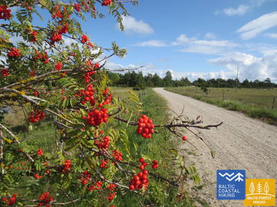
Ranniku matkaraja Tõstamaa – Matsi lõigul näeb tõelist maaelu idülli. Rannajoont liigendavad paljud madalad lahesopid ja poolsaared, mille vahel on rannaniidud, roostikud ja abajad, aga ka ligipääsmatud laiud. Liikudes mööda väikeseid külavaheteid, mida ääristavad sügiseti punetavad pihlakad, saab näha talumajasid ning karjamaid lehmade ja kitsedega. Taluhoovid vahelduvad kiviaedade, põldude ja kadakasaludega. Pääs mere äärde ja puhkekohad asuvad matkarajast lõuna pool, Kastna küla lähedal.
Matsi Port
Rada tutvustab külastajatele endist Matsi kalasadamat. See on 500 meetrit pikk (edasi-tagasi). Rada algab parklast (GPS: 58.360251, 23.746683). Pinnas on asfalt, betoon ja killustik. Tuulise ilmaga võib rada olla kaetud liivaga, mistõttu ratastoolikasutajad võivad abi vajada. Rajal on puutetundlikud objektid ja teave punktkirjas. Olemas on ligipääsetav WC. See asub Jūrtaka kõrval.


39. päev. Matsi - Varbla.
Rannad ja metsad
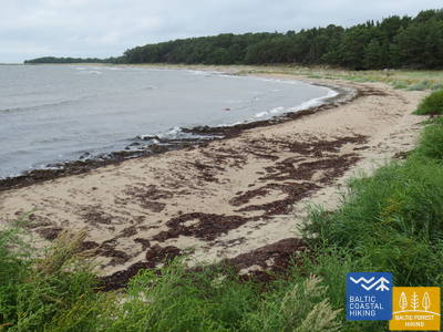
Ranniku matkaraja Matsi – Varbla lõik teeb tiiru läbi Kulli küla ja kulgeb edasi 5 km mööda kohalikke metsade ja luidetega ääristatud teid. See piirkond on sügiseti marja- ja seenerohke. Olles teinud tiiru ümber Uue-Varbla mõisa, jõuab matkarada Varbla külla. Matkaraja lõigul asuv Matsi rand on kuni Haapsaluni üks vähestest liivarandadest.
Matsi Port
Rada tutvustab külastajatele endist Matsi kalasadamat. See on 500 meetrit pikk (edasi-tagasi). Rada algab parklast (GPS: 58.360251, 23.746683). Pinnas on asfalt, betoon ja killustik. Tuulise ilmaga võib rada olla kaetud liivaga, mistõttu ratastoolikasutajad võivad abi vajada. Rajal on puutetundlikud objektid ja teave punktkirjas. Olemas on ligipääsetav WC. See asub Jūrtaka kõrval.
70. päev. Rusnė – Šilutė.
Šilutė – a charming authentic town
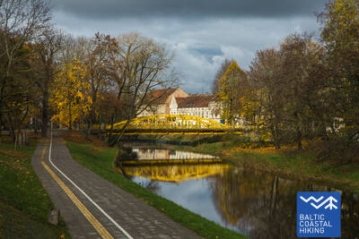
Rusnė külas kulgeb Balti ranniku matkatee mööda Taikose tänavat ja Kuršmarių tänavat, ületades Nemunase delta jaotusala Atmata jõe üle Rusnė silla. Seejärel kulgeb rada eraldi sõidurajana mööda teeserva, jätkates edasi Šilutėsse. Veidi enne Šilutesse jõudmist peavad matkajad kõndima teeservas. Šilutes ületate Šyša jõe ajaloolise silla. Rusnė tänav, mis ühendab Rusnė saart ja Šilutėt, viib teid otse linna keskmesse. Kuni Šilutėni kulgeb Balti ranniku matkatee läbi Nemunase delta regionaalpargi, kus kevaditi ujutavad üle suured alad Nemunase jõe alamjooksul – tänapäeval on need alad põllumaa ja soometsad (Žalgiriai mets).
Šilute
Linna kaks kesktänavat – Lietuvininkų tänav ja Tilžės tänav – on varustatud puutetundlike juhtliinidega nägemispuudega inimestele. See võimaldab läbida linna ligikaudu 1,5 kilomeetrit. See asub Rannaraja lähedal.
71. päev. Šilutė – Ventė.
Through Nemunas Delta Regional Park
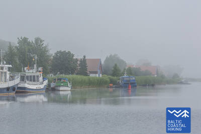
Mööda Klaipėdos tänavat ja Aukštumalės tänavat väljub Balti ranniku matkatee Šilutė linnast Kintai suunas (tee nr 4217), järgides korraks poldritammi tippu (pakkudes head vaadet Nemunase delta madalikule, mis üleujutab kevadel), uidub see mööda maanteed ja pöördub tagasi Aukštmalės tänavale (tee nr 4217). Vähem kui 6 km pärast ristub Rūgailiai küla ristmikul Läänemere ranniku matkatee vasakule Minija poole ja 1,5 km pärast paremale, pöördudes tagasi Šilutė–Kintai maanteele. Balti ranniku matkatee läbib üle kõrge ja pika silla Minija jõe ja Kintai karpkalajärved. Siit avaneb teile üks suurejoonelisemaid vaateid Leedu rannikule koos laiaulatusliku panoraamiga madalikule ja vetele. Enne Povilai külla jõudmist pöörab rada vasakule, mis kulgeb umbes 5 km läbi põllumaa, kus saab rändeperioodil linde vaadelda. Seejärel keerab Balti ranniku matkatee rannaäärsele teele (Marių tänav, tee nr 2201), mis viib 5 km kaugusel asuvale Ventė neemele. Sellelt maalilisel marsruudilõigul avaneb avar vaade Kuramaale üle Kura lahe (lahe laius on siin 8–9 km). Matkajad saavad nautida ka endisi kalurikülasid oma värviliste kaunistatud hoonetega. See rajalõik on osa Nemunase delta regionaalpargist.
Šilute
Linna kaks kesktänavat – Lietuvininkų tänav ja Tilžės tänav – on varustatud puutetundlike juhtliinidega nägemispuudega inimestele. See võimaldab läbida linna ligikaudu 1,5 kilomeetrit. See asub Rannaraja lähedal.