


Лесная тропа прибалтики - Riga and Riga Region

Рига и Рижский район
РЕГИОН КРАСОЧНЫХ КОНТРАСТОВ – ОТ БАШЕН ДО ЛЕСОВ И СКАЛ
Старая Рига – Рамкалны: 56 км, 1 – 3 день
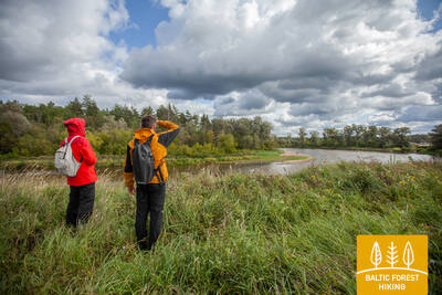
Рига объята лесами, поэтому начав поход в центре города, уже через несколько часов можно оказаться в прекрасном сосновом лесу. Тропа проходит через лесистые приморские дюны, вдоль реки Гауя и по историческому почтовому тракту, который издавна использовался для путешествий в соседние государства. В начале лета на лугах обильно цветет смолка.
Наиболее яркие впечатления: Старая Рига – всемирное наследие ЮНЕСКО, Памятник Свободы и Латвийская Национальная опера, Рижский Центральный рынок – исторические ангары для воздушных судов или дирижаблей, Культурное и природное наследие Верманского парка, Югендстиль улицы Тербатас, Латвийский этнографический музей под открытым небом, Насосная станция в Балтэзерсе – индустриальное наследие, Сад артистов Анны Лудини, Охотничий замок в Инчукалнсе, Охотничья тропа и Инчукалнская пещера Велнала.

 1-й этап. Старая Рига – Балтэзерс.
Сквозь Ригу – объект Всемирного наследия ЮНЕСКО
В Латвии Лесная тропа начинается в самом сердце Старой Риги – на Ратушной площади. Тропа идет по улице Калькю, мимо Памятника Свободы, через Верманский парк и по исторической улице Тербатас. Далее она устремляется к пешеходному мосту, пересекает железнодорожную станцию «Земитану» и продолжается в Бикерниекском лесу и лесном массиве Шмерлис. Лесная тропа проходит через Юглу, мимо Латвийского этнографического музея под открытым небом и по пешеходно-велосипедным дорожкам приводит в Балтэзерс.
2-й этап. Балтэзерс – Вангажи.
По исторической дороге Тербатас вдоль озер и реки Гауи
По туннелю Лесная тропа пересекает автодорогу VIA Baltica и, оставляя за собой тихие коттеджные районы, устремляется к берегам озера Малый Балтэзерс. Там тропа поворачивает на восток и следует вдоль канала Гауя – Балтэзерс. По обеим сторонам Лесной тропы на отрезке пути Гаркалне – Ани простираются живописные луга, утопающие в цветах красной смолки, белой ромашки и желтых лютиков. В средние века пути пролегали вдоль Гауи с паромной переправой в Илькене. Миновав Ани, Лесная тропа проходит как по лесным участкам, так и по сельским населенным пунктам, и по улице Гауяс приводит в Вангажи.
3-й этап. Вангажи – Рамкални.
Мимо Охотничьего замка в Инчукалнсе к национальному парку "Гауя"
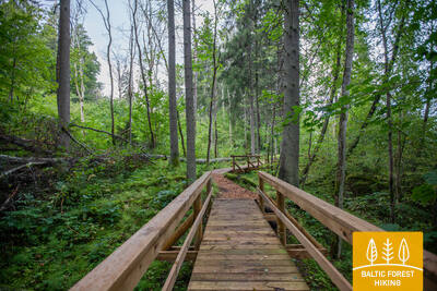
Миновав Вангажи, Лесная тропа разветвляется на маленькие тропинки и приводит к Вангажской лютеранской церкви и сосне Вилкачу. Направляясь к Охотничьему замку по так называемой Екатерининской дороге, тропа ненадолго исчезает в лесу. Путь от Охотничьего замка проходит по Могучей охотничьей тропе. Этот участок имеет очень выразительный рельеф: здесь впервые можно увидеть овраги, образовавшиеся на склонах древней долины Гауи. В одном из них, окруженная древними руслами Гауи, находится Инчукалнская пещера Велнала. Миновав пещеру, Лесная тропа ныряет в прибрежные луга Гауи, а затем пересекает автодорогу Мурьяни – Валмиера, на краю которой стоит парк отдыха «Рамкални».