


Baltijos Miško tako naujienos
Jūrų takas Facebook naujienų kanalas


Miško Takas Facebook naujienų kanalas


Savanorystės judėjimo Latvijoje pradžia – įkvėpta Norvegijos patirties
Šių metų gruodžio 8 d. Tukumas tapo svarbia susitikimų vieta pagal Kuržemės planavimo regiono įgyvendinamą iniciatyvą, kuria skatinama savanorystė ir įtraukusis turizmas Latvijoje. Renginys vyko Europos ekonominės erdvės finansinės priemonės programos „Vietos plėtra, skurdo mažinimas ir kultūrinis bendradarbiavimas“ dvišalio bendradarbiavimo fondo lėšomis, įgyvendinant projektą „Baltijos ir Šiaurės šalių patirties mainai savanorystės ir įtraukiojo turizmo skatinimo srityje“.
Susitikimo tikslas buvo pasidalyti mainų kelionės metu įgyta Norvegijos patirtimi ir aptarti savanorių judėjimo Latvijoje įkūrimo perspektyvas bei galimybes. Renginys buvo skirtas savanoriams, kurie anksčiau dalyvavo kuriant tolimųjų žygių maršrutus, tokius kaip „Mežtaka“ ir „Jūrtaka“.
Nors iš pradžių paraiškas pateikė daugiau nei 15 dalyvių, susitikime dalyvavo 9 savanoriai – skaičius pasirodė esąs pakankamas vertingam dialogui pradėti ir savanorių organizacijos pamatams padėti. Pagrindinis susitikimo rezultatas buvo dokumentų, skirtų asociacijos (kurios pavadinimas iki įsteigimo liks paslaptyje) registracijai Latvijos Respublikos įmonių registre 2025 m. sausio mėn., parengimas.
Šis renginys žymėjo reikšmingą žingsnį Latvijos savanorių judėjimo plėtroje ir padėjo pamatus ilgalaikiam bendradarbiavimui, kuris prisidės prie regioninės plėtros ir įtraukios turizmo patirties. Ši kelionė ir susitikimas neabejotinai taps ilgalaikiu indėliu į Latvijos turizmo ir visuomenės plėtrą, įkvėpti gerosios praktikos pavyzdžių Norvegijoje.
Kuržemės planavimo regionas didžiuojasi šios iniciatyvos svarba ir kviečia visus, norinčius kurti įtraukesnę ir dinamiškesnę visuomenę Latvijoje, prie jos prisijungti.
Savanorių judėjimo susitikimas buvo organizuotas pagal 2014–2021 m. Europos ekonominės erdvės finansinės priemonės programą „Vietos plėtra, skurdo mažinimas ir kultūrinis bendradarbiavimas. Kuržemės planavimo regionas įgyvendina Dvišalio bendradarbiavimo fondo DSF iniciatyvą „Baltijos ir Šiaurės šalių patirties mainai savanorių judėjime dalyvavimo ir įtraukiojo turizmo skatinimo srityje“.
Informaciją parengiau aš, o daugiau informacijos apie šią iniciatyvą gali suteikti:
Aija Neilande
aija.neilande@kurzemesregions.lv
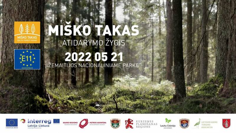
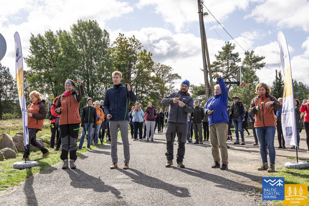
Miško tako atidarymo žygis
Kviečiame kartu atidaryti net 2141 km per Baltijos šalis besidriekiančio Miško tako maršruto dalį Lietuvoje.
Žygio metu įveiksime vieną iš gražiausių Miško tako atkarpų, vingiuojančią tarp didžiausių Žemaitijos nacionalinio parko ežerų: Paplatelė – Plateliai: https://baltictrails.eu/lt/forest/day/162.
Konferencija. TAKAI: TINKA ŽYGEIVIAMS. TINKA BENDRUOMENĖMS. TINKA EKONOMIKAI.
Konferencijoje bus plačiau išryškinti žygių privalumai, pristatont juos ne tik kaip veiklą lauke ar alternatyvų keliavimo būdą, bet ir kaip priemonę pritraukti keliautojus, stiprinti bendruomenes palei takus ir skatinti vietos verslininkus, taip prisidedant prie atitinkamos visuomenės gerovės. Popietės diskusijoje bus kviečiami išklausyti žygeivius iš Estijos, Latvijos ir Lietuvos, kurie pasidalins savo patirtimi ir pasikeis nuomonėmis apie miško taką ir pakrantės maršrutą Latvijoje ir Lietuvoje.
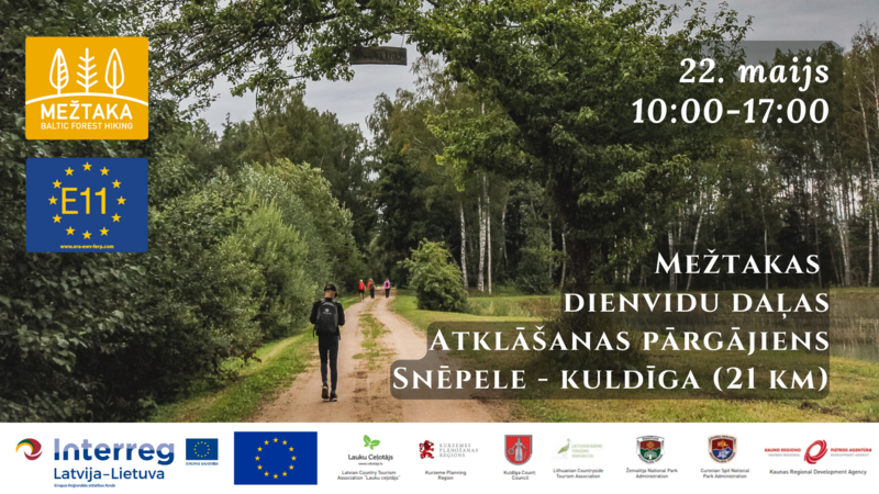
Gegužės 22 dieną pavasario žygis „Miško takas“ iš Snepelės į Kuldygą
Gegužės 22 d. prisijunkite prie 21 km žygio „Mežtakas“, vykstančio Mežtakos Nr. 92 atkarpoje nuo Snėpelės iki Kuldygos. Turėkite žygio batus, geriamojo vandens, atsargines kojines ir orui tinkamus drabužius. Žygis prasidės nuo Snēpelės dvaro. Logistikos problemoms išspręsti bus organizuotas autobusas iš Kuldygos į Snēpelę, kuris visus dalyvius nuveš į pradinį tašką.
>>> PEREINAMOJO LAIKOTARPIO PROGRAMA (PDF)
Registracija į žygį >>> https://forms.gle/kTVamlHiVK7w46fo9 .
Dalyvavimas žygyje nemokamas. Norėdami gauti daugiau informacijos, susisiekite el. paštu aija.neilande@kurzemesregions.lv .
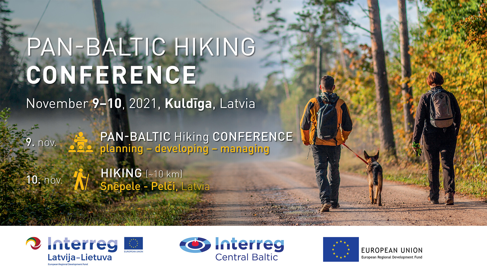
Lapkričio 9-10 d. Kuldygoje, Latvijoje, vyksianti Pan-Baltic Hiking konferencija
2021 m. lapkričio 9–10 d. Kuldygoje (Latvijoje) vyksiančioje visos Baltijos šalių žygeivių konferencijoje bus pagerbta Baltijos šalių takų (baltictrails.eu) sėkmė, jungianti Estiją, Latviją ir Lietuvą su Europos žygeivių takų tinklu kaip E9 (Baltijos pakrantės žygiai) ir E11 (Baltijos miškų takas) maršrutų dalis.
Konferencijoje suinteresuotosios šalys dalinsis patirtimi planuojant, įgyvendinant, valdant ir prižiūrint ilgo nuotolio tarpvalstybinius pėsčiųjų takus. Pagrindiniuose pranešimuose bus pristatyta Baltijos šalių, Švedijos ir Norvegijos patirtis. Po pranešimų vyks Baltijos šalių diskusijos, kuriose bus aptariami praktiniai iššūkiai ir sprendimai, pavyzdžiui, vietos gyventojų pripažinimas ir parama, ilgo nuotolio pėsčiųjų takų nauda ir tvarumas.
Konferencija vyks laikantis nacionalinių epidemiologinio saugumo priemonių. Vietoje galės dalyvauti tik pakviesti dalyviai: projekto partneriai ir kiti tiesiogiai dalyvaujantys asmenys iš 3 Baltijos šalių bei konferencijos pranešėjai. Visiems kitiems užtikrinsime kokybišką ir aktyvų dalyvavimą internetu per „Zoom“, kur bus galima prisijungti prie diskusijų ir užduoti klausimus žodžiu ir raštu.
Antrąją konferencijos dieną bus siūlomas 10 km žygis Miško tako 92-ąja atkarpa, Snēpele–Pelči , daugiausia dėmesio skiriant tako tvarkymui, susitikimams su savivaldybės atstovais ir takų valdytojais. Laikysimės galiojančių saugos taisyklių ir tikimės, kad antrąją dieną visi dalyviai galės susitikti gyvai žygio metu lauko renginio forma. Užpildykite registracijos formą ir laukite mūsų patvirtinimo!
Renginys bus organizuojamas hibridiniu būdu – vietoje (kviestinė auditorija iki 50 asmenų, laikantis galiojančių saugos taisyklių. Dalyvauti galima tik turint COVID-19 skiepijimo arba pasveikimo pažymėjimą) ir internetu. Konferencijos darbo kalba – anglų.
Prašome užsiregistruoti, kad gautumėte konferencijos „Zoom“ nuorodą!
>>>Registracija vyksta iki 2021-10-27.
>>> Visa programa (PDF) .
Konferencijos darbo kalba yra anglų.
>>> Kontaktai ir informacija: anna@celotajs.lv .
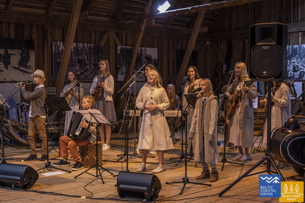
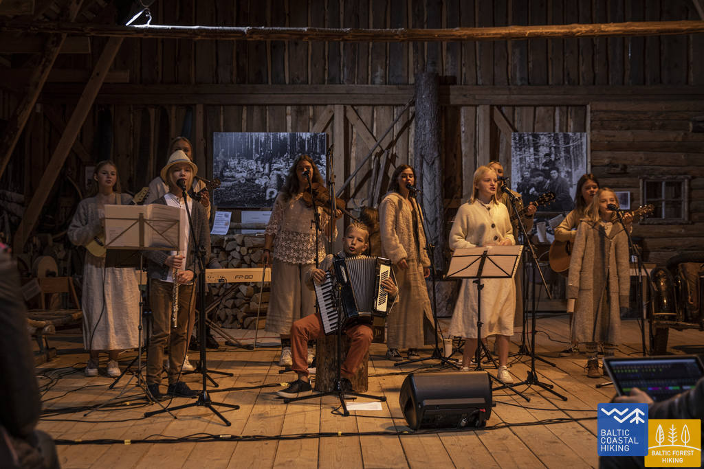
Tai buvo žygeivių festivalis Lahemoje!
2021 m. rugsėjo 25 d.
Dėkojame visiems, kurie padėjo šiai dienai tapti tokia nuostabia! Tai buvo šiaurinės Baltijos miškų žygio dalies atidarymas. Kartu su maždaug 200 žygeivių iš skirtingų šalių šventėme didįjį žygio tako atidarymą 13 km ilgio žygiu, kalbomis, gardžiu maistu, šokiais ir muzika. Štai keletas nuotraukų iš didžiosios dienos. Daugiau nuotraukų iš festivalio galite rasti šioje nuorodoje: ALBUMAS
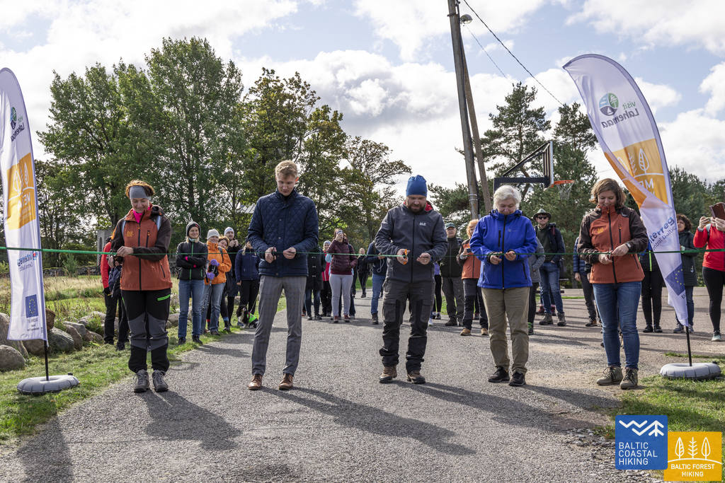


Rugsėjo 4 d. Lahemoje vyks žygių festivalis – didysis Miško tako, kuris yra E11 ilgojo nuotolio žygių maršruto Baltijos šalyse dalis, atidarymas.
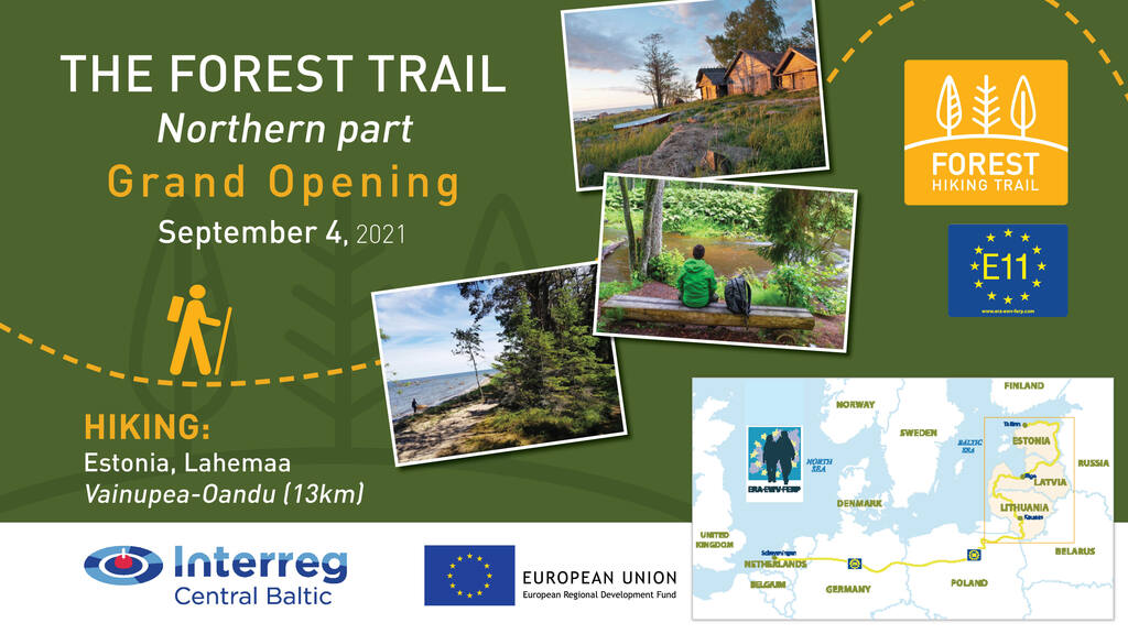
2021-08-12
Rugsėjo 4 d. Lahemaa nacionaliniame parke, Estijoje, vyksiančio žygio metu bus atidarytas Miško takas, kuris yra Europos pėsčiųjų takų tinklo E11 ilgojo nuotolio žygio dalis. Visi kviečiami prisijungti prie 13 km ilgio pirmojo žygio nuo Vainupea iki Oandu kaimų Lahemaa nacionaliniame parke:Miško tako 41 atkarpa .
Talinas Estijoje yra galutinė Europos pėsčiųjų takų tinklo E11 ilgojo nuotolio pėsčiųjų tako stotelė. E11 maršrutas driekiasi: Ševeningenas (NL)–Osnabriukas (VOK)–Potsdamas (VOK)–Poznanė (PL)–Ogrodnikai (PL)–Lazdijai (LIT)–Ryga (LAT)–Talinas (EST).
Renginio PROGRAMA ir REGISTRACIJA .
!!!! Dalyvauti galės tik tie asmenys, kurie gali pateikti COVID-19 pažymėjimą arba kurių testo rezultatas neigiamas ne anksčiau kaip prieš 72 valandas.
Miško takas Baltijos šalyse veda per miškingiausias Lietuvos, Latvijos ir Estijos vietoves, regioninius, gamtos ir nacionalinius parkus. Maršrutas prasideda nuo Lenkijos ir Lietuvos sienos netoli Lazdijų miesto, veda per Latviją, pasukdamas į Rygą, ir baigiasi Taline, Estijoje. Maršrutas suskirstytas į ~20 km ilgio vienos arba dviejų dienų atkarpas su apgyvendinimo ir transporto galimybėmis.
Rugsėjo 4 d. prasideda užsiregistravusių dalyvių susibūrimas Oandu kaime, galutiniame taške. Jie ten pastatys savo automobilius ir autobusu bus nuvežti į pradžios tašką Vainupea kaime. Prieš žygio pradžią Miško takas bus oficialiai atidarytas E11 projekto metu, kurį žygeiviams kreipsis ERA – Europos klajoklių asociacijos – atstovas.
13 km žygis iš Vainupea į Oandu prasidės 12:00 val. Dalyviai pietaus Mustojos laužavietėje. Toliau maršrutas driekiasi per istorinį Altjos pajūrio kaimą su pakrantės ūkiais, tinklų sandėliukais ir smukle.
Žygis baigsis popietę, apie 16 val. atvykstant į Oandu kaimą. Renginys baigsis sveikinimais, padėkomis, vaišėmis ir vietinės jaunimo folkloro grupės „Uurikad“ koncertu.
Miško takas kviečia visus leistis į žygį bet kuriuo metu, su gidu ir žemėlapiu rankose, sekant ženklinimo ženklus ir kelio ženklus. Kiekvienos atkarpos maršruto GPX failus galima atsisiųsti iš https://baltictrails.eu/en/forest . Svetainės turinys pritaikytas mobiliesiems įrenginiams. Informacijos apie Miško taką taip pat galima rasti daugelyje žygių programėlių https://baltictrails.eu/lv/forest/apps . Patartina atsispausdinti duomenis, kurie bus naudingi vietovėse, kuriose prastas mobiliojo ryšio ryšys.
Iki pasimatymo Miško take!

Paslaugų ženklas „Draugiški žygeiviams“
28.10.2020
Kas yra „Draugiški žygeiviams“?
Žygeiviai yra gamtos mylėtojai, turintys artimą ryšį su juos supančia aplinka, tačiau taip pat norintys pažinti vietinius papročius, tradicijas bei žmones. Labai svarbu sukurti tokią aplinką, kad jie jaustųsi laukiami ir galėtų patogiai žygiuoti bei mėgautis. Tokį pojūtį visų pirma kuria vaizdinė informacija, pvz., informaciniai stendai, nuorodos, tinkamai parengta informacinė medžiaga, teminės knygos ir vadovai. Žygeiviai tikisi rasti reikalingų prekių vietos parduotuvėse ir sutikti supratingų, geranoriškų ir jiems padėti pasirengusių paslaugų teikėjų.
Paslaugų ženklas „Draugiški žygeiviams“ – tai simbolis, rodantis, kad žygeiviai čia yra laukiami. Šis ženklas yra gerai atpažįstamas visame pasaulyje, todėl jį pamatę keliautojai aiškiai supranta, kad jų poreikiai bus patenkinti ir paslaugos teikėjas galės jiems padėti bei suteikti informacijos apie apylinkes
Žygeiviai ir turizmo paslaugų teikėjai šio draugiško ženklo kriterijus ir gaires gali rasti čia: https://baltictrails.eu/en/forest/marketing
Kviečiame pasimėgauti aktyviu poilsiu Miško takuose ir kituose pėsčiųjų maršrutuose, kad patys įsitikintumėte žygeiviams draugišku svetingumu!
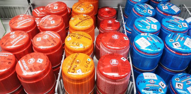
Apsipirkimas maršrute
Surinkome informaciją apie parduotuves „Miško tako" trasose, kuriose galima įsigyti mažų dujų balionėlių. Ilgų distancijų žygeiviai šią įrangą dažniausiai naudoja ruošti kavai, arbatai ar valgiui.
Apibendrintą informaciją rasite čia: https://baltictrails.eu/en/forest/route/info - skiltyje "Naudingi patarimai".
Teprasideda „Miško tako“ žygis po Baltijos šalis!
05.07.2021
„Miško takas“ – tai pėsčiųjų maršrutas, vedantis pro gražiausius Lietuvos, Latvijos ir Estijos miškus. Galite apsilankyti „Mežtaka“ interneto svetainėje, kurioje pateikta žygių ar pasivaikščiojimų planavimui naudinga informacija. Išsiruošti į žygį miške galite kad ir kitą savaitgalį – pradėti galite čia, nuo Latvijos maršruto atkarpos!
Jau dabar Lietuvoje ir Latvijoje žymimi paskutiniai „Miško tako“ kilometrai. Visgi, jau galite pradėti žygiuoti, pasinaudodami aprašymais, žemėlapiais ir atsisiunčiamais GPX maršrutais. „Miško tako“ interneto svetainė vis dar kuriama, taigi gali būti pateikta neišsami informacija, pvz., gali nebūti nuotraukų arba trūkti aprašymo tam tikra kalba. Planuodami netolimą atostogų kelionę, pasinaudokite aprašymuose pateikta kontaktine informacija ir iš anksto susisiekite su reikiamais paslaugų tiekėjais, pvz., apgyvendinimo ir maitinimo paslaugų tiekėjais, kad įsitikintumėte, kad jie dirbs tuo metu, kai atvyksite.
Prie kiekvienos „Miško tako“ žygio dienos yra aprašymas – nurodomos starto ir finišo vietos, numatoma trukmė, kelio danga, ką verta pamatyti pakeliui. Galite pasiskaityti apie įdomiausias vietas, kraštovaizdį, gamtos paminklus, taip pat peržiūrėti jų nuotraukas, kad eidami pro šalį jų nepraleistumėte. Taip pat pateikiama informacija apie tai, kur galima pavalgyti, nusipirkti vandens ir užkandžių, pernakvoti. Maršruto aprašyme ir žemėlapyje nurodyta, kurios atkarpos tinka trumpesniems pasivaikščiojimams.
Bendras „Miško tako“ ilgis ~ 2141 km. Kai bus atvertos sienos, taip pat galėsite mėgautis miškais ir grynu oru kitose Baltijos šalyse. Lietuvoje „Miško takas“ veda pro Žemaitijos ir Aukštaitijos nacionalinius parkus, Nemuno kilpų regioninį parką ir Kauną. Latvijoje „Miško takas“ veda pro Gaujos nacionalinį parką, Ziemelgaujos ir Veclaicene saugomas kraštovaizdžio teritorijas. Estijoje „Miško takas“ veda pro Hanjos aukštumas, Setų žemę (Setomą) ir palei Peipaus ežero pakrantę iki Šiaurės Estijos, toliau takas veda Šiaurės Estijos pakrante ir pro Lahemos pusiasalio nacionalinį parką iki Talino. „Miško takas“ yra tarptautinė Europos ilgų atstumų pėsčiųjų maršruto E11 dalis.
Nepraleiskite galimybės pabūti gamtoje gražiausiu metų laiku – pavasarį. Pirmyn į mišką!