


Metsa matkarada - Riia ja Riaa piirkond

Riia ja Riaa piirkond
MAALILINE KONTRASTIDE PIIRKOND – TORNIDEST METSADE JA KALJUDENI
Riia vanalinn – Rāmkalni: 56 km, 1.-3. päev
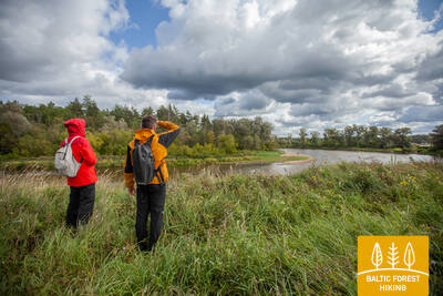
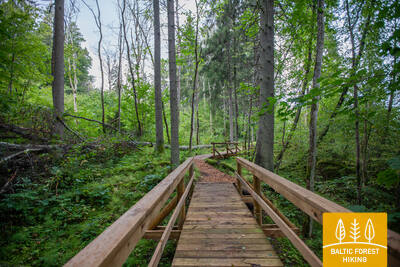
Riia on ümbritsetud metsaga, sellepärast on linna keskusest võimalik vaid paari tunniga jõuda kaunite männimetsade keskele. Rada lookleb metsaste rannikuluidete vahel, Gauja (Koiva) jõe ääres ja mööda ajaloolist postiteed, mida kasutati naaberriiki rändamiseks juba muistsetel aegadel. Suve algul õitseb heinamaadel rikkalikult tõrvalilli.
Vaatamisväärsed kohad: Riia vanalinn – UNESCO maailmapärand, Vabadussammas ja Läti Rahvusooper, Riia Keskturg – ajaloolised õhusõidukite ehk tsepeliinide angaarid, Vērmane aia kultuuri- ja looduspärand, Tērbata tänava juugendstiil, Läti Etnograafiline Vabaõhumuuseum, Baltezersi järve pumbajaam – tööstuspärand, Anna Ludiņa Kunstnike aed, Inčukalnsi jahiloss, Inčukalnsi Kuradikoobas.

 1. päev. Riia vanalinn ‒ Baltezers.
Läbi Riia ‒ UNESCO maailmapärandi meistriteos
Metsa matkaraja alguspunkt Lätis asub Riia vanalinnas, Raekoja platsil. Rada kulgeb piki Kaļķu tänavat, mööda Vabadussambast, läbi Vērmane aia ja jätkub Tērbata (Tartu) maanteel, ületab Zemitāni raudteejaama jalakäijate silla ning suundub Biķernieki ja Šmerlise metsadesse. Tee läbib Läti etnograafilise vabaõhumuuseumi ja kulgeb mööda kergliiklusteed Baltezersi külani.
2. päev. Baltezers‒Vangaži.
Ajalooline Tartu maantee Gauja (Koiva) jõe kallastel
Metsa matkarada ületab tunneli kaudu Via Baltic maantee ja kulgeb läbi Mazai Beltezersi järve eramupiirkonna. Seejärel suundub tee piki Gauja-Baltezersi kanalit itta. Garkalne-Āņi lõigus laiuvad kahel pool teed kaunid niidud, mida suvel ehivad punane pusurohi, valge karikakar ja kollane tulikas. Juba iidsetest aegadest saati on Gauja jõe kallastel kulgenud tähtsad ühendusteed; üle jõe on pääsenud Iļķenes parve või praamiga. Pärast Āņi küla suundub metsa matkarada läbi metsade ja asustatud kultuurmaastiku, kuni jõuab Gauja tänavat pidi Vangažisse.
3. päev. Vangaži‒Rāmkalni.
Läbi Anna Ludina Kunstnike aia Gauja rahvusparki
Pärast Vangažit kulgeb metsa matkarada väiksematel teedel, mööda Vangaži kirikust ja Libahundimännist. Teel jahilossi juurde möödub rada ooperilaulja Anna Ludiņa rajatud arboreetumist ja järgib seejärel jahirada. Siin on juba näha Gauja ürgoru sügavaid kõrvalorge. Üks selline reljeefne kõrvalorg asub Kuradikoopa (Inčukalns Velnala) juures, mida ümbritsevad Gauja jõe vanajõgede jupid ehk soodid. Siit edasi kulgeb matkarada niitude vahel, ületab Murjāņi-Valmiera maantee ja jõuab Rāmkalni puhkeparki, mis asub juba Gauja rahvuspargis.