65. Etappe. Pervalka (dt.Perwelk)- Juodkrantė (dt. Schwarzort).
 Sehenswert
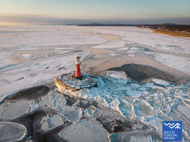
1. Leuchtturm vom Žirgų ragas (dt. Pferde Kap/Horn) - auf einer künstlich geschaffene Insel im Jahr 1990 errichtetes Gebäude ist der einzige Leuchtturm der nicht auf dem Festland außerhalb des Kurischen Haffs steht.GPS: 55.41968, 21.11445
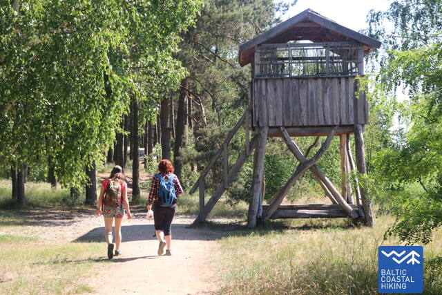
2. Vogelbeobachtungsturm. GPS: 55.41734, 21.10342
3. Lehrpfad des Naturschutzgebietes von Nagliai (dt. Neegeln). Das ist der einzige Ort im Reservat, an dem das Königreich der Toten Dünen (lt. Mirusių kopos) zu betreten möglich ist. Hier kann man die wüstenähnliche Sandlandschaften bewundern, die Geschichte der versandeten Dörfer erfahren, sowie seltene Tier- und Pflanzenarten kennenzulernen. Ein tolles Erleben. GPS: 55.44060, 21.07537
4. Avikalnis (dt. Berg des Scharfes). Auf dem höchsten Punkt der Straße Nida – Smiltynė befindet sich ein eingerichteter Weg mit einer neuen Aussichtsplattform.
GPS: 55.51362, 21.11063
5. Reiher- und Kormorankolonie. Die Kolonie mit mehr als 3.000 Kormoran- /und Nester von 200 Graureiher - ist eine der größten Kolonien der wunderbaren Vögel in ganz Litauen.
GPS: 55.51868, 21.11199
6. Raganų kalnas (dt. Hexenberg ). Dies ist eine Exposition von Holzskulpturen, installiert auf den alten Promenaden des Kurortes, die die Personagen der litauischen Märchen und die Fabelwesen der Kurischen Nehrung darstellen. GPS: 55.53681, 21.11022
7. Küstengalerie des Litauischen Nationalmuseums für Kunst (lt. Lietuvos nacionalinio dailės muziejaus Pamario galerija). GPS: 55.53189, 21.11797
8. Ausstellung von Steinskulpturen in Juodkrantė (lt. Akmens skulptūrų ekspozicija Juodkrantėje). GPS: 55.53544, 21.11865
9. Historische Ausstellung des Kulturzentrums von Ludvikas Rėza (lt. Liudviko Rėzos kultūros centro istorinė ekspozicija). GPS: 55.54217, 21.12145
10. Historische Villen in Juodkrantė (lt. Schwarzort). Juodkrantė war der erste Kurort auf der Kurischen Nehrung, wohin die Urlauber aus Litauen und Deutschland mit Dampfschiffen kamen. Über die goldene Zeit des Ressorts am Ende des 19. und Beginn des 20. Jahrhunderts erinnern die luxuriöse Villen. GPS: 55.54465, 21.12252


