


70. Etappe. Rusnė (dt. Ruß) – Šilutė (dt. Heydekrug). Nemunas delta.
70. Etappe. Rusnė (dt. Ruß) – Šilutė (dt. Heydekrug).
Sehenswert
 Sehenswert
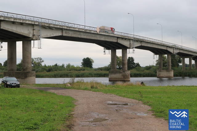
|
|
In 2020, a new overhead road was opened above the meadows flooded in the Nemunas Delta. In springtime, flooded meadows and forests can be seen from here. |
|
|
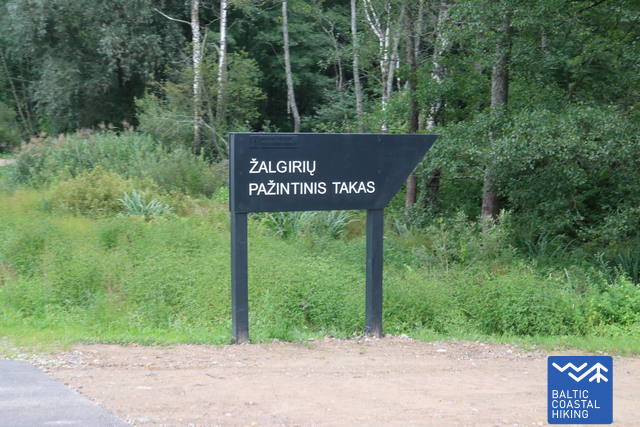
Žalgiriai Village dating back to the end of the 19th century was the largest colony of marshland residents. The history of this unique settlement and interesting facts about local nature are presented in the 2-km-long trail. |
|
|
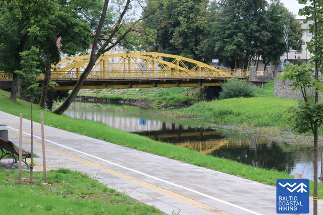
The bridge was built in 1926 and named after the President of those times. It is one of the most complex and awe-inspiring bridges constructed during the interwar period in Lithuania. |
|
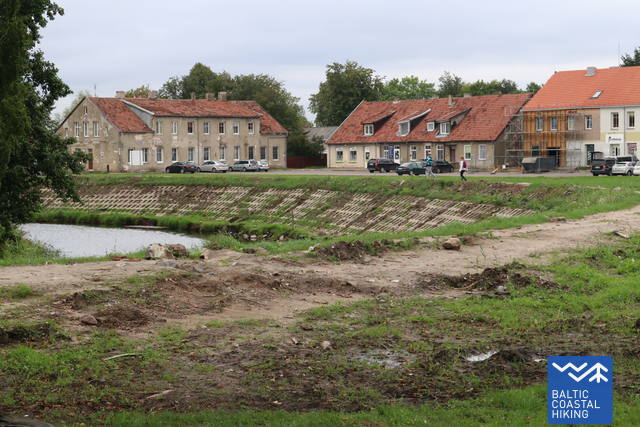
The history of Šilutė started with this manor. |
|
The walkway of Lietuvininkų Street hides unique glass-paned miniature rooms with fragments of the lives once passed in the historical houses of Šilutė from the end of the 19th century to the beginning of the 20th century. |
|
|
The bridge across the Šyša River was constructed in 1914. It is an urbanistic monument of the Old Town. |
|
This was the most important place of the entire town right until the Second World War. This is where weekly markets and fairs were held. The first tavern that started the expansion of Šilutė was built near the Market Square. |
|
The entire history of the town is depicted on a 500-meter-long wall of a furniture manufacturing facility. It contains the most important events and prominent local figures. |

1. Brücke von Rusnė über den Nemunas (Atmata). GPS: 55.30170, 21.38143
2. Estakada durch überflutete Wiesen. Im Jahr 2020 m. wurde eine neue Überführung über die überschwemmten Wiesen des Nemunas-Deltas eröffnet. Es bietet während des Frühjahrshochwassers einen Blick auf überflutete Wiesen und Wälder.
GPS: 55.30782, 21.41006
3. Lehrpfad Žalgiriai. Am Ende des 19. Jahrhunderts gründete Einwohner das Dorf Žalgiriai - die größte Kolonie der Sümpfer. Auf dem fast 2 km langen Wanderweg lernt man die Geschichte dieses außergewöhnlichen Dorfes und die Besonderheiten der Natur des Ortes kennen. GPS: 55.31485, 21.43358
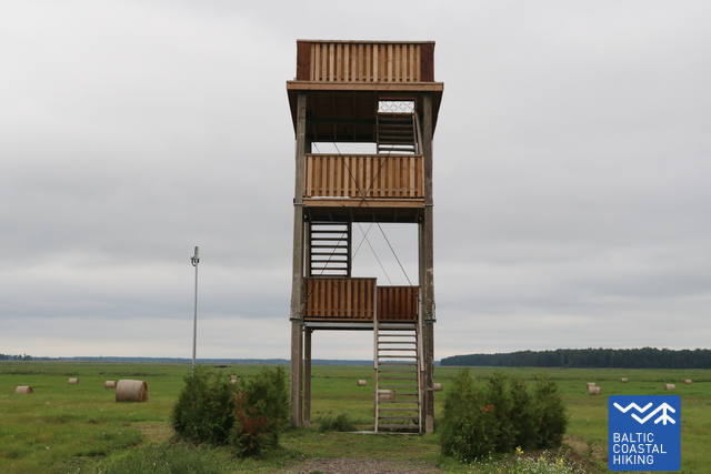
4. Aussichtsturm. GPS: 55.31950, 21.44767
5. K. Griniaus-Brücke über die überflutete Wiesen. Die im Jahr 1926 erbaute Brücke erhielt den Namen des damaligen Präsidenten. Es ist eines der beeindruckendsten und komplexesten Ingenieurbauten des unabhängigen Litauens zwischen den Kriegen.
GPS: 55.32302, 21.45384
6. H. Šojaus Gut-Museum in Šilutė. Die Geschichte der Stadt Šilutė ging von diesem Herrenhaus aus. GPS: 55.34069, 21.46018
7. Šilutės „sekretai“ (dt. Geheimnisse von Šilutė). Auf dem Bürgersteig der Hauptstraße Lietuvininkų befinden sich einzigartige, mit Glas verkleidete Räume, in denen das Leben der Vergangenheit, das am Ende des 19. und Anfang des 20. Jahrhunderts in den historischen Häusern von Šilutė stattfand, wiederhergestellt wird. GPS: 55.34173, 21.46350
8. Metallbrücke über den Fluss Šyša. Die Brücke wurde 1914 über den Fluss Šyša erbaut und zählt zu den urbanistischen Denkmäler der Altstadt. GPS: 55.34104, 21.45897
9. Alter Marktplatz. Bis zum Zweiten Weltkrieg war das der wichtigste Platz in der Stadt. Hier fanden Wochenmärkte und Handelsgeschäfte statt. In der Nähe des Marktplatzes wurde die erste Taverne gebaut, von dort aus begann dann Šilutė sich zu entwickeln.
GPS: 55.34252, 21.45813
10. Wand von Šilutė. Die 500 Meter lange Mauer rund um die Möbelfabrik beinhaltet die gesamte Geschichte der Stadt – die wichtigsten Ereignisse und bedeutendsten Persönlichkeiten des Landes. GPS: 55.34345, 21.45967