


Miško takas - Ryga ir Rygos regionas

Ryga ir Rygos regionas

VAIZDINGAS KONTRASTO REGIONAS – NUO BOKŠČIŲ IKI MIŠKŲ IR UOLŲ
Rygos senamiestis – Rāmkalni: 54 km, 1 – 3 diena
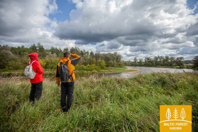
Rygos miestas yra apsuptas miškų, o tai reiškia, kad jei pradėsite žygį pačioje miesto širdyje, po poros valandų atsidursite nuostabiame spygliuočių miške. Takas veda miškinga pakrantės kopų zona, palei Gaują ir istoriniu pašto keliu, kuriuo kažkada buvo keliaujama į kaimynines šalis. Vasaros pradžioje pievose puikuojasi žydinčios muselės.
Rygos senamiestis – UNESCO pasaulio paveldo objektas, Laisvės paminklas ir Latvijos nacionalinis operos teatras, Rygos centrinis turgus – istoriniai lėktuvų (cepelinų) angarai, Vērmanės sodo parko kultūros ir gamtos paveldas, Art Nouveau pastatai Tērbatas gatvėje, Etnografinis atviras Latvijos oro muziejus, Rygos vandens tiekimo muziejus – pramonės paveldas, Annos Ludiņa menininkų sodas, Inčukalno medžioklės rūmai, Medžioklės takas ir Inčukalns Velnala (Velnio) urvas.

 Atkarpa 1. Rygos senamiestis - Baltezers.
Per Rygą – UNESCO pasaulio paveldo vietą
Miško tako pradžia Latvijoje yra pačioje Rygos senamiesčio širdyje, Rotušės aikštėje. Maršrutas veda Kaļķu gatve, eina pro Laisvės paminklą, per Vērmanės sodą ir palei istorinę Tērbatas gatvę. Tada jis vingiuoja per Zemitani geležinkelio stoties pėsčiųjų tiltą ir žengia į Biķerniekų ir Šmerlio miškus. Miško takas vingiuoja per Juglą, praeina Latvijos etnografinį muziejų po atviru dangumi ir eina pėsčiųjų-dviračių taku iki Baltezero.
Atkarpa 2. Baltezers - Vangaži.
Istoriniu Tērbata keliu palei ežerus ir Gaujos upę
Miško takas tuneliu kerta VIA Baltica greitkelį ir eina per privatų būstą prie Mažojo Baltezero ežero. Paskui Gaujos-Baltezero kanalu pasuka į rytus. Ruože Garkalnė–Aniai abipus Miško tako driekiasi gražios pievos, vasarą paskęsta žydinčių raudonųjų skraidynų, baltųjų ramunėlių ir geltonųjų vėdrynų krūvose. Gaujos pakrantėmis nuo senų laikų driekėsi viduramžių keliai, o keliautojai persėsdavo keltu ties Iļķene. Už Anių Miško takas eina per miškingas vietoves ir apgyvendintą kaimo vietovę, o galiausiai Gaujos gatve pasiekia Vangažus.
Atkarpa 3. Vangaži - Rāmkalni.
Palei Inčukalno medžioklės rūmus link Gaujos nacionalinio parko
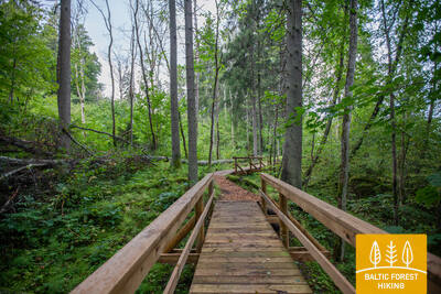
Išvažiavus iš Vangažių Miško takas veda mažesniais takeliais, pasiekia Vangažių liuteronų bažnyčią ir Vilkolakio pušį. Pakeliui į Medžioklės rūmus eina vadinamuoju Katrīnos keliu, kuriam laikui dingsta miške ir po Medžioklės pilies tęsiasi Medžioklės taku. Čia matomos pirmosios šoninės daubos su ryškiu Gaujos senslėnio reljefu. Vienas iš jų yra prie Inčukalno Velnalos urvo, apsuptas nedidelių senosios Gaujos upių vagų. Iš ten Miško takas tęsiasi per pievas ir kerta greitkelį Murjaņi–Valmiera, kur yra poilsio parkas „Rāmkalni“.