Baltic Forest Hiking - Itinerary
Dzūkija ethnographic region
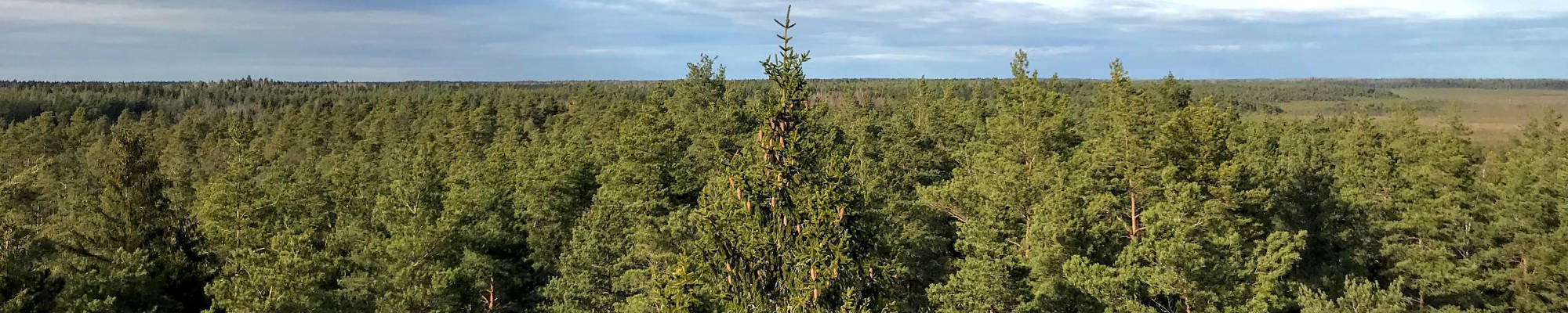
Most wooded area of Lithuania
Lazdijai (Polish/Lithuanian border) – Veisiejai – Trikojis – Didžiasalis – Druskininkai – Žiogeliai – Merkinė – Nemunaitis: 140 km, 6 days.
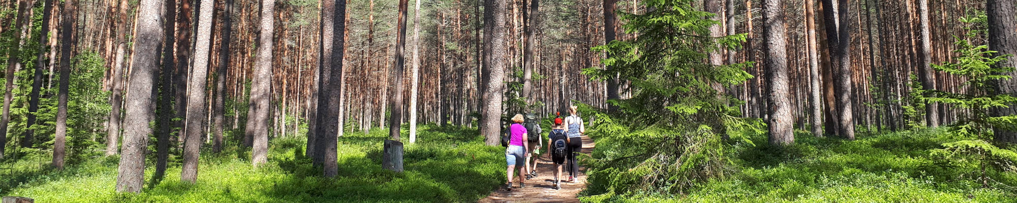
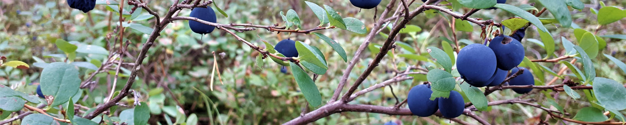
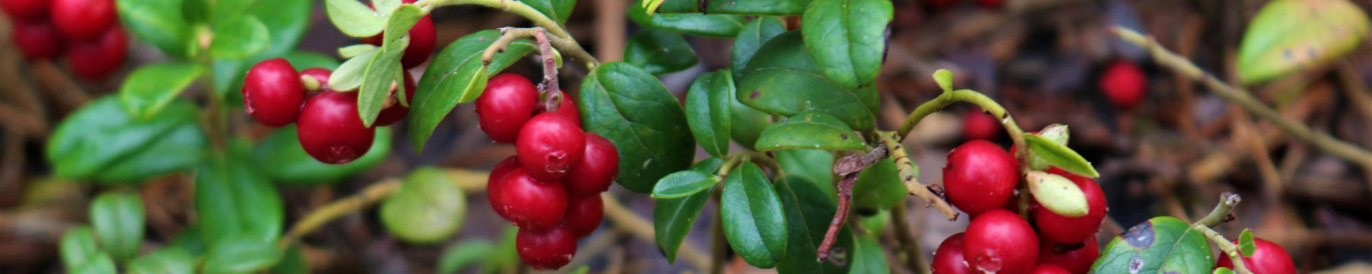
The Dzūkija landscape was shaped by a glacier more than 10,000 years ago. The Forest Trail passes through a vast, sparsely populated woodland and small villages along forest roads. Features and traditions of Dzūkija ethnographic region have been shaped by the forest. People’s occupation and the traditional lifestyle are linked to the forest. Since ancient times, they have been going to the woods to pick and later sell mushrooms. Hence there is the saying of the people of Dzūkija: "If not mushrooms and berries, the girls of Dzūkija would be naked”. The resort of Druskininkai has evolved thanks to springs of salty natural mineral water. The name of the town originates from the Lithuanian word druska — salt. The town of Merkinė, at the confluence of the Merkys and the Nemunas, is among the oldest settlements in Lithuania. In this region, the Forest Trail passes through Dzūkija National Park.
 Section 51. Lazdijai – Veisiejai.
Along the hills of the Sūduva Upland
A little further than 1 km from the Lazdijai Tourism Information Center, the Forest Trail leads along the Lazdijai–Augustow road (No. 135), then turns onto a small country-forest road, which used to serve as a border guard road during the “Iron Curtain”. Walking along it, the landscapes of the Sūduva Upland offer beautiful landscapes. After crossing a more open place opposite Kučiūnai village, the Forest Trail slips into a wooded area again. After about 5.5 km, it turns east, further winds through a maze of forests and lakes, crosses the Zapsė river and meets the Lazdijai–Kučiūnai–Veisiejai road (No. 2510). After less than 6 km, the Forest Trail turns right to Dainaviškiai village. Then it turns around the bays of Veisiejai lake and, through Veisiejai Manor Park, takes you to the centre of the town. The section before the town of Veisiejai is part of the Veisiejai Regional Park.
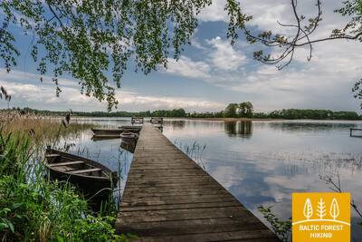
 Section 52. Veisiejai – Trikojis.
Through the Veisiejai Regional Park
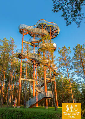
After leaving the centre of Veisiejai town, the Forest Trail crosses the channel of Veisiejai lake, then, along Vytauto, Turgaus and Leipalingio streets (road No. 134), it takes you to the shore of Snaigynas lake, where there is an observation tower and recreation places. After crossing a small forest massif near Veisiejai, the Forest Trail leads for about 1.4 km on the Veisiejai – Barčiai (No. 2529) road, then turns right. It continues through a beautiful pine forest along Ančia lake, which is rich in berries and mushrooms. Turning to the east, the Forest Trail approaches Barčiai village from the south, and further to Trikojis lake leads through cereal fields. At the bay of Trikojis lake, the Forest Trail crosses wooded areas and goes to road No. 2517. This section of the Forest Trail is part of the Veisiejai Regional Park.
Section 53. Trikojis – Didžiasalis.
Forests rich in forest goods – mushrooms and berries
From Trikojis lake and Bertašiūnai village, the Forest Trail goes south along the road No. 2517, crosses the Leipalingis–Kapčiamiestis road (No. 2505) and Viktarinas village. Further on, the trail turns around Stirtos lake and winds its way through wide forest massifs, where in some places you can see fields and small villages. In summer, the forest is rich in blueberries and mushrooms. Then, the Forest Trail crosses the canal connecting the Baltajis Bilsas and Juodajis Bilsas lakes, rises on the steep shore of the lake and turns south. From here you can see Didžiasalis village. The section from Trikojis lake to Viktarinas village belongs to the Veisiejai Regional Park.
 Section 54. Didžiasalis – Druskininkai – Žiogeliai.
Druskininkai – the most popular resort in Southern Lithuania
Between Didžiasalis village and the resort town of Druskininkai, the Forest Trail leads through a coniferous forest with abundant berry and mushroom spots. Before Druskininkai, the Forest Trail merges with the Nemunas road, turns around the Druskininkai Snow Arena and continues along the pedestrian and bicycle path to the Park Bridge across the Nemunas river. After crossing the bridge, the Forest Trail continues on Maironio street. and continues along the small streets of the historic Druskininkai resort and the park roads, crossing the Ratnyčia river and the forest park on the right bank of the Nemunas. The route behind Veisiejai street goes along the sidewalk of Neravų street and after about 1 km turns left into Sodžiaus street, which at the end of Neravai village becomes a beautiful forest road. This is where Dzūkija National Park begins. The Forest Trail turns around Viečiūnai village, opening a beautiful landscape to the Liškiava monastery on the opposite bank of the Nemunas. The Forest Trail then leads to Žiogeliai village along a beautiful secluded forest road.
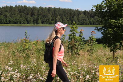
Section 55. Žiogeliai – Merkinė.
Through the Dzūkija National Park
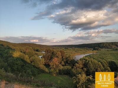
Up to the Merkys estuary to the Nemunas, the Forest Trail leads along the banks of the Nemunas valley, where it is surrounded by large and beautiful forests of Dzūkija in the vicinity of the Dainava Lowland (Dainavos lyguma). In some places in the forest massif there are open places where small villages are scattered. Nearby Česukai village, the Forest Trail forms a large circle around the Merkys estuary to the Nemunas, because the nearest bridge is on the A4 road. Here you can see picturesque landscapes over the wide and deep Merkys valley. After crossing Merkys, the Forest Trail stretches along a narrow country road on the left bank of the river and leads to the Merkinė mound, from which one of the most beautiful landscapes of Southern Lithuania opens up. Along the small and winding streets of Merkinė (Piliakalnio, V. Sladkevičiaus, S. Dariaus and S. Girėno) the Forest Trail reaches the town centre. This section of the Forest Trail is a part of Dzūkija National Park.
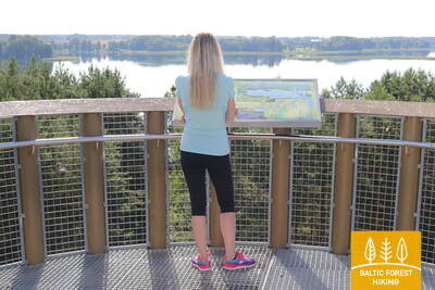
Section 56. Merkinė – Nemunaitis.
Along the Nemunas valley
In Merkinė small town, the Forest Trail goes along Seinų street in the direction of the Nemunas, turns right and comes to the observation tower. It offers an excellent landscape over the wide river valley and the island in the Nemunas river, which is grazed by livestock. For more than 3 km, the Forest Trail moves to the steep slopes of the Nemunas valley, then sharply turns to the north and further goes along small forest roads to the villages of Netiesos and Druskininkai. After Druskininkai village, it crosses the largest open area of this section with beautiful views. Then the Forest Trail runs along the Nemunas valley, but the river itself is not visible from the trail. In some places along the way there are hills with steep slopes. At Vangelonys village, the Forest Trail comes out again in an open place, crosses a small forest massif and reaches the main street of Nemunaitis village along Vangelonių and Saulėtekio streets. Part of this section from Merkinė to Druskininkai village is located in Dzūkija National Park.